Pietrosul
- Pietrosul
- 2303 m
- Primary factor 1578 m
- Location: North 47:35.828, East 024:38.046 (GPS at the summit)
- Romania
- Difficulty: YDS class 1
- Climbed: August 12, 2011
Pietrosul
|
|
How to get there:
The starting point for climbing this peak is the city of Borsa on
the north side of the mountain. Borsa is located far north in Romania, not far
from the northern border with the Ukraine. In order to get there, first locate
the major city of Cluj-Napoca in Northern Romania. From here, take E576/1C north
to Dej. From here, drive east on E58/17 until you locate Hwy. 17D going north to Salva.
From here, continue north along Hwy. 17C. This road is a pretty good, paved road that
quite efficiently will get you north to Moisei, where Hwy. 18 runs east-west. Travel
a short distance east (up the broad valley) to the city of Borsa. This is a city with
all services, hotels, restaurants and big supermarkets.
In order to get to a reasonable trailhead, one can travel a bit further. As you travel
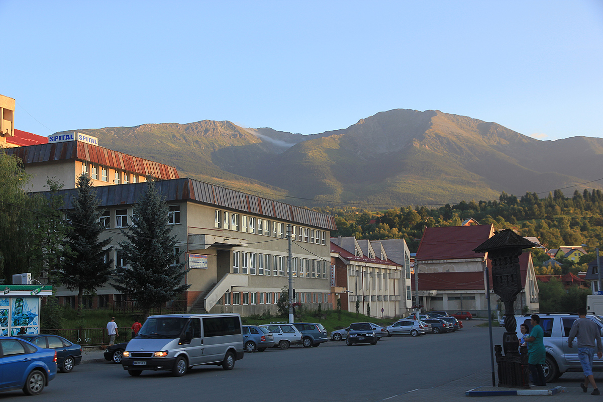
east in Borsa, locate the city hospital on your right hand side. The next sideroad running
right (across the river), is a key location. This intersection is located at N47:39.231, E024:40.112,
elevation about 670 meter.
Turn right here, and continue to follow what at any time appears to be the main road, generally heading uphill.
The road runs a bit towards the left in the beginning, but gradually, this road heads more and more uphill.
This road gets a bit rougher as you drive uphill, but normal cars can at least drive 3.8 kilometer as measured
from the main street turn off. At this location, the road forks and there is good parking for 2-3 cars on the
left hand side of the road. I decided that this spot serves as a good trailhead, the location is
N47:37.642, E024:39.580, elevation about 950 meter.
The road continues (left fork) further uphill and there is another good spot with parking, higher up, near the
last dwellings. Many cars can also make it to this location.
Route description:
From the trailhead, continue to follow the road uphill. This road gets progressively worse higher up.
Not far beyond the last buildings, one definitely will need a high clerance, 4WD vehichle. However, on the
day of our ascent, we observed several vehicles (all very rough 4WD jeeps) that made it all the way up to
the Met. station.
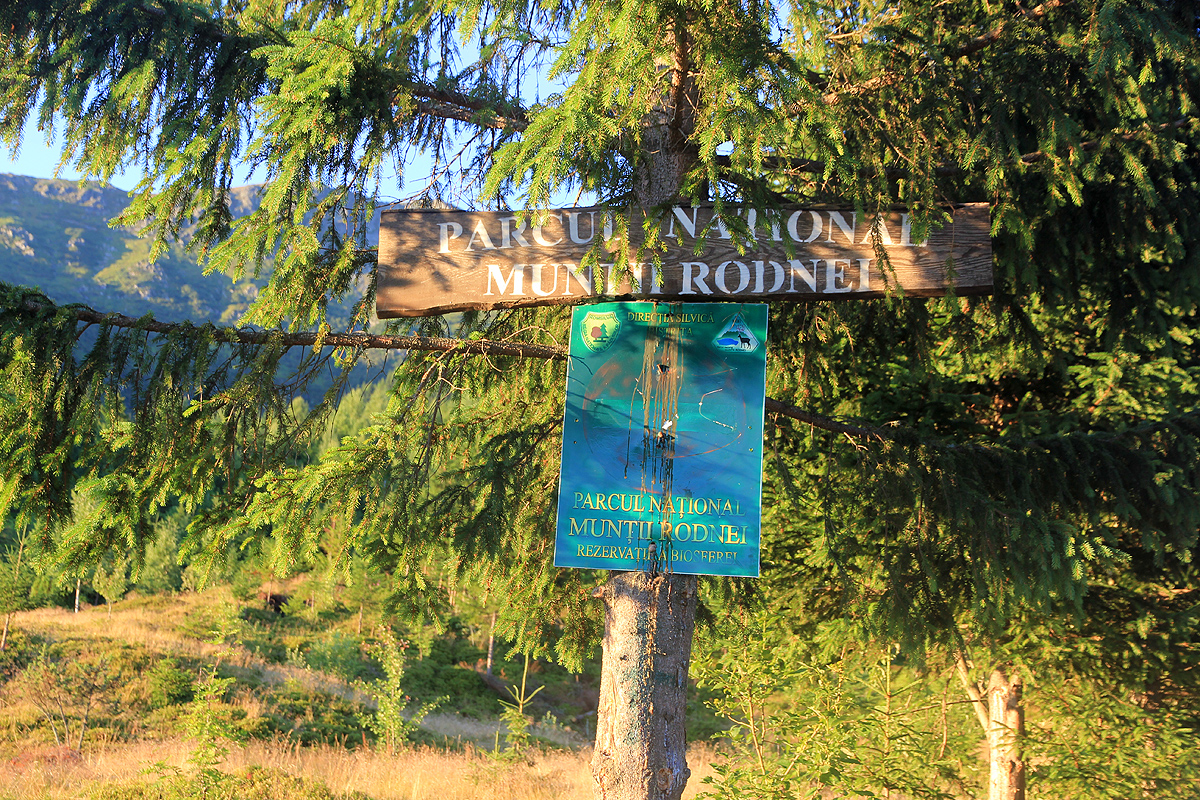
Fairly soon, you pass a sign on a tree announcing the
existence of a national park. Higher up, not far
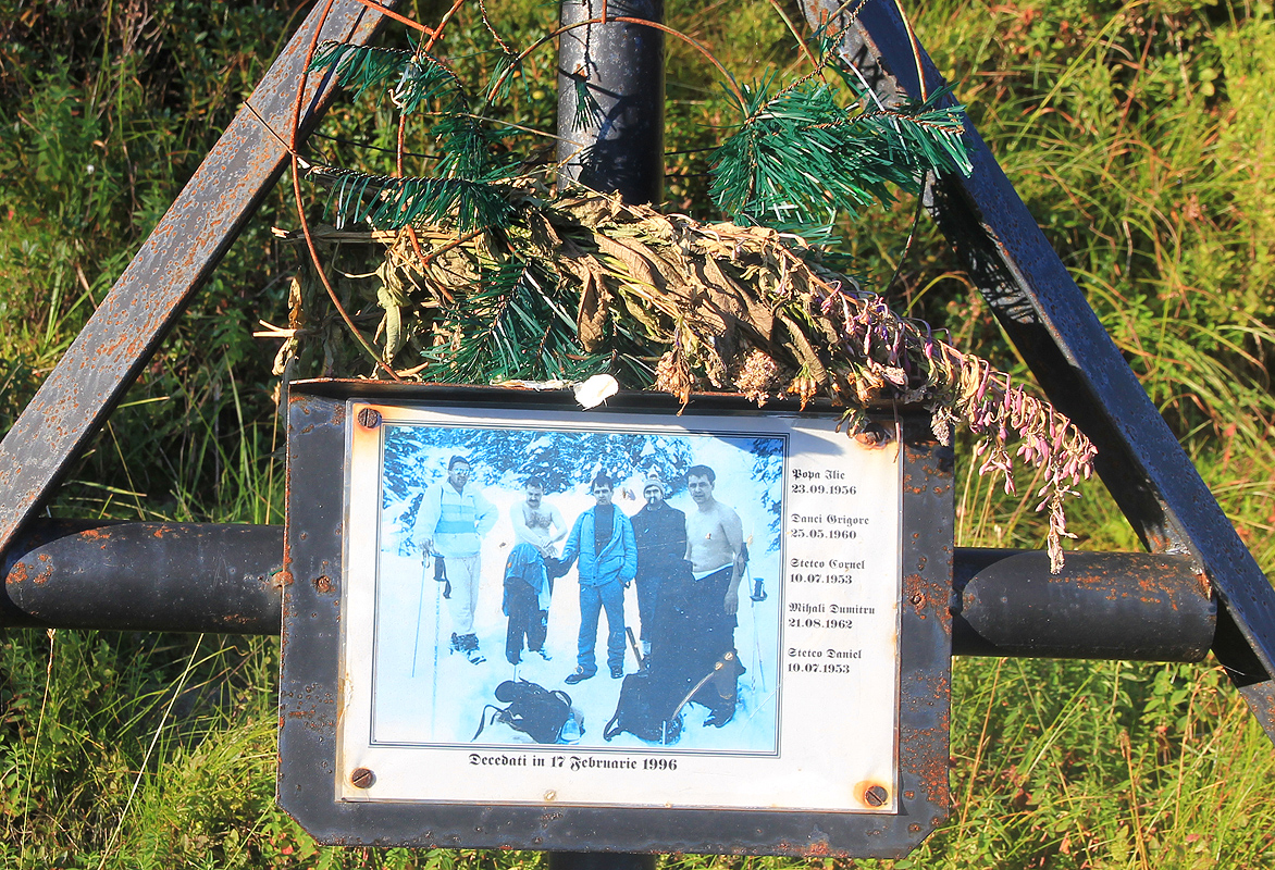
below the Met. station, there is a memorial symbol with a picture and the names of 5 men who all died in
a tragic avalanche in 1996.
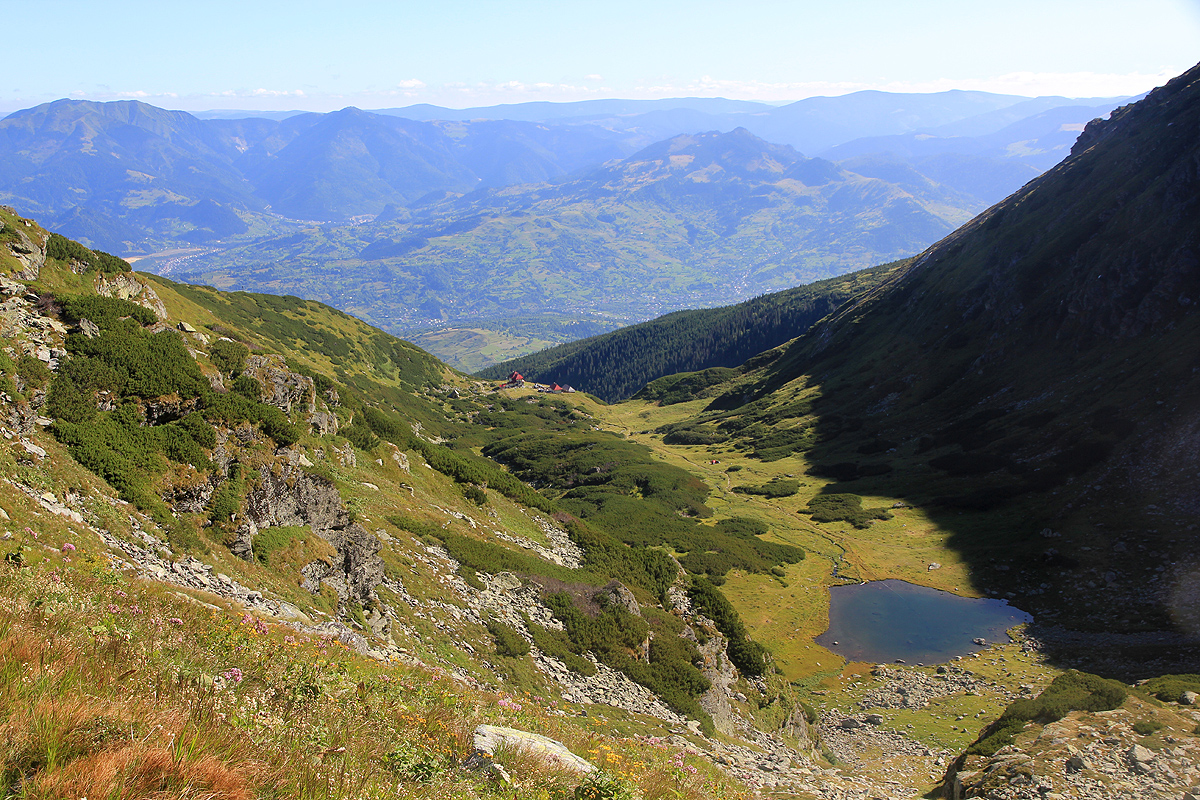
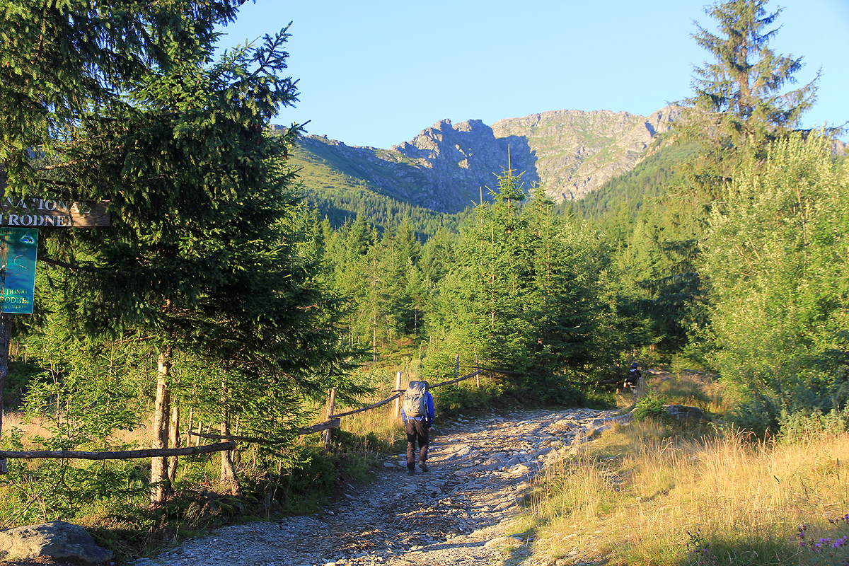
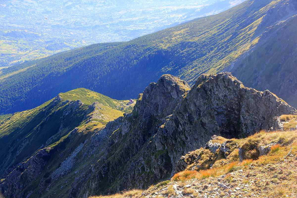
Turning a corner, the dirt road enters a high hanging valley (photo from the return hike) and
the Met. station is right ahead. This is
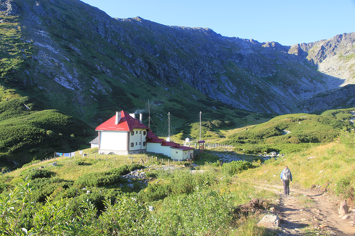
the end of the 4WD road, location N47:36.159, E024:38.935, elevation about 1790 meter.
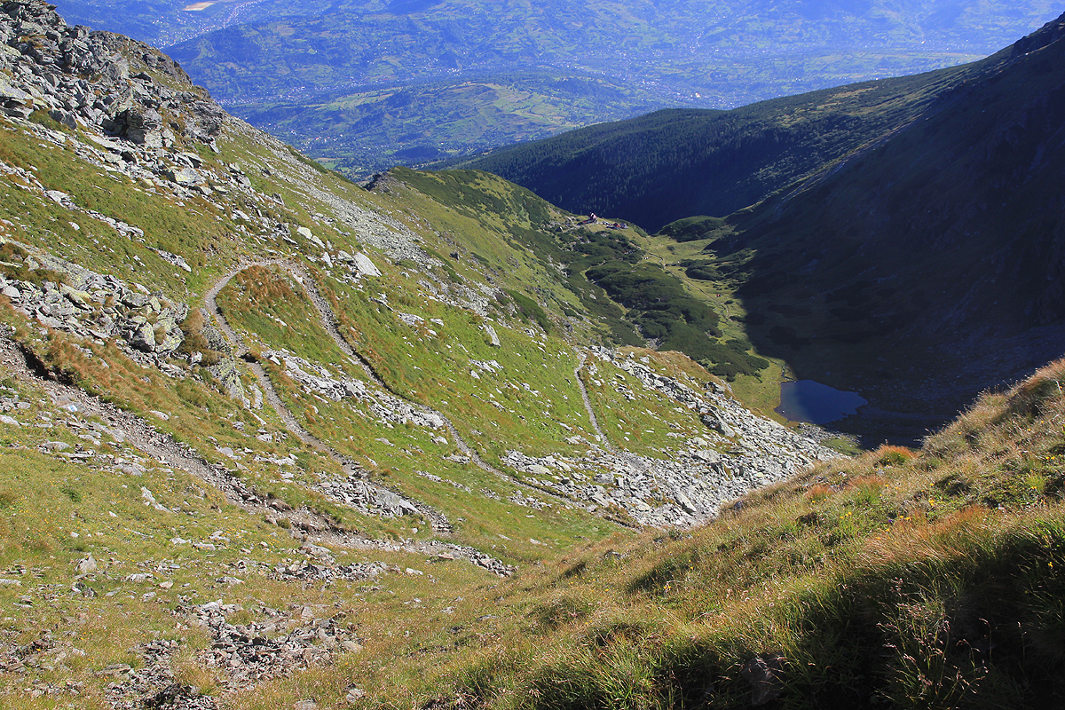
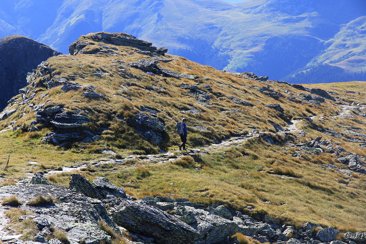
From the Met. station, the well marked trail continues into the small valley, passing a couple of
designated campsites, before arriving near the very small lake. From here, the trail turns left
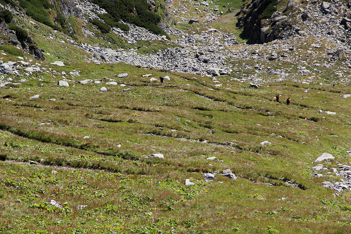
and enters a gentle traverse that contours right all the way across to the opposite slope. Here,
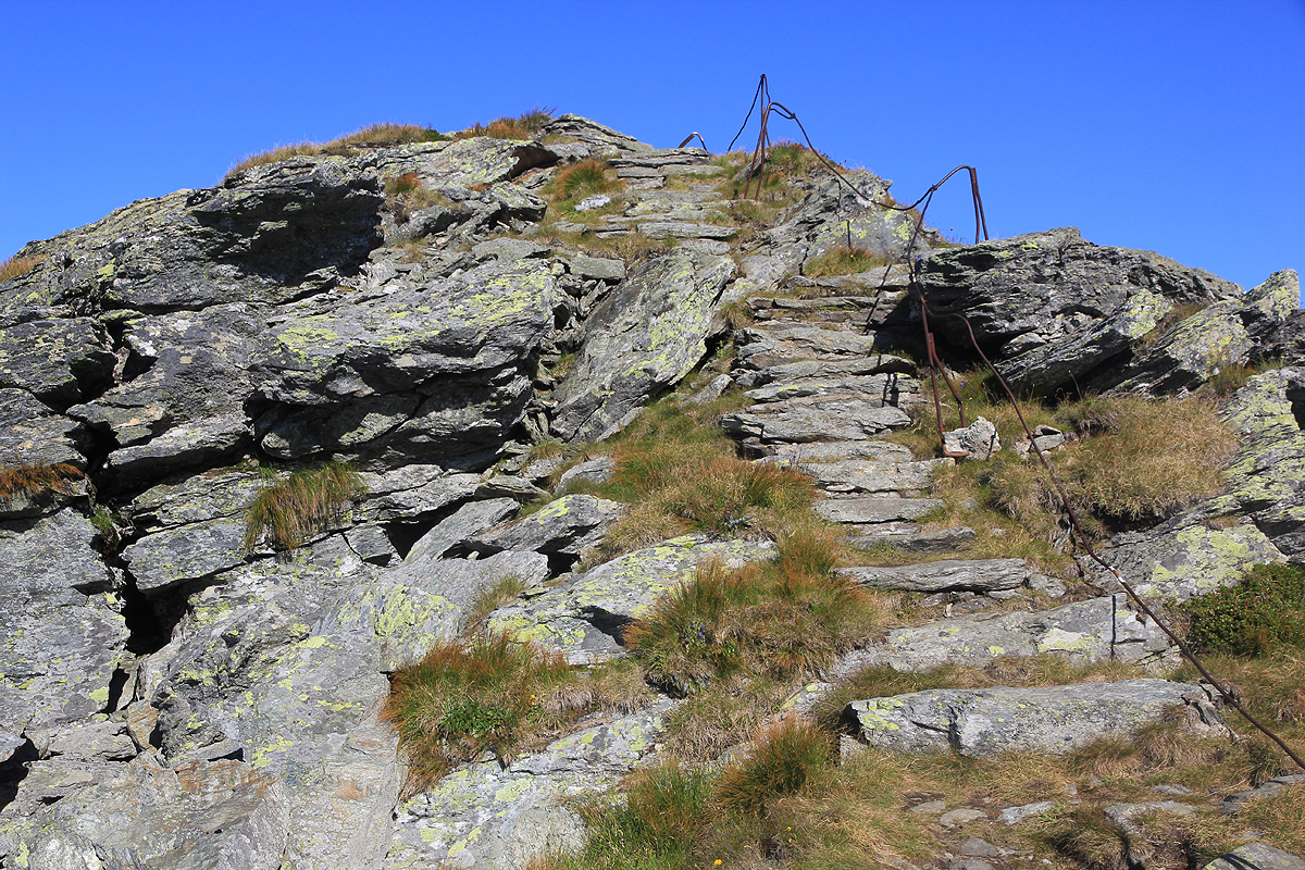
the trail zig-zags uphill all the way to a high, local col. From here, a short trail going right,
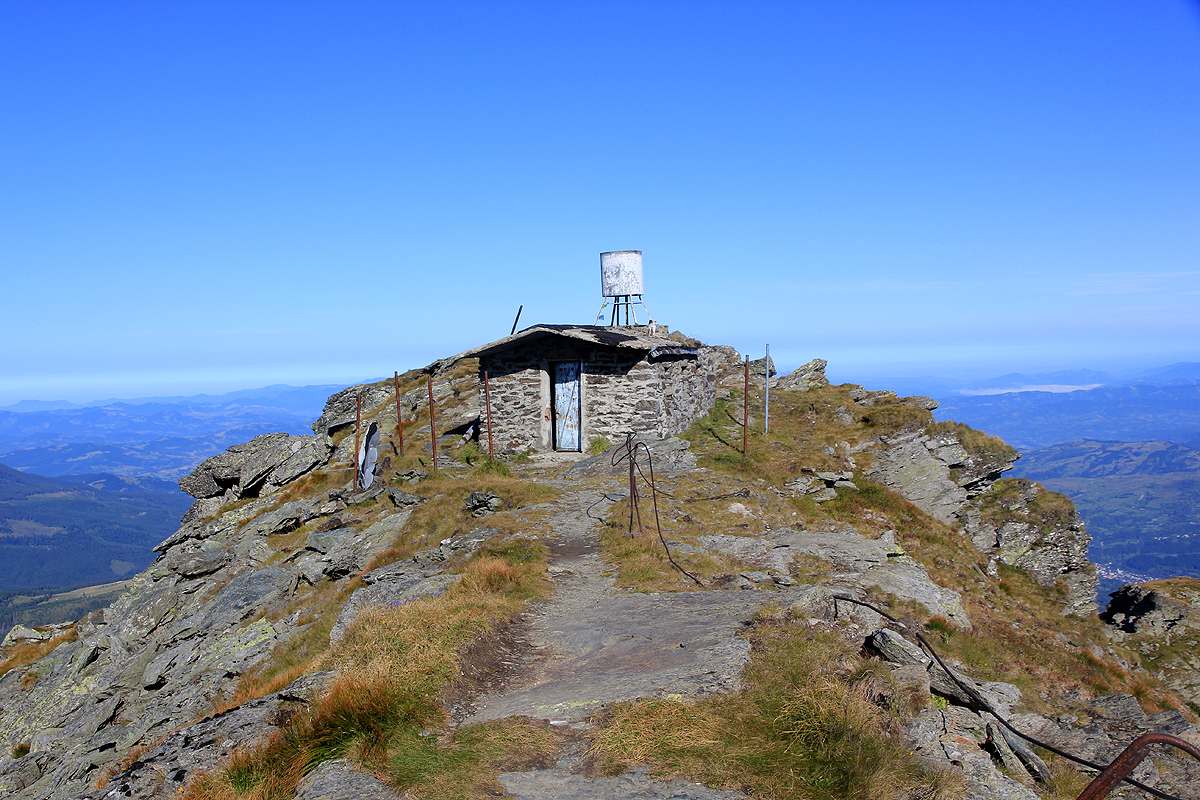
leads to the summit. There is a small stone hut at the summit.
Comments:
We left the Bihor area and drove north-east towards our last goal,
stopping for lunch in the
city of Turda, where we ran into Hotel Dracula.
We arrived in Borsa and explored the access road to our planned parking, before booking a room
at an old hotel located directly on the main street, not far from a large supermarket.
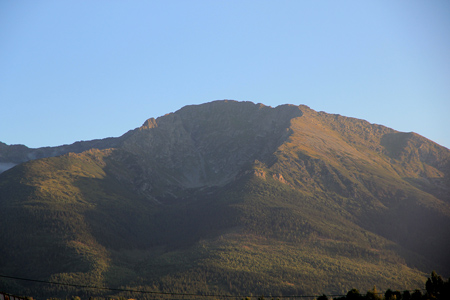
Our objective tomorrow was clearly visible above the village to the south.
After dinner,
we quickly slept in order to get an early start.
We started from our planned trailhead at 0625 and headed up the rough dirt road. This road was quite
a bit longer than anticipated and continued uphill all the way to the Met. station.
Smoke was coming from the chimney, and a 4WD was parked outside. This station is clearly in active use and
the staff use the road to drive up and down. We arrived there at 0755 and continued along the trail.
It was a nice morning and we made good time as the trail started switching back and climbing towards the
ridge above us. As we reached the col, a couple were just about to take down their tent nearby. We turned
and hiked the last ridge towards the summit. The last part of the trail had been turned into a small
set of natural stair steps, then a short,
almost flat section with a completely destroyed guard rail
on our right side. We arrived at the summit of
our last Ultra Prominent Peak in Romania at 0850.
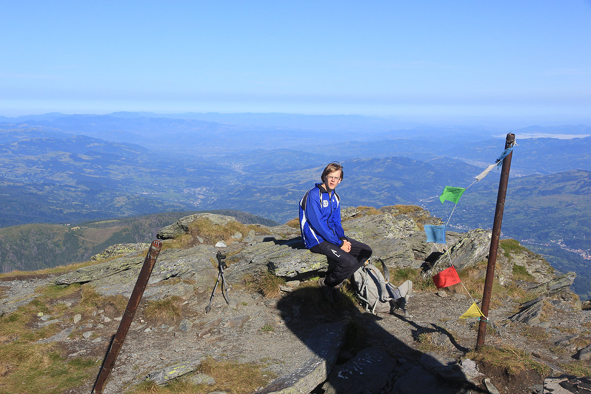
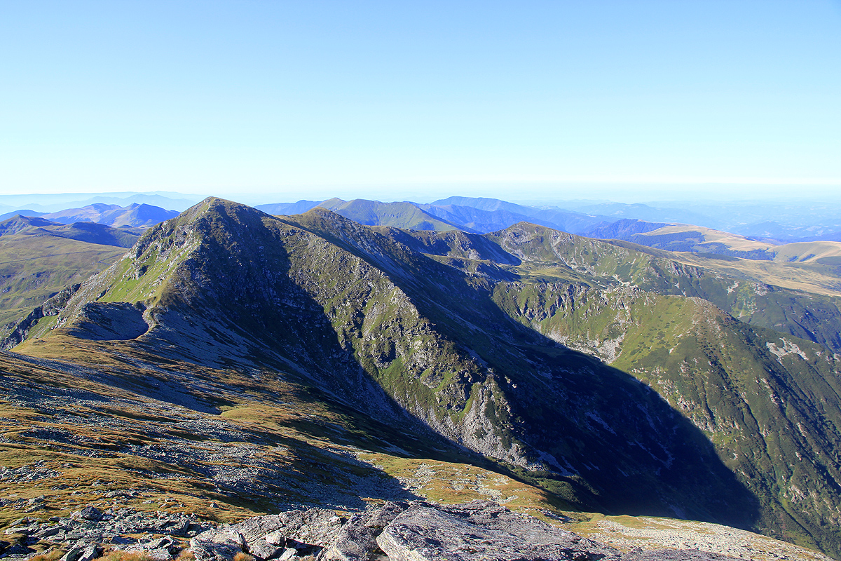
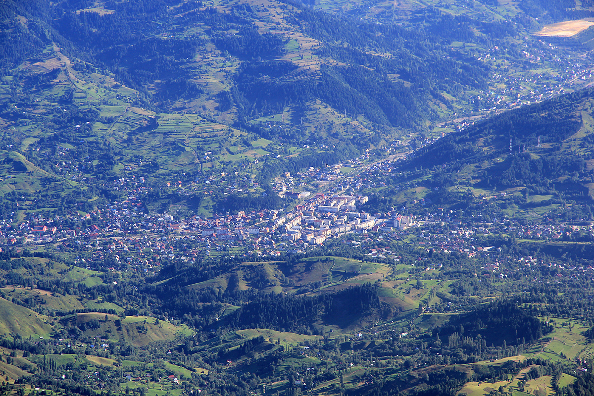
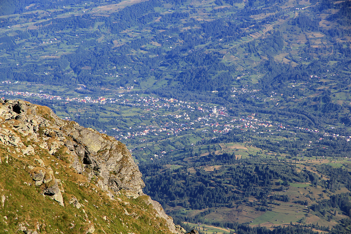
The summit commanded a very nice view. From here, one can see the
pretty densely populated area in the
valley on the north side of the mountain.
The view was nice all around and we had a good break until 0905.
Starting down, we had a leisurely pace and reached the car in a little less than 2 hours at 1100.
This concluded our very successful trip,
where we were able to climb the 5 most prominent mountains of
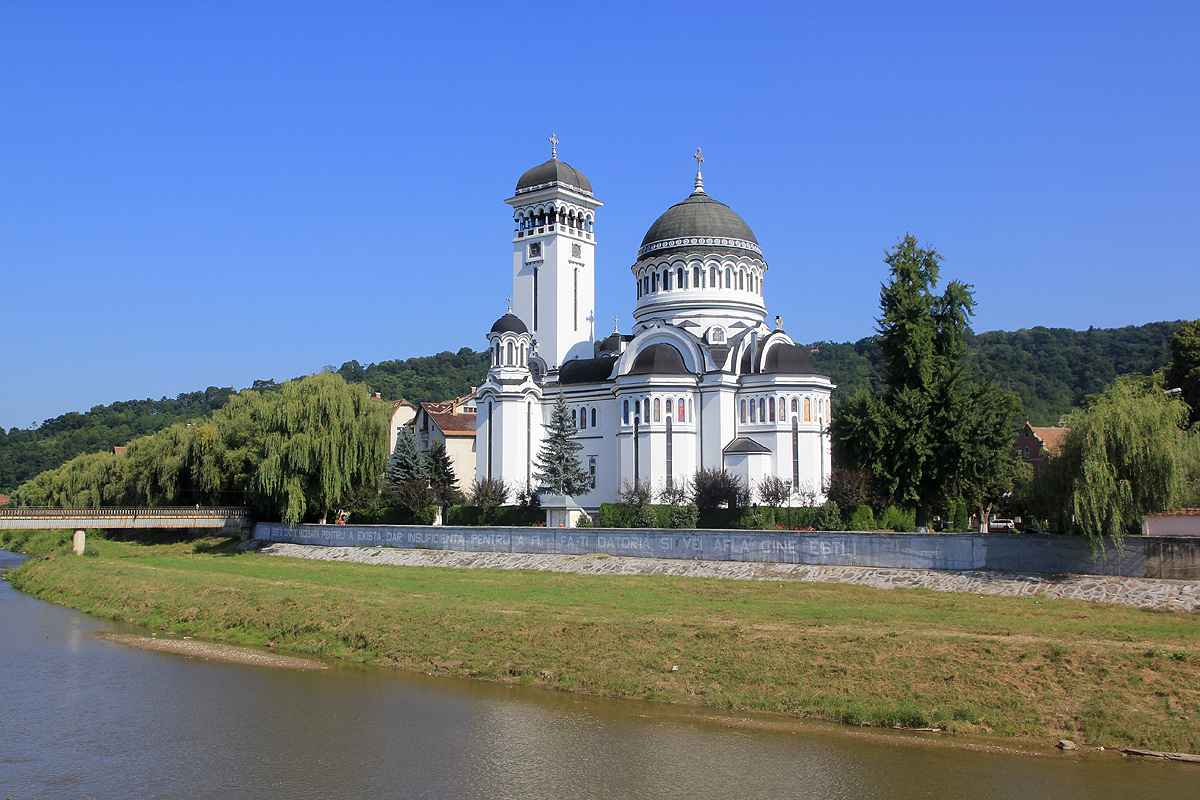
Romania in 5 days. We had 1.5 days to spare and decided to be tourists on Saturday, while just taking it very
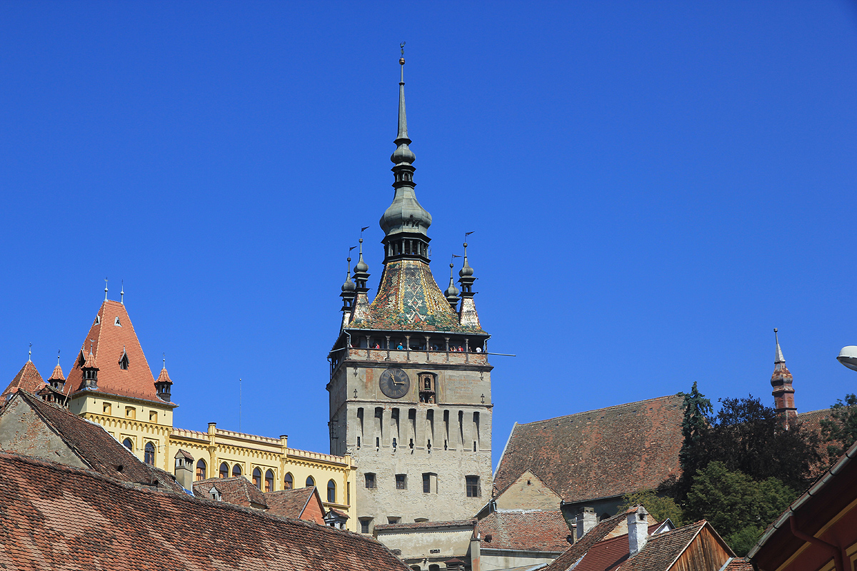
easy on our Sunday day of departure. Thus, on Saturday, we first visited the medival city of Sighisoara in
Transylvania, where we looked around and had lunch.
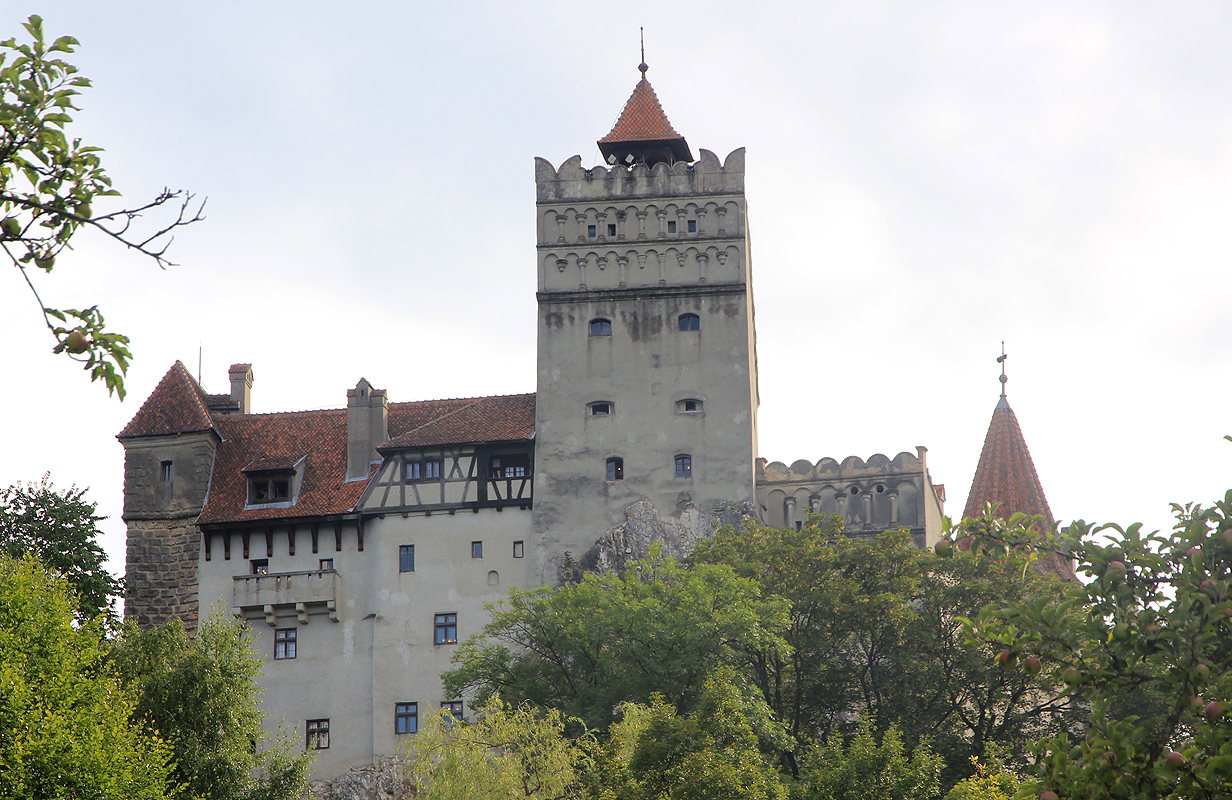
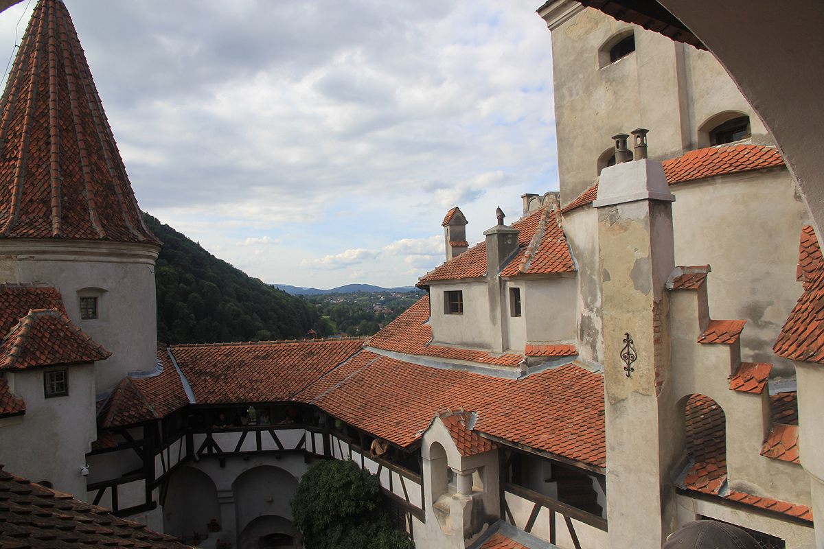
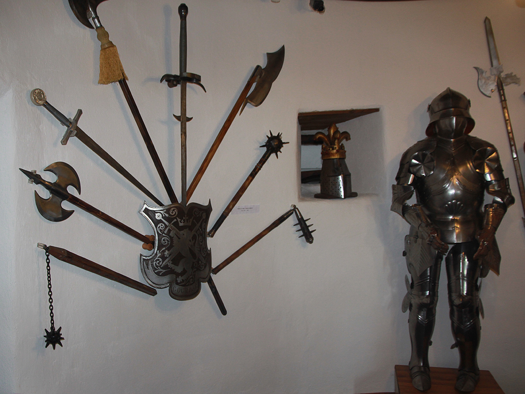
Later in the same day, we visited the very famous
castle of Bran, a 700 year old castle, ruled
among others, by the famous Vlad Dracula.
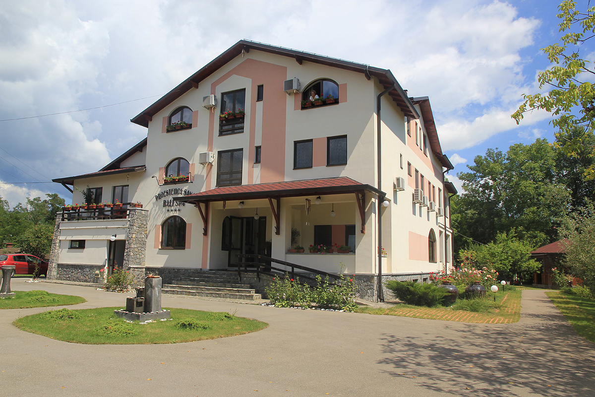
We stayed at the 4-star Bali Spa hotel, enjoyed the swimmingpool and a sunbed out on the lawn, before
driving back to the airport in the afternoon.
Notes:
This mountain was only "discovered" as being Ultra prominent within the last year before our visit.
A pretty obscure saddle (since there was no major highway crossing) had been completely overlooked.
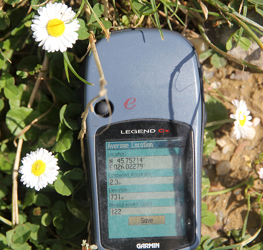
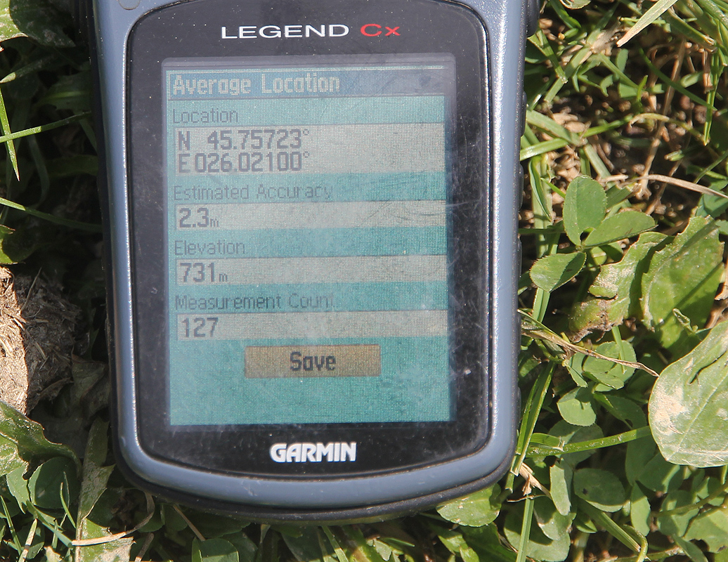
In order to investigate this more closely, we decided to visit this key prominence saddle, located
a significant distance away from Pietrosul itself. It turned out to be a very nice, rural area.
The saddle itself is very broad (many hundred meter wide), with two local areas that compete for
being the lowest natural crossing. The first location is
essentially along the road, just
as it emerges into the open and curves left (when going south). The other location is out in the
grassy field where some local water drains two ways. This is a bit west of the road location.
GPS measurements provided the same reading at both spots, 731 meter. As our GPS readings turned
out to be consistently at least 6 meter high across all of Romania (across also 6 days), our best
estimate for this saddle is 725 meter.
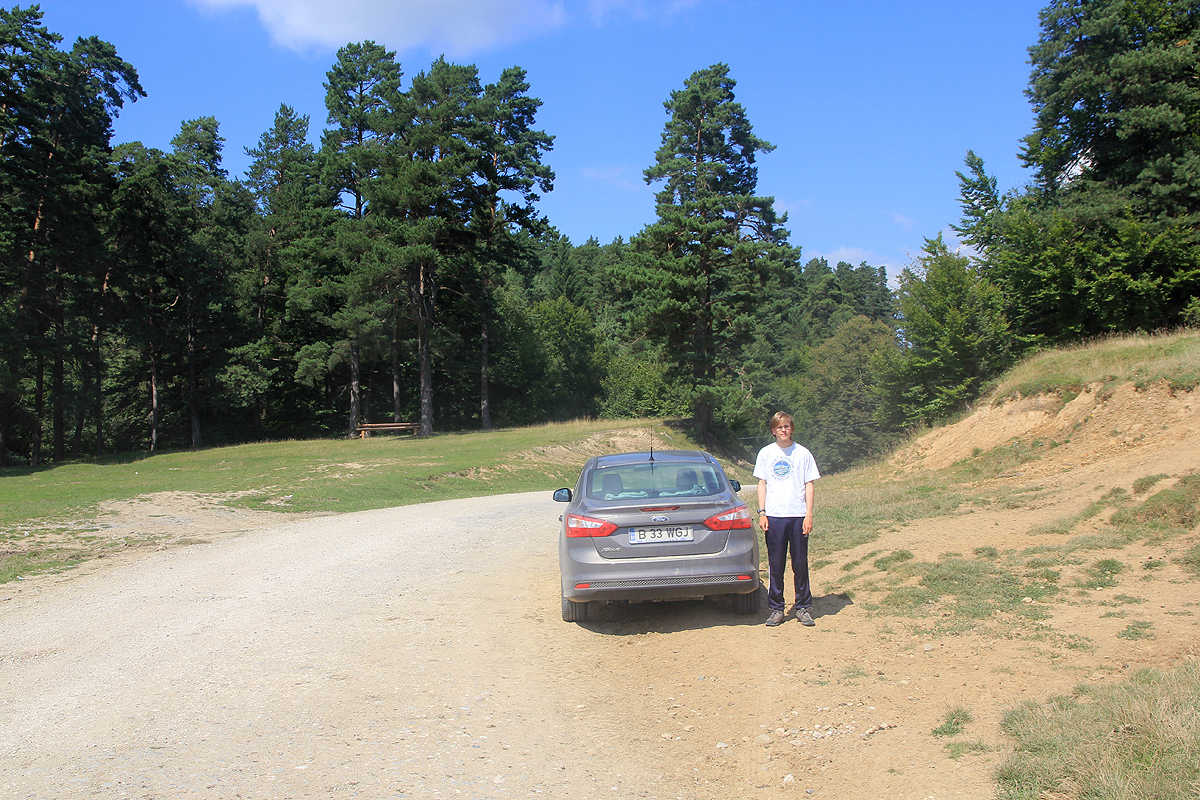
We drove to the saddle from the north side, but subsequently continued south before
taking a paved road,
Hwy. 10, back via an official col of 820 meter.