Location: North 46:13.647, East 012:24.200 (GPS on summit)
Location: Dolomites, Italy
Saddle: San Osvaldo, 827 meter?
Difficulty: YDS class 2+
Climbed: July 14, 2004.
Information:
How to get there:
The nearest big town is Belluno, located about 85 kilometer north
of Venice along autostrada A27. From the center of Belluno drive north-east towards
Cortina (about 6km), do not turn left (to Cortina), but right across the river, then
left, after about 10 km from Belluno, there is a sharp left turn off the main road
to Paiane, this turnoff is right next to a large concrete bridge that carries the
autostrada. Measure from this turnoff, drive through the small village of Paiane and head towards
Arsie, you pass the church after about km 3 and continue uphill towards the village
of Pieve d'Alpago that you reach at km 7. Make a sharp left in the middle of town and drive
to the even smaller village of Plois, you should locate the houses at km 8. Continue uphill on
the biggest road, at about km 10, this road forks. Take the right fork that heads slightly
downhill. (The left fork head up towards Refugio Dolomed al Dolado.) Continue along this narrow
road for about 3 km. The road turns into a dirt road, but it is quite ok to drive. Shortly before
the trailhead you will pass a few picnic tables and benches on your left. Continue onwards
until you find a bridge that crosses the main stream that comes down the valley in front of you.
This is the trailhead. There is space for a couple of cars off the road near this bridge.
The precise location has elevation about 1035 meter
and GPS coordinates North 46:12.147, East 012:22.930. Route description:
A brief description of this route would be: "Struggle uphill on loose scree and small rocks
sliding a bit back with every step."
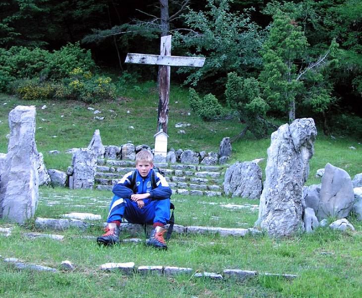
Leave the road directly from your side of the bridge and hike up towards a building, find the
old, gravel road (closed to traffic) that climbs the valley just beyond the building. Hike uphill
along this road. Further uphill, you will see another building (ruin) on your left. Continue
to the end of the road where there is a memorial cross on a small, green plaza on your left.
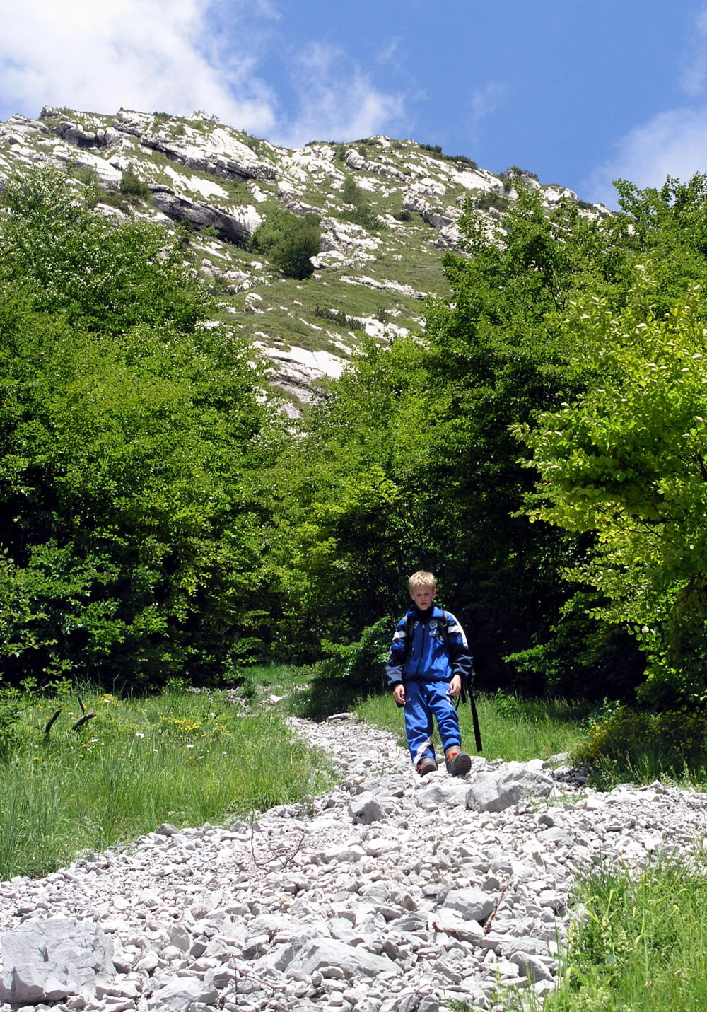
The trail continues first gently, then steeply uphill. The trail is basically a band of
loose rocks, quite unpleasant to walk on. Any hope that the trail character shall improve is
soon forgotten. The loose rocks continues through a tree section and all the way up to
the steeper rocks that guards the valley on this side.
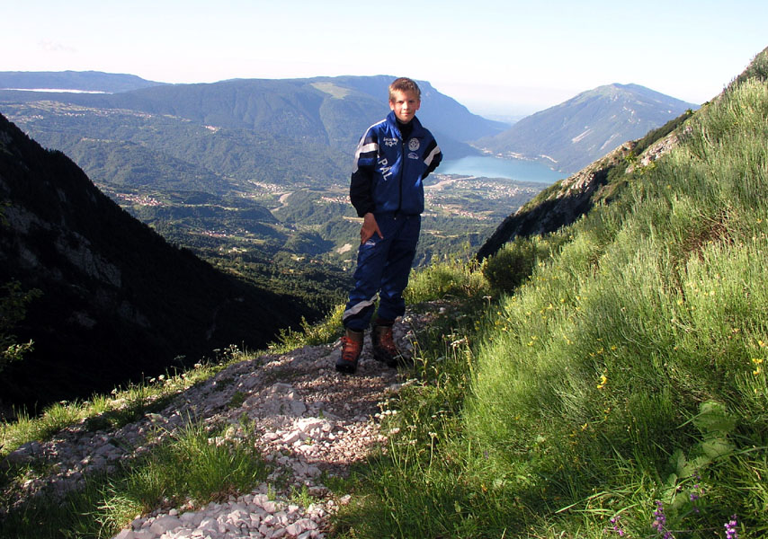
After about one hour, we were at elevation 1558 meter, north 46:12.945, east 012:23.059.
This is a reasonable area for a first break. Higher up, the route climbs briefly onto a short
section of grass before returning to the endless scree.
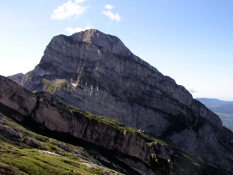
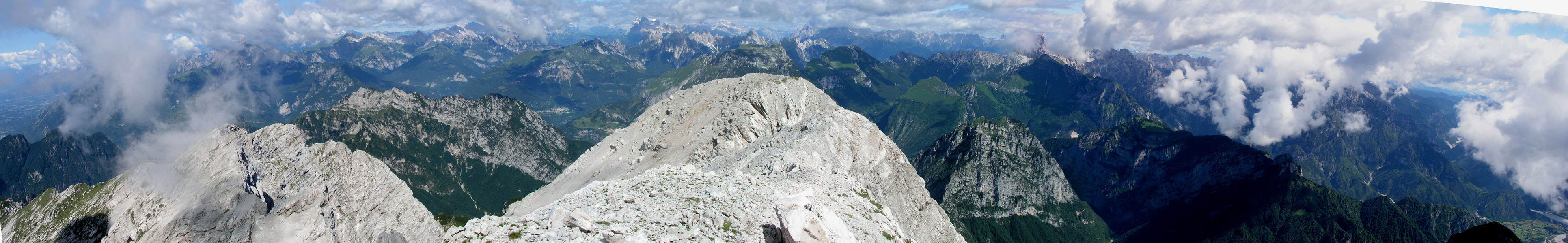
The route climbs relentlessly along the left side of the valley until at last, it turns right
when blocked by cliffs above. You now have Col Nudo right above you, slightly right. The easiest
route to the summit branches left from the trail at this point. There is a trace of trail zig-zag
up the slope. This location is at elevation 2073 meter, north 46:13.483, east 012:23.662.
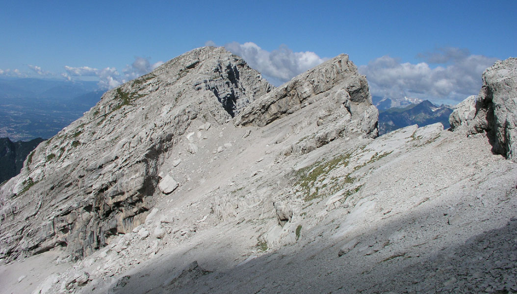
The route marked on the map, traverses further east to a saddle and climbs the peak along a north
going rib that connects to the south-west ridge of Col Nudo. This route is (YDS) class 4, having a
section of narrow, exposed ridge.
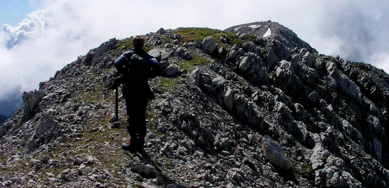
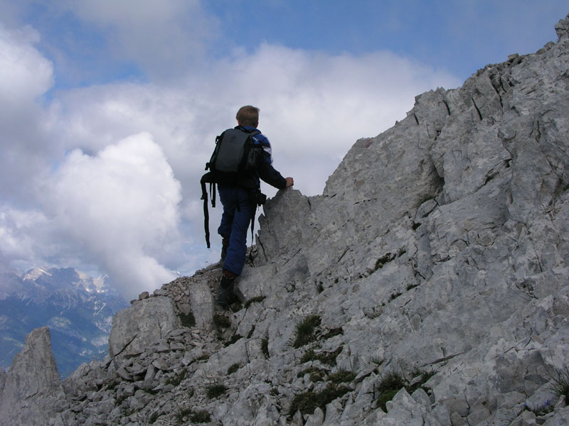
Continuing on the easiest route, head up the slope following the trails in the scree slope.
Higher up, you notice a small notch or short gully in the top ridge. Avoid this and contour left.
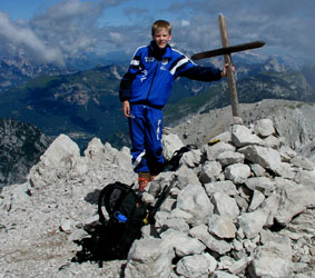
You will then easily arrive at the 11 meter lower north summit. From here, one can easily follow
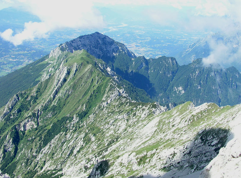
the top ridge south to the summit of Col Nudo.
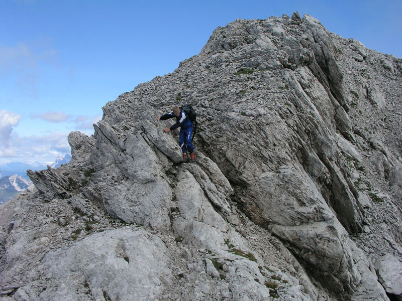
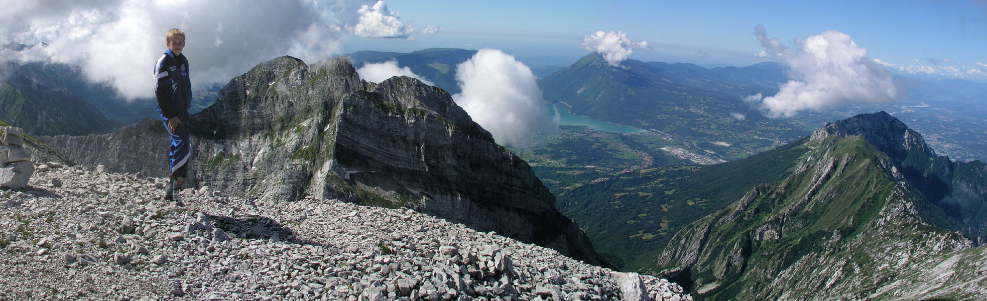
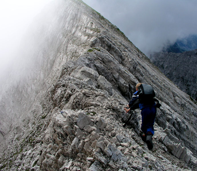
We explored the south-west ridge route from the summit and down to a horizontal
stretch of the ridge that is very narrow with considerable exposure.
The passage appeared to be YDS class 4. One should hold onto the top ridge
and walk below on the south side, technically relatively easy, but loose rocks
makes the passage a bit unpleasant.
It is likely that this
indeed is the most difficult part of the route, however, since we did not complete this
route, there may be further problems beyond. Comments:
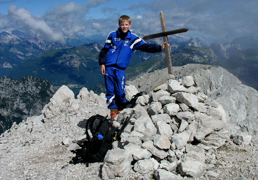
I did this climb with my son Pål Jørgen, age 15. We started from
the trailhead at 0700, made the summit in 3.5 hours at 1030. We got there just in
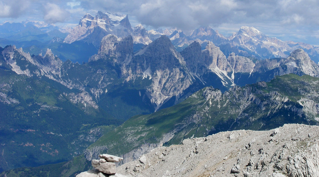
time to appreciate the nice views alla round before clouds started rolling in.
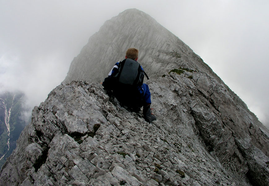
We next explored the route down the south-east ridge as far as to what is most likely
the crux of this ridge, a very narrow section. With no protection and no knowledge of
the remainder of the route we turned around and scrambled back to the summit. We
started down at 1100 and reached the car at 1230 after a descent that mostly consisted
of a controlled slide among all the small loose rocks that had been a bit frustrating
on ascent. Our trip continued (2 days later) with the ascent of
Cima Dodici O Ferozzo.