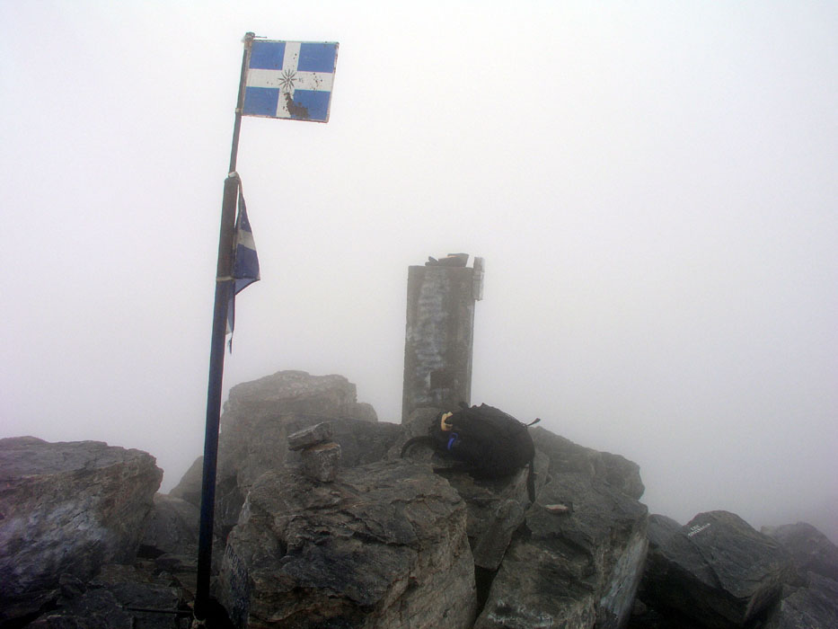
Location: North 40:05.174, East 022:21.512 (GPS on the summit)
Saddle: tbd
Difficulty: YDS class 3
Climbed September 9. 2004
Information:
How to get there:
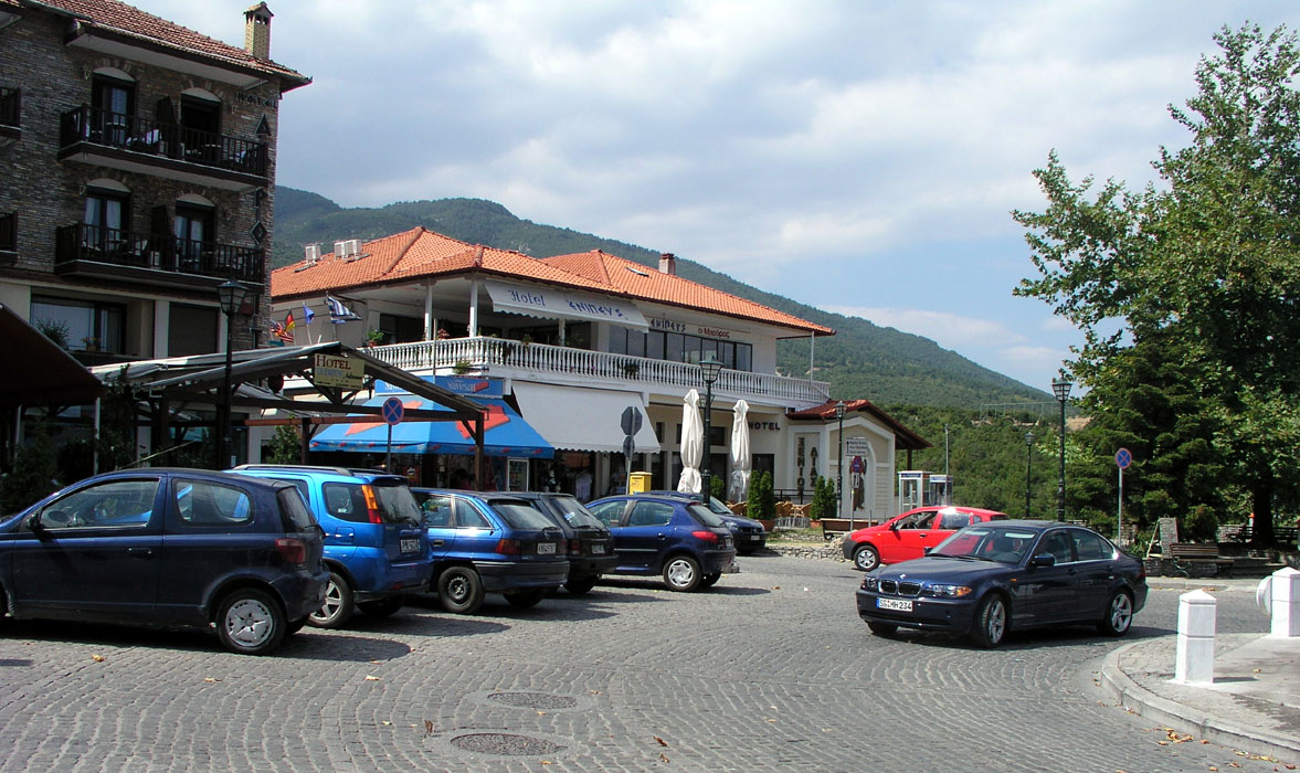
First go to the charming village of Litóhoro. There is an exit
west from Hwy. E-75 (the main road between Athens and Thessaloniki)
about 90 km (south) of Thessaloniki. This village has hotels, shops and
restaurants, even a store that sells topo maps of the area. The location of
the town square is N40:06.261, E022:30.081 with a bit less than 300 meter of elevation.
The normal trailhead is located at Prionia. The road to Prionia goes sharply left about
100 meter downhill from the village square, right if you drive up from E-75. There is a
sign saying Olympos. A bit further along, this road forks, stay left as the road starts climbing.
From here, it is about 15 kilometer to Prionia. It is possible that there is a fee for using
this road. It looked like cars were required to stop (and pay?) when I was returning later in the day.
The road first climbs, then descends quite a bit before a gentle uphill just before the parking area
at Prionia. This location has elevation 1084 meter and is located at N40:05.031, E022:24.414. Route description:
From the parking, head uphill through a gate (on the right side
of the building) and locate a broad, well developed trail that heads a bit
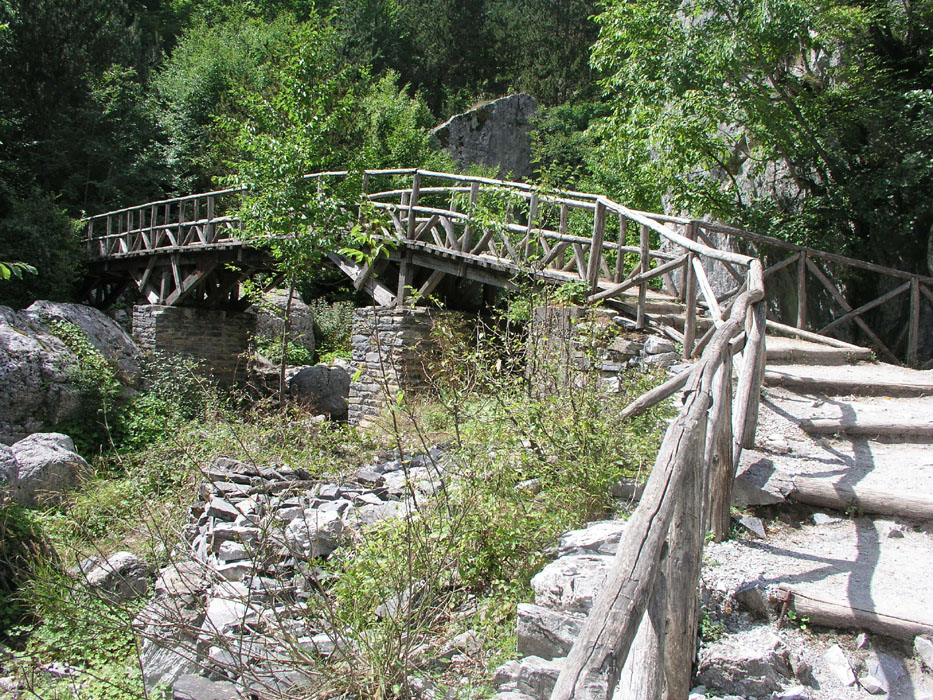
to the right before crossing left on a wooden bridge.
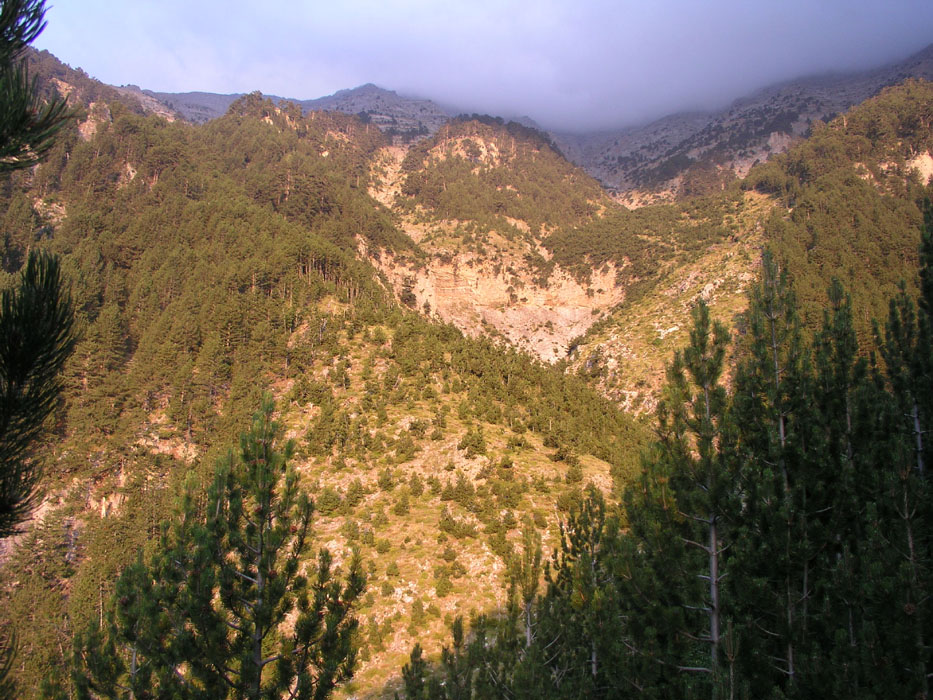
The very nice trail continues next to some very large boulders before ascending
a small hill where one can get a first view of the mountains higher up.
You have now reached elevation 1380 meter, location N40:04.722, E022:23.661. There are
a couple of benches here and (sometimes) a possible supply of water.
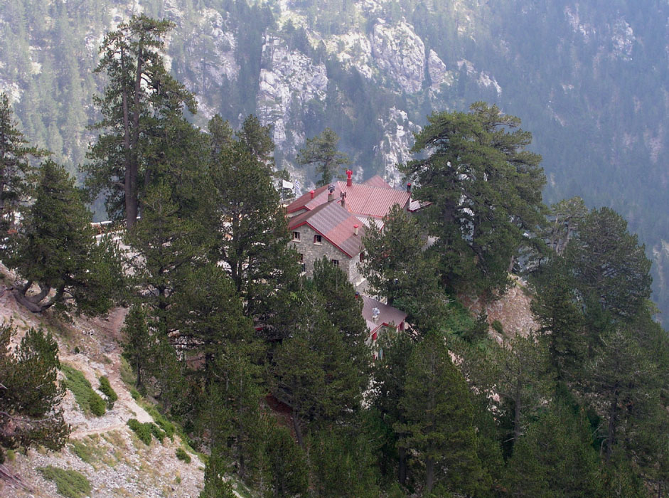
The route climbs further and eventually connects to the refuge situated on the brink
of a steep step in the slope. This refuge is at elevation 2059 meter and location
N40:04.805, E022:22.392, it is called Spilios Agapitos, also referred to as Refuge A.
One can call ahead (+302352081899) and inquire about reservations etc.
From the refuge, cross some concrete in order to locate the trail that heads out
to the left of the trail coming in from below. The trail heads straight uphill, then a bit left and quickly
gains a pronounced ridge that climbs westward towards a basin south of the point called Skala.
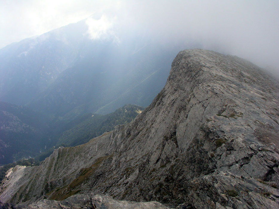
From here, the route climbs a new ridge that runs (slightly west of) north to Skala, 2866 m.
First, the trail stays on the west side of the ridge, higher up it gains the ridge proper.
The east side of this ridge is steep, but the ridge is broad and climbs gently to Skala.
Skala is located at N40:04.976, E022:21.428.
Skala is between the south-west end of the summit ridge, named Skolio at 2904m and the highest
point Mytikas. Skolio has a primary factor of 93 meter towards Mytikas, so would
(barely) rank as a separate mountain under a 300 feet rule.
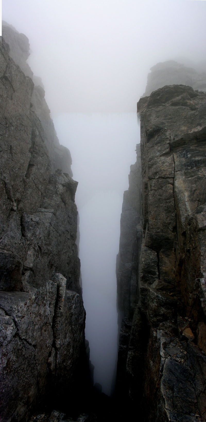
The route from Skala to Mytikas traverses the connecting
ridge, mostly staying on the east (right) side, since the
west slope is near vertical. This section of the route is
(YDS) class 3.
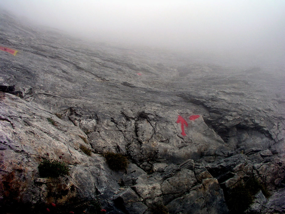
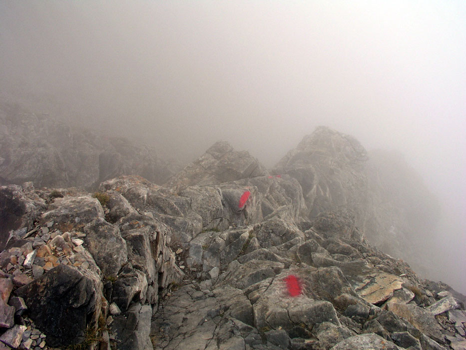
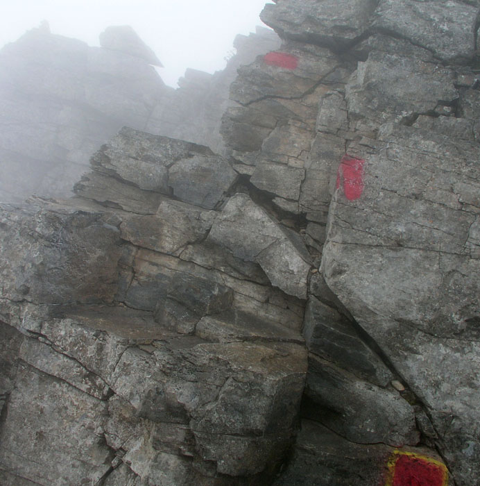
From Skala, the route heads down and to the left, well marked
by red paint. Initially, you will see a narrow gully, descend it a couple
of meter then exit to your left or
just stay above it. Continue descending while traversing a bit more left.
There are variations and plenty of good holds for
feet and (when needed) your hands. The route levels and traverses
below the ridge, eventually reaching the lowest point on the
ridge at elevation 2811 meter, N40:05.052, E022:21.500.
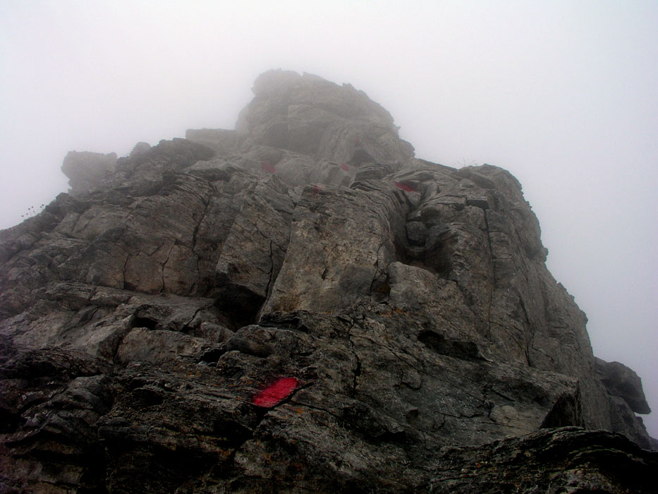
From here, after an initial small step up, the route
leads into a broad gully that can be ascended, again with possible
variations and many good holds. The red paint generally follows
perhaps the easiest line. Crossing from left to right at the very
top of this gully, the route descends along a small rib into the
next notch in the main ridgeline. Going down, this may perhaps
"feel" like the crux of the route, however, again the holds are
good and numerous. From this deep notch, an easy scramble
will complete the ridge traverse from Skala to Mytikas, the highest
point of Mount Olympos.
On all the steeper sections of this traverse, there
were larger painted squares indicating fixed protection (bolts) that may be
used for belaying in case of unfavorable conditions (ice could make this
slope quite unpleasant). Comments:
I came flying in from Bergen, Norway the day before. My original idea
was to drive to the trailhead and hike up to the refuge that day, but
delays at the airport made me reconsider and I ended up staying in a
very friendly (and reasonable) hotel facing the village square in
Litóhoro.
I got up early and drove to the trailhead, leaving the car at 0630.
After a nice morning hike I arrived at the refuge
at 0815. I sat down
outside and drank some water that I had carried up, when a rather
unfriendly hut keeper came out and started lecturing about how this
refuge was intended for people sleeping there etc. and that they
required people passing by (like me) to pay Euro 1.60. This tiny
amount was a strong contrast to the unfriendly lecture, I paid 2 Euros
and told him to consider the 40 cents an extra contribution.
He continued to report that there would be snow at the higher part of the route,
this was far from correct, one would normally expect this kind of person to
at least provide somewhat reliable information to climbers.
It turned out that paperwork, signing in and receiving a receipt etc.
was required, so my stop here took 15 minutes altogether.
People had
generally not started to leave from the refuge yet, and after this
intermesso I continued my hike up towards Skala, arriving there 1:15 after
leaving the refuge. The traverse from Skala to Mytikas took 30 minutes,
it was dense fog and nobody around, so I moved rather slowly since I was
unfamiliar with the route and partly also due
to some very smooth and fairly slippery rocks.
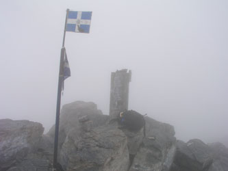
Arriving at the HP of Greece at 1015, the summit had a register that I
signed and a pole with the Greek flag. I drank some more water, took
photographs and looked around a bit. The fog was still dense, preventing
what is likely a very nice view down the steep side (west) as well as seeing
the ocean below. There was really not much more to do and I started
back at 1030.
I was back at the refuge at 1145, wondering if hikers were required to pay
another Euro 1.60 when passing down. (This payment corresponded to the
toll paid along the highway, a sort of mountain toll collection station.)
It turned out that this fee only applied to hikers coming up, or essentially
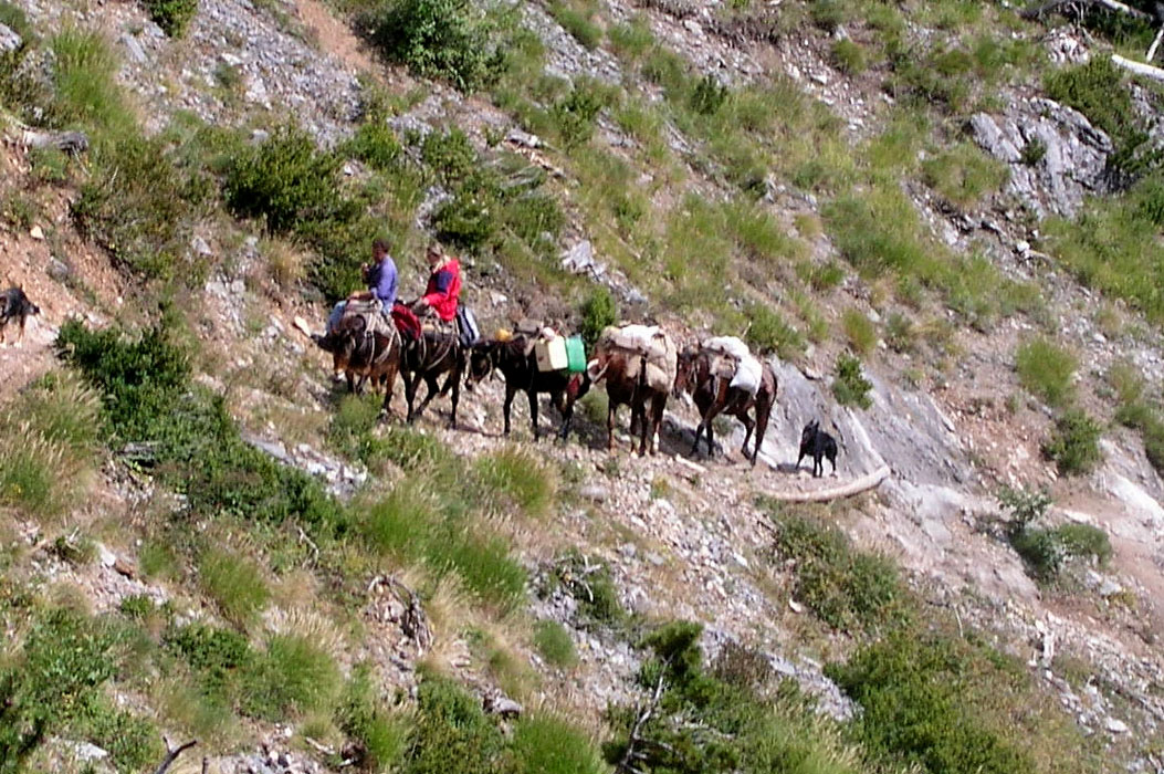
a one time fee. I continued down at 1200, met some mules
that carried
supplies to the refuge and reached the car at 1315.
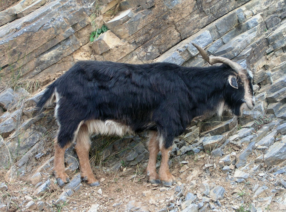
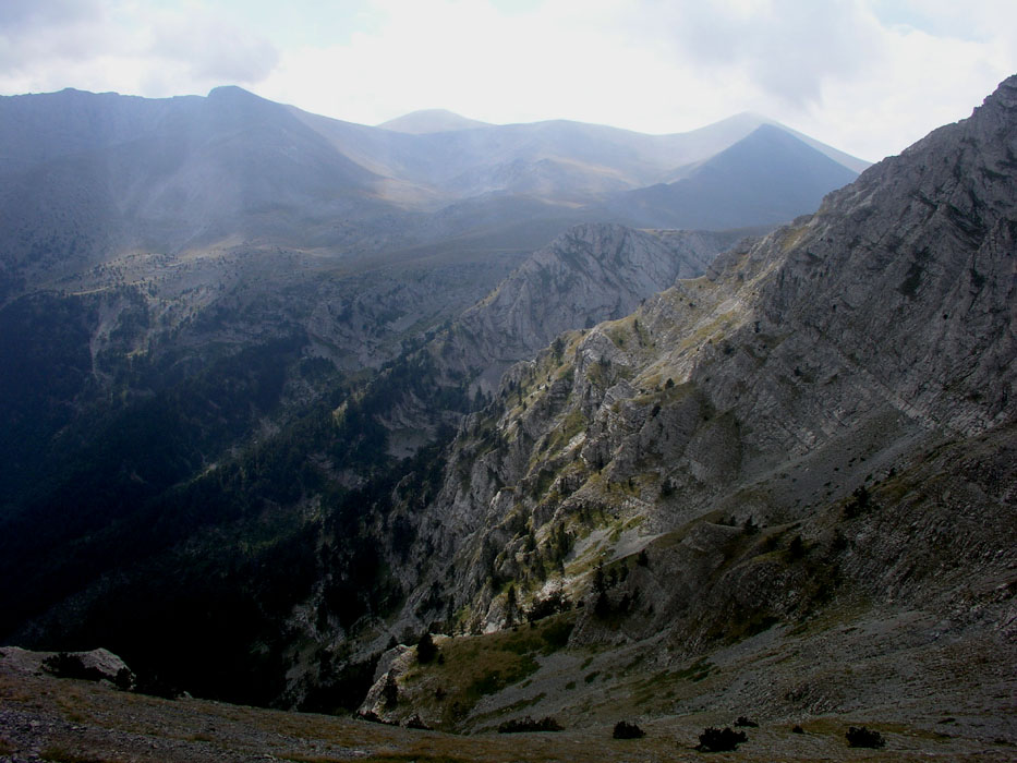
Very few people, but quite a few goats in the Greek mountains.
This hike involved a vertical gain of 1835 meter, the accumulated vertical being close
to 2000 meter.
My Greek trip continued (the same day) with
a climb of Kissavos.