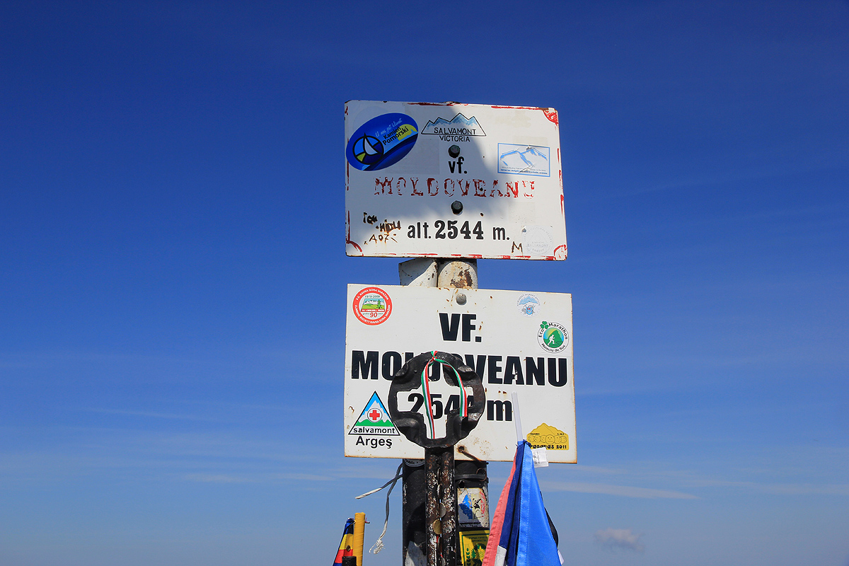
Moldoveanu
- Moldoveanu
- 2544 m
- Primary factor 2046 m
- Location: North (GPS at the summit)
- Romania
- Difficulty: YDS class 1/2 (please read below)
- Attempted: October 27, 2007 (unsuccessful).
- Climbed: August 8, 2011
Moldoveanu
|
|
How to get there:
From the international airport (OTP), exit the airport and drive left (south) towards the capital for about 4 km. Get onto the
ring road (west, right) and follow this to E81/A1. Take this good road to the city of Pitesti, continue through on E81/A1 to a smaller
place (just north), Bascov, where you locate locate Hwy. 7C towards Curtea de Arges.
There are signs for some lake, this is the correct way, the lake is way
north on the other side of the mountains. In Curtea de Arges, drive north through the center. The road becomes
a one way road (north). Continue until this road again merges and continues north as a general highway (7C),
measure from this point.
Drive 28.3 kilometer, you should then be on the top of a pretty large dam that contains lake Vidraru. Continue
on the east side of the lake to kilometer 50.1, this should be immediately after you have crossed a bridge.
You should be at the north-east pointing finger of lake Vidraru.
The location is N45:27.283, E024:37.934, elevation about 860 meter. There are several trail signs painted on
the rock, one says Podragu 7.5 hours. This is the trailhead for the Buda valley access. See further details in the
route descriptions below. In 2011, this forest road was closed by an iron barrier.
If one can use this road, this is by far the shortest approach to the summit. I was informed in 2011, that the
road in Buda valley has been completely repaired and that it is in good condition.
During summer conditions, when Hwy. 7C is not closed by snow higher up,
the route described below (2011) from Cabana Capra, is much
nicer and will give you a more complete experience.
Continue along 7C until you reach a large development area with many hotels. This is a good place to stop for
the night if you arrive late. This location is N45:33.410, E024:36.038, elevation about 1190 meter.
From this location, continue 7km up the road, you will see Cabana Capra on your right hand side and find a good
turnoff where one can park, to the right of the road before it crosses the creek and turns sharply left. This was our
2011 trailhead, location N45:35.060, E024:38.427, elevation about 1640 meter.
Notes: There are many possible trailheads. From the north side, one can go south from the
town of Victoria, then hike to the Podragu mountain hut.
An alternative, quite popular route (also from the north) heads south from Sambata de Sus on a road
that ends in a place called Sambata. From here, a trail leads futher south to the Valea Sambetei
mountain hut. From the west, one can continue the road (7C) described above, and locate the
Cabana Capra mountain hut (2011 hike). From this, one can then follow the main ridge towards the east.
Finally, there is a long forest road access (on the south side) that heads north from the small
place called Bradetu (north-east of Curtea de Arges).
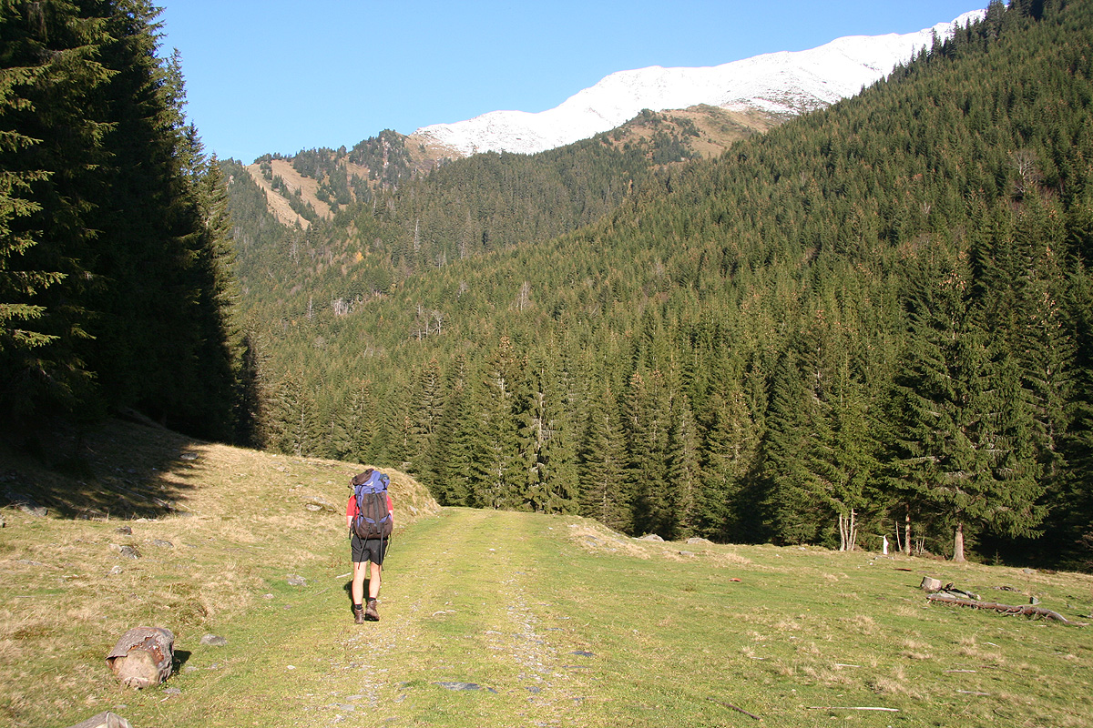
Route description, in late October with snow in the higher mountains:
There are many routes, the description here is the route we took on our first
attempt. This route is the most direct, in particular if one can
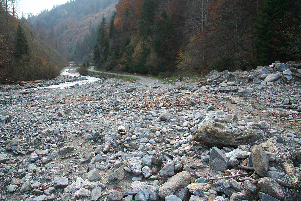
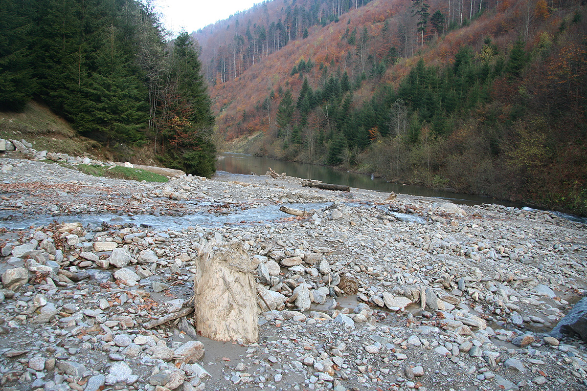
drive on the forest road. This forest road going up the Buda valley, was badly damaged by floods
in 2007. Repairs are scheduled for 2008. The road is roughly 18 kilometer long, plan at least
4 hours for the hike.
From the trailhead, follow the forest road as it enters the Buda valley. Note that there is
a roadfork almost immediately, take the right branch. This road follows the river all the
way to the upper end of the valley, where the valley forks into several small and
steeper mountain valleys. Three trails are marked from this area. A blue trail heads left
up and across the main ridge to the Podragu area. Higher up, near the third and highest
Sana (shepherd hut), there is a red and a yellow trail. The red trail continues up the main
valley and eventually gets you to the col just north-west of Moldoveanu.
The yellow trail heads up to your right (east), when looking uphill from
the shepherd hut. This trail is likely the most direct route to the summit.
As long as avalanche conditions are avoided, this is (with all hindsight) the best route to the summit with
early winter conditions.
However, this description runs to the col north-west of Moldoveanu.
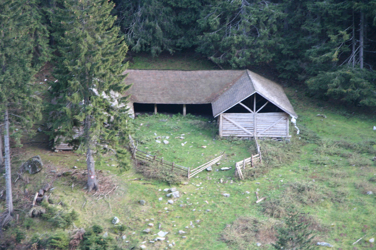
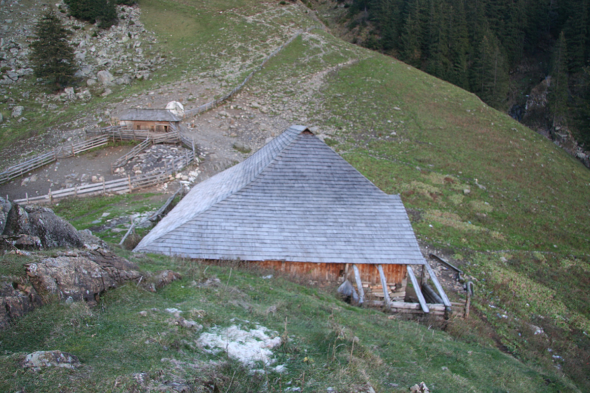
As you enter the flat area and locate the first shepherd hut ahead, cross the river (there
are easy points to cross) and continue along the yellow marked trail passing the second shepherd
hut before a short uphill brings you to the third hut located somewhat higher. From here, the yellow
trail continues uphill (slightly right),
while you must follow a trail north in order to
locate the red trail. Thus, the red trail continues directly
up the main valley above the shepherd's
hut.
It is easy to cross the creek and then follow the red trail
uphill on the west side of the creek or just follow a trail along the east side and cross the
creek higher up. The red trail climbs the hillside well above the creek before turning right,
crossing more gentle terrain, then another hill before the final basin with its
slope up to the col
just north-west of Moldoveanu.
TRIP REPORT, First attempt in October 2007:
I made this attempt with my friend Geir Åke Dahlen. Since we ended up
climbing Vârful Ucisoara, see this entry for
panorama picturs.
I arrived from Vienna into Bucharest late Thursday evening and met Åke the next
morning (he had arrived by night train from Bosnia via Hungary). We drove on a very good
freeway up to Pitesti, then continued via Curtea de Arges to the north east finger of
lake Vidraru where the forest road up the Buda valley starts.
Starting out around 1330, we knew that the hike up to the shepherd's huts at the
end of the valley would be long. What we did not know, was that this road had been
severely damaged in a single day flood earlier this year. I had considered trying to
drive this road, but we ended up deciding to leave the car and hike the road. As it turned
out, this was a good decision since no vehicle can drive the road before it is repaired.
The first part was muddy due to current lumber activity. Soon thereafter, we came to
a section where more than half the road had been washed out by the river. Next, came
a section where a smaller creek coming down from the left
had caused havoc with the road.
A large pile of rocks and water not only blocked the road, but had also partially
created a dam
and a small "lake" that completely flooded the road. The only bypass involved
climbing 30 meter above some cliffs, then descending very steeply back down
to the road.
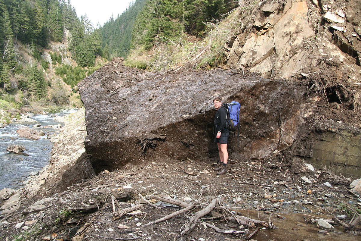
There were numerous smaller sections of the road being damaged, quite high up in the valley
a large rock
had detached and essentially blocked the entire road. This rock was interesting
since it had about 5-10 centimeter of ice coating. Exactly how this could come about became
a topic of discussion as we continued our walk.
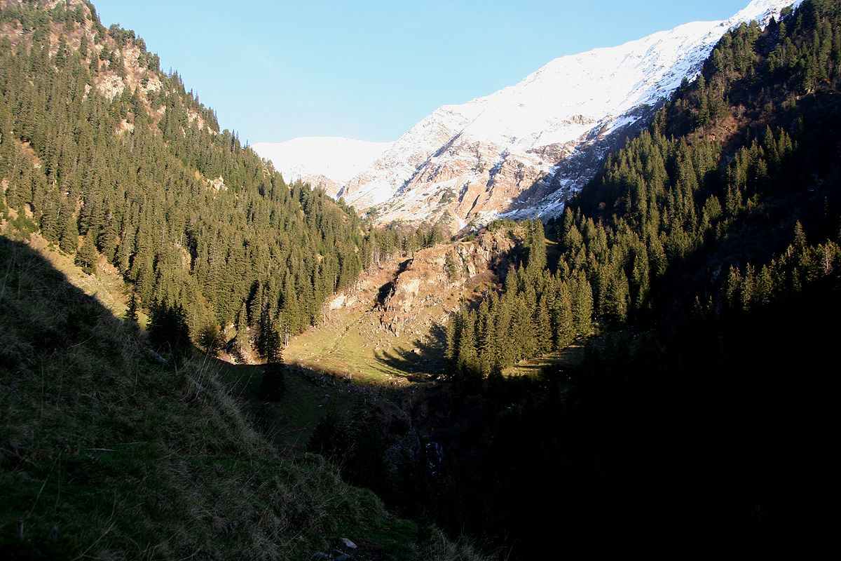
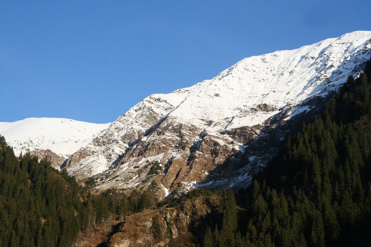
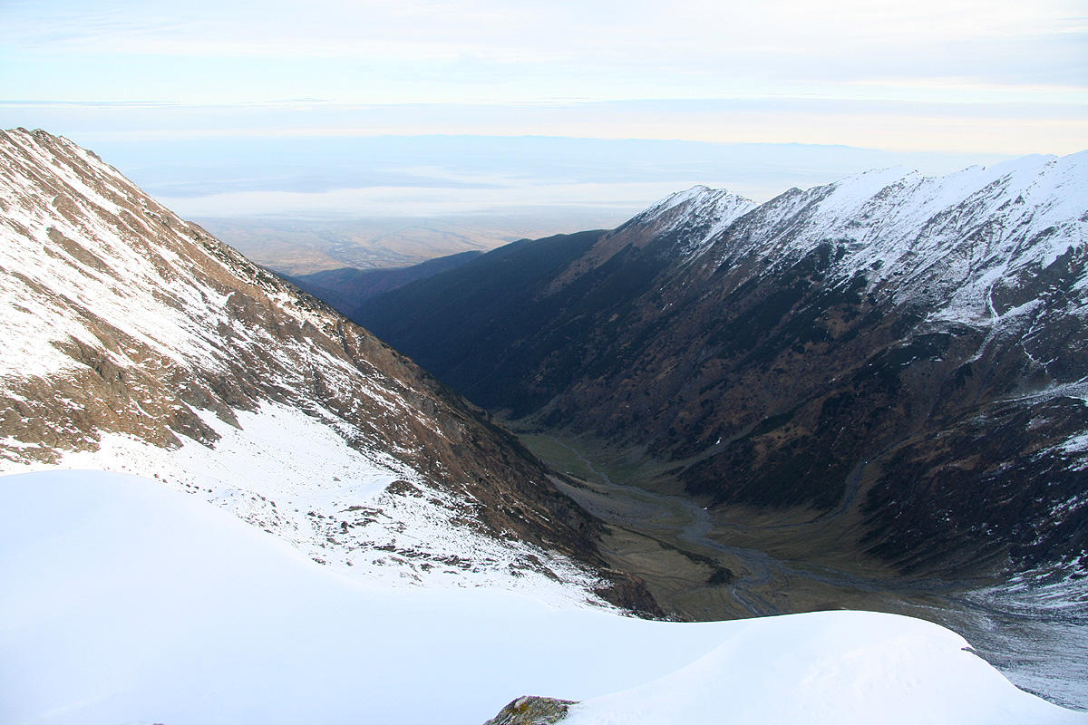
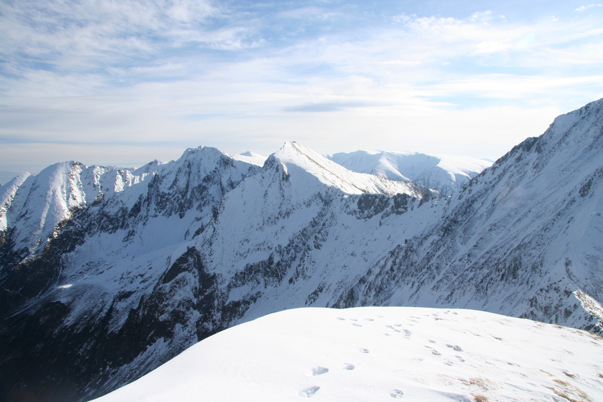
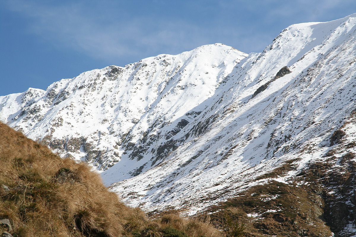
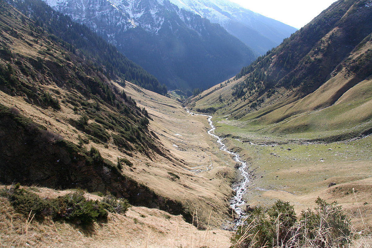
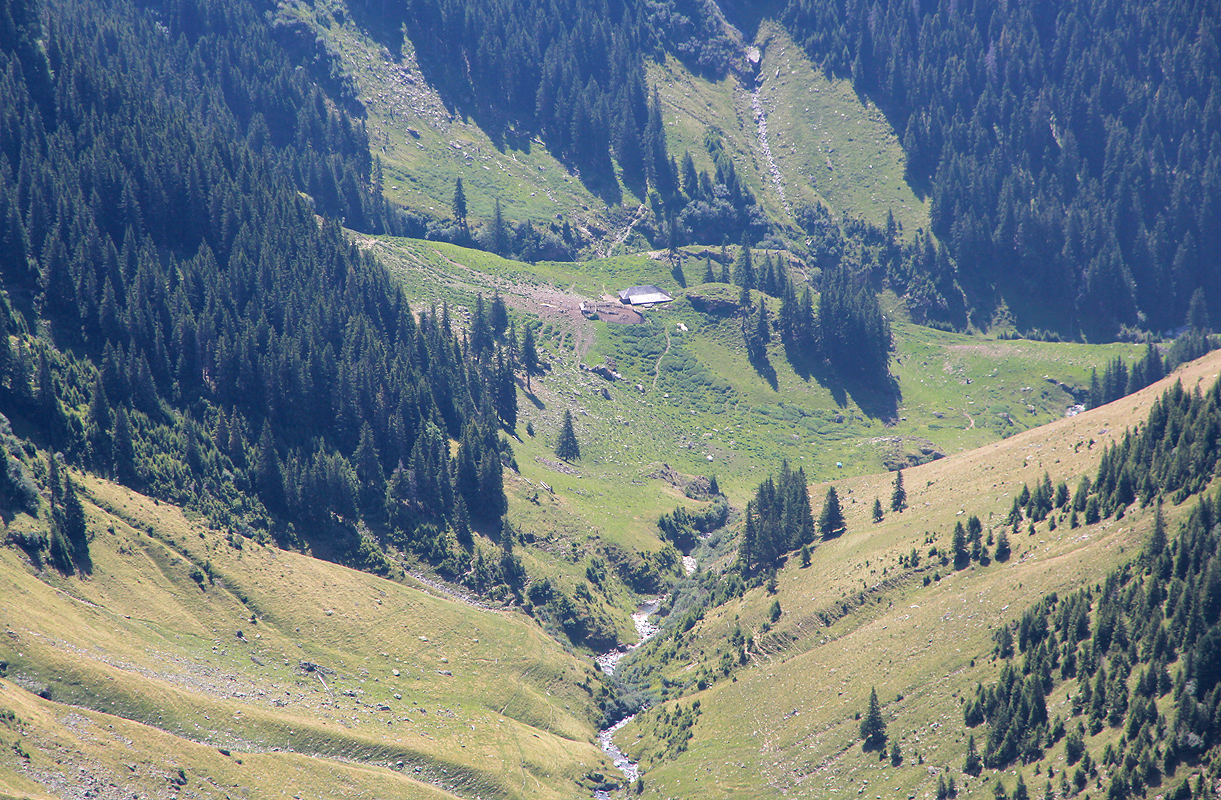
This valley is quite impressive with steep sides and several sharp bends. Higher up, the
mountain ridges became visible, very impressive with snow towards the blue sky. We gradually
entered more mountain like pastures
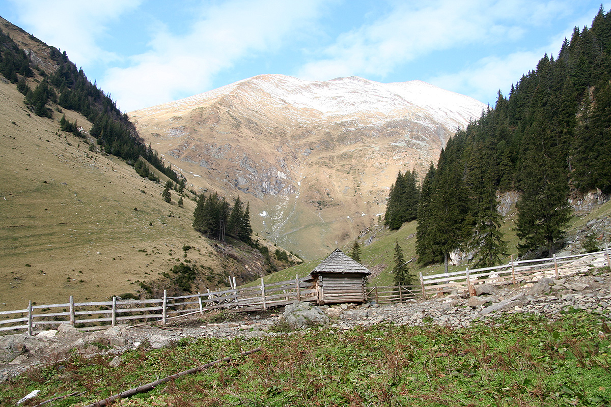
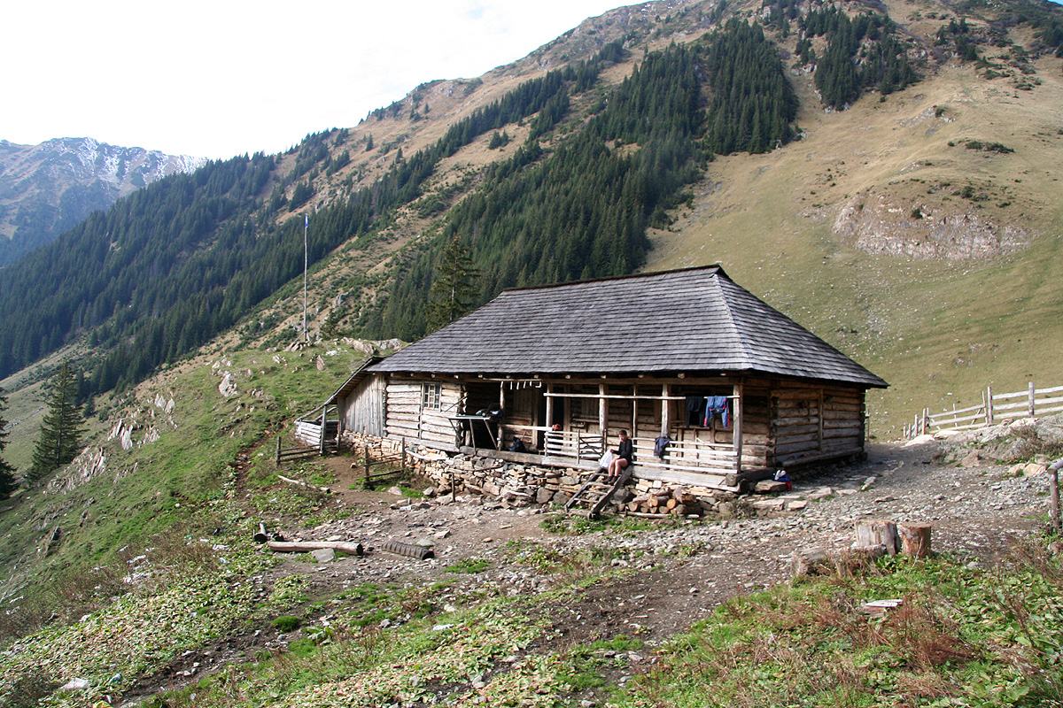
and passed by two shepherd huts before stopping
at the third hut located where the valley bends.
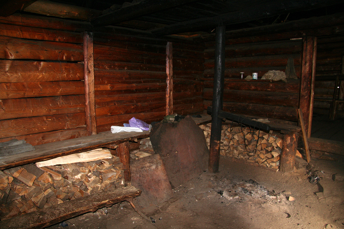
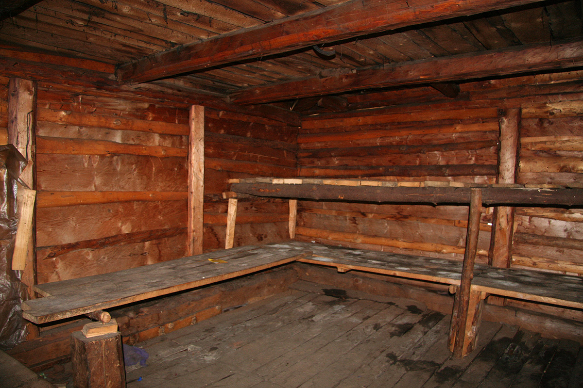
It was open and provided us with a good place to
spend the night. The hut
looks very well built from the outside. The inside was a bit more
primitive, a dirt floor in the first room,
an open fireplace on the floor and some firewood
neatly stacked in the corner. The second room had
a rough floor and several wooden platforms
serving as beds. The weather was perfect as the sun set
and we went inside, no need to get up before
six the next day meant a fairly long night.
The next morning we started out around 0645. We had to decide between two routes, a route
marked by yellow triangles (painted) going fairly directly up to the summit crossing a south facing slope
then up along a south-east ridge, or a route marked by red triangles (painted) ascending the
valley called Orzaneaua Mare to the main east-west ridge of the mountain range, then ascending from
the north-west.
We believed that the red triangle route was likely to be the easiest (in terms of steepness) and decided
to go that way. What we overlooked was a careful assessment of the snow conditions and what difference
a south facing route as compared to a north-west facing route could imply. This was possibly a costly mistake,
however, since there was no snow yet, it was difficult to make any firm conclusions.
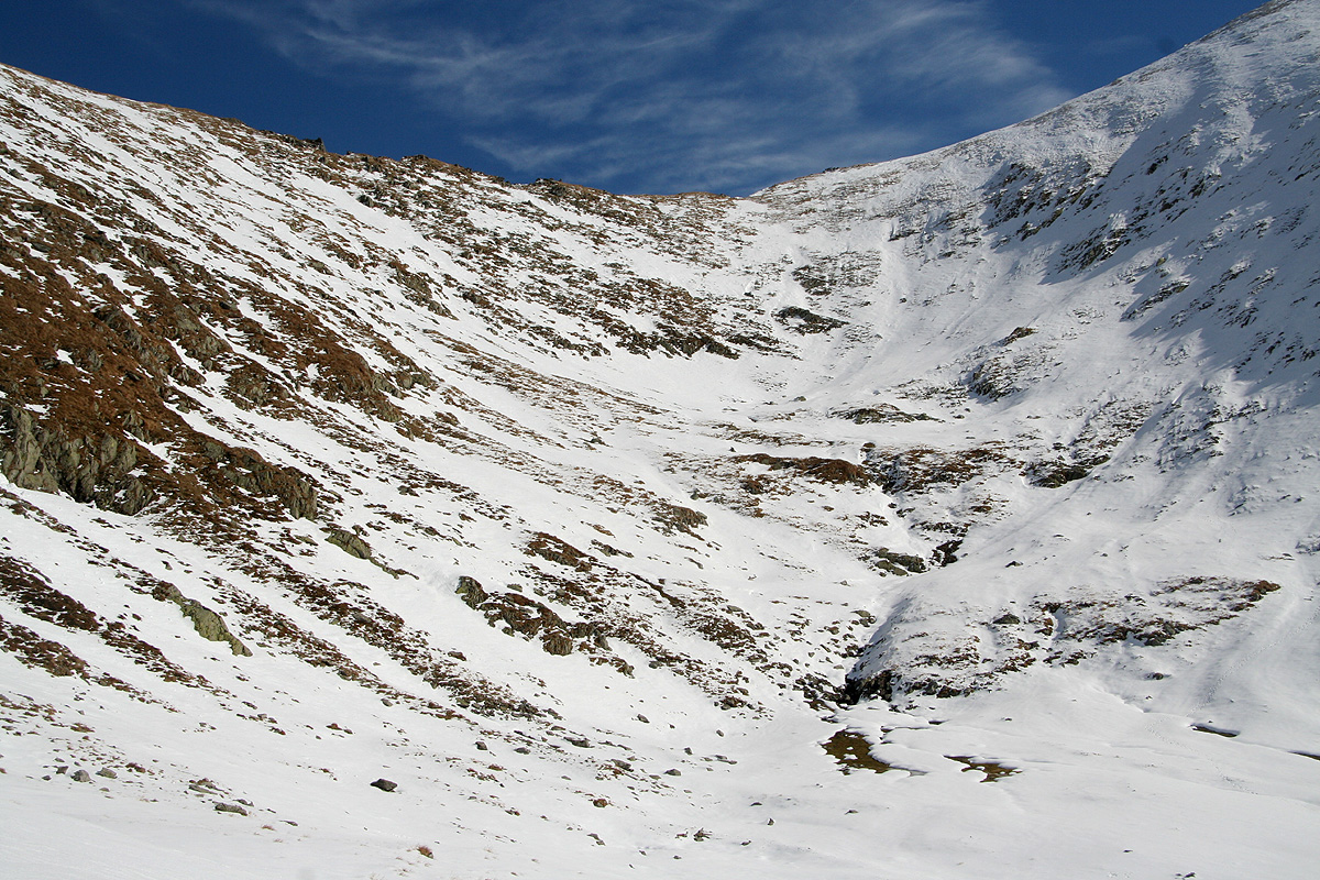
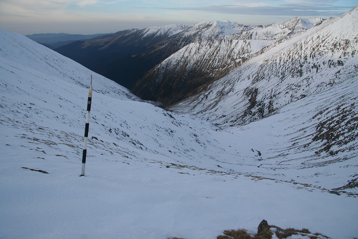
We crossed the creek and headed steeply uphill until we hit the trail, then followed it into the basin
below the slopes coming down from Corabia (2406m). Here, the route turns right (north-east). The creek is
coming steeply down making small waterfalls along its way. The trail first climbs the lower slopes of
Corabia, before traversing right into the basin above. We climbed a second somewhat steeper step, then headed
into the final bowl before
the col ahead. The going was easy and the snow was pretty good. We did not
sink into it, but made footsteps in the crusty surface. Unfortunately, as we completed
the last few meter before the col,
the snow conditions deteriorated badly. The surface became hard as ice and very
slippery. We declared a rest as we now could look down
into the Zanoaga valley going north.
Unfortunately, Åke had left his ice axe as well as crampons behind
in Norway. Since he had started his Balkan trip many days before we met and since his main objectve was
travelling, not ice climbing, this was not at all unreasonable. However, right now it seemed obvious that
this gear was badly needed. I carried the items and decided to check out the conditions, the surface looked
good for crampons. As I started to put on my crampons, I realized that the front part of my Scarpa boot had
detached and was partially gone, due to extensive use (wear and tear). This had the rather unfortunate
effect that my right crampon would not attach to the boot anymore. A bit inexcusable, I should have checked
this prior to departure. Anyway, we suddenly agreed that this route was the wrong choice and that the
yellow marked route would have increased our chances for a successful summit bid. The only way to
improve the situation here would be a strong and warm sun. Unfortunately, the sun would take a long
time before hitting this slope
with any impact. On the other hand, the sun was obviously already hitting
the alternative route.
We had arrived at the col about 2 hours after leaving the shepherd's "stana" (hut).
We waited about one hour while looking to see if the sun would come our way, no such luck.
We finshed some trail food that was left over from my trip to Albania, then hiked up the small
summit located along the main crest, but in the wrong direction. We discussed briefly if this
summit had 100 meter of prominence or not, hard to say and our GPS units could not render
a conclusive answer either. Regardless of such theory, this was a small, but nice summit. We decleared
another rest for photography as well as just looking around.
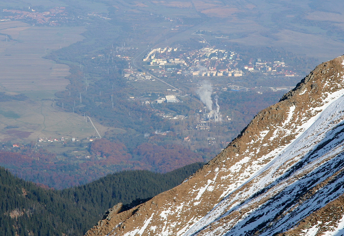
The town of Victoria was right below us,
the main crest continued west across a summit that we guessed was only
slightly higher. To the east, several more peaks,
some of which must be traversed if coming from
the Sambetei mountain hut.
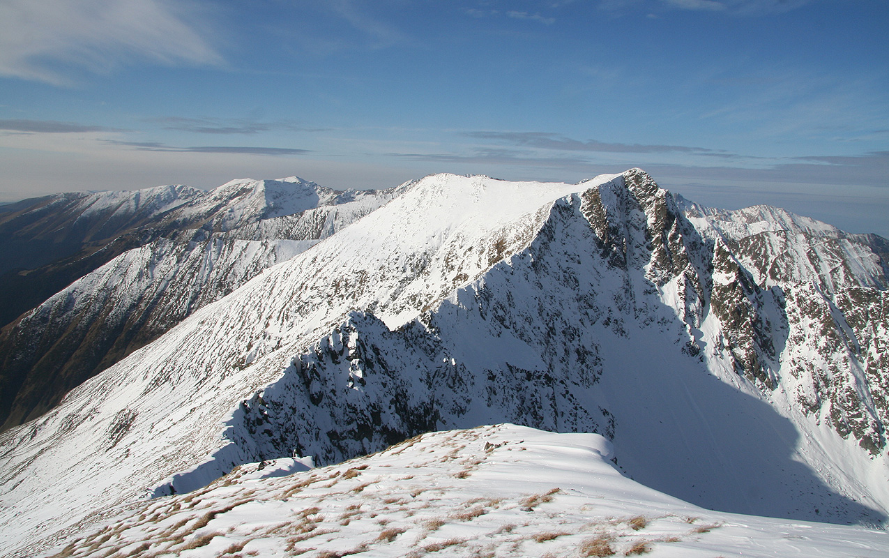
Looking back on Vistea Mare,
we could see its summit marker. We could also see
the main Moldoveanu ridge extending behind and what was most likely its highest point further to
the right (south) along the summit ridge.
We started our descent around 1100.
Before then, we had talked about waiting to see if conditions
would improve, we had talked about one of us trying a solo climb with the combined gear available etc..
Mostly speculations, I knew that the summit would remain
without a visit today as soon as I had tested
the surface and understood the implications of the missing gear. The slope was steep enough
and the ridge behind that was partly out of sight,
did not invite to splitting our small team.
We had plenty of time, unfortunately, the weatherforecast had been clear that this was the last day
before more rain and snow. Thus, we made the somewhat reluctant decision to turn back,
descend to the hut
and then hike the long way out the Buda valley.
We left the summit at 1100, were back at the "stana" by 1315 after meeting three hunters somewhat
surprisingly. They were flown in each morning and out each afternoon by a large helicopter. Must cost
a fortune, but serves as proof that some Romanians are extremely well off.
We left the hut by 1345 nad made it back to the car by 1730, almost 20 kilometer, a pretty long hike indeed.
The next day came with rain as promised. We took the car on a long loop drive in order to
find and explore the trailheads for the two other ultra prominent summits in Romania. This was
successful and we now have a pretty good idea of how to schedule a next visit to Romania.
We said goodbye in the airport, Åke heading towards Bulgaria while I flew back to Vienna, then
drove 200 kilometer (to Linz) somewhat faster than what is possible in Romania. We had a very nice
two day hike, walking about 50 kilometer, no big summit, but lots of knowledge that will be useful
when we return.
Route description, in August 2011:
From the trailhead, take the 4WD road that forks off from Hwy. 7C, where 7C turns sharply left. Follow this
road into the short, but nice mountain valley until it ends, and pick up a marked trail from there.
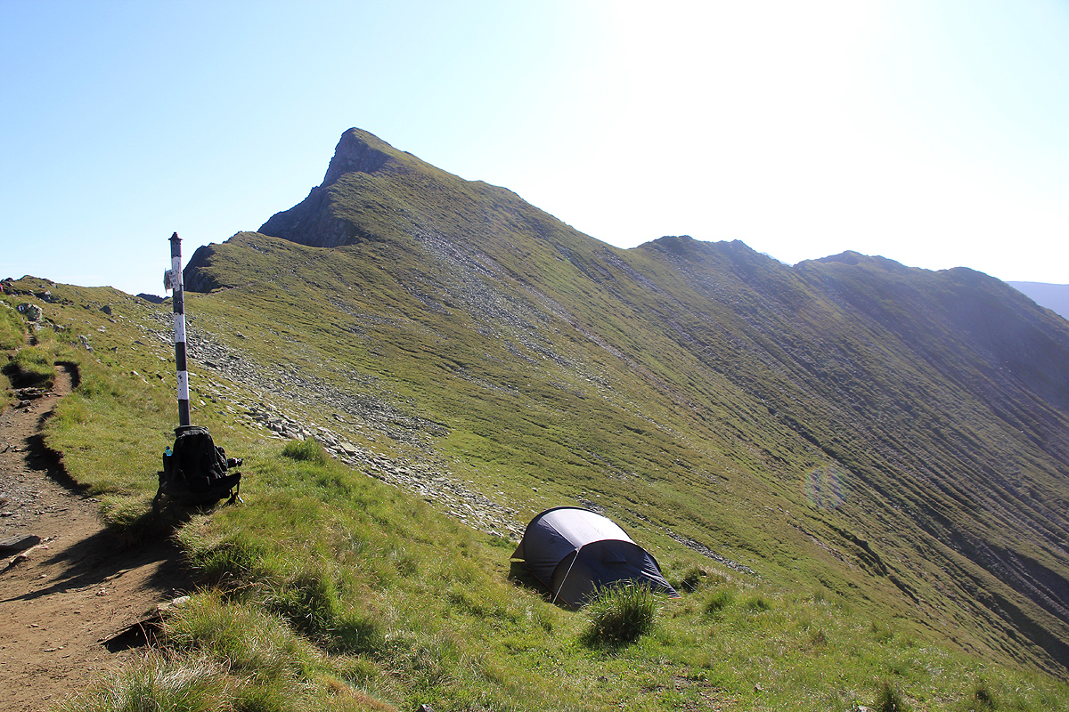
This trail climbs steeply, attains a new plateau with a shelter on your right hand side, before heading
directly up to the first col, a 4-way trail intersection.
Turn right and cross the short, but rugged ridge ahead. There are wires and a big chain to assist hikers and
not much exposure. Next, the route traverses left and contours around the big peak ahead, descends slightly before
a short, but steeper ascent to the next ridge, marked with a visible cairn.
This ridge is pretty sharp and the route traverses a bit on your left side of the
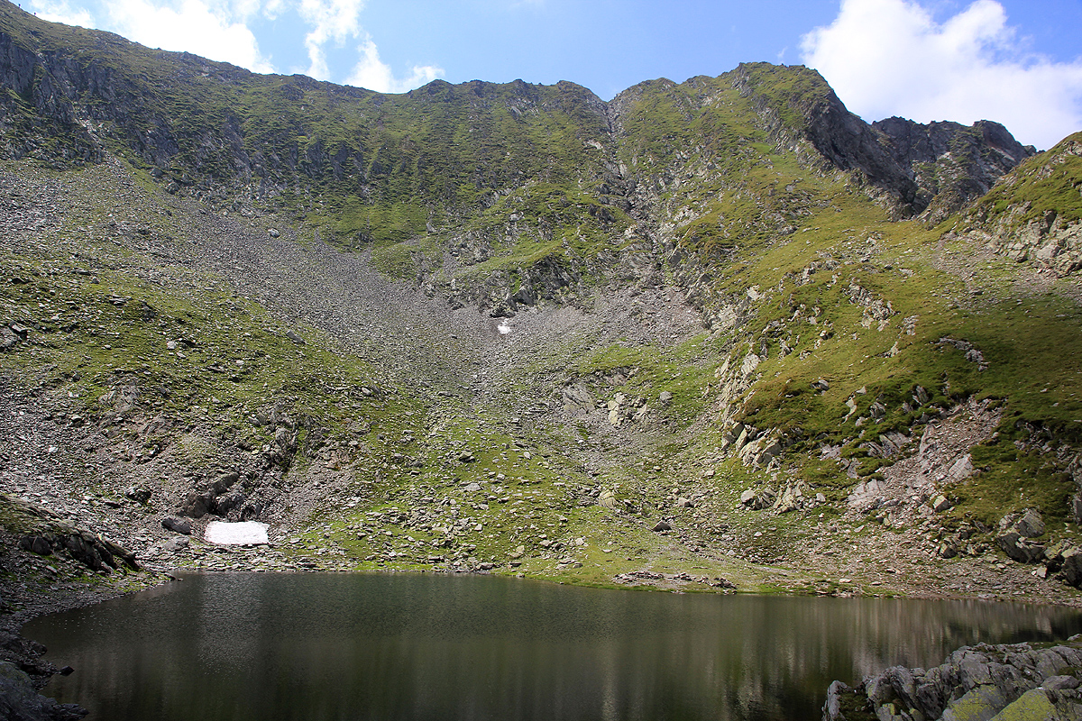
very top ridge before gaining the slopes leading to Arpasu Mare (2468m). Traverse towards its slightly lower sister
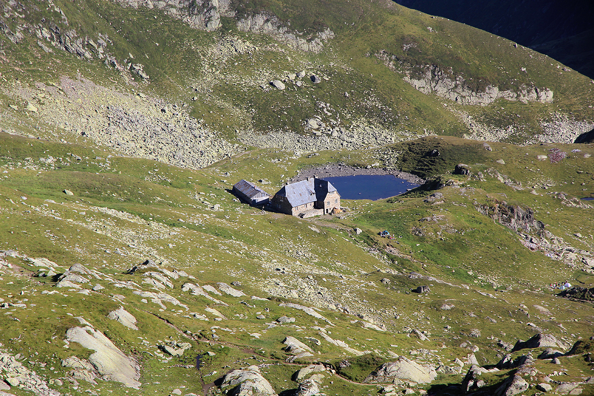
summit, Mircii, 2461m, traverse around its summit on your left and descend to the small pond with the self-serve shelter
and (possibly) several tents.
Traverse south of Podragu, then hit the next col where a trail ascends from
the Podragu refuge and where you get a good view of the hut and its vicinity.
From here, again bypass Tarata (2414m), gain
a local high-point (almost no
prominence) marked with a big pole, before descending more than 100 vertical meter to
the col Saua sei Mari. From here, the trail pretty much contours around on your right side until gaining the
final col before Moldoevanu. Next, climb the ridge to the north end of the Moldoevanu summit ridge. You are now
well above 2500 meter, so little elevation remains to be gained. The main crest continues
from here, and another trail ascends form the east. Follow, the
summit ridge to the highpoint of Romania. There is a small
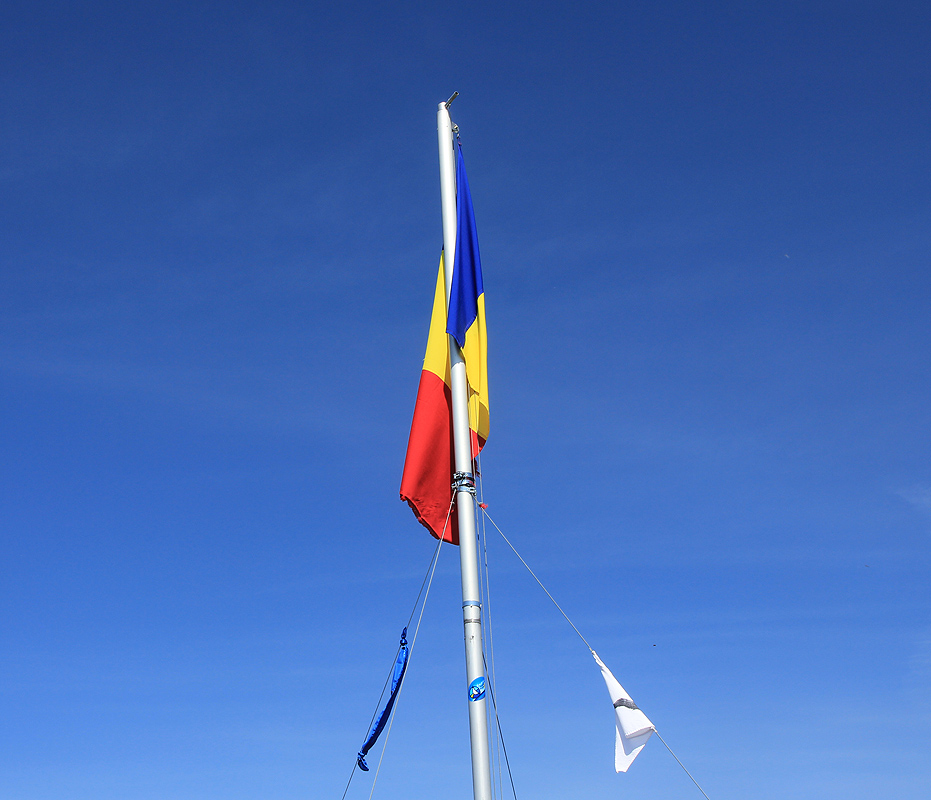
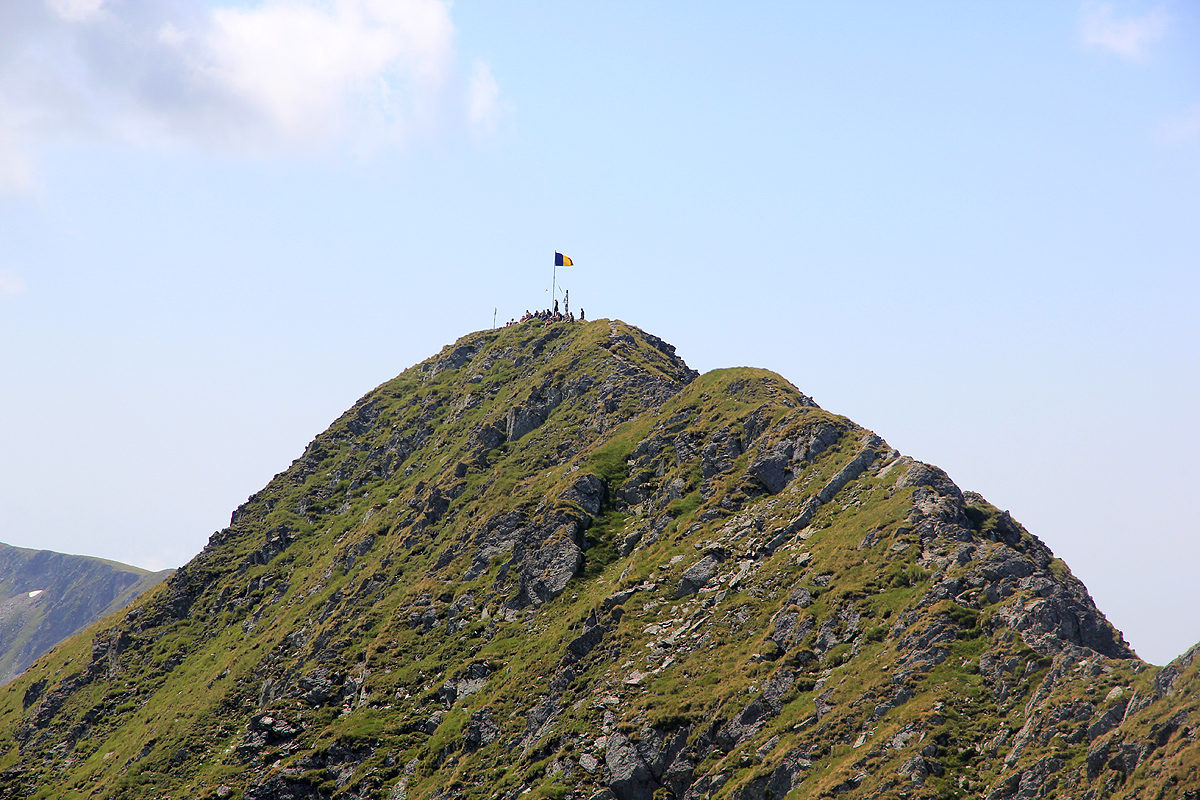
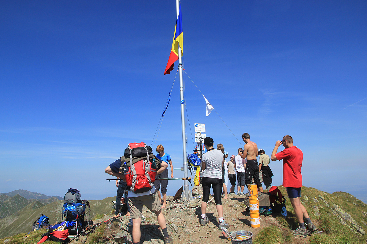
notch along the way that may have a few (YDS) class 2+ moves, otherwise a good trail. In the season, there is a flag pole
with the Romanian flag (as well as other people) there.
TRIP REPORT, second attempt in August 2011:
Finally! Four years have quickly passed since Åke and I made a most memorable, but
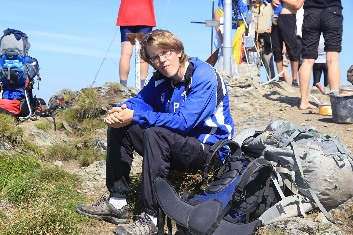
unsuccessful attempt to climb this mountain. This time, Pål Jørgen made good company
as we left Bergen on short notice to enjoy a week in the mountains before the academic year would start.
The beginning did not go too well, Lufthansa did not get our two bags from one flight to the next in Hamburg, and we
were told that they would arrive on the next flight which was due in about 5 hours later. Our plan called for driving
to the trailhead today, then start early tomorrow on what looked like a pretty substantial hike. We set out on foot from
the airport, turned towards the capital, and to our delight, found a hotel with a very charming semi-outdoor restaurant
a few hundred meter down the Hwy. on its right hand side, in fact close to a pedestrian crossing bridge. The name was
Ursus - bear, and they provided us with an excellent lunch. Coming back, all eager to go, Lufthansa announced that the
flight would be 2 hours behind schedule, urghh.
We got all organized with our rental car, brand new, only 43 km driven, then finally took off about 7 hours late.
No more trouble and we still arrived at the hotels located less than 10 km from the trailhead well before midnight.
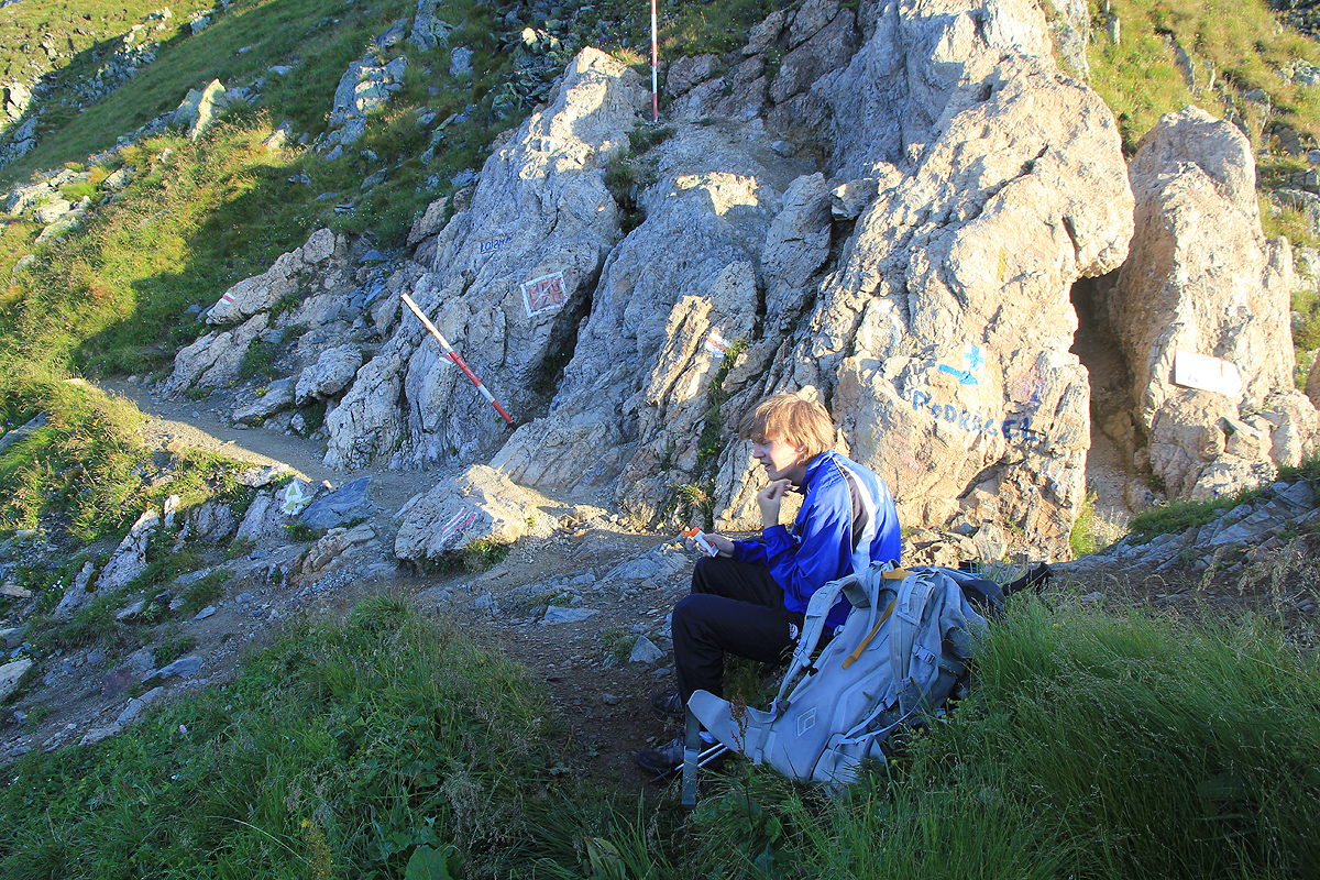
The next morning, we rose early drove to our planned trailhead and set off by 0620. Our time to the first col would pretty
much calibrate this attempt. I had read some reports giving 1.5-2 hours, if we were close to 2 hours, then this trip would most likely
require an overnight along the trail. Much to our delight, we arrived there well within an hour (50 min), and the prospects
for this climb being a single day event looked promising.
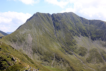
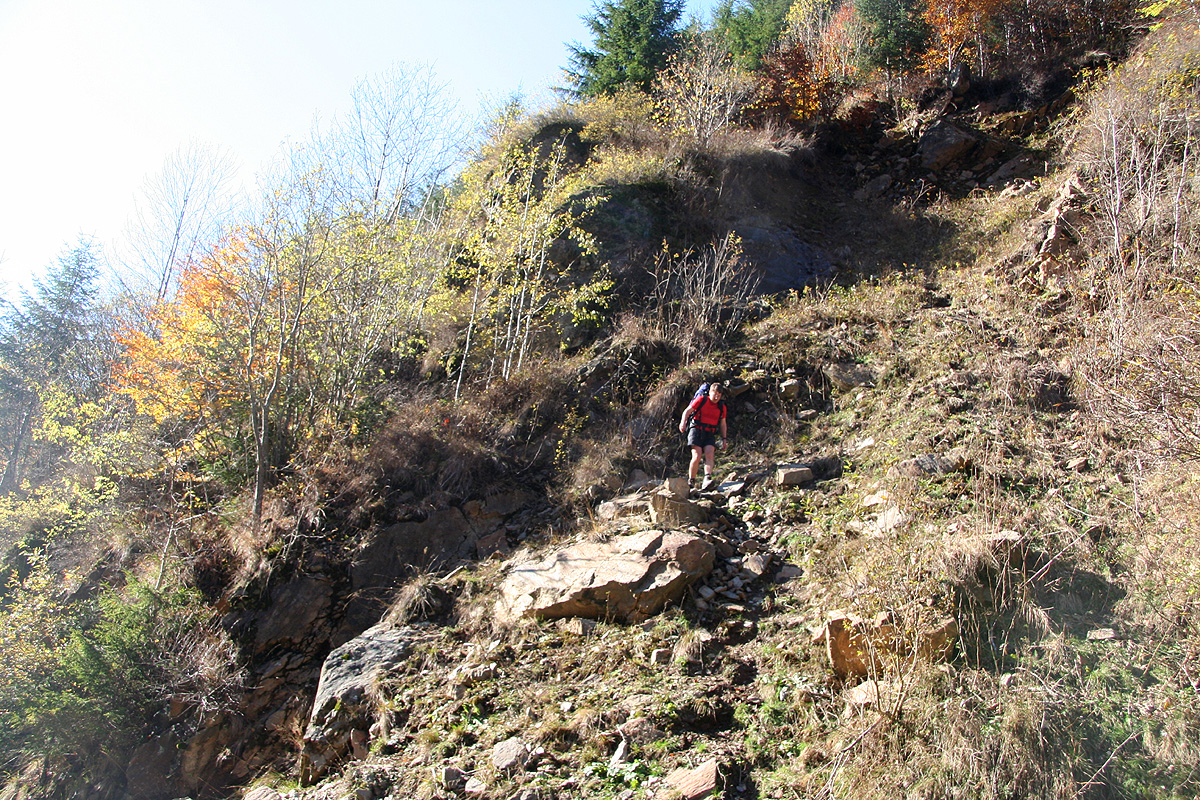
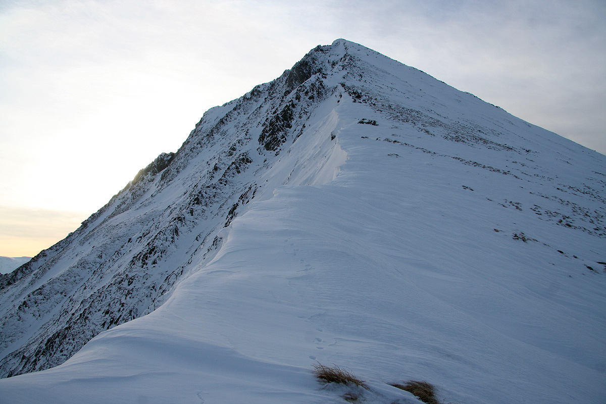
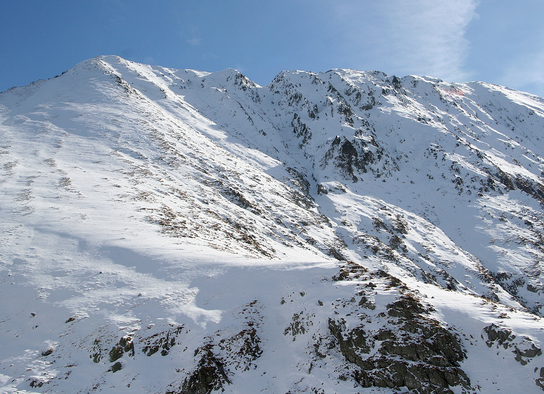
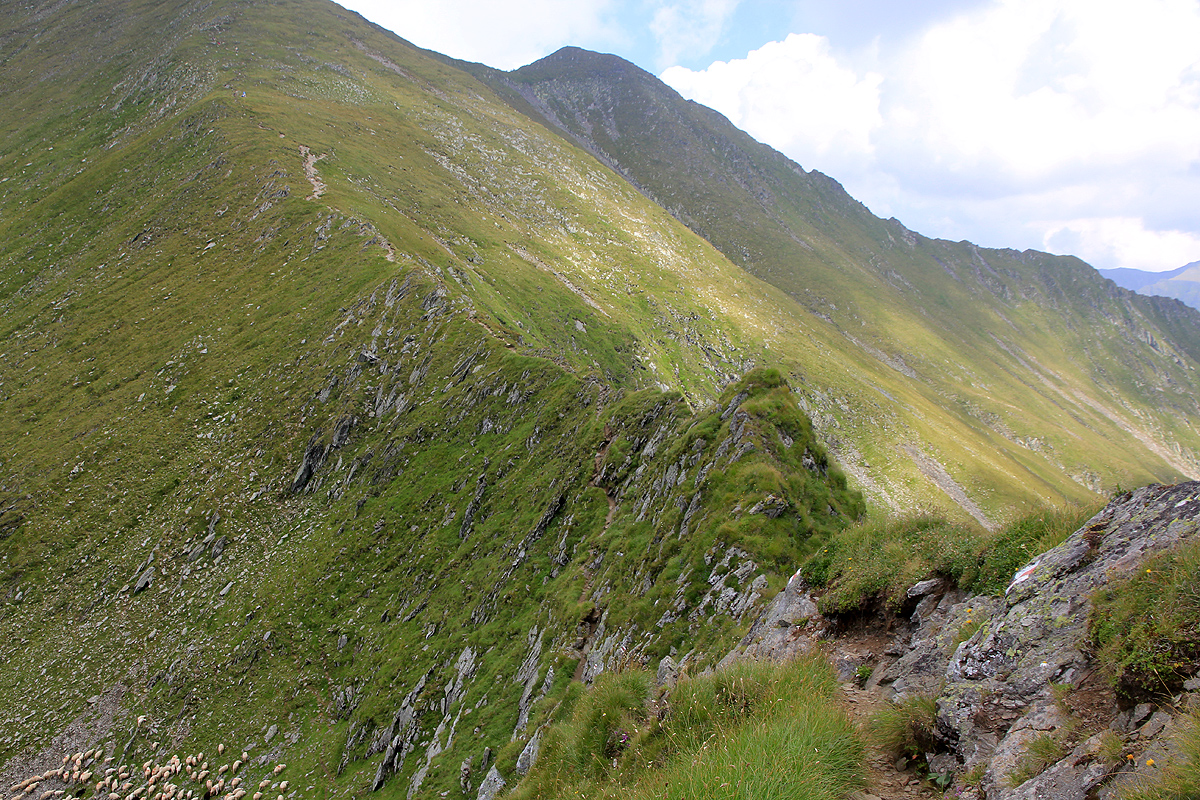
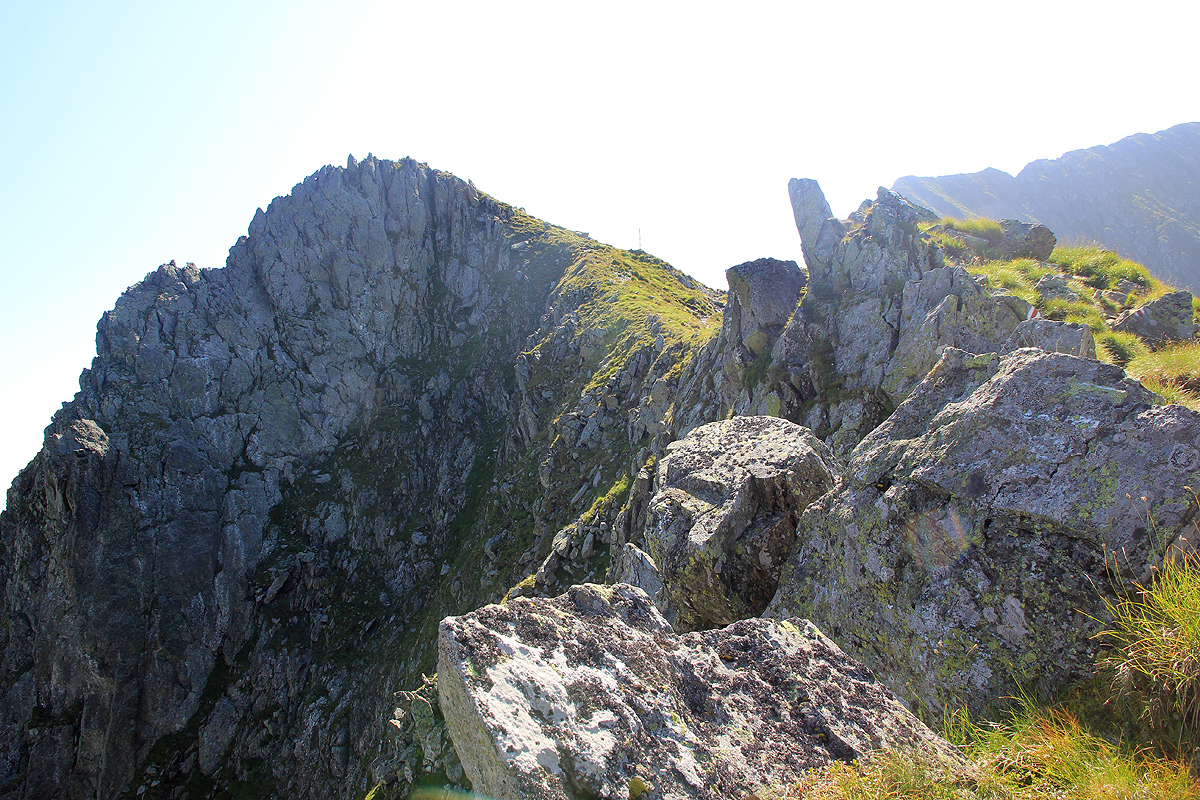
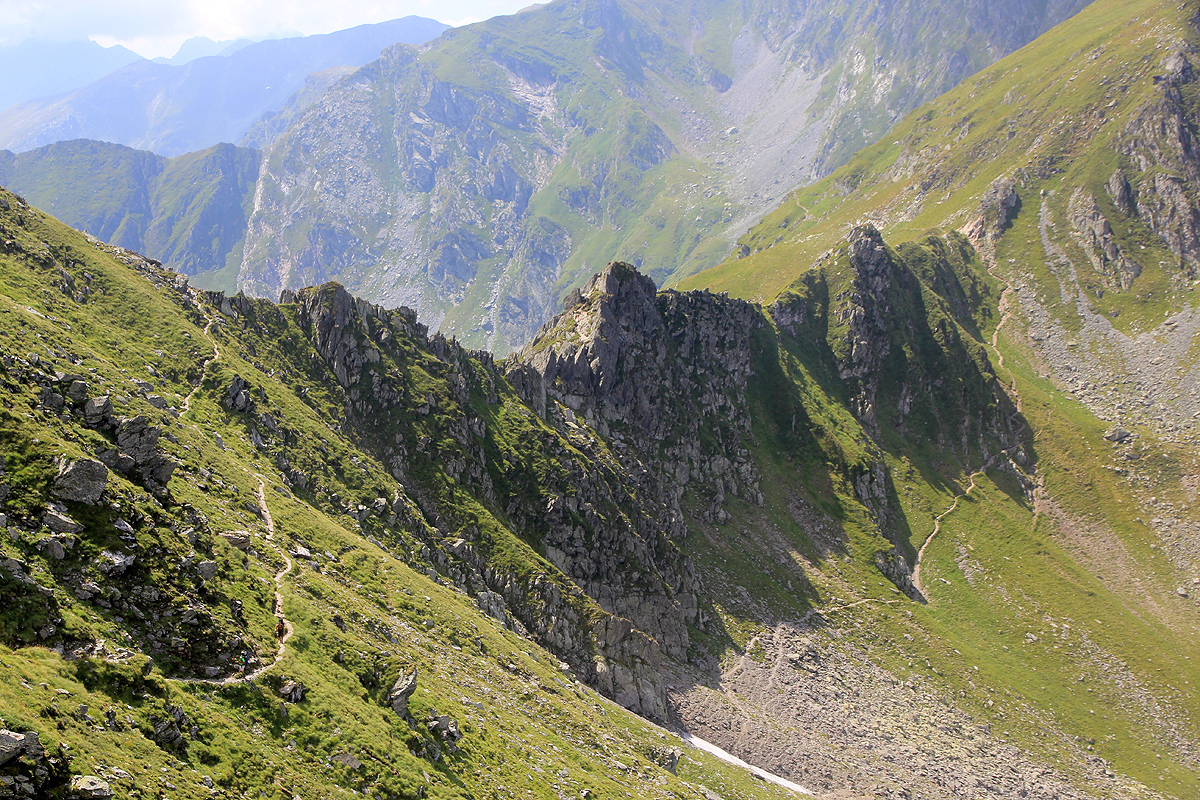
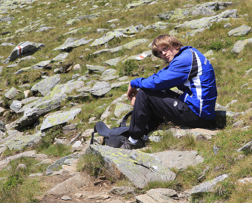
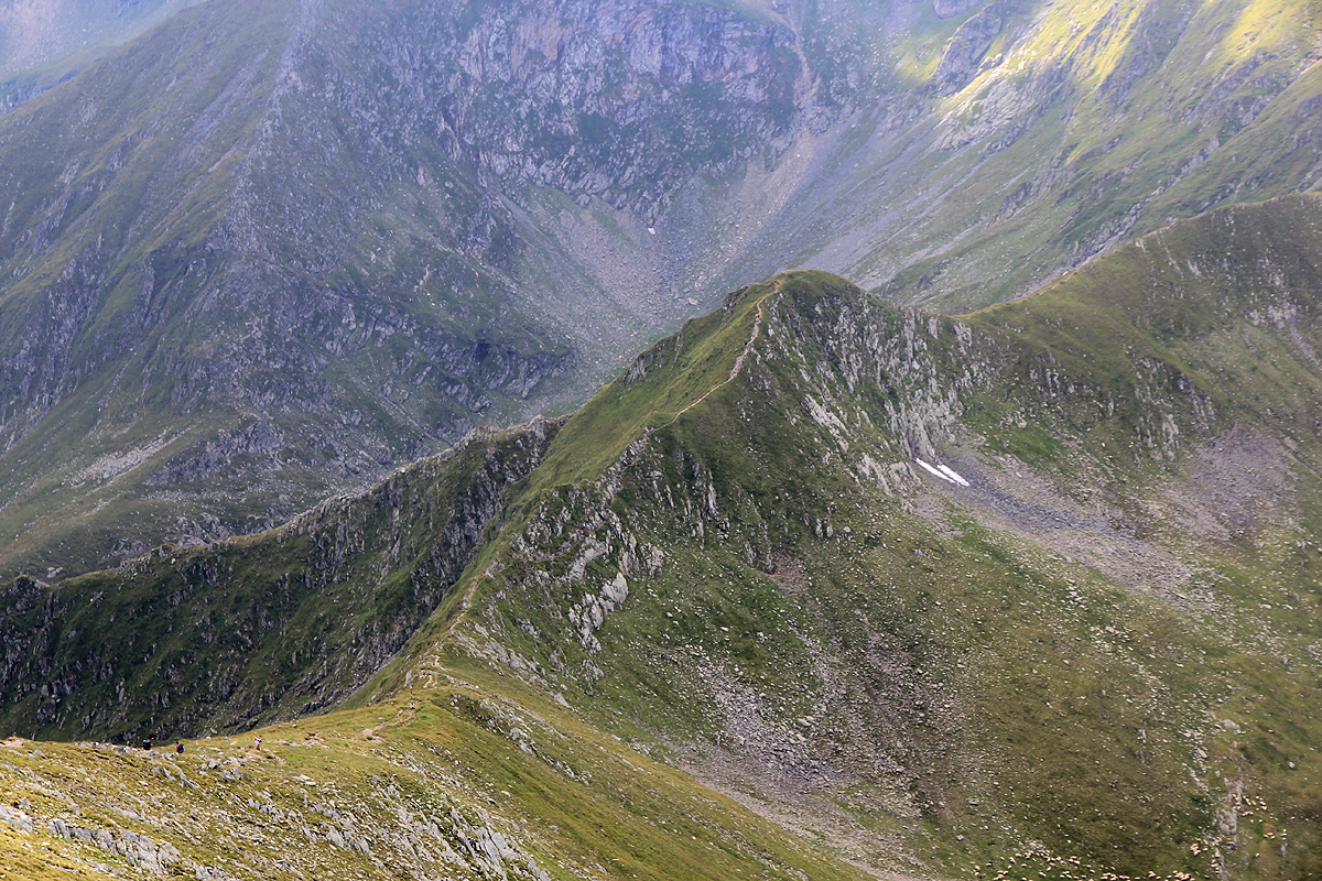
The next ridge was pretty rugged
(photo is looking back, the trail below is a different trail.) and
involved a couple of sections that certainly would be (YDS) class 3 (possibly even
a class 4 move), had it not been for wires and a big chain. Still, I wondered, if the terrain would continue like this,
then it would be time consuming.
After two hours, we met a party of 4, they all shook their heads
when we told them we were headed for Moldoveanu (and back!) in a day. They claimed it would take us another 6 hours to reach
the peak from were we met. The weather was gorgeous, and we were not to concerned.
We continued to a small pond with an unmanned, self-serve shelter and about 6 tents,
a well deserved break was called for in
this beautiful spot.
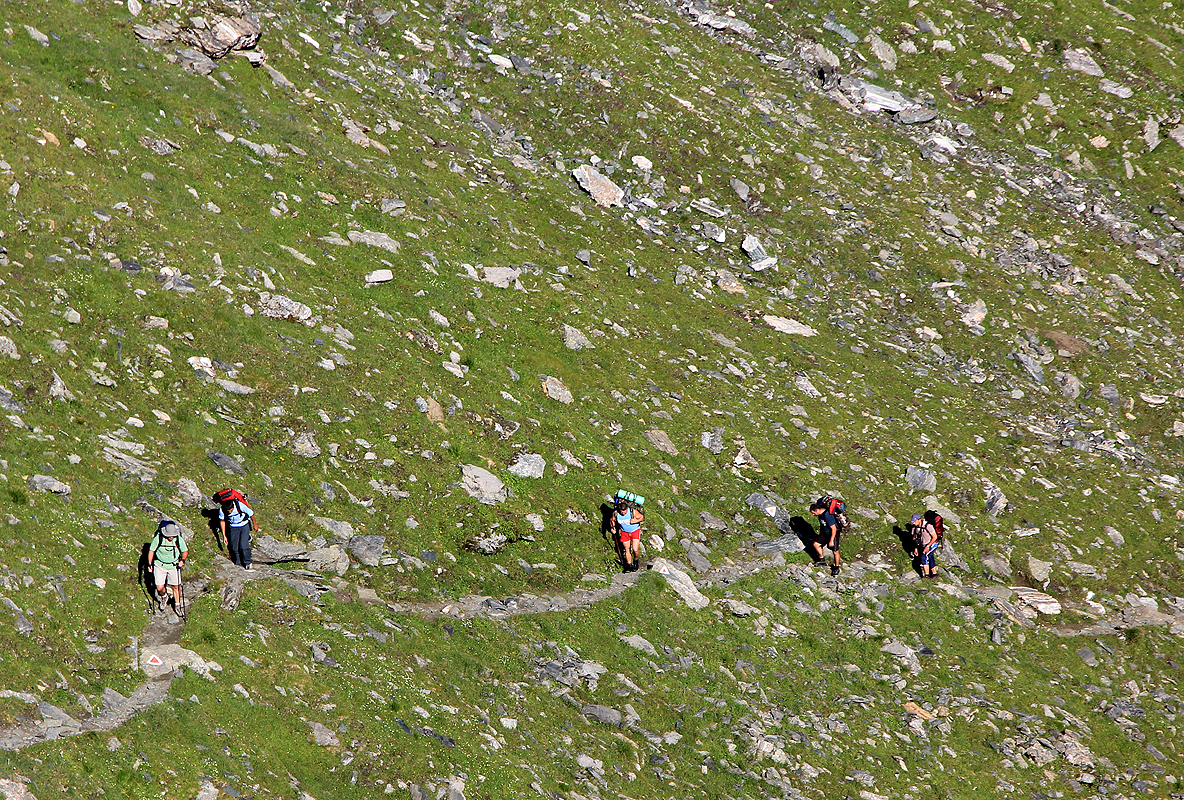
The trail continued as a good class 1 trail, it bypassed most peaks instead of climbing across and we made good progress.
Quite a few people on this trail, most likely one of the most popular in all of Romania. The view down north to
the Podagra hut was nice, and people were coming up to the ridge on a rather steepish trail. This would be a possible place
to stop on the return if it became obvious that we would run short on time.
A bit further along, and I saw the shepherd hut
that Åke and I slept in 4 years back, way down into the valley on my right. A good sign.
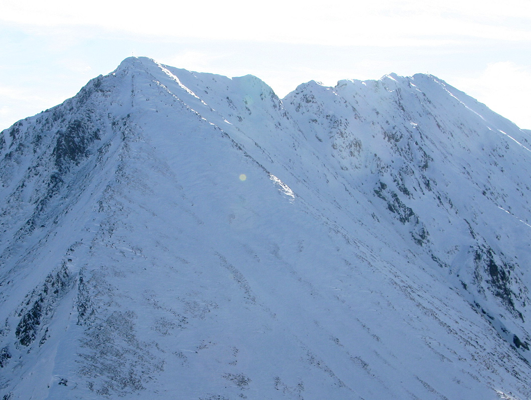
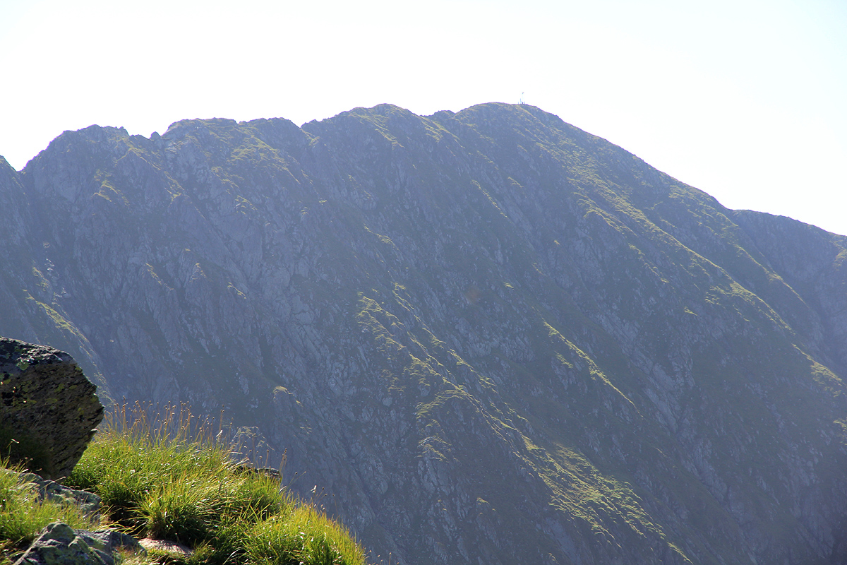
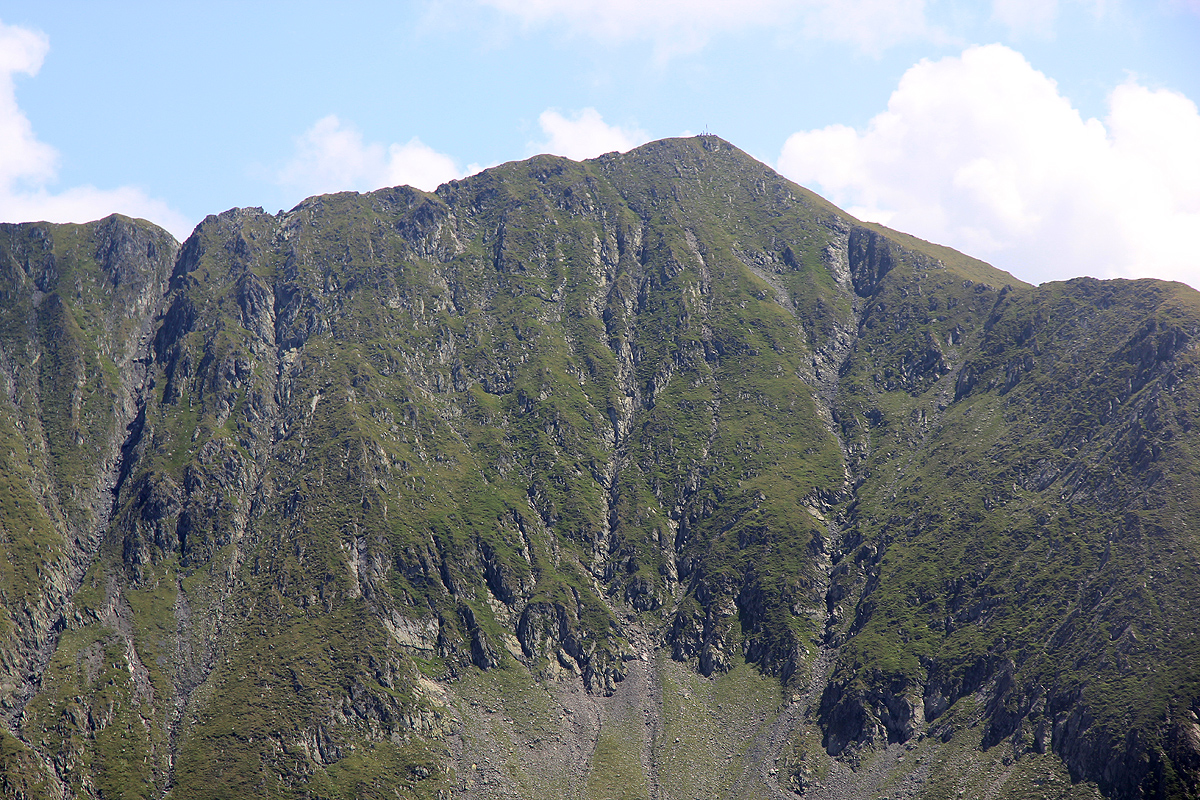
Perhaps even better, the final summit ridge of Moldoveanu came into view across the upper
part of the Buda valley, and we could clearly see the flag on the summit.
The final climb was smooth,
and by 1115 the summit was ours.
Not exclusively, there were perhaps another 20 people on the top.
Rest, lunch, water and photo. I got confirmed that a more direct route up from the Shepherds hut, then possibly a traverse
right to the more gentle ridge, would have been our key to success back in 2007. It looked substantially easier.
We still had a long day ahead, so started back already at 1130. The return hike was equally good, this time we decided to
include Arpasu Mare, as our route went really close to the summit anyway. We were there about 1410, knowing that most
uphills were now behind us. Photos and a short summit break.
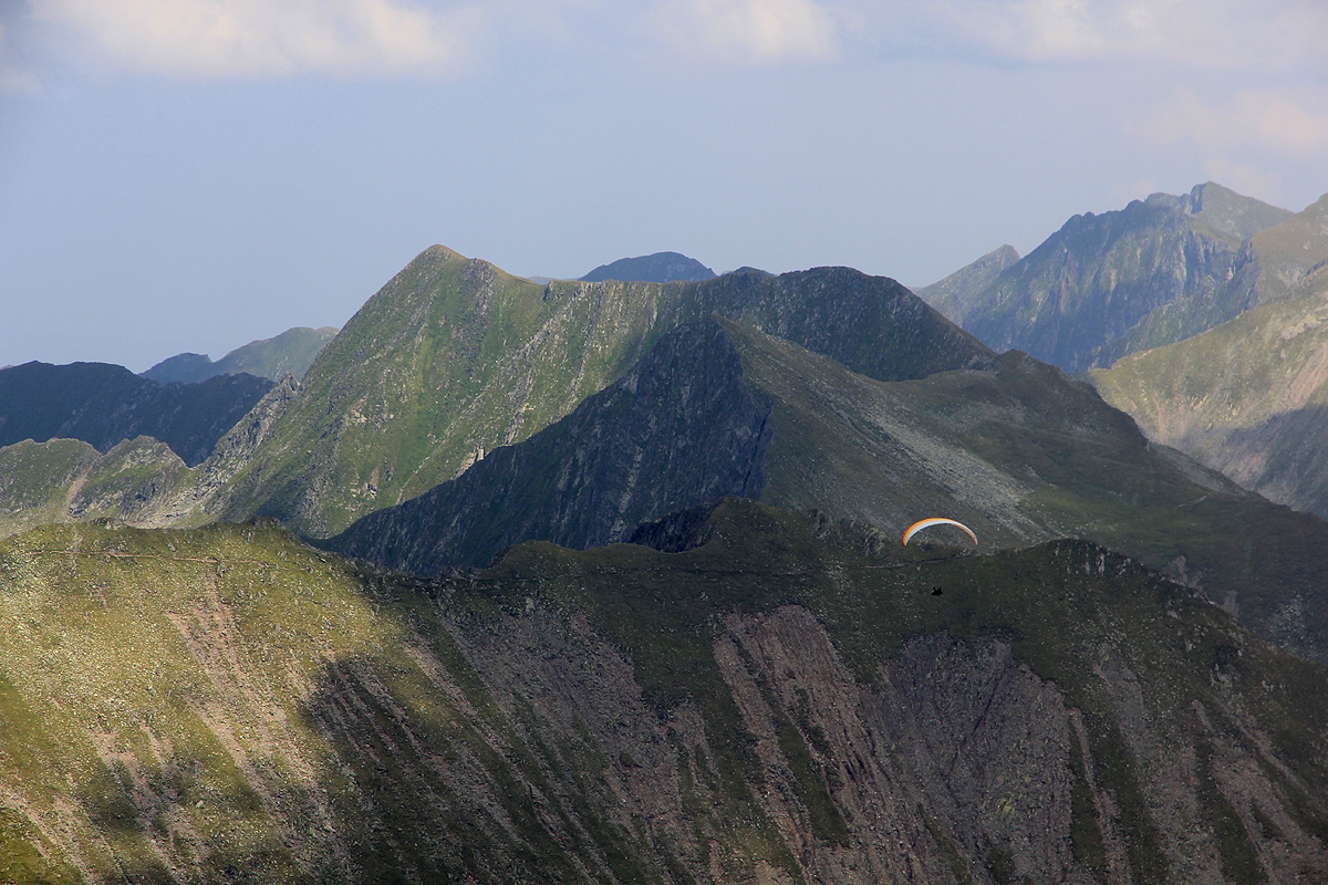
We became aware of several para gliders that seemed to enjoy the local updrafts.
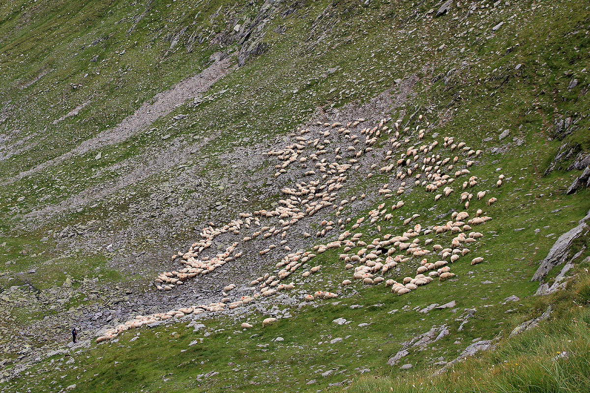
We descended and continued back along the sharper part of
the ridges (with lots of sheep far below),
hitting our first and key col at 1515. From here, an easy descent arriving back at
the car by 1610, a bit short of 10 hours, a very nice day. This was a fairly rough start on our trip, the next several mountains
should be somewhat easier. We succeeded to drive across to hotel Rusu,
thus in a perfect position for a good continuation the next day.