Location: North 35:45.898, West 82:15.906 (GPS on the summit)
HP North Carolina
Primary factor 1857 m
Difficulty: YDS class 1
Climbed: March 10, 2008
Information:
How to get there:
The city of Asheville, northwest in North Carolina, is a good
starting point. Asheville is located on Interstate 40, with Interstate
26 coming from the south. Follow signs for Blue Ridge Parkway going
north-east. Look for Mount Mitchell State Park and make
a left turn.
Alternatively (since this section of the road was closed
when I visited), go east to the small village of Marion, then take
Hwy. 80 north. This road will intersect the Blue Ridge Parkway north-east
of Mount Mitchell, so make a left and drive to Mount Mitchell State Park,
making a right turn.
In either case, drive a few kilometer uphill and park at the State Park
Visitor Center, on your right hand side just as the road makes the
saddle. This is a good trailhead, location N35:44.730, W082:16.651,
elevation 1857 meter.
One can drive almost to the summit, however, a short hike makes the
visit much nicer.
Route description:
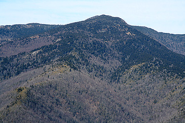
From the trailhead, follow the clearly marked trail to the summit.
The trail partly climbs, partly contours across two hills before arriving
at the final slope to Mount Mitchell.
After passing the first hill, you cross near some buildings and the road is
also just to your left side. Further along, the trail forks. This fork is clearly
marked with a sign. Make a sharp left turn here and proceed to the summit.
One may return the same way, or walk along the road. If one drives to the end
of the road, this hike is reduced to a total length of only a few hundred meter.
Comments:
I had arrived in Tennessee after a very successful week in Colorado, productive work
at the Colorado School of Mines, staying with good friends and a finishing off with
a long, but good climb of Bison Peak in The Lost Creek
Wilderness.
I started from Oak Ridge in the morning. The Blue Ridge Parkway was closed by a rock slide
between Asheville and Mount Mitchell. Thus a slight detour via Marion and then Hwy. 80 north
was required.
I left the trailhead at 1045 and arrived at the summit by 1130. The place looked really messy,
work to make some kind of viewing platform was clearly in progress. I rested and looked around,
then descended at 1145, making it back to the car by 1220.
I drove by here along the Blue Ridge Parkway in the summer of 1993. We visited Clingmans Dome, however
may have passed by Mount Mitchell.