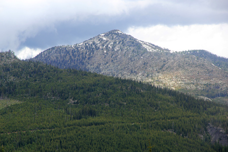
Kootenay Mountain
- Kootenay Mountain
- 2456 m
- Primary factor 1801 m
- Location: North 49:14.448, West 116:49.357 (GPS at the summit)
- West of Creston, BC, Canada.
- Difficulty: YDS class 2
- Climbed: July 14, 2011
Kootenay Mountain
|
|
How to get there:
A good point of reference is the village of Creston in British Columbia, Canada.
This village is located just north of the border across from Idaho.
Locate Hwy. 3 heading west from the north side of town. From the junction with Hwy. 21, proceed
5.4 miles, if you start from the junction with Hwy. 3A, this distance is about 6.4 miles.
You have just crossed a bridge across Summit river. Turn right immediately after this bridge.
The road, a nice dirt road, is signed as Topaz Creek Forest Service Road. Folllow this road
to mile 2.1, ignore three smaller roads that have forked left before this point. There is a
kilometer marker 3 at this point.
Consult this map in order to see the route to the trailhead.
The road that continues straight ahead is in theory the
best way to proceed, however, only 0.7 miles further along you will encounter a big metal
gate that is locked and a (fallen) sign that declares a conservation area, access by (special?)
permit only. I would think that this is hard to obtain, but I might be wrong. If anybody obtains
a permit and a key to this gate, I would be interested in hearing about it.
Back to the junction at mile 2.1, this leaves only the option to make a sharp left turn and
drive uphill. Shortly after this turn, you will pass a yellow gate that (hopefully!) is open.
Continue to mile 8.1. This is an uphill right-curve, but you should fork left here, just before
entering the curve. There is a three-way fork here, the middle road looks rough, the right hand
road serves a local top with antennas. The correct way is to take the leftmost road here.
At mile 9.4, stay left (more or less straight), then at mile 12.7, you should take the right (uphill)
fork. There is a sign on a tree a bit uphill (left side of road), saying Toby Road. Ignore smaller
sideroads and turn right (Toby Basin) at mile 15.7. Drive another half mile and park at the
end of this road at mile 16.2.
In July 2011, this road was in very good condition and a normal
passenger car could drive all the way to this trailhead.
Route description:
The key to this route is to utilize the (closed) road for most of the hike, since the
terrain and vegetation is generally quite unfriendly to hikers. Again, the best route from
this trailhead to the summit can be studied in more
detail on the enclosed map.
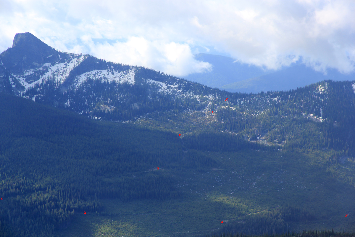
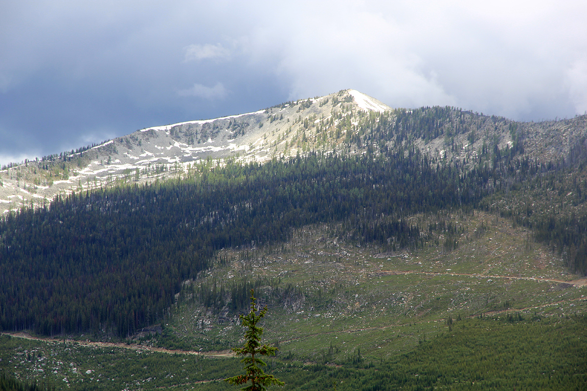
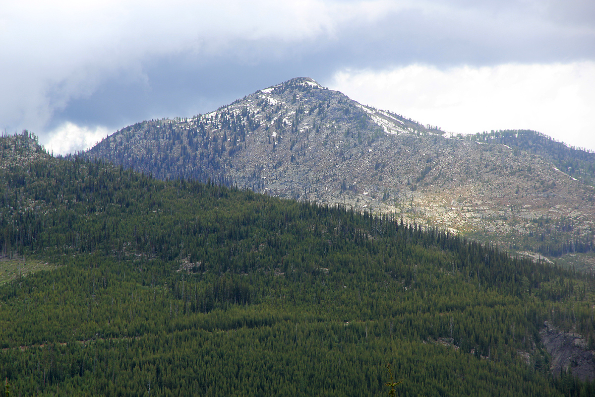
As can be seen from the map, first proceed uphill and gain the saddle that will bring you from the
outside to the inside of the horseshoe shaped basin having Hulme peak on its south side and Kootenay
Mountain on its north side. The saddle tops out at about 2040 meter, from my waypoints one will find
a small track that leads steeply down on the north side. You quickly enter an area that has been logged and
that is served by a forest road. Follow this road for a few hundred meter, then make a choice. It is possible
to follow an old track downhill to your left, connect with a second forest road and then with the main
road below, or you can just follow the original forest road until it connects to the main road.
This latter route is longer, but stays on a nice road. I tried both and guess the overall hike is more
pleasant if one just stays on the road.
Either way, you end up on the main road that one could have travelled if it had not been blocked by the
locked gate described above.
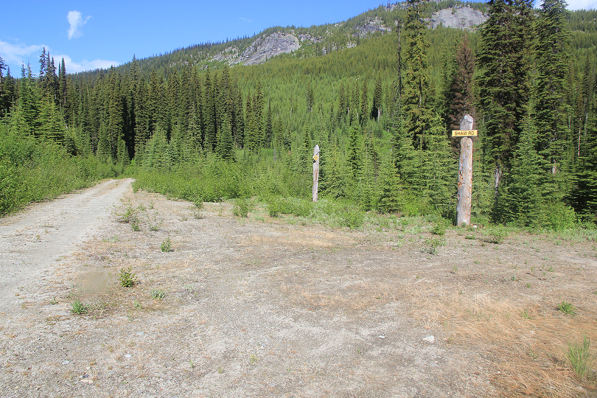
Go left on this road, as you approach its lowest point there is a road that forks right and seems to go
even more dowhill, there is a sign saying Shaw Road.
Do not take this road, but continue straight as your
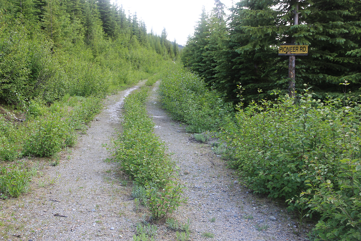
road curves around a pretty dominant hill, then arrives at a new road fork. Take the right fork (straight)
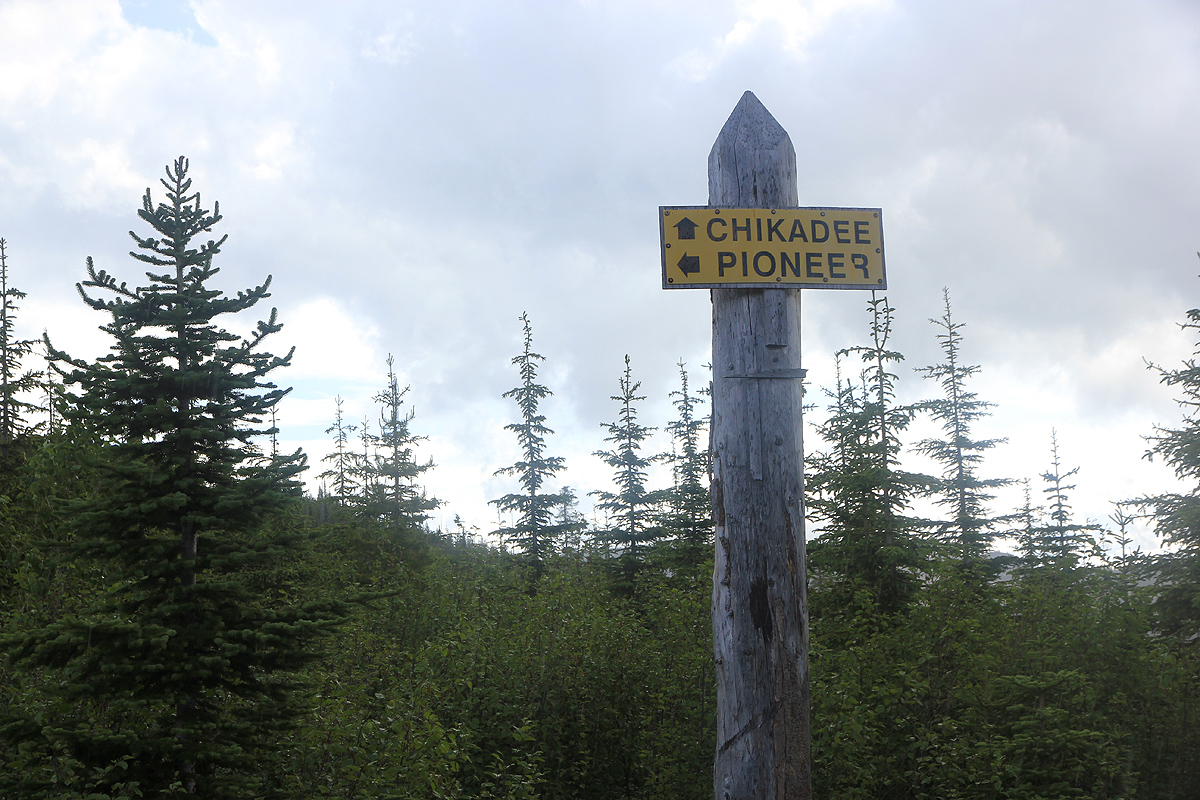
named Pioneer Road. Continue along this
road until the next fork, where again you should stay right. Pioneer
road goes left, your new road is named Chikadee Road.
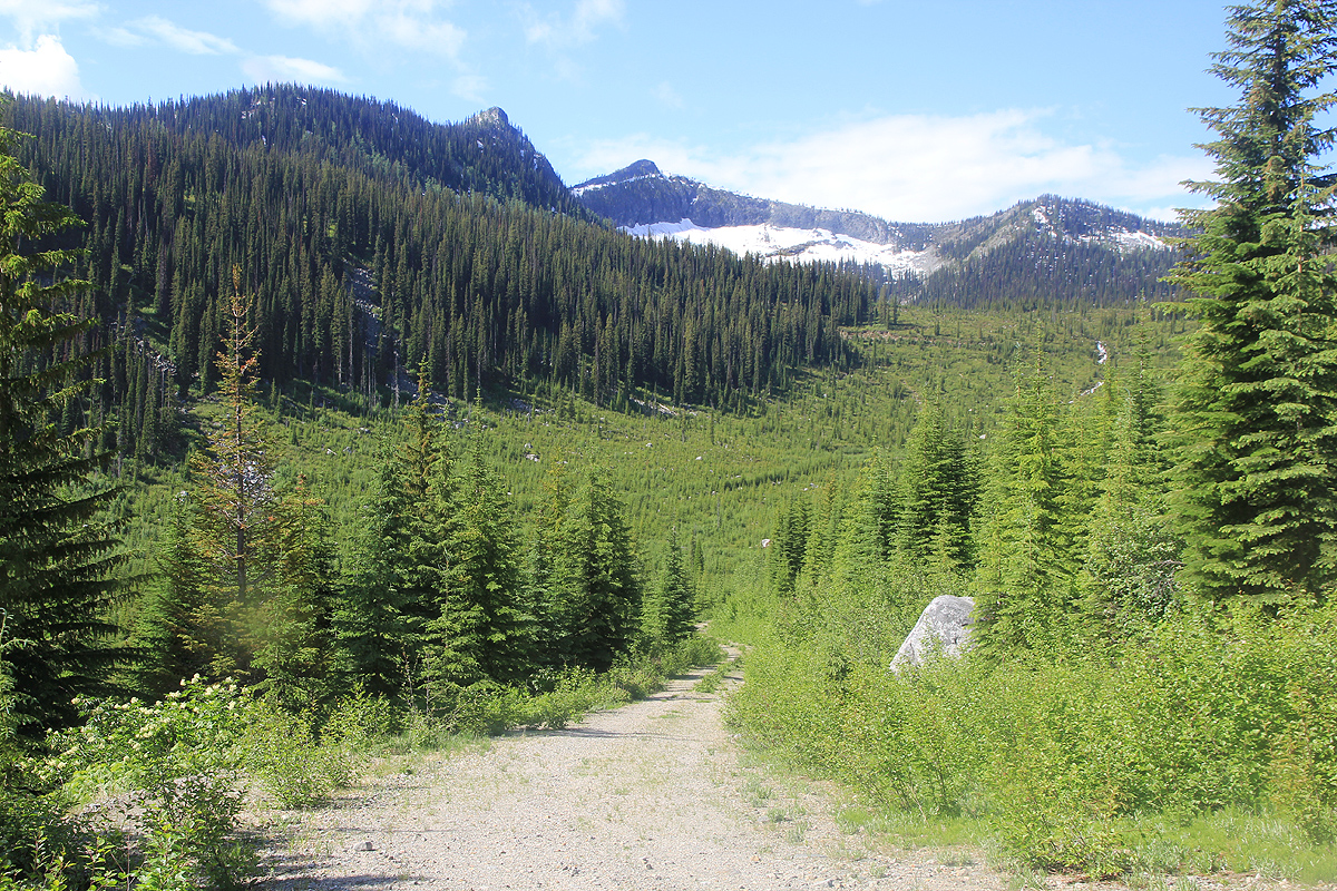
Even further along, you will get to kilometer marker 30. At the
road fork here, you keep left and enter the basin west of and
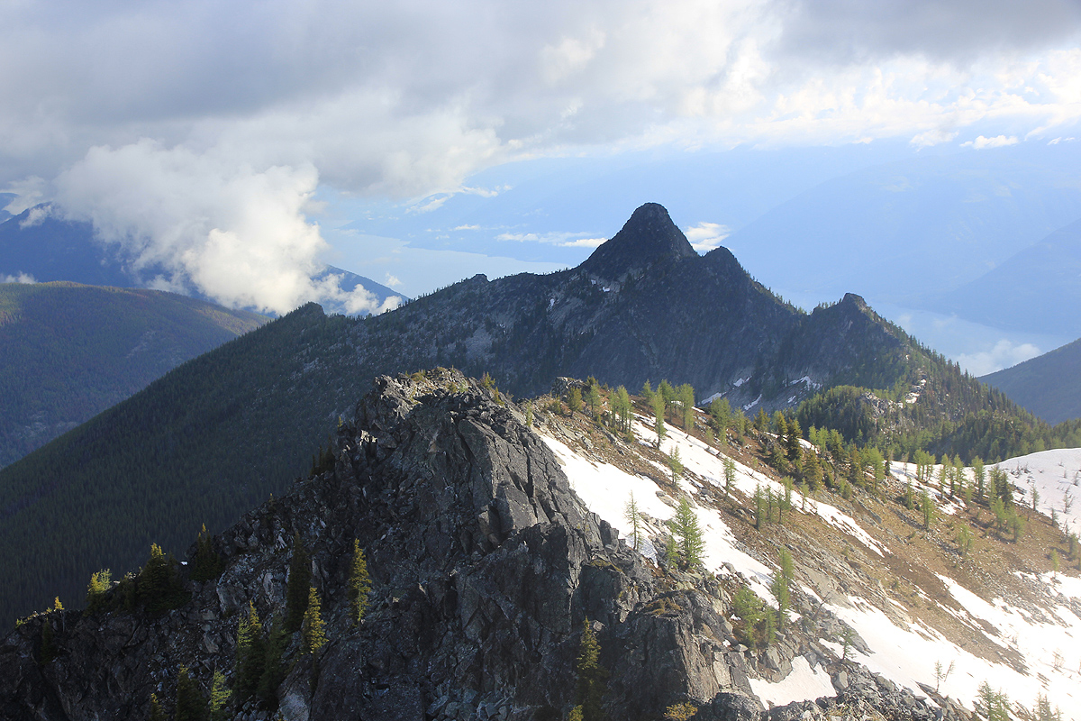
between Wood Peak (2294m)
and Kootenay Mountain.
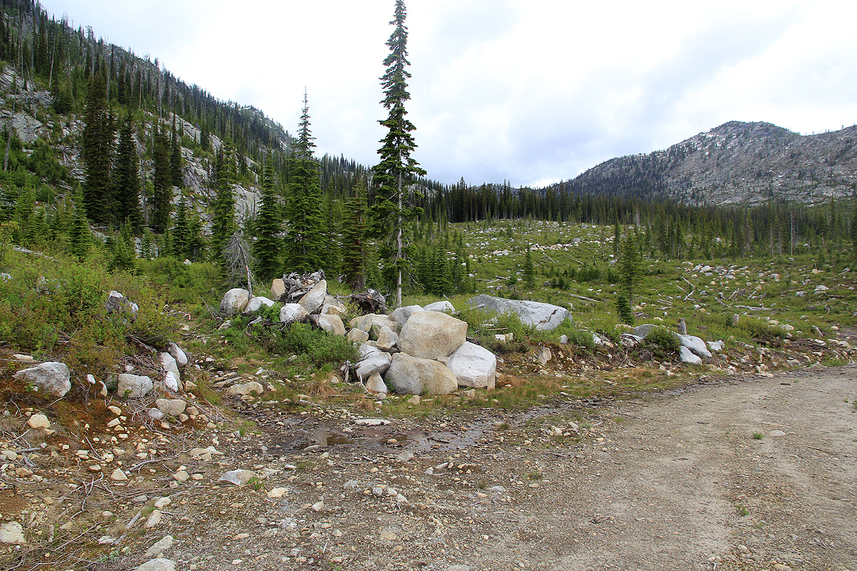
Leave the road where a rough forest track goes left,
obviously used when this area was logged. It will take
you higher to a place where the creek is crossed. From here, pick your way towards the peak, aiming slightly left.
As the terrain starts sloping uphill, continue up, but move left in order not to enter an area of big boulders.
Staying just left of the rocks will give you good uphill terrain, easy to walk while gaining most of the
elevation to the summit. You will reach the main ridge (that connects to Wood Peak) as indicated on the
map. From there, a short ridge will take you to the summit. The ridge itself has some sections where big boulders
will create some short class 3 scramble, but these may be avoided by going further right.
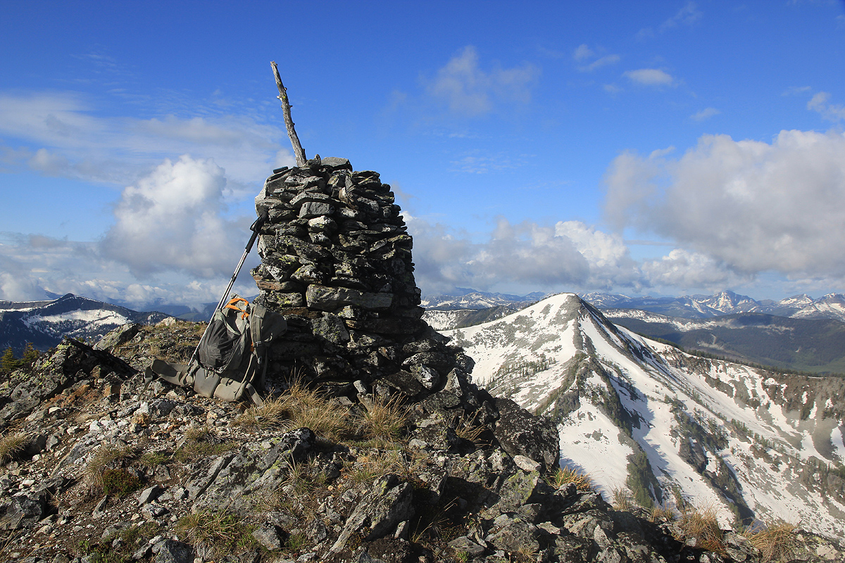
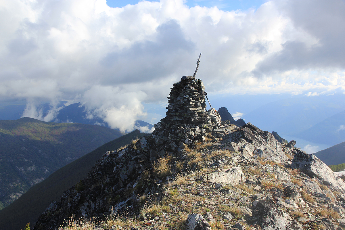
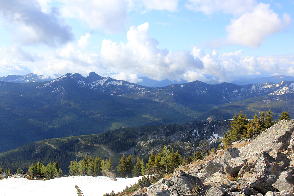
The summit has a nice cairn and a good view all around.
Comments:
I had explored the possible driving route described by Edward Earl the day before and made the rather
unpleasant discovery that the road he had used is now blocked by a solid, locked gate. I subsequently
discovered that it may be possible to drive to near a saddle on the outside of the nice horseshoe shaped
basin, hike into it, then take advantage of the road to hike near the base of the summit. This was the plan
and I set out from our motel in Creston shortly before 0300. (Pacific time)
The driving was easy and I started out shortly before dawn, around 0400 from my trailhead.
It took me one hour to reach the end of the forest road at the other side of the saddle. I tried to
shortcut down to a second forest road, but overall decided that it would have been more pleasant to just
walk on my road, thus decided to do that on the return.
The nice road walk consumed about 1:45, before I left the track were it crossed a creek, however, from here
it was only one hour before I sat on the summit. The time was still before 0800 in the morning and I was pleased
with having pioneered a new and very feasible route to this summit.
After photos and a snack, I headed back the
same way and were back by my car at 1140.
The drive back to my the motel and Heidi was smooth, and we could continue
our trip towards Golden, our planned stay overnight. The next day I would climb Morton Peak.