Kendervices
- Kendervices
- 2121 m.
- Primary factor: 1666 m.
- Location: South-west Albania
- Location: North 40:17.186, East 019:51.014 (GPS at the summit)
- Difficulty: YDS class 2.
- Climbed October 5. 2007.
Kendervices
|
|
How to get there:
From Tirana (or from the airport), head west towards Durres, then take the main
Hwy. down to the city of Fier. This Hwy. is partly a 4 lane, divided freeway.
In Fier, locate the Hwy. to Tepelene, this road is a two lane paved road, and the
distance from Fier to Tepelene is about 80 kilometer.
Tepelene has (at least) a small hotel as well as restaurants. From here, the road
becomes more of an adventure, but also very scenic. The table below should give
good directions as well as approximate driving times.
| Km | Time | Action | |
| 0.0 | 0:00 | Start at the traffic circle in Tepelene. Head down main street, that is a sharp right if you arrive from Fier. | |
| 1.2 | 0:02 | Go left (uphill), sign for Benca. | |
| 2.3 | 0:04 | Paved road ends (2007). | |
| 6.6 | 0:11 | You are in the village of Benca. | |
| 18.5 | 0:39 | Village on your right. Continue straight ahead. | |
| 21.9 | 0:45 | New village with paved street. Measurement is after paved section. | |
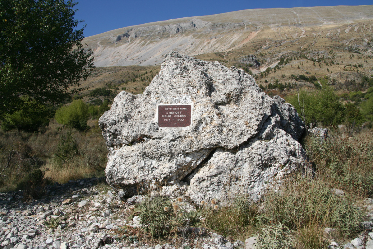
| 24.4 | 0:49 | Monument on your right side. | |
| 28.3 | 1:01 | Pass through a village. | |
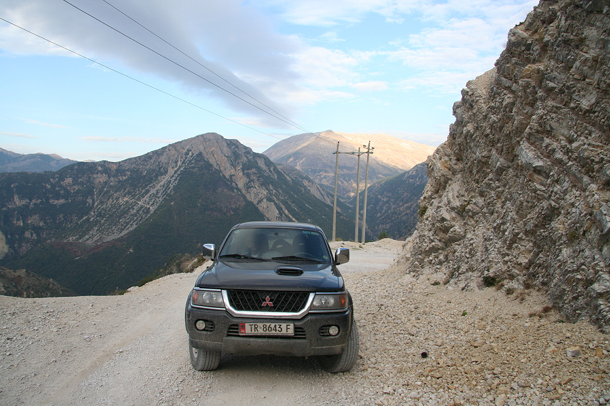
| 32.1 | 1:11 | The village of Nivic. Turn left on main square. The statue should be on your right. You need a 4WD, high clearance vehicle from here. | |
| 32.7 | 1:14 | Road forks, stay left. | |
| 34.8 | 1:26 | Wet area, stay in tracks, the crossing is OK. | |
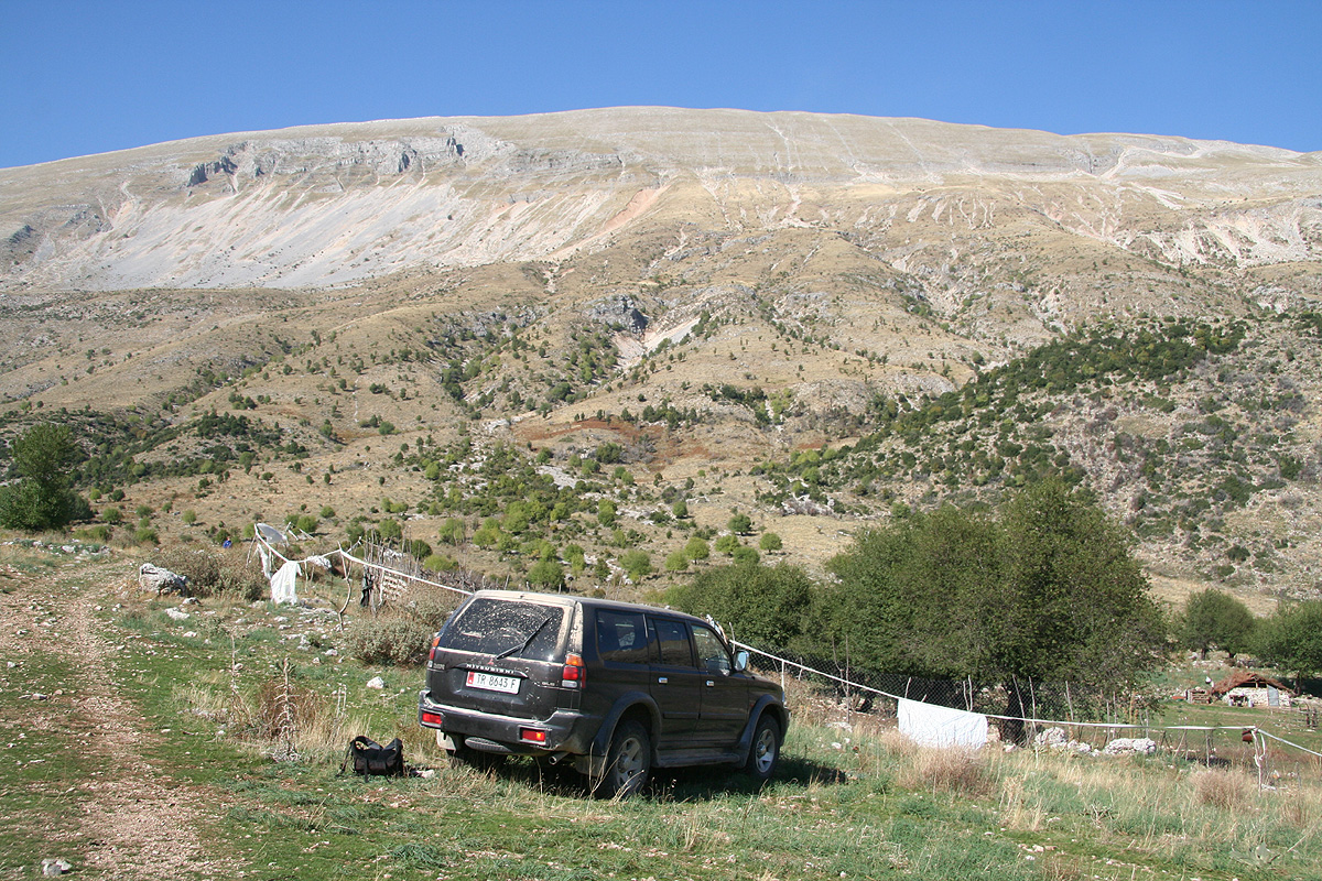
| 39.3 | 1:48 | Trailhead, park here. Your location is: N40:15.743, E019:50.684, 1009 m | |
Route description:
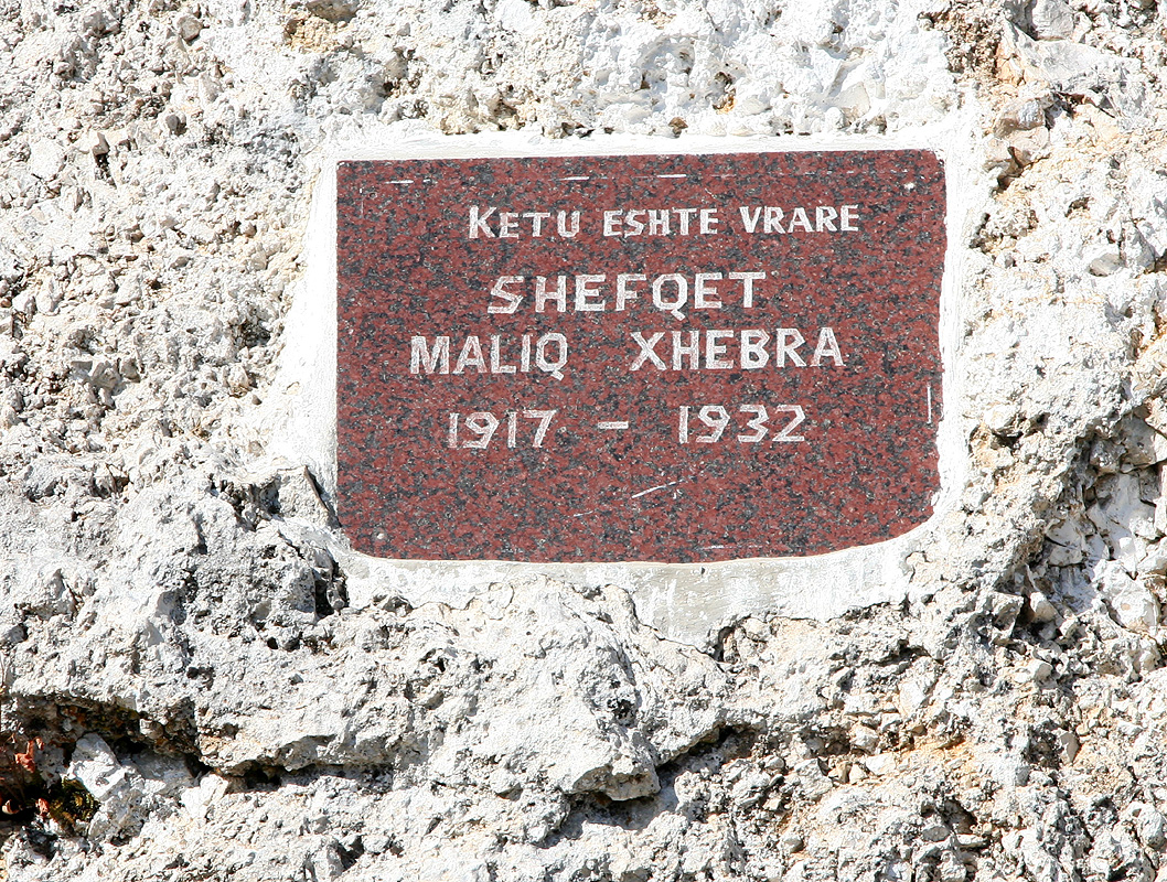
From the trailhead, follow a
path towards the mountain. You will pass a rock with
a memorial inscription.
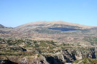
This trail heads up a small valley as it curves right. Leave the
trail and ascend directly up the natural slope above. Higher up, you will see a horizontal layer of
cliffs. One can either traverse to the right and find easier terrain or one can ascend directly
up the cliffs for example by way of a shallow, but distinct gully. The rock is broken into natural
steps and is easier to ascend than it looks from a distance. Above the cliffs, the terrain again
is more gentle and you quickly arrive to the broad summit ridge. The highest part of the ridge
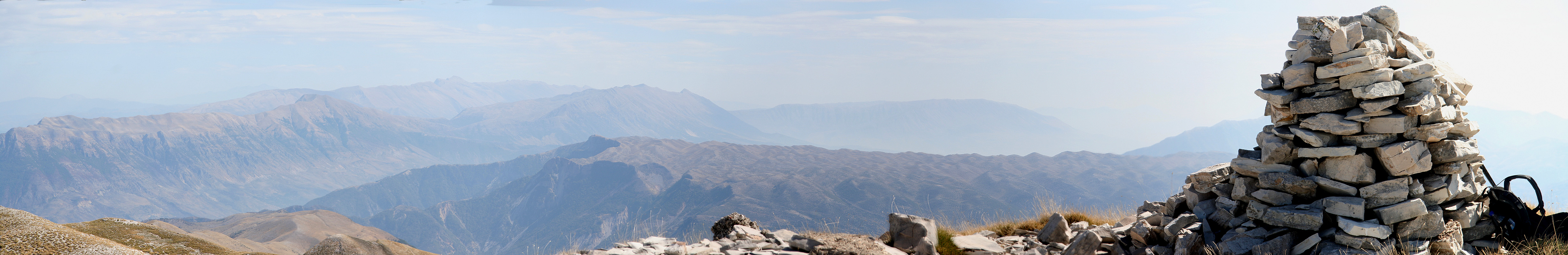
has three humps, two are marked by cairns. The eastern cairn marks the highest point.
For completeness, we provide GPS coordinates and approximate hiking times for
the route we followed in the table below:
| GPS coordinates and elevation | Time | Location | |
| N40:15.743, E019:50.684, 1009 m. | 0:00 | The trailhead. | |
| N40:16.420, E019:50.712, 1365 m. | 0:35 | Waypoint on the route. | |
| N40:16.618, E019:50.799, 1548 m. | 0:55 | Waypoint on the route. | |
| N40:16.813, E019:50.974, 1733 m. | 1:20 | Waypoint on the route. | |
| N40:17.058, E019:50.917, 2049 m. | 1:55 | Waypoint on the route. | |
| N40:17.184, E019:51.015, 2121 m. | 2:10 | Summit (East end of summit ridge). | |
| N40:17.117, E019:50.724, 2108 m. | N.A. | Middle top on summit ridge. | |
| N40:17.110, E019:50.560, 2104 m. | N.A. | West top of summit ridge, cairn. | |
Trip Report/Comments:
October 5. Summit day.
Due to our late arrival last night (courtesy the army of Albania), we slept an extra
hour and got up around 0700. We took our remaining bread and coke for breakfast in the
car while driving slowly out of Tepelene around 0730. Since our exploration of the
north side had been rather a failure, we decided to look for a better access on the
south side. Thus, our plan was to drive towards the small village of Benca and then
consider our options. It became pretty clear that our road map and the actual roads
in this area were in wild disagreement. In such cases, the best thing to do is to
follow the road.
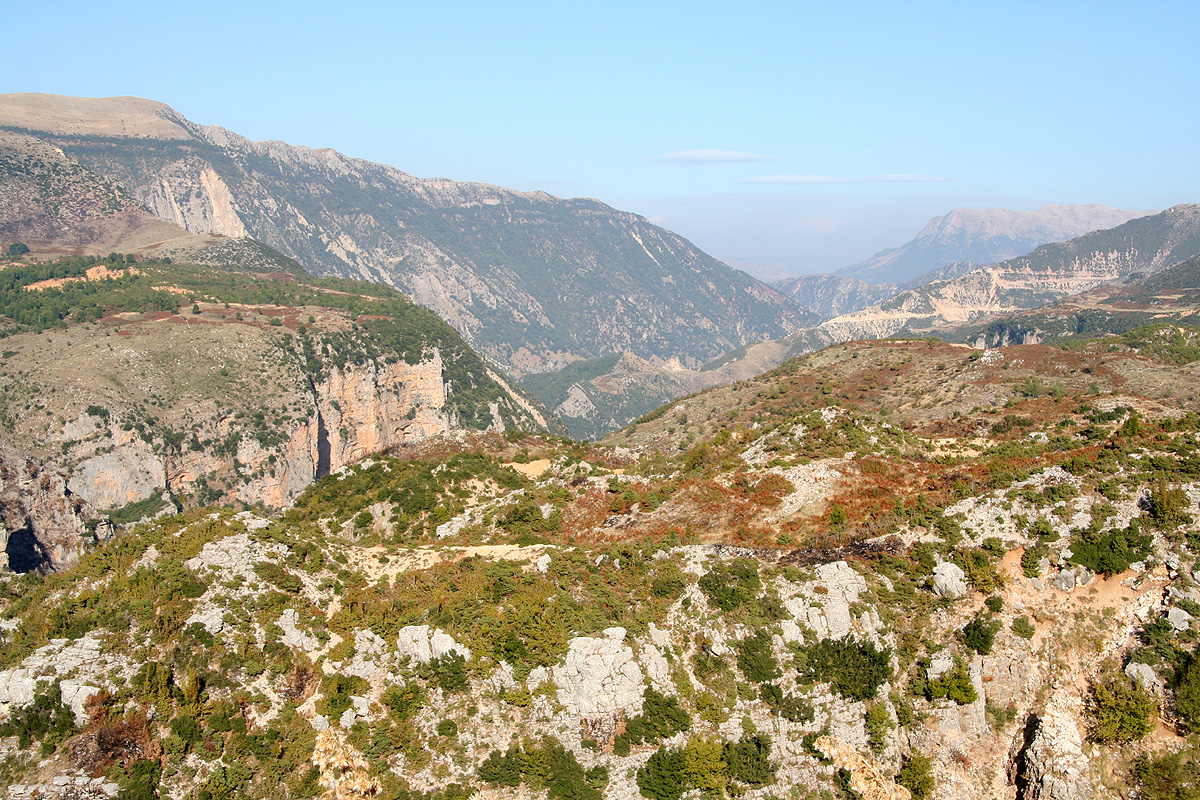
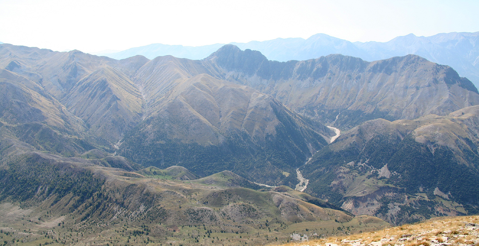
What a spectacular valley.
We could not see our objective, but our GPS reported on its
distance. The road climbed high on "the wrong side" of the valley, but we hoped this
could be fixed further inland. Subsequently, some
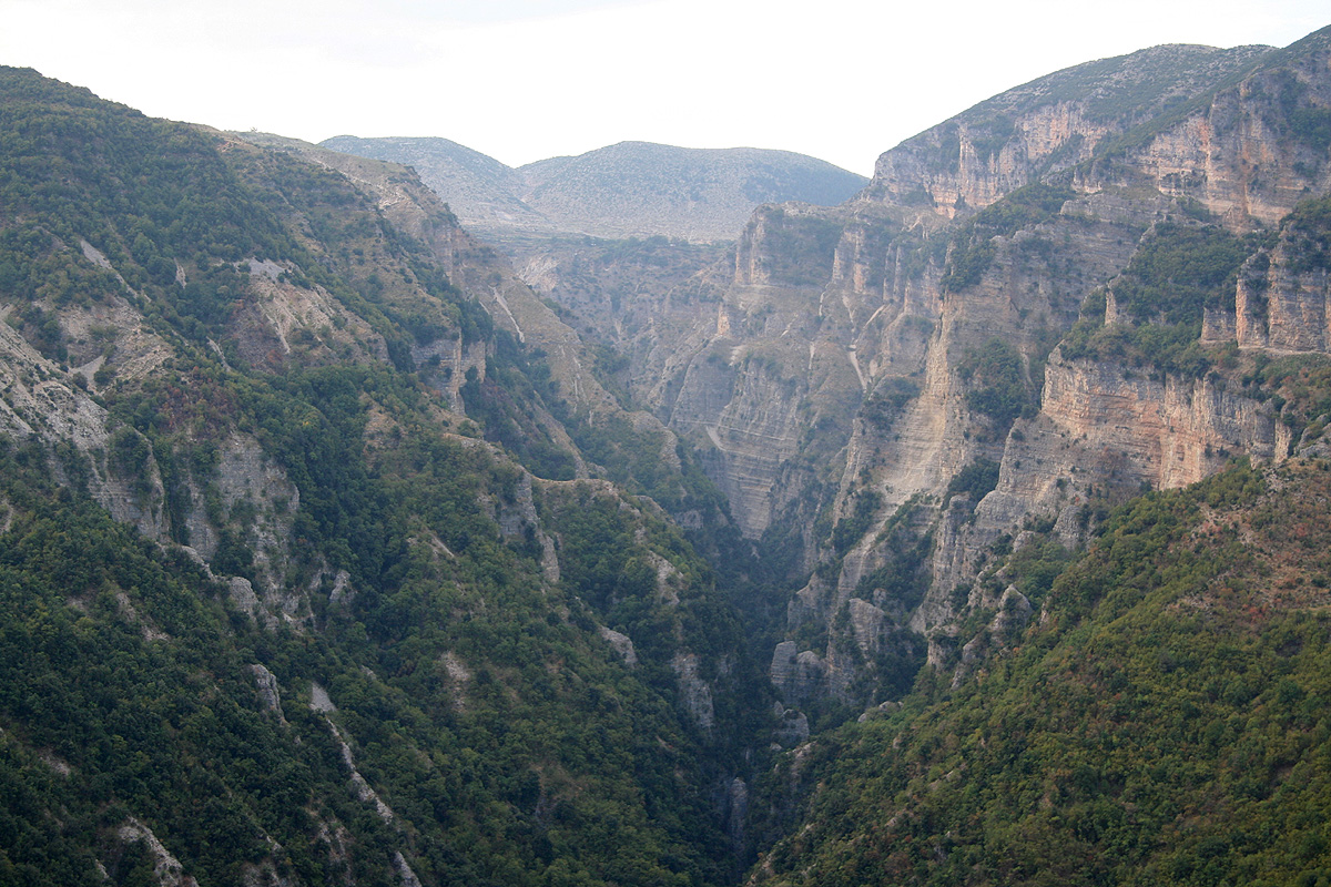
rather impressive canyons started to
branch left and it became obvious that our road would need to loop around these as well.
The road stays extremely scenic with good views down into these steep gorges. You pass
several small villages before getting to Nivic.
Our map, one week old from ADAC
was completely wrong. It showed many nonexisting roads as well as villages that were really
single houses while leaving for example Nivic out. The locals, that had a look at our map
just laughed. This long road is a dead end, contrary to what our map told us. Or old Russian
topo map showed a possible access across a saddle just east of Kendervices, however people
told us that this was gone long time ago. Parts of the current road had been built by
the Italian army almost 70 years ago.
Thus, we were quite pleased when we finally approached a village that turned out to be
Nivic (not marked on our map). We could now see the mountain and we were within
"striking distance" for an assault on foot.
In Nivic we found a very helpful man named Mujo. He spoke English well and was able
to provide further advice. The road continued a bit further to an even better trailhead
for 4WD vehicles. He offered to make sure our vehicle was looked after while we hiked.
He ran a small restaurant in Nivic and would like to welcome more hikers in the
future. His full name was Mujo Gjoni and his phone number is +355-(0)682951906. He should
be contacted by anybody wanting some local support/services in Nivic.
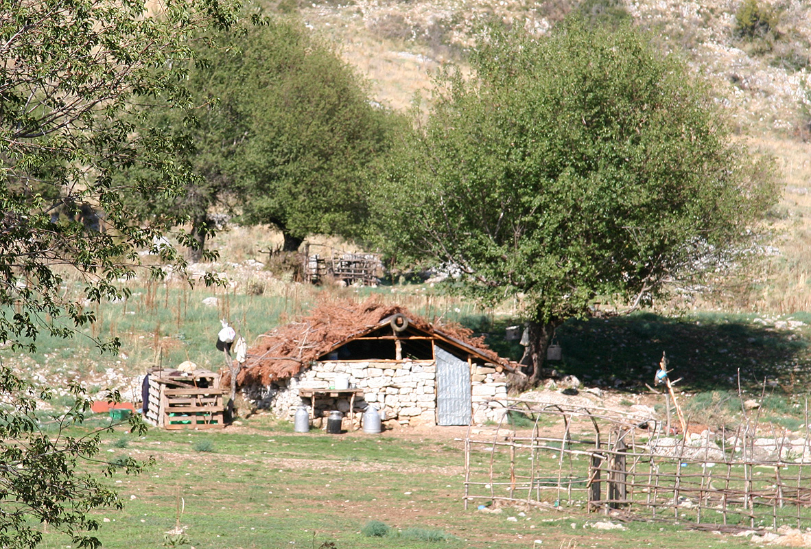
We parked next to a shepherd's house,
Mujo told him to keep our car safe and protected.
Mujo could not quite believe that we intended to ascend the mountain straight up, he seriously
indicated that our project would require at least 2 days. That somebody would travel
from Norway to the small village of Nivic in order to scale the local mountain was perhaps
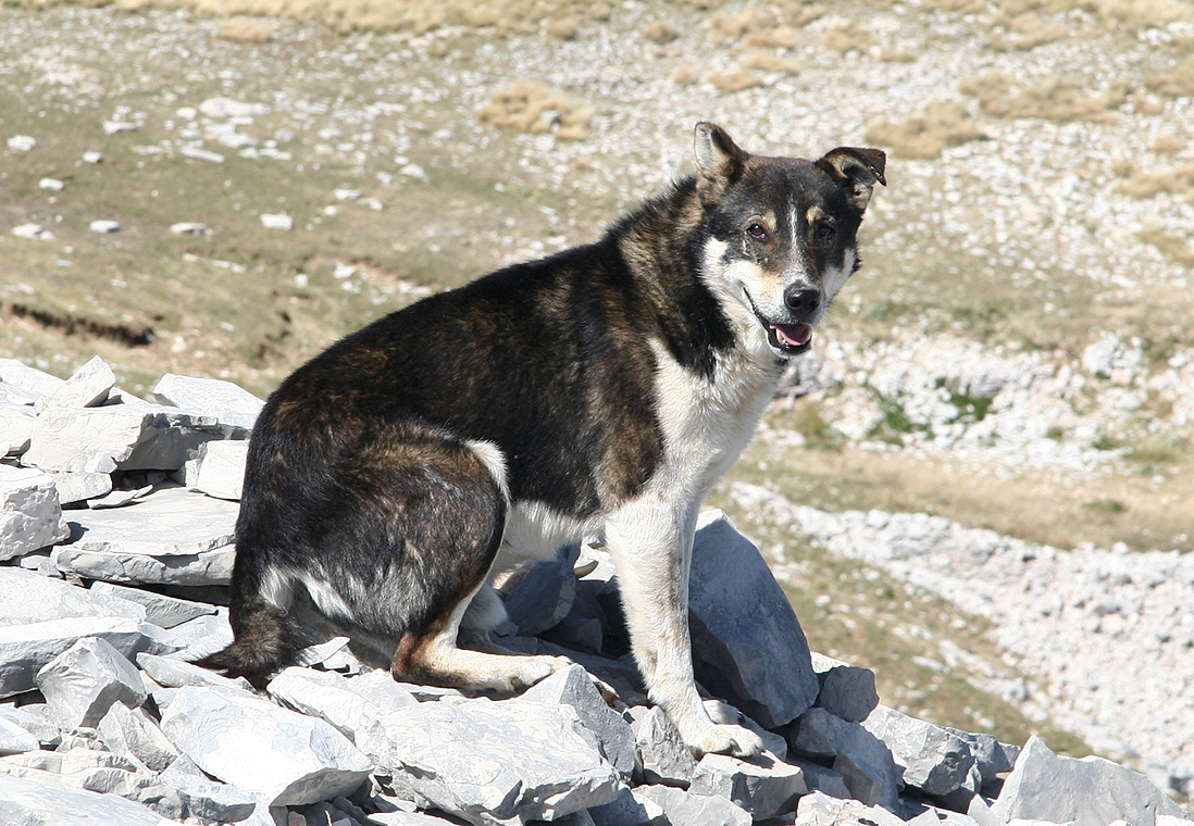
even more unbelivable. He warned us about possible aggressive dogs and I took both my
hiking poles along. They had proven effective as defensive weapons when we climbed Korab.
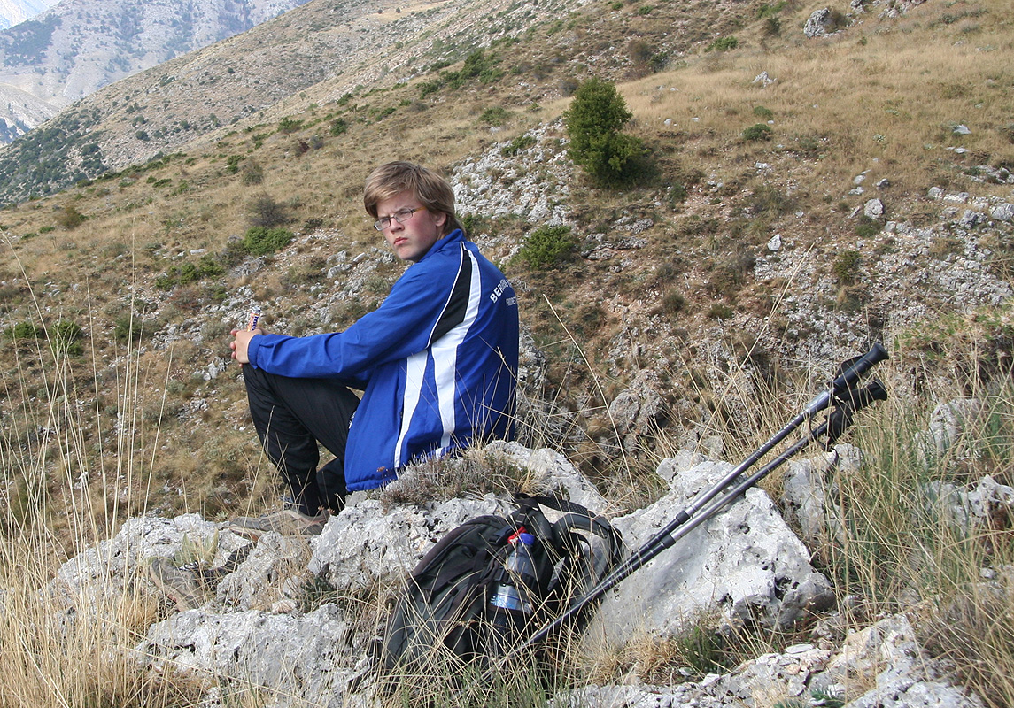
Thus at 1020, we headed straight up the slope, easy but definitely uphill.
We made several short stops along the way,
looking back down as we gained elevation.
Higher up, we had planned a traverse
right (east) in order to avoid a cliffband, but upon closer inspection we entered a shallow
gully then climbed directly up on nice, natural rocksteps, still YDS class 2 terrain.
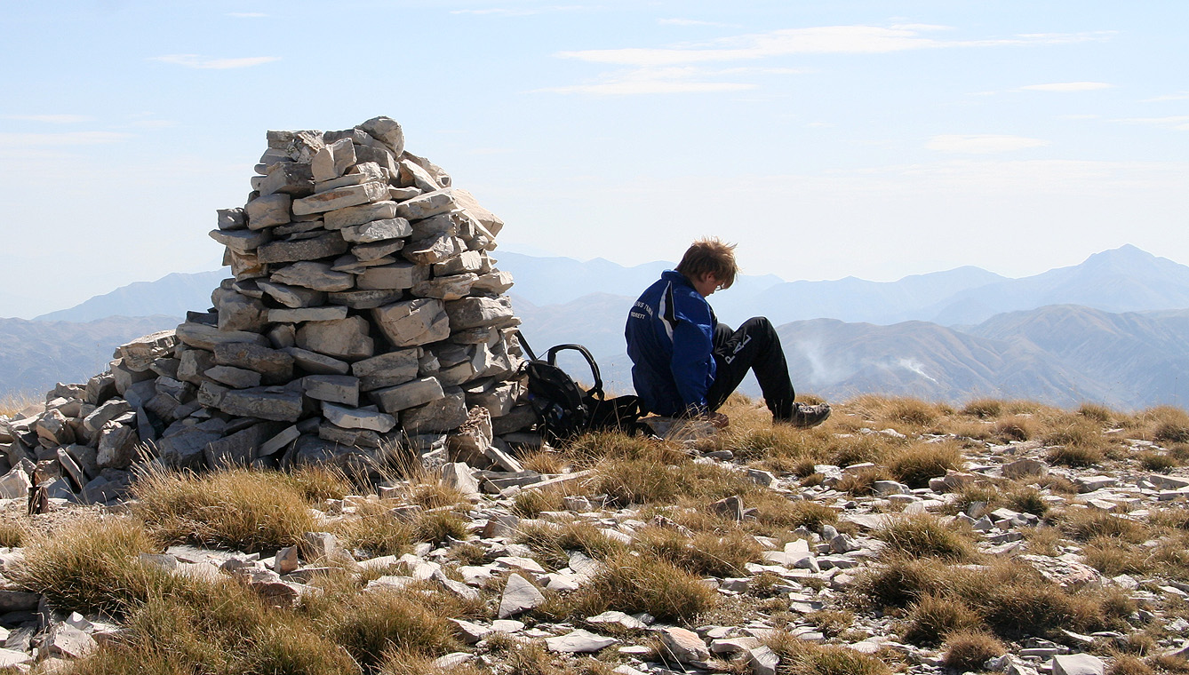
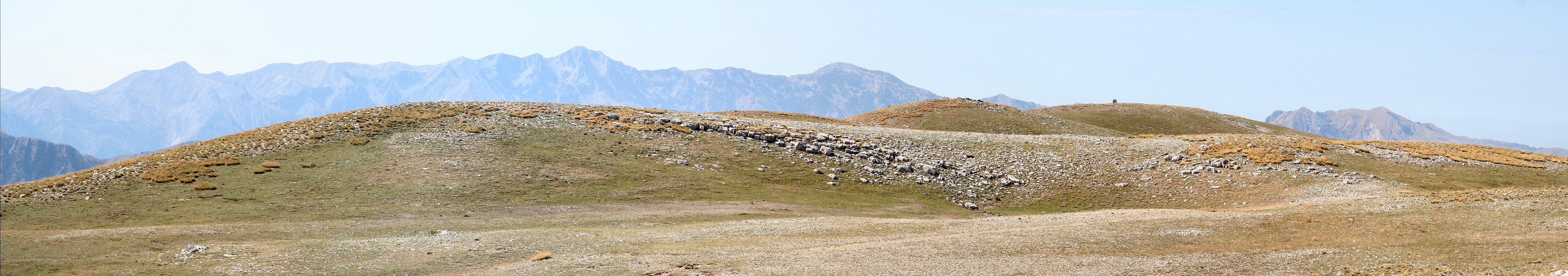
We arrived at the summit ridge about 200 meter west of what looked like the highest point, marked by
a cairn. The summit ridge runs from west to east with three small highpoints along it.
We had arrived at 1230, 2 hours and 10 minutes
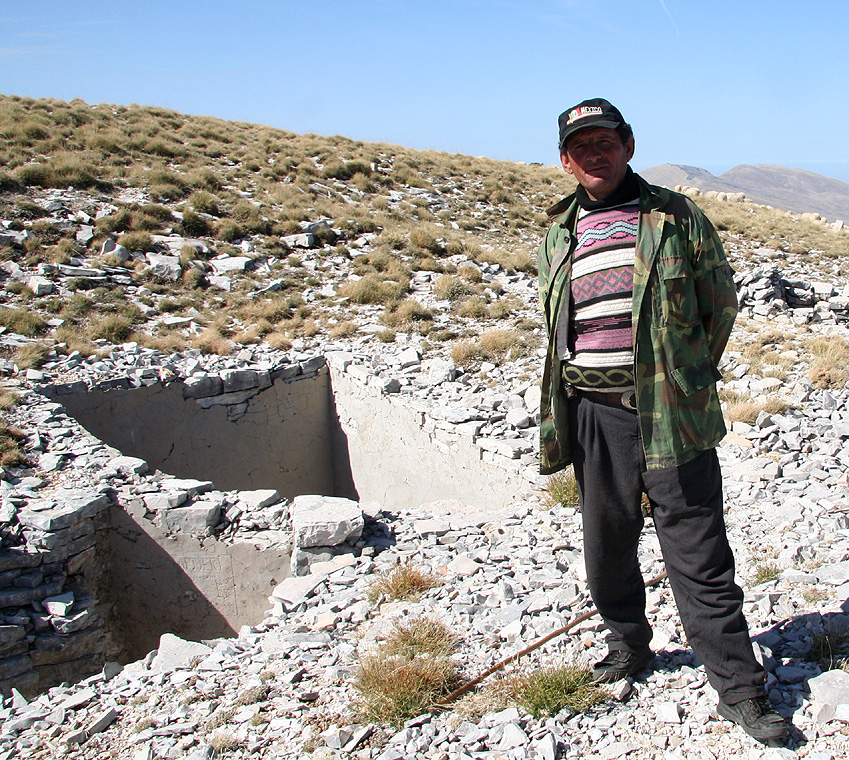
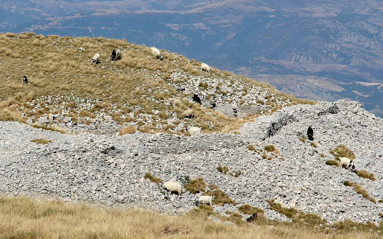
from the trailhead. We soon met a shepherd and carried out
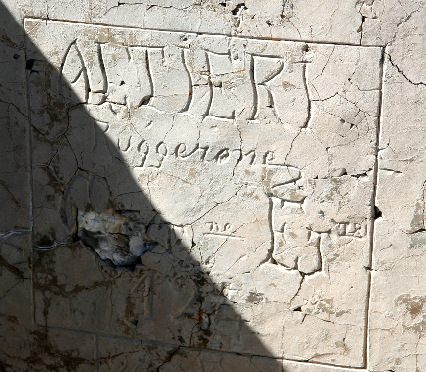
an improvised conversation. He showed us ruins from a war between Italy and Greece, including some
inscription left behind (please send translation!).
His goats were feeding peacefully around what used to be defensive walls.
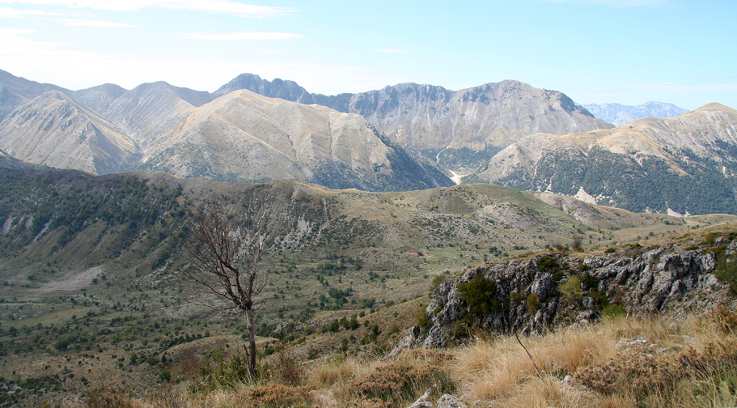
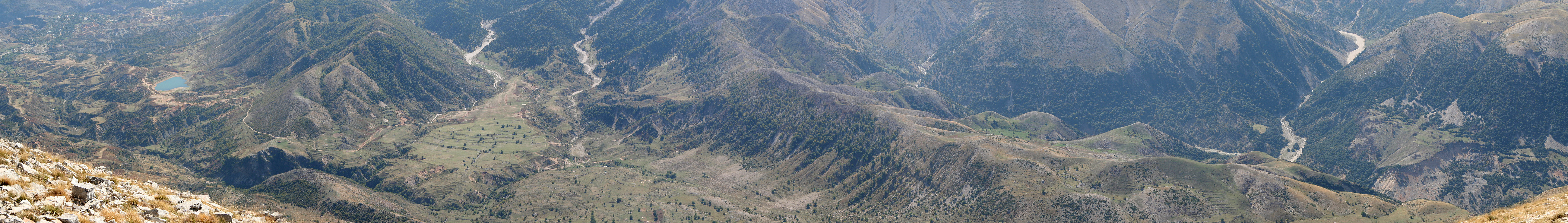
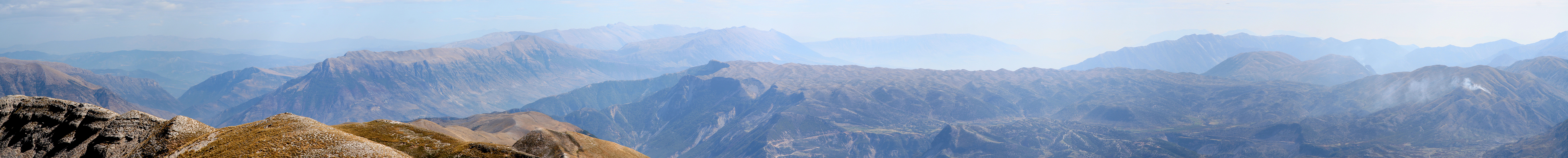
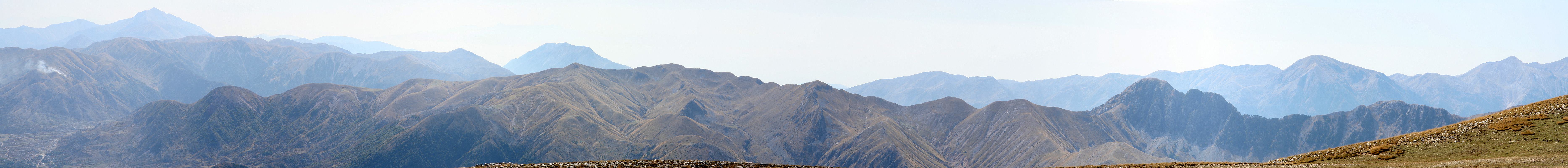
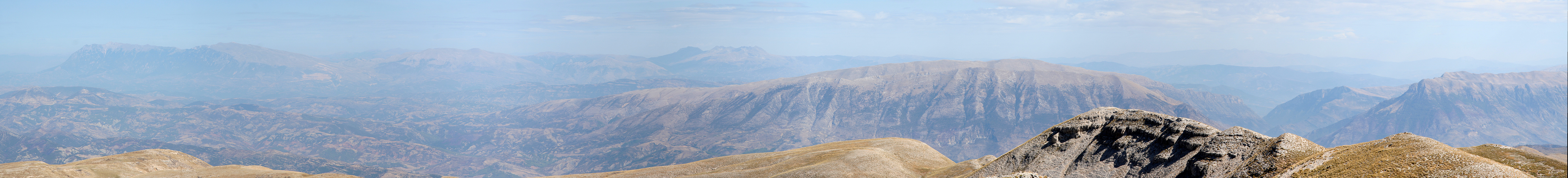
Otherwise, we agreed that the panorama views was among
the best anywhere. He eagerly pointed out peaks and places, unfortunately, it was impossible for me
to understand anything.
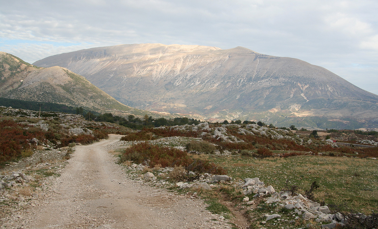
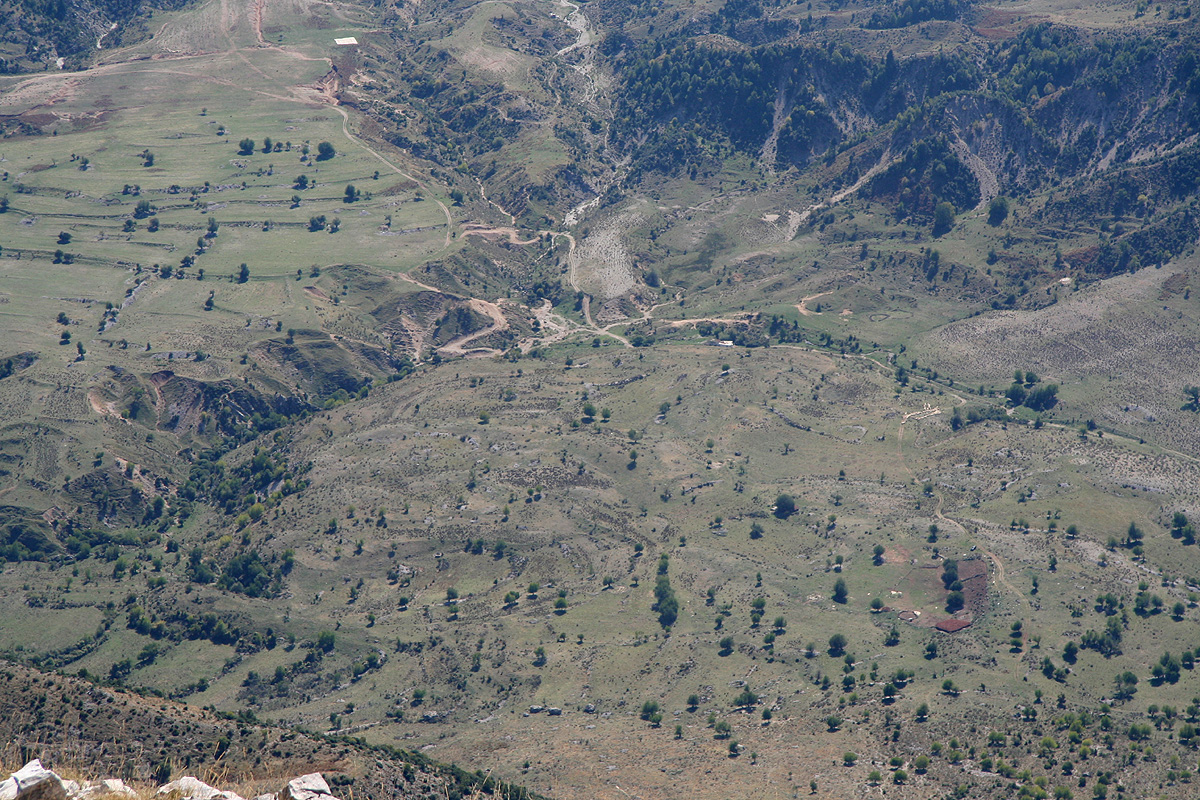
We could see the path we had driven from the village of Nivic to the saddle
beyond where we had parked our truck. The mountains across
this valley had many interesting features.
His dog
was somewhat smaller than the "wolves" at Korab, it also behaved well. The trick
is to meet the shepherd before the dog, good theory, not always easy in practice.
We started descending at 1315 and reached the car in 1.5 hours, this time traversing a bit east to
avoid the slightly steeper section with the cliffs. We observed sheep and dogs, but traced a route
having the wind draft going towards us. Thus, the dogs never discovered us and we avoided all conflict.
Driving back to Nivic, we had hoped that Mujo could serve us lunch (we had spoken to him about this),
however, we came back way too early relative to his expectations. Lunch got cancelled and dinner planned for
back in Tepelene.
In Tepelene, we toured the kitchen (no menu, no english), and picked some nice lamb meat for a well
deserved dinner. The day ended with a drive back north to Lushnjë, where we stayed overnight.
October 6. Travel day. We reorganized all gear for the flight back to Vienna, then drove
to the airport north of Tirana by way of the coastal town of Durres. Our week in Albania came to
a close, 4 ultra summits "found and climbed", 1336 kilometer driven, much on roads with a (lack of)
quality that has to be experienced. Two ultra summits remain to be climbed, both are in southern
Albania. One is near the coast and one is very close to the border of Greece. I (at least currently)
plan to visit these as a side trip(s) from travel in Northern Greece.
We booked us in on the airport hotel in Vienna and celebrated a successful trip to Albania with a
delicious meal in the hotel restaurant.
This trip now concluded with Schneeberg in Austria.