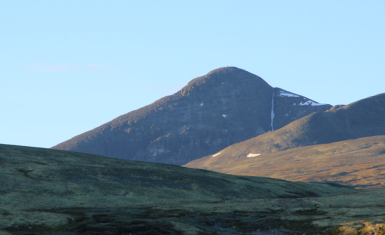
Høgronden
- Høgronden
- 2115 m
- Primary factor 705 m
- Rondane, Norway
- Location: North 61:56.661, East 009:54.013 (GPS at the summit)
- Difficulty: YDS class 1.
- Climbed August 1. 2010
|

|
Information:
How to get there:
This report describes a route from
the mountainhut Dørålseter.
Alternatively, one can clib this peak from the DNT hut Bjørnhollia (south-east of
the peak), or from Straumbru on Hwy. 27 (also south-east).
A good point of reference is Folldal, Folldal is 28 kilometer
along Hwy. 29, from Hwy. E-6 at Hjerkinn on Dovrefjell.
From Folldal, drive approximately 10 kilometer south on Hwy. 27, then
start looking for a signed side road that forks right. The sign should
read "Dørålseter 12 km". Take this road, after about 800 meter
you will find a self-service gate where toll should be paid. (NOK 50.- in 2010)
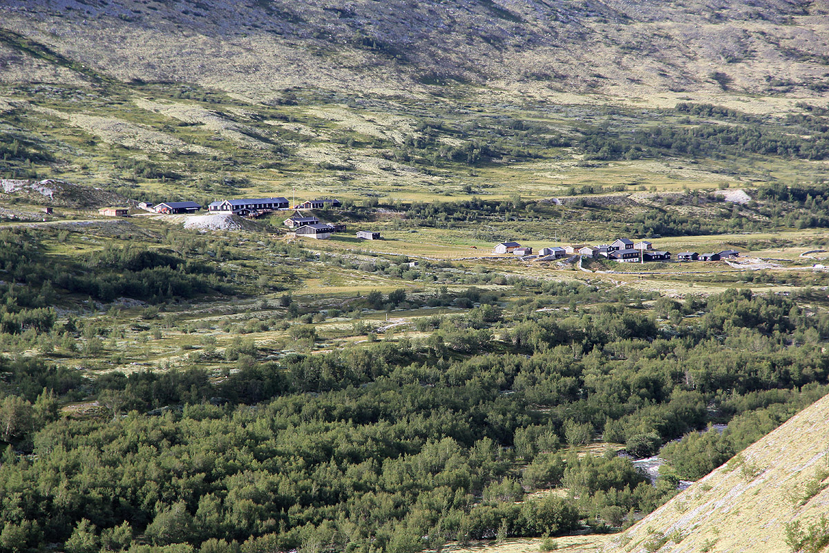
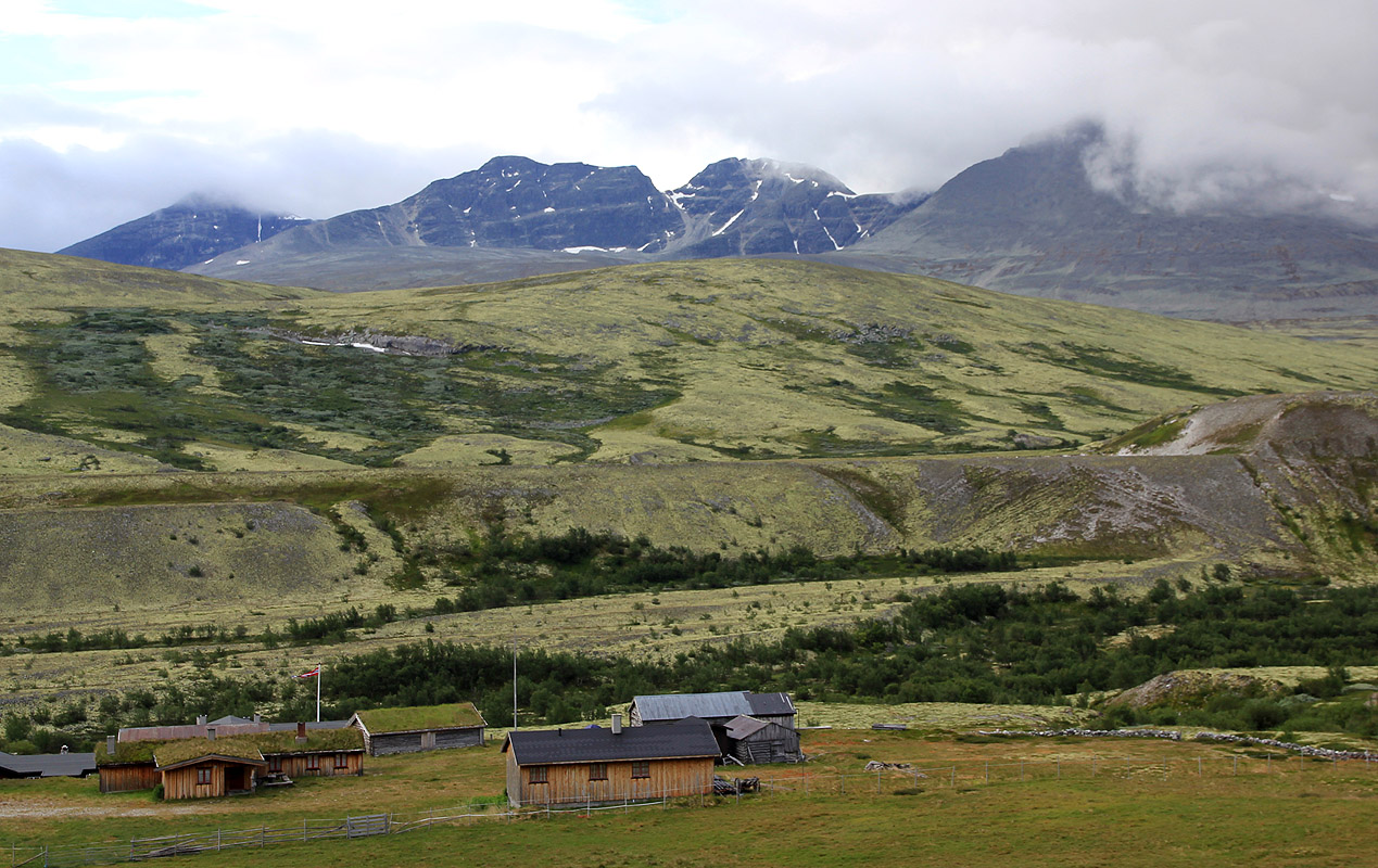
Continue about 12 kilometer to Dørålseter where the road ends. At the
very end, take the right fork to the mountain house that is located higher on
the slope. This location is N61:59.942, E009:48.260, elevation approximately 1060 meter.
Route description:
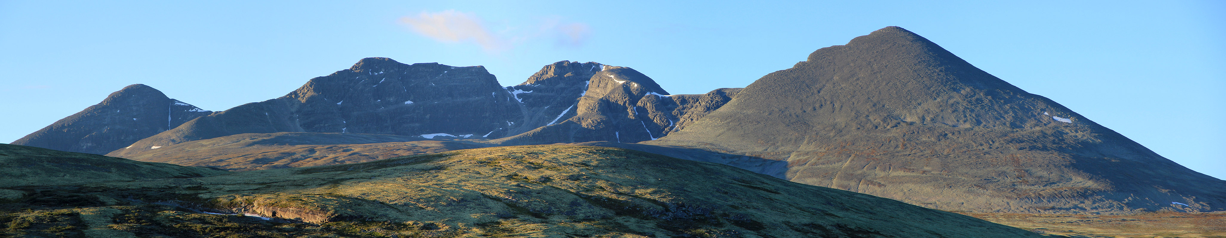
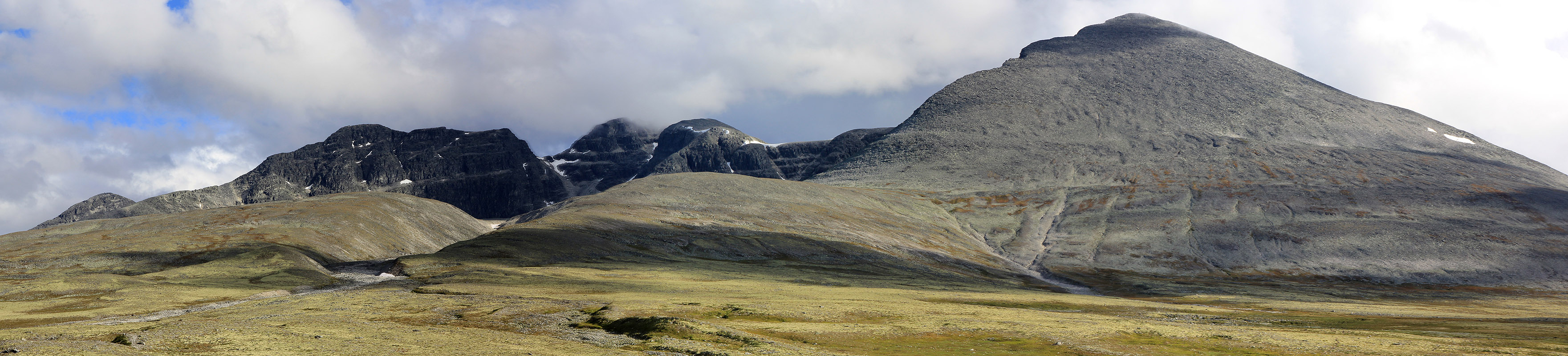
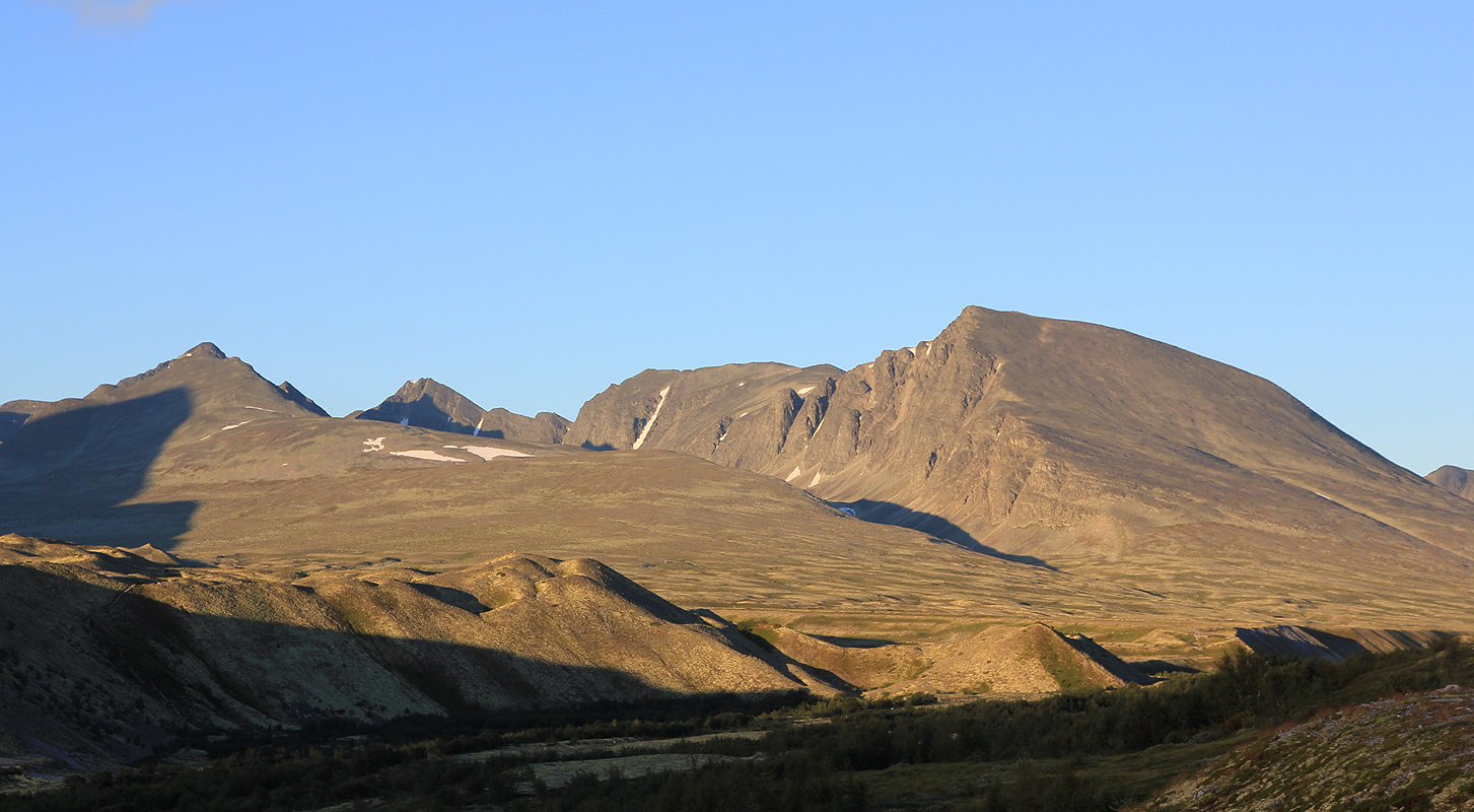
This description is a loop tour where
you climb Digerronden and Midtronden on
the way to
Høgronden. You will also cross over a subpeak of Midtronden, with less than 100 meter
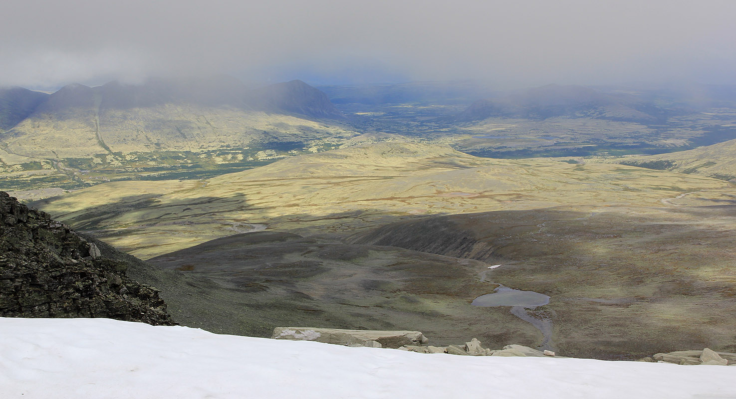
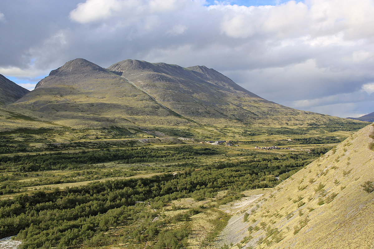
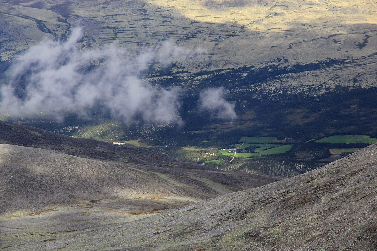
of prominence. From Dørålseter, one
can see an outline of the route across the 3 peaks.
(Midtronden is the double peak in the middle.)
From Høgronden, the route follows a marked trail (DNT) back to
Dørålseter. The loop tour is (YDS) class 2. If you only want to climb
Høgronden, then just read the first and last part describing the trail. Such a hike is
(YDS) class 1.
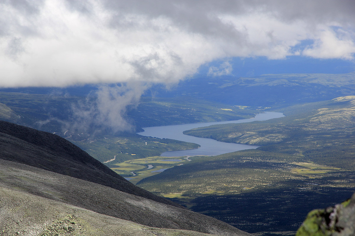
From Dørålseter, head slightly downhill and follow the red "T" marked trail that
may be signed for Rondvassbu. The trail runs south-west along the river, then crosses on a large,
wooden bridge. Shortly thereafter the trail forks and you should go left, the sign says
Høgronden and the trail climbs steeply
out of the river gorge. The trail now heads more
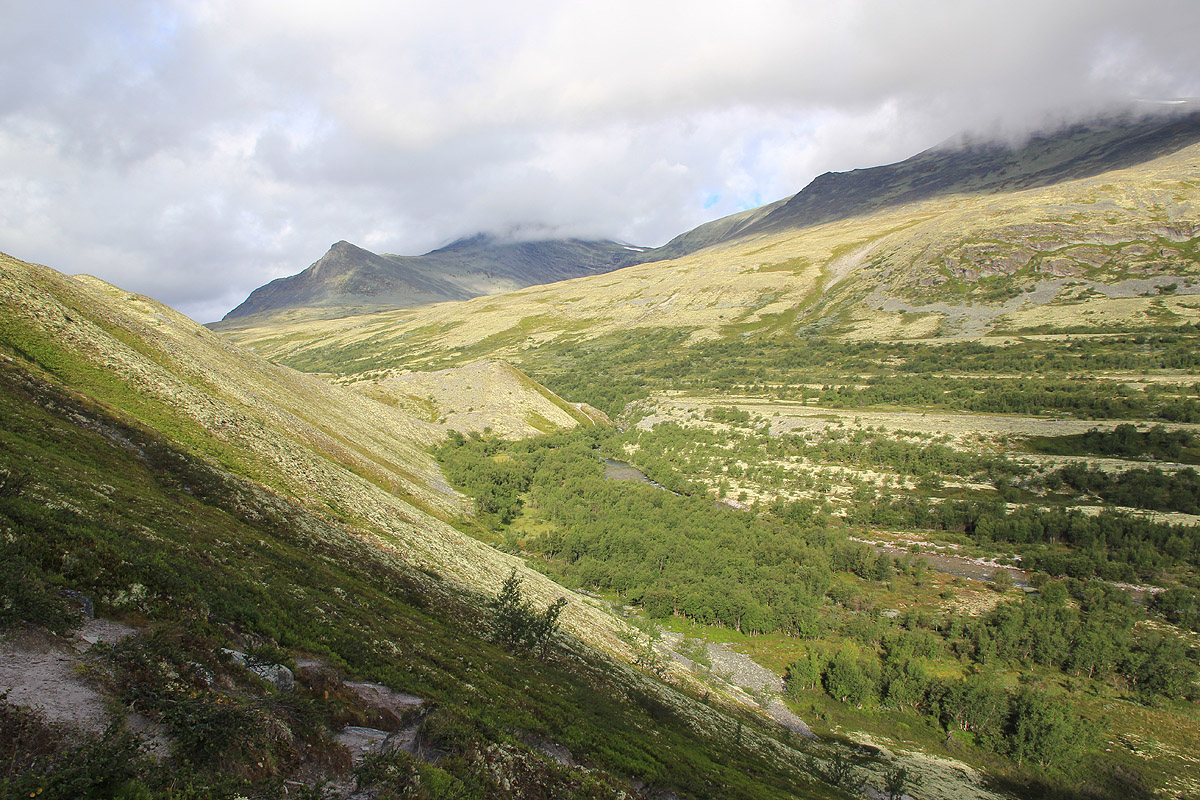
south-east and follows the creek Vidjedalsbekken. Look for a smaller, unsigned
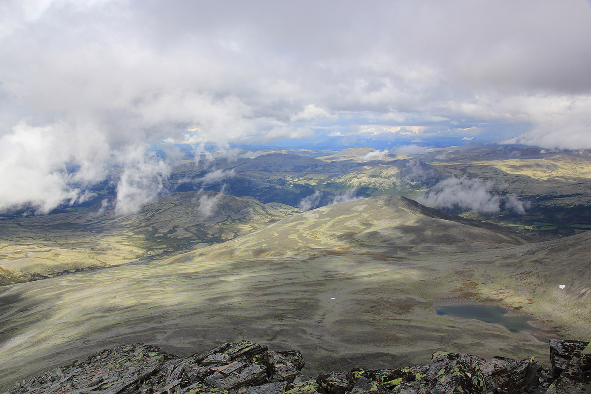
trail that forks right and follow this for a short while. You will now have Digerronden directly south.
Leave the trail and follow a line that runs directly towards the big slope. We went quite a bit left
of the snow that may be visible near the shoulder Salen (1515m). The mountain slope starts at
location N61:57.586, E009:48.720, elevation 1365 meter.
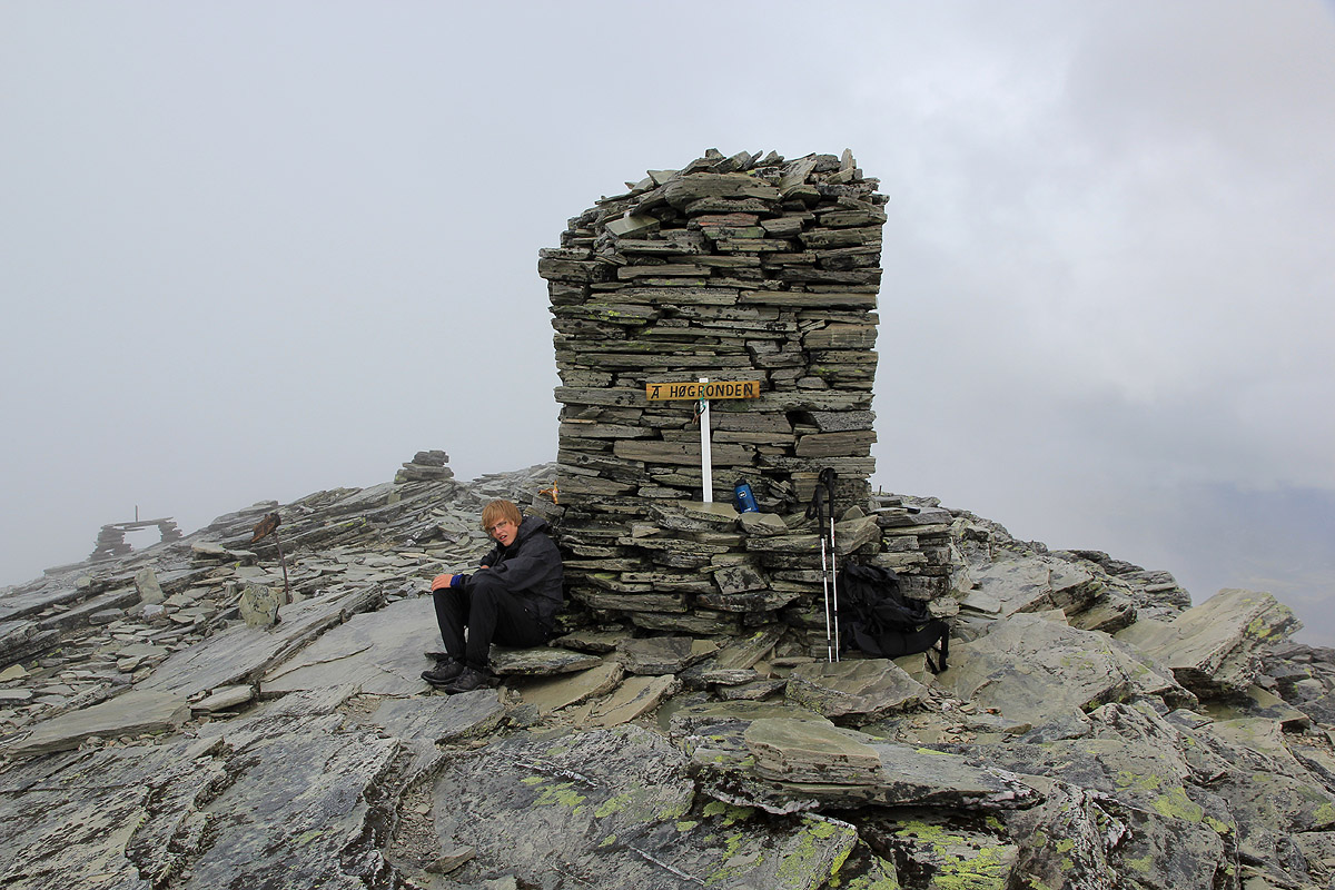
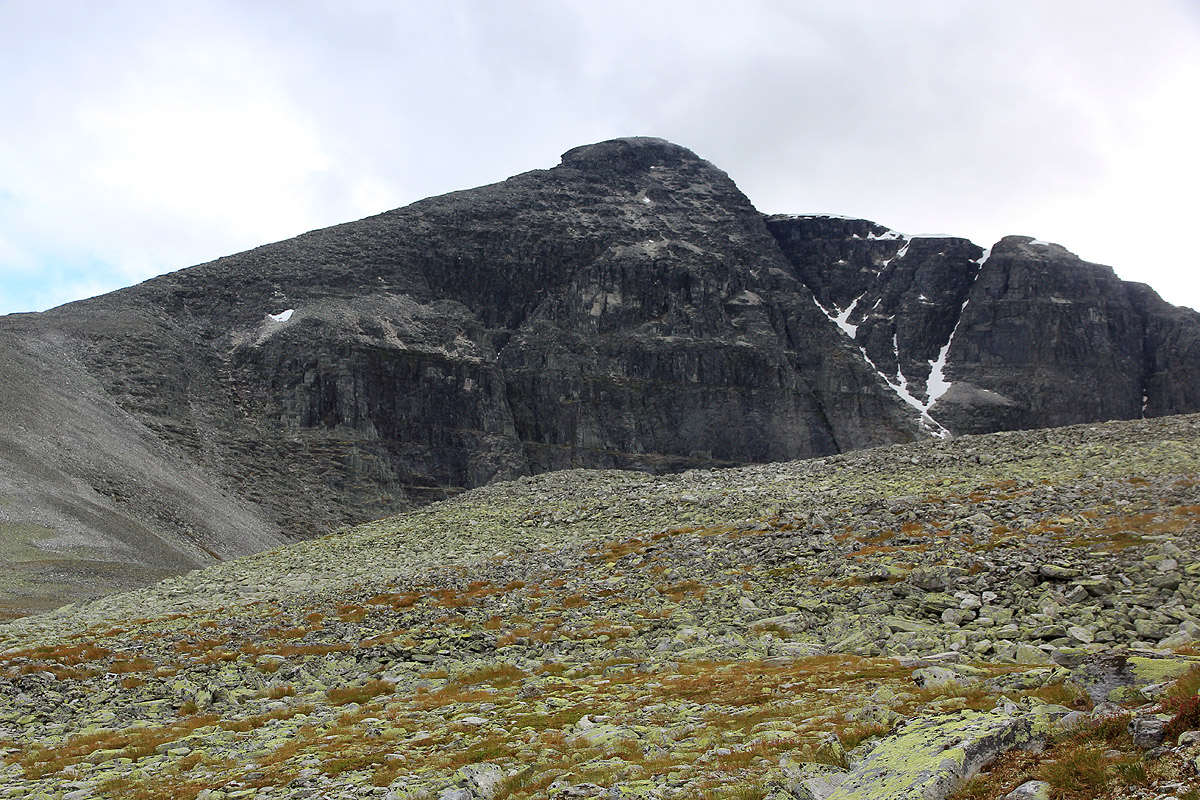
Follow smaller trails from previous climbers and head up the ridge to the
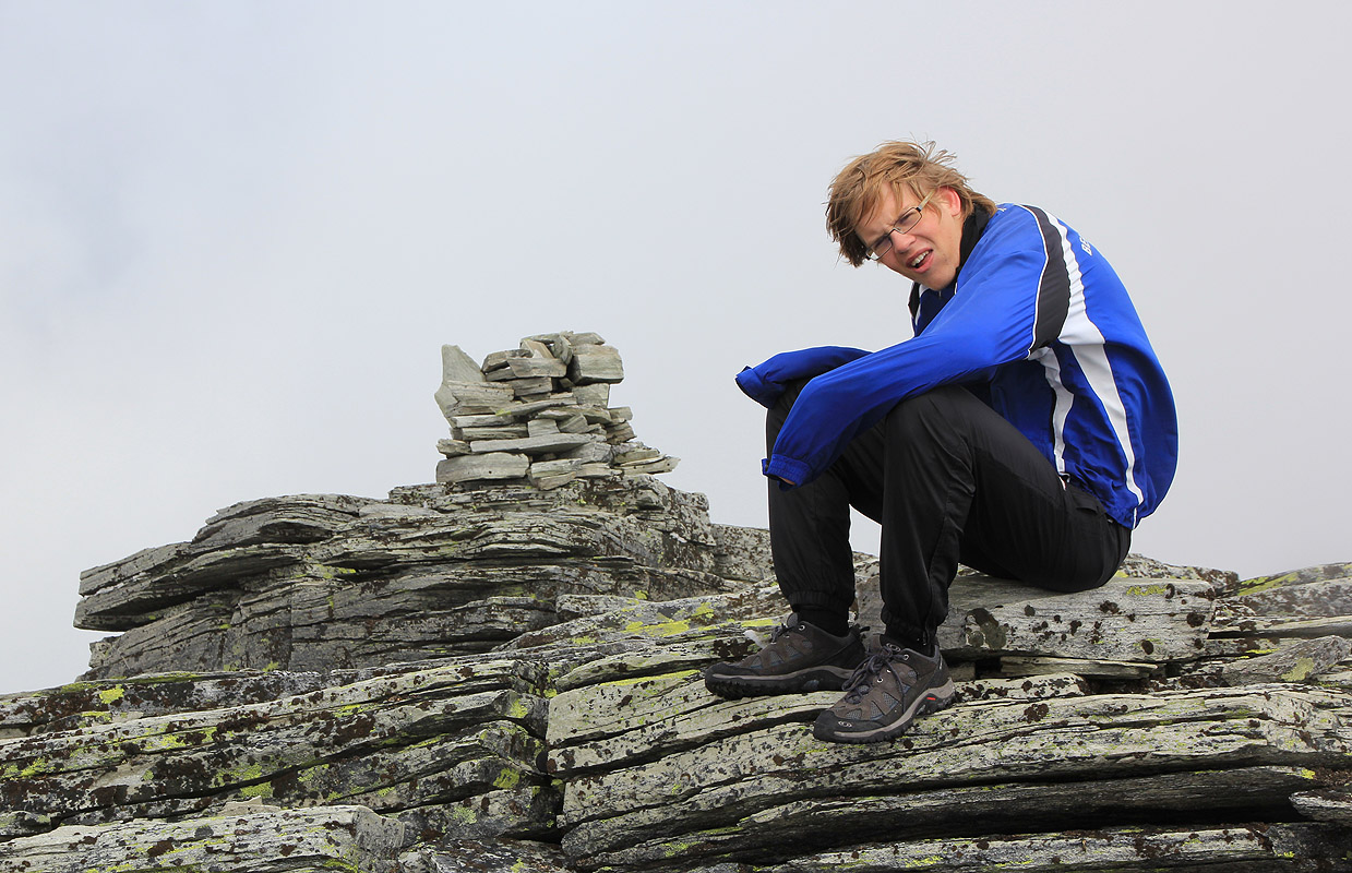
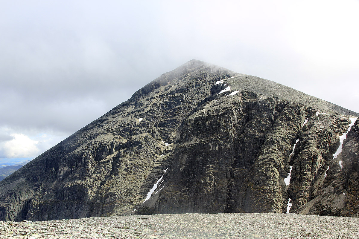
impressive summit cairn.
From the cairn, descend the east ridge, you should have the steep side on your left.
The terrain is quite easy as you get down into the saddle at location N61:56.938, E009:50.385. Cross
over a small hump in the saddle before ascending the north ridge of Midtronden. Again, the slope is
broad and gentle as you gain a bit more than 200 vertical meter. The cairn on
Midtronden is quite modest.
There is a second point just a bit further
along the top ridge to the north-west of almost
equal height.
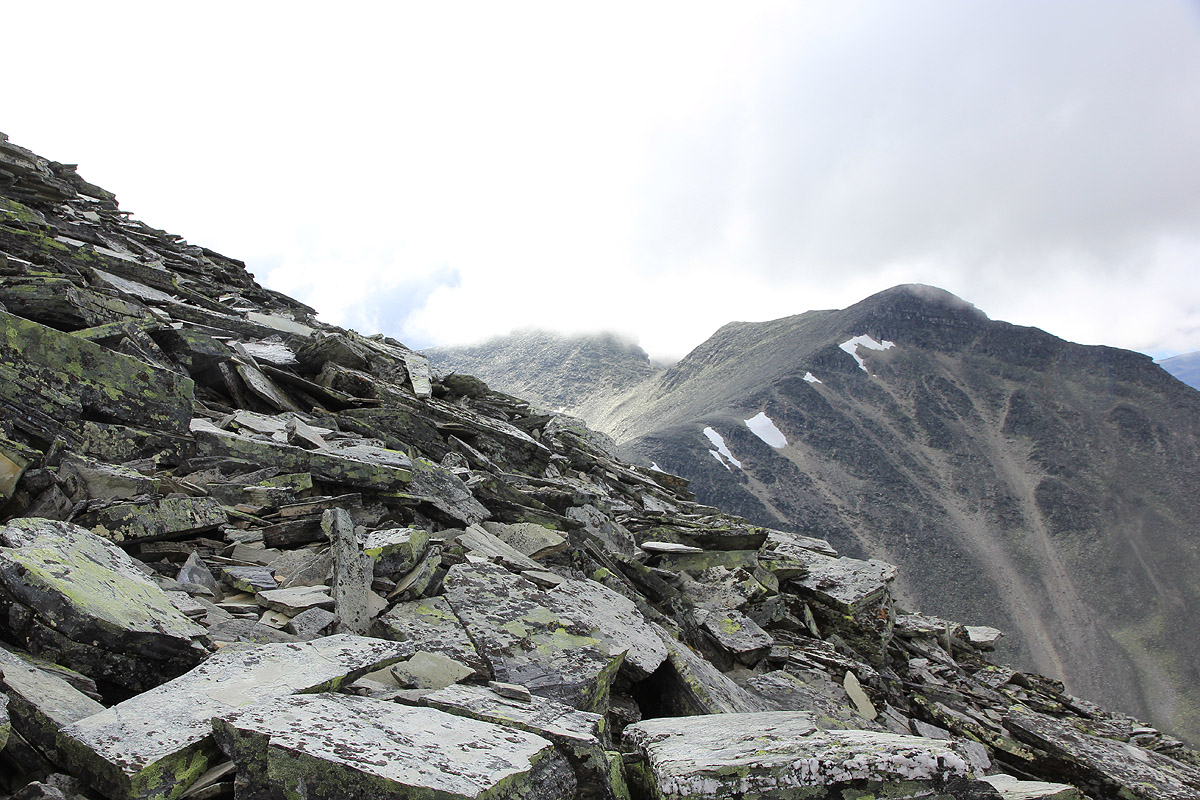
In order to continue the traverse, you need to visit another subsidiary peak further north-west. This
peak is 2042 meter and is separated from the main
summit by a col that is about 1950 meter. Thus, using
a 100 meter criteria, this peak is not independent from Midtronden. The terrain is more rugged, descending
along the top ridge will quickly involve more than off-trail hiking. Descend to your right, ie. on the
south side of the ridge and follow broken rocks and small ramps and ledges in order to reach the col.
This section is more rough than the rest of the traverse, but with a careful choice of
route, the difficulties should remain within (YDS) class 2.
Ascend on the other side and pass the two small highpoints in order to descend south-east to the
col that separates Midtronden from Høgronden.
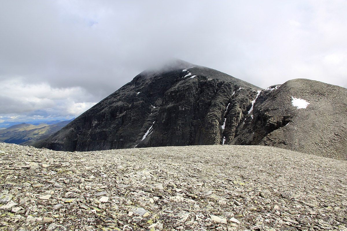
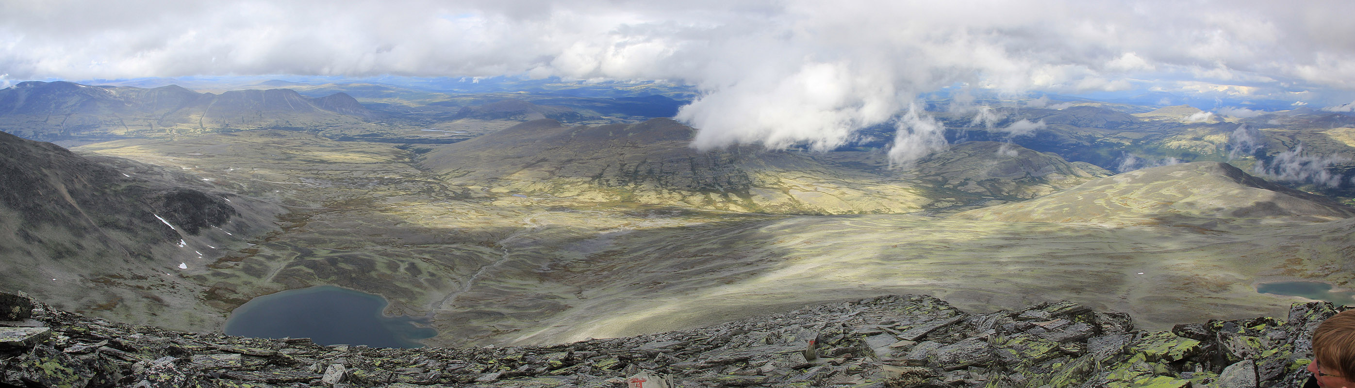
This saddle is slightly below the 1780 contour, so another 330 vertical meter awaits you. Again, the terrain
is easy and as you turn more north towards the end of your climb, you will again see a very
impressive cairn.
From the cairn, follow red "T" marks as you descend north, then more north-east. Lower down, you fork left and
descend more north-west to the base of lake 1461. The trail continues across fairly flat terrain, pretty
steady to the north-west until you descend back into the small valley Vidjedalen where you left the
main trail on the way to Digerronden.
Comments:
On our way from Trondheim, we had hiked Høg-Gia on July 31.
and today, on the first day of August, we wanted to climb Høgronden. Observing that a good loop
hike would be to traverse Digerronden and Midtronden on the way to
Høgronden, this became our plan.
We started out after breakfast and we were on the trail by 0815. The day started
out nicely with scattered
clouds and blue patches, the sun was mostly there.
We had some light rain showers, producing
a very nice rainbow, overall
quite ok. It took us a bit more than one hour to reach the
base of Digerronden, our first objective. This would also be our single biggest uphill on the trip, having
gained about 300 meter to the base, we now needed to gain another 650 meter before reaching the summit.
Just as we started uphill, dark clouds assembled and made a coordinated attack. Heavy rain and quite a bit
of wind, before long we felt pretty soaked despite wearing pretty heavy duty (rain)jackets.
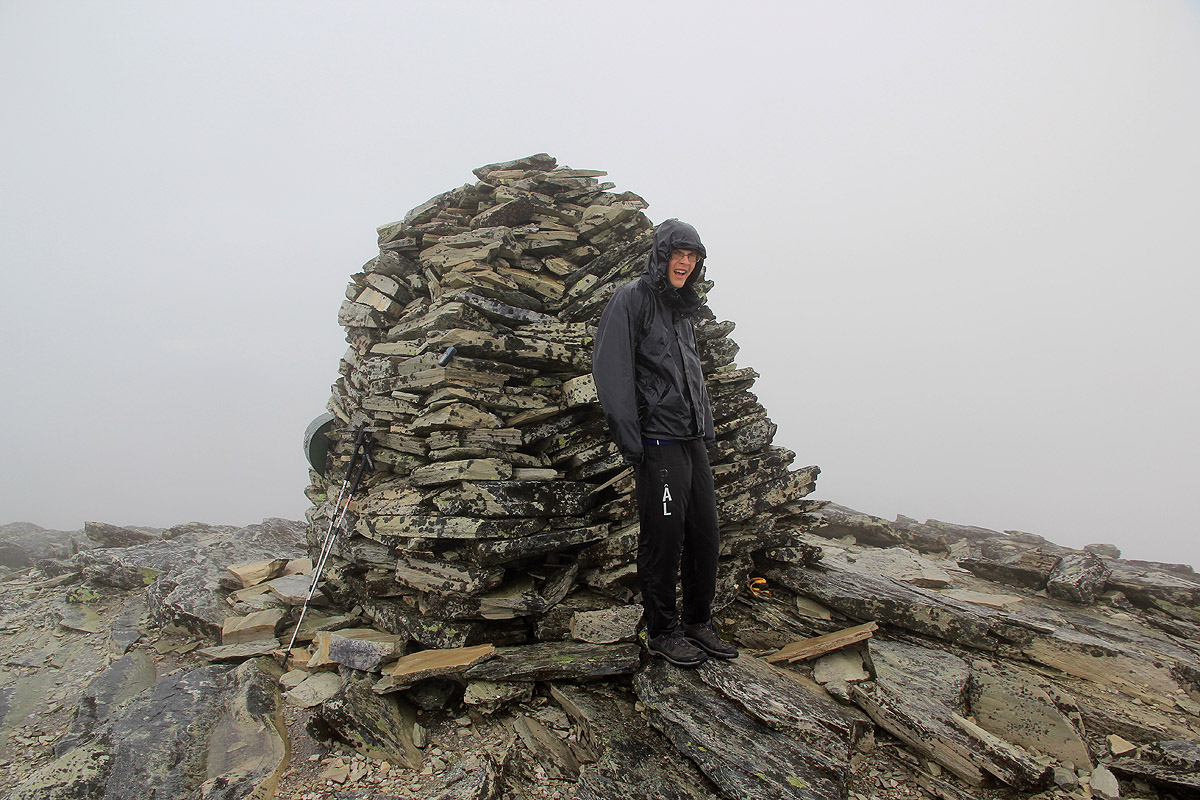
We arrived at the summit by 1045, 2.5 hours.
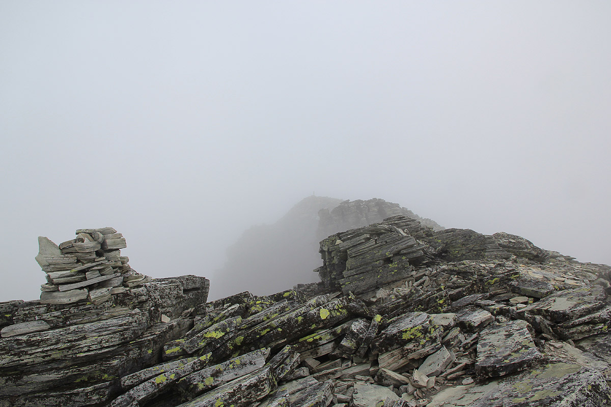
The visibility was essentially zero.
There was no view across towards Midtronden, but we continued pretty steady on the course that had
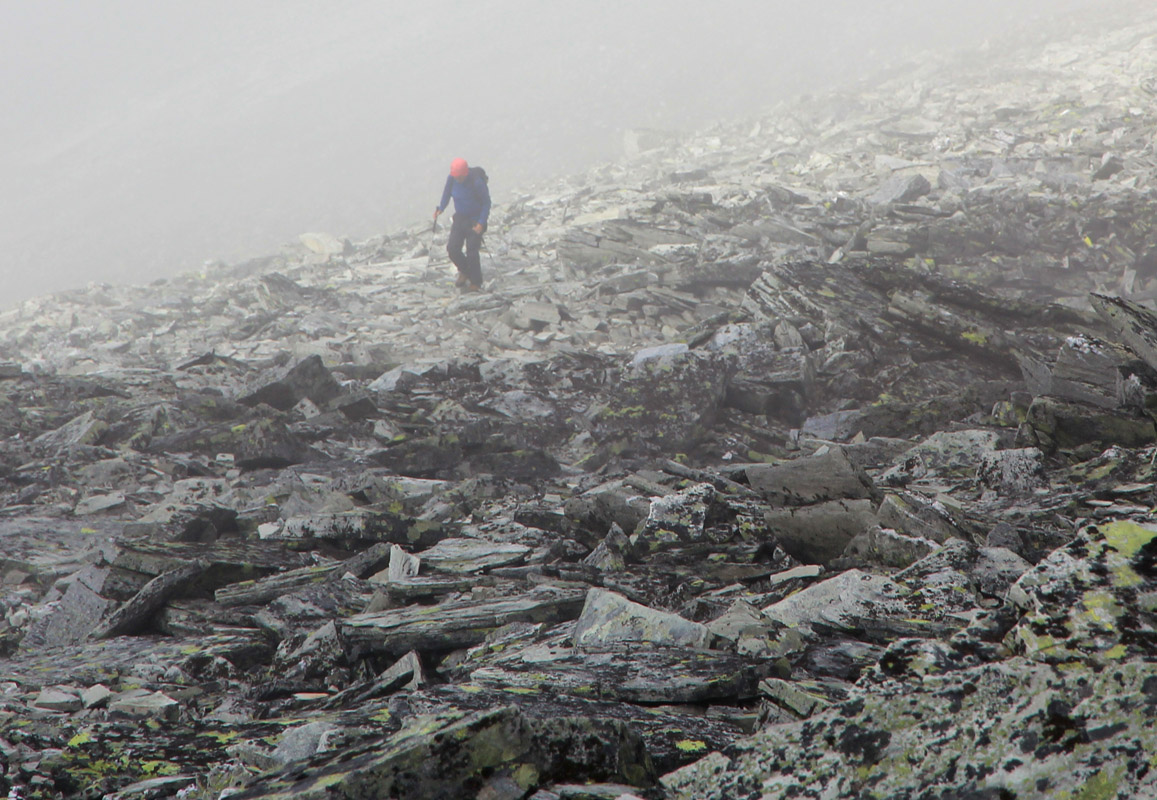
brought us to the summit. The rocks had quickly turned extremely slippery, it was obvious that this
kind of bluish rock with greenish lichen soaked with water created a very dangerous surface. My boots
would slip, possibly sideways even on almost flat surfaces.
We carefully descended and I noted that we had steep cliffs on our right hand side.
With no col or new mountain in sight, I decided to consult with the map. Shit, the map clearly
showed that we should traverse the ridge with the cliffs on our left hand side. We were now off
on the north ridge while we should have been on the ridge going eastward. Thus, turn around and
regain lost elevation until we again were back at the cairn.
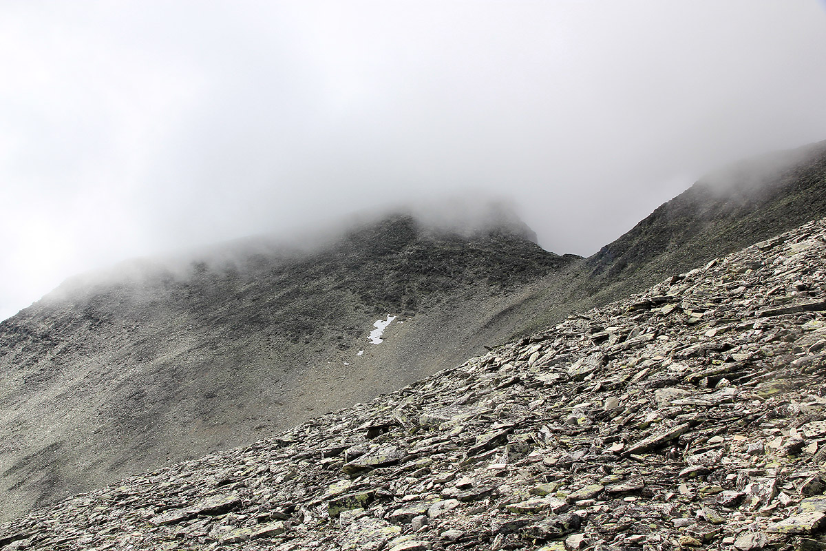
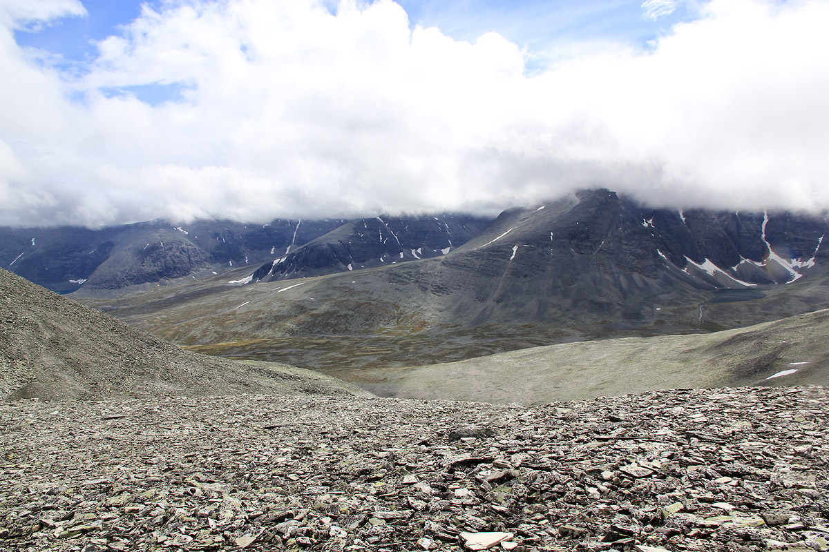
This time, we descended carefully along the correct ridge, and when we were almost down,
the fog broke up and
showed us the route ahead to Midtronden. However, the good news had short duration.
By the time we reached the cairn
of Midtronden, visibility had diminished to almost nothing and the
rain resumed in intensity.
We were at the Midtronden summit by 1230, 1.5 hours from Digerronden is fair testimony to our
navigational error and the very slippery rocks that made it awkward to descend. I realized that
this hike would require more time than planned and that we should have carried some lunch.
Rule: Always carry some extra food with high carbohydrate
After a short break, we started descending towards the subsidiary peak on Midtronden. Again,
it seemed like something was seriously wrong. I quickly discovered a vertical cliff below me and
a seemingly big void. Obviously, no good way to continue. At this point, I took my compass and
map and decided we had to traverse right. Unfortunately, the map had no plastic cover
and with the deluge of water combined with wind, I understood that there would be no
map left unless I put it away within 5 seconds.
Rule: Always keep your map in a waterproof plastic cover
We traversed right and discovered what looked like
a nice ridge to descend.
Descending on this ridge got us back out of the fog, but I did not appreciate
what I saw. No Høgronden, this ridge was the south ridge leading nowhere!
Back up again and into the dense fog. Another check on the map before it would
totally disintegrate and we set off pretty much as we had done perhaps an hour
earlier. Further down, I recognized the cliffs and realized that we had been only
about 20 meter too far to the left on our previous visit.
The terrain was rougher here and slippery as soap on a tiled floor, we descended carefully
and understood that part of the navigational problem was caused by not knowing that this
col was indeed pretty deep. The vertical drop from Midtronden to the saddle was more than
100 meter, while we had (somehow) the impression that this was a very shallow col.
Again, as we descended to the saddle that connects Midtronden with Høgronden, the
weather improved and
we could see the terrain around us.
How extremely easy this navigation
would have been if one could have seen the ridges when standing on the summit. Additionally,
we had moved across treacherous rocks where mountain boots would slide in totally unpredictable
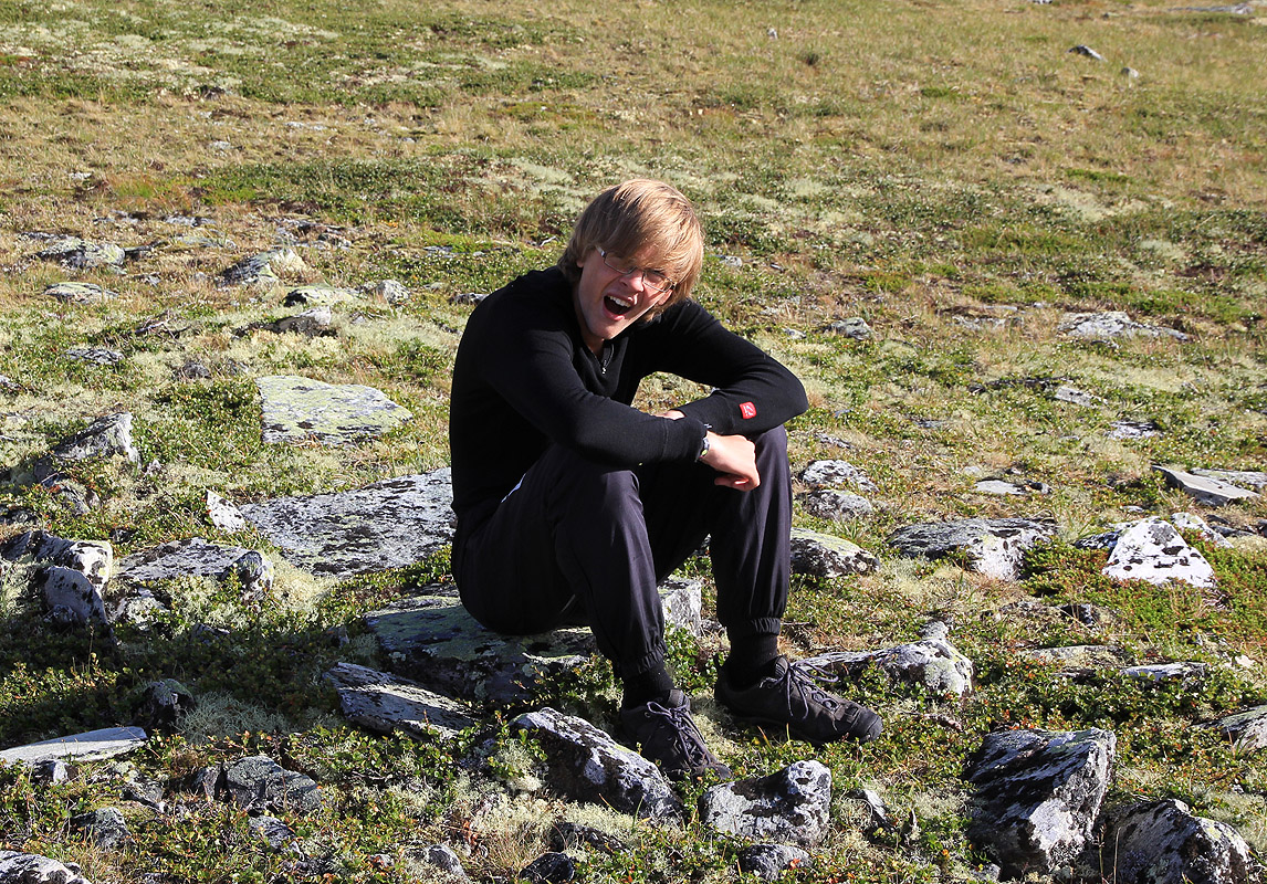
ways. Pål Jørgen now admitted that he was terribly hungry and felt that he had
little energy left. We had been moving pretty non-stop for about 6.5 hours by now and I
readily understood how he felt. With all carbohydrates totally depleted, the process of
switching the body to work from fat is a tough one, possibly much harder for younger
people. (I recalled how I had "hit the wall" in a few long distance x-country ski races when
in my 20's.) He sat down and needed a rest. For the first time on this hike, I moved
considerably faster up the slopes towards our final summit, only
about 300 more vertical meter to go.
I told him what he knew perfectly well, there is no food before we are all the way
back to Dørålseter.
We made the third and final summit at
1550, 3 hours and 20 minutes from the previous top,
what a nightmare of a trip in terms of time consumption. I knew very well that this to
some extent could have been avoided if I just had followed the two basic rules (see above).
When time in itself becomes an issue, then the distance is not important any more. As you
slow down, even more time is consumed etc. The fact that all rocks up here are insanely
slippery when it rains like today would have added quite a bit of time to this trip
regardless of other issues.
A well deserved rest until 1600, it was still a long way home. The weather continued to
improve, we could now look back at
the Midtronden double summit. We
descended following the
red "T"s and gradually, the rocks gave way for something that really looked like a trail.
The rain stopped and blue patches of sky reappeared. Sunshine. I noted how only a brief time with
dry weather
improved the friction on these rocks considerably.
Pål Jørgen obviously had his fat burning machinery up to speed, he was up front
and needed to make short breaks in
order for me to keep up. We walked with good speed across
what looked like a very large expanse of fairly flat mountain landscape knowing that our
hut was located on the slopes of distant looking mountains. Still, the team had some sort
of moral boost, we knew that this walk would end with a nice dinner. We had already changed
all plans of driving onwards to my Lillehammer vacation home. Dinner and a second night
at Dørålseter was currently the only option. Finally, as we descended the
steep slope down to the main river, we
could see the hut and knew that only 15 minutes
remained. Arriving back at 1915, exactly 11 hours. I checked back in and asked about
dinner. Dinner served right then, so we were pushed into the dining room, adviced that
the room key was something we could get later. Only a few other guests, we had to
admit that we were kind of hungry and that dinner would taste extremely well pretty
much regardless of the menu.
The following day felt like a rest day, we had a solid breakfast and started our drive
back to Bergen around 0900, arriving 9 hours later at 1800.
Resources: