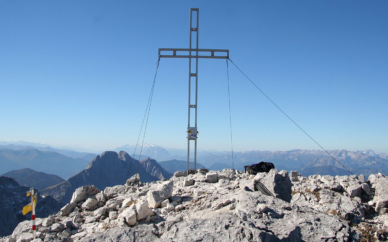
Location: North 47:33.712, East 014:37.952 (GPS on the summit)
Difficulty: YDS class 3.
Climbed October 16. 2007.
Information:
How to get there:
This mountain lies within the Gesäuse National Park, a collection of very steep
and characteristic limestone peaks. The trailhead is about 140 kilometer from Linz.
From autobahn A1, locate autobahn A9 (Linz to Graz), this autobahn intersection is
south-west of Linz (direction Salzburg on A1).
Take A9 towards Graz, there are several tunnels, but only one that exceeds 5 kilometer.
As you exit this tunnel, there is (2007) a toll plaza where you pay Euro 4.50. Measure
from here. Immediately after the toll plaza, exit right and follow signs towards Admont.
In Hall, go right in the traffic circle at kilometer 12.8. You enter Admont, go through
the town and locate a traffic light related to a railway crossing straight ahead. This
is at kilometer 13.9. Do not cross the railroad, rather make a left here and follow
signs for Johnsbach. At kilometer 24.4, you are in Johnsbach (railway station). Turning right
here can get you to a trailhead for trail no. 601 to Hesshütte, see comments below.
To reach my trailhead, continue straight for 7 more kilometer (to kilometer 31.4), immediately
after crossing the river (on a short bridge), you will locate a signed parking area on your
right. Turn right and park here. This is the trailhead, location N47:35.240, E014:40.154, elevation
572 meter.
Route description: To the Hess Hütte:
Near the entrance to the parking, the trail (marked as trail no. 660) immediately
goes into the forest. There is another big trail (small road, no. 87) that heads
downhill, do not follow this.
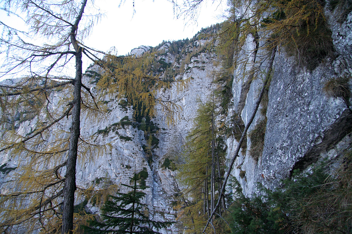
The trail initially traverses west (right) along the hillside without much elevation gain.
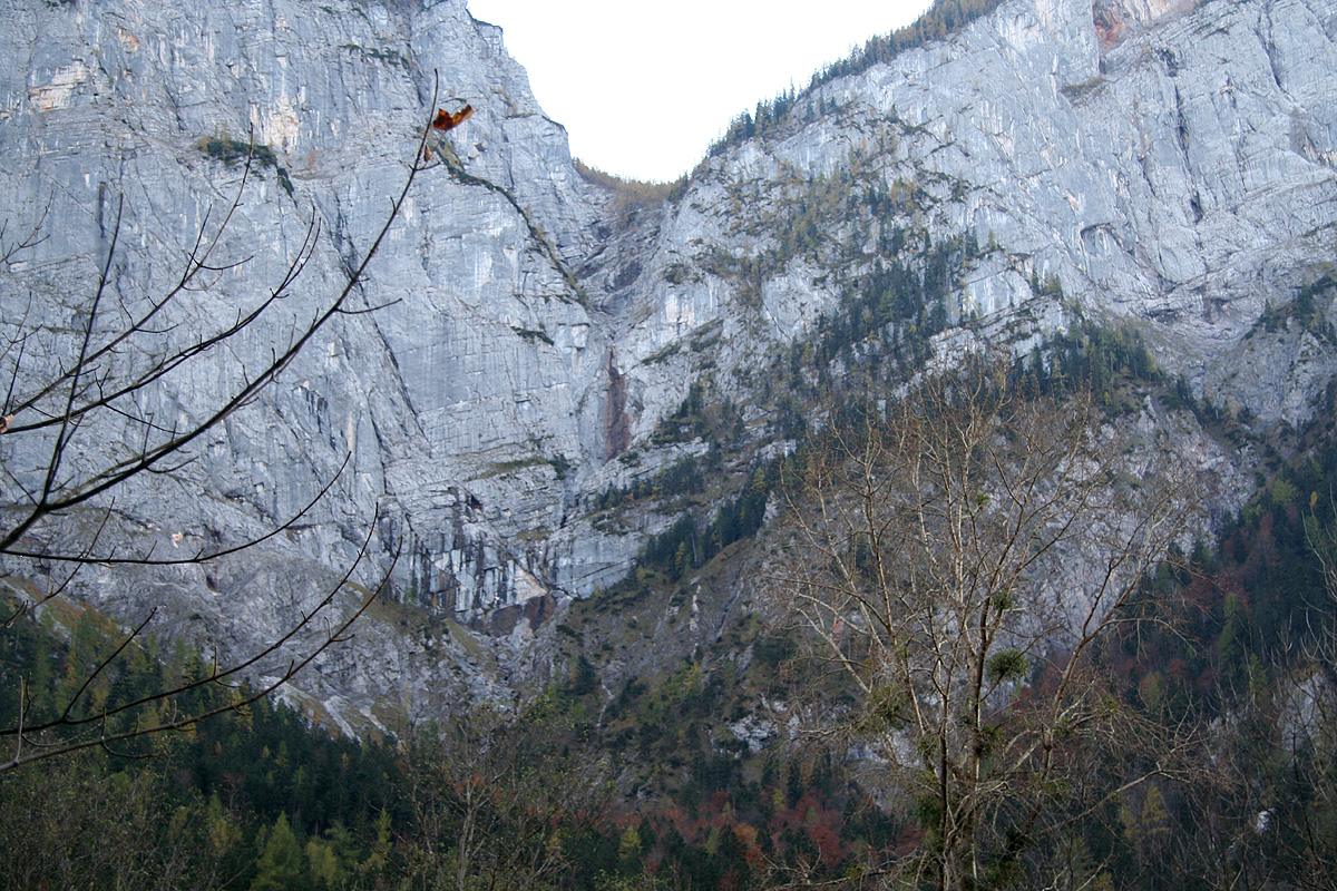
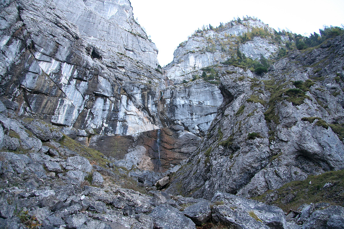
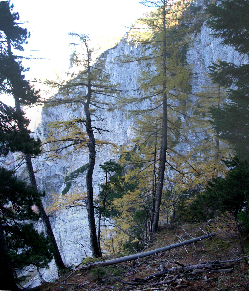
After crossing a river bed, the trail heads more uphill. The terrain above you looks
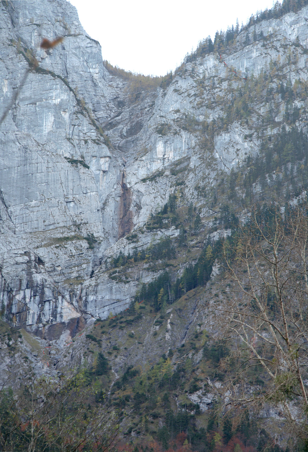
pretty impossible (for a trail), but there is a way. This trail
is called Wasserfallweg (waterfall trail) and
is more than 100 years old. In this photo, the
trail has been indicated by faint red
lines near the bottom and near the top.
First, climb uphill towards a waterfall (possibly with little water) that comes
down the vertical cliffs towering above. Pass straight uphill on the left side of some big
boulders, this is the first place an iron bar has been placed to provide an extra handhold.
Close to the waterfall, the trail crosses right and now climbs steeply while following the
cliff as you traverse right. Higher up, the cliffs that you have followed (within 1-2 meter!)
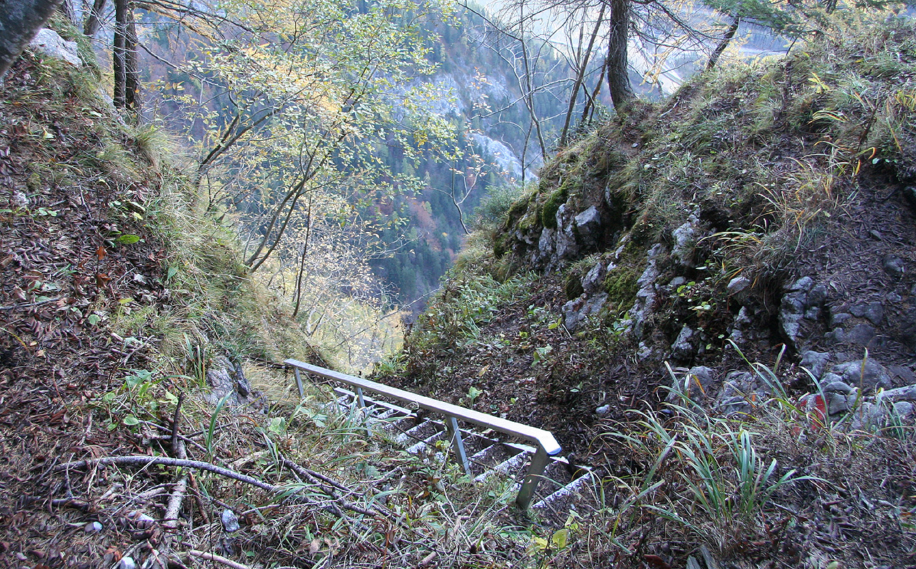
runs out and there is a staircase then a new slope
going up to your left. The trail climbs this slope in several
zig-zag turns.
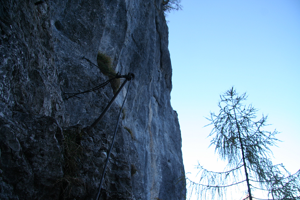
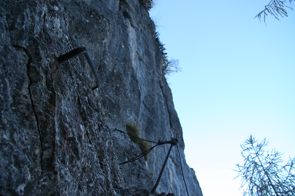
As you near the top of this slope, this trail is getting more exposed and there is now steel
wire and ladders almost continuously until you top out. The general line follows some narrow
ledges that climb fairly steeply towards your left when viewed from below. You have impressive,
vertical cliffs further left. For being a trail, this is a "pretty desperate" route, without the
steps and wires - a climbing route. As it stands (using all the help that has been provided), it
may go as a very exposed (YDS) class 2+ type route. This route is not for people uncomfortable with
exposure.
As you enter a fairly long ladder (stairway), that changes into a considerably steeper one higher
up, you are near the end of the steep part. Suddenly, you top out in the forest above the cliffs.
From here, the trail is a nice valley hike across a couple of small meadows and up a few moderate
hills. You will see the mountain above
you to the right. You pass a trailfork where trail no. 663
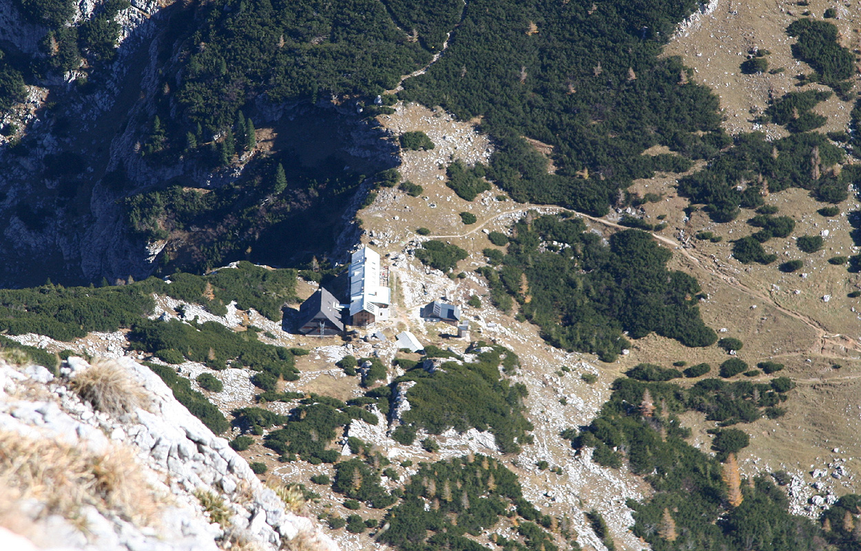
heads west (right). Continue straight, before very long you will see the Hess Hütte up ahead
in the col.
To the summit of Hochtor:
From the Hess Hütte, you exit the terasse at the opposite end from where you entered. Follow the
path towards the mountain for a few meter and you will find a signed trailfork. Take the left
branch, this is called Josefinensteig, trail no. 664. The trail finds its way through the low pines
then enters the talus slope and crosses left while ascending. The first part of this climb will now
take you up the mountain face to the main east (or south-east) ridge.
In the beginning, the trail ascends by following ledges with some steeper scrambling to ascend from
one level to the next. All scrambling parts are equipped with cable. However, the entire route
to the summit can be done without the use of these cables, the climb is then fun (YDS) class 3
scrambling on excellent limestone with plenty of hand and foot-holds.
As you get higher in the slope, the terrain gets steeper and there is more scrambling and less of
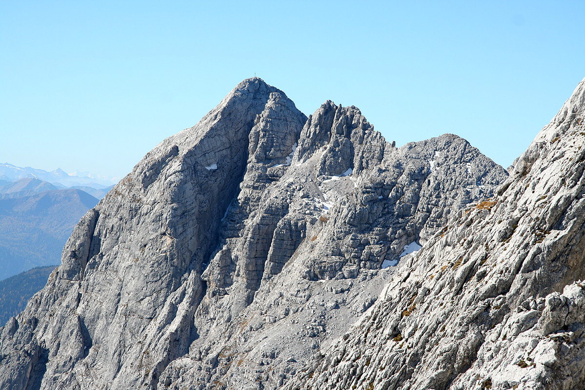
a trail. Eventually, you reach the main ridge at location N47:33.521, E014:38.380, elevation 2227 meter.
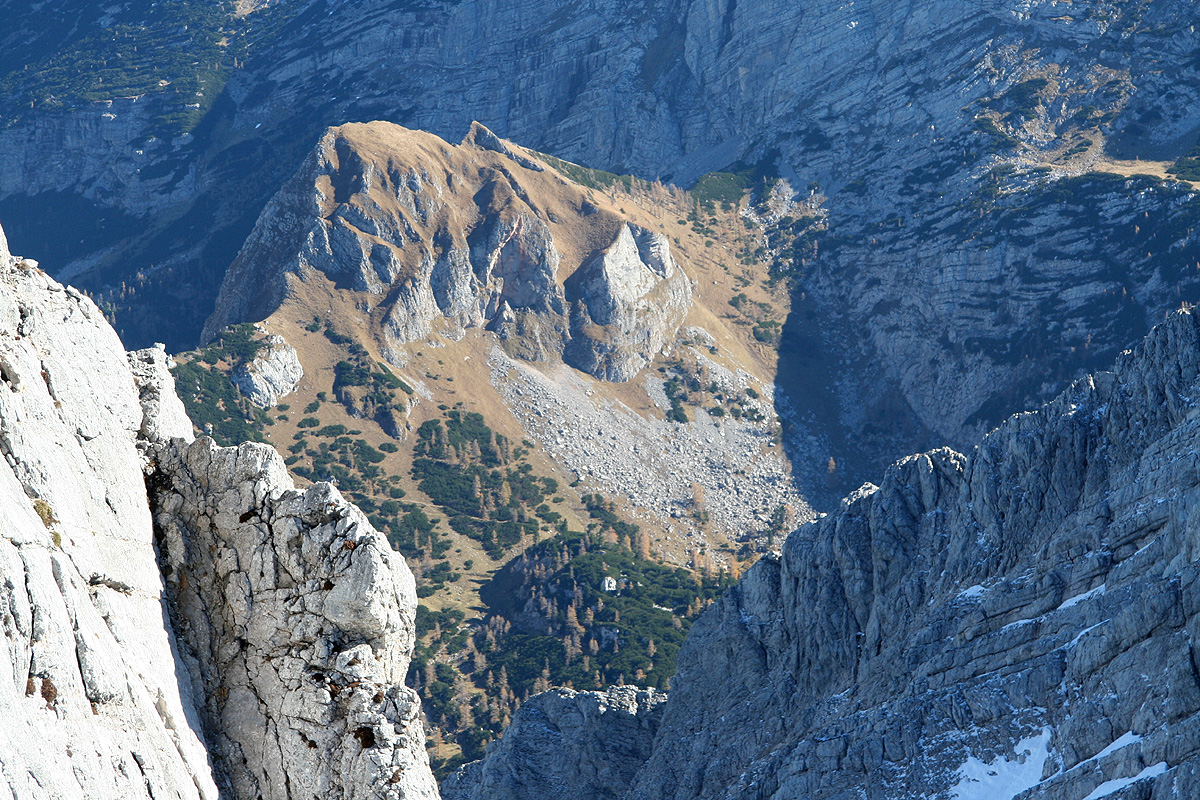
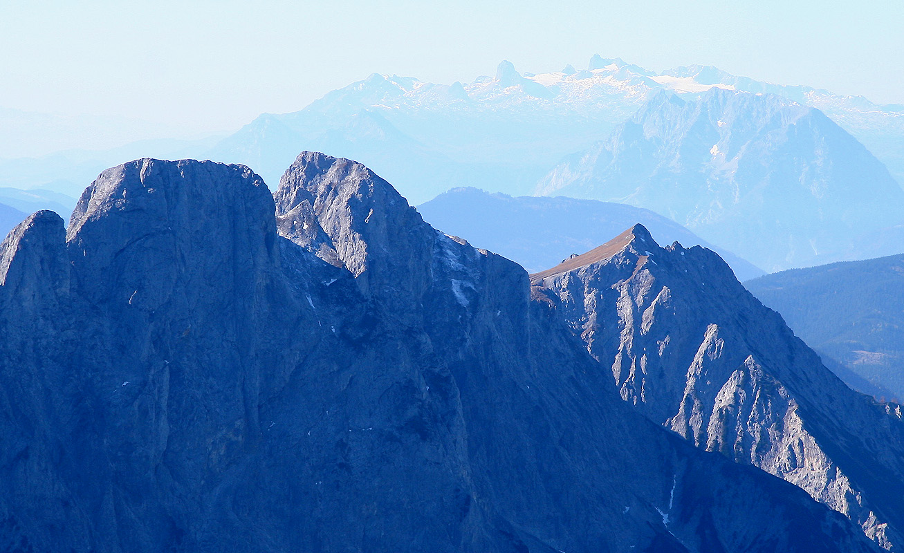
The view north is already outstanding.
One can see Festkugel (2269m), but not yet
the summit of Hochtor.
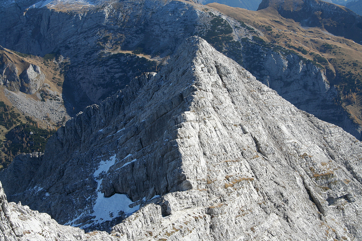
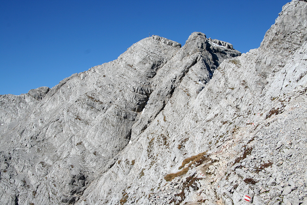
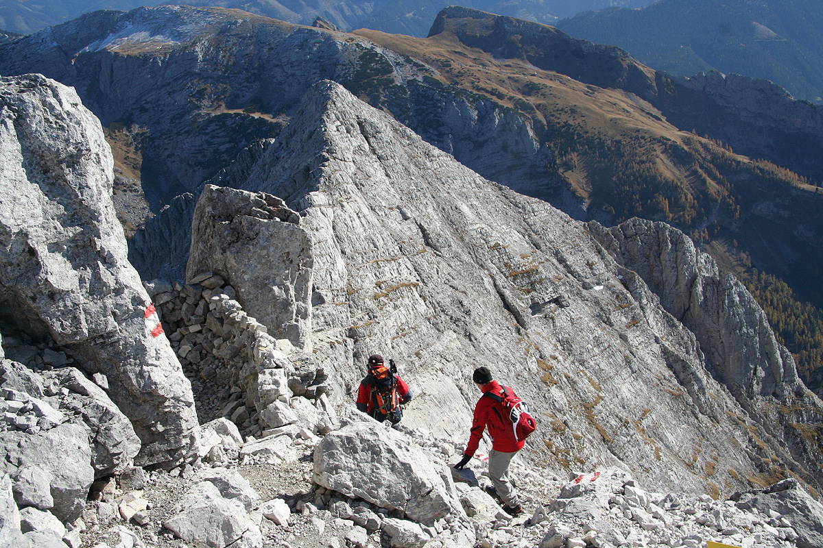
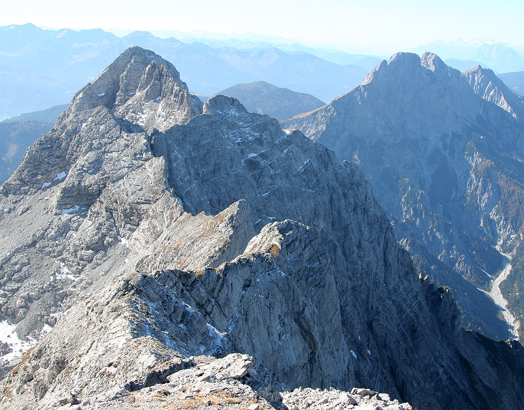
The trail descends briefly on the opposite side of the ridge, then regains it. At this point, it is tempting
to continue on the (easy) ridge directly to the summit ahead.
However, this is not the summit of Hochtor. The
route traverses the left (south) side of this false summit
along a system of fairly narrow ledges (the picture is from the summit, ie. the opposite way). There are a few
places where you must downclimb in order to reach a new ledge below you. The terrain is steep and care is needed.
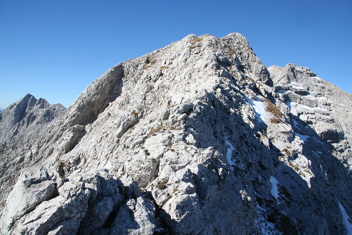
At the end of this traverse, you again briefly advance near the top ridge with
good views to the north as well as back
down to the Hess Hütte. What remains is a final scramble to the main summit, the last part is quite
easy.
Comments:
The weatherforecast was nice and the day promised to be the last day before
winter in the high mountains. I left Linz at 0640 and set course for the village
of Admont. I had studied the map and decided that all hikes of Hochtor involved a
substantial vertical, however the trailhead that could be reached by going south from
Johnsbach seemed best in order to pull of this climb in a single day in mid October.
I located the Johnsbach railroad station and the proper side road without any problems.
After driving a few kilometer, nearing the highest point of the road, I came to an
area with road work, the traffic seemed to be regulated one way at the time by a
(portable) traffic light. I stopped for the red light and waited. Nothing seemed to
happen. After a while, I left the car in order to examine a sign that was posted
further ahead. It said that this work would take place Monday-Wednesday. Then it went
on to talk about how traffic was supposed to get by, but my German was a bit
inadequate to completely understand the message. About at this time, one of the
men working on the road came walking. He explained that the road would be completely
closed for the rest of the day. Bad news, I took a quick look at my map and remembered
that there was an alternative trailhead on the north side. It started lower, but seemed
like the only choice. I drove back to the main road and located the new trailhead 7 kilometer
down the road. By the time I was ready to go, it was already 0845, more uphill than planned
and some time wasted due to this unexpected road closure.
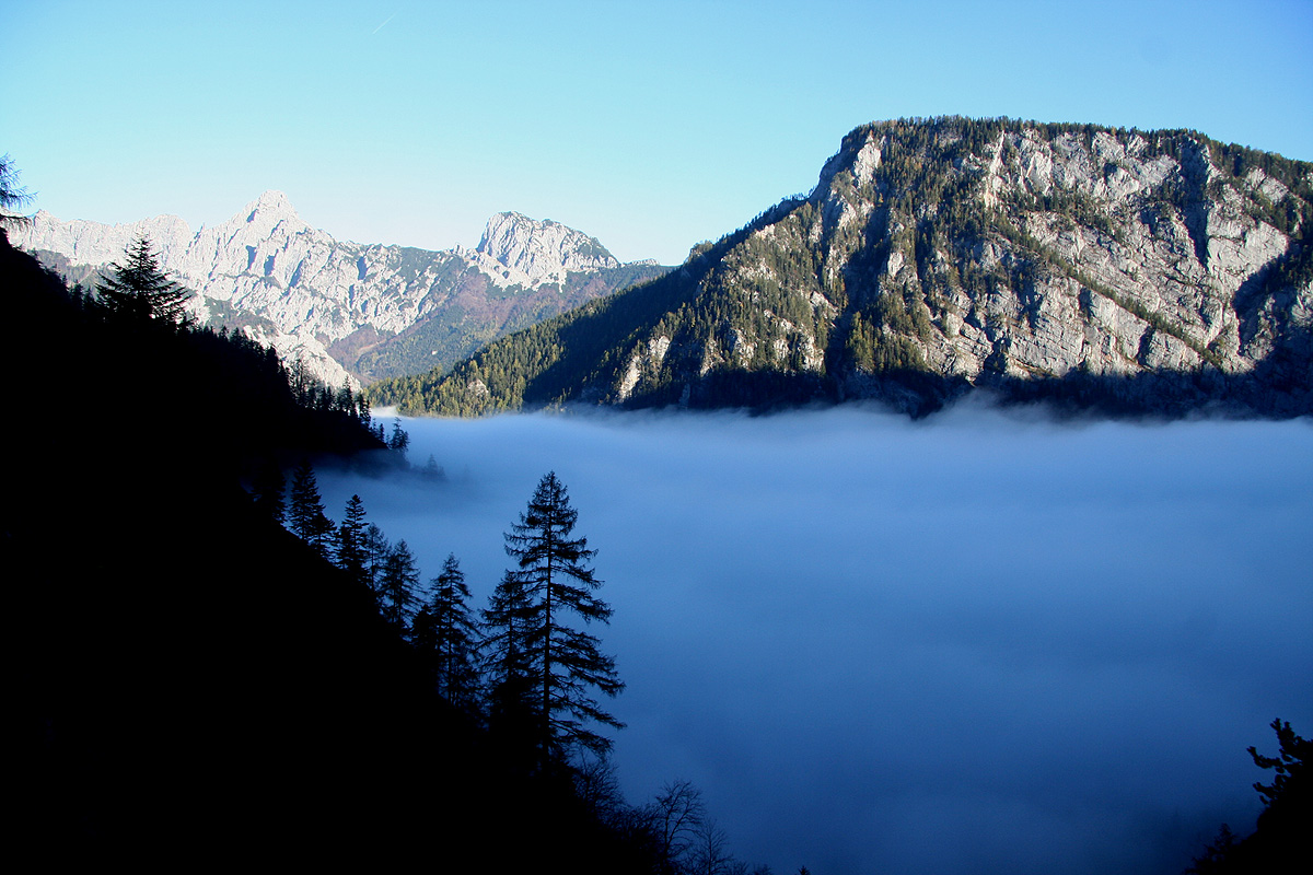
The vally was full of dense fog as I started out along the trail that took me into the forest.
Starting out for a mountain as high
as Vesle Galdhøpiggen from a trailhead at 572 meter
can be mentally tough. If I had been able to see the terrain above me,
I might not have accepted
the challenge. I hiked along and gradually
came out of the fog, at least to the extent that
I could see the cliffs above.
"You got to be kidding!", "the trail cannot possibly go up here", I told myself.
It seemed like it possibly could traverse right, and that is what it looked like as I crossed the
small waterfall. Higher up, I came upon a nice memorial sign posted 100 years after this trail came
into use. I learned that the trail was called "Wasserfallweg".
"The guy that decided to make a trail up here was an optimist," I said to myself while
struggling higher, already having negotiated a pretty tall staircase. The trail turned left, the
immediate future looked ok, but I thought we might then return to the insane cliffs I had seen
from below the waterfall. Sure enough, more wires to help people and much steeper, but it still looked
impossible higher up. Suddenly, I arrived at the base of a pretty vertical cliff. I looked up
and noticed what had to be the continuation.
"And this is supposed to be a general access trail
to a mountain hut?" I said loudly. The guy was not just an optimist, by now he had clearly made
this trail his prestige project, and was obviously getting desperate.
I hauled myself up on the next,
small foothold and took a look around. Sure enough, the trail angled steeply upwards along
a pretty narrow ledge. OK, this is clearly supposed to be possible, so just keep going.
The ledge became more narrow, the exposure on my left
was getting phenomenal. I could now see
another staircase above, it rose perhaps at 45 degrees and ended in a much steeper ladder that
went out of sight. "Boy, but there is no way this can get much worse," "things are at a point
where they can only improve." Just as quickly as
such "positive thinking" went through my mind, I popped out
from the last ladder onto a small,
but FLAT piece of real estate.
I had almost forgotten what
"flat" felt like. I looked down from
where I stood, enough to scare many hikers, first
a fairly ordinary staircase, but leading down to - a big void, then the valley hundreds of meter further down.
Only later did I notice that this trail indeed has a section with "red dots"
on the map, meaning steeper or more difficult, while I hiked I believed this to be a completely
normal Austrian trail serving a major mountain hut. The contrast between my expectations and
the actual trail clearly contributed to my overall surprise and disbelief this morning.
The remaining part of the trail was what most people think of, hearing the word trail, - a nice
path between trees, and across small meadows as it followed a small valley leading to the col that
separates north from south in this area. The Hess Hütte
was located precisely in this col.
I arrived at 1055, 2 hours and 10 minutes for more than 1100 vertical meter, told me that the
summit should be within reach despite the relatively short day now in mid October.
I had a good 20 minute break and a big beer. The friendly keeper of the hut said he believed
there was little, if any at all, snow. I had carried both crampons and my ice axe, in order to
prepare for possible snow or just some ice on the higher parts of the route.
The remaining part turned out to be a fun scramble on good limestone. The sun was warm and
I decided to try completing the route from the hut to the summit without touching the steel
cable that had been placed on all slightly steeper sections. Climbing without using the
wire certainly takes a bit more time, but it was altogether sustained, nice YDS class 3
scrambling. Just after I had reached the main ridge, I eagerly advanced up the summit ridge, only
to discover the trail traversing this false summit far below me on my left side. I had to retrace my
steps partway, then descend to the trail. At this point,
the final section of the climb with the summit
came into view for the first time.
I arrived at the summit
precisely 2 hours after leaving the hut. I met 3 parties
returning along my way, clearly I was the last climber to summit this peak today.
A very nice summit indeed. Two climbers
descended just as I arrived, I then had the
world for myself. I wanted to spend an hour up here, but in order to reach the car
before it got dark, this was unfortunately not an option. I still had plenty of
time to take photos, to eat my single piece of bread, and to look at
the landscape,
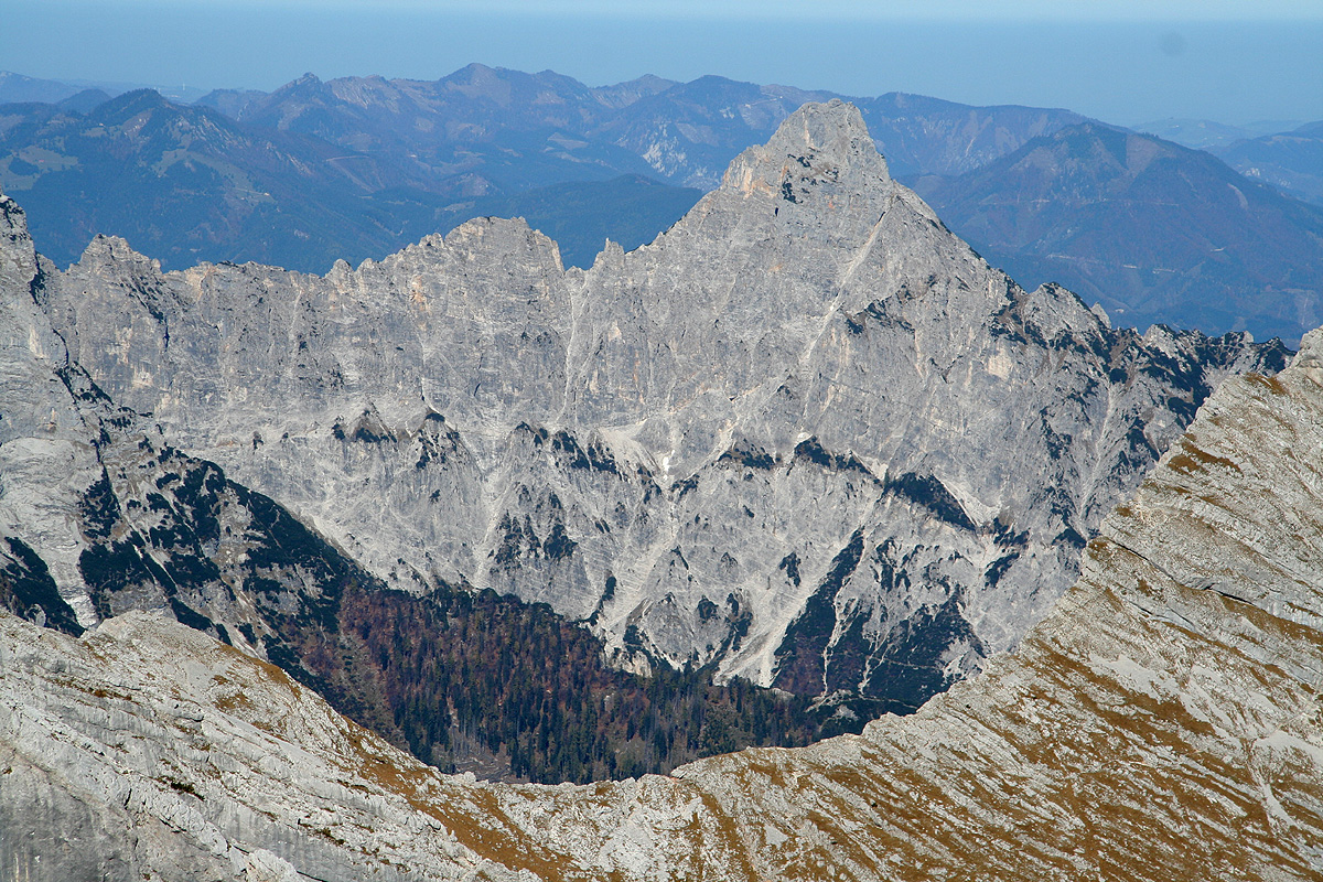
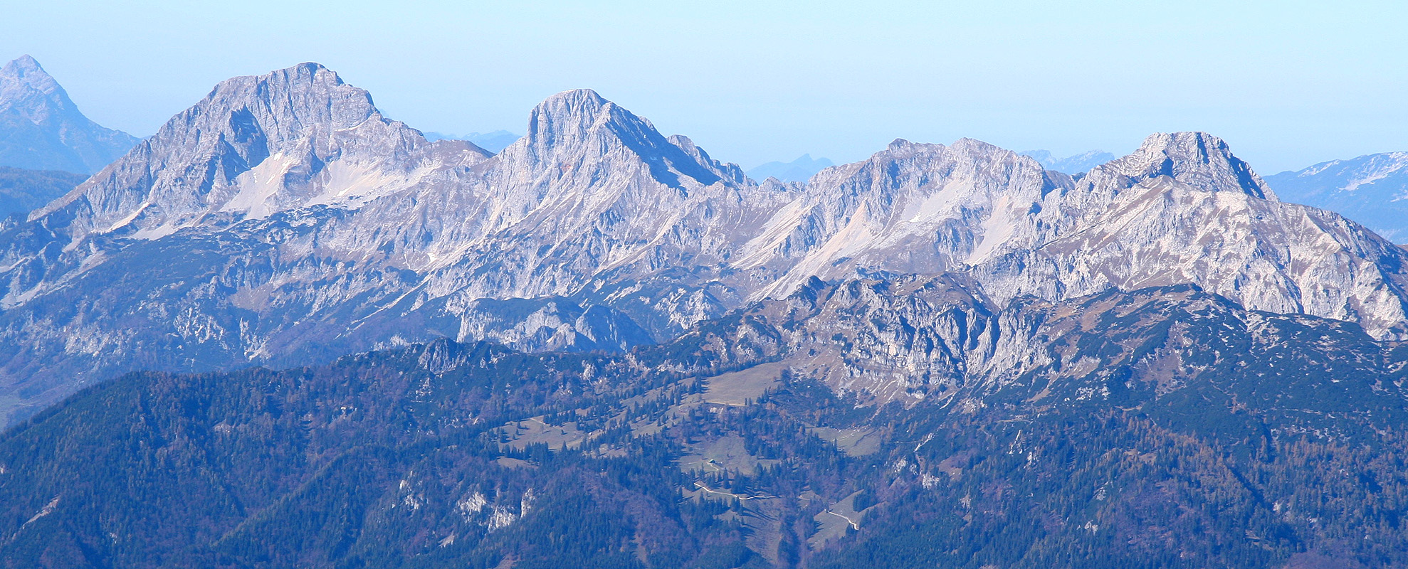
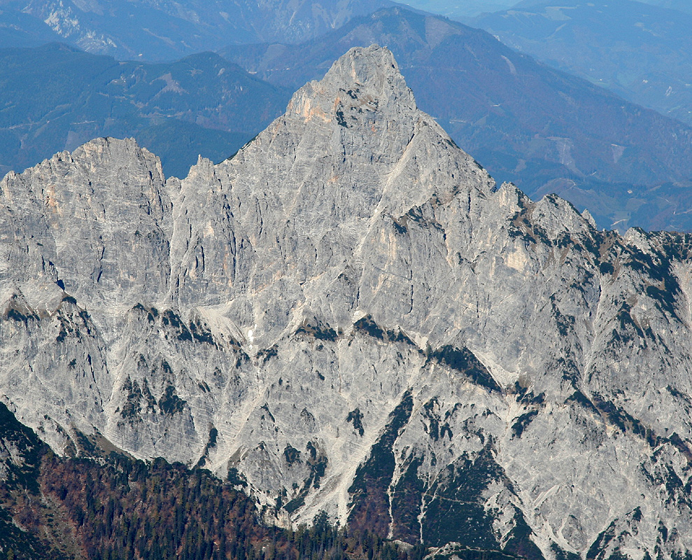
the hills and the mountains in
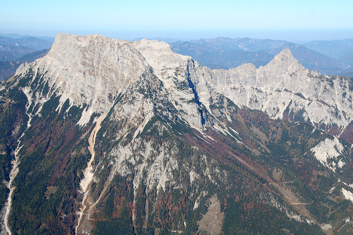
all directions (Kleiner Buchstein, 1990m).
I noticed
the Dachstein,
the nearby peaks, Festkugel and Grosser Ödstein,
as well as the prominent Grosser Buchstein (2224m) across the narrow
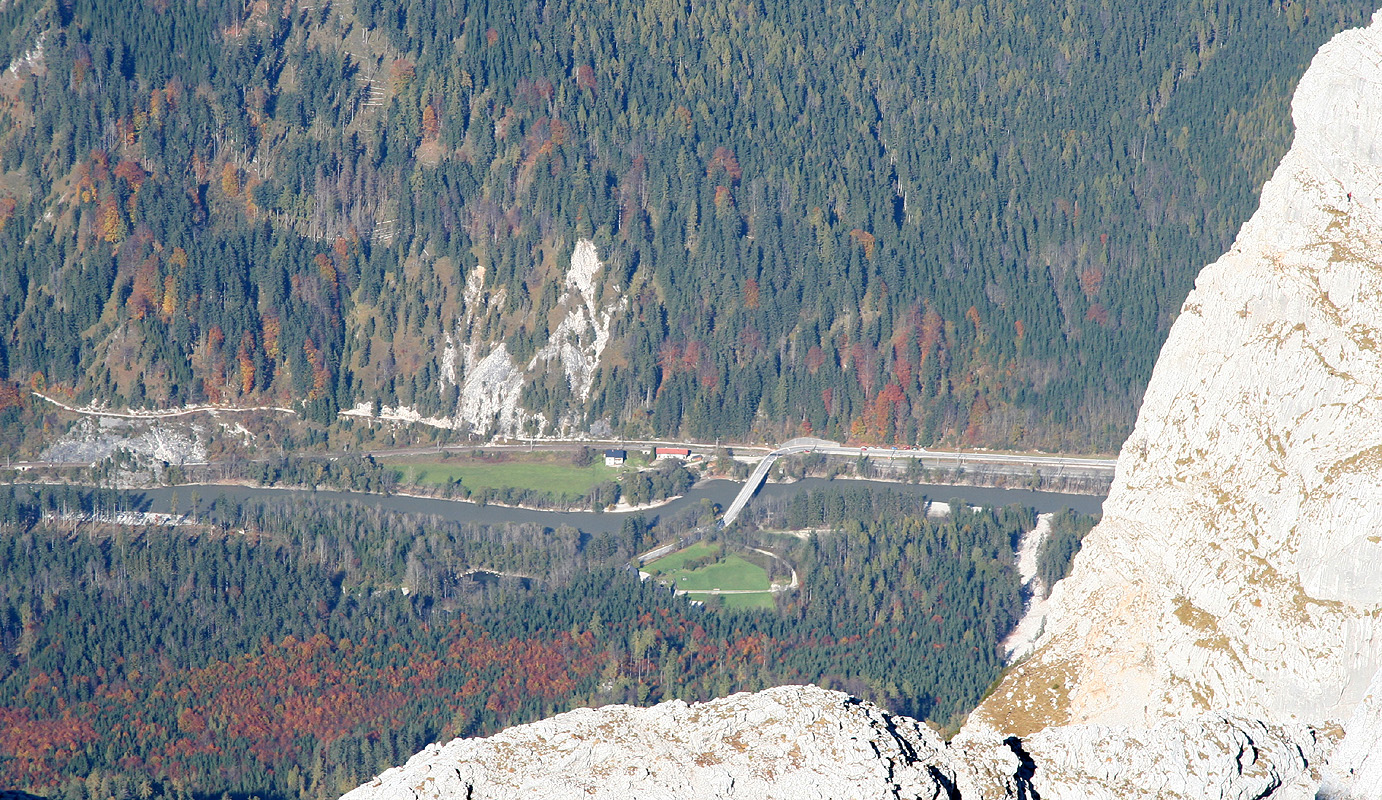
valley. One could look directly
down to the road, 1800 vertical meter, quite close to my trailhead.
I left the summit at 1330, and descended back down the the mountain hut by 1500.
Another good half hour rest was called for. I enjoyed a second beer as well
as a huge glass of Coke before setting out to descend the remaining 1100 vertical
meter.
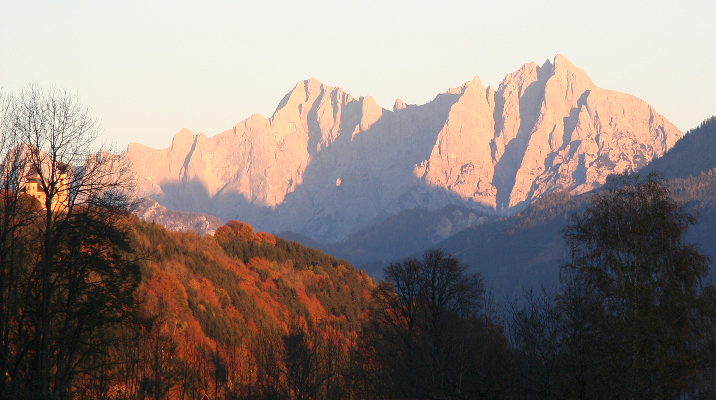
I reached my car at 1715. I was soon driving back towards Admont, the sun was
setting in the west and the dramatic peaks of Gesäuse National Park sent a
fantastic goodbye
as I saw them through my rear view mirror.
The Hess Hütte with the mountain behind. The first part
of the route heads up the slope behind, it gets steeper near the top as it gains the ridge towards
the right side.
