Location: North 47:25.220, East 013:03.747 (GPS at the summit)
Difficulty: YDS class 2 (one short ladder)
Climbed August 12. 2005.
Information:
How to get there:
This mountain is located south of Salzburg. From Salzburg, go south on A-10 to
Bischofshofen, then east to Mülbach, where a side road goes right to Arthur-Haus.
From the west, starting at A-12, go east on Hwy. 312 to St. Johann, then the smaller, but
very OK road 164 to Saalfelden. From Saalfelden, you drive east to Mülbach and turn left
up the hill.
At the end of the road you will find a nice hotel, Arthur-Haus, and parking.
This is the trailhead, elevation 1502 meter, location N47:24.559, E013:07.698. Route description:
From the parking above Arthur-Haus, head up along the trail that passes between
the two smaller buildings highest on the slope.
Do NOT follow the road through the pass, this (wrong) road subsequently goes downhill.
The correct trail initially runs in the
direction of the mountain above you, then contours more right on an ascending traverse of
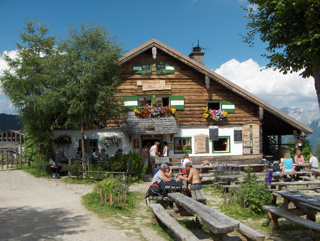
the hillside. This small road connects to the nice farm called Mitterfeldalm located at
elevation 1669 meter, just where the main north-east ridge of the mountain massive runs down.
A smaller trail runs parallel to the road for part of the way, it climbs a bit more evenly
and is a good alternative to the road on this section just before Mitterfeldalm.
Pass through the farm and continue on a well developed trail. This trail first descends a bit
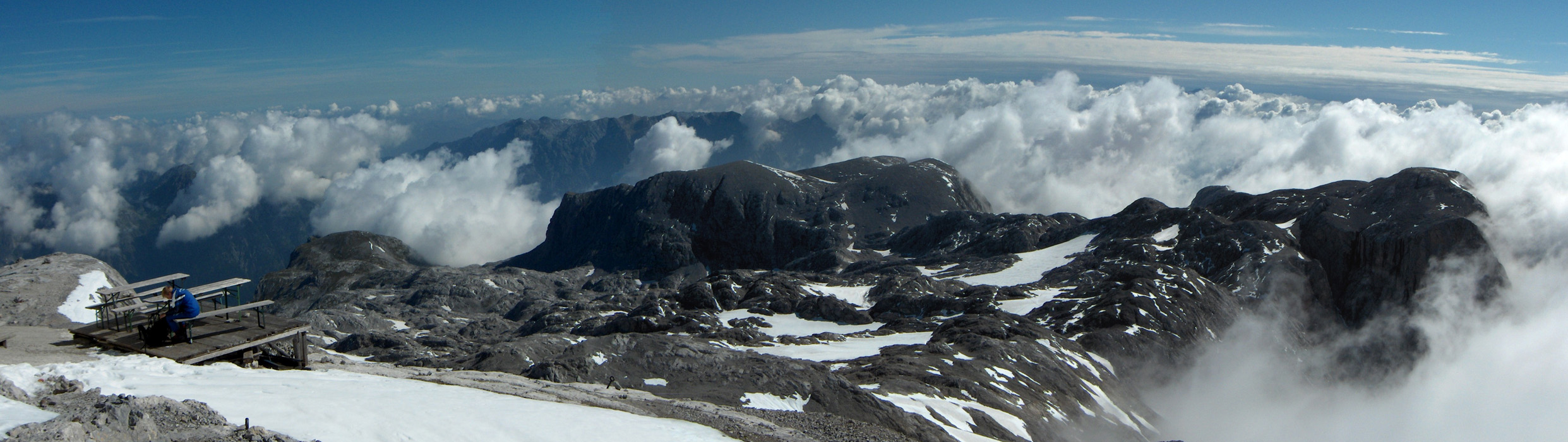
in order to cross the slope ahead just below some cliffs, then gradually ascends as it enters
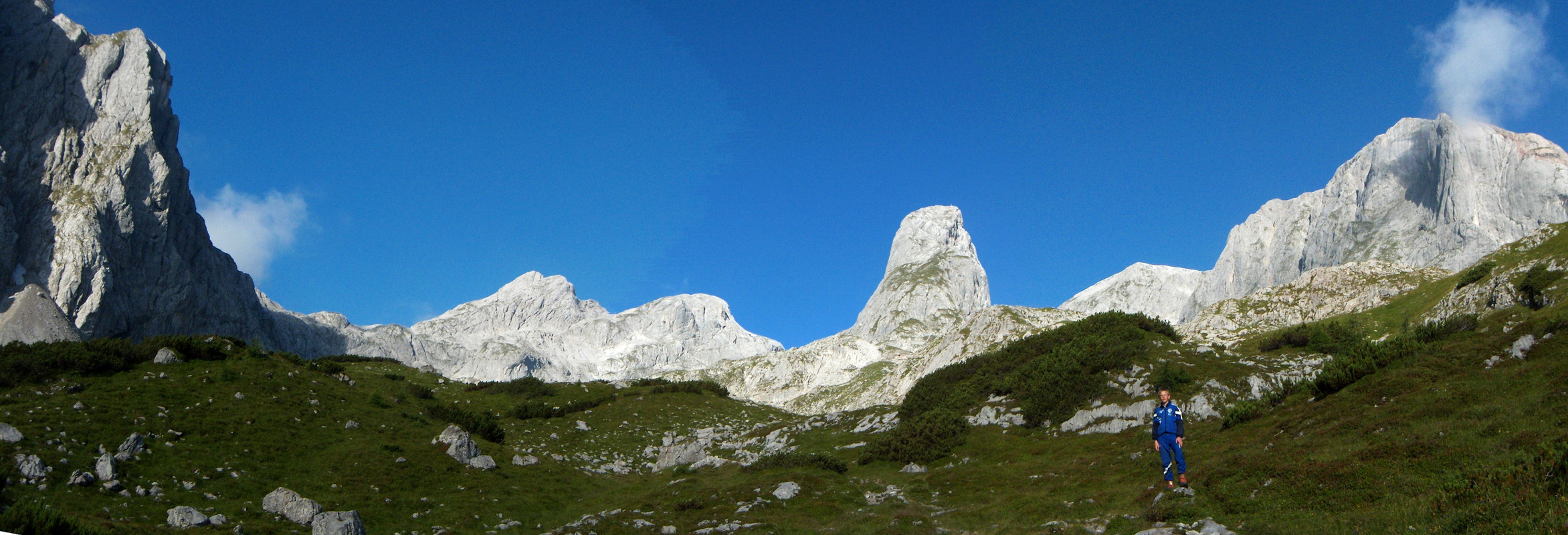
the large valley basin facing north-east with its jagged ridge of mountains in a horseshoe
form around it.
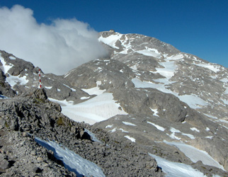
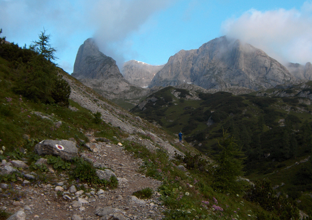
The very special peak Torsäule immediately attracts attention. It stands alone with steep
sides and looks hard to climb. The trail heads up towards this peak and passes very close to
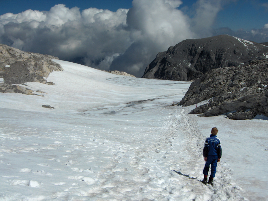
the impressive south face. Our trail becomes slightly more rugged as it climbs higher, crosses
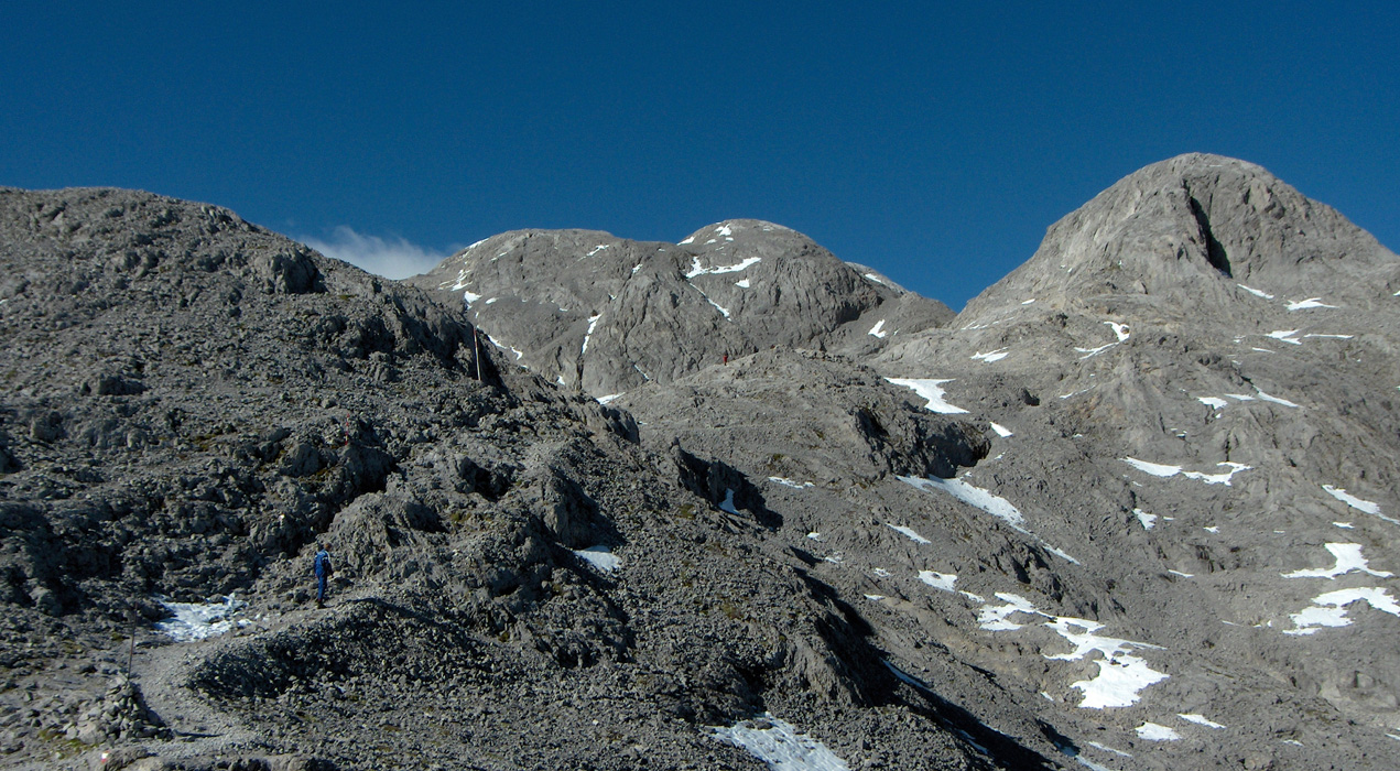
e patch of snow and enters a very distinct col. At this point there is a signed trail fork.
The left path connects to the Hochkönig base across a broad rock ridge, while the path turning
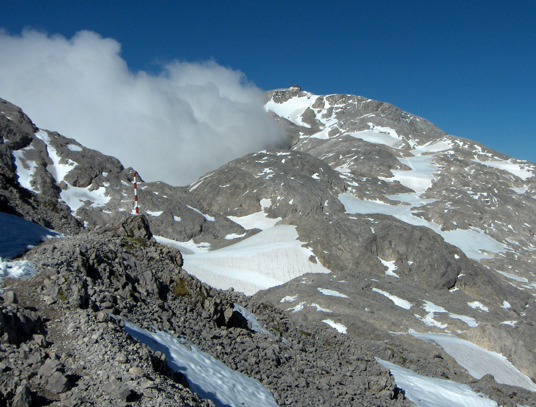
right descends to a small glacier and runs across it to the base of the summit where the two
alternative routes again merge. The final uphill is short and runs up a narrow gully. This section
has been equipped with a ladder and a small metal platform. Without these artificial objects the
route would be YDS class 2+ in this section. However, to climb parallel with the ladder is not
difficult, but still YDS class 3. Since, by definition, a ladder climb is also YDS class 3, this is an
example where the placement of metal objects has made the climb more (not less!) difficult in an
objective sense. That some people may find a ladder more comfortable than a 2+ rock section is
another matter.
From the top of this section, the trail completes the remaining part of the broad ridge to the
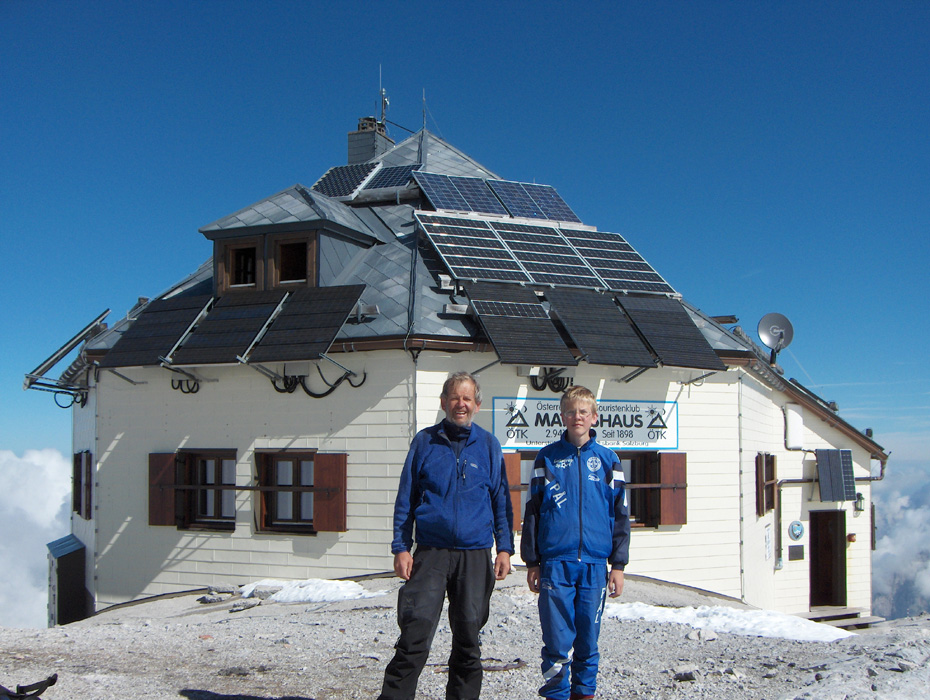
summit. There is an alpine hut called Matrahaus on the very top. Comments:
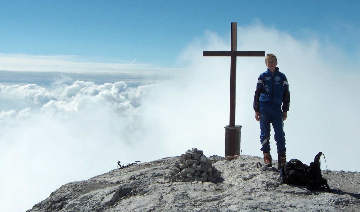
I did this climb with my son Pål Jørgen, age 16.
We started from the trailhead at 0630 and reached the summit after 3:40 hours at 1010.
The summit has a hut where one can stay overnight, however, we decided to have lunch.
A nice bowl of soup together with a half litre of quality Austrian beer, I think this is a first
for me on a summit without any easy access. The beer was less than half the price you must pay in Bergen,
given the extraordinary location this is quite a difference.
The young girl that worked in the hut told me that she arrived in mid-June and would work until
mid-October. Quite an isolated place for somebody her age for such an extended period.
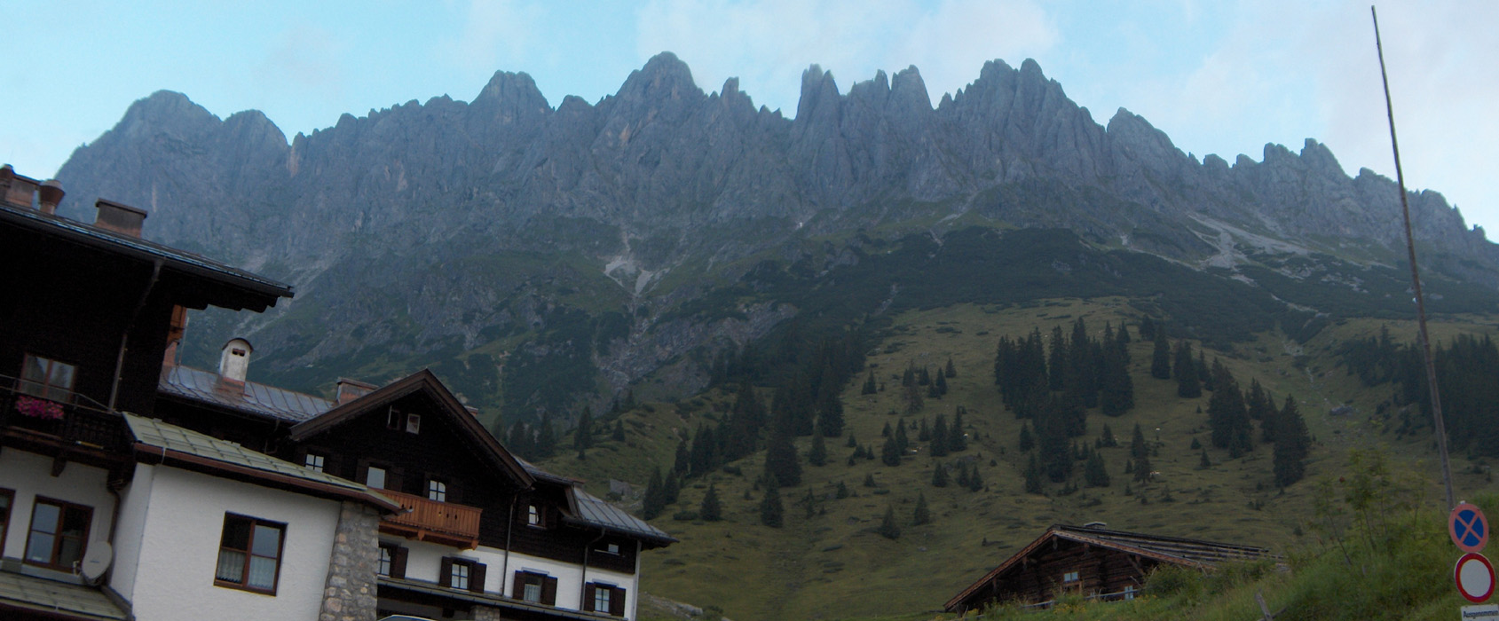
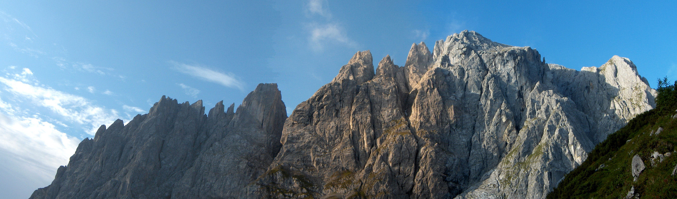
The trail was quite nice and the landscape is quite extraordinary. The limestone
rock contributes to a very rugged appearance of the peaks with jagged ridgelines and
smooth, vertical faces of rock. Soon, the spectacularly nice
summit of Torsäule caught our
attention. We started down after one hour on the summit and reached the base of Torsäule
at 1245. The next hour was spent on climbing this nice mountnain, we then continued back to
the car, reaching the trailhead at 1510.
We drove to the charming village of Ellmau. The E5 trip should end with an ascent
of Ellmauer Halt, the highest point in Kaisergebirge.