Location: South 02.61244, East 036.10445 (GPS at the summit)
Difficulty: YDS class 2
Climbed January 8. 2019.
Information:
How to get there:
Route description:
Comments:
We left Arusha before noon and drove north along a paved Hwy. (T2).
Just before
turning left onto a dirt road, we stopped for lunch in a small place called
Longido. The dirt road was generally ok, but with a few rough spots.
We turned right near a ridge-top and stopped for overnight
in a local village named Bomba Gelai, a few hundred meters uphill at location
S02.73164, E036.11309, elevation about 1160 meter.
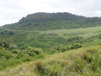
In the afternoon, I had a nice walk across the village and climbed the nearby
characteristic hill called Kazaroho.
I followed the ridge to the top and that route involved a couple of (YDS)
class 3 scrambling moves.
This was the first peak on my 2018 trip to Tanzania, the next peak
is Kitumbeine.