Mount Cronin
- Mount Cronin
- 2396 m
- Primary factor 1571 m
- British Columbia, Canada.
- Location: North 54.92997, West 126.86398 (GPS on the summit.)
- Difficulty: YDS class 3
- Climbed August 20. 2018
Mount Cronin
|
|
How to get there:
Route description:
To the d'Orsa hut:
Follow the forest road 8.4 kilometer. There are markers for
every kilometer. The trail remains a forest road all the way.
From the d'Orsa hut to the summit:
Continue on the wide trail, it crosses the creek on a bridge and runs near
an old silver mine. Next, the trail zig-zags up towards Hyxxx Pass. Follow the
trail until it levels out and a bit more as it again climbs in some gentle turns.
Leave the trail just before it starts contouring towards the Hyxx Pass. I marked a good
point with a small cairn on the left hand side.
Continue uphill along grassy slopes keeping your direction slightly right of
the distinct rock face that is up front on your left. Higher up, when you see the natural line,
turn left and traverse uphill below the rocky area. You should pick up a faint climbers trail
here marked with a cojuple of cairns. Continue uphill until reaching the edge of the more
gentle plateau, there is a large boulder in the vicinity where the vague trail tops out.
Continue uphill, there are several good routes largely avoiding rocky patches. Some cairns
mark a reasonable line, but there are equally good alternatives. Continue uphill to the
top of this slope, marked with a quite visible cairn. Now you see the summit of Cronin Peak
ahead, as well as seemingly more complex terrain.
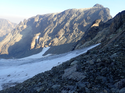
No need to worry, this route works quite well. Previous reports indicate that one perhaps should
descend left to the glacier, this is a bad idea. In fact, one should leave crampons and ice axe behind
on thjs hike, if in August or later. Continue slightly downhill to the
connecting saddle to ther small middle peak. This peak should be traversed, better to stay essentially at
the highest ridge. The difficulty does not exceed (YDS) class 2.
Once you are down in the last saddle before Cronin Peak, traverse left below the steeper cliffs, but the
best line is as high as possible, while still being easy walking. Look for cairns up on your right.
Ascend a fvew meter as soon as you see a cairn. Next, ascend further while going right. I added a couple
of small cairns in this location to make it absolutely clear. From here and a bit further uphill,
the route is (YDS) class 3, but only a fewe moves here and there. The route is very well marked
with cairns. Turning left half way up, the scramble becomes easier, then just hike the last few hundred
meter to the nice summit.
Comments:
We had driven almost 1100 kilometer the previous day and stayed in a small motel in XXX.
We arrived at the trailhead around 1130 and started hiking at 1200. Since previous reports adviced that
one should bring crampons and ice axe, we carried (as it turned out) more weight than needed.
Arriving at 1353, this hike took less than 2 hours despite a fair amount of weight. The d'Orsa cabin is
nice, but very basic. On e should bring a sleeping mat, cooking gear, food etc. We relaxed in the
sun and thus had a good rest from the long travel the day before.
This was Sunday afternoon and only 4 people (including us) spent the night. The cabin has capacity to sleep
about 20.
Monday morning, we got up before 0600, had breakfast and then started hiking at 0630. The day was
gorgeous, blue sky and the sunrise hitting the peaks. We easily made the first, local summit, then
immediately decided to traverse the ridge across to Cronin. This was a lot easier than expected, we soon
decided to leave our ice axes and crampons behind. The route to the short scramble was pretty obvious
as well, however a single going left or right decision was not entirely clear. Therefore, we marked
the right direction (going right) with a few additional cairns.
The scramble was straightforward and we arrived at the summit by 0915. Good views and good weather.
We enjoyed the summit for 30 minutes, drinking water and taking pictures. Leaving at 0945, we took
the same route back arriving at the cabin after 2:15.
Reorganizing backpacks and taking a short rest in the nice sun, we left at 1230 and walked at a
leisurely pace back down to the car in 1:53, the same time as going uphill, but with
considerably less effort.