Location: North 31:50.752, West 109:17.476 (GPS at the summit)
Arizona, USA
Difficulty: YDS class 1
Climbed: July 15, 2008
Information:
How to get there:
The city of Tucson, Arizona is a good point of departure. Get on the
interstate I-10, direction east and drive approximately 62 miles to
exit number 318, exit here and start to measure.
You are now on a short-cut road across to Hwy. 191. First, pass through Dragoon,
then continue to Hwy. 191, you will see some indistry (large chimmney) on your left.
Arrive at Hwy. 191 at mile 13.0, make a right turn here. At mile 30.5, you arrive
at the intersection with Hwy. 181, make a left turn here onto Hwy. 181. At mile
42.8, Hwy. 181 makes a sharp left, while your route continues straight ahead, this is
a good dirt road suitable for ordinary cars. This road is called Turkey Creek Road.
At mile 49.1, there is a dip in the road that may be flooded, check before crossing.
At mile 51.2, you cross a cattle guard and enter the Coronado National Forest.
Finally, at mile 52.8, you pass a campground and at mile 53.7, the road ends. We parked
off the road just below the turn-around, there may be a few more possibilities. This is
the trailhead, location N31:51.005, W109:19.538, elevation about 2050 meter.
Route description:
Note, there are several routes. At least one route starts quite a bit further down the
road at Mormon Creek Trailhead and runs by Mormon Spring. However, we describe a (nice)
route that starts at a trailhead by the very end of the Turkey Creek Road.
Start out from the trailhead up the canyon along the only good trail. This trail starts
out on the right side of the small creek, but soon changes over to the left side. It climbs
in zig-zags to a col on the main crest, location N31:49.860, W109:19.641, elevation about
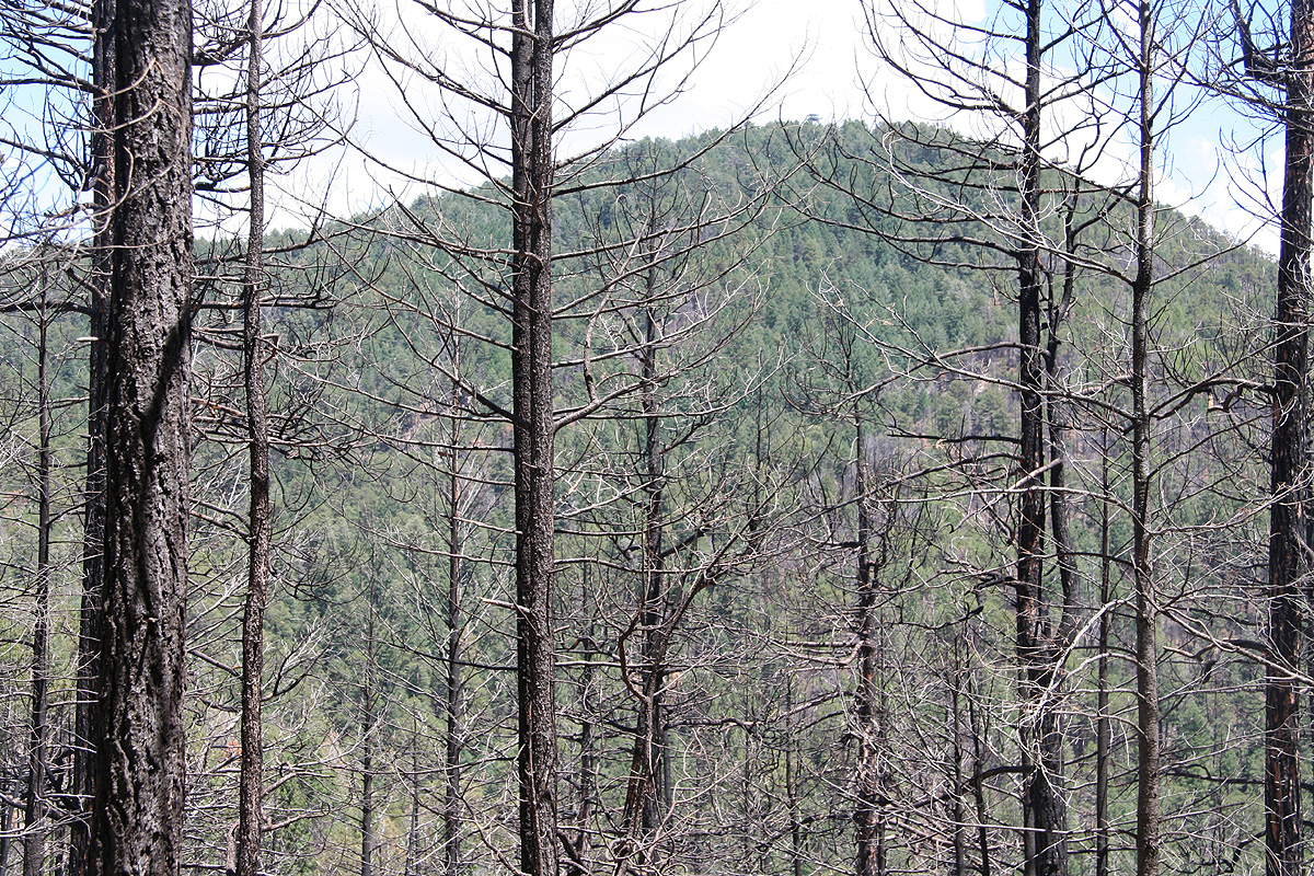
2596 meter. From here, the mountain
called Monte Vista (elevation 2857 m, prominence
about 61 meter) is clearly visible, one may
see the forest fire lookout tower on its top. Take the trail going left, this trail
will follow the crest, then climb part of the slopes of Monte Vista. You will find a new
trail fork where there is a sign pointing left for Chiricahua Peak. One can also visit
the top of Monte Vista along a very short uphill trail from here.
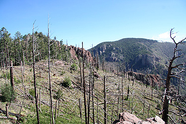
The trail to Chiricahua Peak first traverses below Raspberry Peak (elevation 2866 m), this
peak is independent (prominence exceeding 100 meter) and an easy climb from the trail.
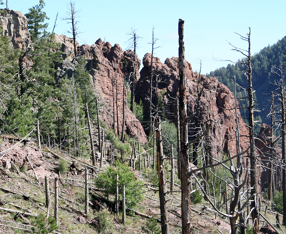
The route regains the main crest north of Raspberry Peak and follows the ridge to an interesting
rock called Paint Rock,
bypassing this on the right (west) side before descending slightly
into the main saddle before Chiricahua. This saddle has elevation 2747 meter and is located at
N31:50.301, W109:18.013. As you continue a gentle uphill towards Chiricahua, you will reach
a trail fork. The right hand fork climbs the peak, but does not gain its summit. However, it
is an easy walk (to the left) to gain the summit from this trail when the trail levels off
before starting a gradual descent.
The left fork traverse to the north side of Chiricahua, slightly west, where there is
another trail fork. From here, one trail traverses below the peak to its south-west side, while
another trail actually climbs the peak to its summit area.
The summit area is fairly flat and has big trees growing on it, however, there is a single
small rock with a USGS benchmark located right about the very highest point in the area.
Comments:
I did this hike with my son Pål Jørgen. We drove from Tucson, and were ready
to start hiking at 0655.
We reached the first col on the main crest after about one hour, continuing along the crest,
we located the summit benchmark at 0955, 3 hours. This included a nice break right near the
Painted Rock cliffs. We were slightly confused about the terrain, as we had no map of the area
and had arrived via the trail that traverses below the summit on the south side.
The USGS benchmark carried no name, but gave an elevation of 9795 feet, this is about 10
meter higher than what we believed to be the highest point in the range. Moreover, my GPS seemed
to confirm this as it showed an elevation that was about 4 meter higher than this, possibly more
in line with the more recent adjustments of elevations in the US.
Thus, it seemed
that no trail led to this summit, quite contrary to what I had read. We spotted the Snowshed peak
to the south-west and it looked about equally high. Thus, we set out to also climb this peak, just
in case we were on "the wrong peak". This effort required quite some time, arriving there at
1115. We quickly decided (from our GPS) that this peak in fact was lower.
We now turned home, but hiked the trail on the north side of Chiricahua, thus exploring it in
great detail. Here, we came upon the only sign in the area that actually says Chiricahua, thus
confirming that we had indeed climbed the correct peak. Going back, I also paid a visit to
the Monte Vista top, there is a forest fire lookout tower (40 feet tall) as well as a cabin
on the very summit. Returning to the car at 1440, this turned into a 7.5 hour hike, quite
a bit longer than anticipated.
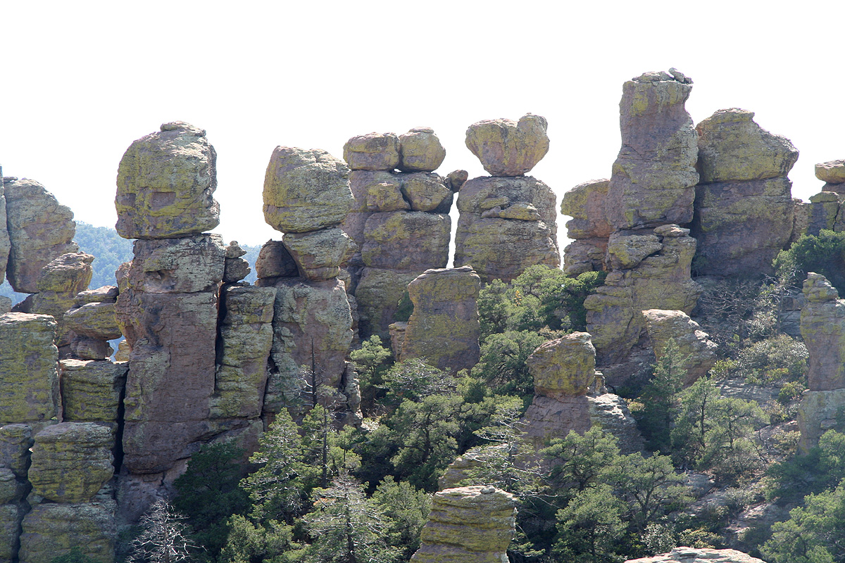
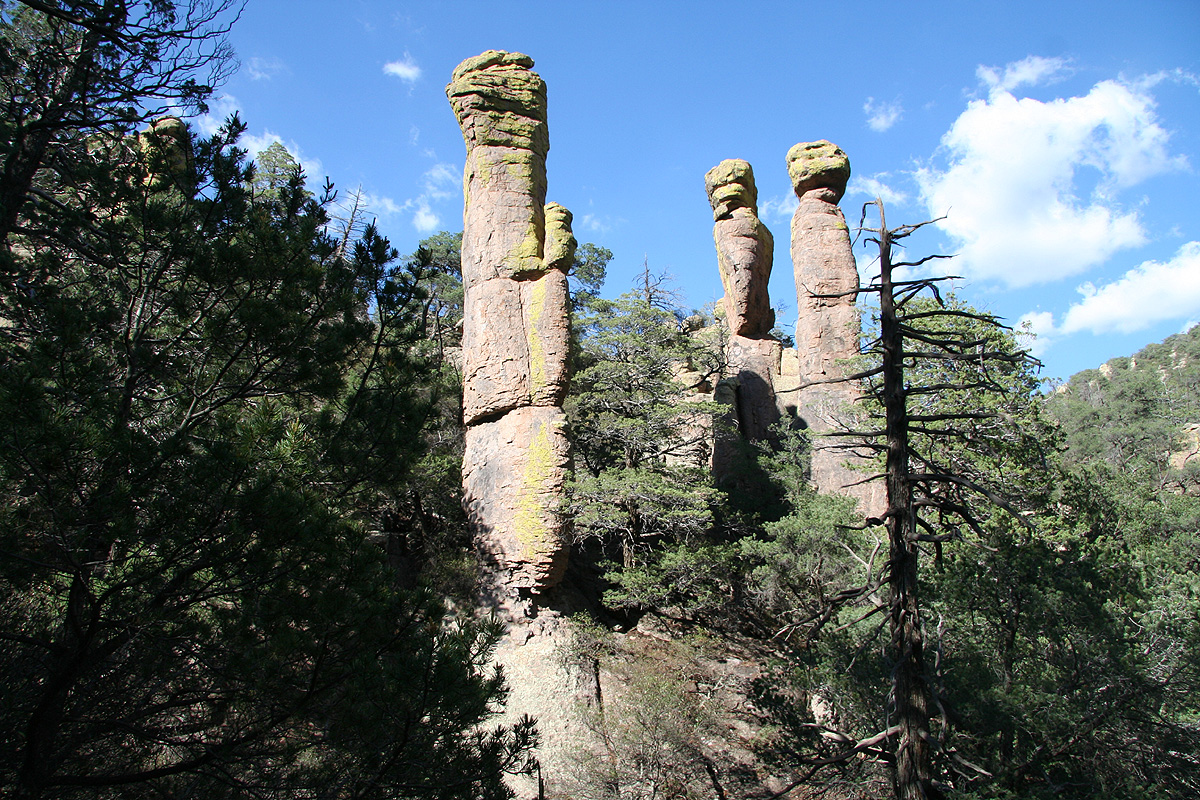
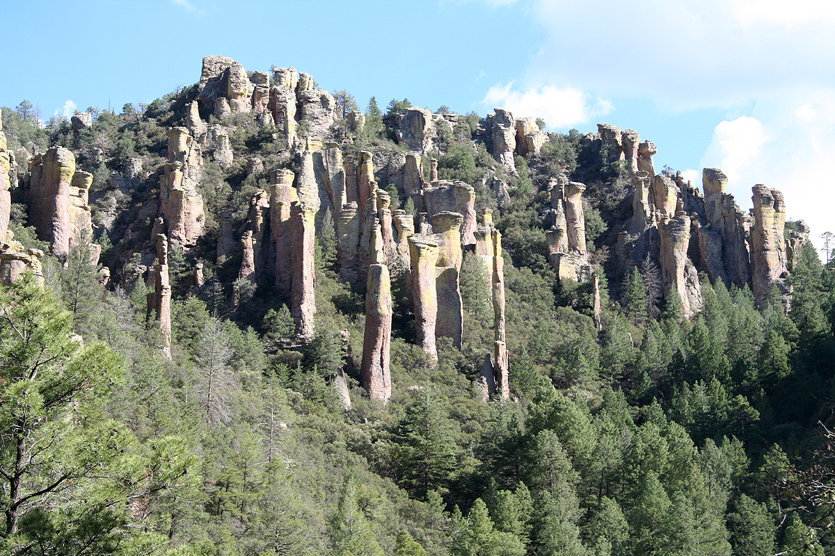
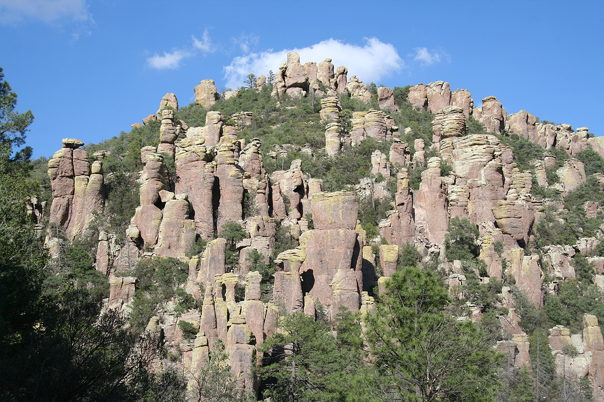
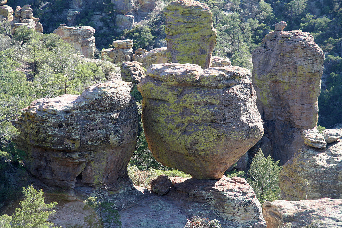
The next day, we visited the Chiricahua National Monument. This is an interesting area with
impressive rock formations.
The local indians called this area "Standing up rocks".
See below for more pictures.
To read about the other peaks climbed on this
trip, see this summary.