Location: North 42.56313, East 023.27912 (GPS on the summit)
Difficulty: YDS class 2 (only the very last few meter)
Climbed July 9. 2013
Information:
How to get there:
Locate the big traffic circle on the south ring-road E79 south of the capital Sofia and
the properly named Bulevard Cherni Vrah. This location is N42.64176, E023.31230.
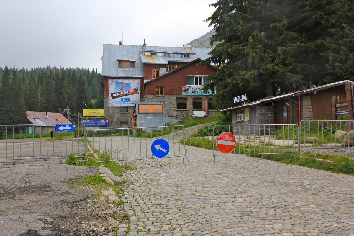
Take this road (Cherni Vrah), uphill and find your way through the area with buildings.
The road to follow has cobblestones as its surface. Higher up, this road is easy to
follow, it is quite wide and cobblestones all the way.
Follow it until it ends at Aleko, the
top station of a gondola lift that one may take instead of driving. Note that there are
signs along this road saying that it is closed to traffic in the period 1100 to 1400 each day.
Aleko is at approximately 1800 meter of elevation, location N42.58335, E023.29227.
Route description:
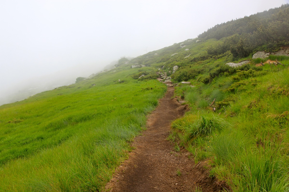
From the trailhead, proceed to follow the trail that runs uphill in the
downhill ski slope. This trail will
eventually show painted markers and do a couple of
zig-zags, then continue uphill to the ridge where it connects with a forest road.
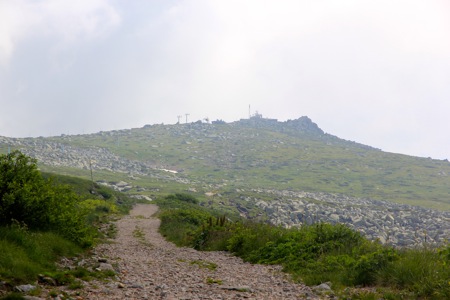
Follow this road (left) as it will bypass the first peak (the one you can see from the trailhead).
Another peak is straight ahead, this is the correct one. When the road bends left, a very visible
trail continues directly towards the summit.
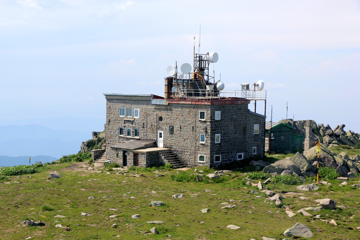
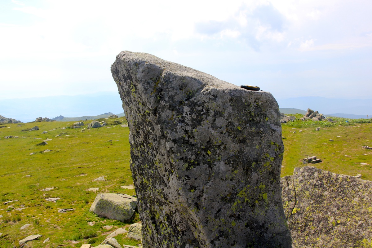
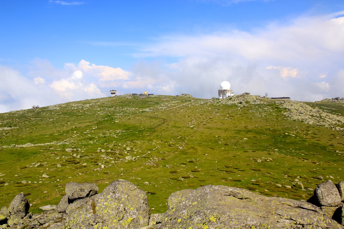
As you get closer to the building on the summit
plateau, you will notice the pile of huge boulders with a very characteristic obelisk like highest point.
Head over towards this and climb it sort of slightly left of the highest point. This is easy class 2 terrain.
The very summit has significant exposure as the rock drops directly on the outside. Climb carefully onto the
summit or just touch it with your hands, either way you have definitely earned the summit.
Comments:
We had just arrived at our nice little Amsterdam hotel, preparing for an early departure the next morning.
A violent thunder shower caused us to cancel all plans regarding a stroll to the city center. Our rental car
should be delivered at the airport, but with plenty of time, we decided to explore the local city mountain.
The drive was initially quite dramatic, the rain had caused immediate flooding. No proper drainage in this
part of Sofia. The water was meter deep in the traffic circle and one car had stalled. All uphill roads looked
more like rivers than roads.
We did find the cobblestone road and the flooding subsided. Moreover, as we drove higher, we had blue sky and
sunshine again. We parked at the top by 1530 and I started uphill around 1535. The hike was nice, in mostly
sunshine as I arrived
at the very sharp summit at 1615. I was the only hiker on the mountain, I guess this is
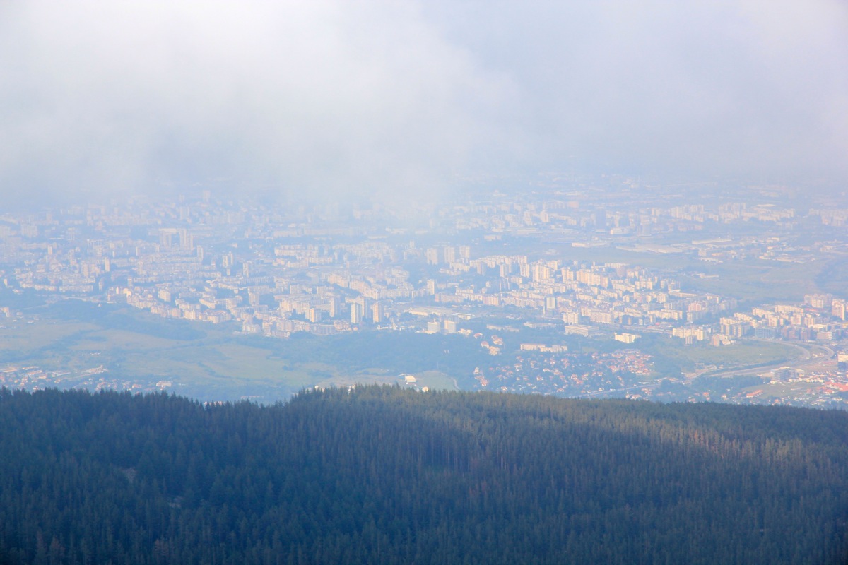
far from normal in July. The view across the summit area was nice, however, clouds
made the view back down to Sofia less sharp.
I started back down at 1630 and met Heidi at the parking area at 1700. We next drove
to the airport to deliver our rental car. Thunder and lightning (and rain!) had returned, we did indeed have
a nice 2 hour window for this excursion.
Here is a brief summary of the peaks climbed on this trip.
Our Balkan trip next moved to Monte Negro.