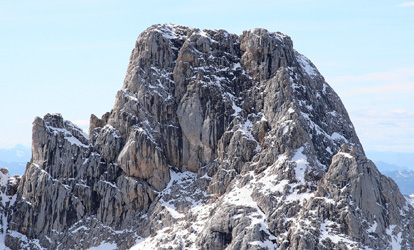
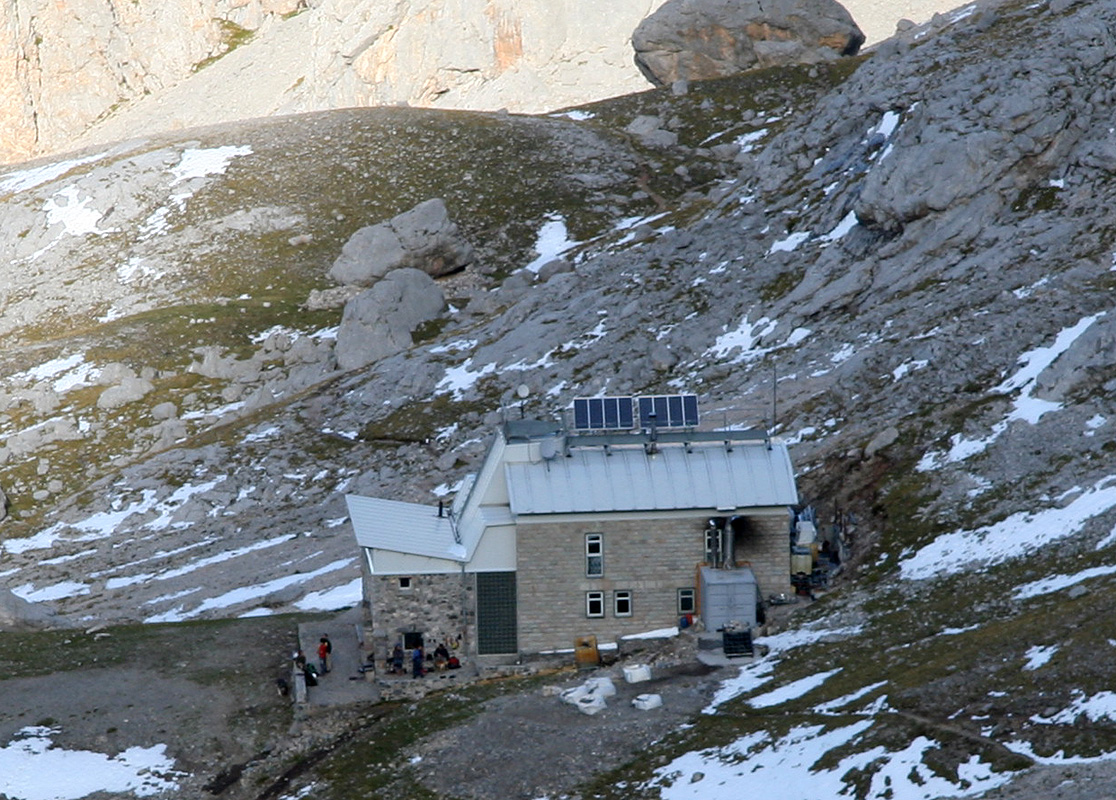
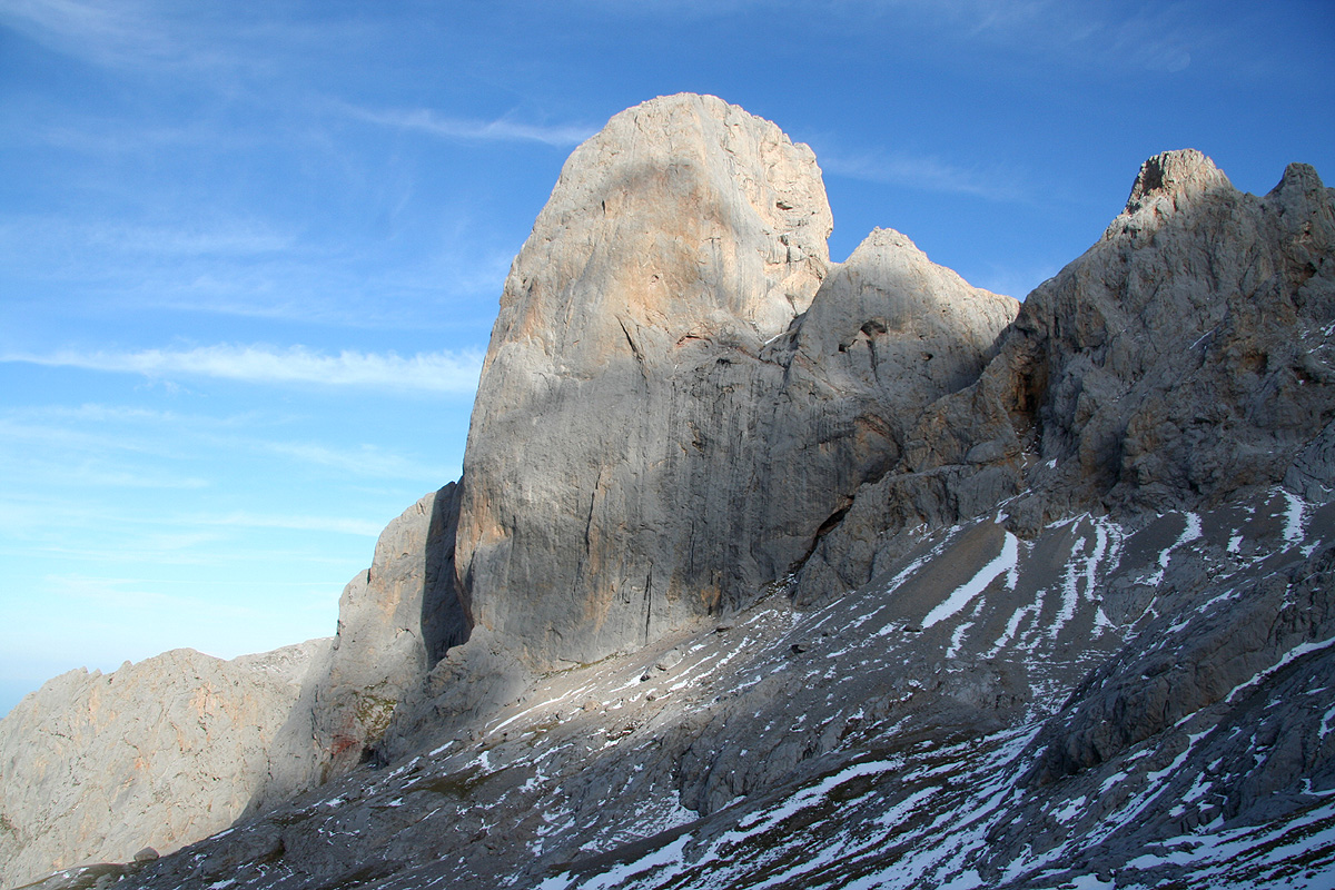
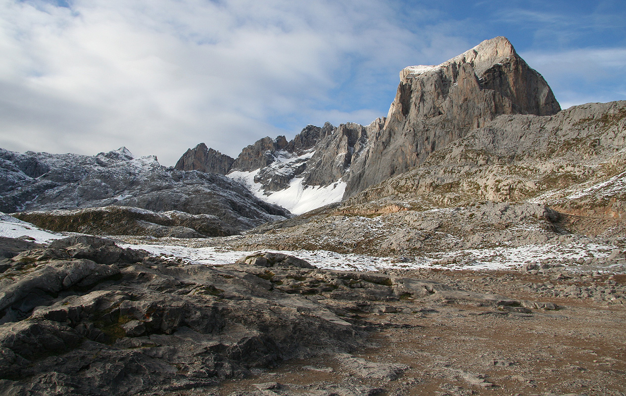
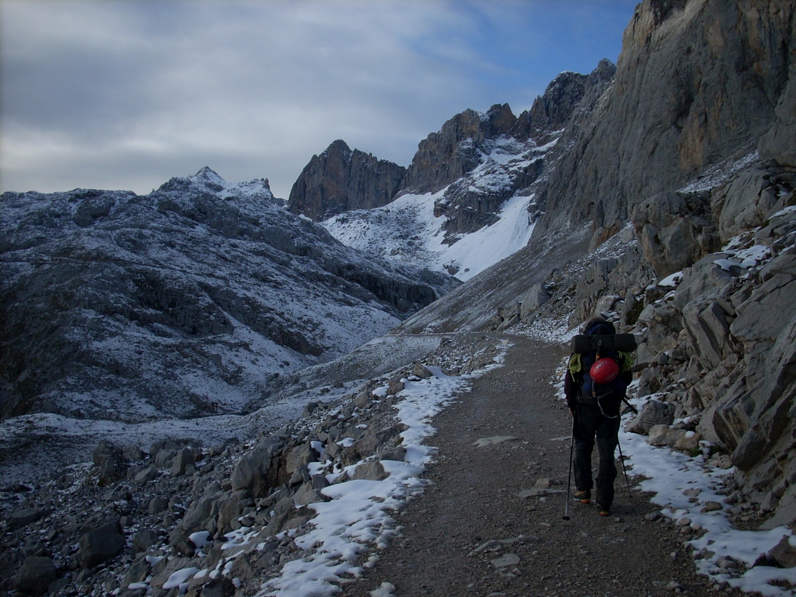
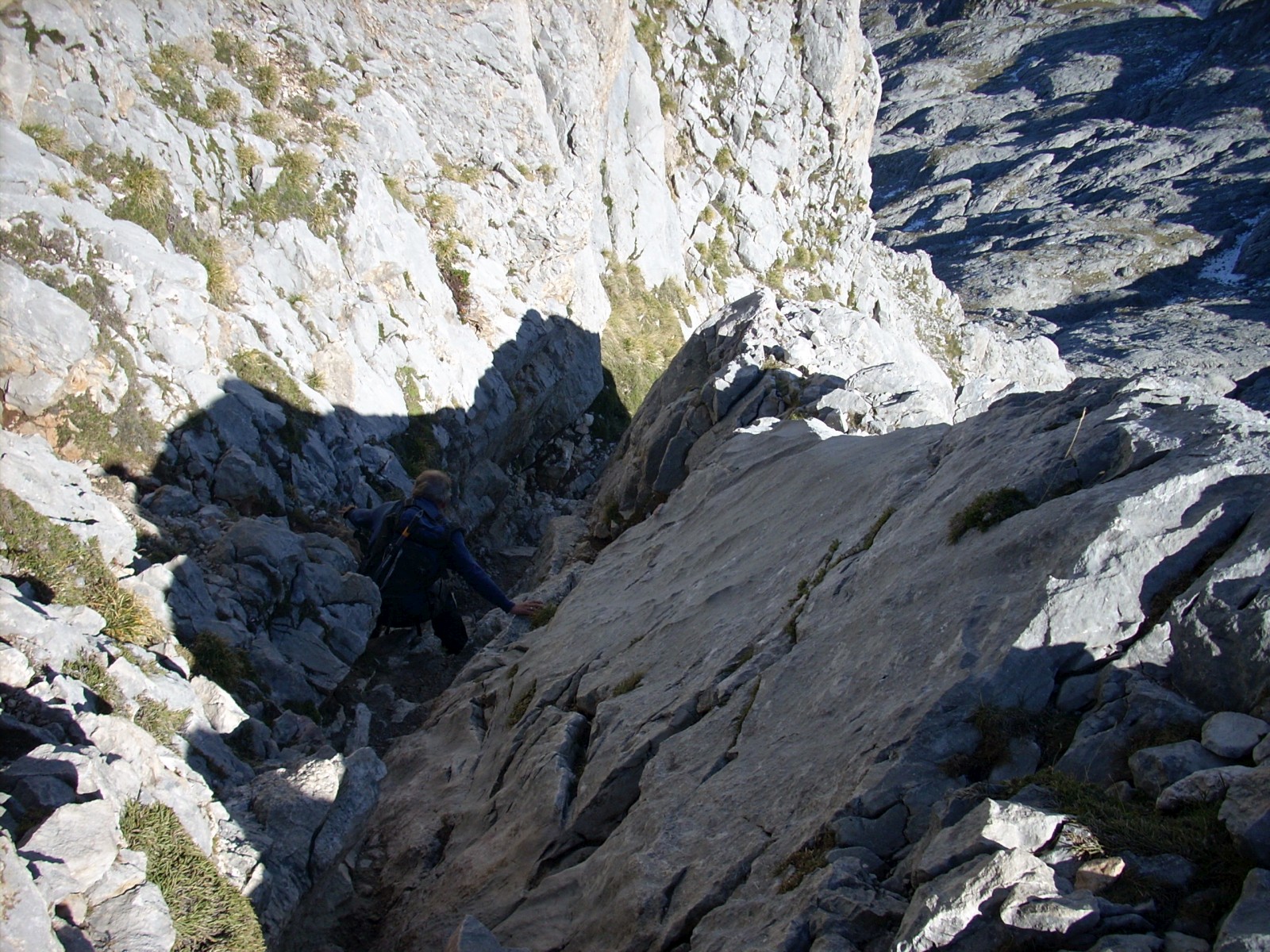
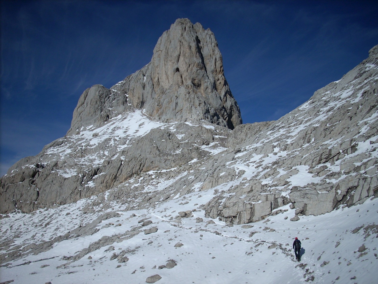
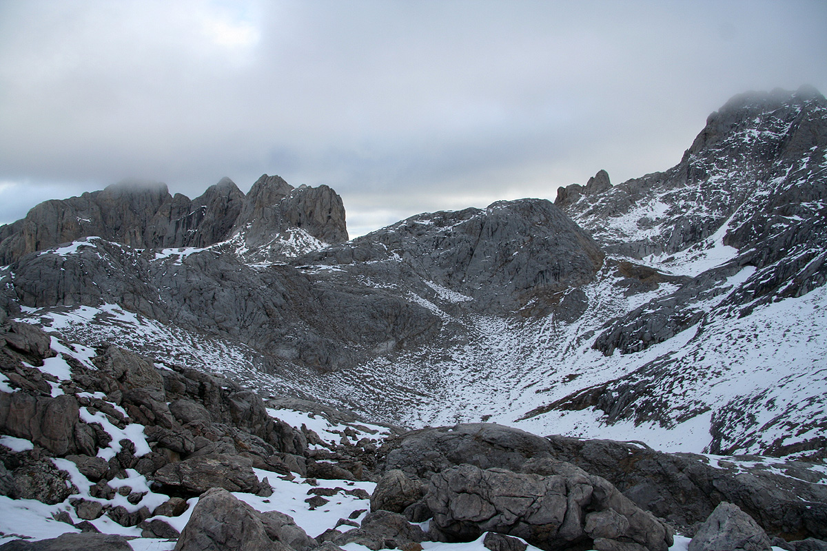
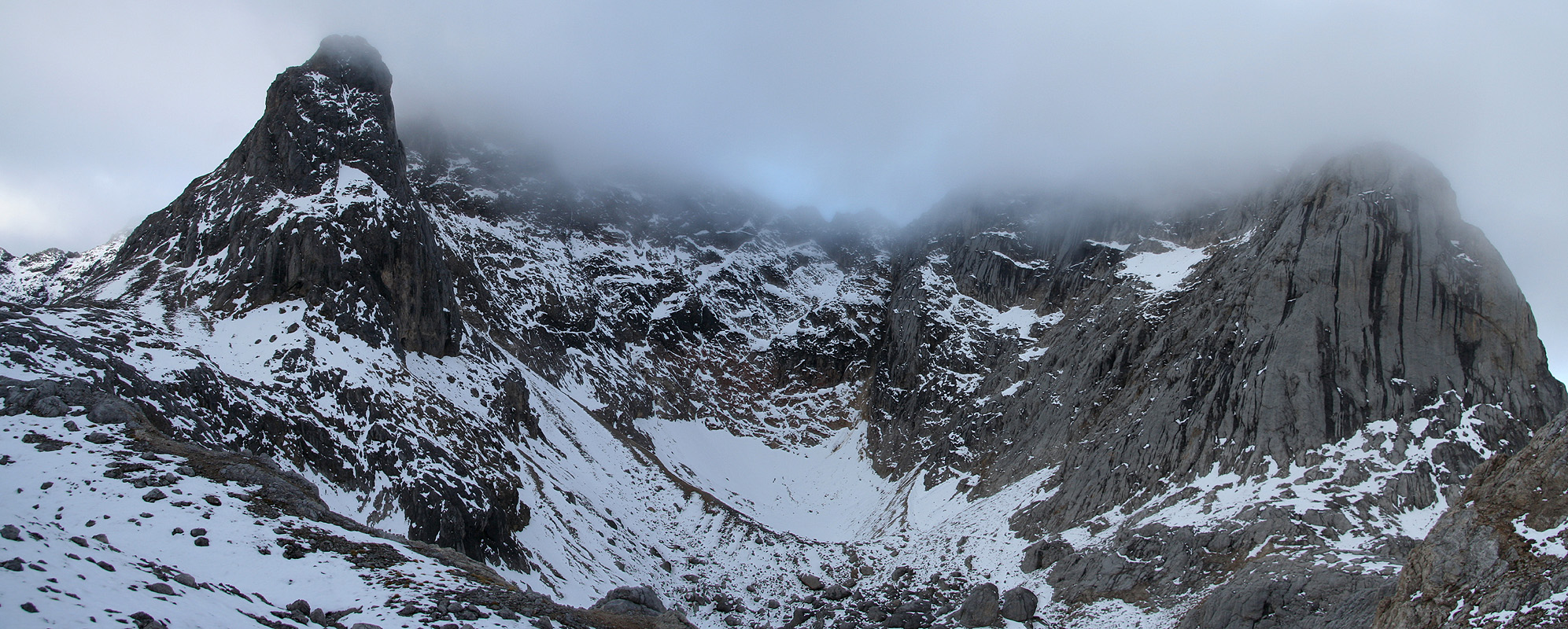
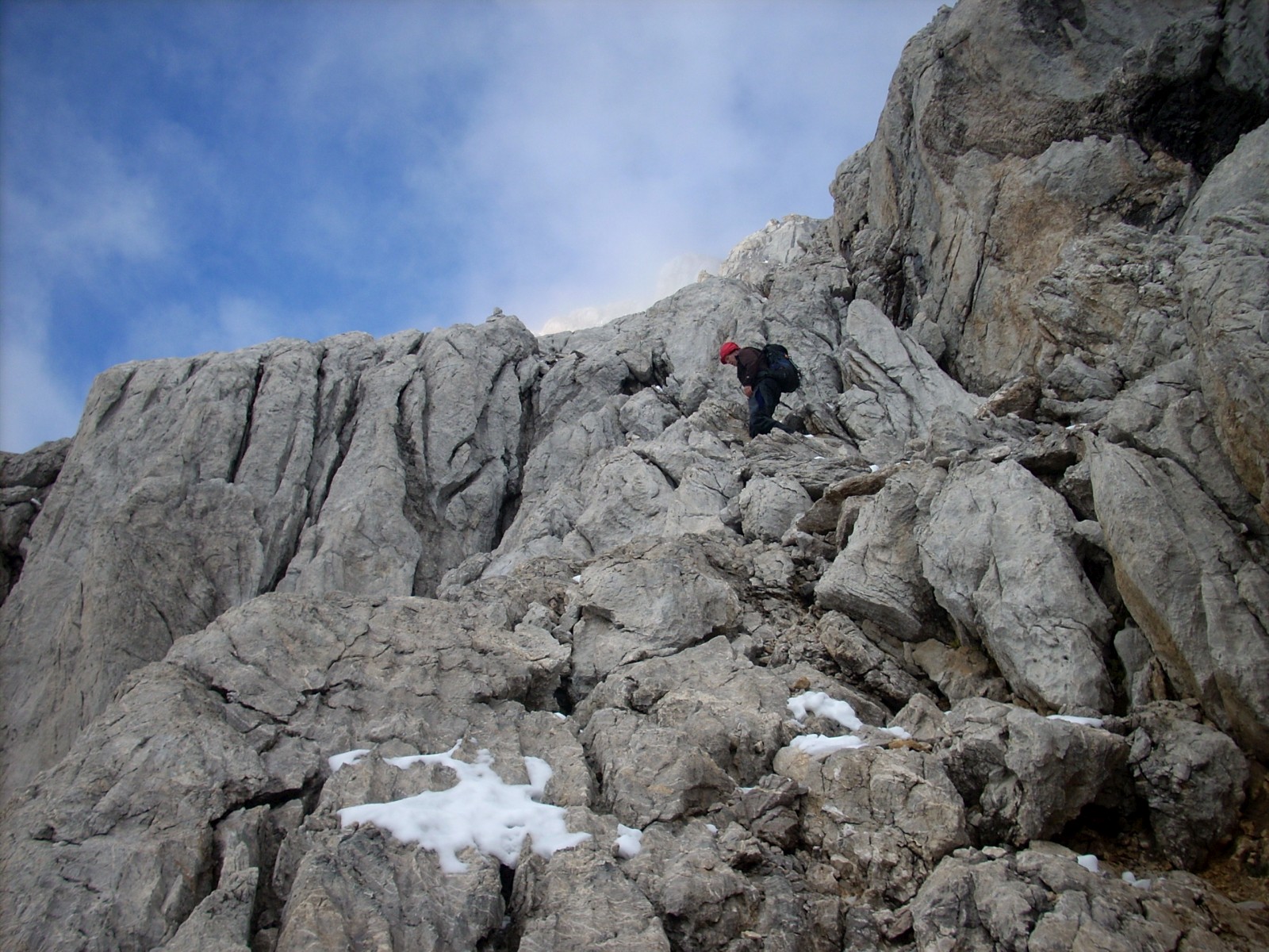
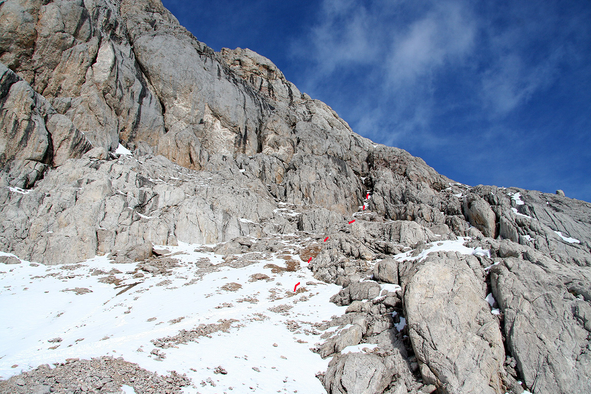
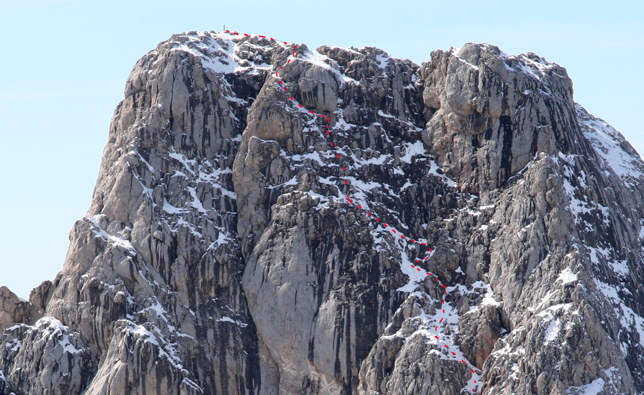
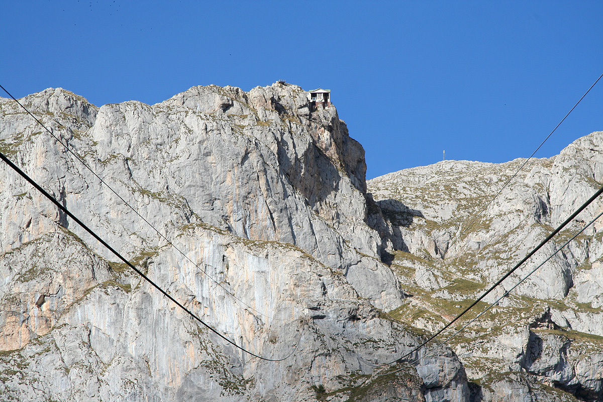
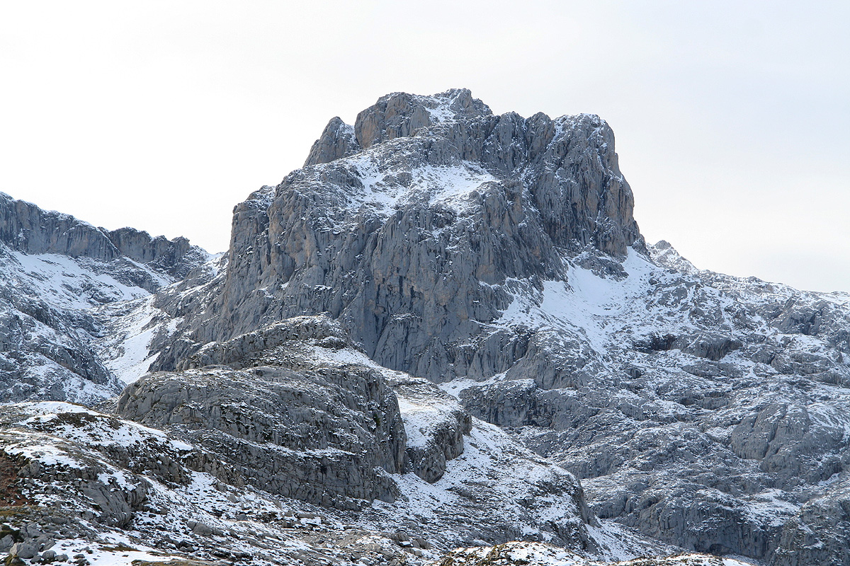
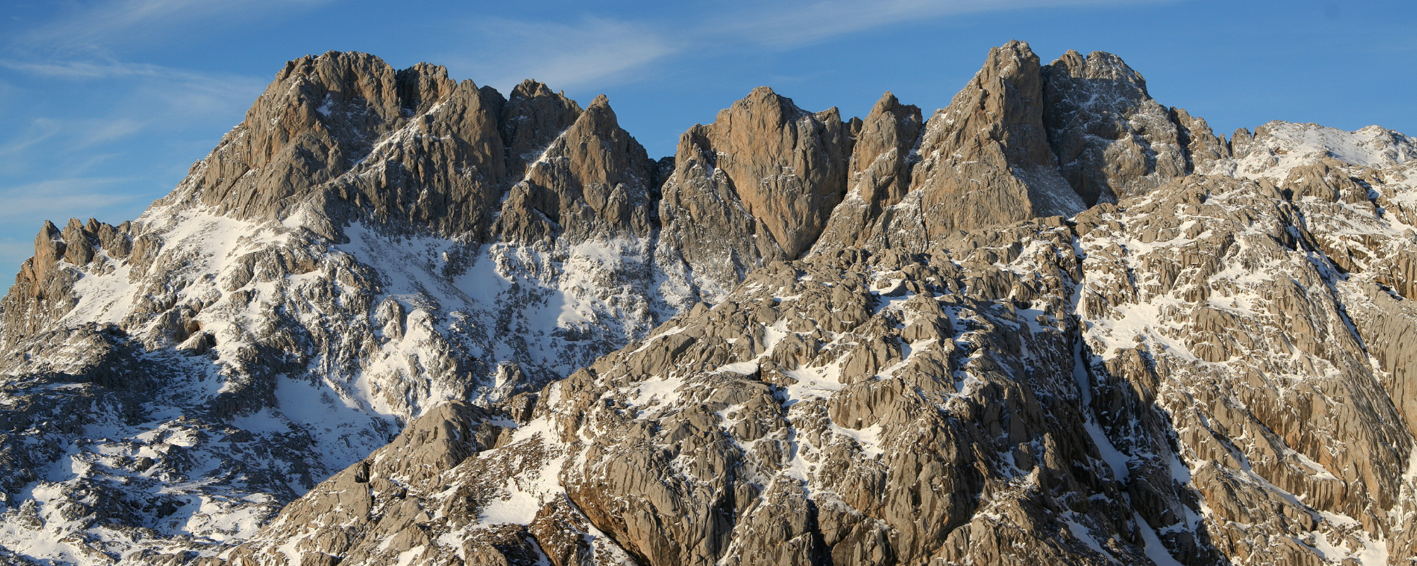
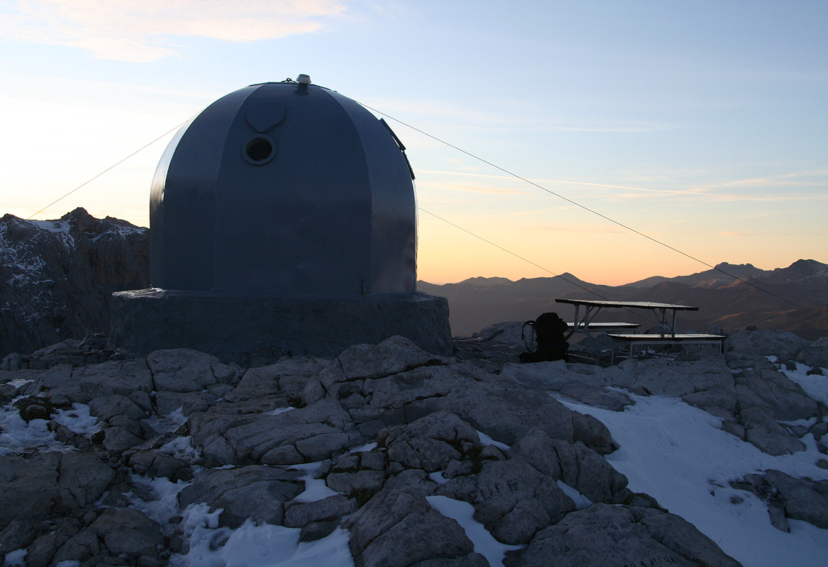
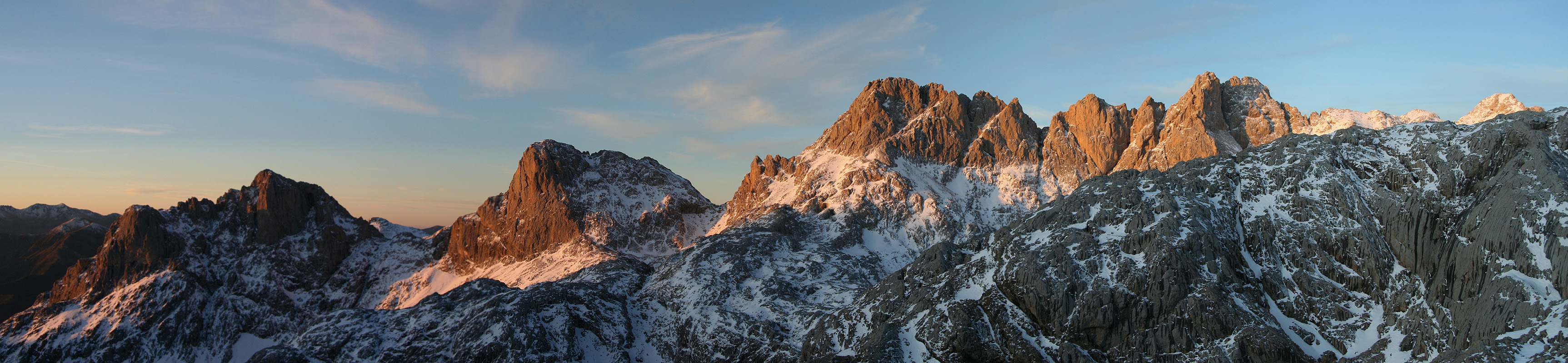
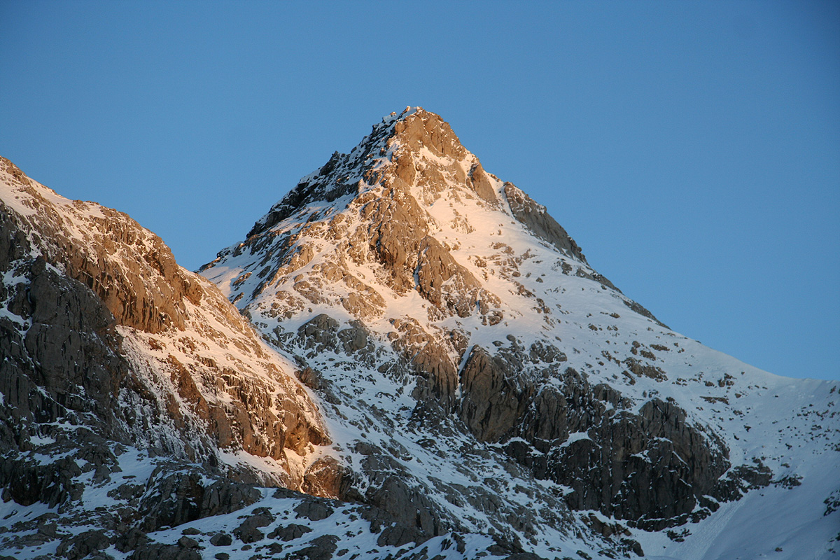
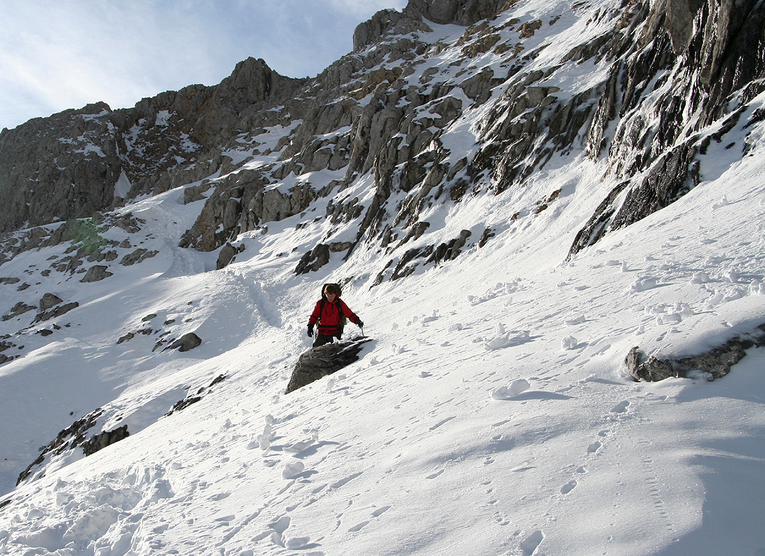
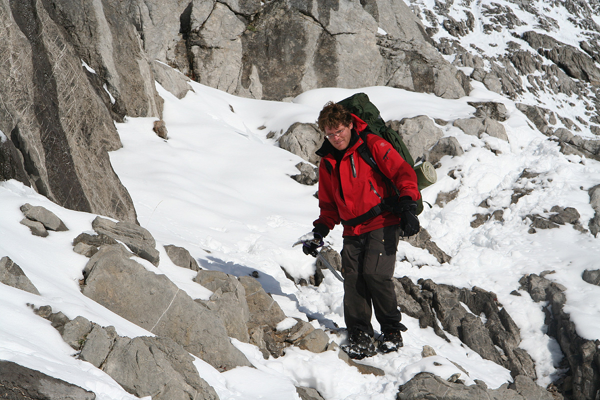
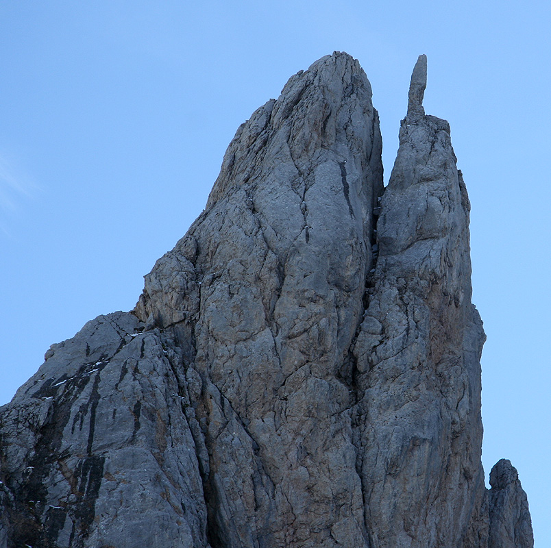
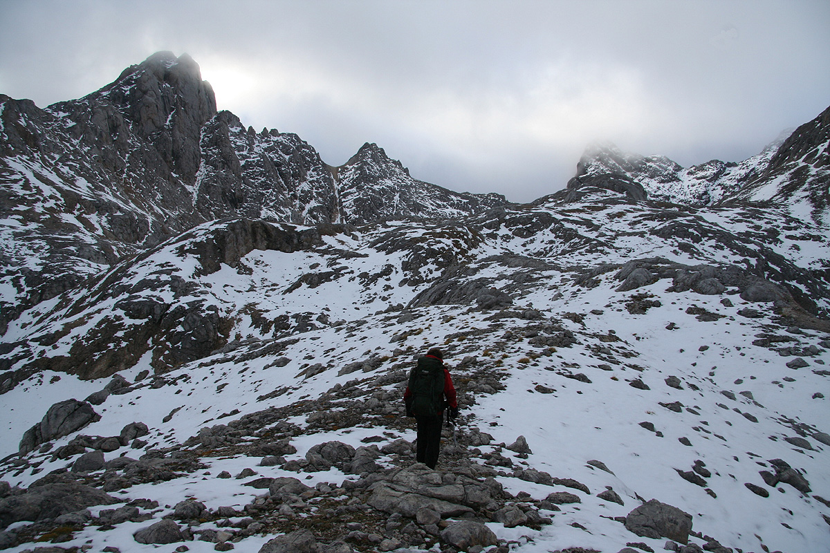
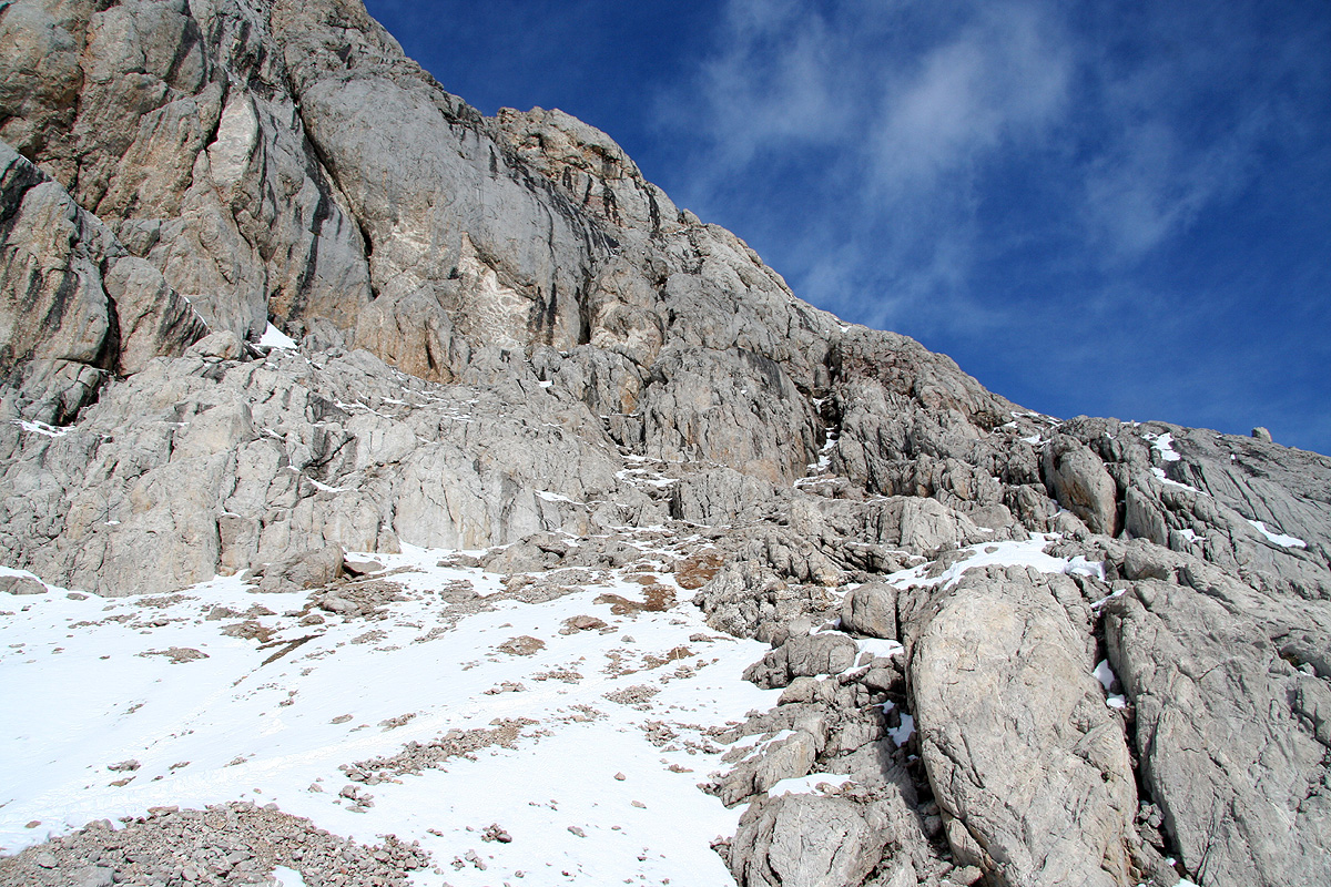
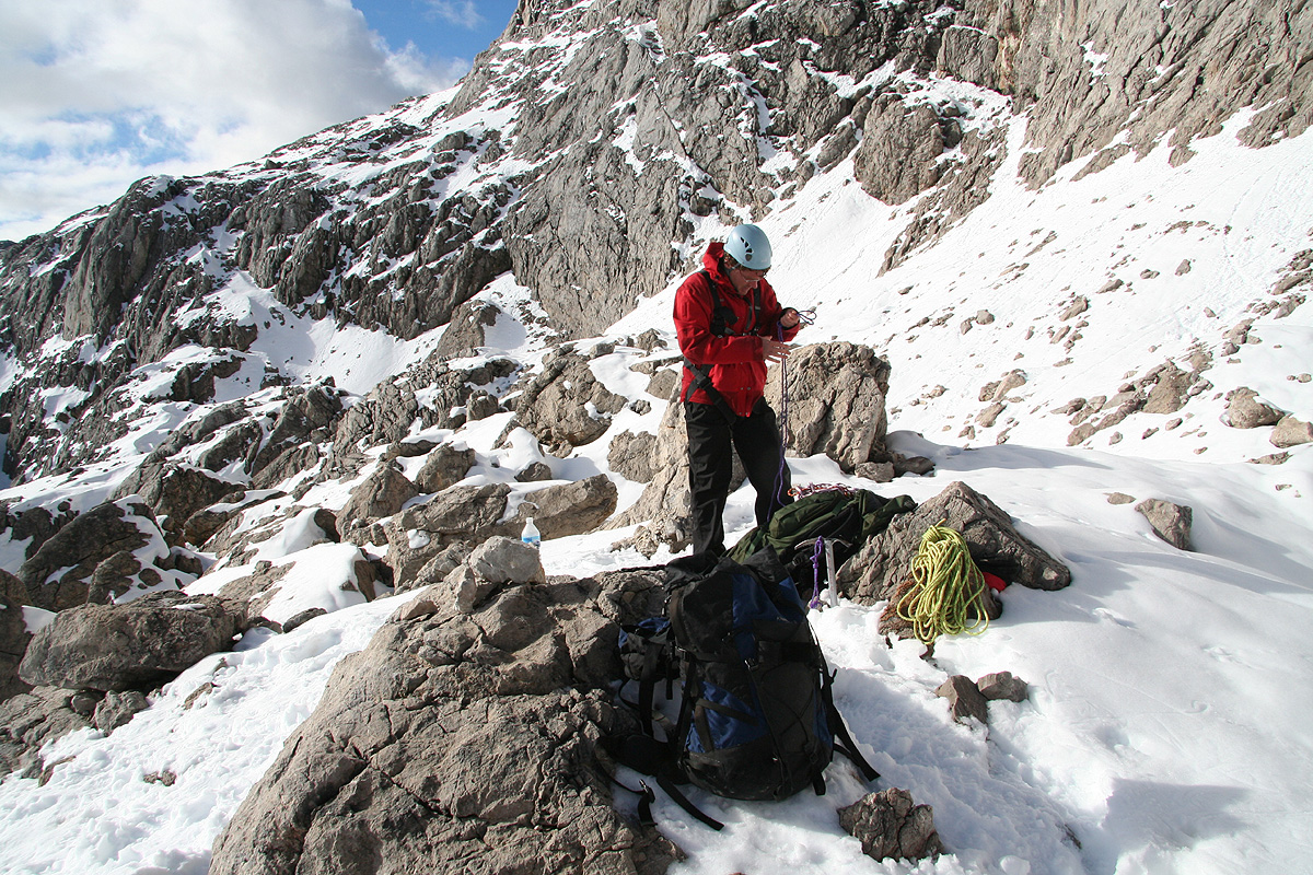
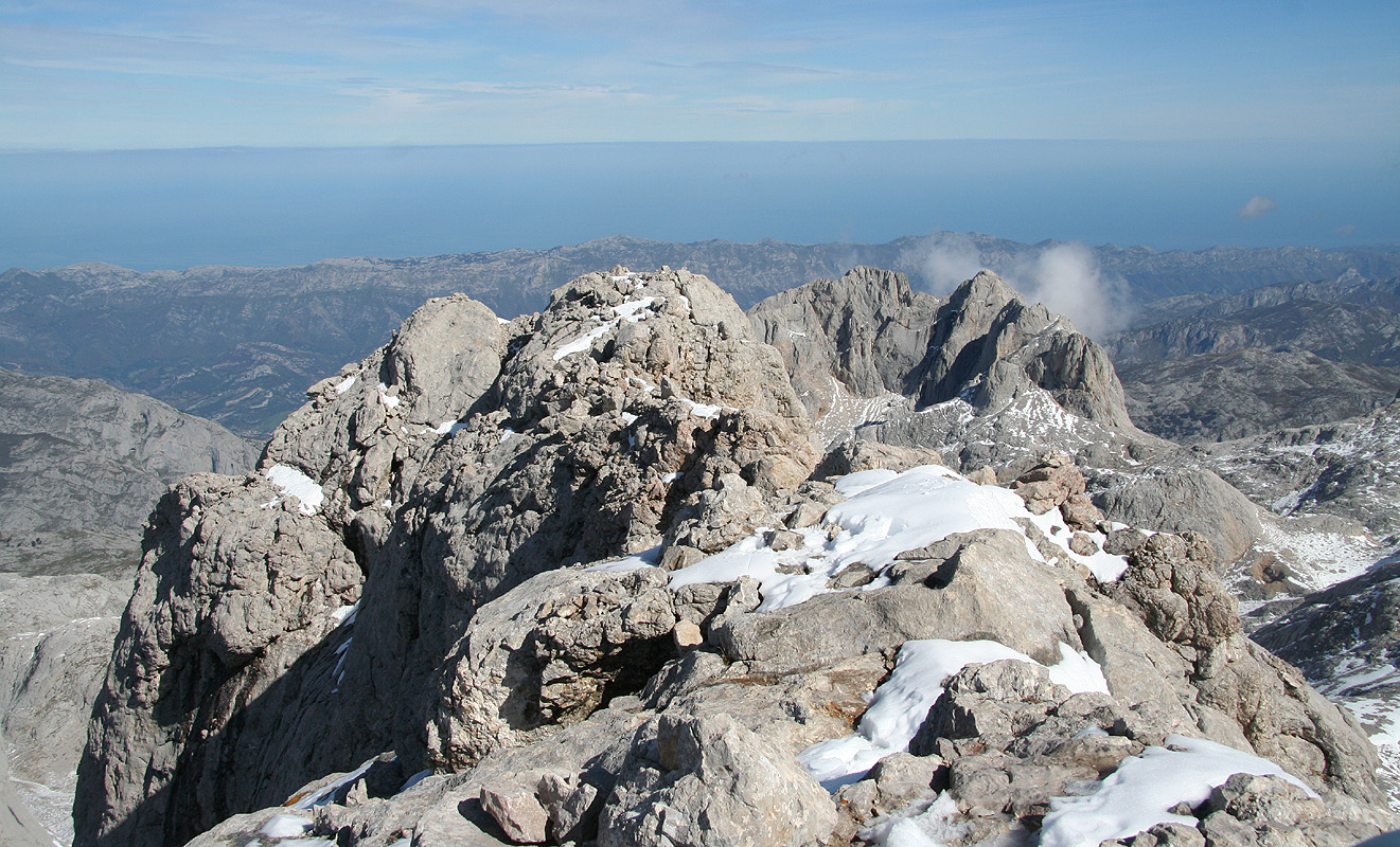
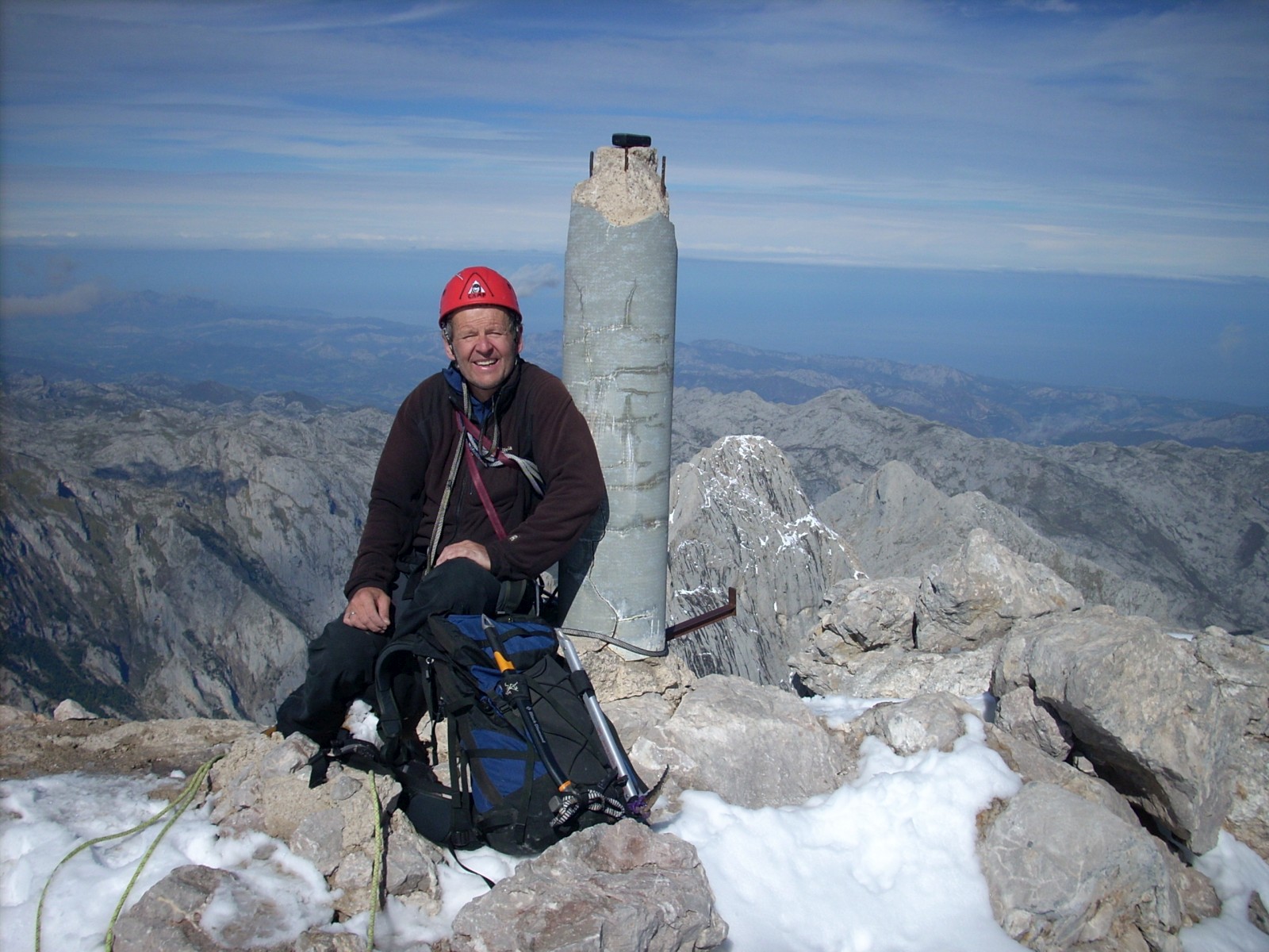
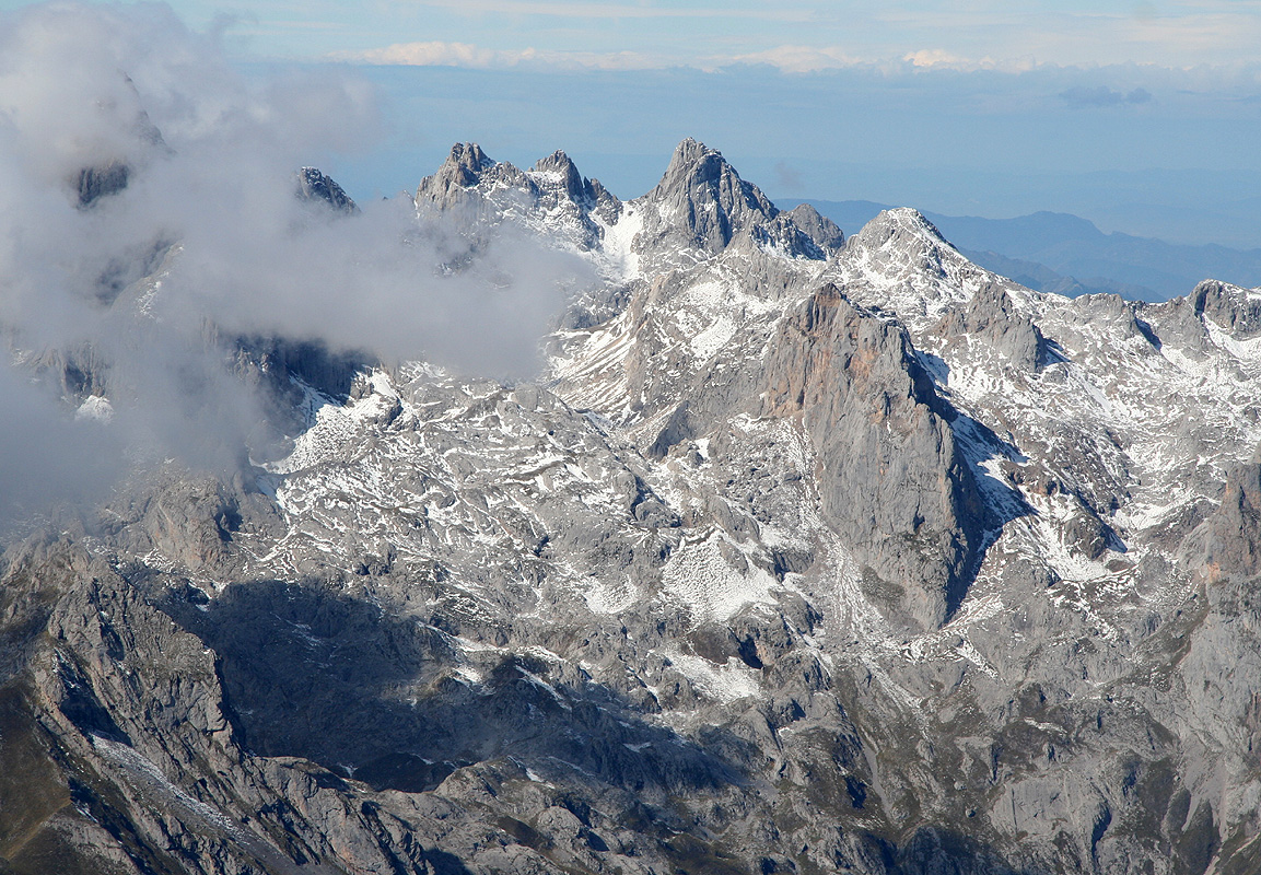
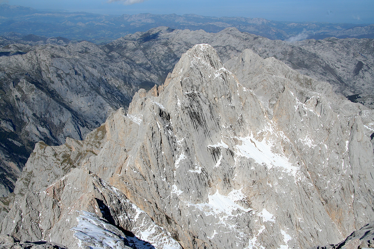
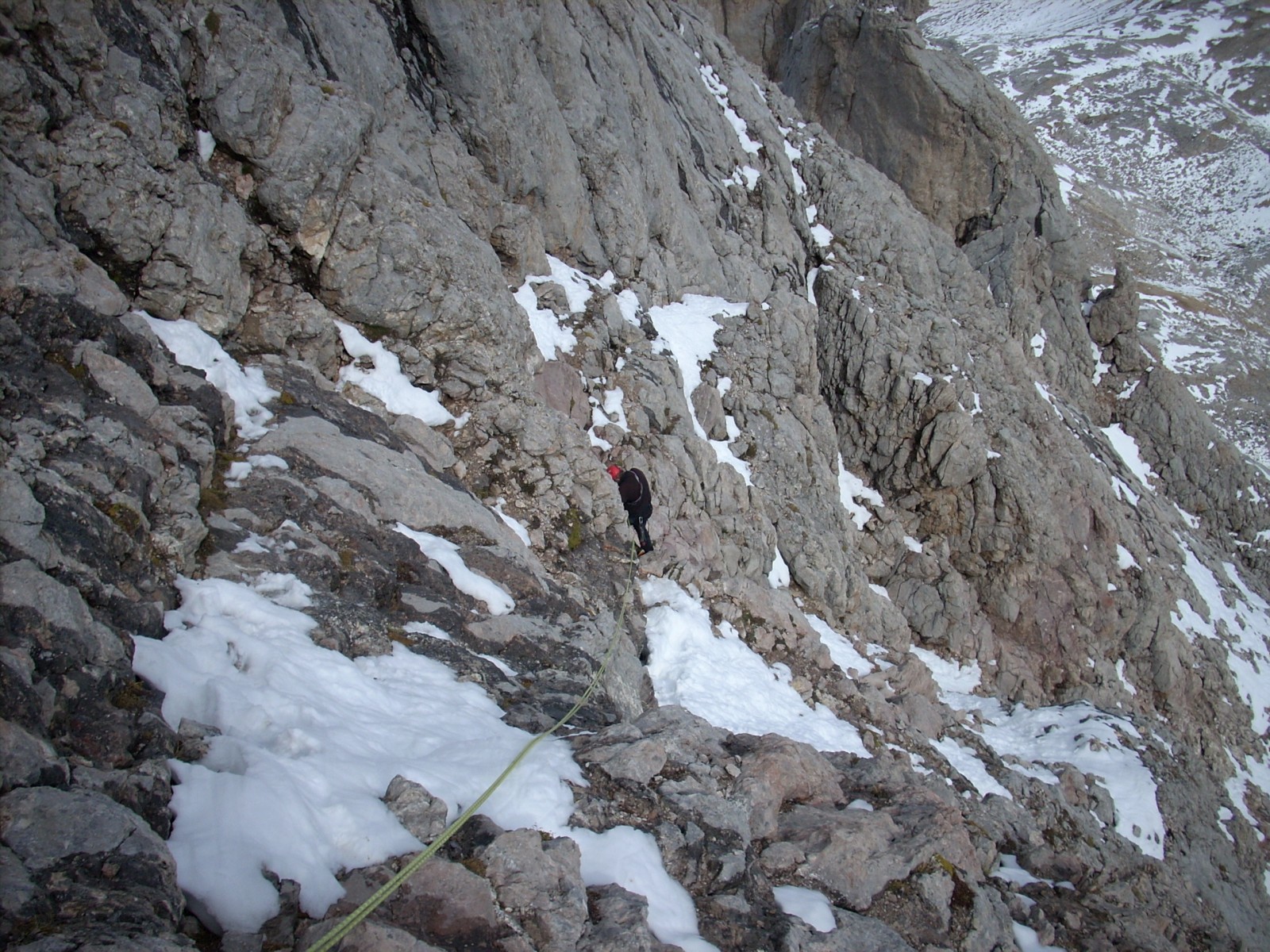
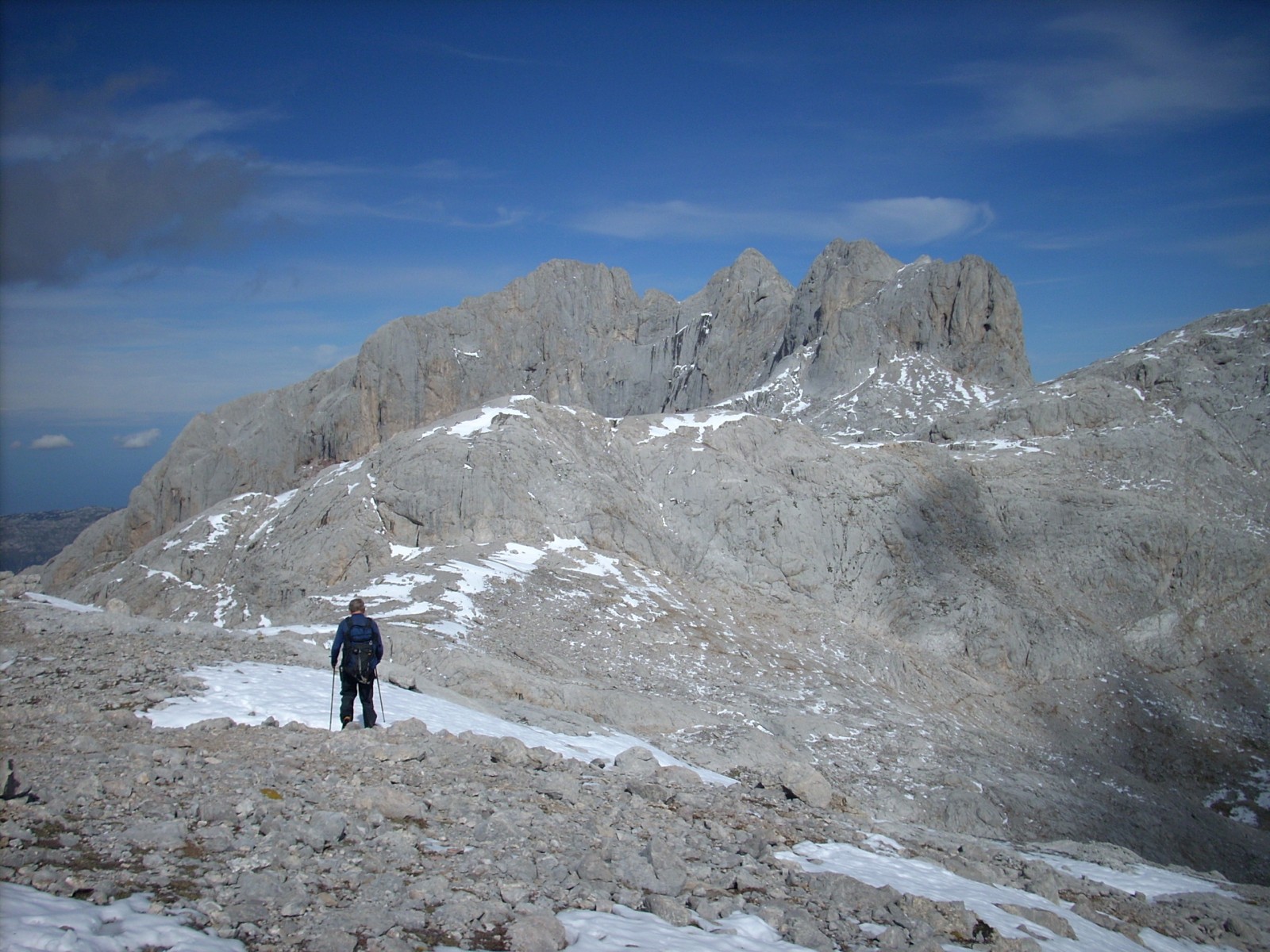
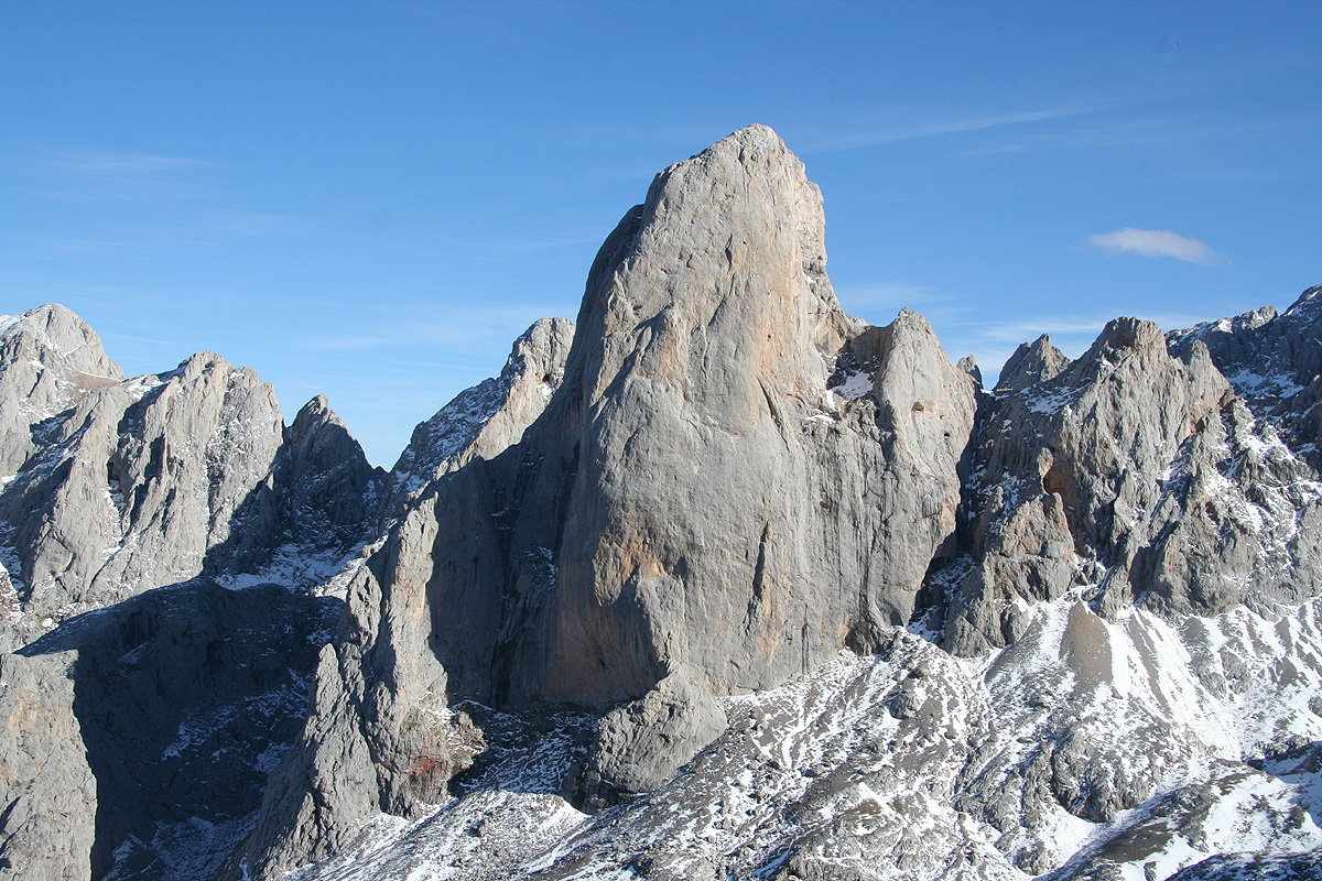
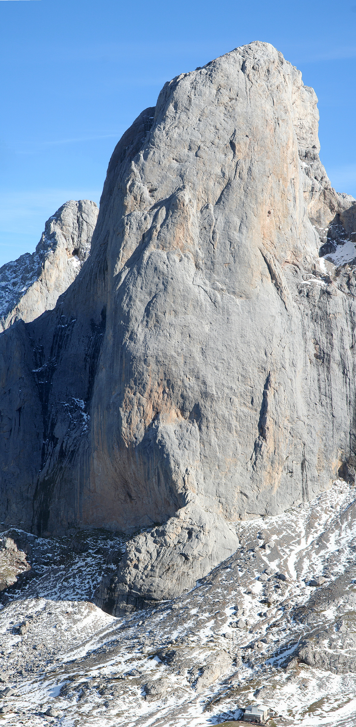
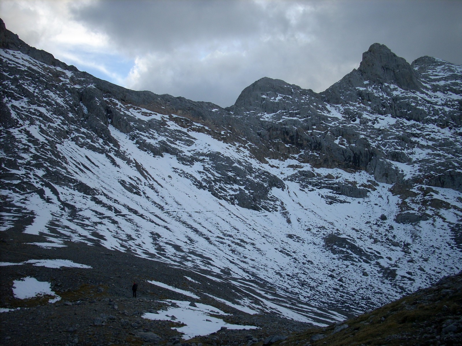
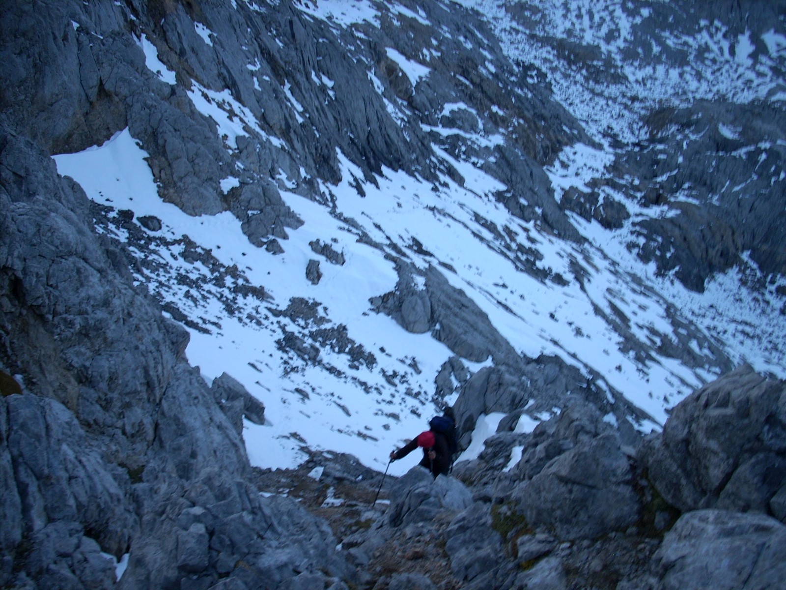
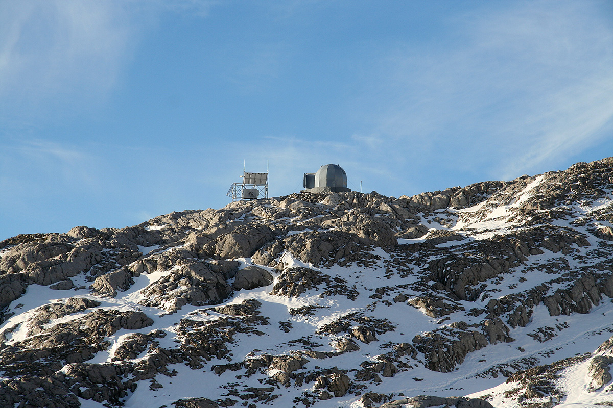
Torre de Cerredo

  • Torre de Cerredo
  • 2648 m
  • Primary factor 1931 m
  • Location: North 43:11.865, West 004:51.173 (GPS at the summit)
  • Location: Picos de Europa, North-West Spain
  • Difficulty: YDS class 4, PD (with snow)
  • Climbed: October 6, 2008

Information:

General information: Picos de Europa is located only 20 kilometer from the northern coast of Spain. The name originates from being the first sight of Europe from ships arriving (back) from America. Picos de Europa is mainly limestone, the area is compact, about 15 by 35 kilometer, but extremely rugged with many peaks exceeding 2500 meter. Picos de Europa was the first area to become a national park in Spain already in 1908. The area consists of three distinct regions, the west, central and east part. There are deep north-south valleys separating the three parts. In particular, the valley between the west and the central section is a very deep canyon/gorge. A trail runs along the river from the village Cain at the south side and across to the north. Due to the limestone, almost all water drains directly into a complex underground system of caves. Thus, there are numerous basins from where one must ascend in all directions (negative prominence), as well as some of the deepest caves in the world, the cave Torca del Cerro extending 1589 meter in depth. The nearest major city is Bilbao, about 215 kilometer east of Picos de Europa.
The main hut (refugio) in the central part is called Vega Urriellu, it has room for 96 guests and is open all year. The phone number is +34-985925200, email: info@picuurriellu.com. This hut is located just below the very impressive, 500 meter vertical wall of Picu Urriellu (2519m). When coming from the south, the cable car at Fuente De is a convenient point of departure. It operates all year between 1000 and 1800, with longer (0900 to 2000) hours in the summer time. A one way ticket was 8 Euro in October 2008. One can call for further information at +34-942736610.
This web site seems to be a good source of information (and discussions) about Picos de Europa (local weather, routes, etc.). The staff at Cabana Veronica also provided the email address: kiketrepa@yahoo.es and the phone number +34-689027994, for possible use if interested in climbing peaks in the region. Much of this is in Spanish, but try Google translate if needed. Cabana Veronica is open all year, this small shelter was actually the dome of an anti aircraft battery on the US carrier Palau before becoming a refugio in 1961.
How to get there: From Bilbao, take the coastal Hwy. west to Santander, then continue west on E-70 towards Oviedo. Exit south on N-621 (near Unquera), and drive a bit more than 10 kilometer before making a right turn onto Hwy. AS-114. Arriving in Arenas de Cabrales, leave AS-114 and head south (make a left turn) following AS-264 the last 15 kilometer to the village of Sotres. Locate the trailhead west of Sotres for the path that will lead to the refugio Vega Uriellu.
Note that one may also stop already about 7 kilometer south of Arenas de Cabrales, and take a ride with a funicular that serves the tiny village of Bulnes via an underground tunnel. Again, there is an easy trail from Bulnes to the refugio Vega Uriellu.
From the south, the best approach is likely the tourist area Fuente De. From Fuente De, a cable car serves the top of the steep cliffs above. From Madrid, head north on A-1 to Burgos (2 hours). Continue north, follow signs for Hwy. N-627 to Aguilar. Continue north-west via Cervera de Pisuerga and then C-627 north across a smaller mountain range to the village Potes. From Potes, there is a rather large road that runs up the valley to Fuente De. One can complete this drive in 5 hours. As you enter Fuente De, there is a large (free) parking area on your right, while the cable car station is slightly higher on the opposite side of the road. This is the trailhead, park here.
Route description: As I have only arrived via Fuente De, this is the route that will be described below. See the remarks above for alternate possibilities.
To the hut Vega Urriellu: From the top station, called El Cable (1834m), follow the road that heads north in the direction of the nearby, impressive Pena Olvidada (2406m). Here the road forks, follow the left fork on the west side of the mountain to the end of the small valley where the road makes a sharp left bend (1960m). Leave the road here (going right) and follow the nice, marked path as it climbs to the pass Hdos Rojos (2344m). Shortly before this pass there is a trail fork and you can see the rather special Cabana Veronica (2325m) up on the ridge to your left.
The descent from the Hdos Rojos pass is rather steep and assisted by a cable. It is strongly advised not to take this route when there is snow. There is an alternative route that is much safer. Well before reaching the col, leave the main trail and follow a cairned route up a rather big gully on your left. This route will lead up on the west side of the subsidiary peak Penes Urrieles (2398m), locate a small col there at location N43:10.855, W004:50.131. At this point, there is a small gully leading downhill on the opposite side. The cairned route continues in a gradual, descending traverse and arrives below the steeper part of the hillside, where a traverse back east will merge this route with the steeper, cable route from the Hdos Rojos pass.
Circle south and east of the pit Hou Los Boches (2099m) then descend towards the pit Hou Sin Tierre (1955m). This pit is passed on the east side as the trail again climbs to the final col at 2082 meter. (Thus, this pit has a negative prominence of 127 meter.) From this saddle, the trail descends gently to to the refugio Vega Urriellu, location N43:12.166, W004:49.287, elevation 1957 meter.
Approach to the summit: Proceed west from the hut, ie. as you exit the main entrance, just continue straight. There is a clear path that will take you in a north-west direction as you climb the slopes east of and below Neveron de Urriellu (2559m). This trail enters a nice ramp going more north and, surprisingly, at the very top of this ramp where everything appears to dead end, there is a narrow crack ascending to the very top of the ridge (easy YDS class 3).
Follow the ridge west (left) a short stretch, then continue along the trail as it traverses the slopes on the north side of Neveron de Urriellu before reaching the very distinct col (photo when returning) named Hda L'Arenera. This col has location N43:12.550, W004:50.329, elevation 2283 m. Descend slightly, then proceed south (into the small valley) before arriving at a new (smaller) col at location N43:12.325, W004:50.428, elevation 2294 meter. From here, there are two (minor) trails forking left providing access to the two peaks Neveron de Urriellu (2559m) and its higher neigbor Torre de la Pardida (2596m).
In order to cross over to the base of Torre de Cerredo, there are several possible trails, on either side of the pit (2186m) located immediately west of this fork. It is slightly longer, but probabely the easiest to follow the main trail as it descends a bit and contours north of the pit. Another trail from the north (Refugio J.R. Lueje) merges in from your right hand side. Continue around on easy terrain and follow the cairned path as it turns south towards Torre de Cerredo. The route proceeds along a broad ridge, first the pit (2220m) just north of Cerredo appears on your right hand side, next you traverse into the east slope of Torre de Cerredo with a new (2222m) pit on your left. This pit fills in the end of the valley and you now see the jagged ridge connecting from Torre de la Pardida to Torre de Cerredo.
Pay attention as the cairns suddenly heads quite steeply uphill. Higher up, there is even a short section that requires (YDS class 3) easy climbing. The terrain is more gentle higher up as the route follows natural gullies while steadily gaining elevation. Finally, you emerge at the base of the upper part of the mountain. This location is N43:11.854, W004:51.103, and you have reached 2512 meter of elevation.
Summit climb: From location N43:11.854, W004:51.103, you are less than 150 vertical meter below the summit. Continue up the slope in order to access a very distinct crack (gully with vertical sides) that is easily visible above you. Enter this crack and proceed uphill inside it until stopped by a steep section. At this point, climb out of the crack on your right hand side (YDS class 4 move). Proceed uphill on the right side of the crack (short stretch), until you can easily cross the crack above the steeper part encountered further down. From here, continue to gain elevation as you move up along a very natural passage heading more left. This section will lead you to the final and more exposed part of the climb. The remaining part is well illustrated on this picture (taken from the summit of Torre de la Pardida.) First, continue an ascending traverse (going left) that will get you to an area with several distinct rocks just above the steep cliff below. This section may be about 25-30 meter. Next, head straight uphill, a rather steep section, but technically easy, as there are natural steps all the way. You will arrive at a small flat area with a partial overhang (tiny cave). This section is approximately 20 meter. From here, traverse horizontally left, then move up an easy (short) gully followed by a second gully going right, that tops out on the summit ridge. Follow the narrow, but easy summit ridge to the concrete cylinder that serves as a summit marker. This final leg is about 35 meter.
Comments:
I did this trip with my friend Geir Åke Dahlen. I flew from Bergen to Oslo early Saturday morning, hooked up with Åke and flew onwards to Madrid. Ideally, I wanted to fly to Bilbao, however, the air fares there were just unreasonably high. We arrived on time in Madrid around 1215 and after the normal delays, we were on the road with our rental car by 1300. We knew that the cable gondola (Teleferico) at Fuente De ran until 1800, thus the first thing to check out was the feasibility of driving there in 4.5 hours. This worked out and by 1745 we had parked our car at Fuente De (large parking area) and bought a map as well as tickets for the teleferico. We took one of the very last rides of the day and started out on foot around 1800.
A couple of unexpected events had already come to our attention. When crossing the last range before Picos de Europa, we had observed that the mountains were all white of snow. This was indeed very bad news. My research on this mountain indicated that this was a peak where we should have dry, summer conditions. I called the refugio a few days earlier and asked about possible snow, the reply was "no snow and good conditions". The weatherforcast did not indicate any snow, but we soon heard that they had received a major snowfall just the day before our arrival. This was supposed to be a last "summer hike" before winter, we both carried shorts in our packs. Here, we are met with snow and a temperature just barely above freezing. Another surprise was the brutal steepness of all peaks around us. There were dozens of peaks everywhere and they all looked rather wild and rugged. Thirdly, there was not a single small creek anywhere. The limestone rock made all water sink directly into the ground and the landscape between the sharp peaks contained numerous rather large pits.
We left El Cable shortly after 1800 and walked to the refugio called Cabana Veronica. It is located high on a ridge next to some solar panels and antennas. The refugio looks like a lunar station and this was also the name we used for the rest of the trip. Arriving at 2000, just as the twilight was gradually giving way to nightfall. There were 4 people in the hut and it was indeed already crowded. We were still welcomed and ended up sleeping at the lowest level of the single bunk bed in the hut. This bed had 4 levels and the lowest level provided about 10 centimeter of free space from your nose to the wooden support of the next bed.
The next day, we started out around 0900. Our first destination was the bigger refugio Vega Urriellu. However, already at the main pass, Hdos Rojos, we ran into trouble. We had been told to avoid the cable route and go further left. The directions were certainly incomplete and we looked around further left, the cliffs and terrain looked nasty. Åke was quite unhappy about the future and I believed strongly that if we had trouble hiking a trail from one refugio to the next, then we would indeed never be able to climb the peak Torre de Cerredo.
We finally decided to backtrack and explore the possible route that would first go significantly higher on the left side of the pass. This turned out to be a wise decision, we quickly discovered the correct route. Everything was now more easy and we arrived at the Vega Urriellu at 1200. After a long break and some lunch we set out at 1300 in the direction of Torre Cerredo.
As the hiking from the refugio to the base of Torre Cerredo typically takes at least 2 hours, we decided to wait with Cerredo to Monday and rather try climbing the Torre de la Pardida (2596m). There were several reasons for this. A climb today, starting out at 1300 would likely run into evening and night. Tomorrow, we could start at 0800 and hopefully, the sun would melt more snow and make the climbing somewhat easier and much safer. We still decided that we needed to return to Cabana Veronica on Monday in order to make certain that we would make our return flight from Madrid on Tuesday.
Consequently, we left the main trail and attempted the (much) easier Torre de la Pardida. This trip would give us an opportunity to look across to Torre Cerredo and get a good impression regarding the snow conditions.
Successfully back, we enjoyed a good, three course dinner (with red wine) and a good night sleep. The next morning, we got up at 0700, had breakfast and started out a few minutes before 0800. We knew the first part of the route from yesterday and soon started out circumventing yet another huge pit. The nature in this area keeps you impressed wherever you look. Sharp peaks and incredible pinacles. We jokingly thought about climbing all peaks exceeding 2000 meter with a prominence exceeding 10 meter (as some do back in Norway). Such a project would indeed be quite demanding.
We contoured around the pit located between us and Cerredo, then entered the "dead end" valley at the base of the peak. The weather looked omnious with big black clouds as we started out this morning. The local weatherforecast also said rain after 1200 and substantial rain in the evening. However, the clouds had vanished and the sun was shining from a reasonably blue sky. The trail started steeply uphill and tested its users in a scrambling section. We arrived at the base of the upper mountain at 1030 and decided to proceed with helmet and climbing harness from here. Before soon, we encountered a (YDS) class 4 move, then more snow higher up. Suddenly, the terrain shifted and asked us more serious questions. I looked ahead, then told Åke that we should take out the rope. Proceeding with the rope, I first crossed along a ledge covered by slippery snow, then traversed across to some rocks that looked like somewhat safer terrain. Åke soon joined me here while I looked for the continuation. There were still patches of snow, but overall the rocks were more dry here. It looked possible to climb straight uphill. Good holds and good placement for feet, however the exposure just below is indeed a bit intimidating. No room for any mistake in this terrain. I proceeded up and soon discovered a tiny cave (overhanging rock) with a good rock to belay. The third leg turned out to be rather easy, two gullies and a short top ridge. I anchored the rope to the concrete summit marker and shouted "climb" to Åke.
We had arrived at 1250 and sat down to enjoy the scenery all around us. Against most odds, as we had been seriously in doubt if we could complete this ascent, with new, wet, melting snow left on the steeper slopes. The views were not quite as good as yesterday, but still magnificent. We could see the blue Atlantic, Torre de la Pardida that we already climbed and all the major peaks in the central part of Pico de Europa. Straight down on the west side, we could see where the deep valley from Cain runs.
We left the summit at 1315, quite focused on making the descent equally safe. The first third could be descended without any risk, the second leg was certainly technically easy, but required attention since recovery from any slip would be very difficult. A couple of intermediate slings and Åke came down with all the care that was called for. The last third had more snow and fewer good holds. I suggested that we should negotiate this via a rappel (abseil), the route was diagonal, but relatively short. This made the last section relatively quick and safe at the expense of a sling, quite a good investment. We continued unroped and arrived at the base shortly before 1500. The hike back was both nice and easy, we really felt we knew the route walking along the last section for the fourth time. We arrived back at the refugio around 1645, well ahead of our goal being back before 1800. Near the refugio, some local mountain deer were peacefully walking around.
After a 45 minute rest with food and drink, we set out for refugio Cabana Veronica. The weather was still nice, evening light hitting the famous Picu Urriellu. We made a brief stop next to the deepest pit in order for Åke to "descend it".
Later, we contoured around the last significant pit along our route, ascended the steeper slope above, then traversed back to the final gully where the route crosses the ridge at close to 2400 meter. The staff at Veronica knew we were coming. It turned out that this tiny hut with only 4 beds had a staff of two. Thus, the maximum number of (comfortable) guests would be limited to two. We arrived well before 2000 and a rich vegetable soup followed by an omelette and pineapple for dessert were promptly served.
The weather turned stormy during the night, our tiny "lunar" station was shaking in the gusts. We set out the next morning at 0800. Rain gear for the first time. We arrived at the "El Cable" top station well ahead of the first car at 1000. It was a somewhat cold and wet waiting time. What if they decided to cancel the first hour of operation due to the strong wind? However, at 1000 sharp we descended to the valley floor onboard the first run of the day. Our trip back to Madrid went according to plan and by late evening we were back home after a very successful trip.

Resources: