Location: North 47.61031, East 014.59659 (GPS on the summit)
Difficulty: YDS class 3
Climbed September 27. 2014.
Information:
How to get there:
This mountain is accessed from Hwy. 146 going through a narrow
valley, the Gesäuse national park is located here.
Locate the National Park Pavillion (signs along the road), it is on the
right hand side if you are driving from east to west. Park here,
this is a good (free) place to park. Location N47.59162, E014.63705, elevation about 590 meter.
Route description: Hut hike.
The hut is named Buchsteinhaus.
Get back onto Hwy. 149, and head west. There is a sidewalk on the left hand side.
As you get to a bridge where the Hwy. crosses over to the left side, a small dirt road
continues on your side, take this and climb gently up a hill. Continue essentially flat
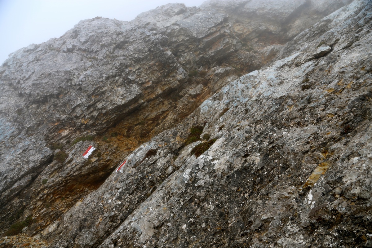
until a fork where you turn right, then leave the road left as you follow the standard red and
white markers. The trail heads uphill, then zig-zags before reaching a forest road. Continue
to follow the trail crossing the road several times, including a few short sections where
you follow the road uphill. You reach a saddle and soon the lower station of a "sailbahn", cable lift,
used to ferry supplies up to Buchsteinhaus,
From here, the trail runs in many very gentle zig-zags up to Buchsteinhaus.
Summit climb.
Exit the terasse at the opposite end from where you arrived (from the valley). The trail runs steadily
uphill in several turns. You will first arrive at the spot where the via ferrata route forks right.
This route is supposed to be quite easy, classification A/B, a proper via ferrata kit is needed.
The trail descends a bit and a new option forks right. This route is called "Wengen weg", it is
steep and most likely best when the conditions are nice and dry. The normal route descends a bit
more and traverses
into a huge gully with a small stream coming down in the middle,
then climbs uphill, sometimes assisted by cables. This part of the route is
fairly steep and less pleasant when wet.
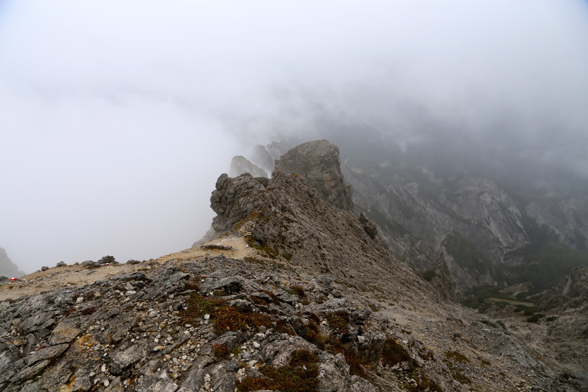
The path runs all the way up to the main
crest with a signed trailfork. Next, the marked route runs along the top ridge, sometimes a bit
off on the left side. You pass a small, local hump,
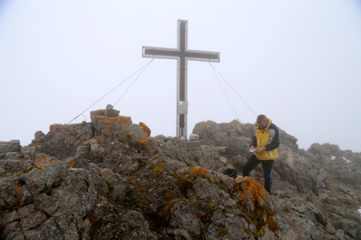
then a final easy scramble to the summit. Comments:
The day did not look perfect, since better weather was forecasted later in the day,
I delayed my departure as long as possible. The weather did not seem to improve
and I finally left at 1005. The hike up along the trail went nice and soon I arrived
at the fork where the via ferrata route went uphill to my right. I carried my harness
and a via-ferrata kit and my plan was to ascend this route and descend back along the
normal route.
Somewhat to my surprise, the via-ferrata itself did not start right away. Rather, the
route started up across fairly steep and fairly smooth rock. I started scrambling up,
but soon found myself more climbing than scrambling. This section would be easy with
dry rock, however with fog and rain plus some thin morning ice, this was no fun
at all. I quickly came to the conclusion that this climb was not what I would enjoy
with these conditions.
I carefully descended back down to the normal trail and packed away the climbing gear.
This certainly wasted quite a bit of time. By the time I was ready to hike another
climber had caught up with me. I now continued along the normal route and arrived at
the summit at 1205, so 2 hours including the diversion along the way.
The weather was still not good and I started descending after only 10 minutes.
I was back at the hut in 1:30, took a well deserved rest while watching a gradual
improvement in weather. I left at 1410 and had a very nice descent back down to
my car, arriving there at 1525, a bit less than 1:30 on my return hike.