Location: North 42.71608, East 024.91739 (GPS near the summit)
Difficulty: YDS class 2 (crux), mainly class 1.
Climbed July 7. 2013
Information:
How to get there:
From Sofia, travel along Hwy. A1 / E80 towards Plodiv. Exit north onto Hwy. 64, sign for Karlevo.
Driving north, well before Karlevo, fork right onto Hwy. 641, sign for Kalofer. This road joins Hwy. 6 / E871.
Notice a significant uphill and pay attention, as the road that serves Kalofer forks left. Take this road and
measure from this fork. Cross over a hilltop with some sort of stone (white) monument on your left. Just as
you start downhill, at kilometer 0.5, turn left onto a smaller road.
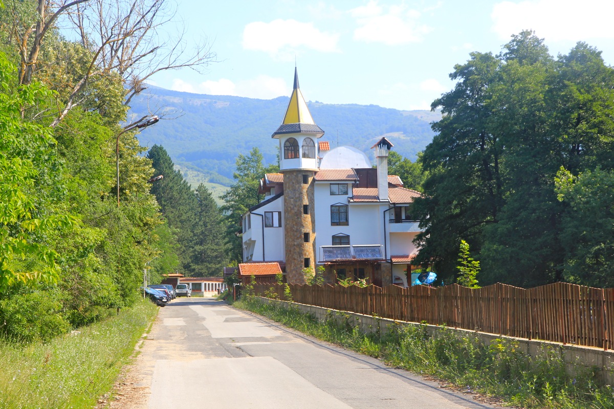
Follow this road (approximately 6 kilometer) until you see this hotel
coming up on your right hand side. I drove down a small road forking left shortly after this. This road
had many small signs indicating trails etc. I asked to park on this private property (a small cafe), and
that was completely OK when paying 3 Lev (1.5 Euro). This location was N42.65538, E024.98228, elevation about
750 meter. However, if one drives 100 more meter, then turns left (downhill, dirt) and crosses the small
river, there seems to be multiple possible places to park. This was clearly where the local (Bulgarian) people
parked. (Well my car was perhaps in a slightly safer location, 3 Lev may be worthwhile..)
Route description: Hut climb:
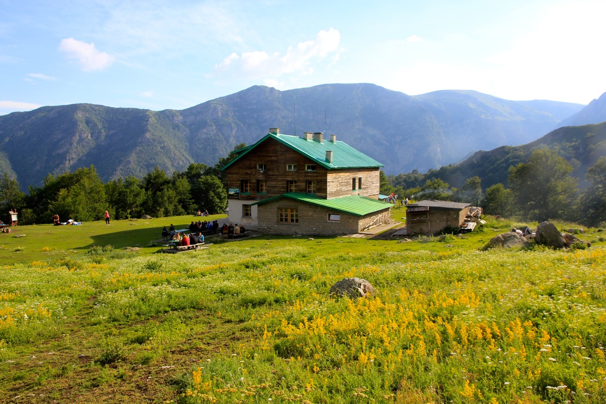
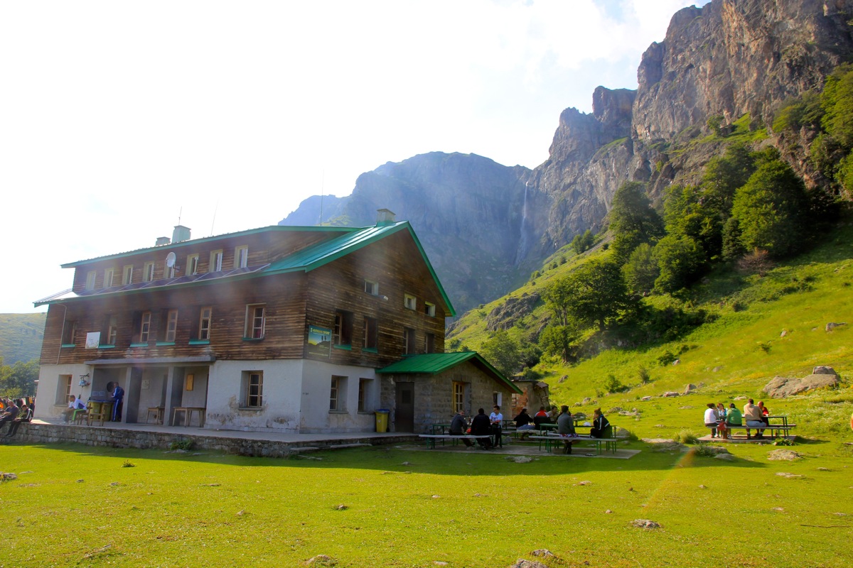
There are frequent signs for the Rey hut, they read: х Рай. The х is
an abbreviation for хижа this word means "chalet" or "hut". The Bulgarian word
Рай (Rey) means paradise, that is, this hut is called Paradise Chalet.
The route is well marked with paint, white, blue and yellow stripes. Most of the way one can also see metal poles,
these are yellow and black in color.
From the trailhead/parking walk along the small river (you shall have the river on your
right hand side) until the small road ends. Do not cross the river, but rather head steeply uphill to
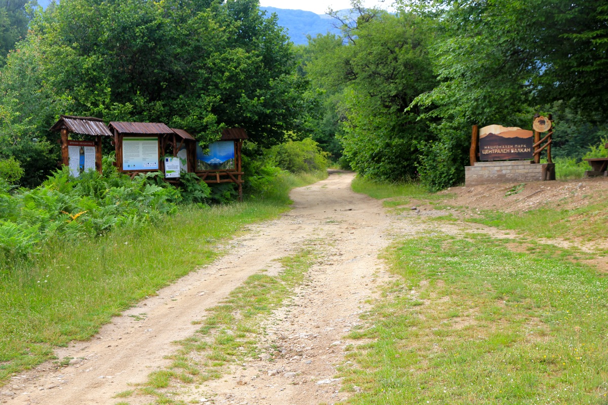
your left. There are some trail markers. On top, you will emerge on a small farmers road and there are
informational signs posted.
Continue on this road, then pay attention as the route again heads uphill on
a trail. The route now follows (climbs) a ridge and it will eventually again enter a farmers road as it
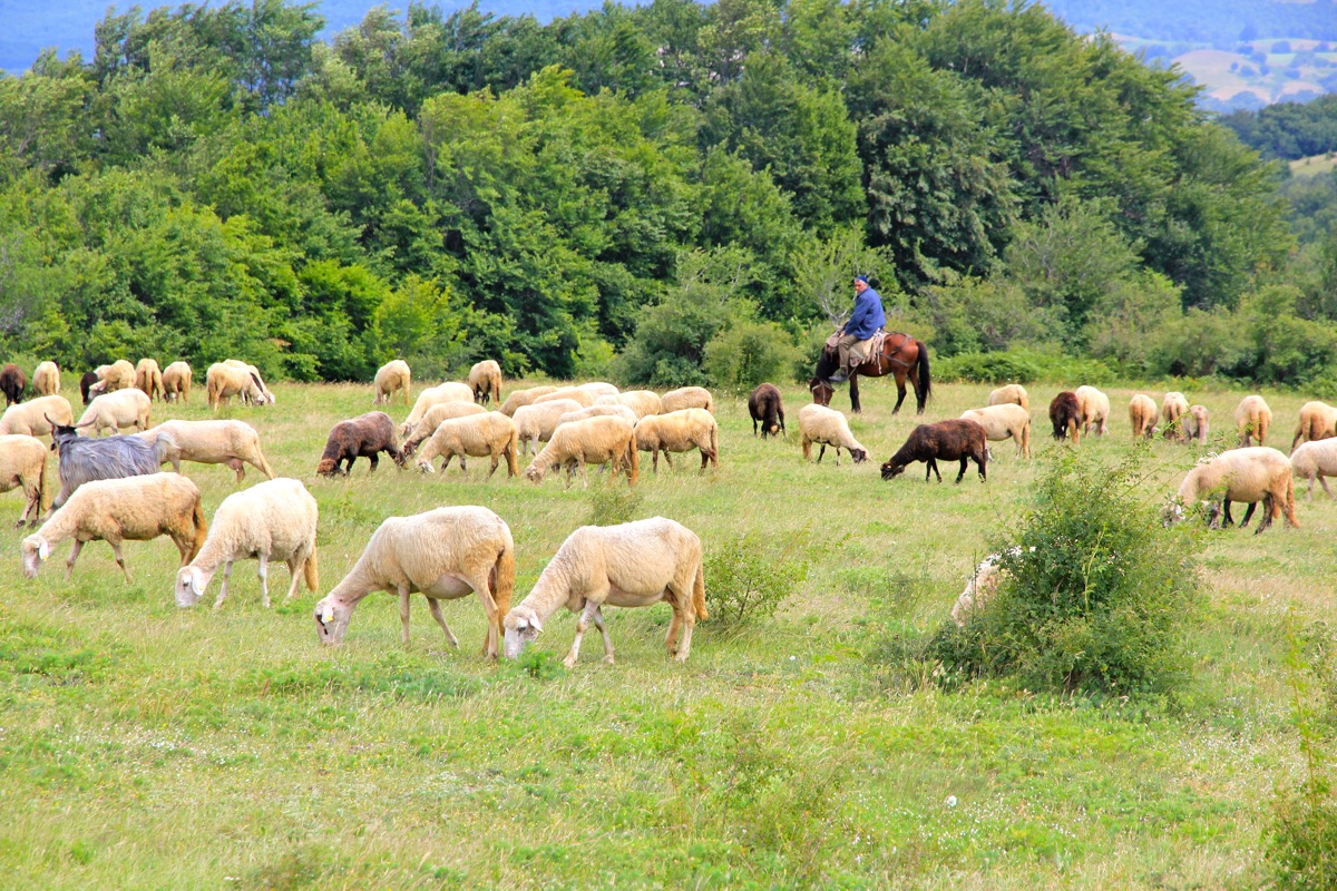
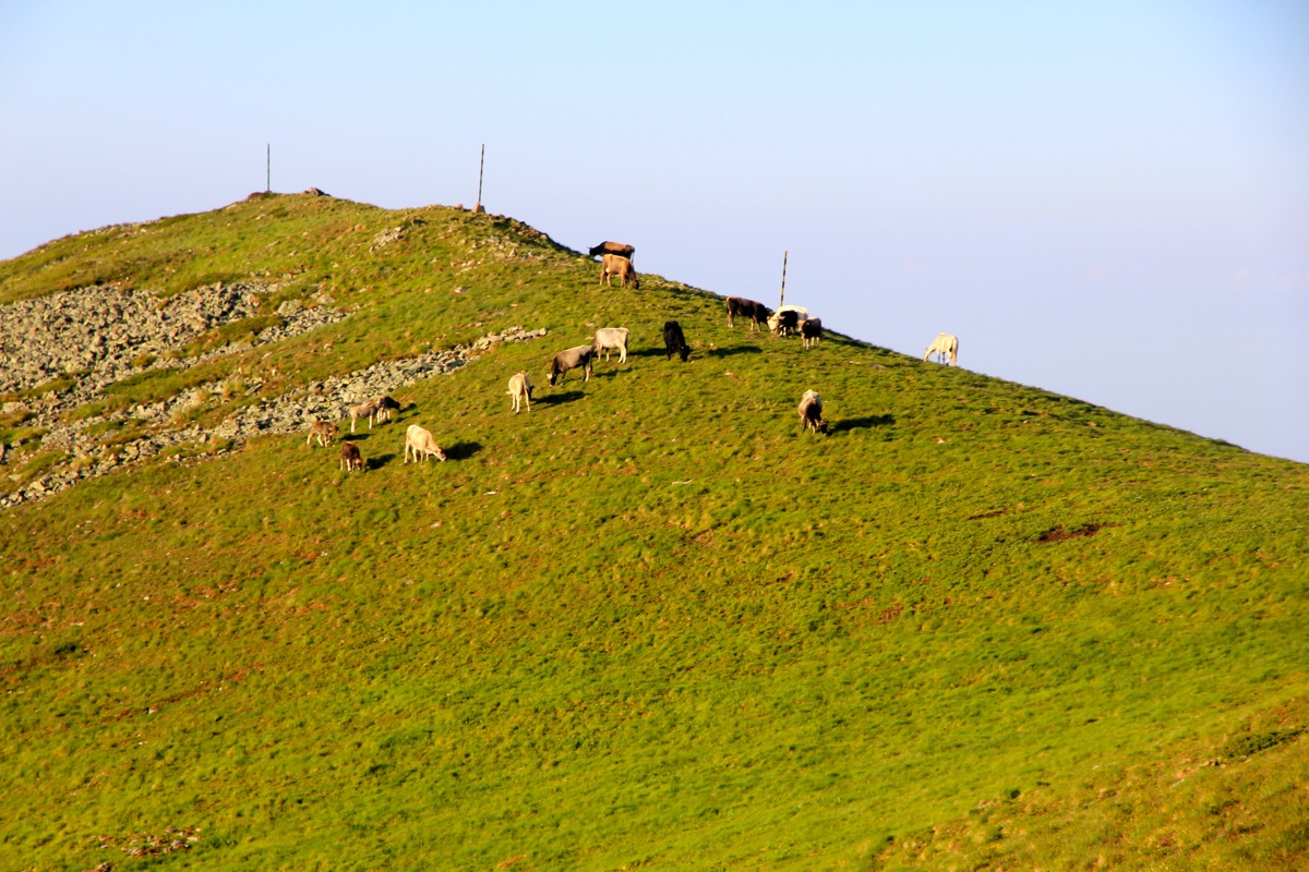
continues gently uphill across pastures. Sheeps are in the area as well as a possibly unfriendly sheep dog,
bring hiking poles as an effective deterrent.
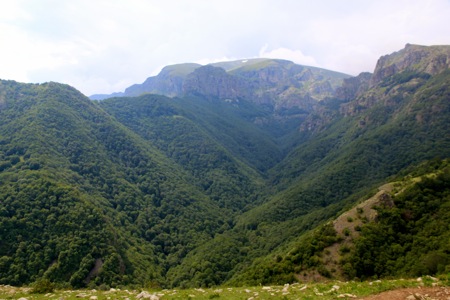
The trail continues its traverse across the fields, Botev is looming ahead. You will arrive on the
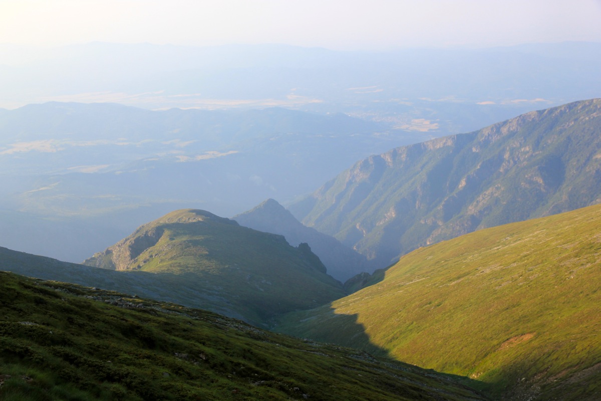
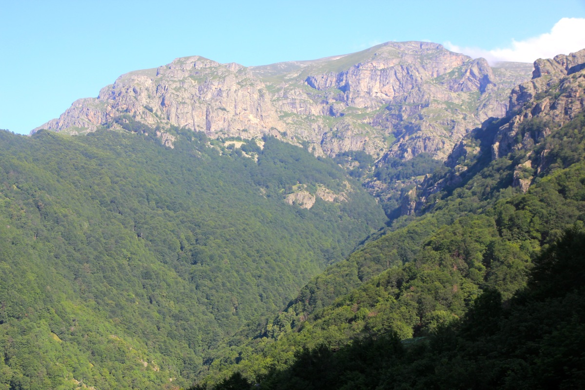
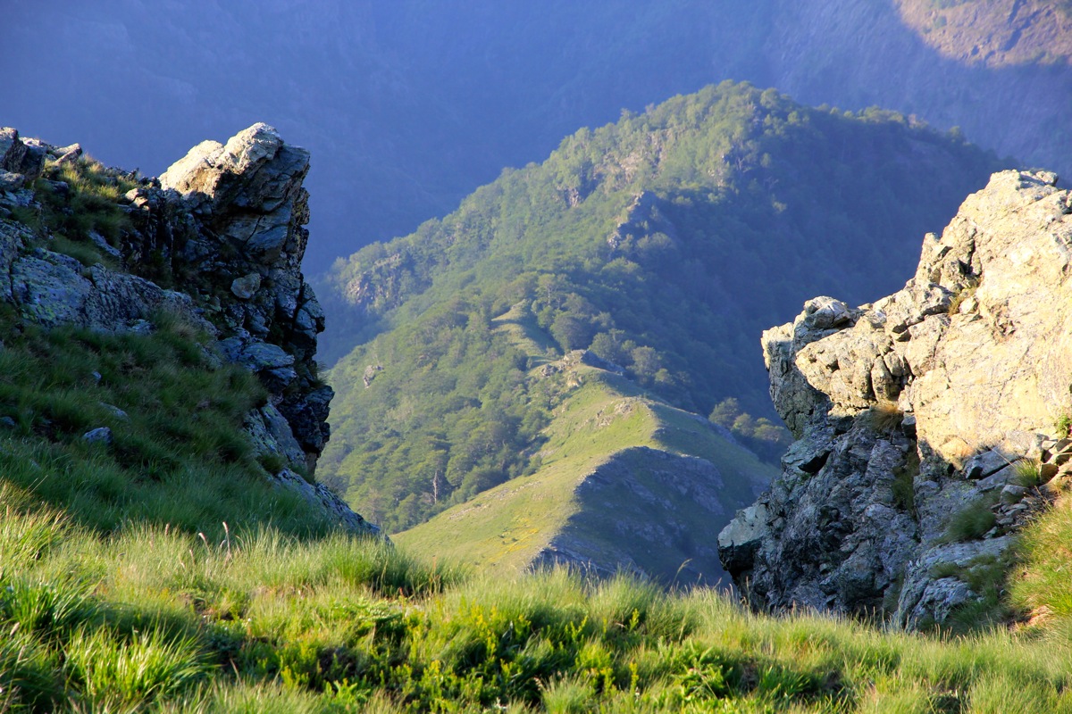
brink of the large bowl (all full of forest).
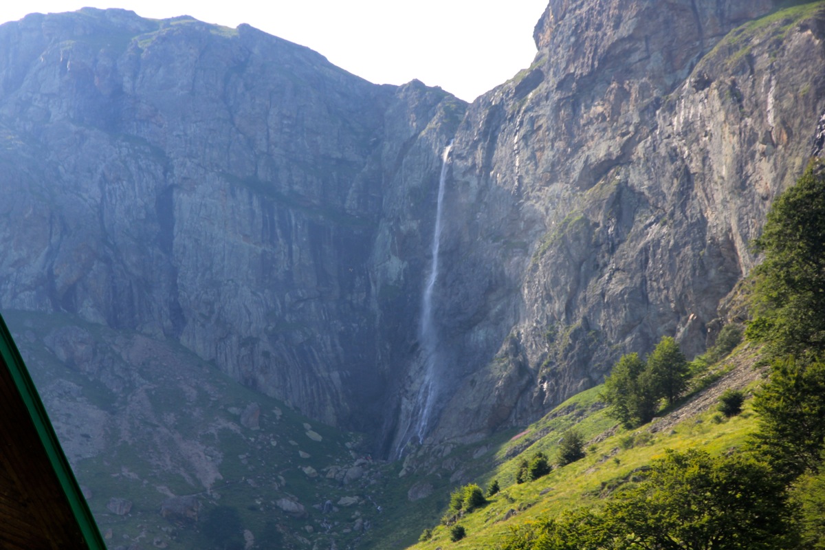
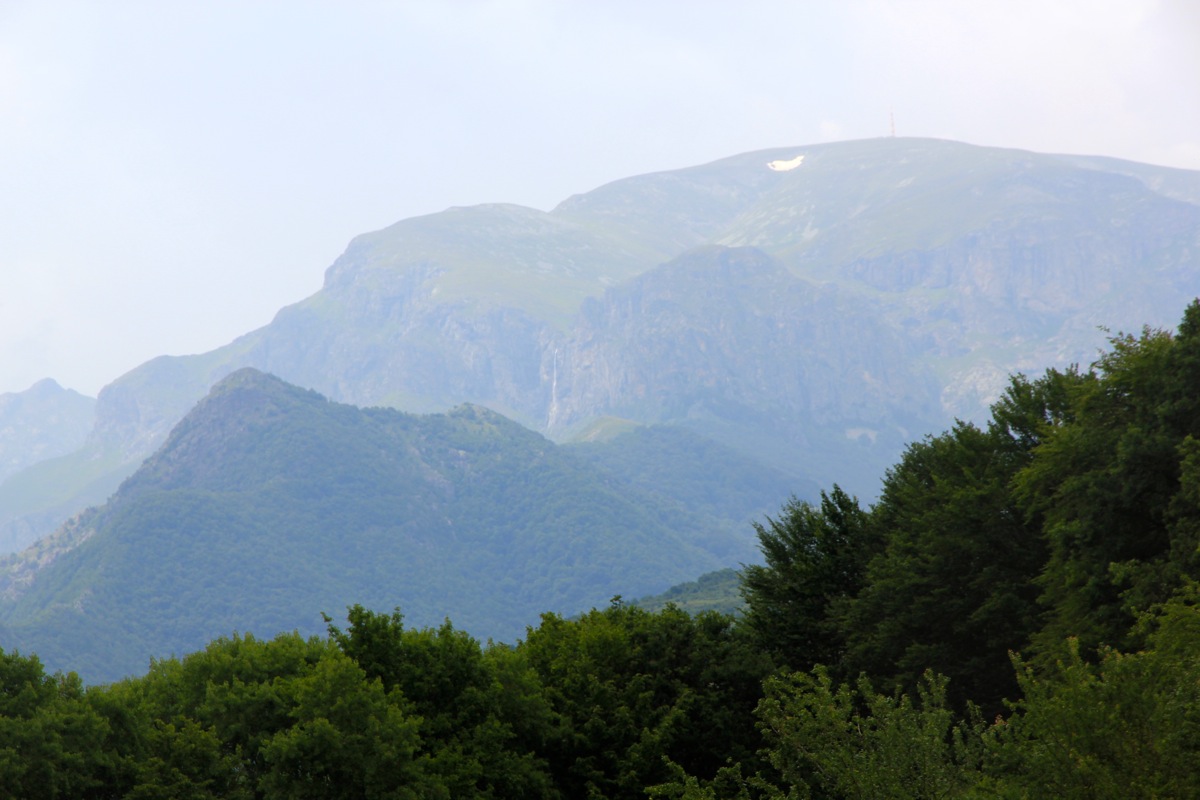
This is a very nice viewpoint. Botev is up the valley,
the Rey hut is below the waterfall just across the
distinct ridge that forms the opposite side.
The trail now heads right as it keeps the elevation and merges
with a farmers road that ascends from your left. Pay attention to the signs since the route after a short
stretch on the road, forks left and starts going downhill.
Further down, the path crosses the creek and then contours around, Soon, the trail starts uphill again, without
ever coming close to the creek. The trail ascends quite a bit before crossing this second creek. Finish the climb
with a few switchbacks on the final hillside. The trail now emerges on top of the grass covered ridge. Continue
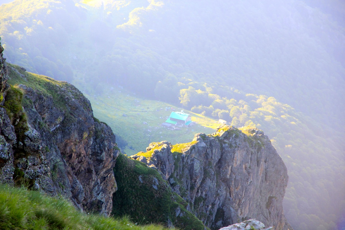
directly across, descend slightly and arrive at the Rey hut. Summit climb:
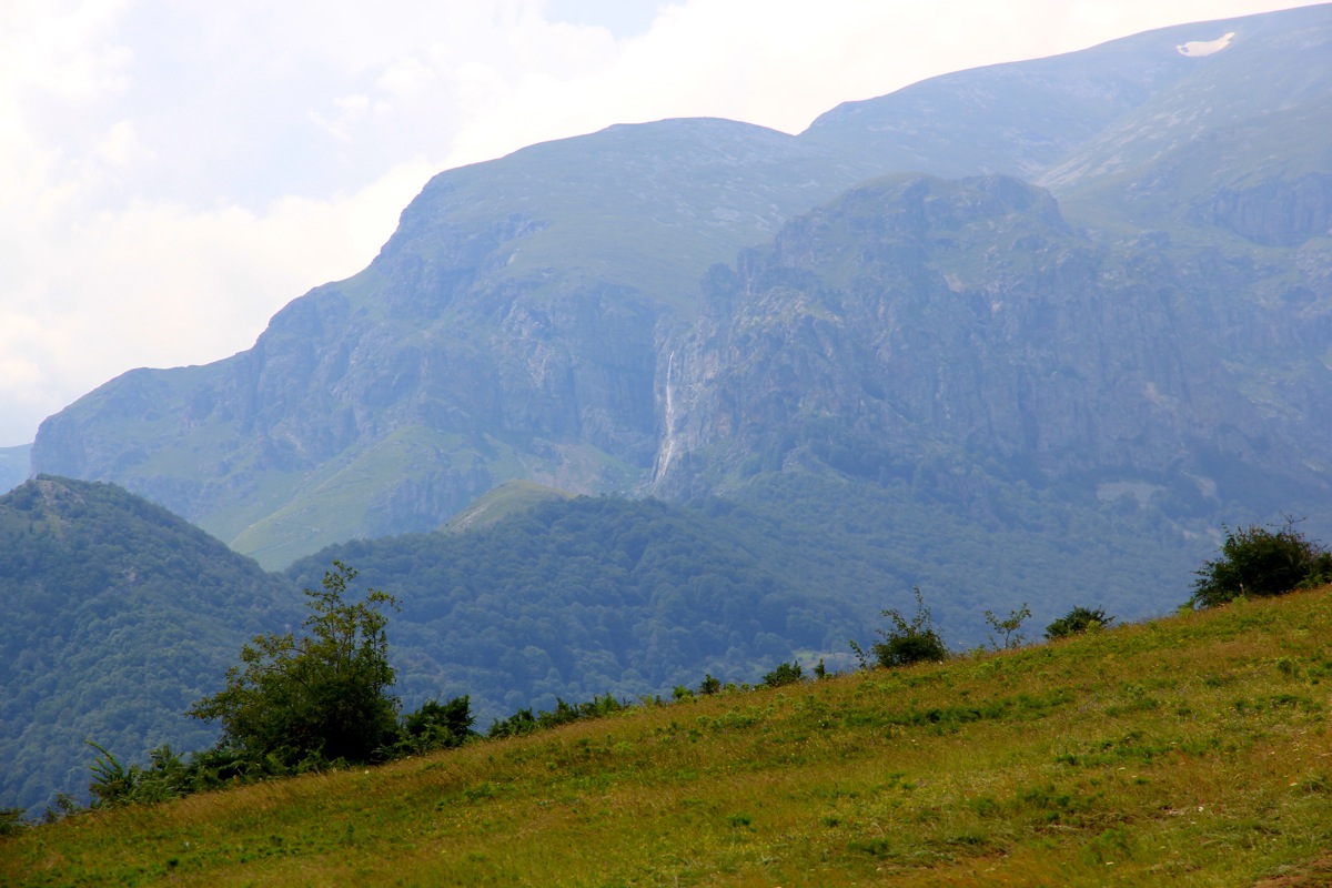
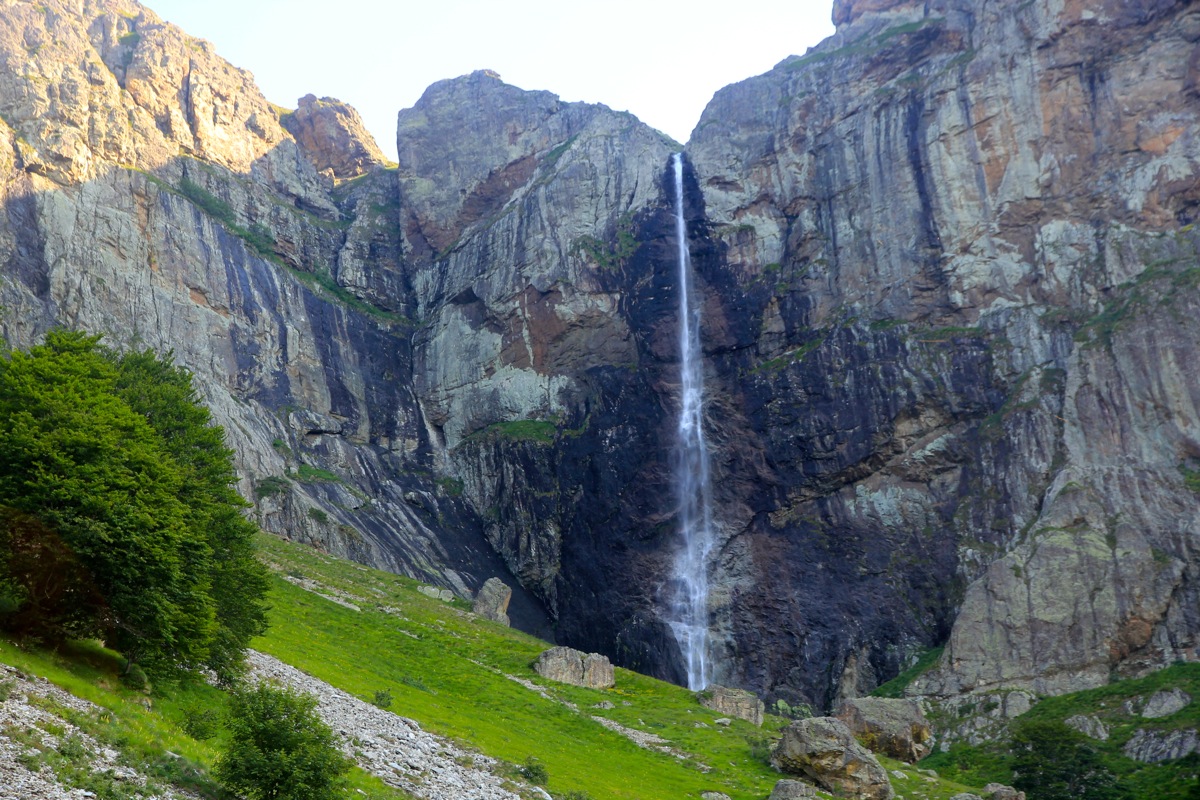
The highest waterfall in Bulgaria, Praskaloto, is
located just above the hut. This waterfall is 124 meter, but has
quite a limited flow of water, since its drainage area is rather small.
From the hut, follow the path that heads in the direction of the waterfall. You pass near an old building then
cross the creek (from well below the waterfall) and ascend the hillside on the opposite side. Soon, you will get
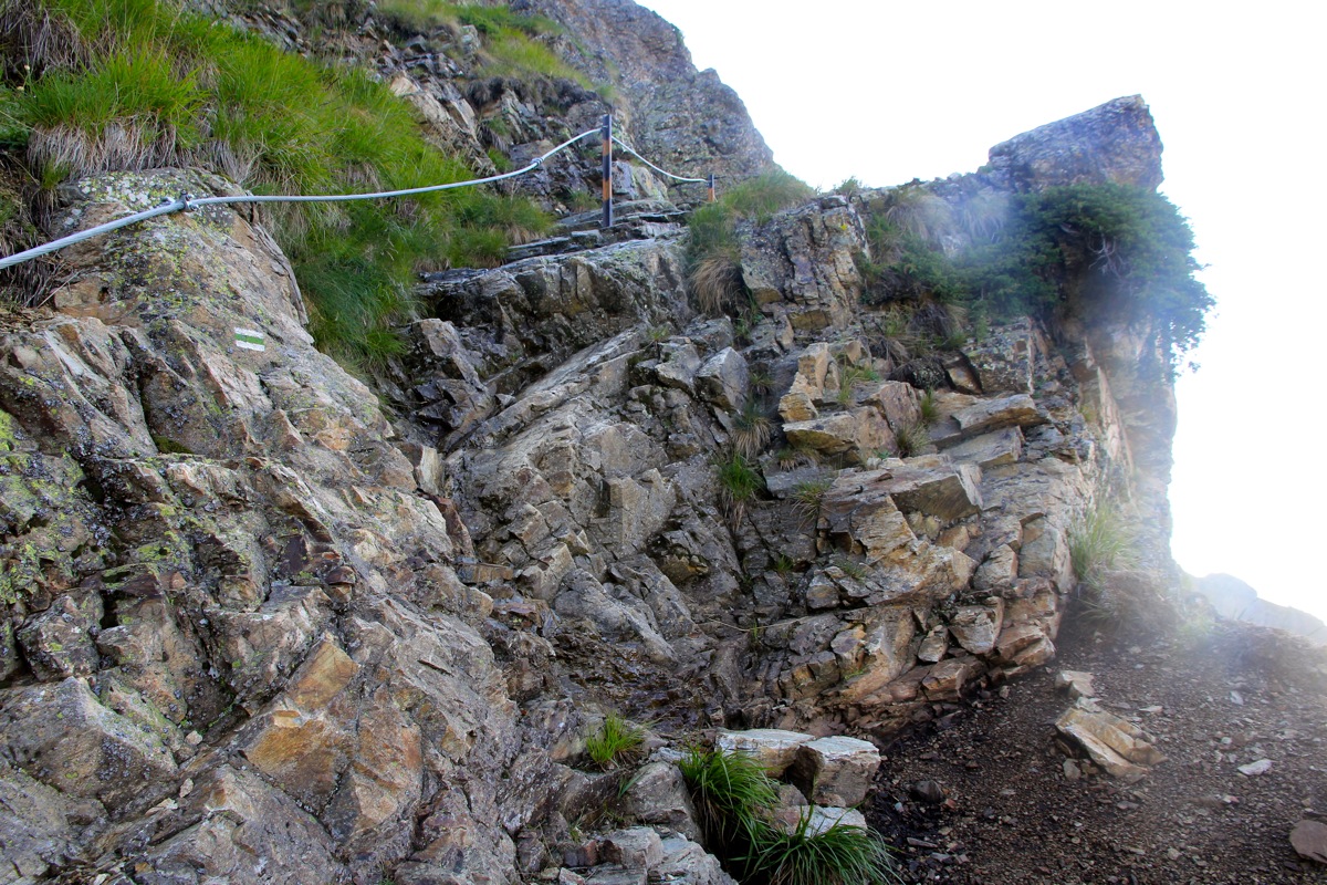
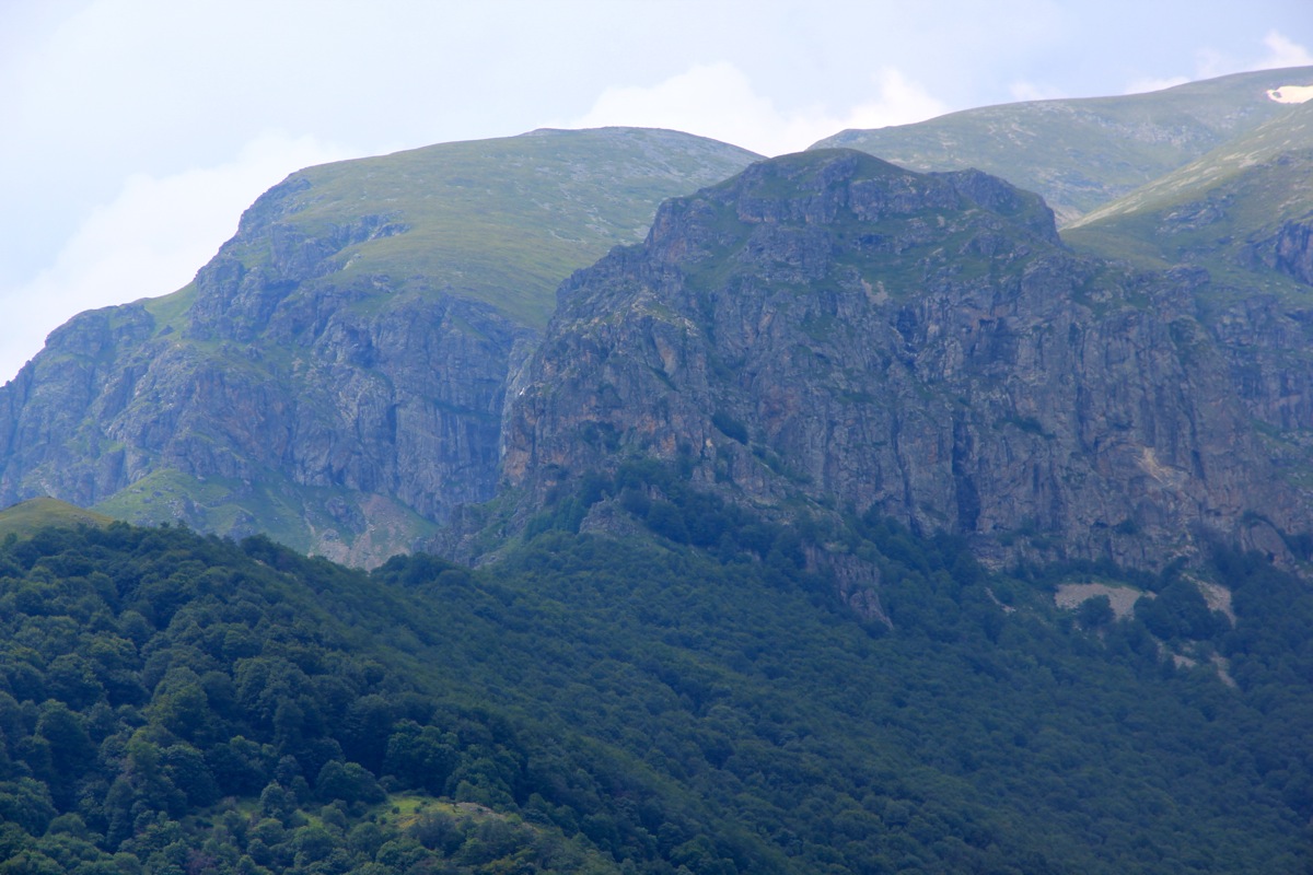
to a trail fork. There are signs here. Take the right fork, heading directly uphill in zig-zags. Upon reaching
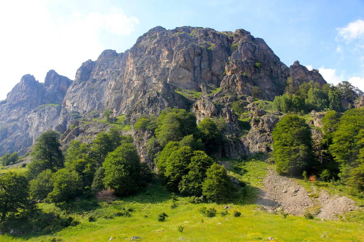
the cliff band, the trail contours left, then climbs along natural grassy ledges as it again crosses more right.
This section is protected by cable in many places, but the trail itself is easy to walk, however with a bit of
exposure in a few places. You may need to use your hands
for added support in one or two places, hence the trail
has received a YDS class 2 rating, however, it is close to pure trail walking (class 1).
The trail finishes the cliff bands nicely, emerging on a fine spot for views back down. From here, continue a pretty
long, gentle ascend across the grassy slope, all the way to the crossing of the creek. You will see the top part
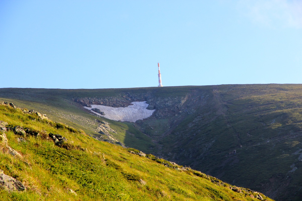
of the summit antenna tower
above the horizon. The last section is a few more switchbacks on the right hand side of
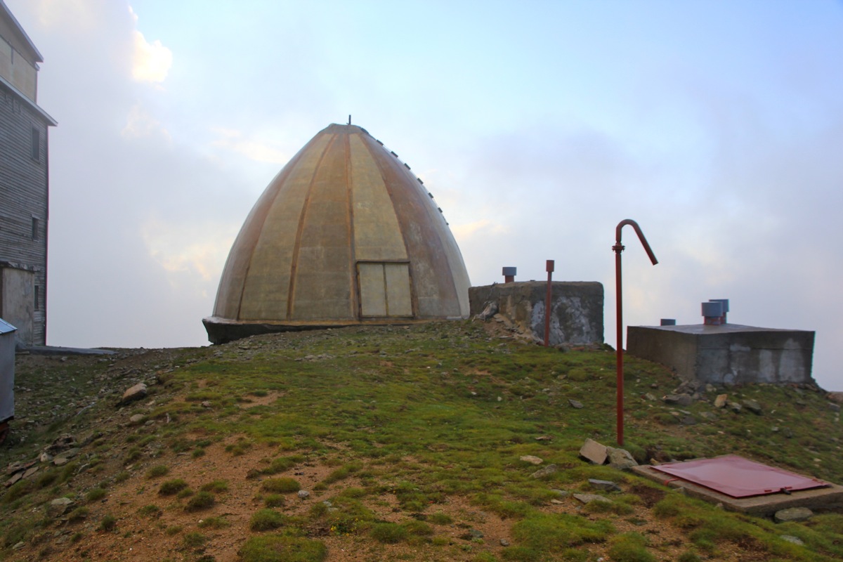
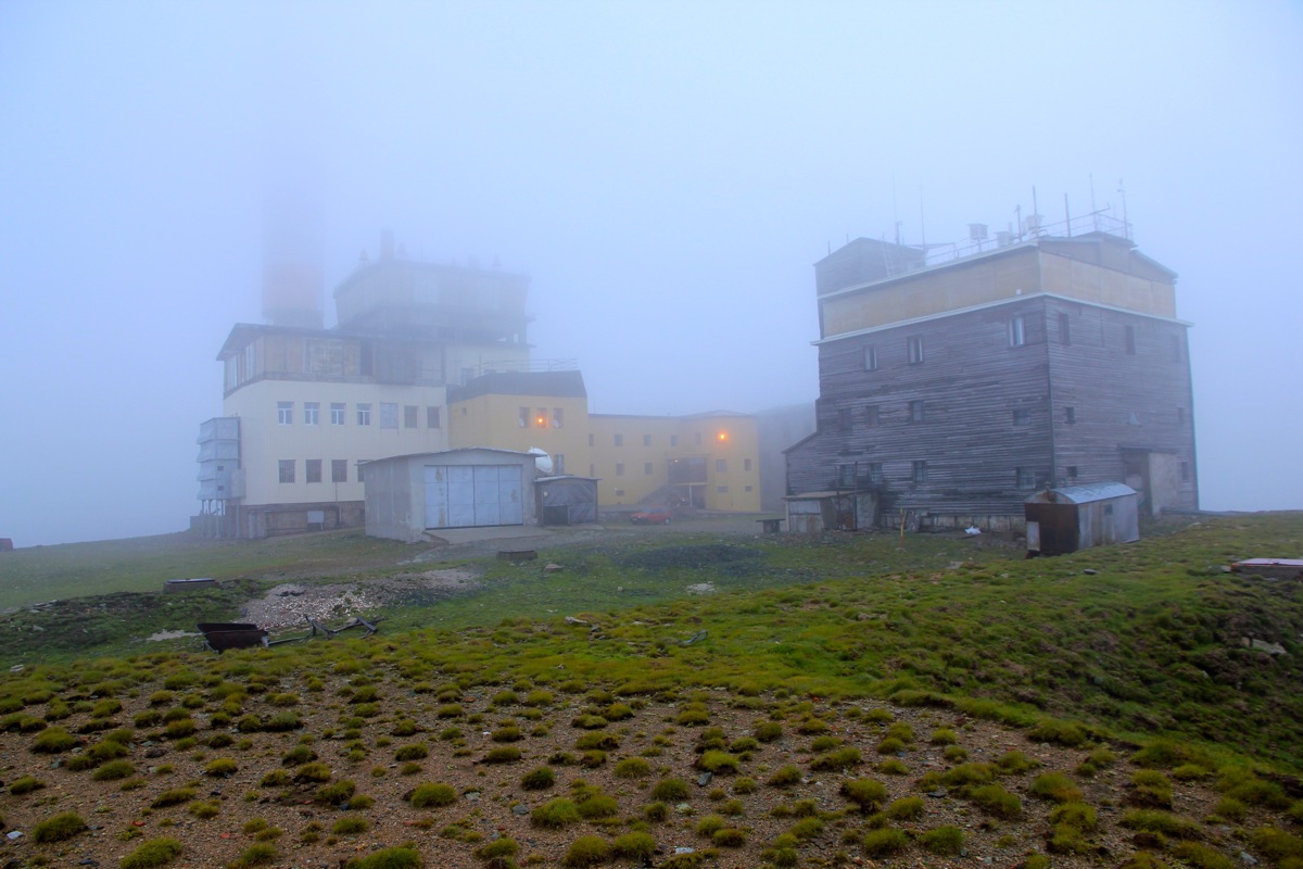
the creek. The slope becomes almost flat the last hundred meters to the summit. Unfortunately,
the summit is rather ugly with a
lot of buildings/structures. What is good is that one only sees this at the very end of the hike.
Comments:
I left our "base camp" in Bansko around 1100 on Friday, planning for arrival at the Rey hut around 1800.
The drive is more than 200 kilometer and for a first time visitor, there are places along the route where
a single driver may get easily lost. That is, you make the wrong turn and find yourself off route. Roads and
intersections are not consistently signed and especially in cities the assumption is that a driver knows where
to go/turn. Thus, I lost some time exploring smaller villages and roads between Pazardzik and Plovdiv. I parked at the
trailhead around 1500 and started hiking at 1510.
Unlike the roads, this trail is very well marked and caused no trouble with respect to route finding.
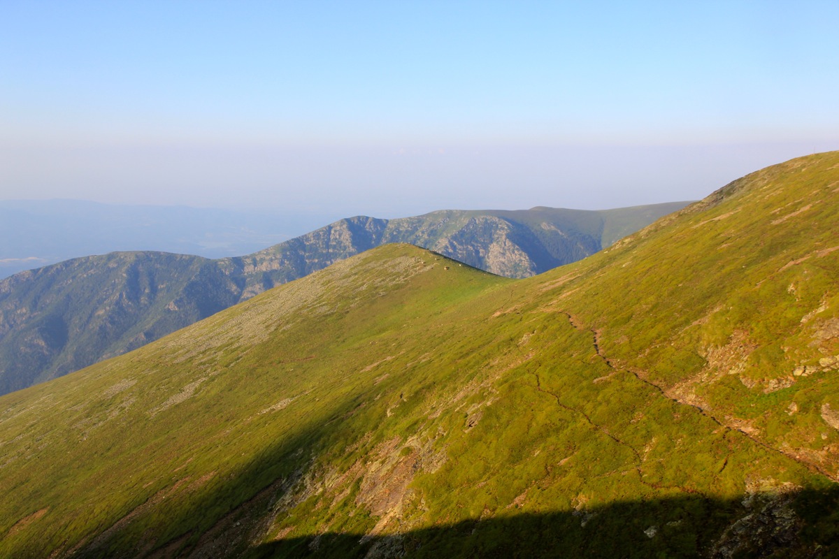
The trail quickly brings you up into pastures and you can
see Botev, it still seems like a long way.
I walked by a shepherd
with his sheep in the pasture land and was attacked by a large, white sheep dog, not unlike the ones that gave us
trouble in Albania back in 2007. Not a big issue, my walking poles are good to keep such dogs at a reasonable distance.
I arrived at the hut by 1725, 2:15 hiking time.
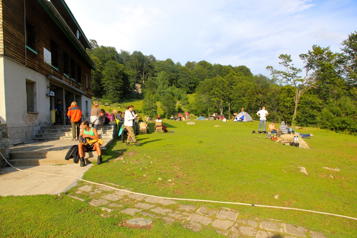
This place is quite nice, the name "Rey" means Pardise.
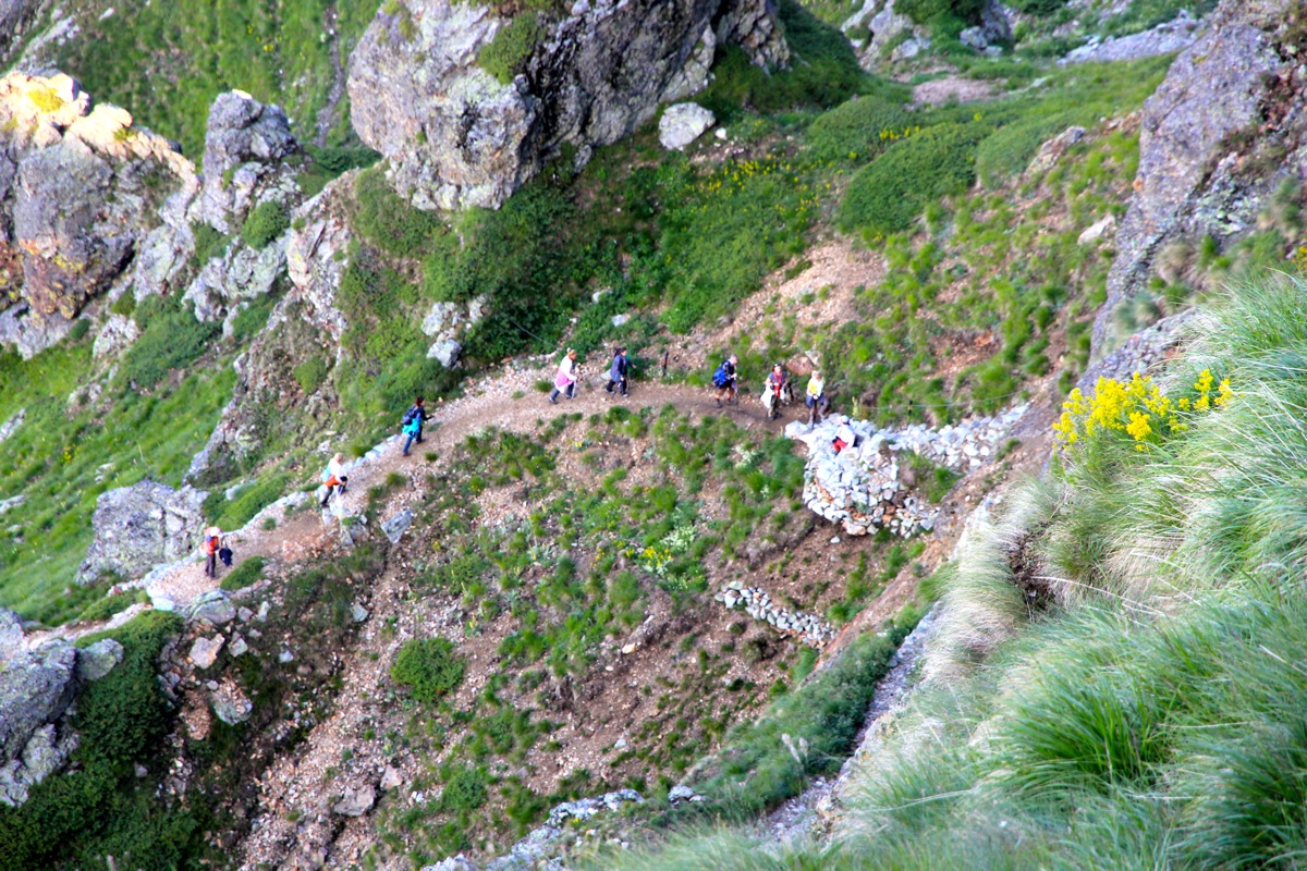
I had not seen many people on the trail, obviously they had all arrived earlier.
The staff did not speak a single word of English, but they understood
that I wanted to stay until the next morning.
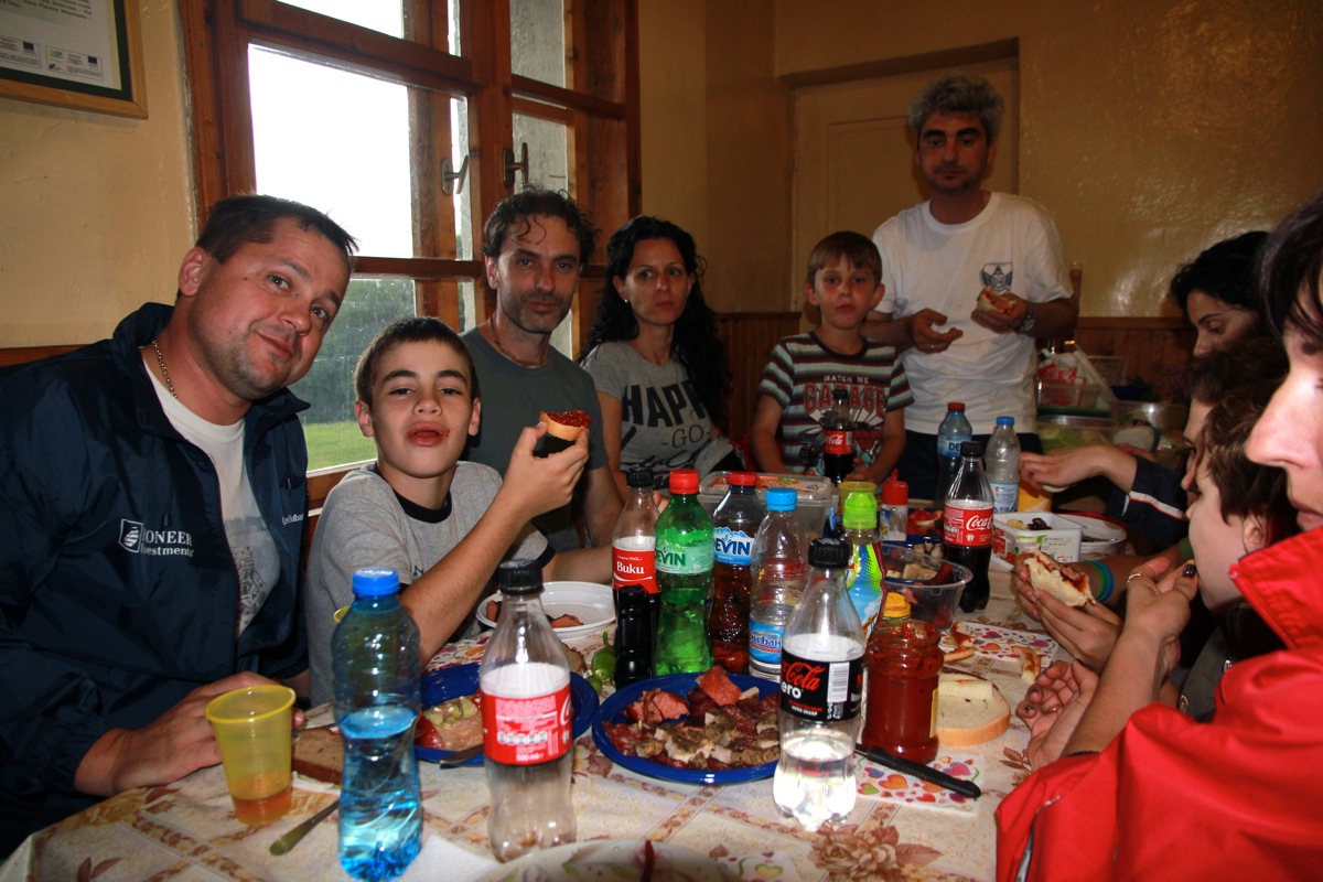
I succeeded to buy some food, a big salad, a couple of kebabs and a large bowl of chicken soup. A bottle of beer (2 lev)
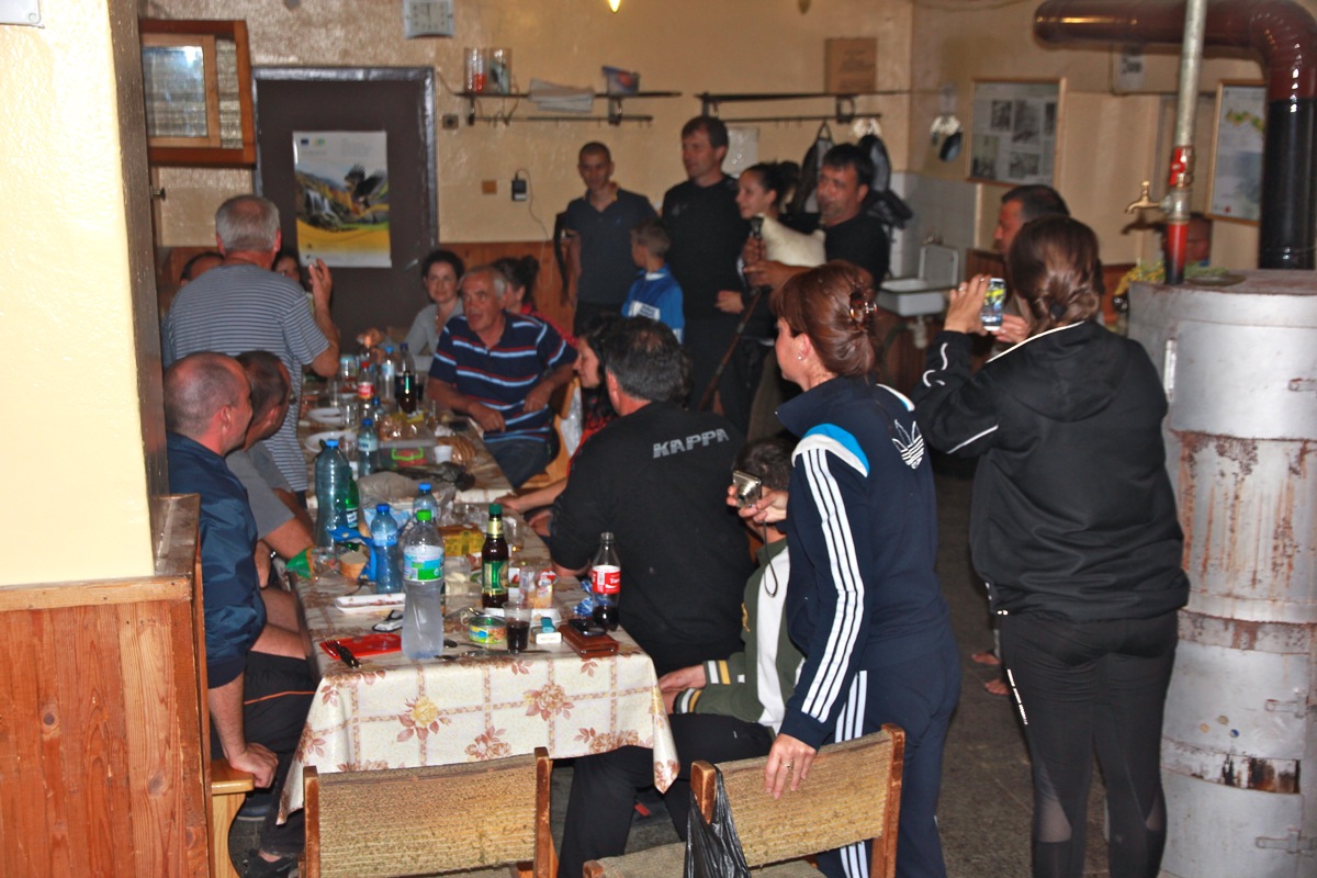
completed my meal. Later in the evening all the local
visitors (close to a 100 persons), had their meals, it seemed that
they largely had carried up their own food.
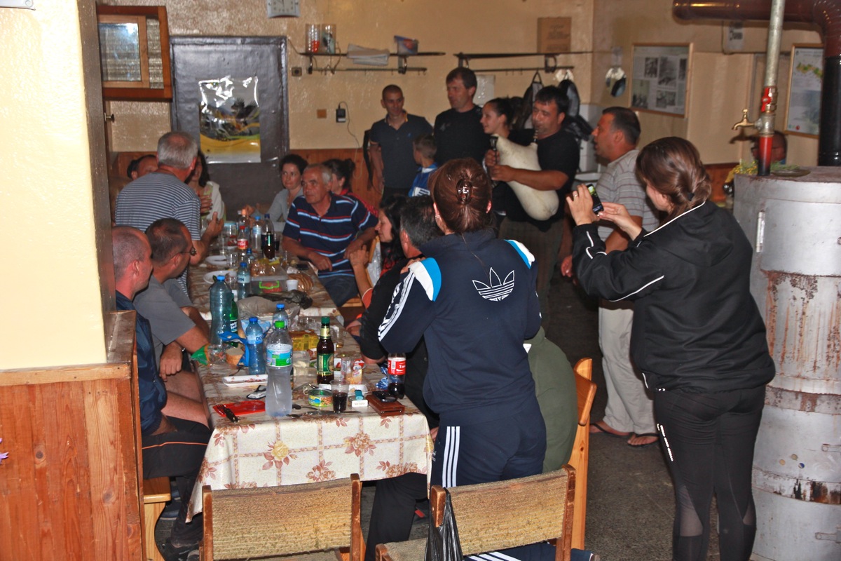
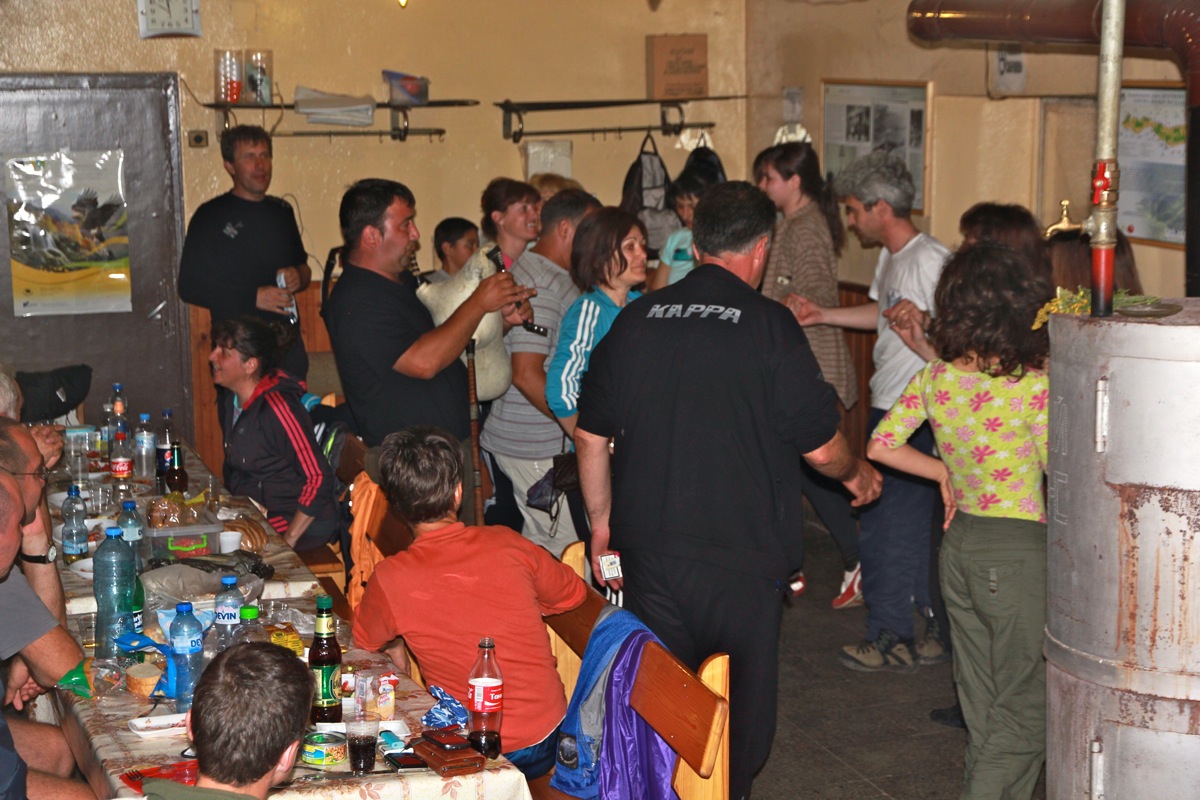
The groups started singing Bulgarian songs,
a man produced his white Gaida,
a bagpipe and soon the little available floorspace was crowded
by people dancing. Quite some party!
I went to bed around 2200 and who knows when the party ended. In any case, I woke up around 0430 and decided to hit
the trail. I was ready to go by 0445, slightly surprised to see that the sky still had stars and that it was borderline
dark for hiking without a light.
I proceeded carefully uphill and the light became better. The trail is very nicely kept and the steeper sections were
well protected. I cleared the cliff bands at 0545 and proceeded uphill along the gentle trail. The summit was hidden
in a single cloud that seemed very stationary.
Perhaps just as fine, this way I did not see the ugly summit buildings before
I almost touched them. Arriving at 0625, the climb had taken 1:40. I stayed around longer than planned due to some mysterious
GPS failure, however by 0655 I started on my way back.
As I descended, the clouds gradually went away. I got a pretty good view
downslope as well as to the nearby ridge.
Animals were also ejoying the fresh mountain grass high on these slopes.
The return hike was uneventful. The first party from the hut
had arrived at the base of the cliffs just as I was descending.
Returning to the hut at 0810, I took a 15 minute rest and a bottle of coke (2 lev). Next, I hiked back to my car.
This hike was equally nice as the ascent yesterday. Predictably, I was again attacked by the shepherd's dog, but he knew
to stay at a safe distance from my sharp hiking poles.
The return hike took 1:40, thus I knew I would return to Heidi in Bansko by early afternoon.
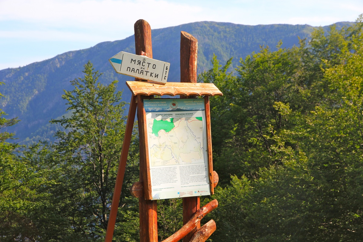
Note on the National Park:
This national park is one of only 3 such parks in Bulgaria.
It has the largest Beech forest (latin: Fagus sylvatica, norsk: bøk) in Europe.
Note on GPS:
I tried more than 15 minutes to get a GPS reading at what seemed to be the highest point.
However, my GPS unit did not find a single satellite. As I moved about 150 meter off the
summit, the GPS immediately had 7-8 satellites. I turned on my "trip computer" and walked back
towards the summit. As I got closer to the summit, suddenly, all satelites were again lost.
My conclusion is that there is equipment on the summit that effectively jam the GPS signals.
It would be interesting to know what the precise cause is. If you read this and do know the cause, please
drop me an email. I cannot recall any other location where my GPS has been jammed like this.
Here is a brief summary of the peaks climbed on this trip.