Cornetto
- Cornetto
- 2180 m.
- Primary factor 1685 m.
- Location: South-West of Trento, Italy
- Location: North 45:59.281, East 011:01.902 (GPS at the summit)
- Difficulty: YDS class 2
- Climbed September 22. 2007
|
|
Information:
How to get there:
This mountain is located south-west of the Italian city Trento. Trento
is on the main Hwy. E-45, connecting Verona to the Brenner Pass.
Take the city center exit in Trento. Already from where you pay the autostrada
toll, there are signs for Monte Bondone. Follow these signs as they take you
through a traffic circle before heading uphill. After about 2 kilometer (from the
traffic circle), there is a road fork with one branch going sharply left with signs
for the village Sardagna. Take this left turn and measure from here. After about
3.5 kilometer, you enter the village of Sardagna. Drive straight through. At kilometer
8.2, in a left curve, there is a small sign for accommodation and
restaurant ("bed and knife/fork" sign)
pointing uphill along a small dirt road that branches right. If you need a place to stay, this
would be my recommendation. (Contact information:
Agritur Malga Candriai di Claudia e Walter, Monte Bondone,
Loc. Candriai 2, 38040 Trento, phone: +39-0461-947526.)
At kilometer 8.5, make a sharp left onto the road that comes from your right. The road continues
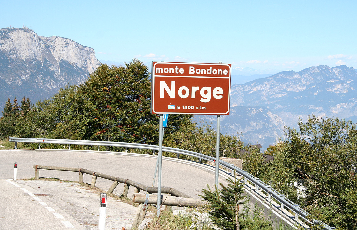
uphill and enters a typical ski area. You pass through several small places,
one is called Norge
(Norway). At kilometer 17.5, you reach the highest point of the road. Continue 3 more kilometer,
at kilometer 20.5, you are at a flat section of the road, with a road going left. Take this road,
after 100 meter you find a large parking area on your left. This is the trailhead, location
N46:01.217, E011:02.595, elevation 1570 meter.
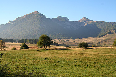
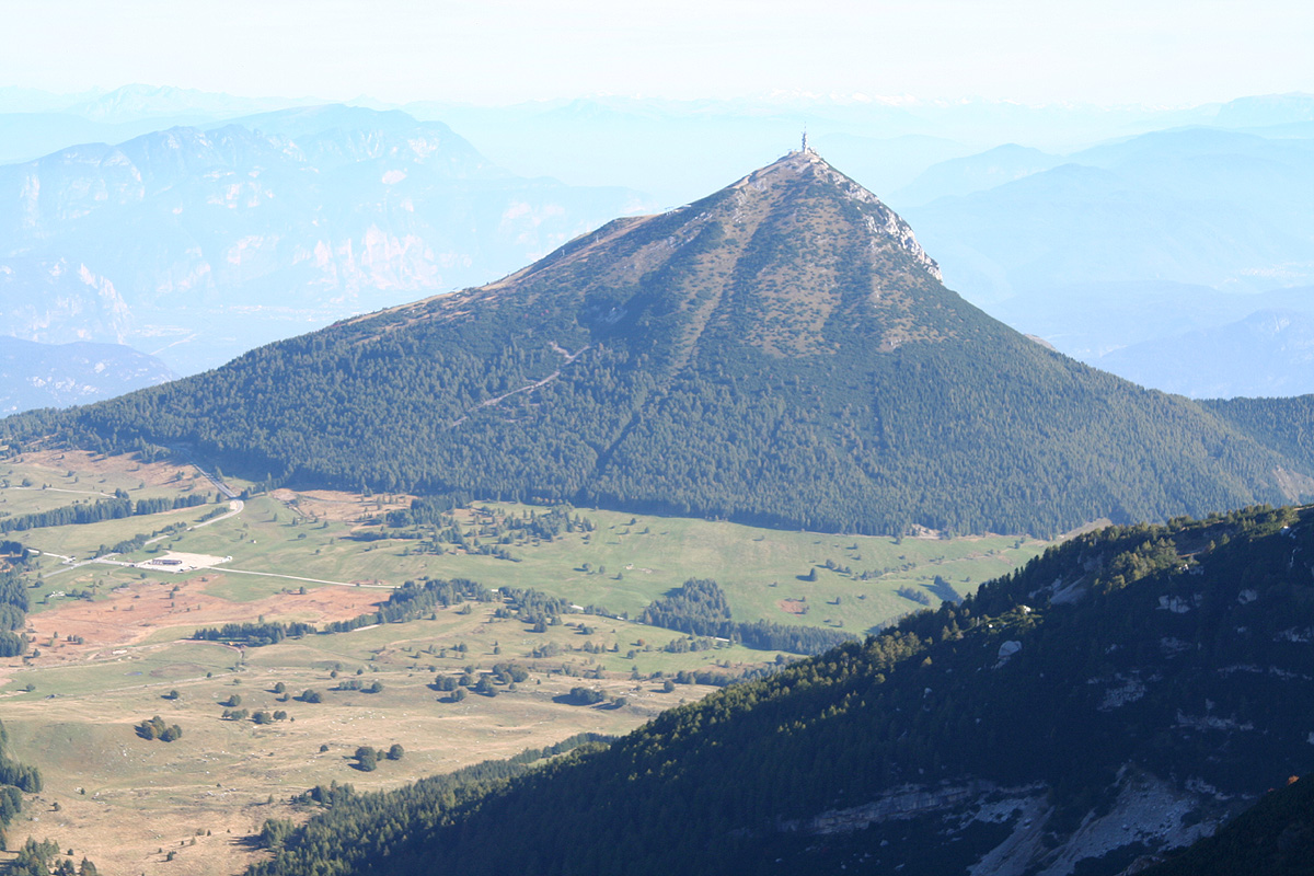
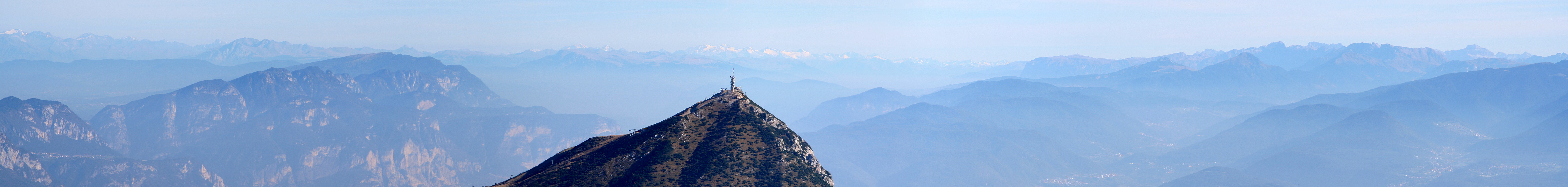
Park here, you can clearly see the three summits,
called the "Tre Cime" of Bondone, across some open fields.
Route description:
This description is a full traverse of all three peaks. The route may also be
done in reverse.
From the parking, continue the road for about 200 meter where a dirt road forks right,
into an area with trees. Follow this dirt road as it sort of curves a bit back (right), before
leading across the open fields towards the slopes ahead. There are few signs in this area, but
the obvious way, which is also the correct one, is to head uphill with your aim set at the
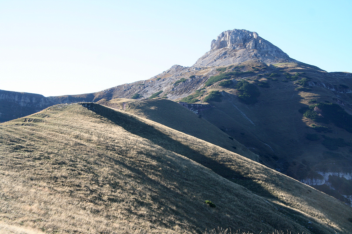
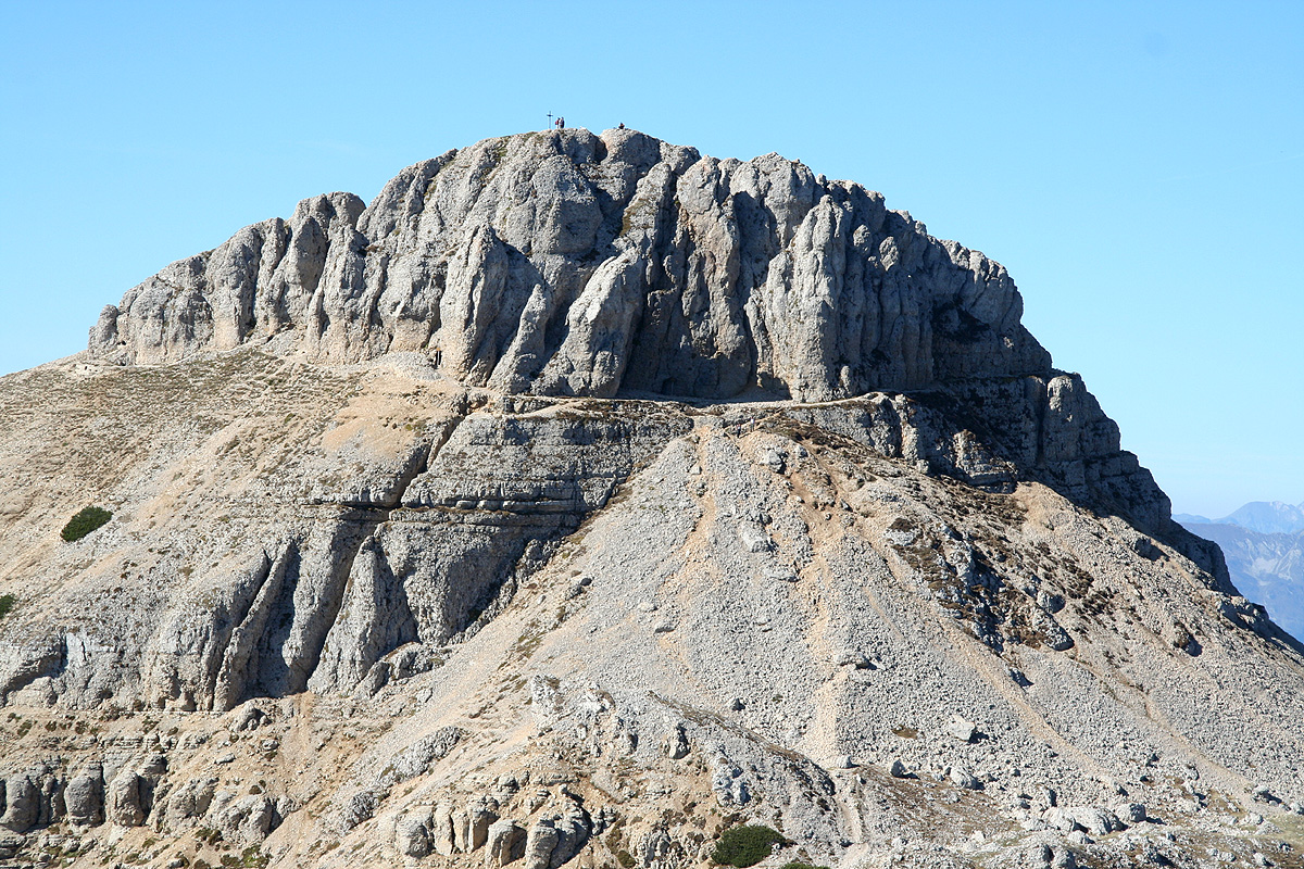
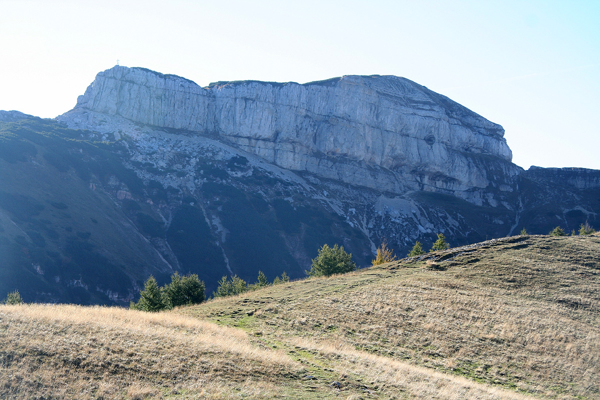
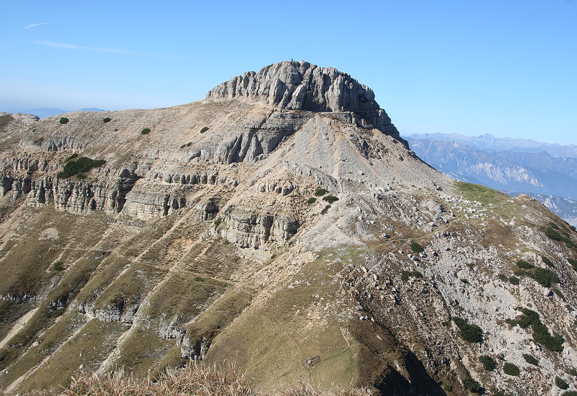
pretty clear saddle that you see on the right hand side of Cornetto, Cornetto is the rightmost
of the three peaks when seen from the trailhead area.
This route is trail no. 607, there are signs, more higher up than lower down.
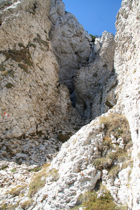
As soon as you start gaining elevation, you
will find traces of an old road leading up to the saddle ahead. The road runs through a small cut
at the very top, and you find signs just at the other side. From here, a very easy to follow
trail (marked) runs uphill through trees before entering the main ridge that
leads up to Cornetto.
Follow this ridge (still on a trail) until just below the final summit rockface.
The trail now runs up and around on your right side when facing the mountain. You may follow
the trail to a new trailsign on the opposite side, or take some smaller trails that heads
uphill a bit sooner. In this area, there is a slightly steeper section, about 5 meter, that
made this route a (YDS) class 2, instead of a class 1 route. Scramble a few steps uphill and
you are back on easy ground for the last few
meter to the very summit.
In order to continue the traverse
of all "Tre Cime", you first backtrack down the same
way you came until you are back down below the cliffs.
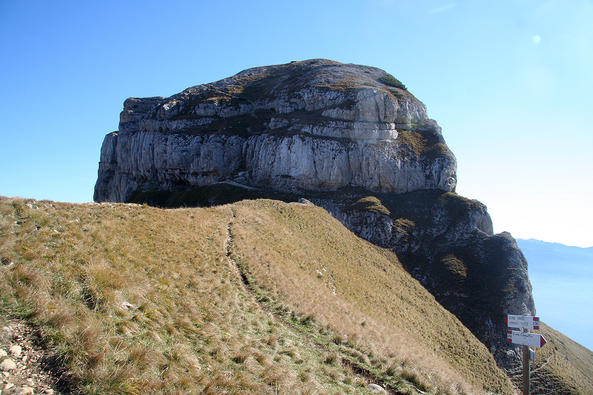
Trail 636 leads from here across to
Monte Verde, bypassing Dosso d'Abramo
(the middle peak) on its left side. There is also a route
that bypasses on the right, it is called "Via Ferrata", indicating that one might want to
carry a self-belay kit for this route (I did not try it, so I do not know how steep it is.)
Finally, there is a middle route, called 638A, that traverses Dosso d'Abramo. Both the
ascent and the descent of this peak are (YDS) class 3 terrain.
The steepest part of this route is the ascent, but there are fixed cables as well as a few
iron steps that guide you up. (This route would be YDS class 4 without the artificial help.)
Thus, a larger party might consider splitting up, some being more comfortable with bypassing
d'Abramo along trail 636, while others traverse across its summit, in order to meet again
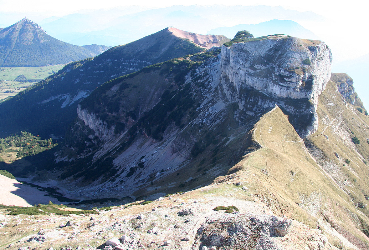
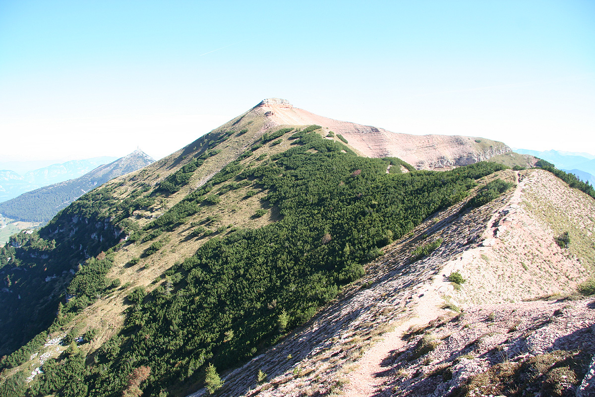
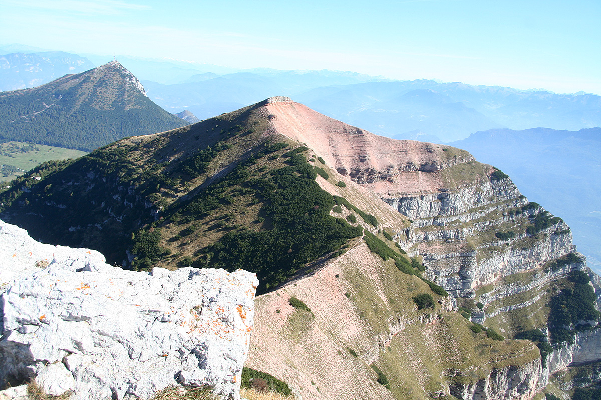
at the other side before climbing Cima Verde, the last mountain.
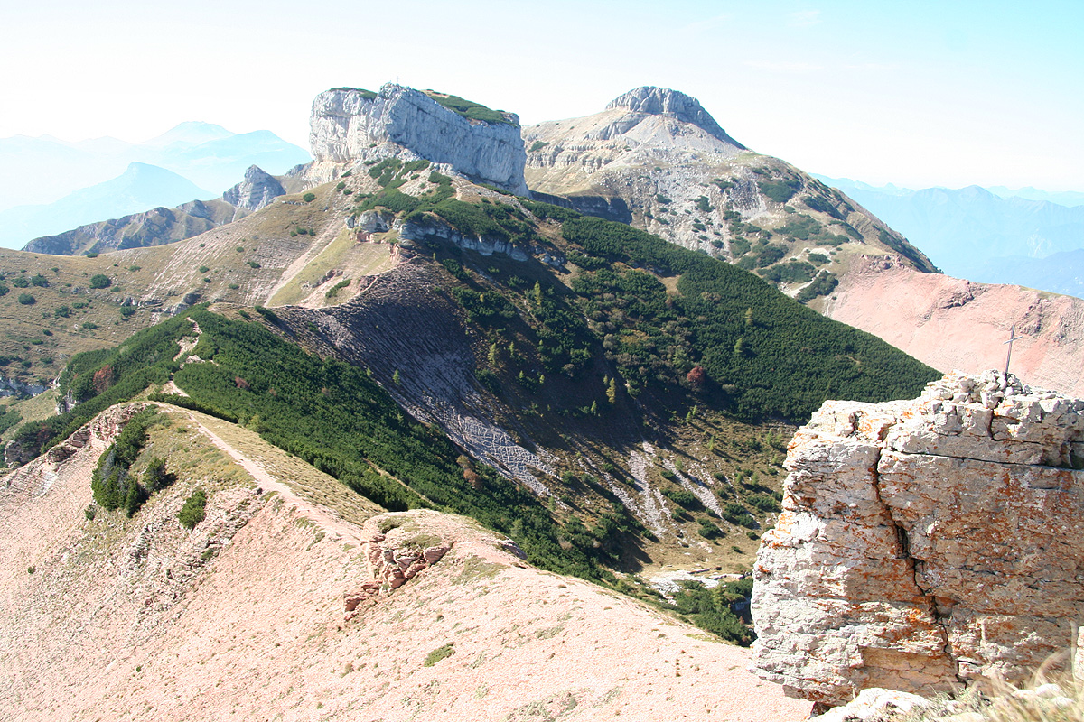
As soon as the cliffband has been climbed, you arrive at the highest point. However, Dosso d'Abramo
has a second summit (at the end facing Cima Verde) with a huge cross. There is a short, nice
and easy trail connecting the two points. As you cross the small dip between the tops, you
will notice the descent route going down a steep gully to your right. Backtrack to here and
descend carefully. There are fixed cables for assistance.
At the base of Dosso d'Abramo,
the three trails merge and proceed nicely along the
final ridge leading up to the third and final top, Cima Verde. This section is
(YDS) class 1. You must leave the trail and go uphill about 10 meter to visit the
proper summit. From this last summit, you have
a nice view of the route across the
three peaks.
Trail 636 now descends directly down the Cima Verde ridge. Mostly among the
trees, the trail eventually hits a large trail at the base. There is a sign here pointing
uphill (the way you just came) saying "Tre Cime", if you do this hike in the reverse
direction, then this sign is important to find.
In order to get back across the open fields, again the trails are poorly marked. I followed
a path that crossed the flat, grassy area and brought me back to the dirt road in the
small forest area where I started out. There are likely several variations.
Aside from Cornetto (which is a European Ultra prominent mountain)
the two other summits do not have enough prominence to qualify
as independent mountains, despite their nice appearance.
A few facts about these two summits are summarized here:
Dosso d'Abramo:
- Elevation: 2140 m
- Primary factor: 83 m
- Summit loc.: N45:59.362, E011:02.248
- Saddle loc.: N45:59.336, E011:02.093
- Difficulty: YDS class 3.
Cime Verde:
Elevation: 2102 m.
Primary factor: 65 m.
Summit loc.: N45:59.747, E011:02.684
Saddle loc.: N45:59.552, E011:02.491
Difficulty: YDS class 1
Trip Report / Comments:
I left work around 1600 (in Linz, Austria) and drove to Trento, via Salzburg and Innsbruck.
A rather long drive, I arrived in Trento around 2100 and had to decide between finding a hotel
in the city or look for accommodation up closer to the trailhead. There were good signs for
Monte Bondone already from the freeway exit, so I opted for trying to find something up the hill.
I came up to the village of Sardagna, but no signs of any hotel. Driving further uphill, seemed to
confirm my growing fear that this was a mistake, that I might have to return all the way down
to Trento. Then, a small sign with a bed and a knife and fork pointed up right along a small dirt
road. I took it and soon parked outside a house with limited signs of activity. I did catch the
attention of the owner and, as he let me in, I immediately asked if he had a room and possibly some
food. He showed me a quite nice room upstairs, but said that eating (this late) was absolutely
impossible. OK, I was happy as it was and told him that I liked the room. As he helped me carry
some luggage upstairs, he hinted that he might just barely make some food after all.
I was quite happy with the piece of bread that he indicated, came downstairs and got seated at a
nice table. The owner then produced a caraffe of red wine, then a large bowl of salad followed
by a delicious, fried trout. To finish it all, he served some nice homemade cheese. OK, the meal
matched what you receive at a very high level place, I was impressed. He then gave me a bottle of
red wine to take home to Norway. What a way to end a long drive, I knew this trip would be a
success, it already was.
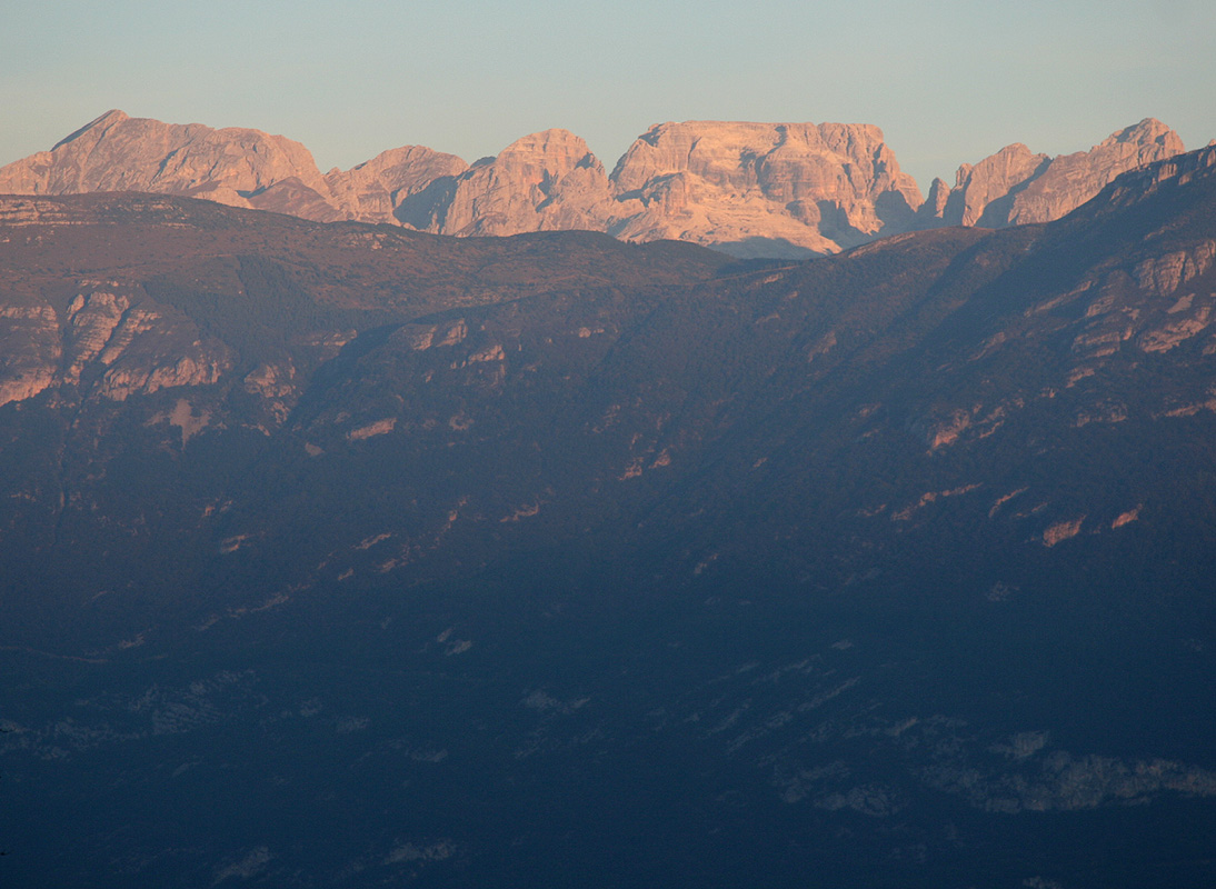
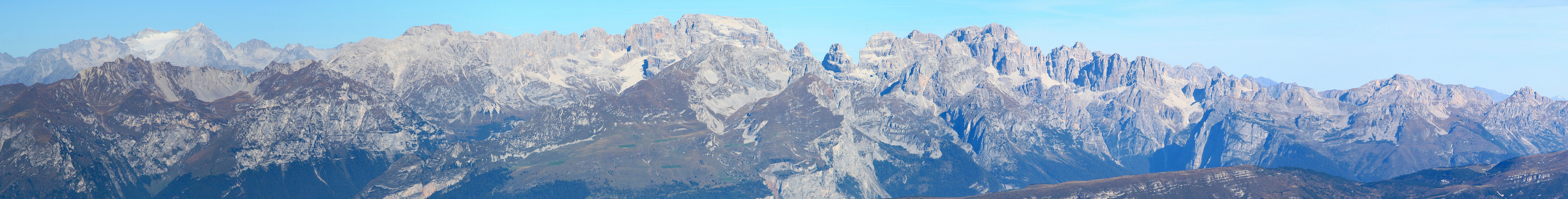
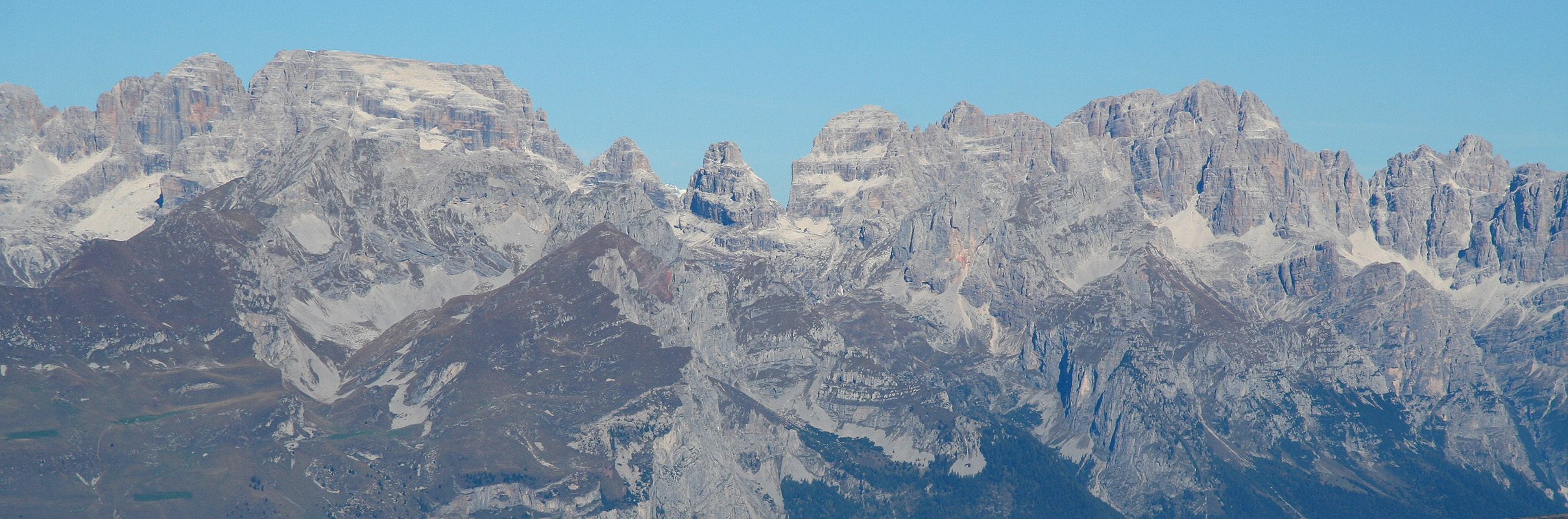
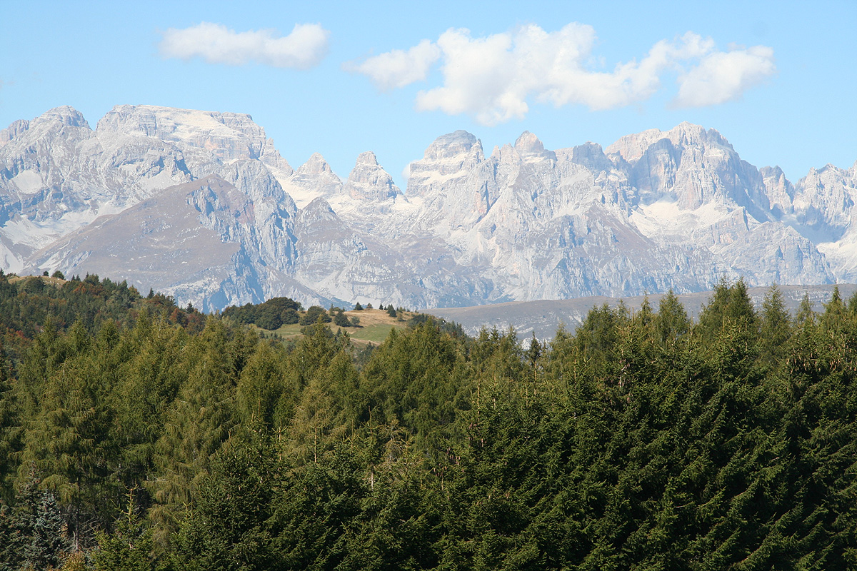
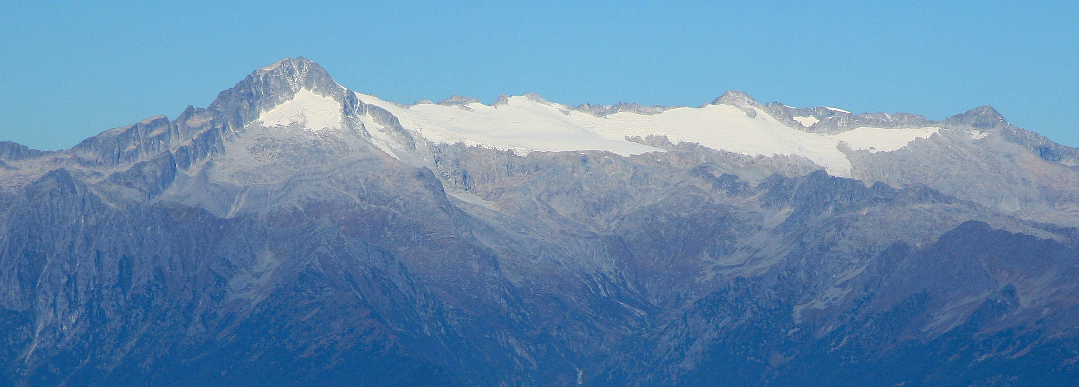
The next morning, brilliant weather.
The sun was hitting the top of Brenta,
as well as the closer Monte Paganella.
Having breakfast around 0730, I checked out, thanked for a very nice stay and paid. He asked way
to little and deserved a healthy extra tip which he accepted with a broad smile. I found the trailhead
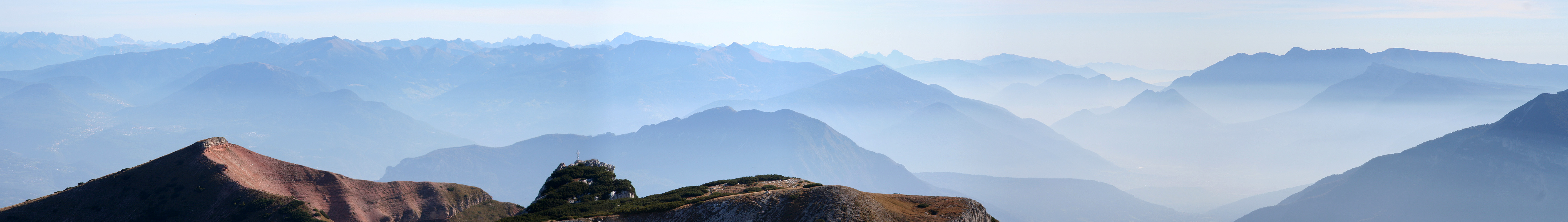
and parked my car. The three summits were pretty obvious, from the parking
it looked like the middle one was by far the steepest.
I started out at 0830, and had a leisurely walk up the old road to the saddle, then through
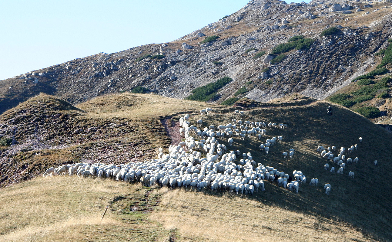
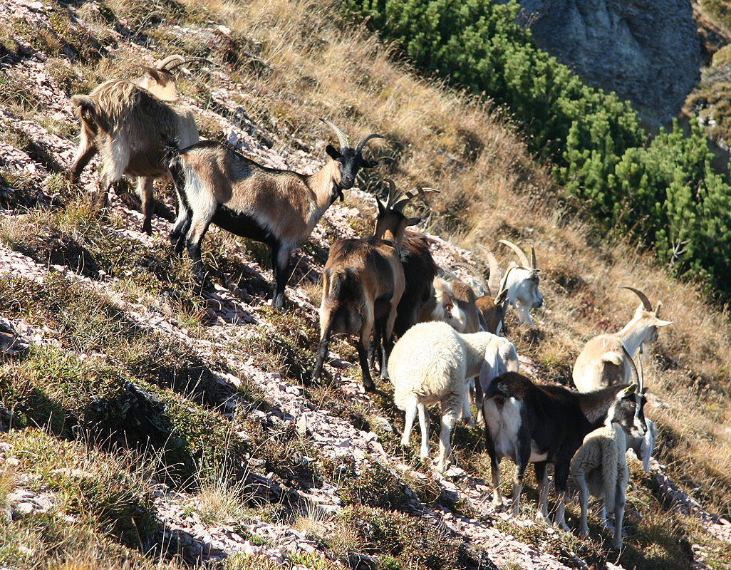
some vegetation (on a wide path), before entering the ride. Being the only person on this
ridge and then in the next moment seeing a good
sized group of sheep coming downhill was
the biggest surprise of the day.
I made
the summit at 0950 after a very pleasant and sunny hike in easy terrain.
In fact, the entire route is (YDS) class 1, with the exception of about 5 meter of class 2 just below
the final summit climb.
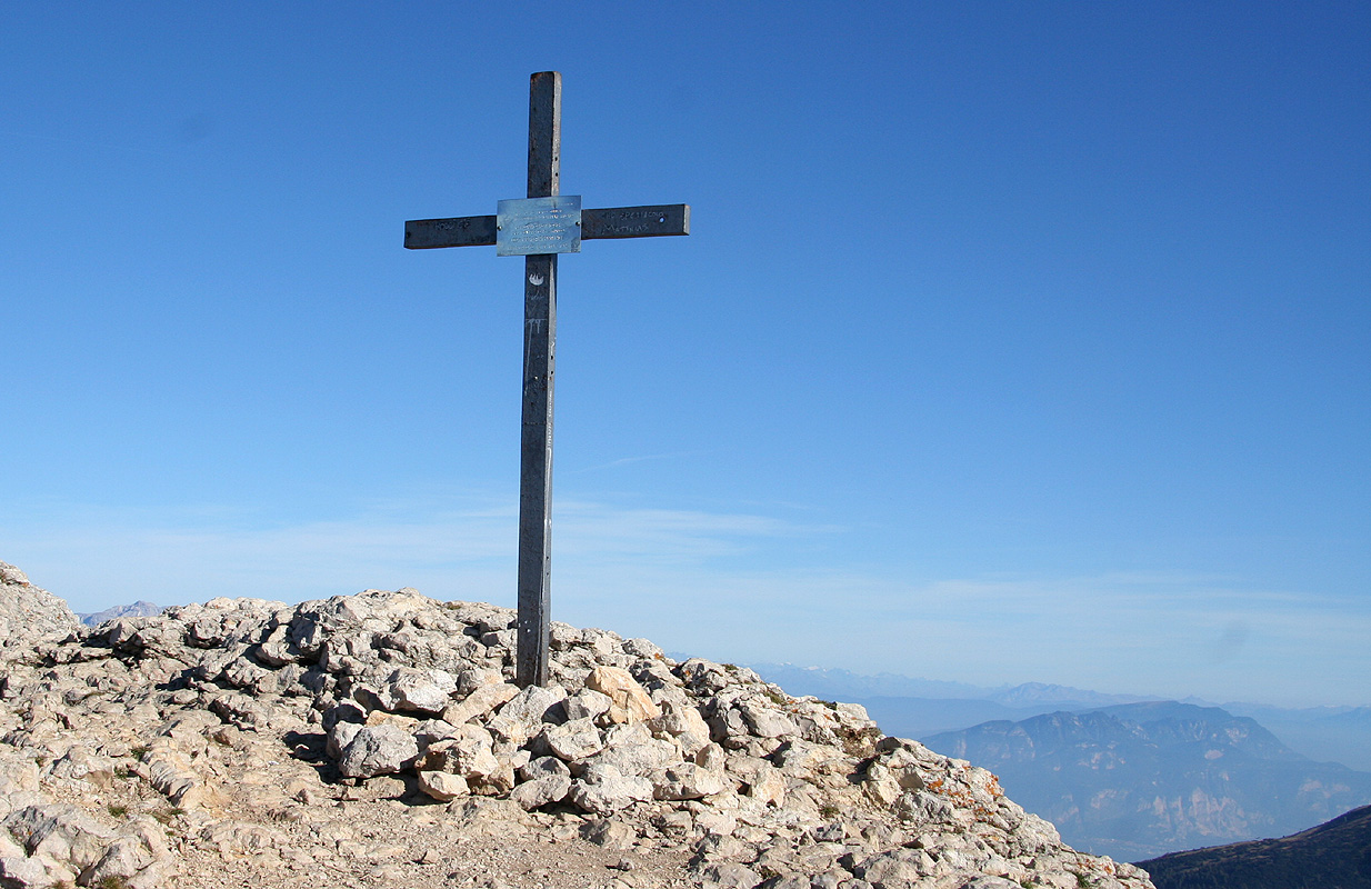
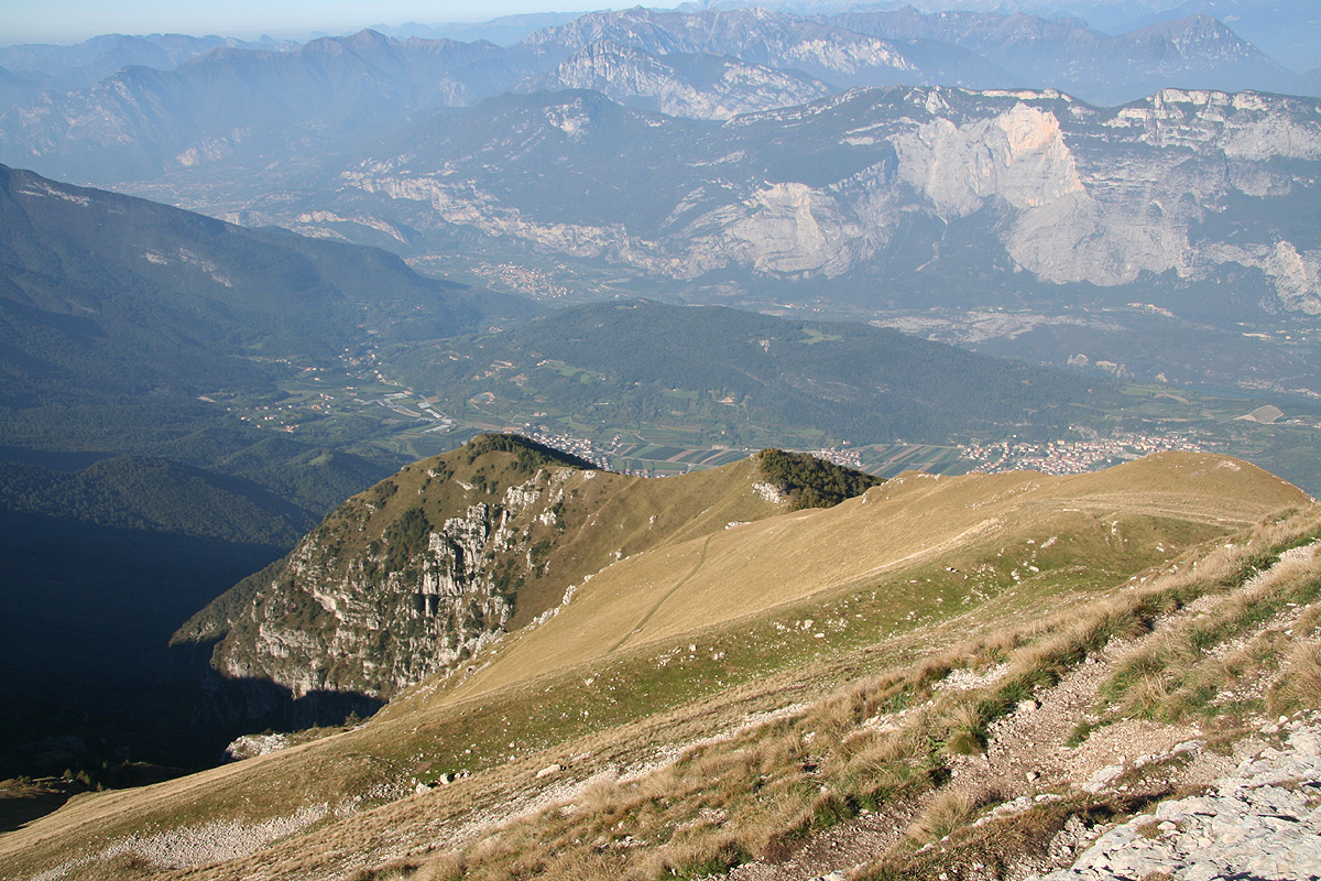
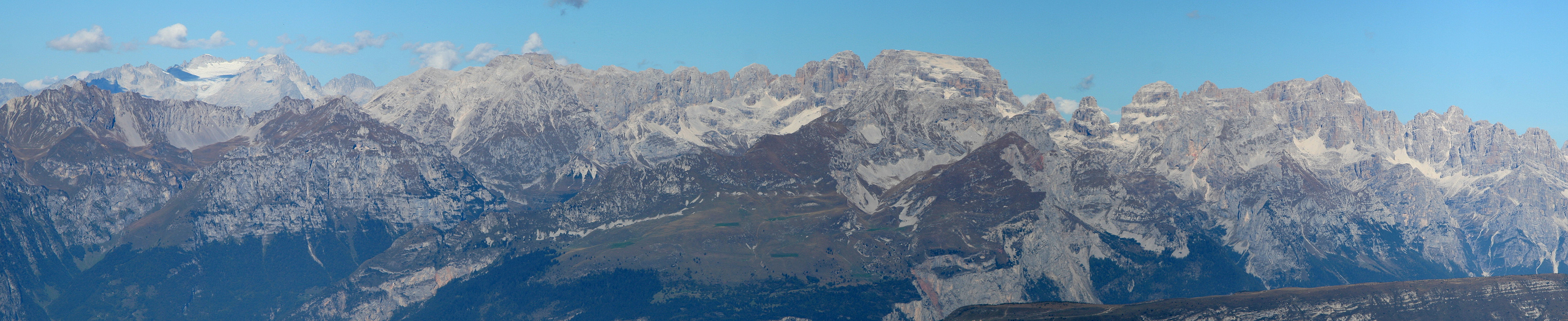
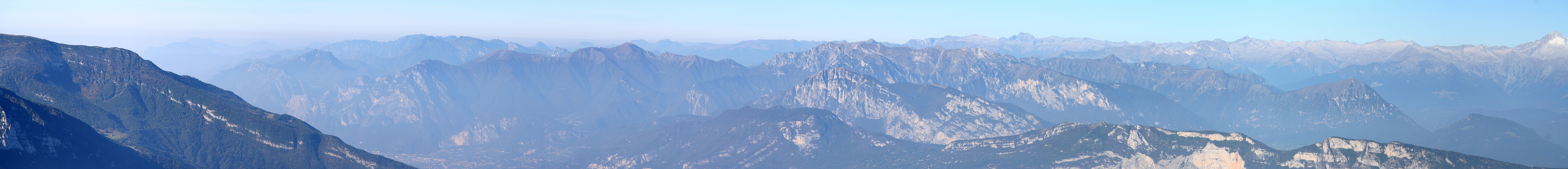
A single guy was already sitting on the summit, enjoying the view.
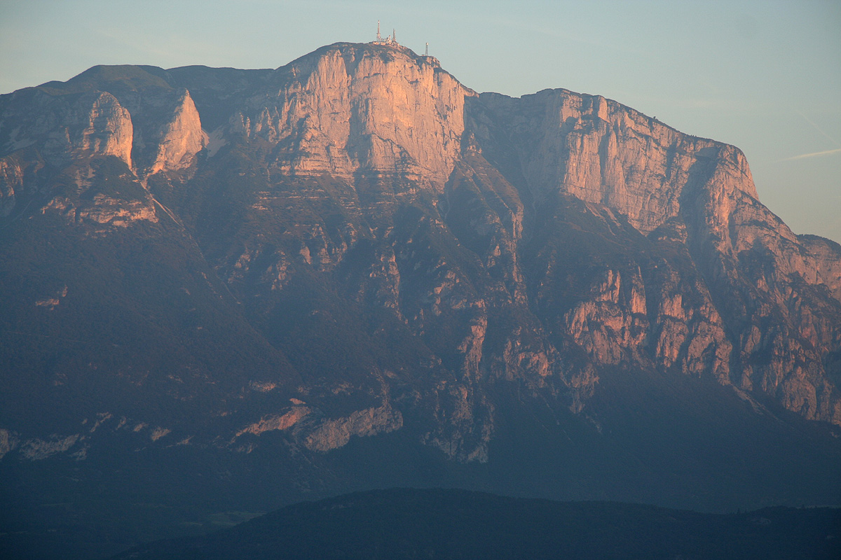
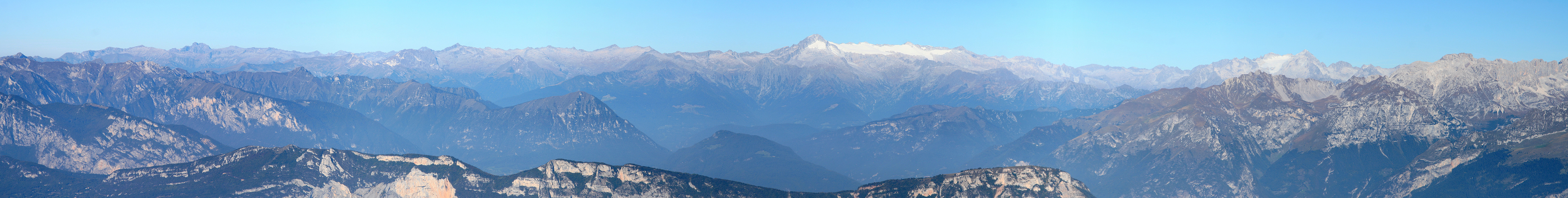
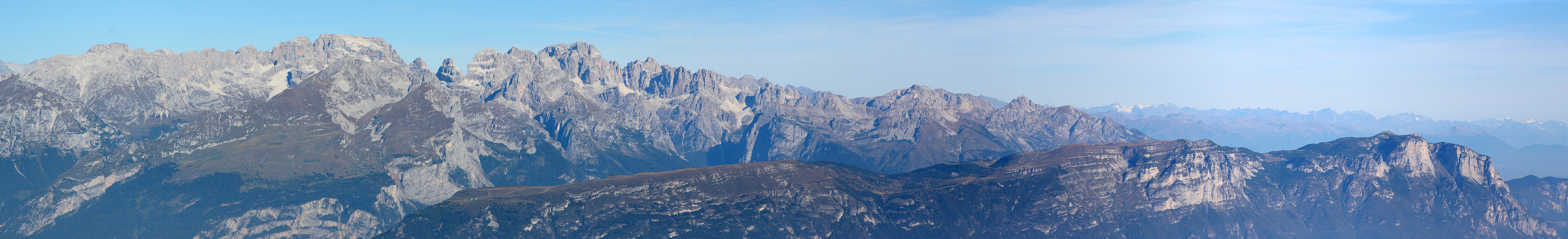
The view is wide, however what keeps
your attention is the fantastic
looking Brenta (group) just across the valley.
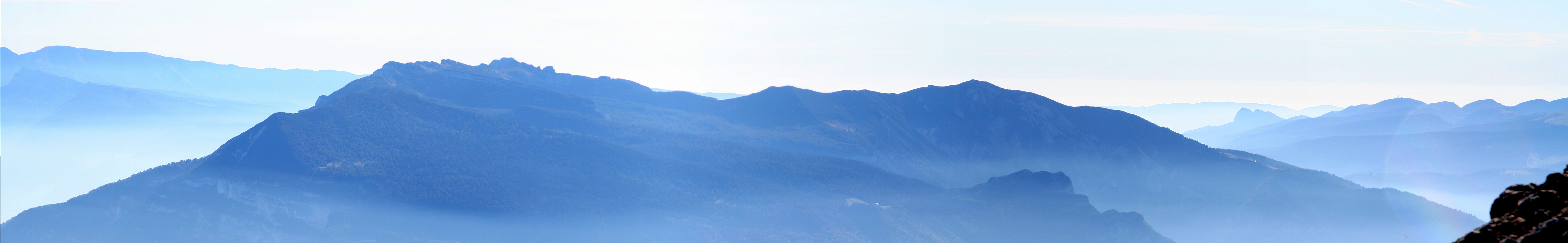
I looked down and across to the next peak, d'Abramo. It was connected with a nice saddle, I could see a
trail heading straight up some pretty vertical looking cliffs, as well as a second trail heading around
on the right side.
Eager to explore the continuation of the route, I started down at 1005.
The cliffs defending Dosso d'Abramo looked hard, but the trail went directly to the
vertical cracks that would be the first place to look for a way up. The next section was
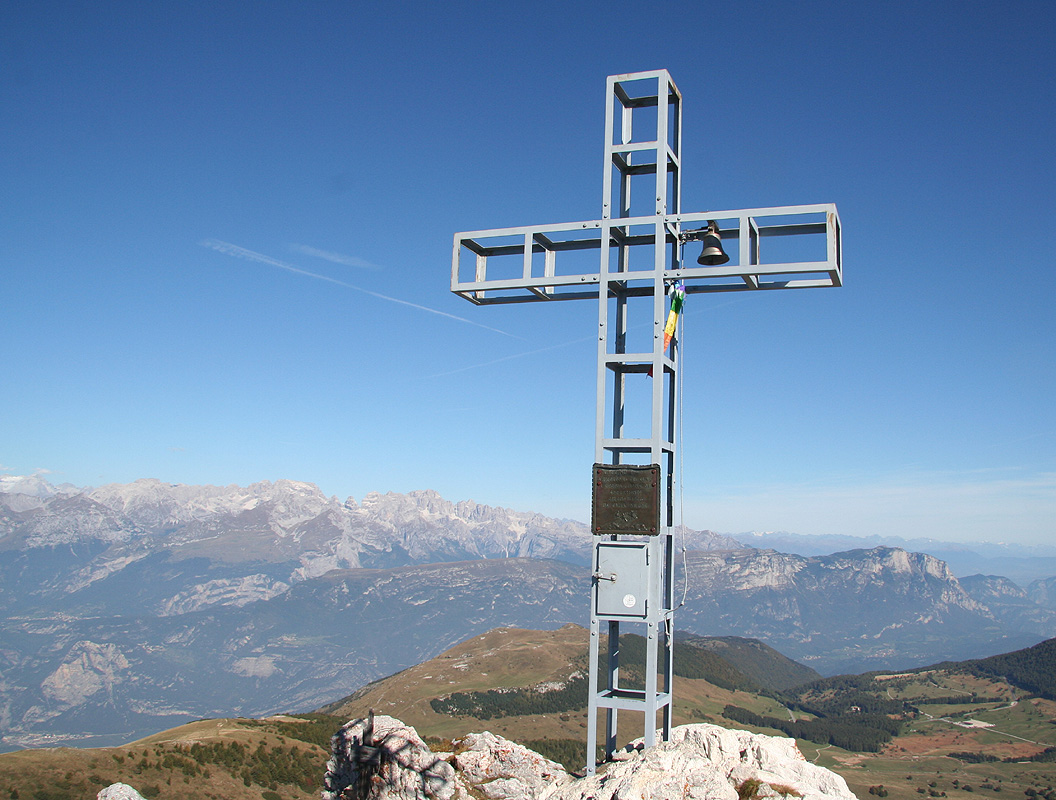
steep, but well equipped with cable and a couple of iron steps. I arrived at the summit
at 1030, continued to the large summit cross
at the top closer to Cima Verde and took another
rest there. On this traverse, one must take a few extra minutes on each summit to admire
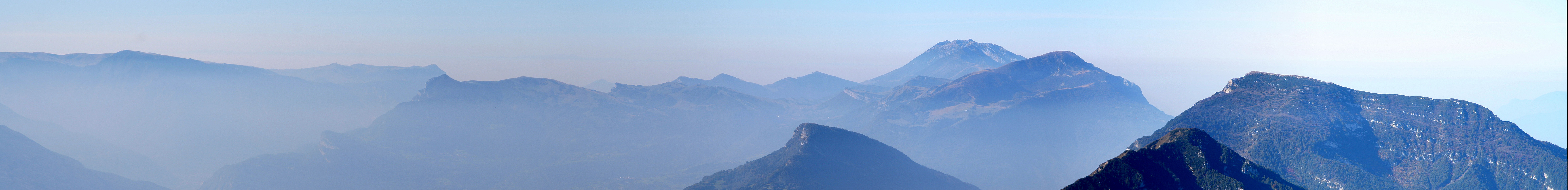
and study the incredible rock formations of Brenta.
The descent back down
to the two other trails was not quite as steep as the
route of ascent, but a cable was also here in place for extra protection.
Local goats had assembled
at the point where the trails 636 and 638A again met. Looking back
up it was easy
to see that this peak only has a few passages that are suitable
for ordinary hikers.
I now enjoyed
the final ridge to Cima Verde,
arriving there around 1115. A good aspect of this traverse is
the excuse for resting at each summit,
they all share excellent views.
Eventually, I started
the descent along a trail that seemed more slippery than one could expect. I was back at the
car at 1215 and noticed that the restaurant right next to the parking was open for lunch and
seemingly quite popular. I got a table, a large beer and a pretty good meal. Looking at the
other guests that obviously just had driven here, I did not feel bad about a somewhat larger
than average meal. A final goodbye to the Brenta
from the parking area, then a nice afternoon
drive back to Austria where Reisskofel was my next goal.
Resources: