Location: North 43.66361, East 142.85413 (GPS at the summit)
Difficulty: YDS class 1
Climbed June 23. 2015.
Information:
How to get there:
This is the island HP. A reference location is the city of Asahikawa.
Drive Hwy. 1160 south-east, signs for the ski area. Asahidake. This road
will take you past a lake, into the valley, then ascend with many sharp turns
to the base of a ski area. There are secveral parking areas, we parked at a pay
parking lot just in front of the building that is the lower station for a
gondola lift. This location is N43.65303, E142.79836, with an elevation
of about 1110 meter.
Here is a quick reference and summary of climbs in the summer of 2015.
Route description:
First, take the gondola lift to its upper station at location
N43.66202, E142.82549, elevation near 1600 meter. There are several
trails and many signs (in Japanese). The correct route runs off somewhat
to your right (when facing uphill), but the extra distance if going more directly
uphill, then right, is small. There should be local maps available as well.
The important point is to get to a small hut near location N43.66113, E142.83275,
elevation about 1670 meter. From here, a clearly marked trail heads uphill following
a ridge-line (or spur). Follow this trail all the way to the summit.
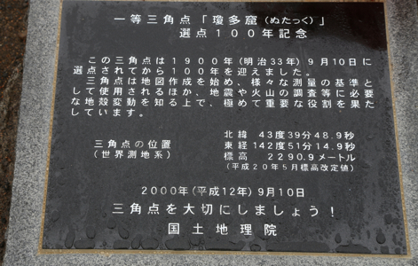
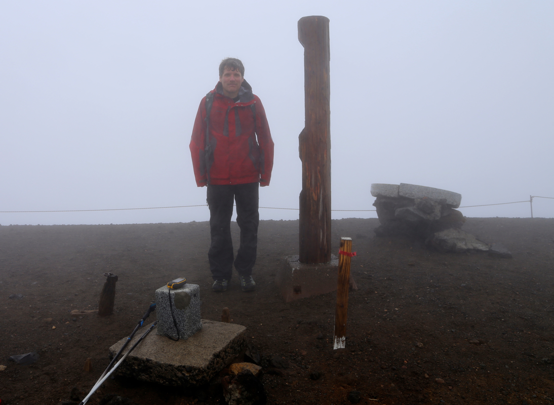
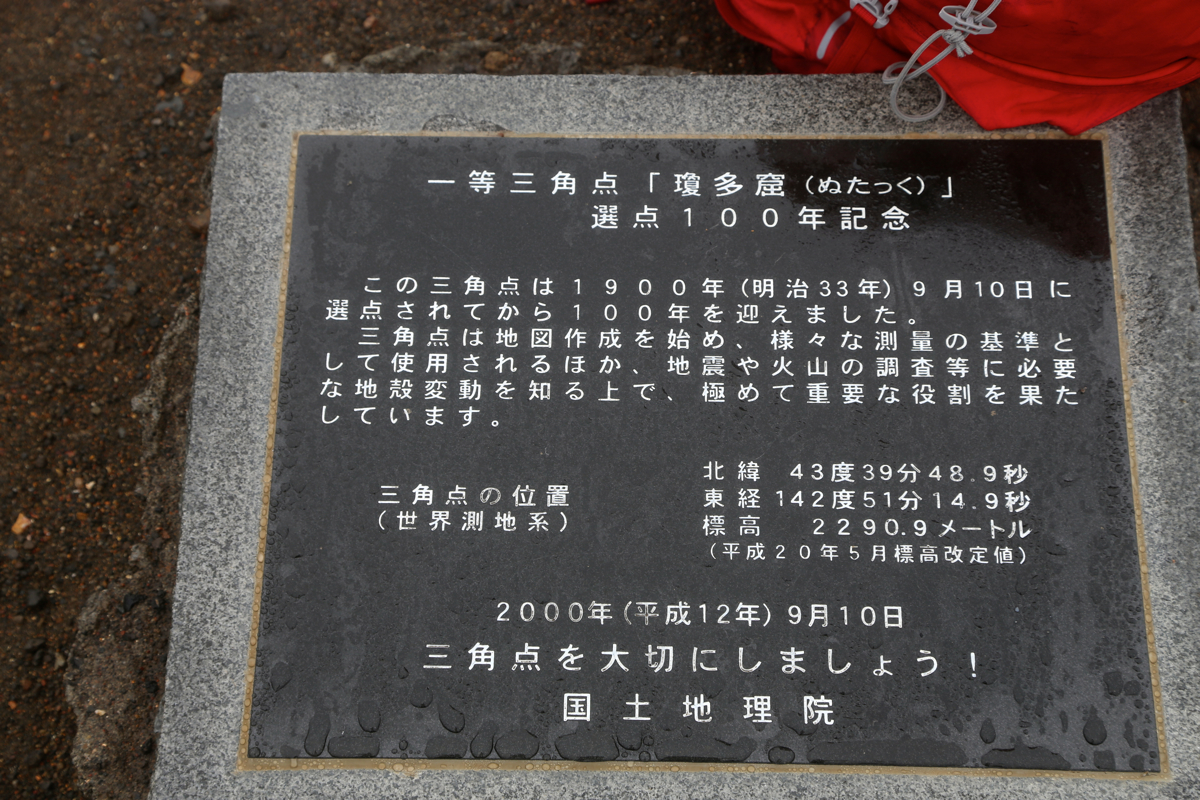
The summit plateau is
pretty large and quite flat, but
with several markers. Comments:
We had driven about half way from our previous peak the evening before and completed
the drive to this ski area in the morning around 1000. The gondola lift quickly took us up into
dense fog with very limited visibility.
We started hiking at 1030 and immediately took the wrong trail, but after a small detour we soon
came to the lower end of the summit trail. From here, one cannot get lost even with almost
no visibility. We crossed a single snow field, otherwise the trail was all a mix of
rocks and scree, altogether fairly stable and not bad to walk. We arrived on the summit at 1200 - noon,
so 1.5 hours up. Nothing to see and nothing to do, we headed back down after 10 minutes. The descent
was rather quick, back at the gondola top station in 45 minutes.