Location: North N48:55.699, W117:27.602 (GPS at the summit)
Difficulty: YDS class 1.
Climbed August 14. 2010
Information:
How to get there:
This mountain is located very close to the Canadian border.
Locate Spokane in Eastern Washington, then drive north on Hwy. 395.
After approximately 62 miles, you are in the village of Colville.
Locate 3rd. Avenue, road 20 turns right at this light. Measure from
this point in Colville.
Drive uphill and turn left at mile 1.1 onto Aladdin Road. At mile
26.5 turn right towards Leadpoint and Dry Lake. Continue your (long)
drive passing Dry Lake (on your left side), then at mile 33.7, turn right
onto a smaller dirt road signed Silver Creek Road. At 34.3, fork left and
continue to a cattleguard at mile 35.2. Stay left at the next fork, mile 35.6,
then turn right at mile 39.9, this road is Forest Road 300. (Forest Road
7078 continues straight ahead at this point, but it is fully overgrown.)
The road is rougher from here and a high clearance vehicle is absolutely preferable.
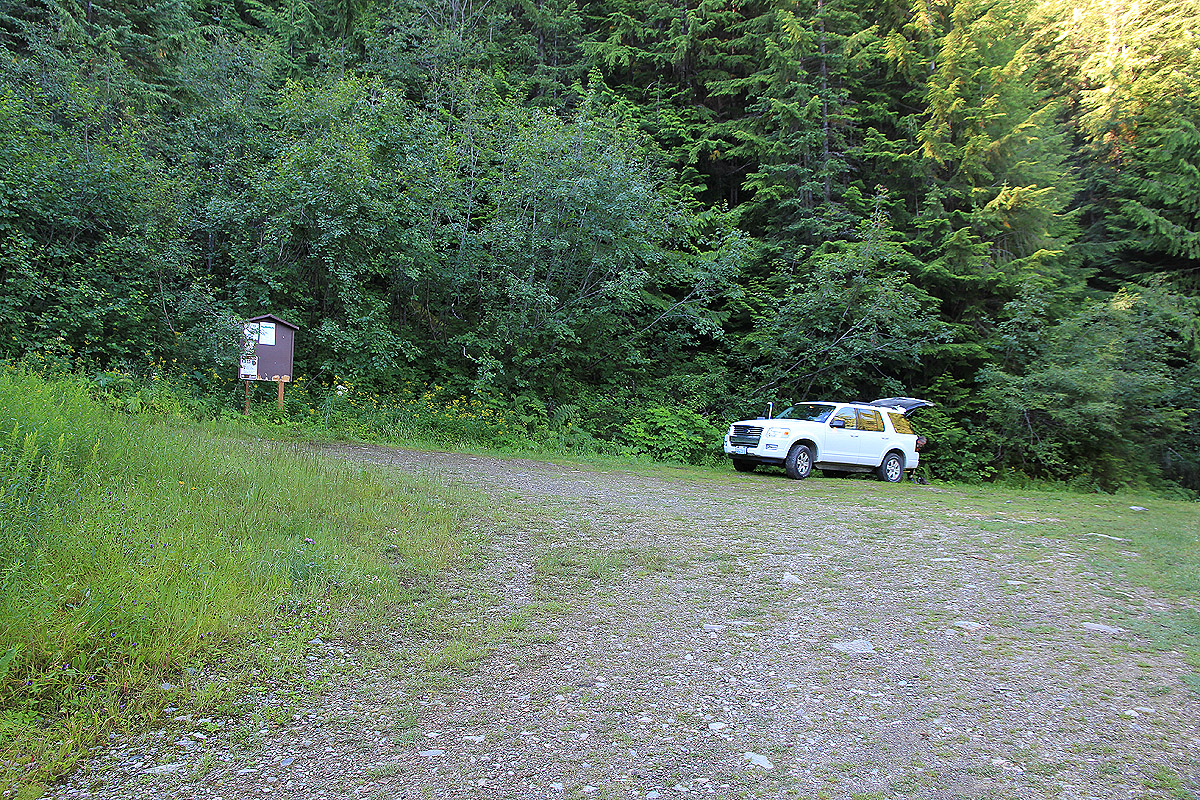
At mile 43.3, the road ends in a small clearing. There is parking for 4-5 cars
and a trailhead sign (for trail 117) on your left side. Park here, the location is
N48:55.928, W117:28.976, elevation approximately 1520 meter.
Route description:
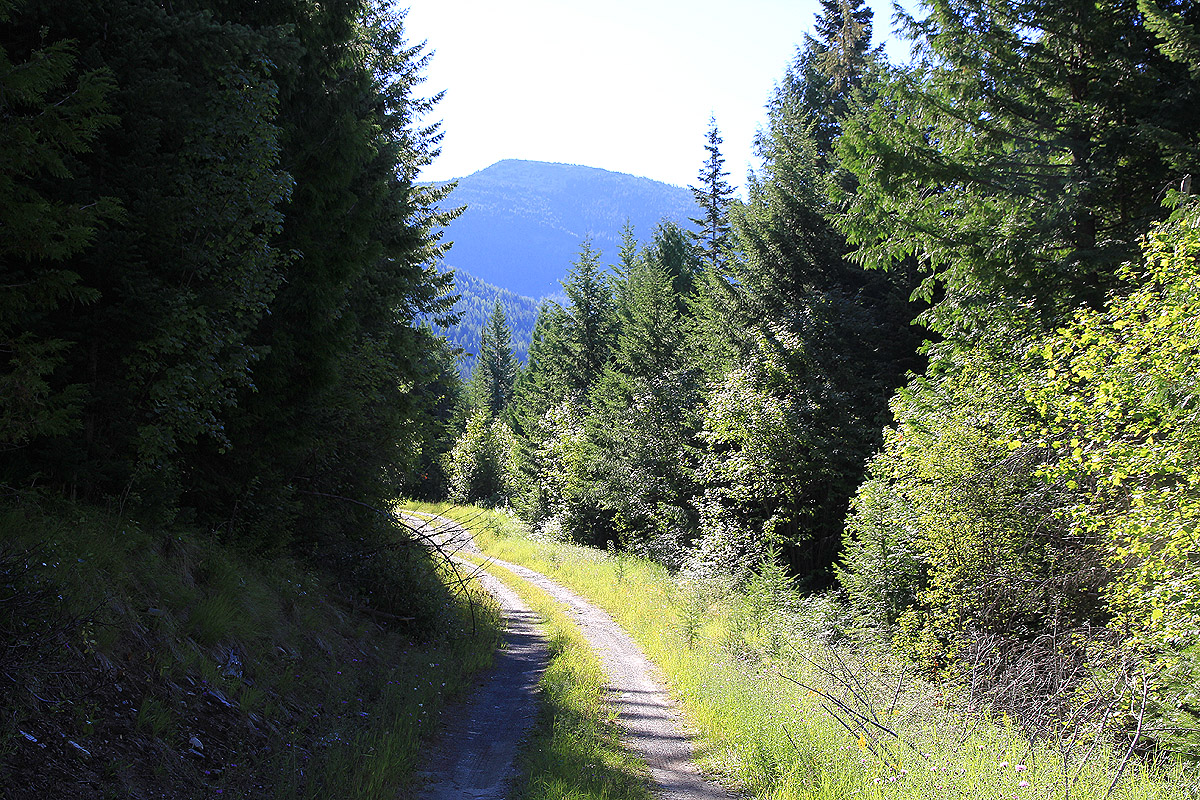
Follow trail 117, starting by the trailhead sign.
This trail runs gently uphill in
pretty large switch-backs through the forest. Initially, the trail is wide as a small
forest road, but possiblly a bit overgrown. Higher up, at a local col, there is
a signed trail fork. Turn left towards Abercrombie and continue a gradual climb up
the hillside, partially turning around the hill as the trail gains elevation and provides
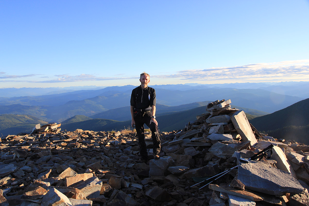
a bit of a view. Eventually, the trail gains a broad and gentle summit ridge and gains
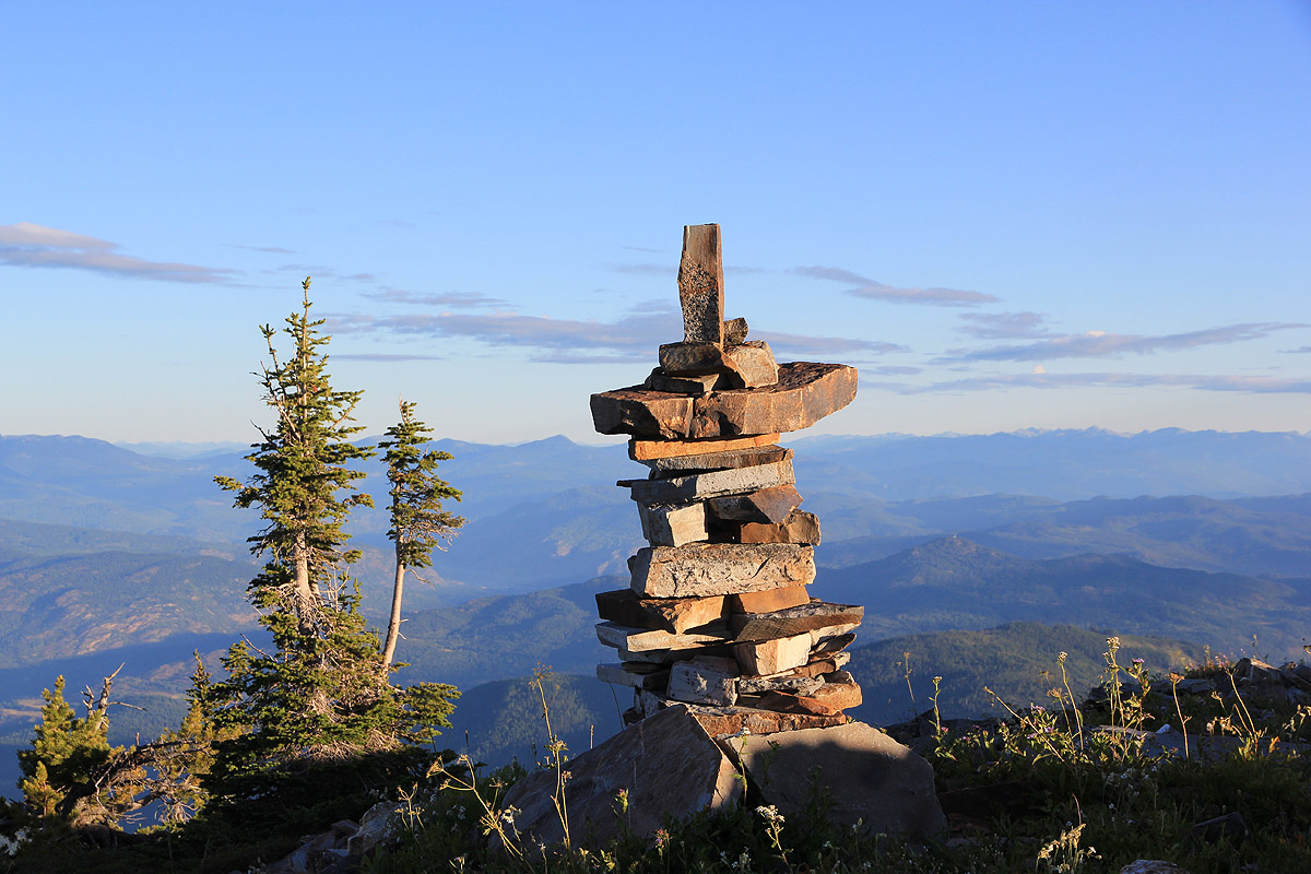
the highest point, barely above the vegetation. There is a cairn as well as a ruin of
an old structure nearby. The summit provides a fine view all around, with nearby peaks
in Canada (BC) as well as further east, perhaps of most interest to the visitor.
Comments:
After our successful climb of Glacier Peak a potentially
very serious problem needed consideration. About 1.5 kilometer from the car, and on a perfectly
flat and fine trail, my right Achilles had suddenly been partially torn. Upon returning to
our Seattle HQ, Ben had helped locate a sports medicine clinic where I managed to get an
immediate appointment Thursday afternoon. After getting through the US health buraucracy
(filling out long forms, measurement of blood pressure etc.),
I finally got to a specialist MD, who confirmed the fact that my Achilles had suffered a sudden
and partial breakage. He took a very constructive approach, advising that if I lived in
Seattle, then a week of rest and physical therapy would be in order, but since I came from
Norway to climb peaks, frequent application of an ice bag combined with a strong anti-inflammation
drug might also provide a path forward. "Live your life and enjoy what you planned to do" was his
get well message as I limped back out to the car. The visit cost about US 150.-, a small and
well justified expense in the larger picture of our planned activity.
Our plan called for meeting Greg Slayden the next day at the Mount Stuart trailhead, then do a
2-day climb. Since I could not even walk, this plan was cancelled and "Plan C" established.
A long drive and no walking, then an easy peak followed by more driving seemed to be the
only realistic start. Thus, we identified Abercrombie, an ultra peak near Canada as our
first goal. This peak did not appear in earlier plans and somewhat counter intuitively, Plan
C included the ascent of 8 peaks, while our original plan called for at most 7 peaks.
We left Seattle on Friday, August 13th. around 1300 and reached Colville around 1830, a good
time for dinner. After an unusually long drive to the trailhead, we arrived around 2030, just as
it got dark. Sleeping in the car, we aimed for an early start and hoped my right foot would
show signs of improvement.
We started out at 0515 the next morning and I immediately noticed that the pain in the ancle area
had gone, while it felt like a knot had formed higher up in the muscle. Not very comfortable, as I
felt some pain in every step, but we still kept a good pace and arrived at the summit by 0630.
We enjoyed the wide view and speculated on the name of a pretty dominant peak north in Canada.
(It turned out to be Old Glory Mountain, 2376m, pf=1046m.) By
0645, it was time to head back down, reaching the car at 0800. A very easy "hike in the park",
I could now ice my leg and rest it as we embarked on another long drive
south to the Devils in
Idaho.
On my flight back to Norway, I spotted a fellow passenger with a T-shirt that read Abercrombie,
I was highly amused that this remote mountain somehow had gotten its own T-shirt. Upon mentioning
this to my wife, I quickly learned the truth, Abercrombie is a 10.000 employee, dollar 3.5 billion company,
oh well, there are many ways to learn basic facts in this world.
Resources:
Images
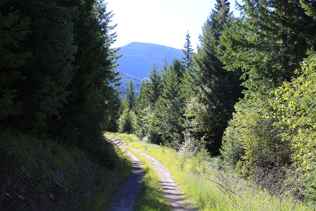
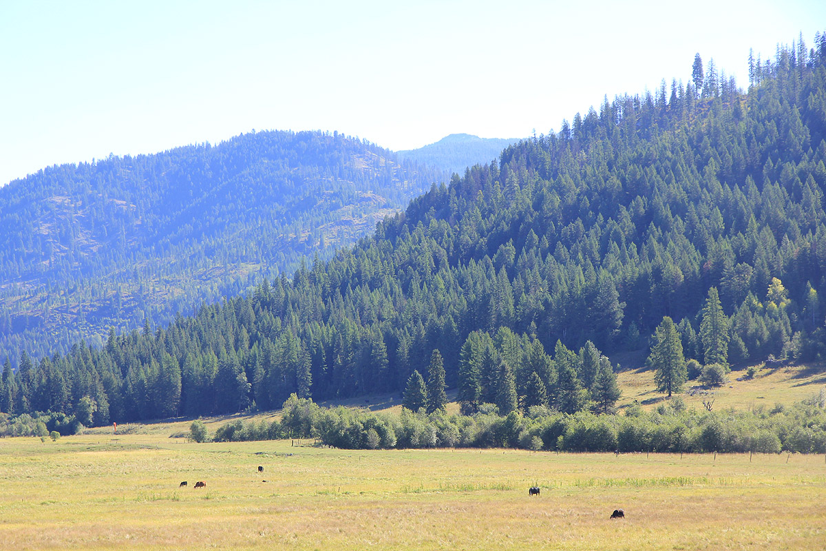
Abercrombie, as seen from the road serving the trailhead.