Location: N36:40.558, W004:59.776 (GPS at the summmit)
Highest in Malaga
Climbed November 21, 2004.
Difficulty: YDS class 1.
Information:
How to get there:
From Malaga, go west along the sea passing Marbella to the exit at
San Pedro. Go north on A-397 towards the city of Ronda. This road has
kilometer markers that count down. The trailhead is on a sideroad that
goes right after kilometer 14 and before kilometer 13. This road is marked
with a big sign saying Parque National Sierra de Las Nieves. Further, there
is an arrow pointing to Los Quejigales. This location is NN36:39.646, W005:05.960,
at elevation 1079 meter.
The first 800 meter of the road is
paved, the rest is dirt, but aside from some bumps and humps, the road is
quite fine for ordinary cars.
There are a number of smaller roads forking off, stay on what appears to be the
main road. Just after crossing a (dry) creek on a bridge, keep left when the road forks.
The trailhead with parking is located 9.7 kilometers
along this road, elevation 1285 meter, coordinates N36:41.436, W005:02.713. Route description:
Continue about 100 meter along the road from the parking and find a sign with an
outline of the route on your right hand side. The trail leaves the road here, crosses
the (dry) creek and climbs almost 500 vertical meter in several switchbacks. On the top, at elevation
1752 meter, location N36:41.352 W005:01.323, the trail crosses the upper end of a dirt road
that serves a small building on the nearby summit (at elevation 1782 meter).
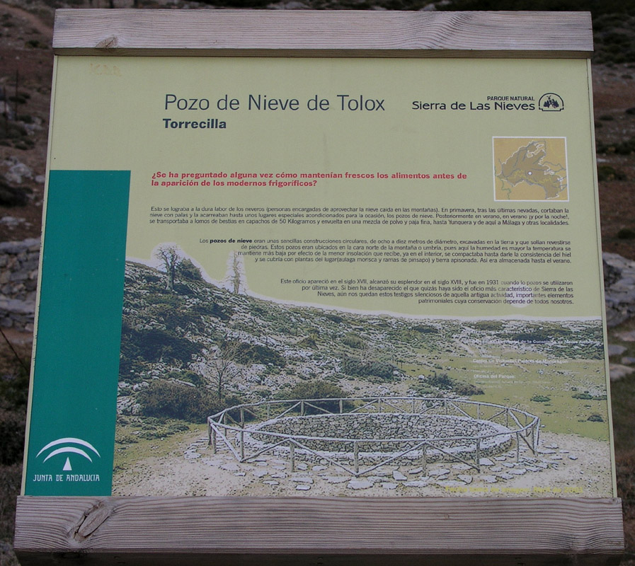
The trail continues more level, descending gently and passes a circular
stone structure with an information sign
in Spanish. There is a trail forking left at this point. Further ahead near a saddle
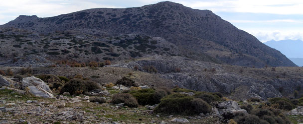
at elevation 1712 meter, yet another trail forks left while the trail to Torrecilla crosses
the saddle and climbs gently in order to cross the higher terrain that lies ahead. The trail
continues down to a second, more distinct saddle, again at an elevation of about 1712 meter, then
curves right and crosses to a final low saddle right next to Torrecilla proper at elevation
1687 meter, location N36:40.926, W004:59.825.
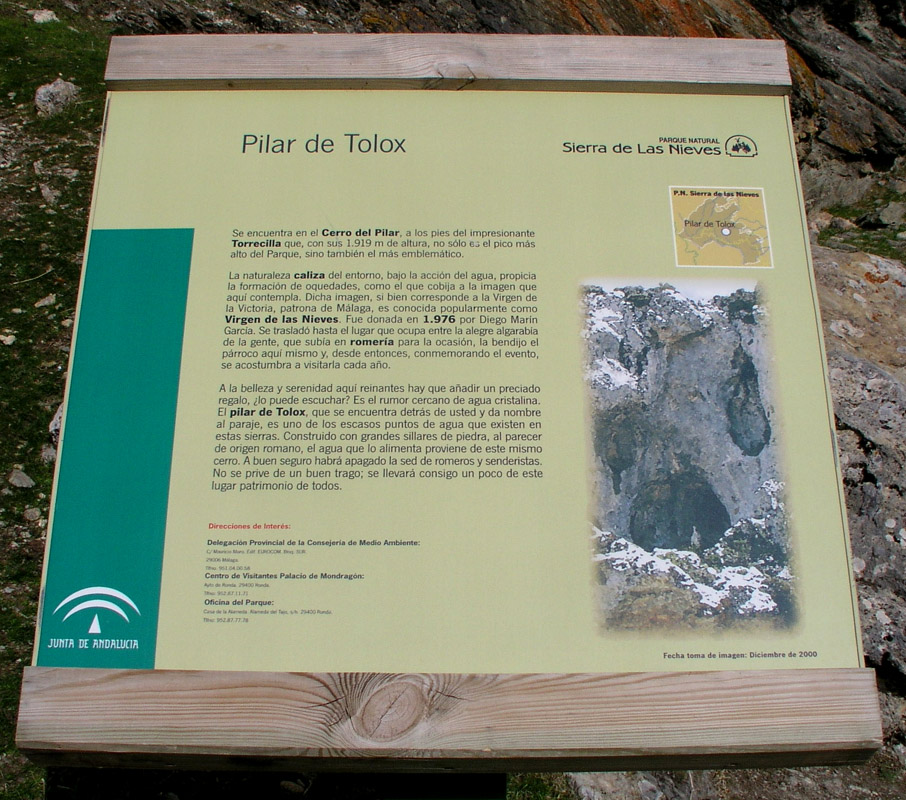
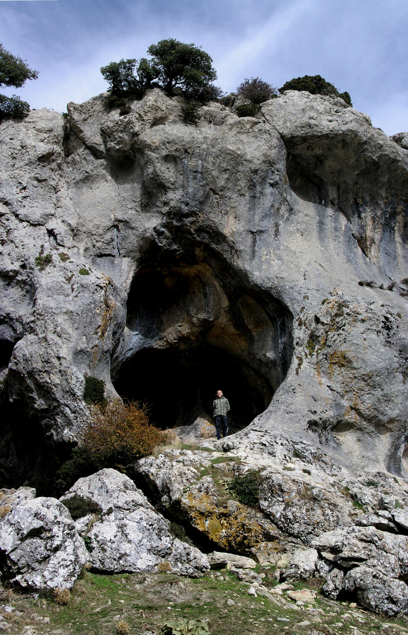
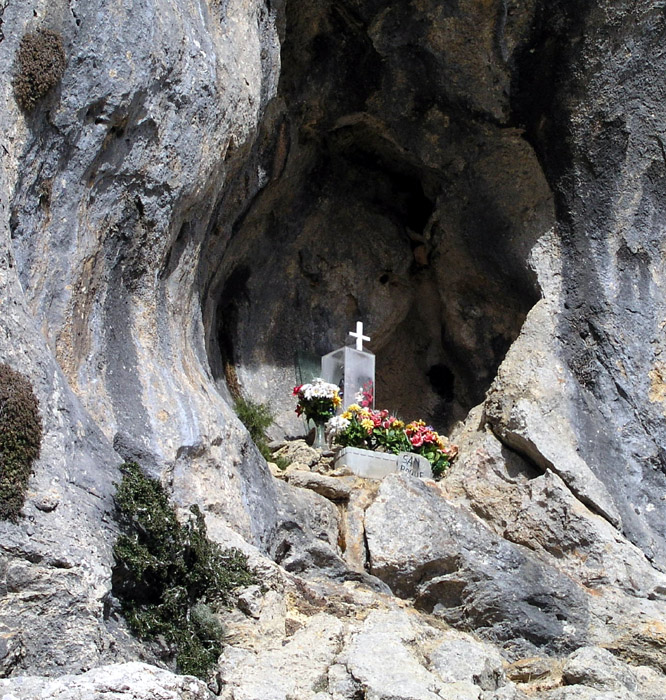
There is another information sign
here and quite interesting
rock formations
with shallow caves, some of which houses religious symbols.
What remains is about 230 meter vertical gain along a somewhat steeper hill, still following
a well developed trail to the summit. Comments:
I did this hike with my son Pål Jørgen, age 15. We started from the car at 1000,
arriving at the summit at 1215. We had lunch and started the return hike at 1245. We visited
Point 1812 for extra credit at 1345 and were back at the
car at 1515.
We actually drove only 7 km from Hwy. A-397 and parked at
N36:40.517 W005:03.160, elevation 1264 meter, where a smaller road forked off to the right.
There is good parking here and since we did not know about the proper trailhead, we feared that
driving further would get us too high and too close to the actual summit. We followed the main road onwards,
but took a road that forks right shortly before the trailhead serving the antenna building at 1782 meter.
This road was closed to
traffic by a chain, however several jeeps carried some people all the way up there.
The lower part of the Torrecilla slope was covered by green protective material, each serving
a new baby tree. This tree planting project possibly contributes to erosion control just as the
numerous small stone walls that could be seen across every little gully. Appearently, a flood
control measure trying to keep rain water in local accumulation, thus delaying what otherwise
could be quite a bit more rapid runoff of surface water.
When doing this hike one should not miss a visit to the historic city of Ronda. Ronda is
split by a very narrow, but more than 100 meter deep canyon.