How to get there:
From Kupang on West Timor, drive the Hwy. towards the town of Soe.
Turn left (north) near location
S9.97256, E124.0703. This is about 5 kilomter before the Soe road crosses a major river.
Follow this (good paved) road north, keep left at location S9.6726, E123.9950.
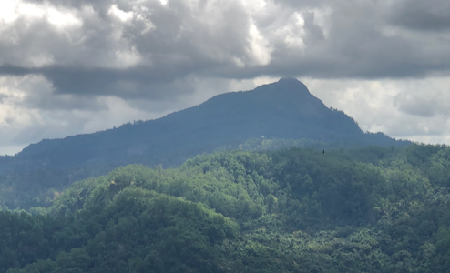
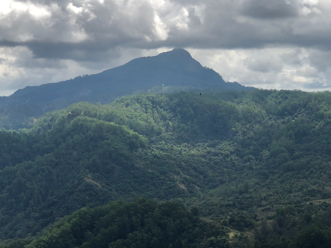
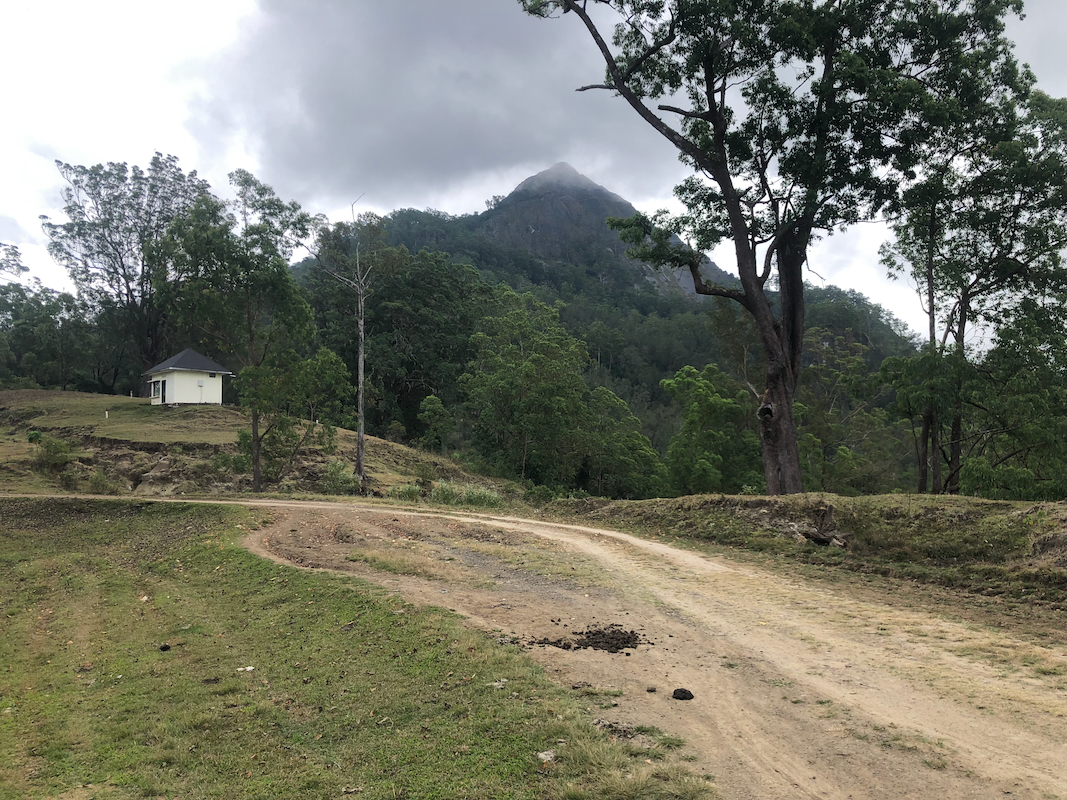
You will see the peak
quite some time before you are there.
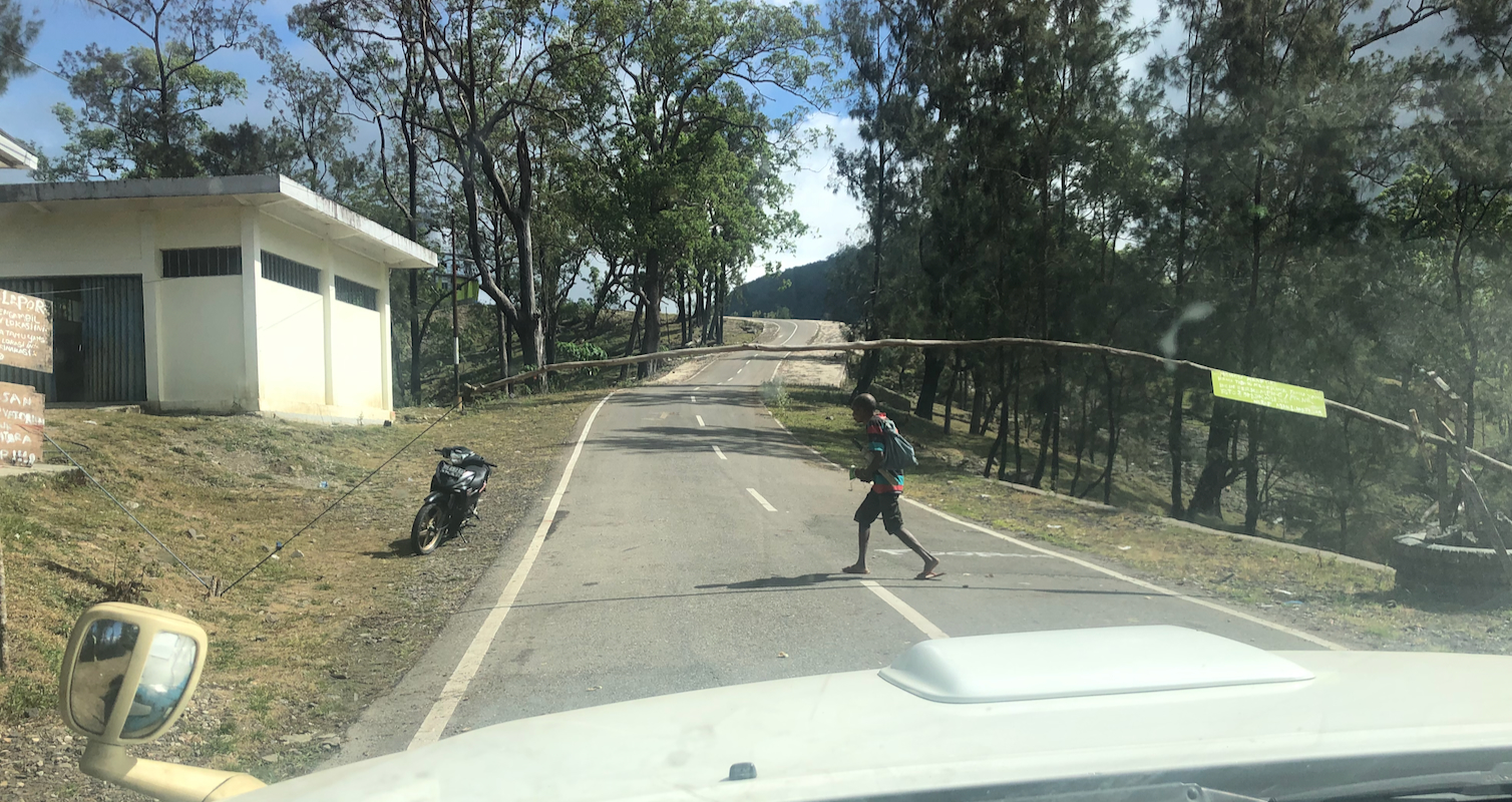
The road serves an observatory, immediately before this,
there is a gated check point.
Immediately after the observatory (the road passes close on its right hand side), the road
deteriorates to a rough 4WD road. Continue up switch-back curves to the highest point
on the road. Drive down the first little hill on the other side, then park on the left side
of the road. This is the trailhead, location S9.58555, E123.941619, elevation near 1425 meter.
Route:
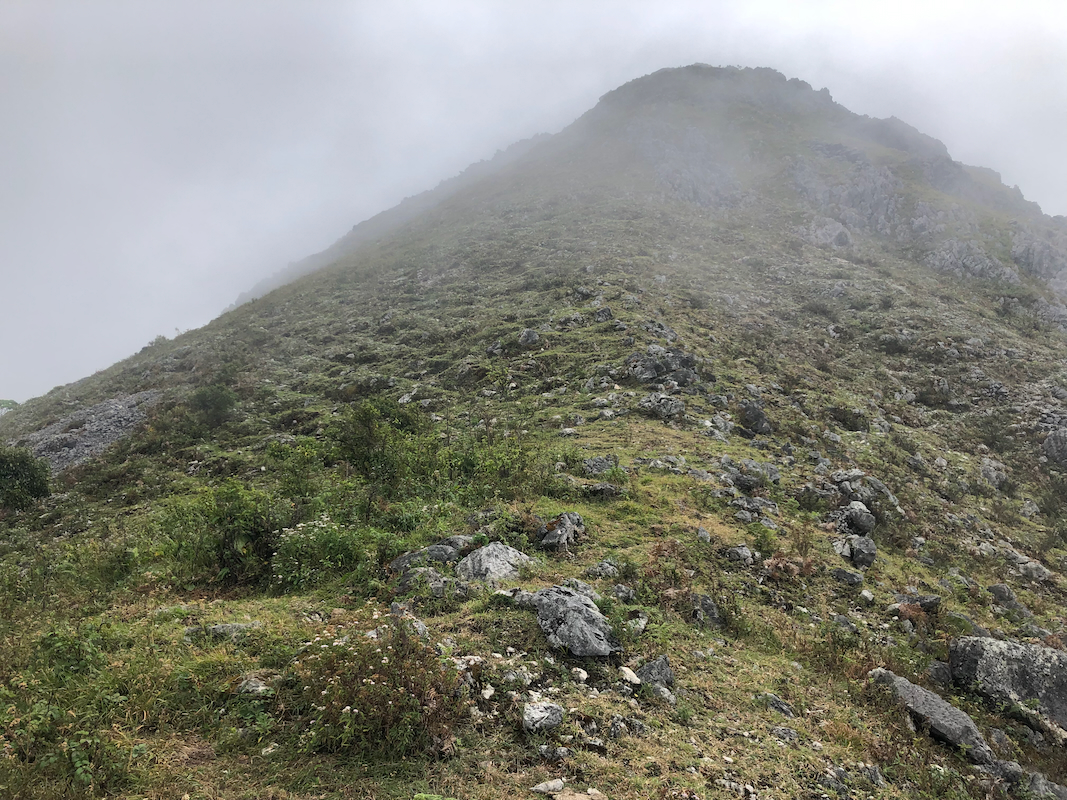
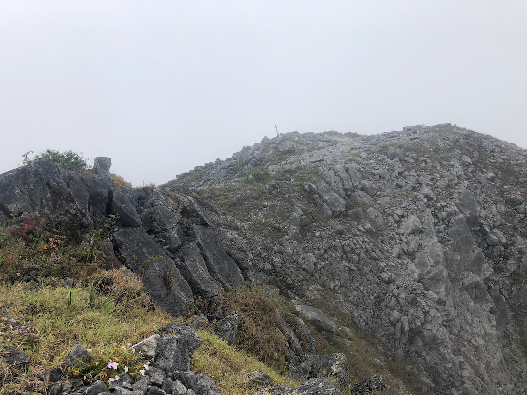
A trail marked with flags starts directly from the trailhead. It is easy to follow
all the way to the summit. There is a very short, slightly steeper section, but it
still justifies as a (YDS) class 1 hike.
The upper part of the
trail ascends terrain above the trees, thus a good view is guaranteed
unless you have clouds.
Comments/Trip Report:
After our climb of Mutis, we left Soe and wanted to
climb this peak while travelling back to Kupang.
All according to plan until we quite surprised
had to stop at the establshed check point just before the observatory.
The guard there refused any continuation. No English spoken. Our driver seemed to agree with
the guard and wanted to turn around. I flatly refused and pointed onwards. For some minutes, no
progress and the prospects looked a bit grim.
In order to explore how to possibly improve the situation, I left the car and walked up to
the small guard house, trying to explain our peaceful purpose. No English, initially little
progress. The guard likely understood that I would not easily give up. A car with several
people came in the opposite direction, most likely from the observatory. The guard went down
to the vehicle and talked to the people, then got a person that spoke English to follow
back up to me. I explained that we came from Norway, that we did not want to visit
the observatory, but rather just do sightseeing along the road beyond. He replied
that this should be possible, provided that we did not take any photos (my interpretation,
of the observaatory.) OK, this was communicated with the guard and our problem solved,
we could continue driving. Puh, it would have been rather bad to turn after driving all
this way here.
We continued to what looked like a reasonable place to park, then discovered that this
was indeed a trailhead with a flagged trail leading uphill.
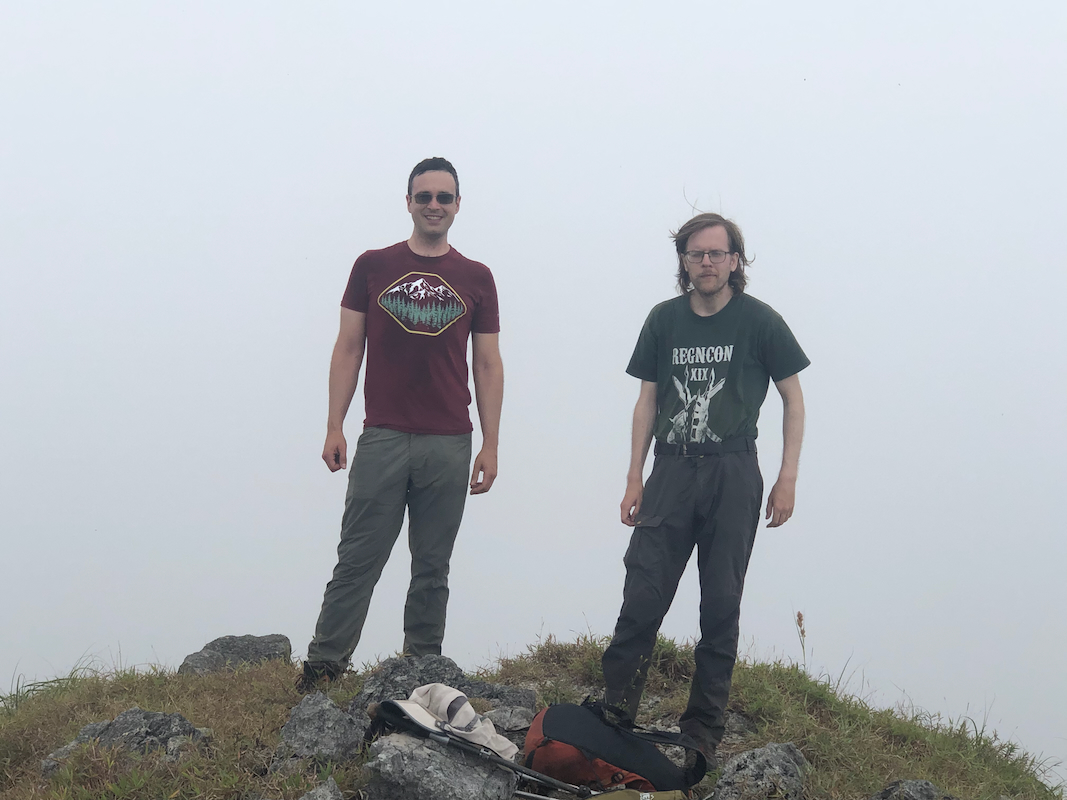
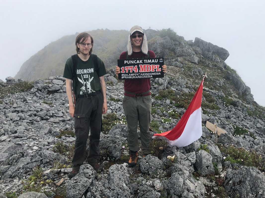
We left at 1010 and arrived on top in 35 minutes at
1045. Nice summit with two almost
equally high points.
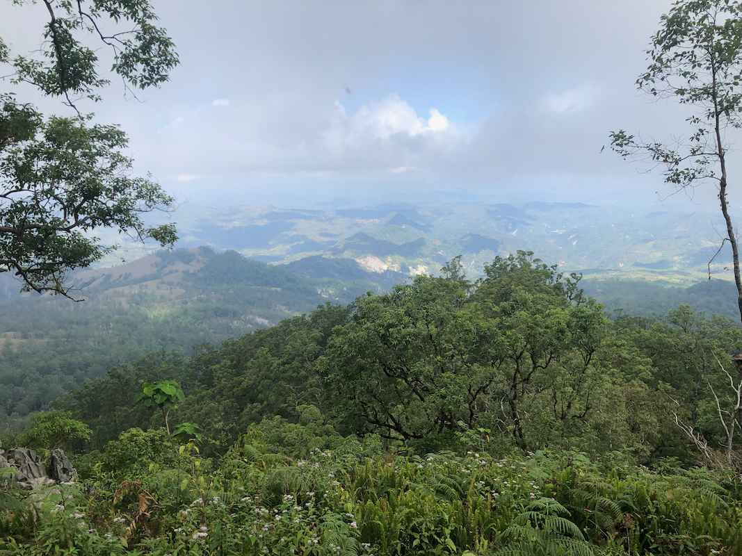
Unfortunately, a bit of clouds and poor visibility from the top.
However, as we descended, the cloud cover stayed
above and the view opened up.
Leaving at 1100, we returned to the car at 1130.