Location: North 39:26.262, East 023:02.775 (GPS at the summit)
Difficulty: YDS class 2 (if off-trail).
Climbed July 18, 2010.
Information:
How to get there:
This mountain is near the city of Volos, south-east of Larissa, on the east coast of Greece.
The area is called Pelion and the mountain was said to be the summer resort used by the Greek
gods, when they needed a break from Olympos. The area is also known as the homeland of the
Centaurs.
The summit is appearently within a restricted military area, our route is relatively short,
it does not cross any fence or pass any sign and it ends at the very summit. A good starting point
is the village of Zaghora, drive east across the mountains from Volos, then a bit north.
From Zaghora, drive about 5 kilometer north to the small village of Pouri. Continue on the main
road through Pouri, you will pass a parking area, then get to the last house in the village.
There is a road fork here, a small paved road forks left. Measure from this point.
At kilometer 0.8, keep right. The road has turned into a dirt road before you get this far.
Continue to kilometer 1.9, where you find another road fork, take the left road here. The road continues
to climb and at kilometer 2.8, there is a new fork where you should go left again. The road now
climbs more seriously to kilometer 4.2, this is a good viewpoint right on the ridge, with coordinates
N39:28.809, E023:04.558, elevation about 784 meter.
The farmers grow apple trees on these slopes.
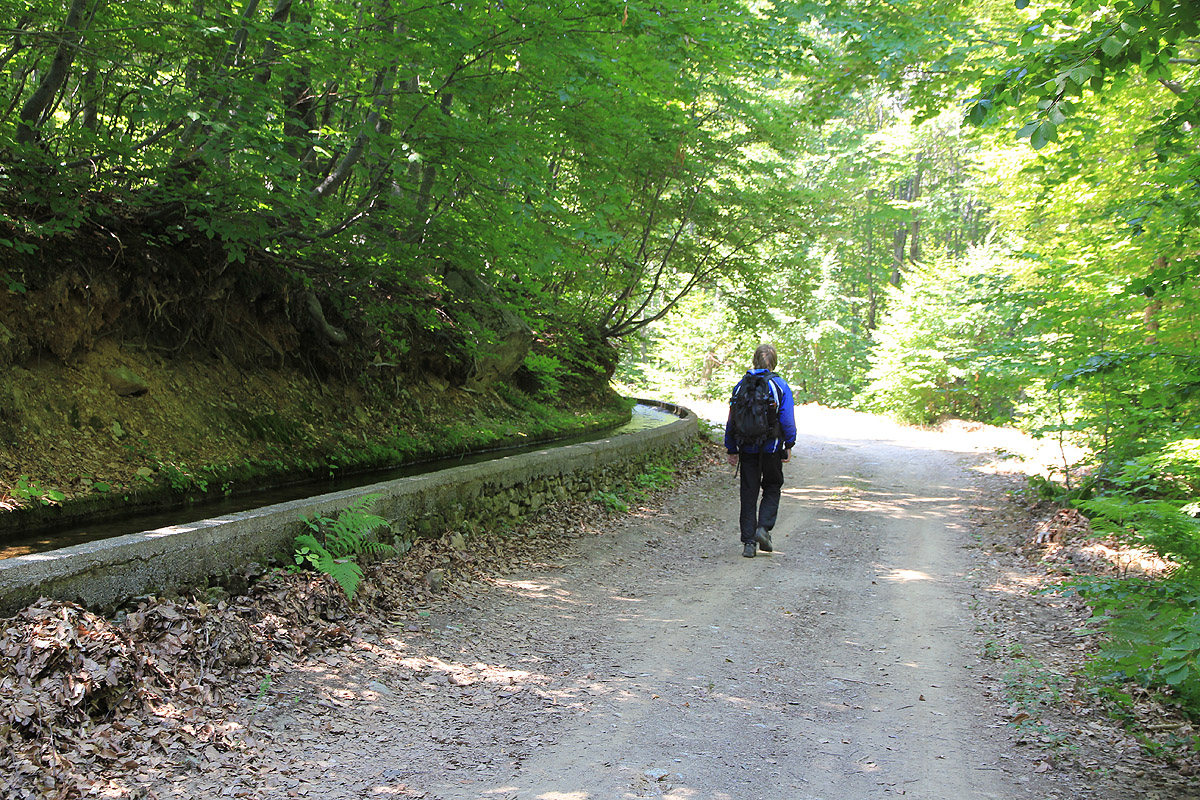
Take the left road again. You will now observe that
the road follows a small water channel that
has been built to supply water to the farms. At kilometer
4.3, a small road branches left, ignore it and stay right. Continue to kilometer 5.6, keep right in a
hairpin curve (a road branches off left).
At kilometer 6.4, you will observe a small,
white building on your left as well as a concrete basin used to hold water.
This may be a good place to park if you want a 600 meter vertical gain on foot.
Higher up, at kilometer
6.6, a small road branches sharply left, ignore it and remember to stay left at this point when
descending. Continue to kilometer 7.6, where you find the key road fork.
This location is N39:27.731, E023:03.851, elevation about 1060 meter.
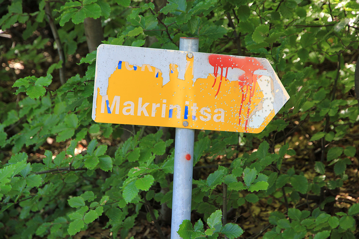
There is a sign here, as well
as red paint indicating that one should take the left fork. One should note that the map "Topo50,
4.4 Thessaly" in scale 1:50.000, is very unreliable above this point.
One may drive further, but since we (wrongly) drove right at this point, the continuation from
here is described in the route description below. See also the comments for more details on what
we actually did.
You should have a 4-wheel drive or at least a high clearance car in order to attempt this approach.
Route description:
From the key road fork, described above, take the left branch and note that your route will
also be marked with red paint as well as with a few signs in
what follows. Proceed to
location N39:27.571, E023:03.610, elevation about 1095 meter, continue straight here, smaller
roads on either side. As the road climbs higher, you will arrive at location
N39:27.432, E023:03.779, elevation 1150 meter. At this point, one may take a short-cut by going off-road
directly right, following a distinct, fairly steep gully that heads uphill and re-connects with the
road at N39:27.424, E023:03.729, elevation 1193 meter. (108 meter horizontally, 43 meter vertical.)
If you do this, then you should turn right as you gain the road on top of the gully.
If you proceed by road, then (most likely!) you will arrive at a road fork where you must take
the right branch. Be sure to reach the tip of the ridge at location N39:27.432, E023:03.779, elevation
about 1195 meter, the road turns around (from one side to the other) the ridge at this point. Shortly
further along, you are at the point where the short-cut comes up, marked with red paint on the tree.
Proceed along the road, now more or less horizontally about 1.7 kilometer (as the crow flies), until location
N39:26.950, E023:02.727, elevation 1227 meter, continue (slightly left) on an overgrown road for another
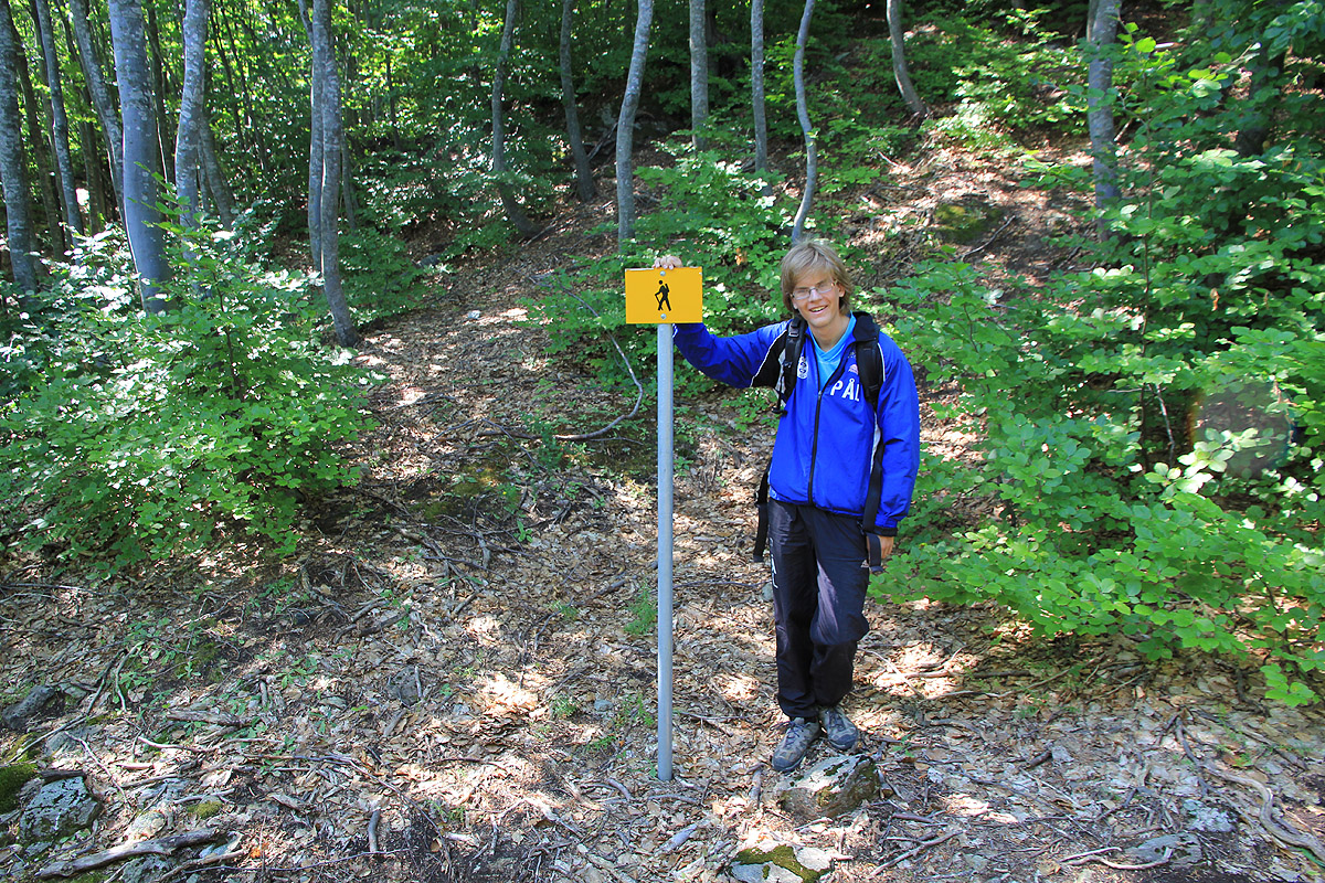
260 meter to location N39:26.917, E023:02.552, elevation 1222 meter. At this point a red marked trail climbs
left, continue uphill along this trail, it is quite well marked.
This trail climbs to about 1400 meter, the last part curves left with pretty good view before curving right
and crossing a small creek (there is a collapsed bridge), finally the trail connects with a new road
at location N39:26.413, E023:02.123, elevation 1413 meter.
Turn left on this road and stay left (go uphill) at a fork higher up.
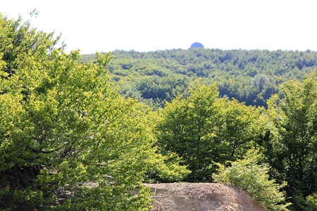
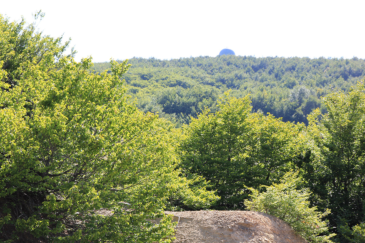
You may see the top dome of the
radar station higher up. At a pretty flat section of this road, location N39:26.240, E023:02.611, elevation
1581 meter, you are about 30 meter below the summit which is located 240 meter away.
Heading directly left through pretty dense vegetation will get you right onto the top. We did this
completely unaware of the fact
that the summit area appearently is military land and that
visitors may not be appreciated.
Comments:
We stayed in a very nice place in the
small village of Chorefto, down by a good beach below Zaghora.
The hotel is
called Aeolos, web: http://www.aeolos.com.gr, email: aelos-pl@otenet.gr, phone: +30-2426022910 or
+30-2426023550.
We got up around 0600 and drove off around 0630. We made the (wrong) choice of following some dirt roads
from Chorefto towards Pouri, driving the (main) paved road via Zaghora would have saved us time.
According to our Topo 50 - 4.4 Thessaly map, 2009 edition, there is a loop road south-east of Pouri that connects
with a trail that heads uphill towards the mountain. Our plan was to drive slightly beyond this trail as the
road descended below 1000 meter of elevation here, then hike back up and follow the trail to the higher roads
on the mountain. However, as there is no such loop road in the hillside, our plan needed modifications. In order
to compensate for this, we did additional hiking and exploration when
descending, such that a proper route to the summit could be fully documented.
Thus, we took the right fork (which was wrong) of the road at the "key road fork" and continued 2 kilometer. Beyond this point
the road forked and we first explored the right branch, guessing that this would be the descending part
of the loop. However, this road quickly dead-ended. We drove back up and tried the left fork. This road again
forked and we first took the right branch. The road went steeply down into a ravine, then even more steeply
back up on the far side, however further onwards it came to a dead end. At this point, there was only
one untried branch. Driving this also led to a dead end. When turning the car, we had a serious scare as
the ground near the edge of the road gave way from the weight of the left front wheel.
A dangererous looking, but necessary left
turn of the front wheels followed by a determined reverse got the car back on solid ground. We concluded that this
road had no continuation, parked at location N39:27.323, E023:02.916, elevation about
1080 meter. Finally, at 0815 we headed straight uphill among the trees.
We came across the upper road without any difficulties, turned right and followed it to the beginning
of the trail. The hike was now easy until we came
to the horizontal road that ran only 240 meter from the
summit. According to the map, we could reach the summit by following the road further, but this would be
a considerable detour. The decision to go straight through the bushes was pretty obvious. It was not all
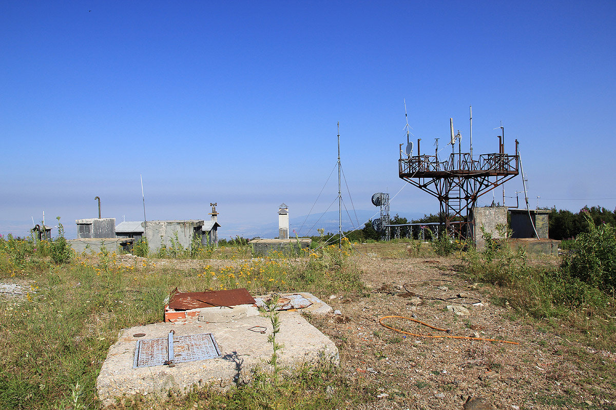
as bad as it looked and soon we emerged at the edge of the top area filled with a pretty big radar station.
There were no signs or fences and nobody around, so we proceeded straight to the highest point where we sat
down and had a look around. We had arrived around 0940, just as the heat from the sun made us drink about
half of the water that we carried.
After perhaps 10 minutes, we left and considered taking an easy stroll back down, this time following
the longer route along the roads. However, just as we were about to leave the area, we noticed a sign along
the main paved road saying "do not proceed without permission". This made us reconsider, perhaps we should
just descend the same way as we had ascended?
Just as we reconsidered, a person came out from the radar dome and
asked what/why we were there. All in Greek, so we really do not know what he said. We indicated by signs
that we had just arrived and that it might be time to say goodbye and leave. He clearly wanted us to stay and
called for someone that knew English. After about 5 minutes a jeep came up the main road with two
soldiers. I greeted the guy in command warmly and told him that we were hikers that had come up
through the bushes. Showing him an outline of our route on the map seemed to make him pretty
happy. After a few moments of thought he asked if we could please return the same way and go nowhere
else, then wishing us a good continued vacation in Greece.
The time was now 1000 as we waved goodbye, turned and jumped into the dense
vegetation, finding a very reasonable path back down to the dirt road.
After getting down to the road below the trail, we
decided to hike it further in order to
explore a route that could be more completely described. This took additional time
and we reached the car by 1200 noon.
We drove via Zaghora, filled gas and were back at the hotel shortly before 1330.
This was the last mountain on our 2 week trip to Greece.