Location: North 62:41.285, East 008:48.477 (GPS at the summit)
Difficulty: YDS class 3.
Climbed October 5. 2006.
Information:
How to get there:
The trailhead is in Sunndalen. From the Sunndalsøra hotel, drive
15.7 kilometer in the direction towards Oppdal (up the valley). As you cross a bridge,
pay attention and make a sharp right just after the hilltop. This small road has a sign
for Hoås. Drive a few hundred meter as this road turns back and runs under the
main Hwy. bridge. Do not drive under this bridge, park on your left just as you see the
bridge ahead of you. This is the trailhead, location N62:37.893, E008:50.589, elevation
98 meter.
Note that this trailhead is new and therefore not marked on the map. The old trailhead is
now closed. Route description:
From the trailhead (parking), continue along the road as it passes under the bridge. About
one hundred meter further, just as the road gently curves left, locate signs for Innerdalen
and the small, but clearly marked trail that leaves the road and heads uphill to your right.
The trail is marked with red "T" as well as small sticks along the first (new) section as it
contours around a farmers field. Higher up, the trail climbs more steeply before merging with
the old trail (coming from the right).
The trail continues steeply uphill with zig-zags. Eventually, it reaches a distinct (broad)
shelf and heads left in a much more level fashion. You pass a small hut, contour elegantly around
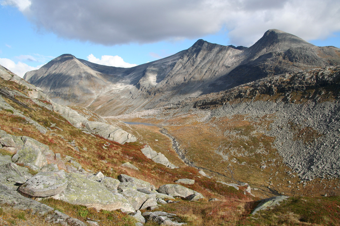
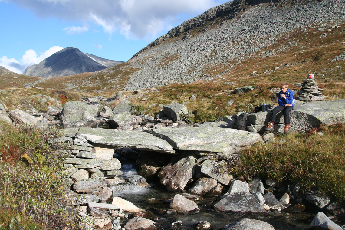
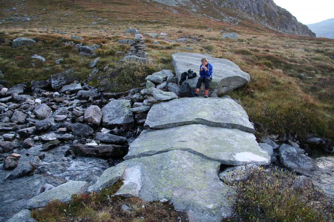
and enter the lower part of Tverrådalen,
where the trail crosses the creek on a very nice
natural bridge formed by two large pieces of rock.
From here, leave the trail and head directly up towards the first summit (1632 on the map). This
summit is called Såtbakkollen on the map, generally agreed to be wrong. The terrain is easy with
rocks on the final part before reaching the very flat summit.
From here, you can see the summit and most, but not all of the remaining route.
Continue across (minimal loss of elevation)
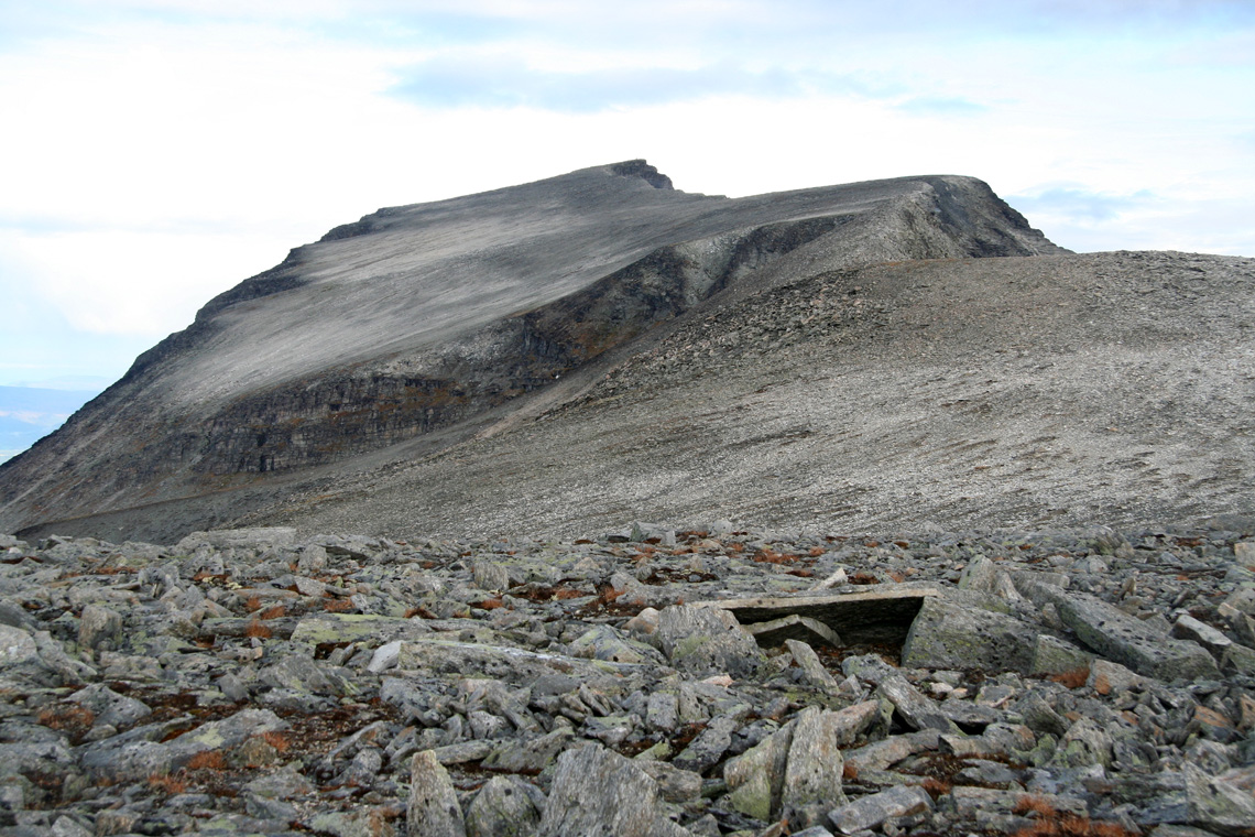
to a slightly higher summit, then across a wide, but more distinct ridge
to a third summit (location
N62:40.453, E008:48.830, elevation 1687 meter) located on the ridge. From here, the ridge is more narrow and
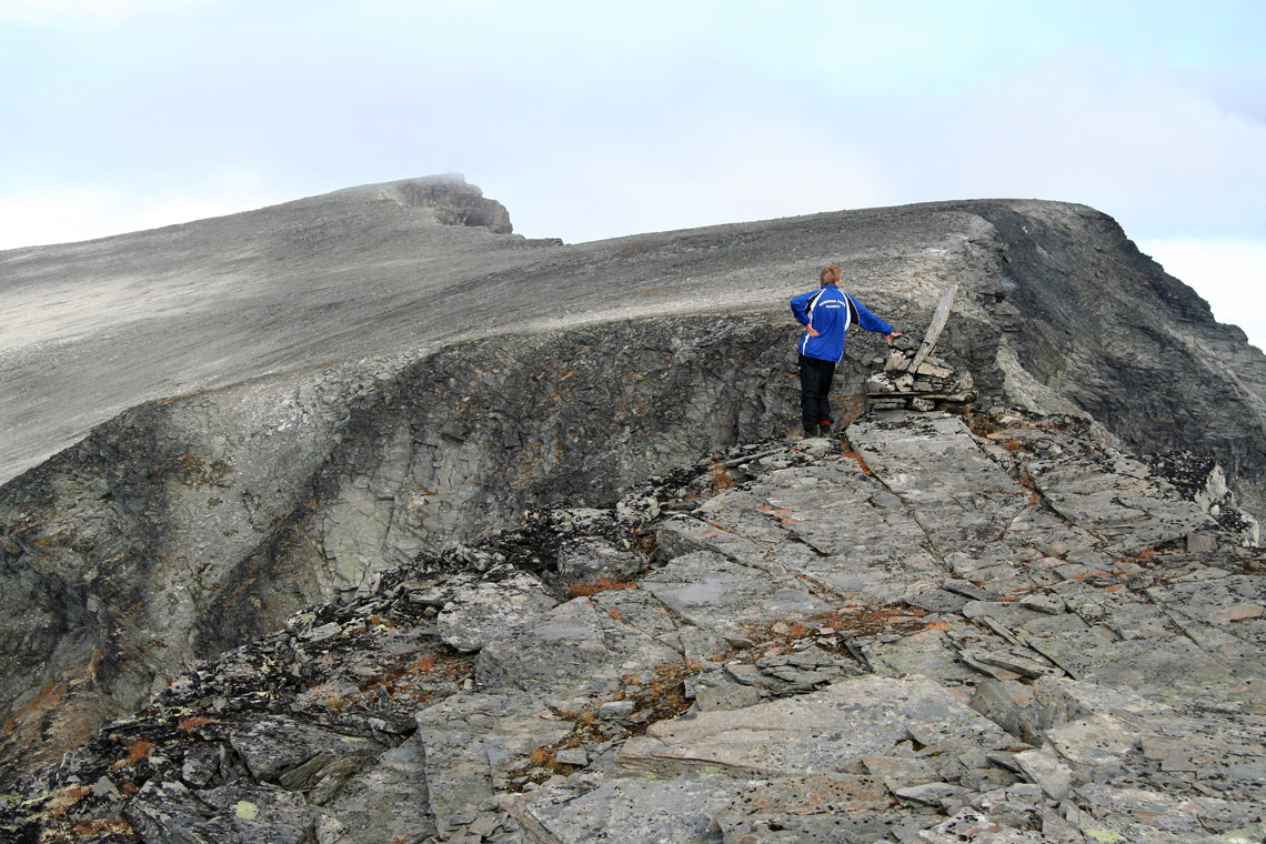
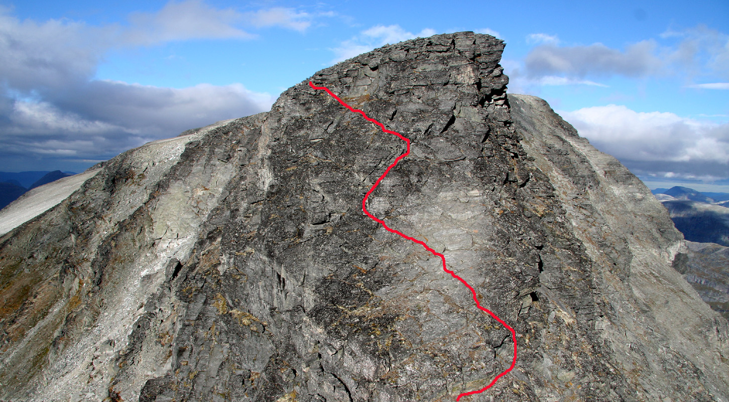
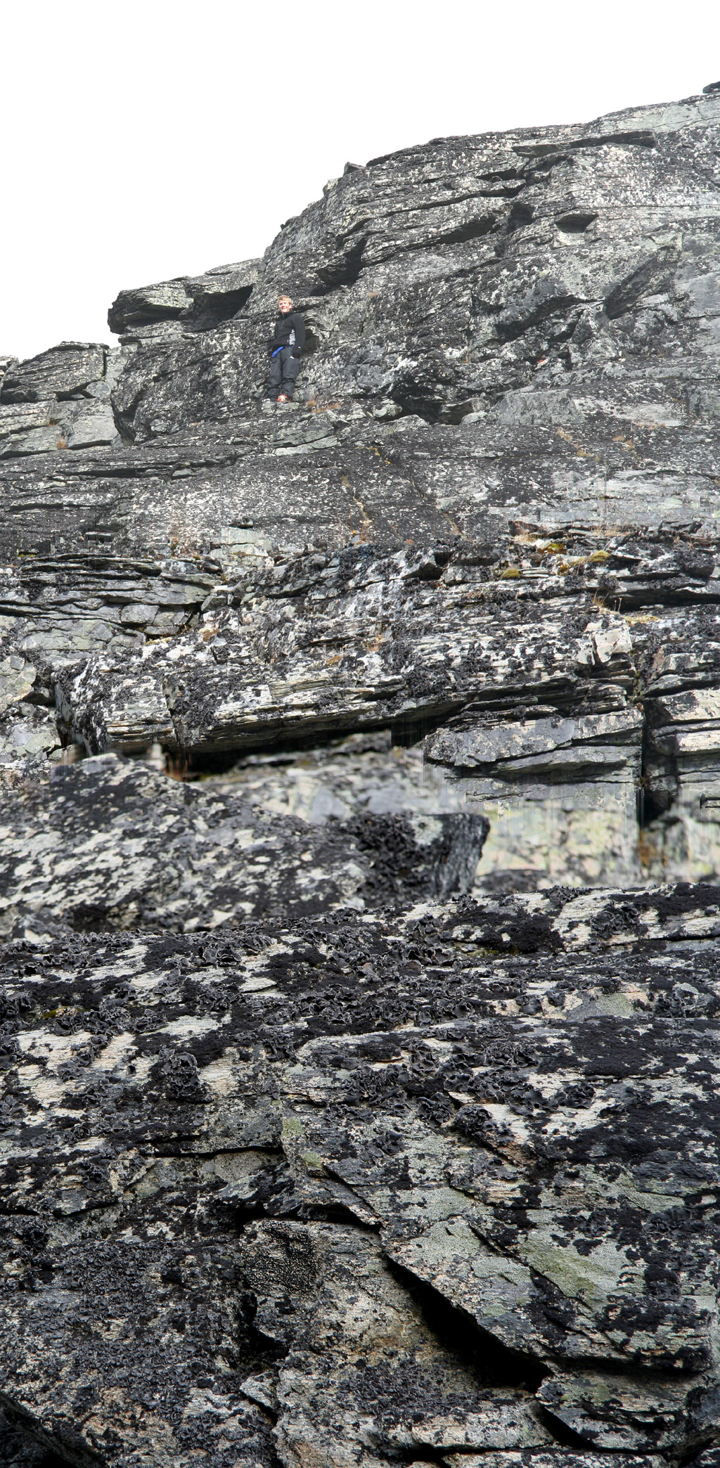
its final section, a deep notch followed by a steep section of rock, looks intimidating. However, things
are not as bad as they may look. The scramble along the ridge is straightforward until you reach the
notch. Carefully downclimb to the bottom (YDS class 3), then climb directly up the other side (also YDS class 3).
The route is indicated on this picture.
From the top of the notch, continue on very easy terrain to the summit. Note: An alternative (easier) route can be found if one enter the west side before the first
summit at about 1500 meter of elevation, then cross up the somewhat steeper,
but short section to the large and gentle
area above, along a line that looks easy.
This variation (avoiding the ridge) is likely YDS class 2 (off-trail hiking). Comments:
I did this climb with my son Pål Jørgen.
We left the car at 0730 and hiked to the nice, natural bridge
across the creek from
Tverrådalen in approximately 2 hours. The view
back into Sunndalen is truly impressive.
We rested there, then climbed up on the first part of our mountain
and traversed along the high ridge to the gentle summit plateau. The ridge route
looked pretty difficult from
the highest summit along the ridge, but we decided to give it a try. To our great delight, the route turned out
to be "just right".
While I took pictures from the sharp saddle, Pål Jørgen started
exploring upwards and soon
shouted down that the route was "open".
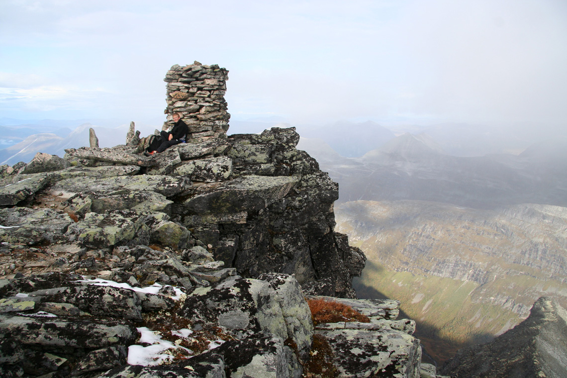
We arrived at the summit shortly after 1215, rested and had lunch. The view all around is truly
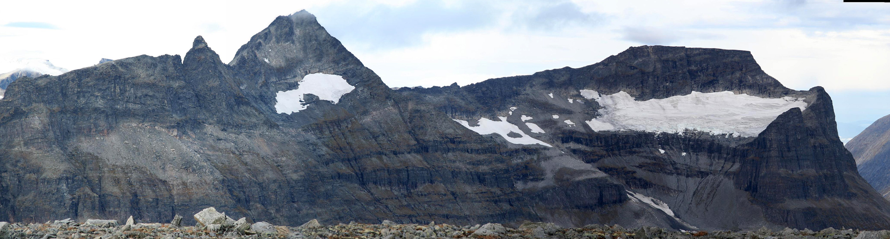
breathtaking. Naturally, we enjoyed seeing Trolla (1850m),
that we climbed in September last year.
We signed the summit register. The last visitor was back in August. We were number 16 and 17 to visit this
fine summit in 2006. The cliffs overlooking Innerdalen are very steep and the view correspondingly impressive.
We left at 1245 and were back at the trailhead in 4 hours, at 1645.
Good luck with the weather, it rained as we left Sunndalsøra, but this stopped by the time we were
at the trailhead. Then, a nine hour hike with mostly sunny weather, only a few clouds now and then. As soon as we
started driving, the rain came back and lasted for several hours.
Our late fall mountaineering trip continued the next day with
a successful climb of Nordre Slotthøa.
Resources:
Images
The Trolla mountain as seen from Sunndalen, the highest summit
is not visible, the rightmost peak is the south summit.
Evening light on Snøvasskjerdingan, Sunndalen, Norway.
Morning light across Sunndalen while ascending the slope next to
Haldobekken.
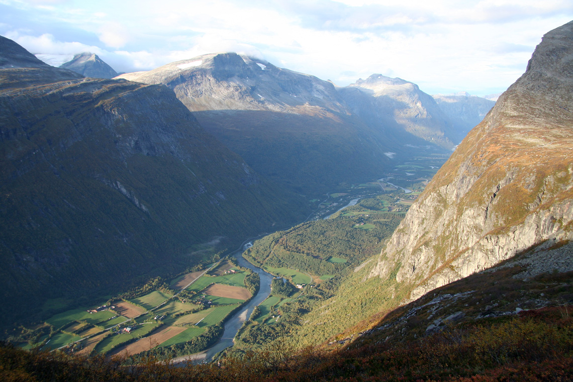
Sunndalen view, a look back down (south-east up the valley).
Sunndalen view, a look north-west. Sunndalen has steep mountains
exceeding 1800 meter on both sides.
The crux of the route, this rock face looked hard from a distance, but turned
out to be a fun (YDS) class 3 scramble. See also the route description above.
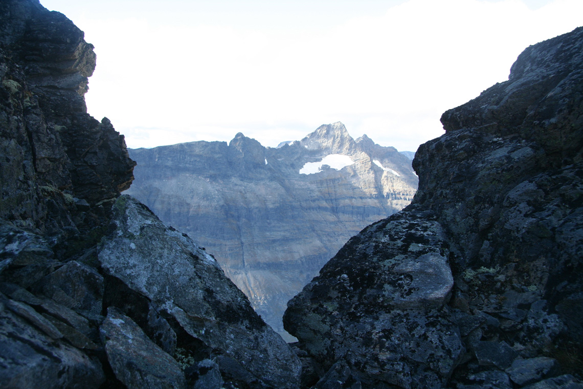
Looking back, just as the crux part of the ridge traverse has been completed.
