Olympos
- Olympos
- 1952 m
- Primary factor 1952 m
- Location: North 32.93813 East 032.86073 (GPS on the summit)
- Cyprus HP.
- Climbed December 13, 2012
- Difficulty: (YDS) class 1.
|
|
`
Information:
How to get there:
Locate the intersection between the motorway A1 and Hwy. B-8. This location is directly
north-west of the centre of Limassol, more often called Lemesos. Lemesos is on the south
coast of Cyprus, about 60 kilometer (west) from Larnaka (where the main airport is located).
Follow B-8 north via Trimiklini to Pano Platres. As you see the sign for Pano Platres forking left,
stay on B-8 a little bit further. As the road curves left and crosses a creek, another road is
coming up from Pano Platres on your left. There is parking on your right and a large number of
information signs.
This is the trailhead and parking, location N34.89581, E032.86860, elevation about
1200 meter.
Route description:
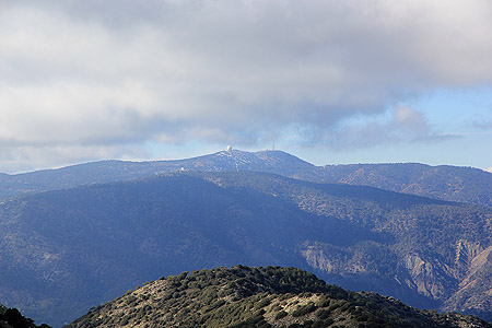
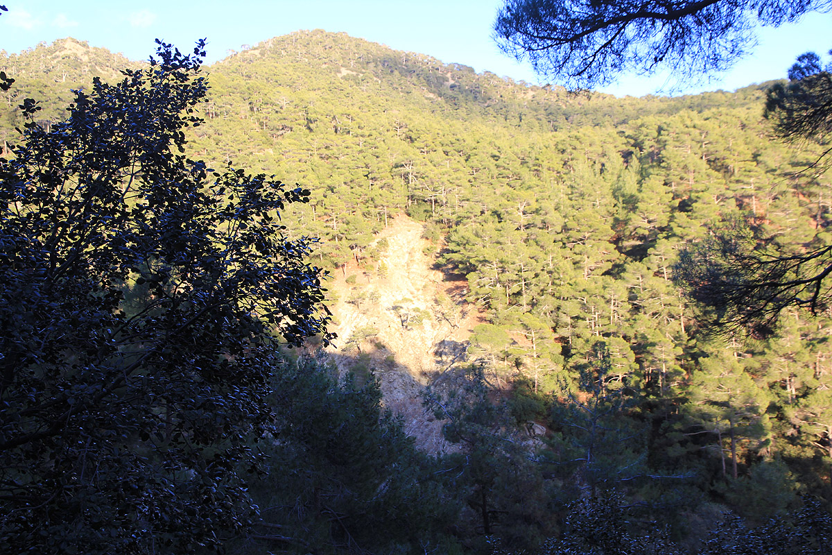
Olympos is the highest point in a pretty large mountain area called Troodos.
Unfortunately, many of the tops have radar
installations, so also with Olympos.
See also the excellent description in summitpost.
I quite appreciated that this documented
a route where one actually climb the mountain on foot with more than 600 vertical meter of ascent.
From the trailhead and parking, head directly uphill and avoid turning left. At the top of the first
short section of road, the trail continues straight ahead with some uphill steps. The forest road that
starts out to the left, actually runs uphill and provides a longer alternative. I came back down that way.
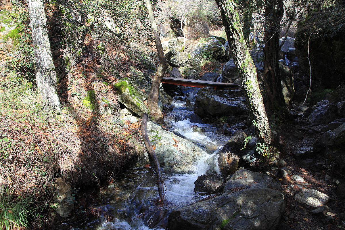
This trail, called the Kaledonia, follows the creek and
has a large number of wooden bridges crossing back
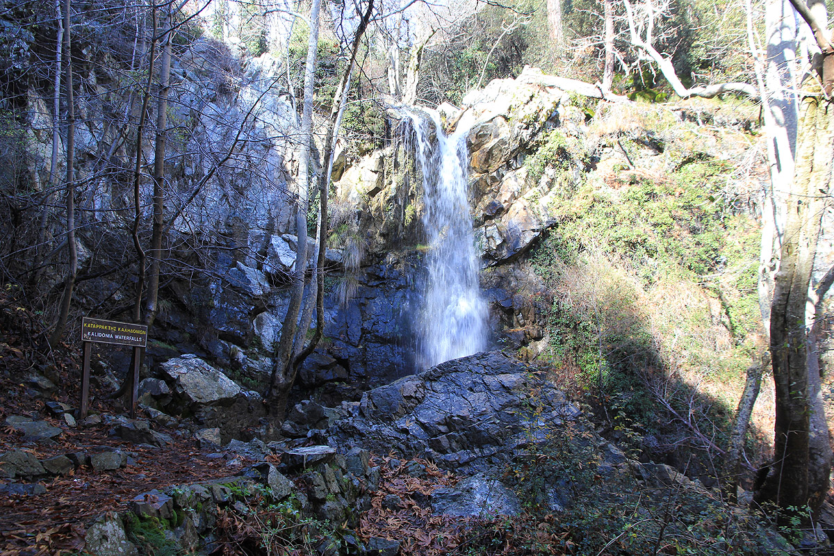
and forth. Part way up, there is a small, but nice waterfall.
Higher up, the trail merges with a narrow and
winding paved road. This road is called the Old Road from Pano Platres to Troodos. Follow this road uphill
until it merges with the main road (Hwy. B-8). Cross this road and continue along a smaller service road
that serves some tennis courts. Take the footpath going right and reconnect with Hwy. B-8 higher up.
Soon, you may leave Hwy. B-8 on its left side and follow easy, open terrain uphill along a broad
ridge. This will connect with the paved side-road that runs from B-8 to the very summit. Alternatively,
just follow B-8 uphill until it reaches its highest point, from where the summit road forks left.
This location is N34.93549, E032.87319, elevation about 1795 meter.
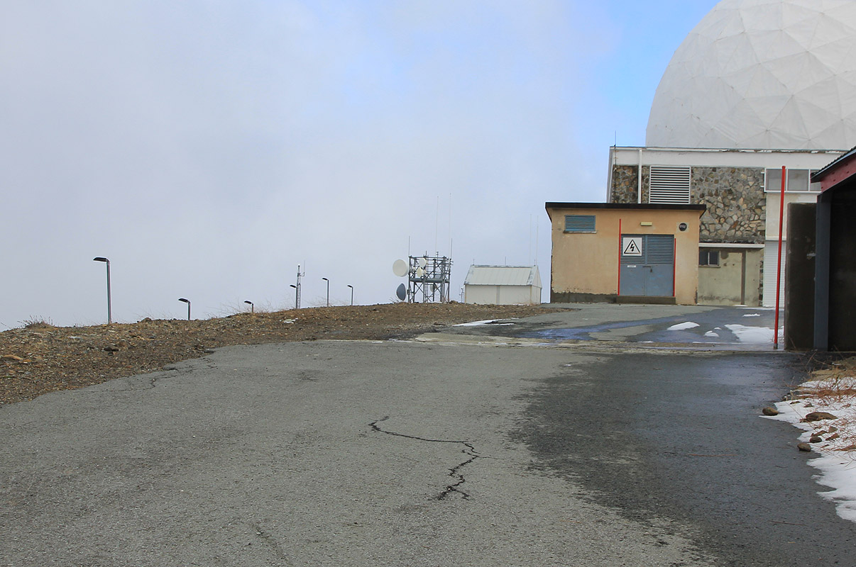
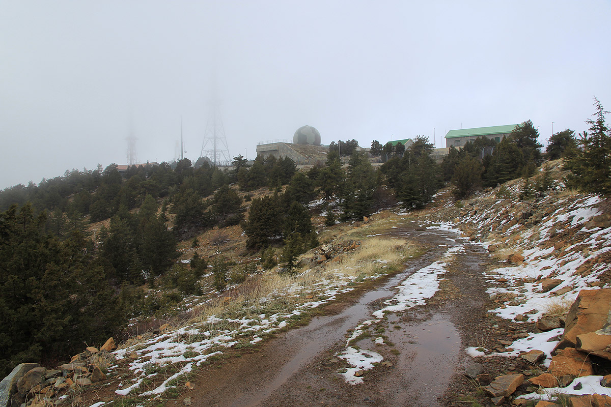
Finally, follow this dead end side road up to the highest area.
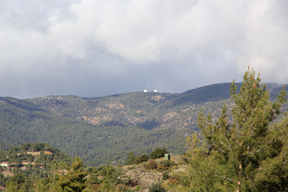
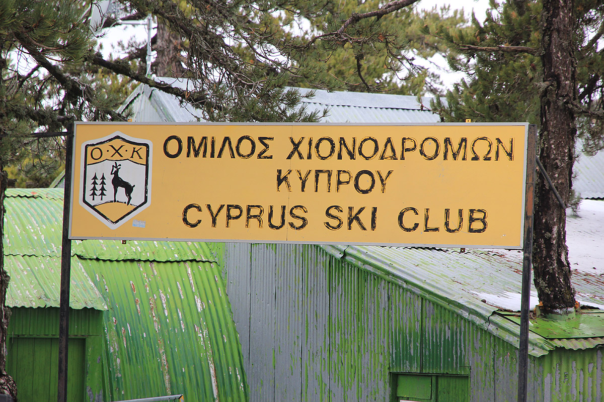
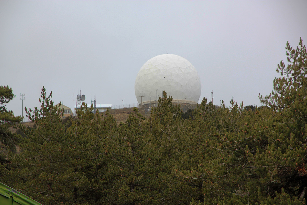
You pass some buildings with a Cyprus Ski Club sign
along the way. The road ends at the entrance to the big white dome containing
a radar. There is a guard house on your
left hand side. If you are lucky, the gate higher up is open and the guard may grant you permission to do a quick
dash uphill. The concern is exposure to radiation from the radar, likely ok as long as one makes a short visit.
Alternatively, just complete the ascent right there. Due to this unfortunate radar, full credit for the climb should
be given if one gets as far as to the guard house. After all, the hike up the mountain is essentially completed, these
few, almost horizontal meter to the highest point may be exempted, due to the military radar installation.
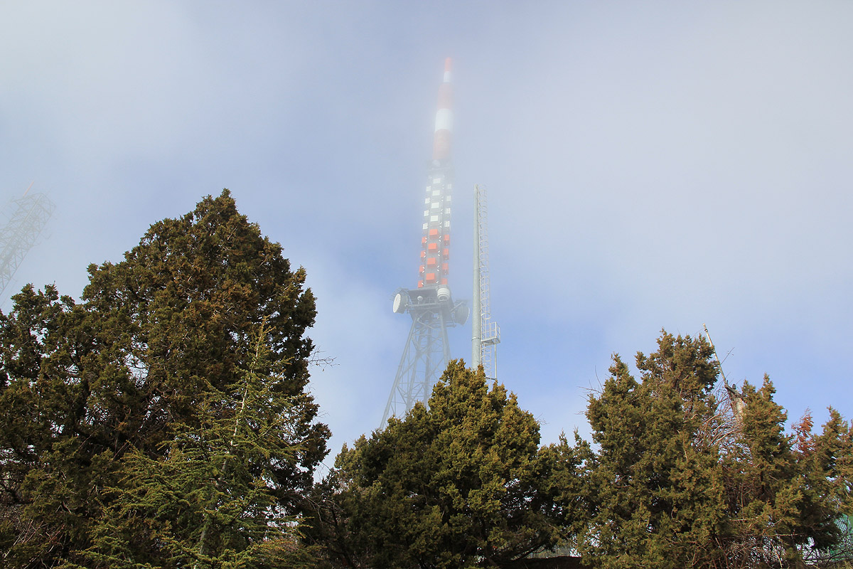
There is a second hill a bit further onwards. This one is also fenced in
and has more antennas and radar installations.
It is very likely that the highest ground is now soewhat lower than the accepted 1952 meter. It looks pretty obvious that
the top was flattened when they constructed the big white radar dome. See further comments below.
Trip Report / Comments:
Here is a Google map documenting my hikes on Cyprus.
My next goal on this trip was Selvili Tepe.
We (my wife Heidi and I) were staying at the Four Seasons Hotel in Limassol. This was a 3 day stay to
enjoy some warmer weather just before Christmas.
Local warning:
I had rented my car via Holiday Autos, however this was a big mistake. It turned out, quite surprisingly,
that they had adopted the policy of having the car returned EMPTY. This is essentially fraud as you
cannot return your car empty to an airport location without risking to loose your flight. Moreover,
they charge much more than what local gas stations do for this gasoline. If anything, they should charge
less, allowing for at least a quarter full tank (on average) that will always be returned.
It is not only about money, but the fact that they try to screw you, that leaves a bad taste.
I asked Holiday Autos to note that I was unhappy about this after my return, but received an extremely
buraucratic answer showing that they really do not care about customer satisfaction. Another bad sign.
My advise:
Never rent your car via Holiday Autos on Cyprus.
I left the trailhead at 1225 and had a quite pleasant hike up the Kaledonia trail. The recent rain made the creek
flow pretty fast and a couple of crossings required jumping. The trail had a good number of pretty new wooden bridges,
interesting how often this trail crosses the same little creek.
About half way, there is a pretty nice waterfall, then more trail eventually climbing
out of the valley and
joining the Old road from Pano Platres. Higher up, I followed the road to the fork where the summit road goes left.
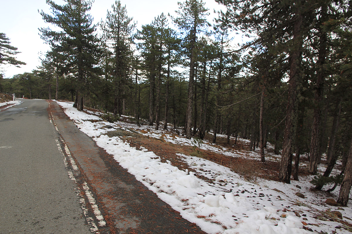
There was some snow on the ground
and the temperature was definitely only a few Centigrades.
I made it to the signs declaring no access, then continued to the small house with a military person.
He came out to ask what I wanted. I first asked if he was British or local, the reply was local. Nobody else seemed
to be around. I then explained that I had travelled all the way from Norway to visit Olympos, one of about 100
very prominent peaks of Europe. He explained that the main concern related to moving any closer to the radar dome was
the increased intensity of radiation. We then agreed that I could do a quick dash up there, since it would be a short
exposure in this way. After all, he was serving several hours of guard duty just a bit farther away.
I expressed my sincere thanks, then took a dash up towards the radar and
got a quick GPS reading as well as a quick photo.
When returning to the guard, I noticed yet another sign saying no photography, oh well, too late.
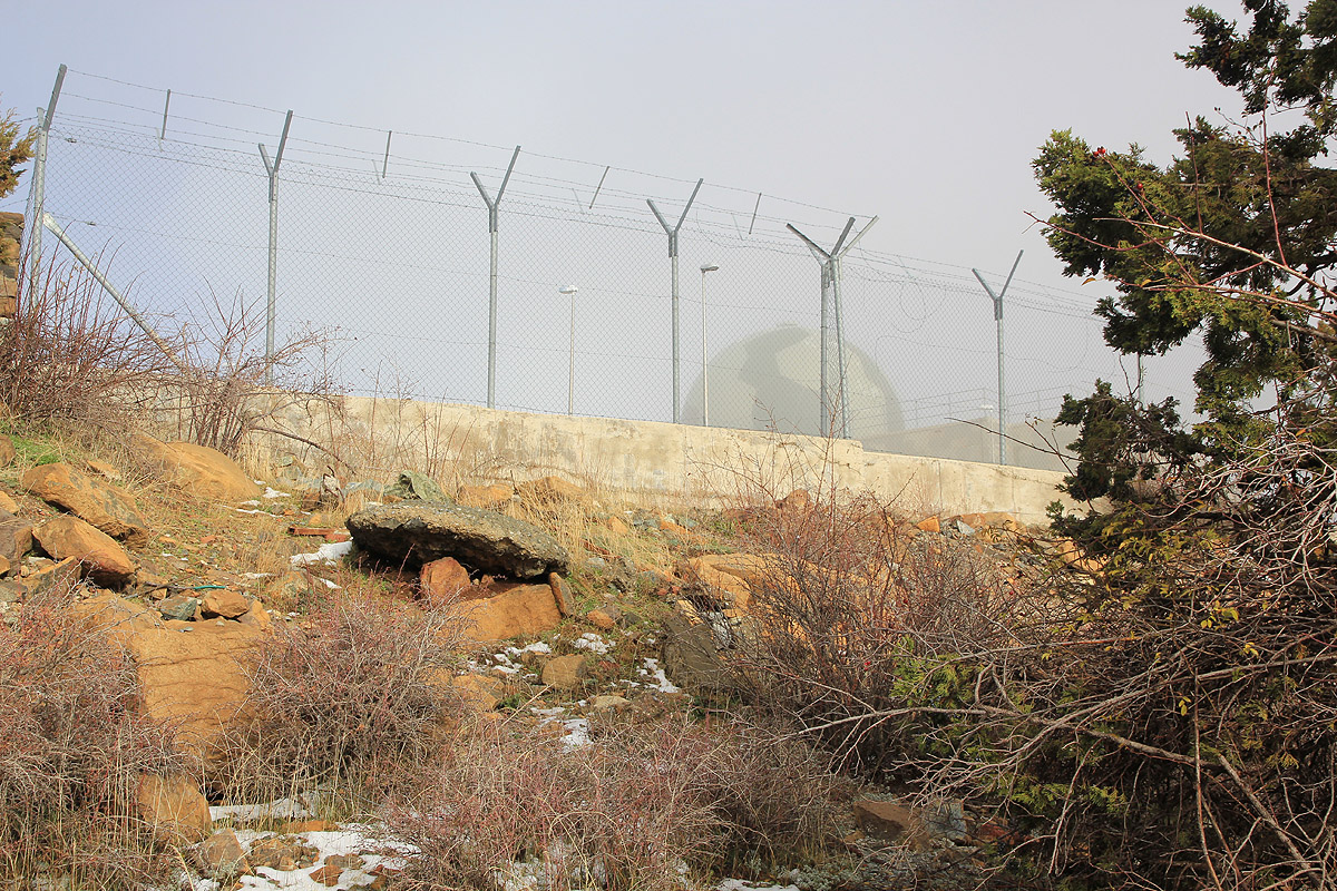
I then headed across to the other hilltop and
climbed to a local high point there, just outside the fence. It seemed almost
as high as the first spot, it looked like natural ground was no higher.
Both of these hills have been made completely flat on the top. Thus, this mountain has been a bit higher before these
radar installations. My GPS recorded as high as 1940 meter, still 12 meter below the official elevation.
The accuracy of this reading could be a bit poor, since I did not spend a long time, however, I find it quite likely that
the mountain was indeed 1952 meter before they leveled the top and constructed the radar.
I had arrived around 1400 and spent about 15 minutes exploring the local ground that I could access. Subsequently, I started
hiking back down. Deciding to not reverse the Kaledonia trail, I continued down the Old Road, then a bit further downhill
along the new road, before going left on what looked like a forest road. This forest road proceeded downhill in many
zig-zags and eventually ended right next to the first few steps that marked the beginning of my uphill trail.
I was back at my car by 1600 and returned to Limassol with the main objective well taken care of.
Resources: