Location: North 65.89228 East 015.26974 (GPS on the summit)
Lappland, Sweden
Climbed November 15, 2012
Difficulty: (YDS) class 2.
`
Information:
How to get there:
From Mo i Rana (Norway), drive E-12 east to Sweden.
The first populated place (of significant size) is Hemavan, an area with
downhill ski slopes. The trailhead is located about 50 meter west of
Syterbäcken, this creek is marked with a roadsign along E-12 about
2 kilometer west of Hemavan. There is parking on both sides of the bridge,
perhaps best on the east (Hemavan) side. This location is at N65.84274, E015.04414,
elevation very near 500 meter. Route description:
From the trailhead, follow the cleared path uphill through the vegetation belt.
The path may be a bit hard to follow at times, but it generally runs uphill parallel
with the creek and quite a bit higher. As the route emerges from the vegetation, it
continues uphill in the same general direction until it (almost) merges with the
marked route from Klippen. At this point, descend to the creek, the crossing is
facilitated by a pretty long suspension bridge (N65.86538, E015.10673).
Continue to follow the marked route
parallel to the creek (but now on its right hand side), until you reach the hut
Viterskalsstugan (N65.88513, E015.15858).
This hut has full service in the summer, a section remains open
as a self serve winter shelter.
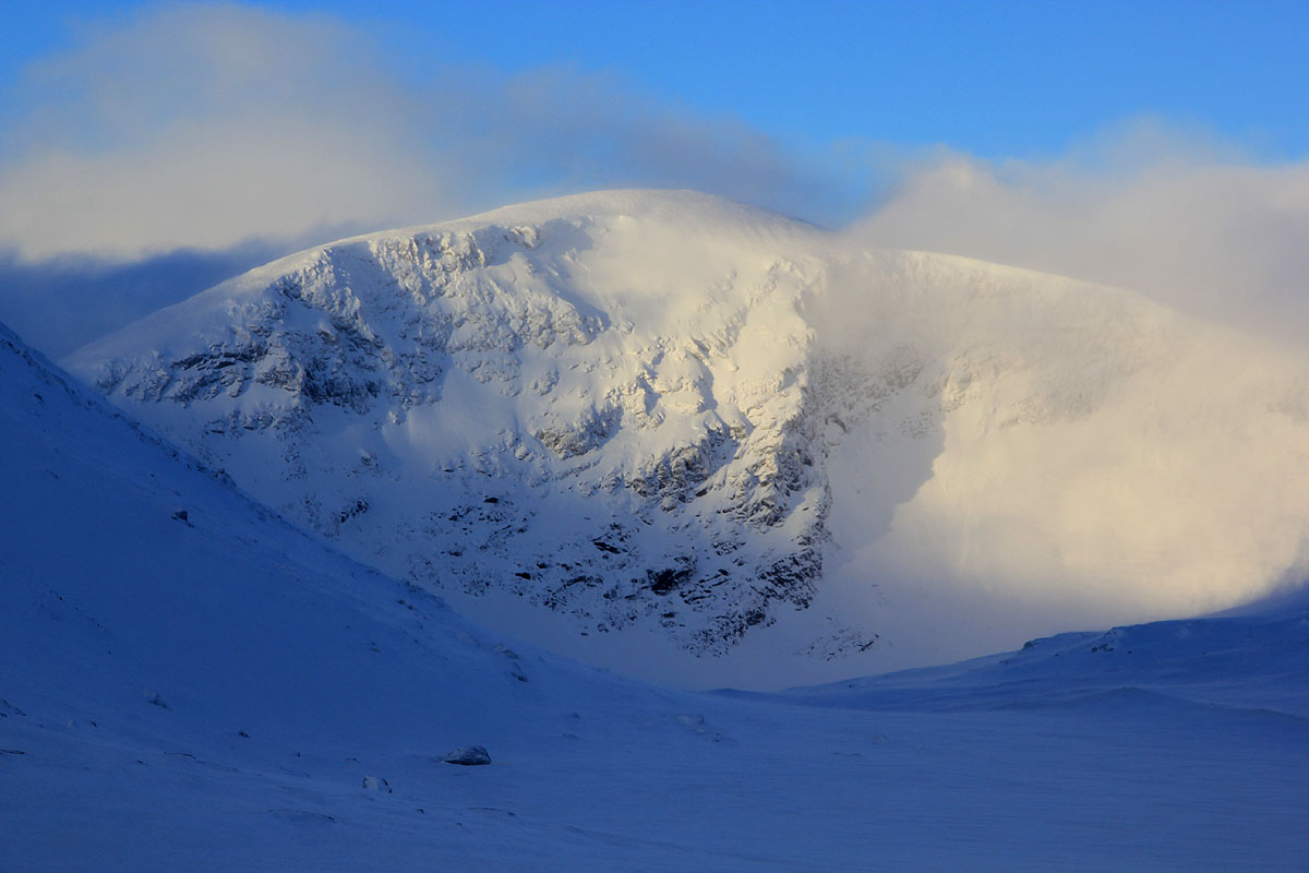
From the hut, there is a summer route that continues east and climbs the steeper slope
of the west side of Norra Sytertoppen. In winter, a much better route would be to
turn north and ascend gently along the right hand side of the creek Viterskalet, that
drains the lake at 1007 meter. Before the lake, contour right and follow gentle terrain
below the steeper slopes on your right,
all the way until heading south, climbing gently
to the small glacier located northwest of the summit. Do an ascending traverse up near the
1420 meter saddle located east of the glacier. Turn south
and follow the summer route to the summit. Trip Report / Comments:
I did this climb with my friend Åke Dahlen. I attended a meeting in
Bodø the day before, we then drove via Mo i Rana to Hemavan. We stayed
at Trolltunet, a place that should be avoided, since it turned out to be
horribly expensive for quite an ordinary room. In fact, 4.5 times as expensive
as our accommodations in Marsliden the next evening.
We knew this would be a long trip and left early. We were at the trailhead next
to Syterbecken at 0630 and ready to go by 0640.
It was hard work to break trail uphill among the trees, one hour of effort and we were
still within 2 kilometer from the car. Above treeline, the skiing improved as
expected and we skied parallel to the creek, merging with the (marked) trail
from Klippen just above the bridge.
Descending to the bridge, we had an easy ski up the valley to the tourist hut where we
had a brief stop. It took us roughly 2 hours to the bridge, then another hour to reach the hut around 0930.
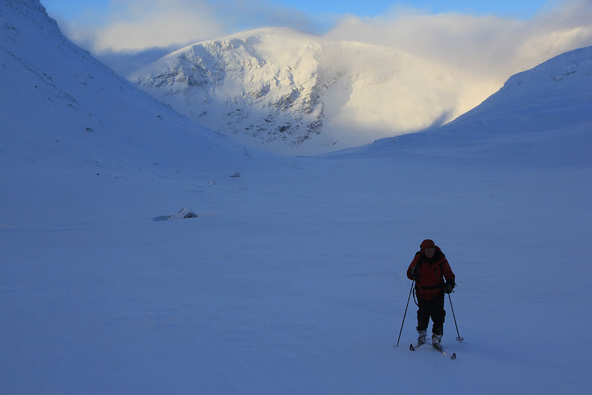
We had decided to ski around to the north side of the mountain, thus avoiding the
steeper west side. We skied south and in
a short break we actually had sun on the peak behind us.
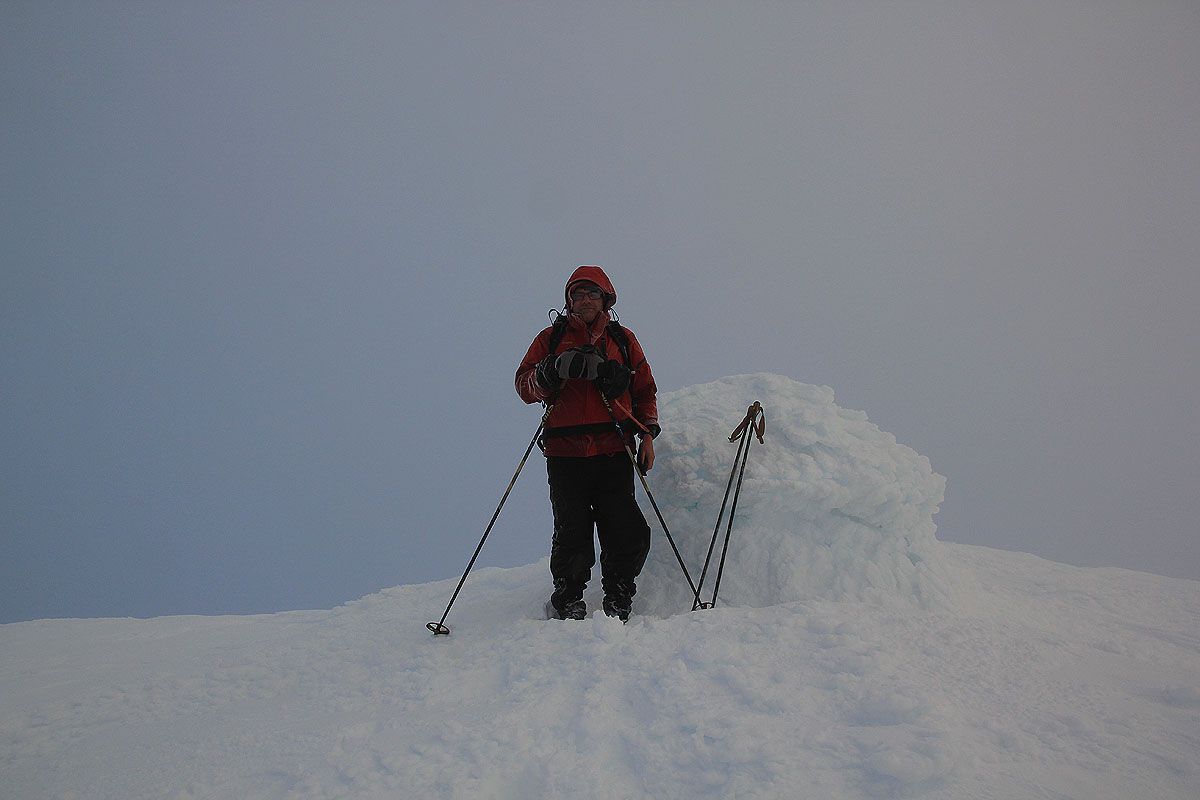
As we got closer to the tiny glacier, the wind got noticeably
stronger. By the time we arrived near the 1420 meter saddle, the weather was
definitely unpleasant. We could easily have continued on skis all the way up, however,
due to the bad weather and in order to get a change of pace, we left the skis at
this location and walked the last 900 meter to the summit. The weather was rough with
blasting snow drifts and full storm force in the gusty wind.
We arrived at the summit 1305, I waited a bit for Åke to
join me, before leaving around 1315.
The weather continued to cause trouble, we had to turn our face away from the wind quite often
or be completely blinded by the snow drift. As we got back to the skis and descended a bit more,
life returned to more acceptable terms. We rested in the hut before skiing back out the valley.
Darkness came and head torches came back on. Just as we reentered the vegetation zone, my ski binding
broke. I carried a repair kit and made some temporary fix. It sort of worked, but made for quite
entertaining skiing back down between the trees. My right ski would not fall off, but it had lost
all directional control. Finally, Åke took care of it while I completed the very last downhill
skiing on my left ski only. We reached the car at 1750, so 40 kilometer in 11 hours and 10 minutes,
not bad in mid november.
