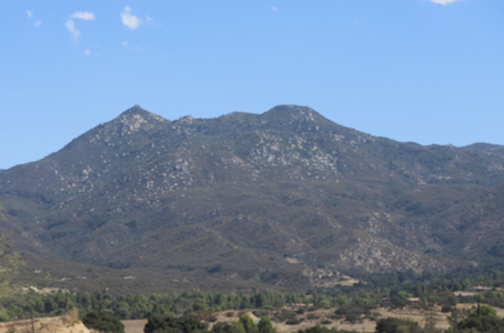
Hot Springs Mountain
- Hot Springs Mountain
- 1991 m
- Primary factor 802 m
- Location: North 33.31522, West 116.57980 (GPS at the summit)
- California, USA
- Difficulty: Drive-up / (YDS) Class 3
- Climbed September 23, 2018
Hot Springs Mountain
|
|
How to get there:
Locate Hwy. 79, branching east, then south from I-15 near Temecula.
Follow Hwy. 79 south to near a place called Warner Springs, this is still north
of Santa Ysabel where Hwy. 79 meets Hwy. 78.
Get onto Camino San Ignacio just as Hwy. 79 makes a big bend (in Warner Springs).
Continue until you reach Los Coyotes Police Department (on the right hand side of
the road). There are road stop signs here informing that any further access is
subject to permission only. Either call ahead or visit in a weekend, one must make
certain that the office is open.
To proceed to the campground, from where one may hike up to the peak, or to get permission
to drive up to the summit, cost 10 USD (2018).
Route description:
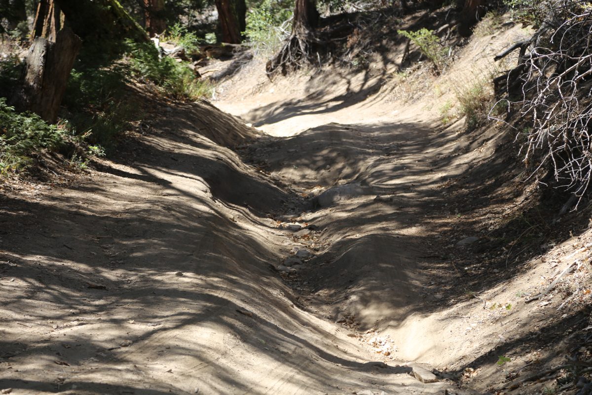
The driving route starts by turning sharp left onto the mountain road about 100 meter after
the police check-point. Follow the road all the way to parking at the very top. This road
requires 4WD and it was (2018) quite rough in a couple of spots.
The best hiking route is likely to follow another forest road that heads towards the summit
area, starting from the camping area, see above.
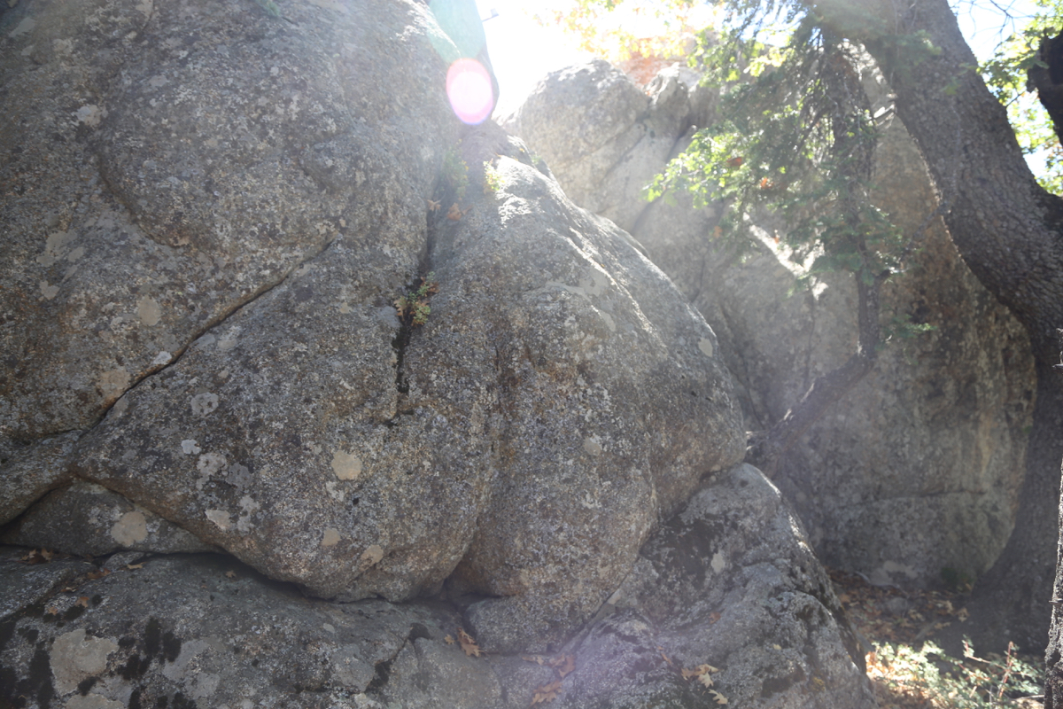
After arriving at the parking area on the summit, one should visit the two local tops. The first,
and most visible is the location of the look-out tower.
This tower has been partially destroyed.
The highest point in this area is a huge boulder at the end of the short ridge, it looks difficult
to climb. (I did not check the other side of it.)
Fortunately, the rock mentioned above need not be climbed, since the highest point of the mountain
is located at the second local top, on the opposite side of the summit parking area. A small trail
marked with micro-flags, will lead you there. The distance is only a few hundred meter.
Surprisingly, this highest point do also have a big boulder
that defines the highest point.
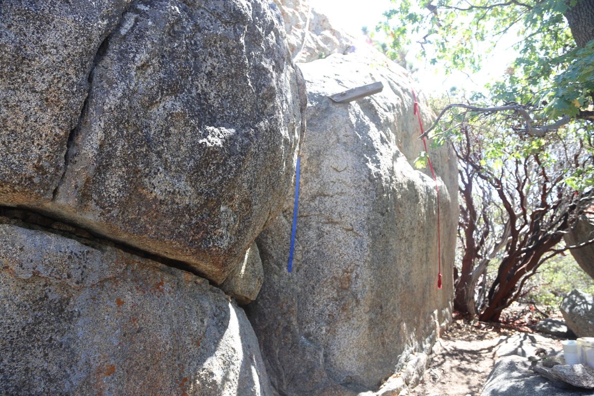
Fortunately, it can be climbed in two different ways along routes that are (YDS) class 3.
The first route, proceed along the rock until you see a very big crack that runs back and
up. If you climb up/into this crack you will arrive on a shelf that can be followed to
a point where one can turn left and ascend to easier ground. There are a few old metal
bolts that may be used for added safety.
The second route, starts even further along, turn the rock and find an area with more
broken terrain and segments of rock that
may be ascended. One needs to cross a crack here and
arrive at a spot from where there is one steep, but very short passage to gain the upper
part of the boulder.
Comments:
I arrived at the police check-point around 1100. The officer was very helpful, he collected
the USD 10 fee for access, then drove ahead of me uo to the gate in order to get it
unlocked. I continued driving, at first the road was really smooth and I thought that
almost any type of car would be able to drive up here. However, higher up this road
turned quite rough in a few spots. It was definitely important to have a capable
4WD (I drove a Jeep Wrangler). I was at the summit parking (only car) at 1145.
I first walked up to the fire-lookout, then headed across to the true summit.
The climb up was easy, I used the crack followed by the shelf. A couple of long
slings had been tied to the bolts to provide access
for non-climbers. This was a very
nice spot and I sat on the summit for quite some time.
After walking back to the parking, I ran into Robeto and his son, they had
hiked up from the campground. I started drving down at 1300. This was the last
peak on my weekend, now back to LA.v