Location North 60.27326, East 005.89853 (GPS on the summit)
Fusa, Norway
Difficulty: YDS class 2
Climbed February 27, 2016.
Information:
How to get there:
From Bergen, follow E16 towards Oslo. At Trengereid, exit right onto highway 7.
Follow highway 7 down to Samnangerfjorden and pass Bjørkheim.
After two tunnels, exit right onto highway 48 (Rosendal/Tysse/Mundheim). Follow highway 48 to
Eikelandsosen and continue further along Hwy. 48 to a somewhat sharp turnoff (left).
This location is Near Holdhus, the road is Hwy. 123.
Measure from here.
After 200m, keep right towards "Tveita/Øvre Hålandsdal".
At 400m, continue straight.
At 3.3Km, turn left towards "Tveita/Gjøn". At 3.7Km go straight, the road
now climbs steeply with hairpin curves.
At 4.8Km, fork left towards "Åse". At approx. 6.9Km,
just above the Berland houses, notice a forest road on your right.
This is your trail. Find parking on a turnout 50m further ahead on the left (3 cars).
This location is N60.24949 E005.89277, elevation about 330 meter.
Route description:
The trail leads nicely uphill breaking out of the birch forest. Then easily
and pretty obviously to the distinct summit Såta at 684m. There is a short,
steep slope on the uphill side, one should ski around Såta on its left hand side (west side).
Follow the high ridge and skirt the next small summit on the left side. Continue along
the highest ridge to the summit plateau,
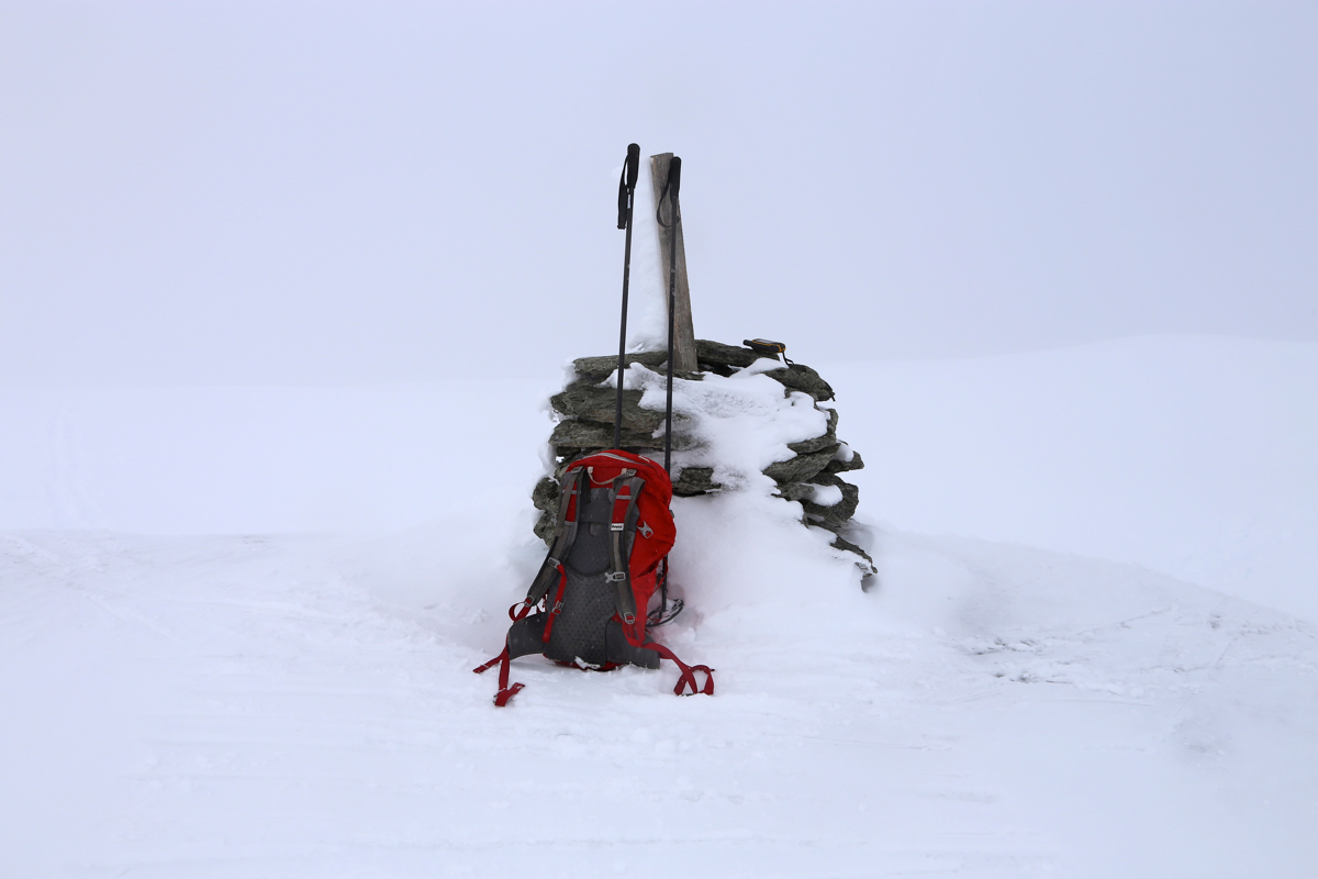
fairly flat with a small cairn towards the north.
Comments:
After a nice saturday morning with pancakes and blueberry, I drove to Fusa with
Våkefjellet as a goal for the day. I parked and was ready to go at 1200.
Fortunately, many locals had already established a nice ski track going up the first
few hills. A lot of new snow, so breaking trail would have been more work.
The ski track continued all the way to the local summit Såta, 684 meter.
All tracks stopped here, the fog was dense and it did not look safe to continue directly.
I went back a little, then skirted around the summit on the west side.
Careful routefinding with GPS lead me safely along the ridge. Total whiteout and hard to
see small variations in the terrain. I finally arrived at the summit cairn at 1400.
Photo and a small side trip (30 meter) to the GPS high-point. It did not look any
higher and I started back down at 1415.
The return ski was nice, but hampered by the fog - flat light. I was back by my car
at 1500.
