Location: North 62:13.804, East 006:01.560 (GPS at the summit).
Sunnmøre, Norway
Difficulty, YDS class 4
Climbed on April 30. 2011
Photos: Anne Rudsengen and Arnt Flatmo
Information:
How to get there:
The best description can be found
at the mountain pages by Arnt Flatmo.
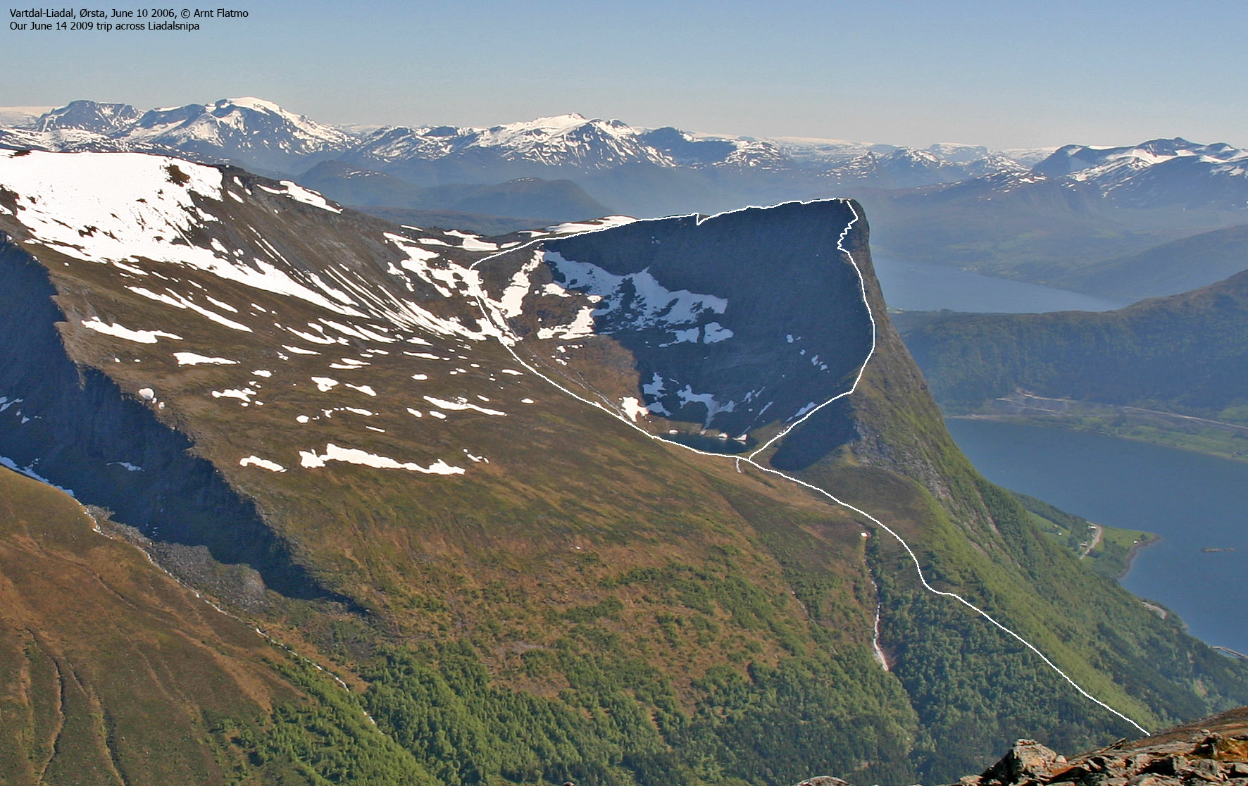
Route description:This picture gives
a pretty good overview of the route.
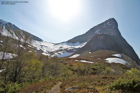
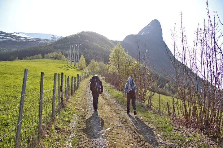
Approach hike:
From the farm, follow a farmers road uphill along the fields in the
direction of Liadalsnipa that looks very characteristic, sort of
leaning above you. The road continues as a trail as it enters the forest
and climbs through the trees before emerging above treeline and now considerably
closer to the peak. The trail continues into the basin with beginning slopes of
Liadalsnipa on your right while a creek is coming down further in and on your left.
As you get closer to the creek, you arrive at a point which marks the junction
if you want to make a full traverse of Liadalsnipa.
The main trail and what is the normal summer route, goes right here and climbs the
main ridge extending out from Liadalsnipa. This description will cover the full traverse
and thus end with descending back down to this point. For more details and accurate
descriptions see the page on Liadalsnipa on Arnt's website Westcoastpeaks.
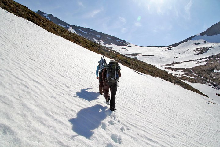
Cross the creek and continue into the basin aiming for
what appears to be the lowest
horizon more or less straight ahead. This is just left of Liadalsnipa as you hike uphill.
There will be a lake, xxx, between you and Liadalsnipa. Almost up, there is a smaller lake
that you will have on your left as you gain what is a very nice and broad ridge turning
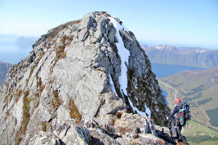
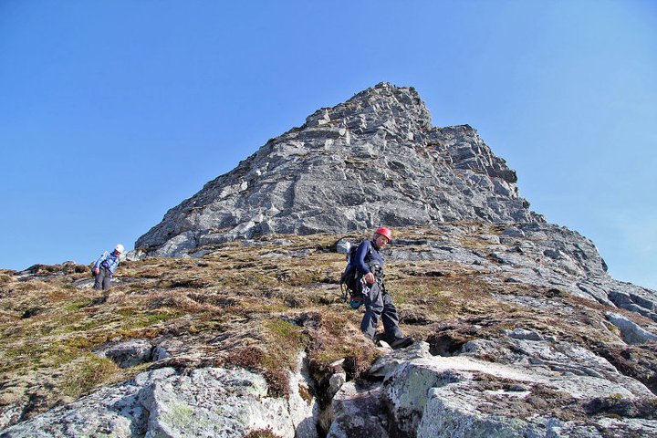
right towards Liadalsnipa that now appears just a little higher. East ridge:
Continue along the ridge until it narrows and steepens considerably.
Downclimb (YDS class 3)
a short section to a notch. Easy scrambling gets you above the next hump and futher down until
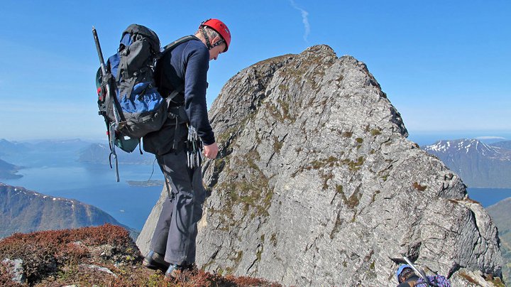
you are right above the main notch in the ridge.
You now have a clear view of the ridge and the route
onwards, it looks steep and exposed from
this viewpoint.
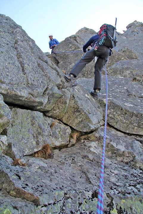
From here, a very short rapell will get you to very
narrow and grassy notch that marks the beginning of the final ridge leading to the summit
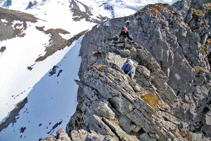
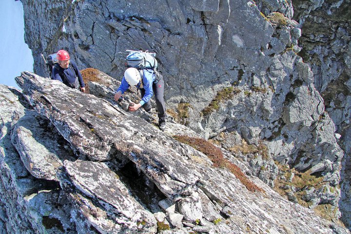
of Liadalsnipa. The ridge is fairly exposed right away.
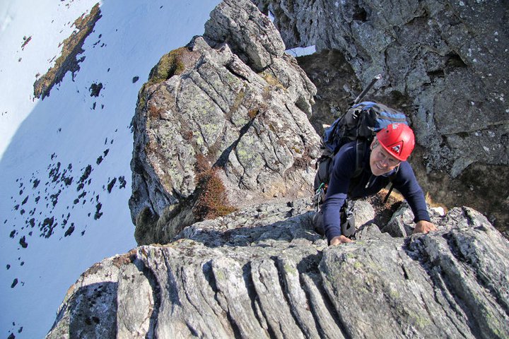
The first two short sections are
slabs of moderate angle.
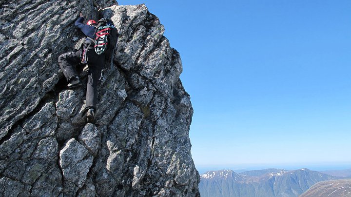
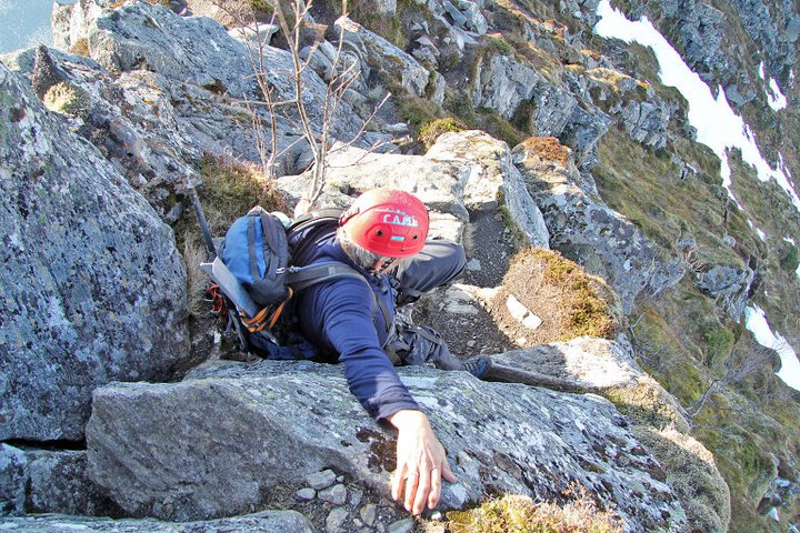
Next comes the crux, a fairly vertical@section. There are some good
footholds, but few handholds higher up. There is a cain here that is attached in a bolt above.
You start from a small area that is slightly slanting towards the void on your right side.
Above this, the ridge has an easier section,
still pretty narrow and exposed, but good scrambling.
Normal route:
Note that this description runs from the summit and down. First, head down the top ridge that
starts out gentle, but gradually gets steeper. There is a big vertical section that must be
bypassed to the right. The trail naturally enters a well defined gully that will take you down
before contouring left and back to the main ridge. There are a couple of short
sections that requires easy scrambling (YDS class 3),
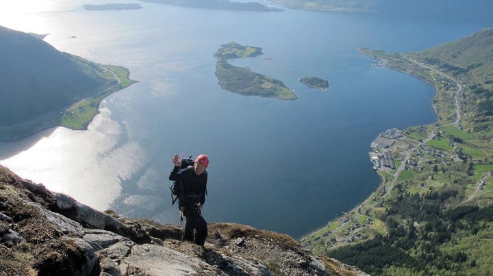
otherwise a nice, but exposed trail
with very nice views of the fjord.
From here, the route descends along the top
ridge until it reaches a pretty horizontal ridge further down. Near the end of this section,
the trail turns right and gets off the ridge ending near the creek in the main basin.
Comments:
I was visiting Arnt and Anne, first time in 2 years and long overdue! Arnt
had planned an airy traverse of Liadalsnipa for Saturday, it tuned out to be an
excellent choice.
We had perfect weather, sunshine and considerably warmer than normal for this time of
year. After some shopping (had to secure dinners for the weekend), we started out at
1030. The local farmer said he thought it was a bit early to do the normal route and
suggested that we consider returning the same way as we planned to approach the peak,
via its east ridge.
The approach hike was easy and soon, we were on the beginning of the route. I looked across
to the final ridge, it did indeed look sharp and the crux area looked nasty hard. Well, things
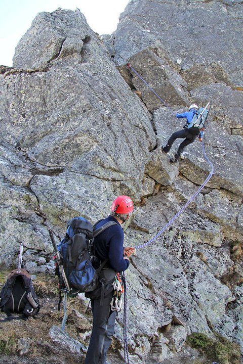
are often easier when you are closer, doing one thing at a time. We scrambled down the
first part and then set up a rapell in
order to reach the fairly deep cut in the ridge.
The ridge was dry and warm and the first pitch was not
too hard. The crux looked easier up close, but turned out to be a bit harder once
half way up and not wanting to use the cain.
right. We proceeded up along the narrow ridge only
to discover that there was snow in the final part of the route.
Proceeding along the rocks on the very top of the ridge still made us succeed
without undue trouble. We reached the summit and noted that nobody had written in the summit register since
October 10.
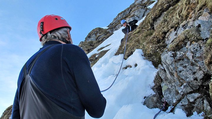
Descending, we soon stood at the top of the gully. It was filled with completely
unreliable rotten snow. We decided to give it a try. Arnt belayed from the top while
I carefully descended. I put in two intermediate belays before finding a very good place
to anchor everything. Anne came down on a prussik,
while Arnt carefully came in last.
From this point only a short traverse remained until we
lere on the normal route with
summer conditions. Care was still needed, but plenty of time to enjoy the phenomenal
fjord view.
Also see the very nice trip report written by Arnt.