Location: North 60:13.254, East 005:15.772 (GPS at the summit).
Bergen, Norway
Difficulty, YDS class 1
Climbed on June 25. 2011
Information:
How to get there:
Drive towards the shopping center Lagunen (on the way to the airport),
then go left in the second traffic circle (just after Lagunen) and drive
to Fana Kirke. At this point, make a right towards Krokeide (Hwy. 546).
Just as you see the left fork to the ferry, stay right and enter a rather more
narrow road that climbs the hill just above the ferry terminal. From this road fork,
go 2.2 kilometer, then look for a pretty large parking area on your right, this is
in a downhill section of your road. the location is N60:12.753, E005:16.273, elevation
about 56 meter. Park here, this is the trailhead.
Route description:
From the trailhead, a forest road heads directly into the woods. Follow this road
until location N60:13.149, E005:16.138, roughly the same elevation. An easy to
spot sign is located on your left. This is the place where the summit trail leaves
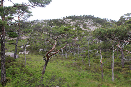
the road. Follow this trail, marked with red ribbon, as it climbs up into a nice area
with scattered pine trees. The trail continues to the twin summits and climbs the
one on your right. This summit has a trig. point as well as a trail register.
The second summit is very nearby on your left. This summit is equally high, it could
even be slightly higher. Thus, you need to head over and visit this one since you are
here anyhow.
Comments:
I had driven across from Kokstad and left my car around 1145. I stopped at the first
summit about 1205 and left the second summit around 1215. I was back at the car by 1230.