Location: North N70:20.502, East 022:40.859 (GPS on the summit)
Difficulty: YDS class 3
Climbed September 2, 2007
Information:
How to get there:
Kjerringa is located on the island Stjernøya, a wild and rugged island
west of its larger neighbor Seiland.
The island has a small population located in Store Kvalfjorden and slightly further north
at a small place called Pollen.
A good starting point is the
town Alta with (fairly) frequent flights to Oslo.
From the center of Alta, drive Hwy. E-6 north (direction Kirkenes) 29 kilometer,
then go left on Hwy. 883 (sign for Lerresfjord). Another 29 kilometer on this highway
will get you to Storekorsnes where there is a boat connection to Hakkstabben on Seiland.
Storekorsnes is located at N70:12.865, E023:11.533.
Check the ferry and boat routes for the schedule, typically,
there is one departure every day. If you arrive by car, then park at Storekorsnes. One may also
go by boat all the way from Alta.
A private boat trip to the west side of Innerpollen will make your hike even shorter, however
the route described below starts at Store Kvalfjord.
Route description:
From Store Kvalfjord, follow the paved road south, when the road forks, continue right
on a dirt road that heads south to Store Kvalfjorddalen. Continue across the meadows north-west
of lake Kvalfjordvatna (47m), then onwards to lake Øvre Kvalfjordvatnet (108m). From here,
head directly north through the saddle (210 m) between Russetinden (416 m) and Saufjellet (356 m) to
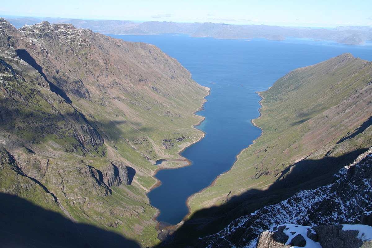
Innerpollen.
There are small trails, the best side of the creek changes a few times, but overall the terrain
is fairly easy. Descend more steeply at the end, down to Innerpollen.
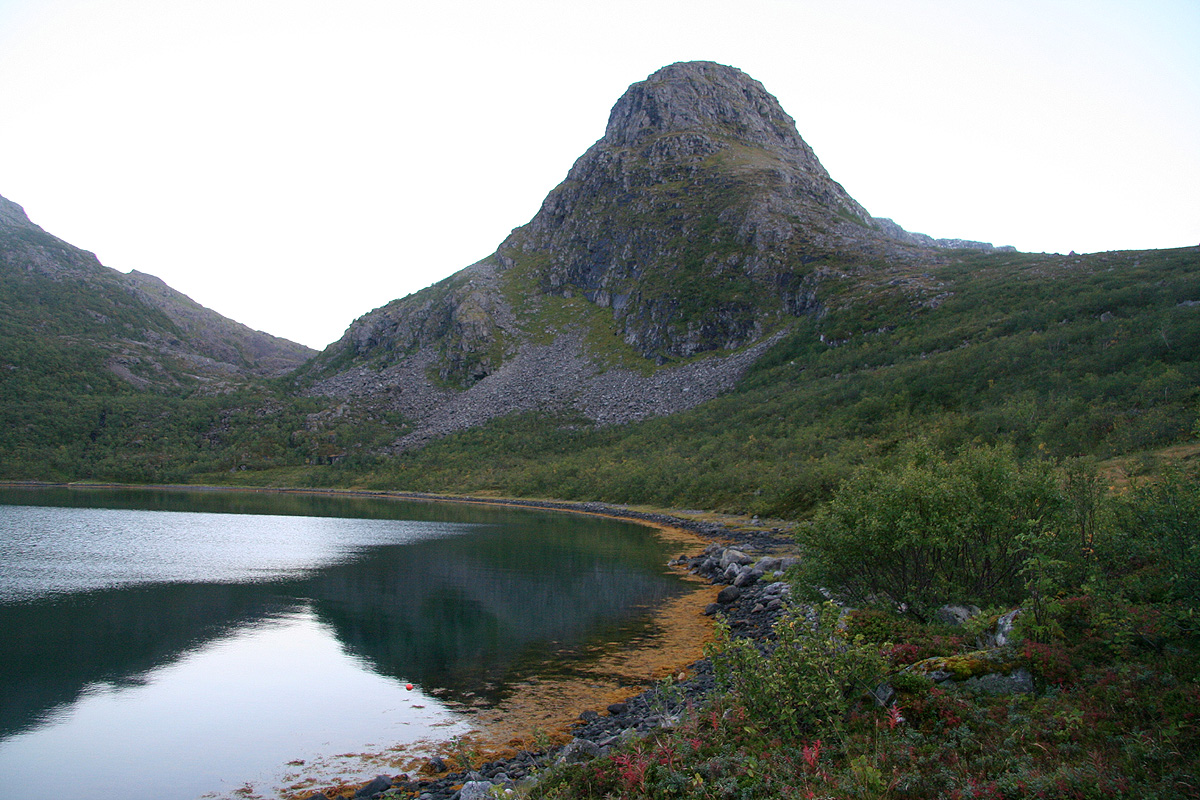
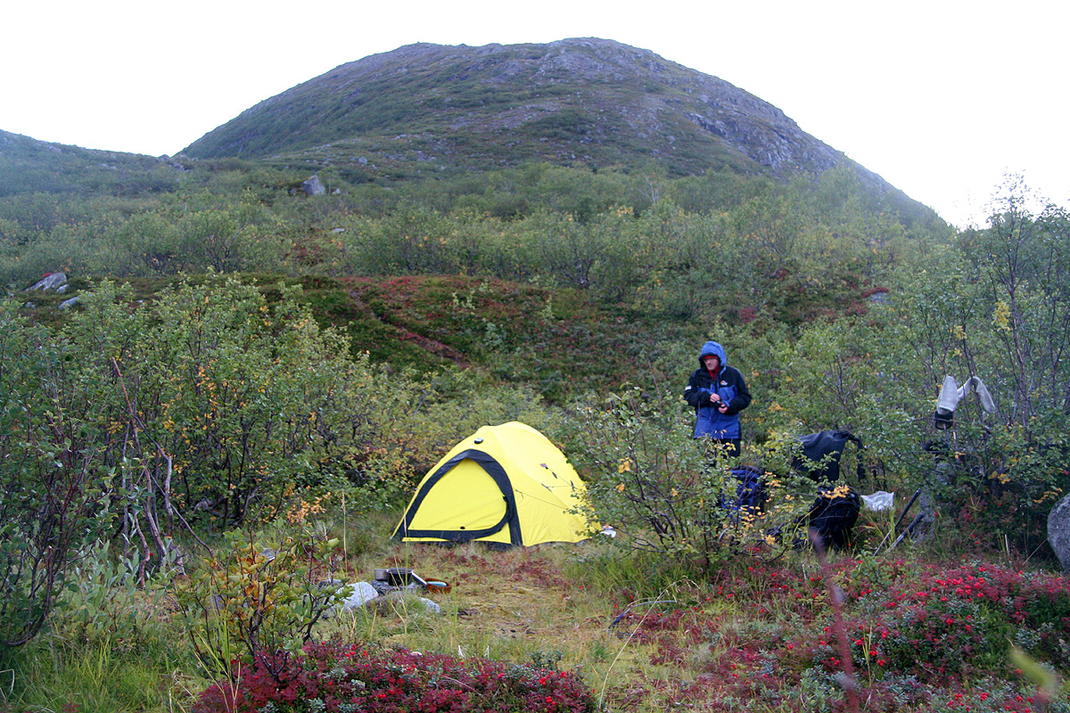
Follow the left side until near the river that drains into Innerpollen from the west, there is
a good camp site just a few meter above the shoreline at this location.
From this campsite, start out directly west along a distinct trail, then leave the trail and
cross the river that drains from lake Pollvatna (92 and 108 m). Follow the smaller creek straight
west into the nice valley that is north of Rundhaugen (490 m). There is a faint trail, it crosses the
creek several times. Near the end of this valley, south of Oterfjellet (665 m), there is a sharp bend
south before you reach a nice saddle (location N70:19.359, E022:44.991) at about 255 meter.
From here, hike west as you pass lake 203 m on its north side, then descend more steeply into
Store Kjerringfjordbotn. The terrain is somewhat better if you stay north of the creek. You cross
a reindeer fence just before the downhill becomes steeper. Cross the river north of where it
merges with the creek from lake 203 m. There is an area with large boulders here and the
river partially disappears under the big rocks.
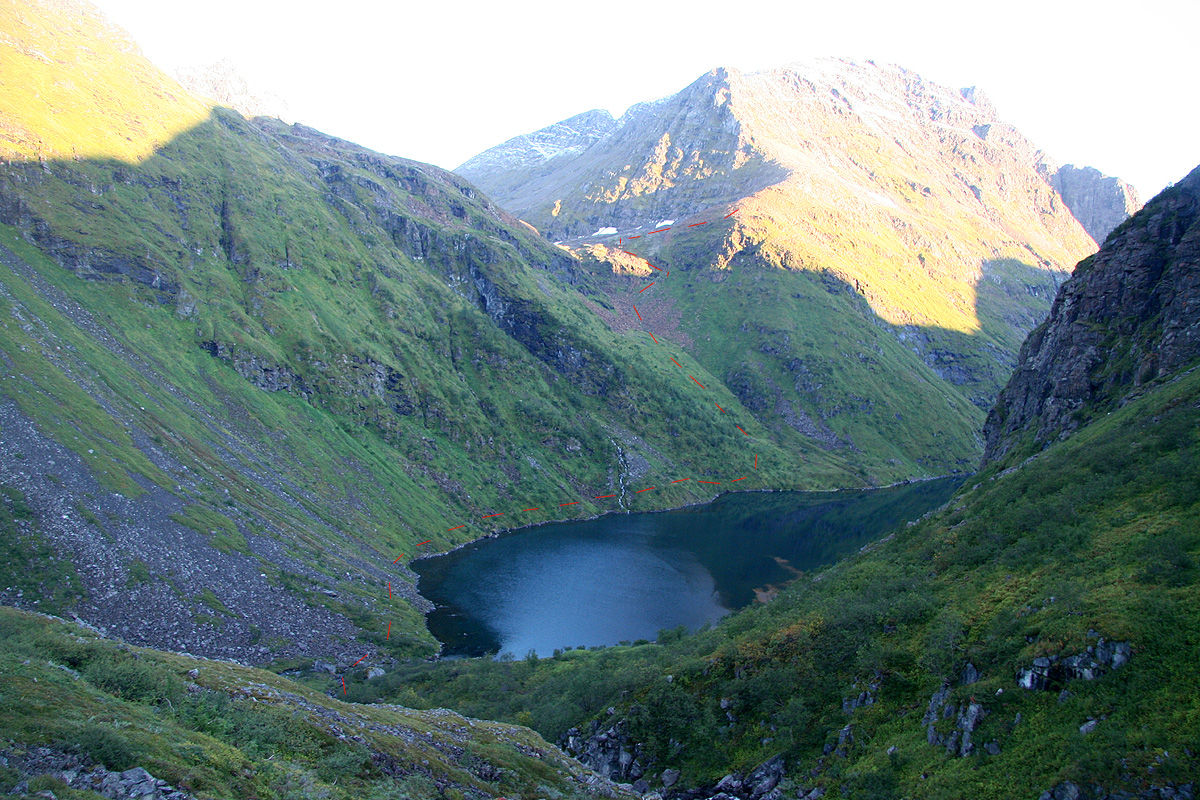
From Store Kjerringfjordbotn, one should proceed along the west side
until near the second creek
that comes down from the west. This creek drains lake 295 m, whereas the first creek comes from
lake 383 m. This stretch is rather unpleasant, the vegetation is quite dense and it is hard to
see where you place your feet. The ground is very uneven with boulders and holes.
Just before you reach this creek, head steeply uphill on a fairly nice grassy slope until a more
level area. From here, cross the creek and climb the natural route to the right in order to
gain the shelf that runs parallel with the creek, but above the first cliff. A very small drainage
seeps down here, the scramble stays at YDS class 2.
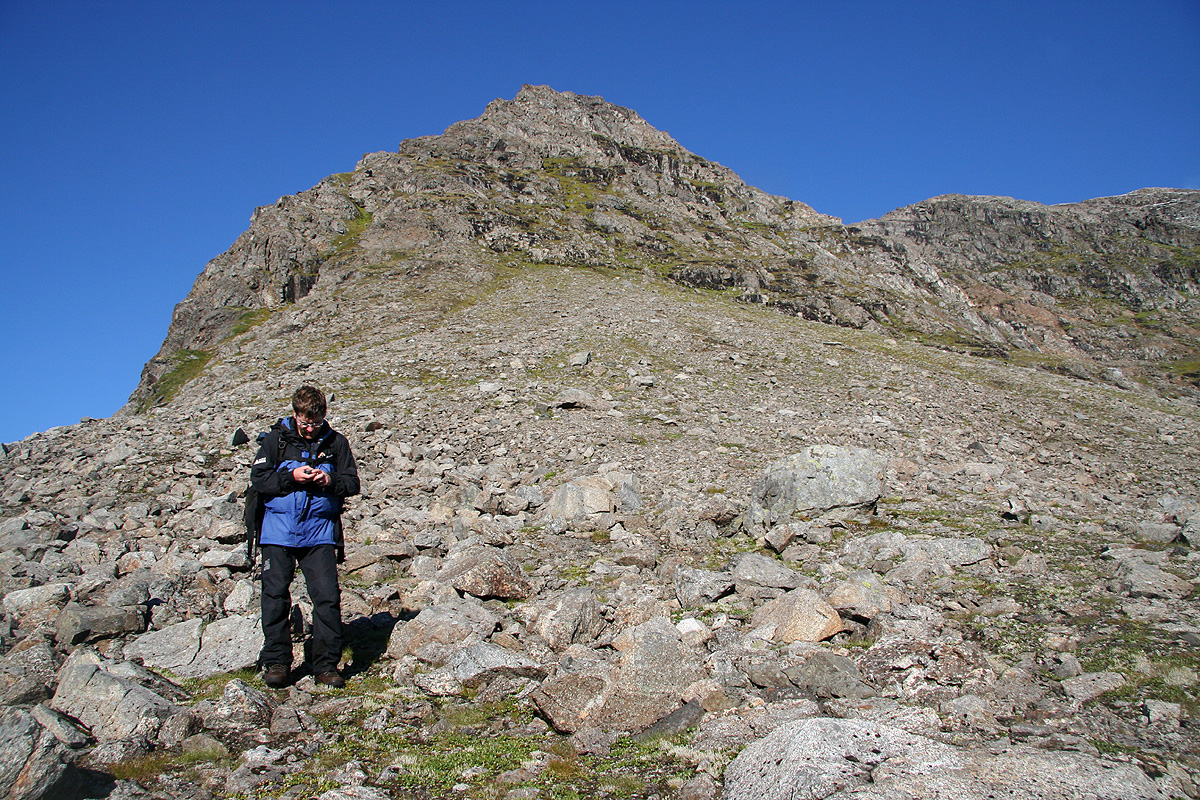
Continue pretty horizontally further west until you overlook lake 295 m. Then, turn right and follow easy
terrain in order to gain the 400 meter level of the pretty distinct ridge that comes down in a south-easterly
direction from the shoulder at about 770 meter higher up. Continue uphill more or less directly
towards this shoulder until the terrain gets too steep to facilitate normal walking.
This point roughly at location N70:20.089, E022:41.458, elevation approximately 500 meter.
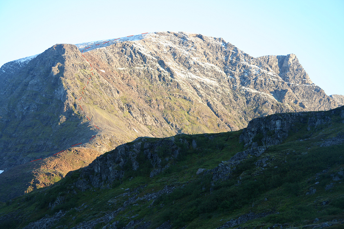
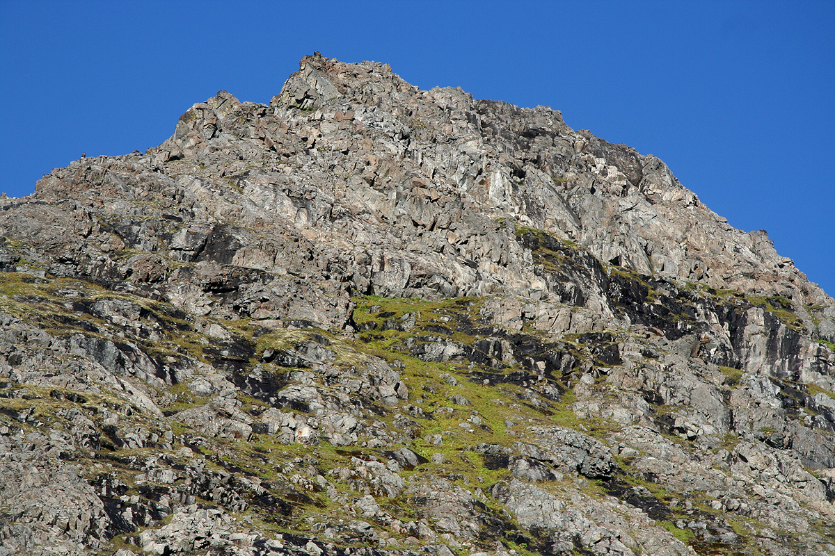
From here, take a careful look at the terrain above you. There are many local alternatives, but your
aim should be to make an ascending traverse going up and right as you face uphill. You will see some
green ledges near the horizon and this is your general direction. The terrain is not very difficult,
but has repeatedly sections of YDS class 3. Many places are steep and the possibly wet grass and moss
contribute to making this section a section that should be traversed with care. A small, natural
rockfall was also observed, so the active use of a climbing helmet is recommended. You will then
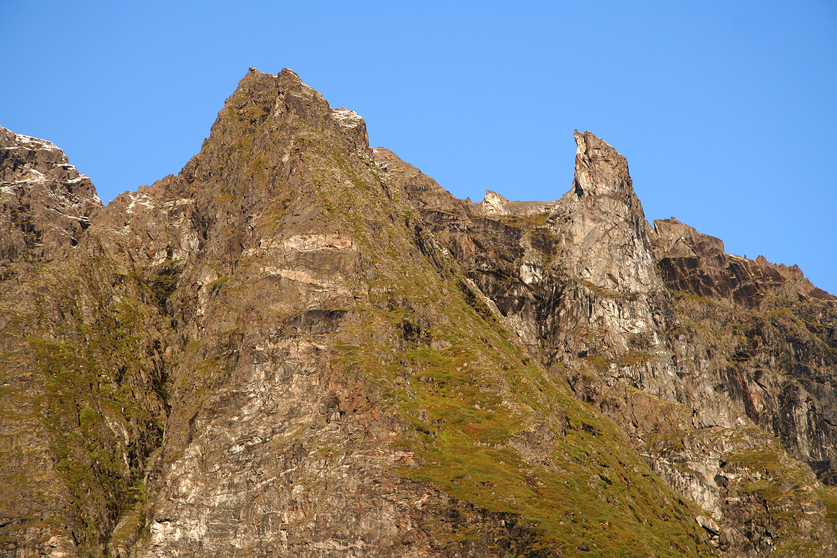
reach location N70:20.226, E022:40.991, elevation about 730 meter and observe a distinct gully among
red rocks that comes down from the shoulder above you. Scramble up this gully and gain the shoulder.
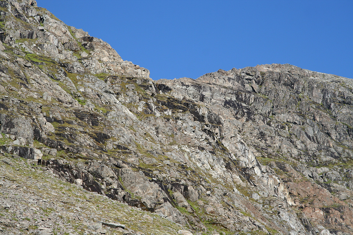
From the top of this shoulder, the remaining part of the route is easy (YDS class 2) walk among
rocks to the large, pretty flat summit.
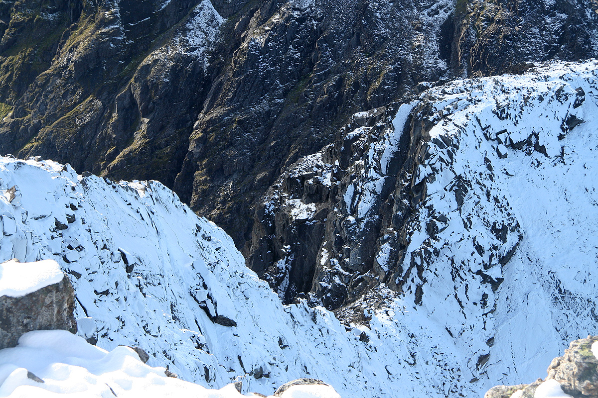
The last part of our route is indicated here.
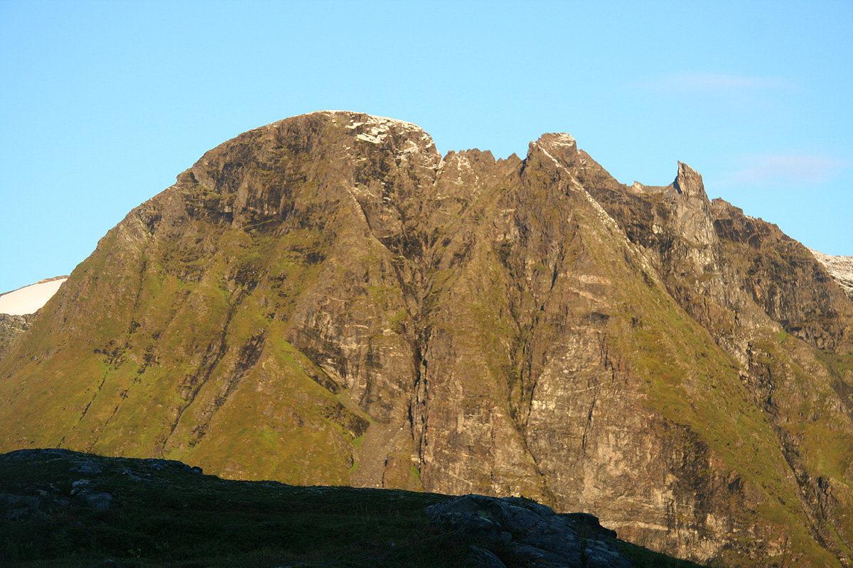
An alternative to this ascending traverse may be to climb more directly uphill to the end of the 770 m shoulder,
that is, stay on the ridge all the way up. The terrain will get steeper higher up, but it appeared that
one would get out of the slippery grass and find pretty good broken rock.
Yet another alternative would be to arrive in Store Kjerringfjord by boat and ascend the slope towards the
same shoulder in a line that starts perhaps one kilometer north of the creek from lake 295, near the third
creek that is indicated on the map. However, this requires a boat ride that is long and may have problems
of its own, see comments below.
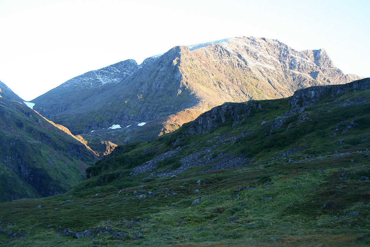
A third alternative is to continue just north of lake 295, then hike west up the valley to the col at
550 meter. From this col, one may climb the broad ridge leading up to the small summit marked at 831 meter.
From this summit, one must go east and the crux of this route is a sharp dent in the ridge that must be
downclimbed. It is difficult to make a precise judgement of this route without actually trying it out.
However, from the picture it looks like more serious climbing than the route described above.
Comments:
Kjerringa is the highest mountain in Hasvik kommune and it has the third highest primary
factor in all of Finnmark.
I did this climb together with my friend Geir Åke Dahlen.
The day before, we had a very long and successful
climb in the new national park on Seiland.
We had then travelled by private boat directly out Store Kufjorden,
across Rognsundet and into the protected fjord
called Indre Pollen. This is located at the island
Stjernøya.
Here, we had established our second base camp and
our ambitious goal for the next day would be to climb the highest mountain, Kjerringa.
We woke up at 0330 to a brilliant blue sky and frost in the air. The clear night had been pretty cold.
Since we planned to leave Stjernøya with the only boat available, at 1630, and since we needed about
two hours to hike across to Store Kvalfjorden where this boat would depart, we figured that a record early
start was needed. We knew that the entire route would be unknown terrain and that our goal, Kjerringa, would
be a rather steep mountain.
We were on our way at 0430, the sun could be seen hitting a few tops, but it would not find us for many
more hours. The first valley looked inviting, as it stretched inland before hiding the route behind a sharp
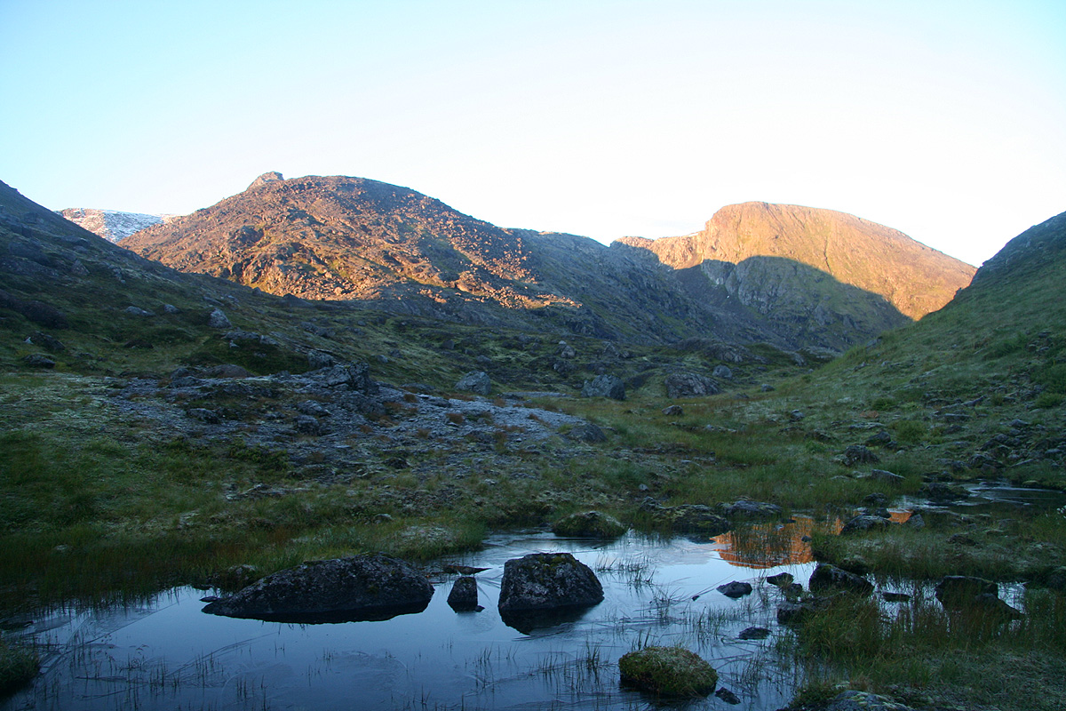
bend. We hiked along and reached the col
at 0525. 255 vertical meter gained, the next goal would be to descend
all the way back down to Store Kjerringfjord.
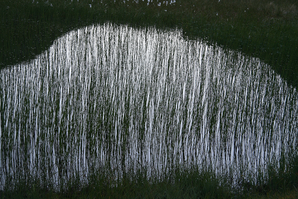
A truly beautiful morning in magic landscape, small
ponds with "siv" displaying art of nature.
The terrain stayed nice as we started to see more peaks appear
in front of us. Boy, this island has quite some topography.
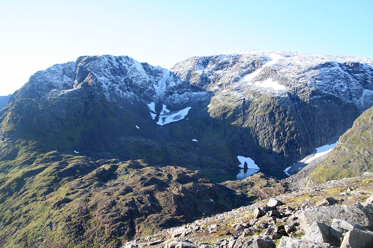
Steep and rugged, we looked across to
Kjerringfjellet,
knowing that our objective, Kjerringa, was still out of sight. We descended the steeper section on the
left side of the creek, observing that the right side was slightly better.
From here, we could see Kjerringa.
It looked steep and uninviting. Her upper slopes all white from newly fallen snow. The lower part was
steep. My plan was to try the approach across peak 831, then a short, but unknown connecting ridge
to her upper slopes. The disadvantage of this route was its length as well as the fact that what appeared
to be the crux was hard to see or judge before actually being there.
From our viewpoint above Store Kjerringfjordbotn, we could more easily look at an alternative route, up the
ridge that was facing us right across the fjord. This route got progressively steeper the higher you
went, however, it caught my attention that a traverse right, pretty high up might provide a route that
would be less steep also near the top. Reminding ourselves that mountains (almost!) always look steeper
than they are when viewed head on, we saw that this route presented a possible alternative.
The next section of this hike was very bad indeed,
traversing along the fjord in fairly steep terrain with
vegetation about one meter high,- obscuring everything. The vegetation was wet, we quickly got soaked with
water. The plants that you could not avoid touching was partly nettle "brennesle", stinging, just to add
more agony. The ground was invisible, but covered by boulders to stumble upon and holes to step into.
It was slippery enough to cause Geir Åke to take a 3 meter slide in the direction of the fjord below,
however with enough plants to grab and thus prevent any cold swim. A pretty short section, but it took us close
to one full hour to get across.
We finally started our ascent and made a few important decisions along the way: 1) We would dedicate this nice
day to kjerringa. Thus, make an attempt to reach the summit even if this meant missing the boat. We had been
told that a boat leaving the next morning at 0800 could serve as a backup. This departure was not listed in the
table of scheduled trips, however, it served to move some schoolchildren across to their respective schools.
An important argument in favor of this decision was the very nice weather. We should enjoy this day to its
fullest, it would be hard to know what the weather might be like tomorrow. 2) We should make an attempt at
the "direct route", ie. the route that proceeded directly up the front of the mountain. We had been able to
look at this alternative and it looked possible. Moreover, this would be quite a bit shorter than the hike
up and across point 831 m. The first sun of the day was now hitting us, all the steep mountains had kept us
in the shade until here.
We quickly gained elevation to about the 500 meter level,
the time was 0910, and we could consider the future.
The future looked
steep and slippery. Some rock to hold on to, but lots of grassy ledges sloping outward. I decided that the
ice axe left behind today would indeed have been very nice right here and now. Exploring upwards, we slowly
advanced. The terrain did not get much worse, but the steepness below us increased the exposure. I briefly
considered going more straight up
in order to find more rock and less slippery grass, but decided to stick
with the original plan.
After about one full hour and 200 more vertical meter, I could see the red boulders and
a promising gully leading upwards. Waiting for Geir Åke, I shouted to him that the rest of the
route looked simpler. Soon thereafter, we both emerged on top of the flat shoulder and congratulated each other,
knowing that the rest of the way to the summit would be easy. We reached the summit at 1100, 6.5 hours one way and
there was no reason to believe that the return would be much faster.
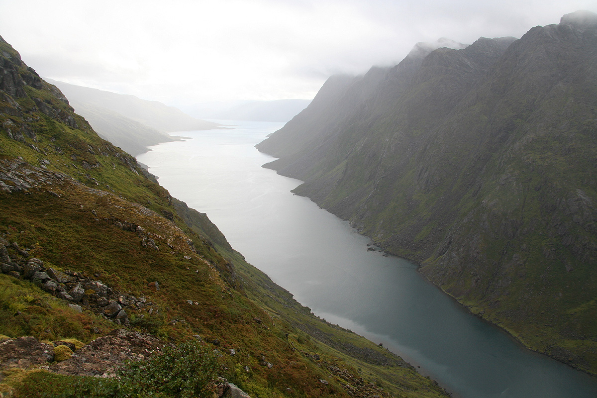
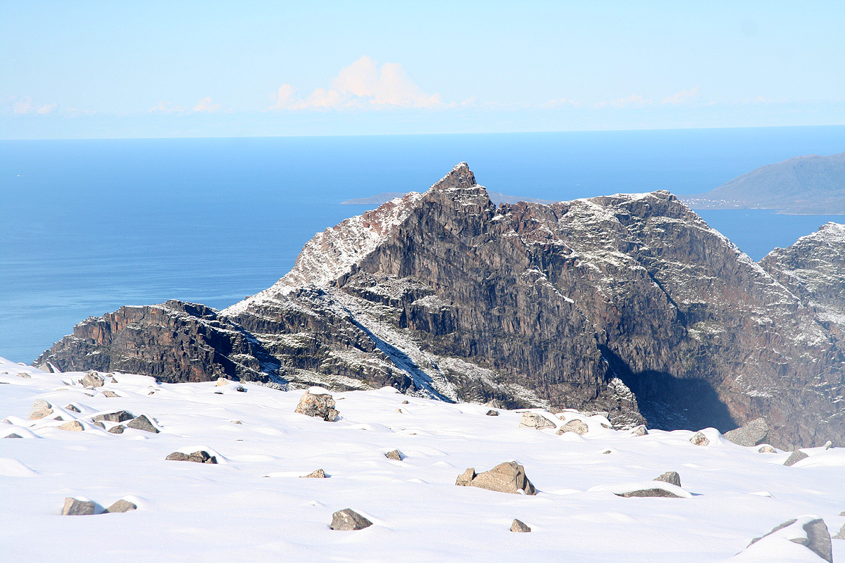
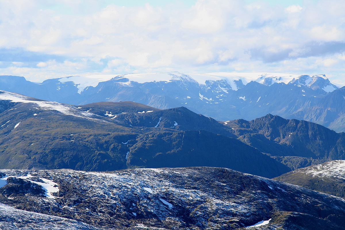
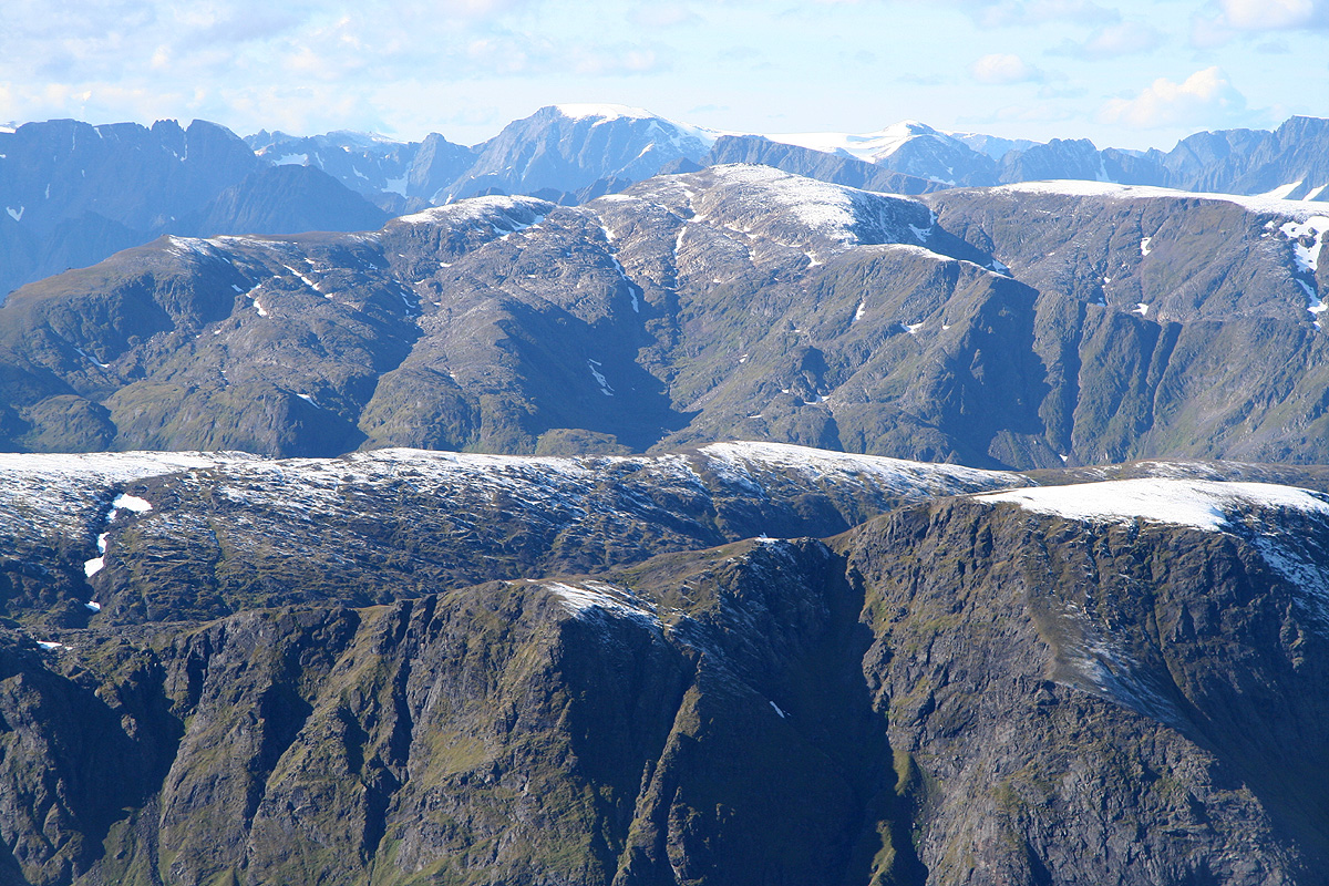
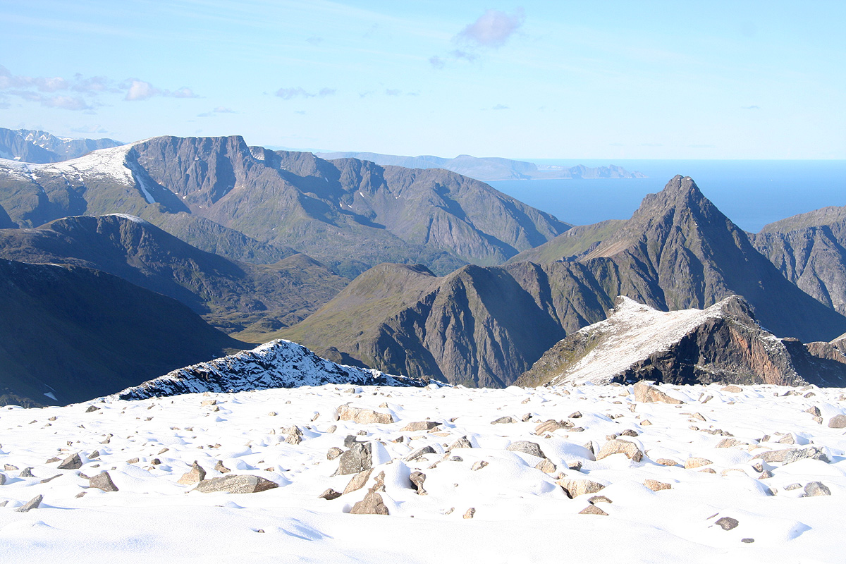
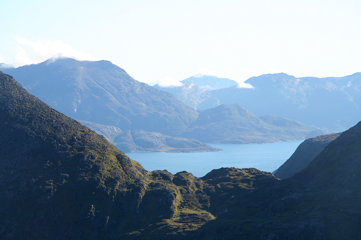
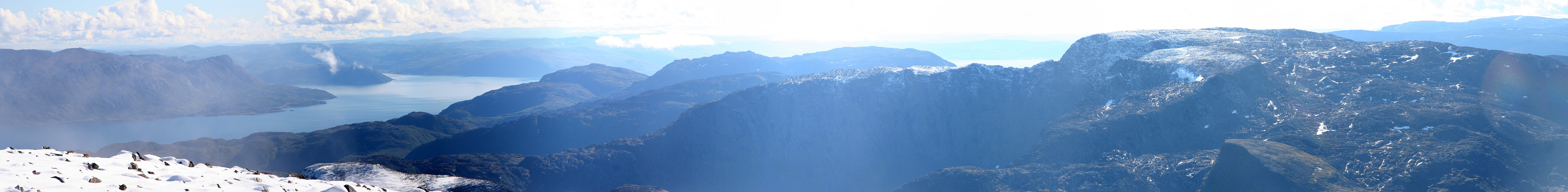
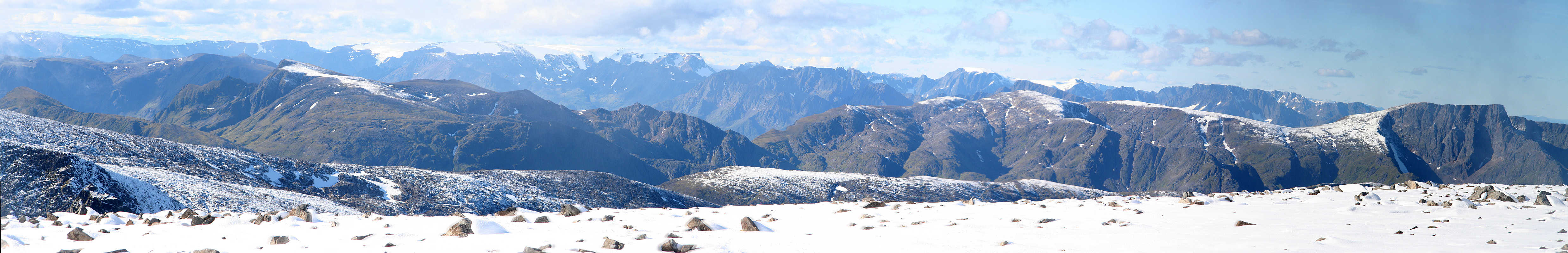
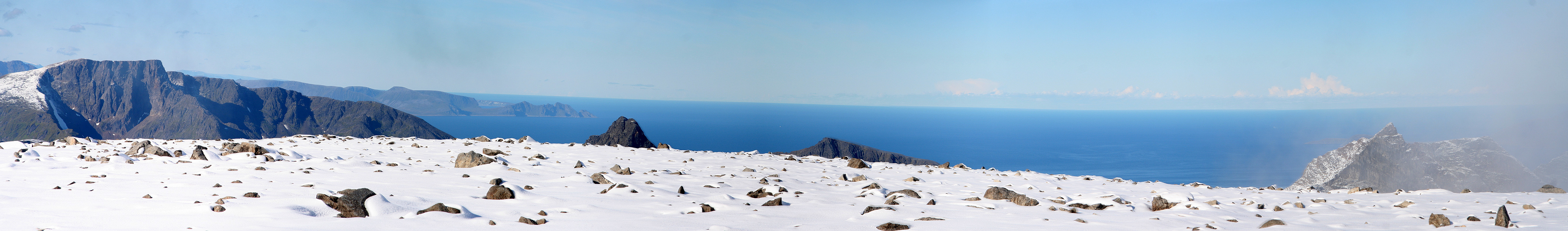
Very nice views all around.
The trip originally scheduled to Øksfjordjøkelen, had just been cancelled, at least we got a good
view of it from here. Further
out (west), Svartfjellet with its glacier, another major
mountain in Finnmark. Nearby, the next mountain out
from here is only a bit lower, impressive cliffs and sea views!
Stjernøya is full of peaks with all sorts of shapes, it must be one of the most
mountainous islands in Norway (however one quantifies such a statement).
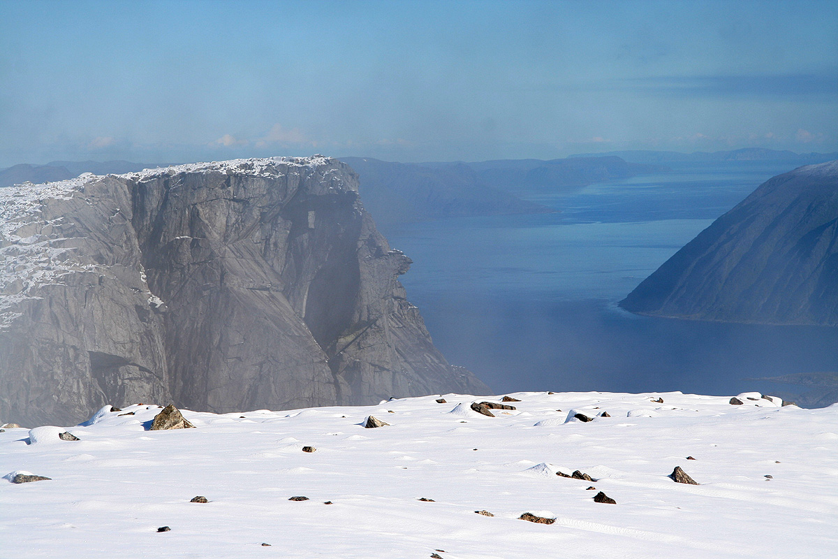
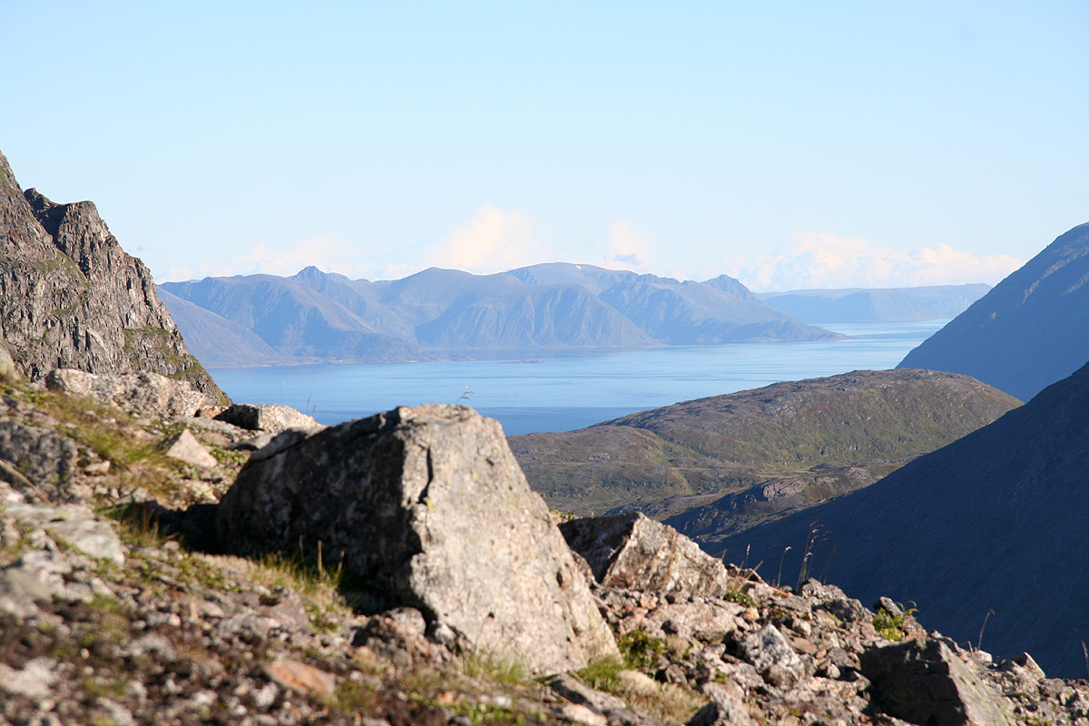
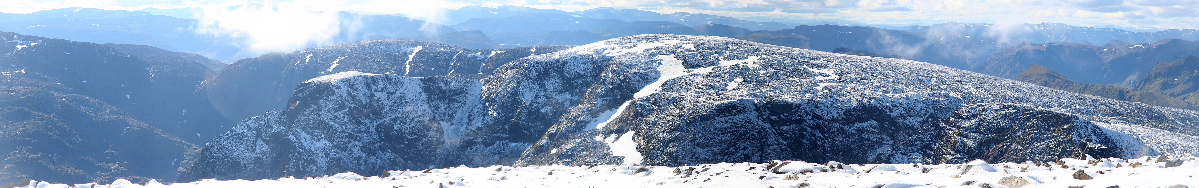
We took a major rest and walked across the plateau to get good views down the steep
sides. Descending, we walked over towards the "ridge route" from point 831,
agreeing that it indeed looked pretty scary.
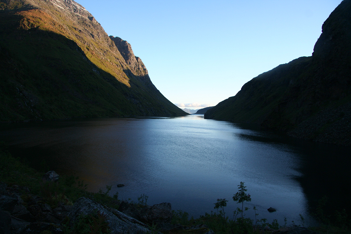
A nice view out Lille Kjerringfjord concluded our summit stay.
As often is the case, our descent followed exactly the way we had climbed up and presented few difficulties.
We made small improvements to our route while going back, but as expected, did not reach the tent until 1745,
a total trip of 13:15.
Thus, we were back by the tent about 1:15 after the boat left Kvalfjord, it had been clear since we
reached the summit that we would have to use the Monday morning boat (at 0800) that Knut had informed
us about. We realized that the first possible ferry across to Øksfjordjøkulen would be
as late as 1400, too late for a climb. Considering alternative peaks, we decided to climb
Svartfjellet the following day.
We still got up pretty early the next day and started our hike to Store Kvalfjord already at 0530. With 2.5
hours we felt confident that a good long rest could be taken before the boat would arrive. However, the hike
up the valley between Russetinden and Saufjellet turned more cumbersome than anticipated. We also ended up sort
of in the middle of two possible routes, either to cross Saufjellet on a high contour and descend directly to
Store Kvalfjorden or cross through the low saddle to Store Kvalfjorddalen and hike it out to Store Kvalfjorden.
The time kept running and towards the end of this hike we needed to (almost) run ourselves in order to
catch the boat. We arrived at the pier with less than 5 minutes to spare! There would be no more boats this
day and my flight was definitely tomorrow.
The boat arrived and three small children from Pollen disembarked, their elementary school being here in
Kvalfjorden. Three young teenage girls entered the boat in order to take it across to their middle school located
back at Seiland. As it turned out, we could have hiked around Inner Pollen and out to the houses at Pollen,
this would have been much shorter/easier, but if course, we had no idea that this boat would pick up
children there.
The captain was very friendly, first informing us that this boat did not serve Storekorsneset (where we had our car),
then adding that he would make the detour as it was very seldom any tourists (like us) showed up. He was pretty
certain that nobody had climbed Kjerringa for about 30 years! He also told us about somebody that had taken a boat
in Store Kjerringfjord. Just then, Kjerringa had avalanched rocks into the fjord almost killing everybody by
sinking their boat (tsunami wave and general shock waves) The fjord is so narrow that any avalanche or rock slide
hitting it from about 900 meter above creates a critical situation for anybody on the surface.
We got to Storekorsnes, thanked the captain warmly for his service and great help, then drove off to our last and
final goal, Svartfjellet, the highest mountain on Kvaløya.
Note: A check with the Norwegian Mapping Authority provided a few historical facts about
Kjerringa. Kjerringa had its (most likely) first ascent already in 1888, by Premierløjtnant Eriksen, he led a
party that surveyed the western part of Finnmark. His notes describes the ascent as:
"Temmelig slem adkomst fra bunnen av Kjerringfjord på 3-4 timer". (Awkward approach from Store Kjerringfjord, 3-4 hours).
We must agree, it seems likely that his party started somewhat further out in the fjord. The Mapping Authority could
further confirm that nobody from their agency has visited the summit in the last 30 years.