How to get there:
I normally start from Osavann (305 m), a lake at the end
of the road leading into Bjørndalen from
the main highway E-16, about 20 minutes drive from
the center of Bergen. There are several alternative
places to start. Route description:1. Normal
The normal skiing route leaves the parking lot and follows
a well marked trail further in the valley, then sharply
across a bridge. The trail has three distinct climbs and
reaches the hut Redningshytten (600 m). From the hut there is a nice
downhill followed by another gentle climb to the bottom
of a rather steep section called Korketrekkeren (the corkscrew).
From the top of this hill, the trail enters a narrow gorge.
(actually, the cairns stay on the ridgetop, but it is much more practical
to enter the gorge).
The trail is marked with numbered cairns all the way. At the top
of the gorge the winter route normally makes an almost 180 degree
turn right and climbs over the ridge above before entering
a larger basin. After crossing this basin along the left side, the
trail again merges with the summer route. From here, the trail
heads down into a valley called Middagsdalen, before the final
climb to the summit. 2. Via Austlirinden
This variant heads across the creek just after leaving the
parking lot, then climbs the ridge and crosses the mountain
Austlirinden (808m) before descending
to the col near Redningshytten. From there, as for the normal route.
This alternative is quite good in late spring, since the snow
on these north facing slopes tends to last long. 1b Variant, roundtrip from Osavatn
Another route that I like to follow on the return in order to
make a circle trip, continues north from the top down the first few
hills in the direction of Gullbotnen, then sharply left (towards west)
following the ridge along the top. Eventually, one can have a fine run down
south towards a basin and further along a small creek before
turning right down to Svartevannet (384 m) that now serves as a drinking
reservoir for Bergen. From here one finds the former trail near the
bridge mentioned on the standard route. 2. Glamregjelet
Start out along the normal trail, but instead of crossing the river
below Svartavatnet (392m), follow the trail that heads up just left (north)
of the dam. Hike around Svartavatnet on the north side, but just as the
trail bends north around the ridge called Svartavasslia, leave the
trail (right), descend to the creek, cross it and contour around the
ridge in front of you. You will now enter Glamregjelet, a big
gully that can be followed up to lake 727. From here, climb right (east)
and follow the ridge Gullfjellhalsen south to the main summit. 2b Variant, Pilatus gully
Follow the route into Glamregjelet and climb to just above 600 meter in
this gully. A pretty deep and very distinct gully forks sharply right
(south) up to the point Ronamanen (890m). This gully has an average slope
of about 40 degrees, a bit steeper in the higher part. There is normally
a pretty big cornice at the very top (4-5 meter vertical), however, it
can normally (at least late in the season), be climbed on the west
side (right side as you face up the gully). 2c Variant, Pontius gully
Continue up Glamregjelet just a bit higher than Pilatus. A second
gully heads up to the right, pretty much parallel with Pilatus.
This gully is not quite as deeply set. The average slope is also
more gentle, just about 30 degrees. Additionally, this gully is
slightly wider and definitely more well suited for skiers. Comments:
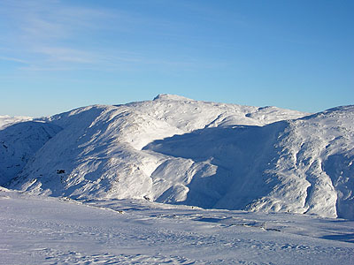
The view from the summit is great, mountains in three directions, but also
fjords on both sides and the North Sea out west. I have enjoyed a late
sunset from the summit several times. One can often ski this mountain
until late May. The summit itself is on the city limit
of Bergen. The mountain has several steep sections and the weather
can change quickly. One should be well equipped. Despite being
a `city mountain' it should not be taken too lightly, fog and nasty
conditions normally found on much higher mountains can be quite
serious.