Geitfjellet
- Geitfjellet
- Elevation: 416 m
- Primary factor 108 m
- Location: North 63:25.997, East 10:18.272 (GPS at the summit)
- Bymarka, Trondheim
- Saddle: on the west side between 305-310.
- Difficulty: YDS class 1
- Hiked many times 1970-1975.
|
 |
Information:
How to get there:
The normal hike (summer and winter) would start
from Skistua, the parking area high on Gråkallen.
One can also have a nice hike to this top from the city
of Trondheim. A suitable trailhead is located at Ila, on the
west side of the downtown area. This location is
N63:25.776, E10:21.828, near a local creek. There is parking
at nearby side roads.
Route description:
There are several alternative trails.
This description starts at the Ila trailhead specified above.
Head up along the creek, partly on nice wooden steps. Follow local
roads and locate a dam. Proceed up on the north side of the lake named
Theisendammen (elev. 157m). There is a golf course in the area. Continue
on trails (keep right) to Sommersætra and further onwards to the small
place called Helkanseter. Look for signs saying Geitfjellet (all along!). There
is a reasonably large and well maintained trail.
Comments:
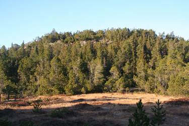
Often visited as part of an orienteering race, famous
for almost inpenetrable pine forest.
I hiked and skied this hill many times
in the period 1970-1975, while I attended NTH in
order to obtain a Master Degree in Physics.
On November 8th, 2009, I had the pleasure to revisit this
area with the very good company of my son Pål Jørgen.
We started out from his house at Ila around 1210 and had a nice trip
to Geitfjellet arriving there after one hour. A short break at the top,
then a rather obscure trail steeply down on the west side. We made a nice
loop hike ending back on Våttakammen (elev. 285m) with a nice view
down to Trondheim. From there, we desended back, traversing slightly in order
to reconnect with the wooden steps that we had ascended near the very
beginning of our hike.
Resources: