Location: North 37.82722, West 25.75447 (GPS on the summit)
Difficulty: YDS class 1
Climbed: July 30. 2014
Information:
This mountain is the only peak having prominence exceeding 600 meter and
not being an island high point in the Azores. There are 7 island high points that
also exceed 600 meter, bringing the total number of P600 in the Azores to 8.
Here is a quick summary of my climbs in the Azores islands.
How to get there:
Drive from Ponta Delgado to the airport, but continue through Relva, the take the first
right signed for Pico do Carvao. After driving by this peak, you will first locate an
official trailhead (Information sign and parking) on your right hand side. Continue driving and
locate a similar trailhead (Information sign and parking) on your left hand side. This is the
trailhead, location N37.83491, W25.75869, elevation about 770 meter.
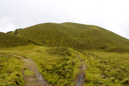
Route description:
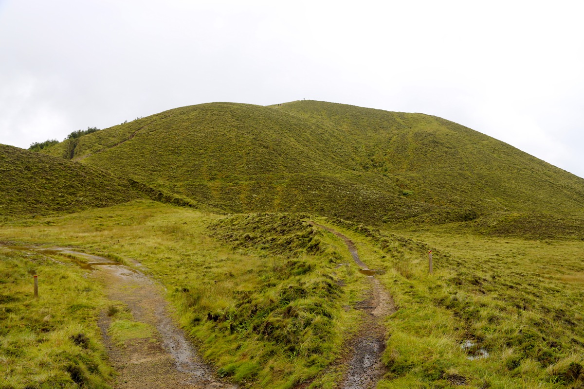
Follow the big trail that starts out from the parking area. Follow the trail markers as you go a bit
left and pass through an open barrier. If you have visibility, then it is obvious how one variant of the
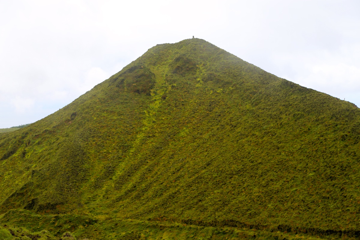
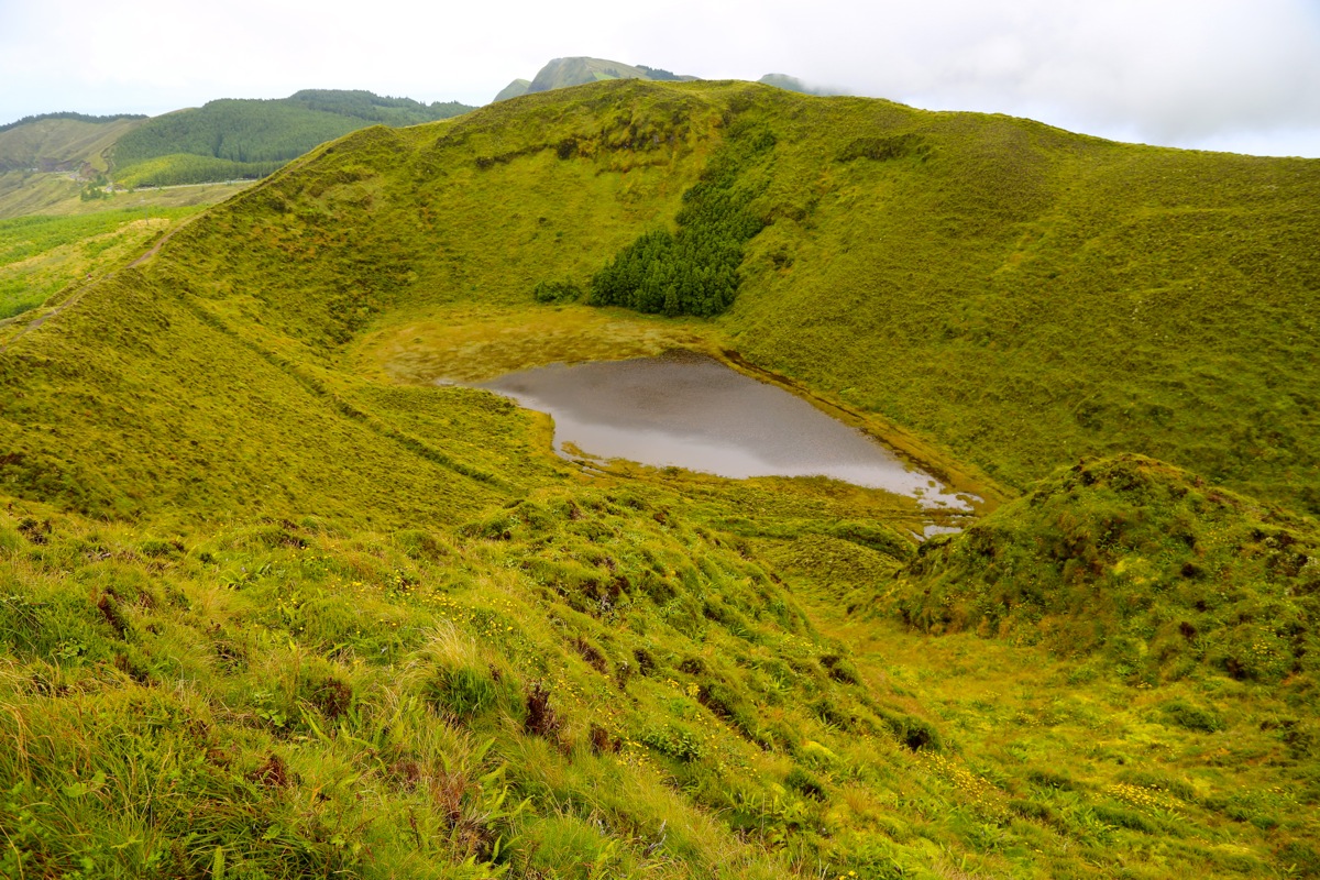
trail now climbs directly up the slope, while a slightly more gentle alternative runs a zig-zag. Once on top
you have reached a small crater rim that may be followed all around.
The most direct path to the highest point is
counter-clockwise, i.e. you should turn right. This trail will descend to a saddle, then ascend the
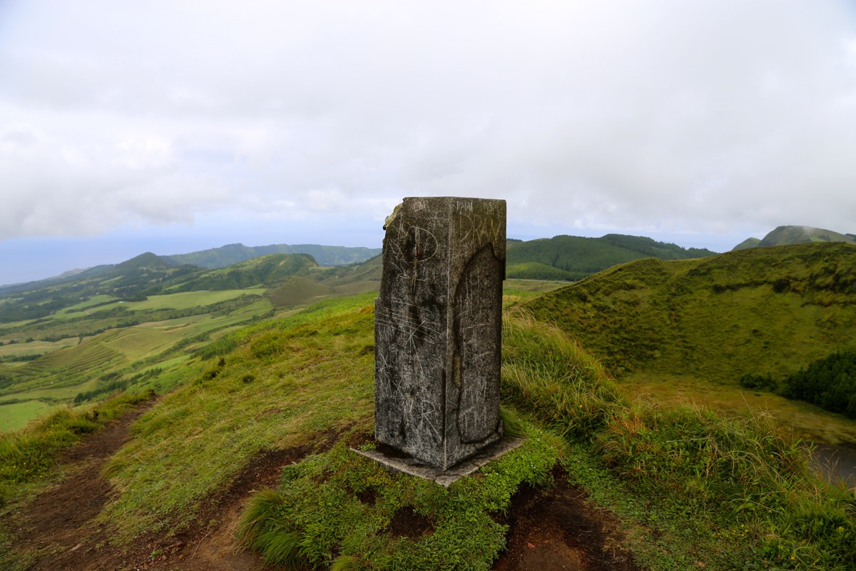
final ridge to the summit marker. Comments:
I arrived at this trailhead fairly late in a day (on July 30.) of general sightseeing and exploring
with my wife Heidi. The weather was completely foggy and I promised to just do a short
hike, hopefully finding the summit. I reached the crater
rim and found what appeared to be a summit.
With no visibility, I decided to check if there was another summit by (unfortunately) going clockwise.
Soon, I did find a second summit point that seemed to be of equal height or possibly slightly
lower. I had no good map, and therefore no idea that I was on a crater rim. Since Heidi was waiting, I
decided to turn back and hopefully, one of the two summits visited would turn out to be the
proper summit.
This turned out not to be the case and I was back at the trailhead the following day, July 31.
Today, there was visibility and I
walked around the entire crater after first going to the
proper summit. The hike takes about 15-20 minutes each way depending on hiking speed and the choice of
route.