Location: North 60.03218, East 005.40990 (GPS at the summit)
Difficulty: (YDS) class 2 (winter) / class 1 summer.
Climbed February 17. 2013.
Information:
How to get there:
This mountain is located on the island Reksteren, north-west of the larger island Tysnes, but
connected to this island via a bridge. Locate the small community Våge on the north coast of Tysnes.
Våge is south of Os and has a frequent connection by ferry. One can also drive to Våge from the
east where Tysnes is connected to the mainland of Norway via a bridge.
From Våge, locate the traffic circle and measure from here. Go uphill along Hwy. 49 (sign for Hodnanes),
at kilometer 6.8, turn right. Then at kilometer 12.2, turn right again (sign Reksteren 5). Continue to
follow what is the main road and turn sharply right at kilometer 19.3 (sign Gjøvåg). Continue
to kilometer 21.1, just beyond a small hilltop.
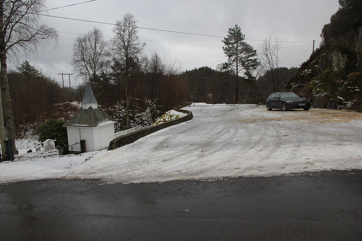
Turn right into a small parking lot just next to a small
white chapel and a local graveyard. This is your trailhead, location N60.01961, E005.38637, elevation
about 46 meter.
Route description:
Exit the parking, turn right and walk down the small hill. Before the first house on your
left, a forest road forks left. There is a sign here saying Dalstuva 2.8 kilometer. Follow
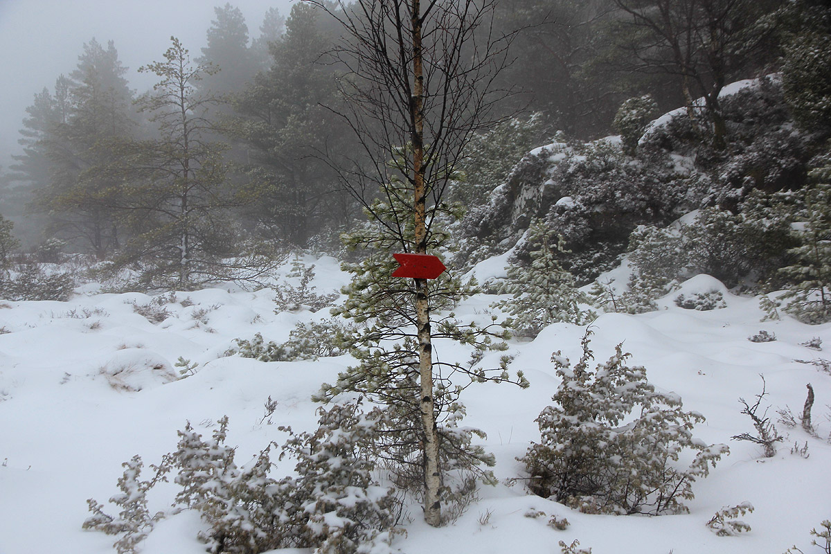
this forest road, after the first little uphill, take the right fork. You will observe that
this route is marked with small, red wooden signs. Continue along the forest road as it turns
gently uphill and follows a small creek. When the forest road makes a big curve left, look for
another small red arrow that points to the continuation, now a small trail. This trail continues
up the small mini-vally along the small creek. Do not leave the general direction before the
trail essentially reaches a col, a flat plateau where the valley ends. Another red arrow will
point right. Continue to follow the red arrows and
arrive at the base of the final, distinct
hill. It pays to go right (between two pine trees) here, then locate the small trail that winds
uphill while avoiding dense bush vegetation (einer or brake).
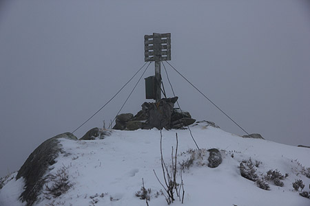
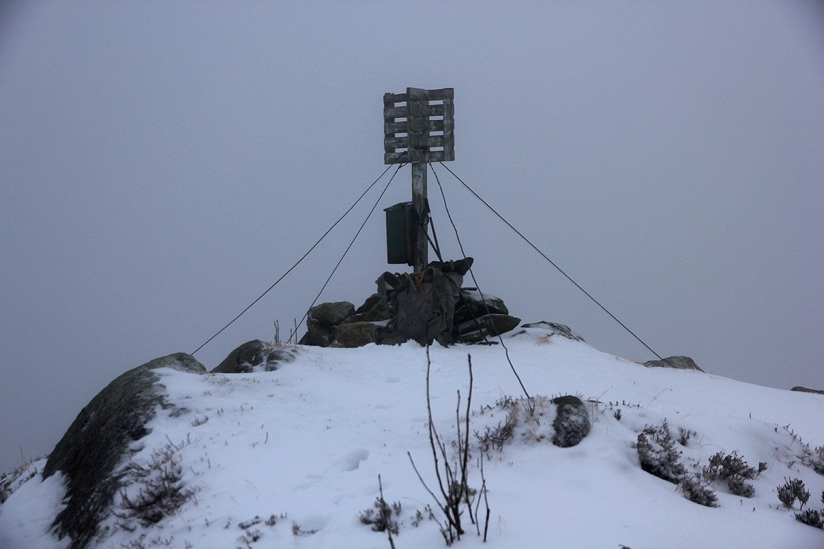
The summit has a trigonometric marker. Comments:
I arrived in the early evening and decided to stay overnight in my car. The next morning, my plan
was to start early and hike using my head torch. However, when I woke up the time was already 0800.
I left at 0810 and had no big difficulties. I lost the trail at the very end of the hike and ended
up fighting some bad brush (brake) covered up by snow. Arriving at 0910, I spent 10 minutes at the summit, then
returning to my car in 40 minutes.