Location: N:62.02.370, E:005.59.604 (GPS at the summit)
Sunnmørsalpene in Møre og Romsdal
Climbed January 5, 2003.
Information:
How to get there:
A good starting point is the small place Søre Bjørkedalen
on Hwy. E-39 about 20 km north of Nordfjordeid (between Nordfjordeid
and Volda). This place is west of Bjørkedalsvatnet (elev. 25m).
If coming from the south, you will first cross a river, then pass the
road to Hjelmeland (a road through the valley Hjelmelandsdalen). Very
shortly thereafter, there is a small road going left. This road serves
a small campground in the summer season. A few hundred meters from the
main Hwy. there is a four-way intersection. The left turn crosses the
creek and serves some farms, while the right turn serves the campground.
The road to be followed continues straight ahead.
In the winter, find
parking near this area. In the summer, one may be able to drive up
this forest road towards Laurdalssætra. There is a sign posted that
this is a self-serve toll road, however this sign is posted further up.
There is a side road at
about 300 meter elevation to the right, this is marked on the M711 map
and the trail goes left from this sideroad, about 100 meter from where
it branches off. However, there is now a new sideroad going right about
100 (vertical) meter higher, locate this and follow it (fairly horizontally) to
the spot where it crosses the creek, park near this area. Route description:
In the winter, ski straight up the forest road as it bends and makes several
distinct left curves while climbing up the valley on the right hand side of the creek.
Take the third, distinct road that branches off to the right at about 400 meter
of elevation (see also the summer description above). Locate the creek that comes down
from Tuvedalen, the road ends shortly beyond the creek. Do not cross the creek, rather
continue uphill along some smaller, but distinct ridges where the vegetation is quite
open and gain the entrance to the (hanging) Tuvedalen valley above. This small valley
is between Litletuva (896m) on the right and Storetuva (910m) on the left. Storetuva is further
connected with the higher point 1010 a bit further in.
Ski or hike in this small valley and straight up the slope at its end between two
creeks, the leftmost being a bit more distict. In winter the two corresponding gullies are
quite easy to see.
At the top of this slope, a more level saddle connects to a new
ridge that climbs to point 1073. The best ski route is just left of the main
ridgeline. At the top of this slope, one will see the summit of Trollvasstinden for the
first time. Continue along a more gentle uphill to the base of Bytingstinden (1250m).
In the summer, there is a trail traversing on the left (south) side of Bytingstinden
to the saddle between this peak and Trollvasstinden. The ascent of the ridge to the
Trollvasstinden summit is most likely easy and the entire route is most probabely YDS class 2.
However, also in summer a fun alternative would be to traverse the summit of Bytingstinden
and the connecting ridge to Trollvasstinden, YDS class 3.
In winter, the conditions can be quite different, the same traverse can be done, or
alternatively, (as we did) climb Bytingstinden first, then traverse to Trollvasstinden.
The ascent of Bytingstinden is straightforward. From the cairn, there is a short, nearly flat and
fairly exposed ridge to the point where the ridge drops towards the saddle of Trollvasstinden.
The technically easiest way down has considerable exposure (to the right) the first few
meters. In order to avoid this, one may consider a short downclimb (earlier and to the left)
that is more protected, but YDS class 4. The remaining downclimb is class 3 if staying on the
ridge and only circumventing a few obvious sections with short traverses slightly below
the highest ridge on the left side. Once in the saddle, the climb back up to the
Trollvasstinden summit is easy with a sufficiently wide ridge and a rather moderate slope. Comments:
I did this climb with Arnt Flatmo. He did a great job
breaking trail all the way up to the treeline. We started at dawn
around 0850, hit the summit at 1325 and started the descent about 15
minutes later. We were back at the car at 1525 after a very good
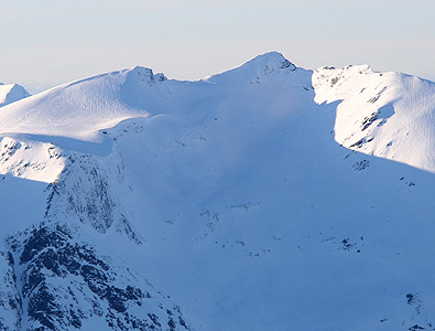
climb with beautiful weather and spectacular scenery all around.
Ascents in this area in January are not common.
This was my very first peak in the "Sunnmøre Alps", no question that
I shall return to this land of sharp peaks and beautiful fjords.