Location: North 62:06.755, East 006:16.476 (GPS at the summit)
Difficulty: YDS class 2
Climbed February 11, 2012
Information:
How to get there:
This mountain is located near Volda, that is south-east along the
new Hwy. E-39 on the north side of Austfjorden.
Shortly after Hwy. 43 branches sharply left, the road approaches a tunnel,
do not drive this tunnel, but take the (old) road that branches right.
You should see parking opportunities near the place where this road curves
left, location N62:05.107, E006:15.316, elevation about 110 meter.
Route description:
From the curve on the road (parking) continue along the main road and
walk by a house on your left hand side. Slightly further (downhill),
a forest road runs uphill to your left.
Take this road and follow it until near its
end. From there, an old (summer) path continues uphill. Ascend more or less directly
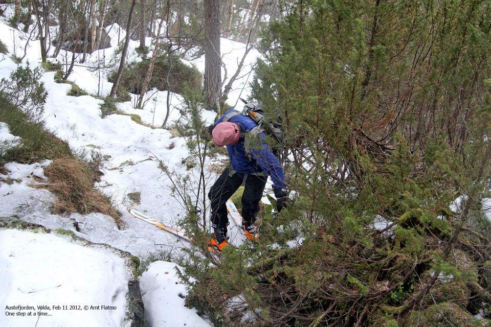
uphill following the most natural line. This part is steep and can be
somewhat cumbersome.
Higher up, you pass near Litlesætra, the route now turns right and
heads up a small valley with steeper cliffs on the uphill (left) side. Continue uphill,
then more horizontally, before a steeper pitch (left) brings you up to the summer farm
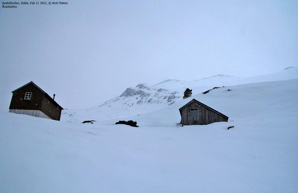
called Årsetsætra at about 545 meter, location N62:05.720, E006:16.304.
From here, head uphill across or around a small local hill, then up the main mountain slope,
find your way, first right, then a
long ascending traverse left will bring you to a
somewhat more level area. From here, ascend while going right then on an easier slope uphill
to gain the main ridge. Finally, follow the main ridge, first uphill, then almost horizontally to
the cairn located at the very end of the top ridge.
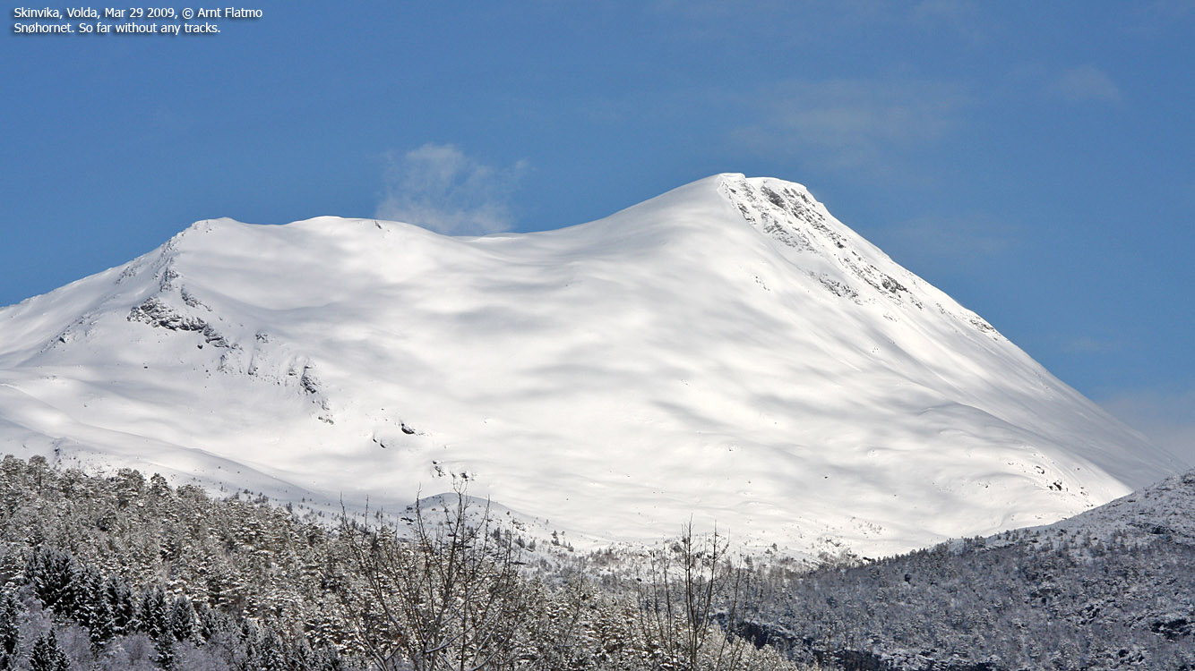
Also see the good description by Arnt Flatmo.
Comments:
I was fortunate to be able to visit Arnt Flatmo this weekend. The forecast was not good, but
at least the wind was supposed to be rather weak. We drove from Arnt's house on Gurskøya and
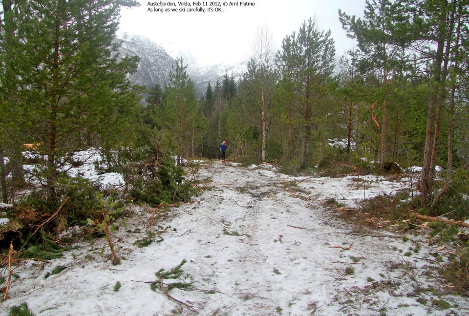
parked at the trailhead around 1000. By 1015 we were on skis through rather messy terrain (trees, but not
much snow). We emerged on a forest road (that one really should take from the main road!), then
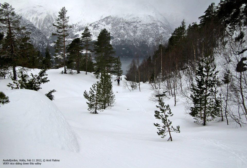
followed this further uphill. The next section was steep, good to use skins under the skis here.
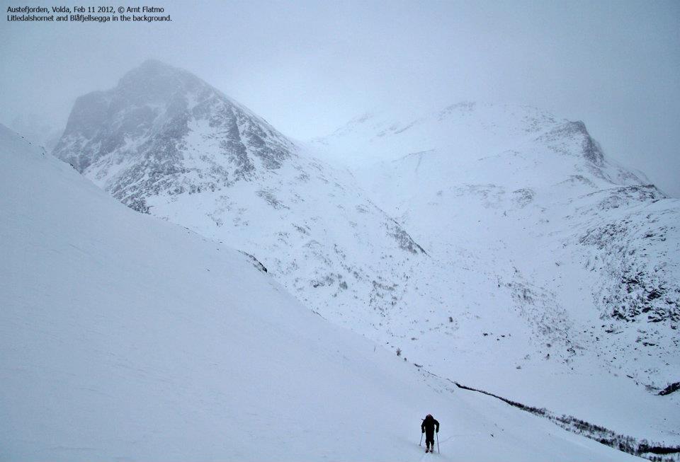
We arrived at Årsetsætra at 1140, time to put on a jacket before starting up the main
mountain slope. Skiing was pretty good, not much ice and we reached a small plateau where a cornice had
formed facing uphill. With fog and poor visibility, Arnt skied close to the edge and the whole thing
collapsed in the uphill direction. Big blocks of snow, a sign that the newly wind accumulated snow was
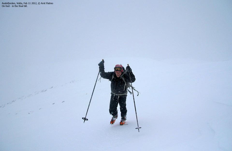
pretty unstable. We continued uphill and made the main ridge. This ridge was easy to follow, but the snow
was slightly more icy higher up. Thus, we continued on foot climbing
slightly more than 100 (vertical) meter.
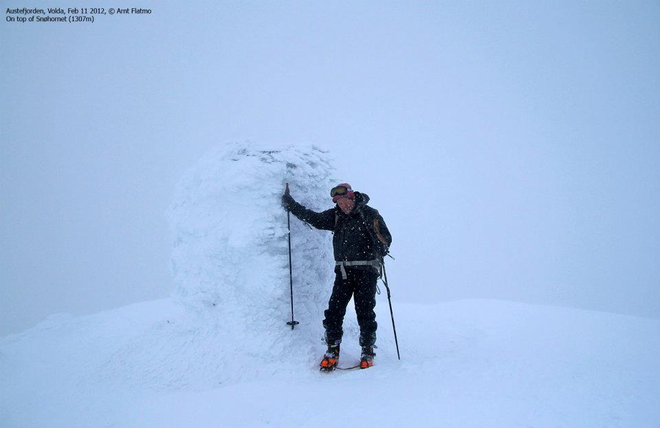
The top ridge was essentially completely flat, in white-out conditions, as we used our GPS units in order
to stay well on the left side when
walking towards the summit cairn. Arriving at 1340, we did not stay long
since the weather was noninviting. We returned to the skis
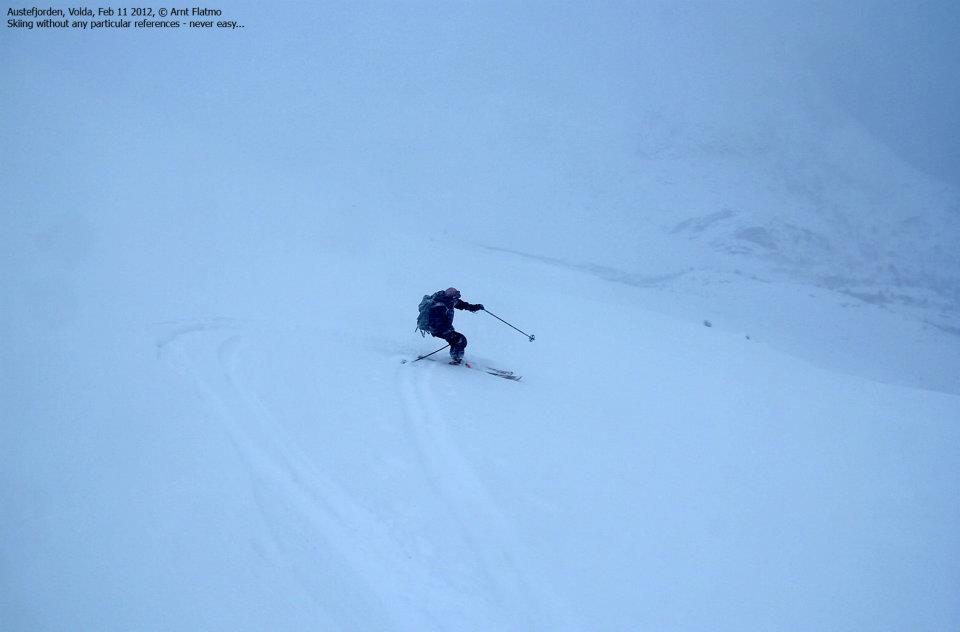
and skied down along the same route as we had
ascended until the visibility improved. The descent was nice, but the steeper section down among the
trees had to be negotiated on foot. We returned to the car at 1530, nice to be able to travel back home to
Arnt's house.
Many thanks are due to Arnt for his expert choice of mountain as well as unlimited patience with
a slow skier.
