Location: North 70:10.791, East 022:03.611 (GPS at the summit)
Difficulty: YDS class 2
Climbed on May 30, 2008.
Information:
How to get there:
Here is a quick summary of the peaks climbed during this T8 trip.
From Tromsø, either drive via Breivika and take the ferry across to Svensby.
Continue to Lyngseidet and take a second ferry to Olderdalen. Check the ferry schedule before
deciding. The slightly longer (in time) alternative is to
drive E-8 to Nordkjosbotn, then head north along E-6 to Olderdalen.
From Olderdalen, continue 142 kilometer north along E-6 to Alteidet, cross into Finnmark and leave E-6
along Hwy. 882 in Langfjordbotn. Drive 40 kilometer on Hwy. 882 to the small village of Øksfjord.
Just before entering Øksfjord, there is a ferry connection that will take you across to Tverrfjord.
Arriving in Tverrfjord, turn left and drive 1-2 kilometer until the road ends. You may also consider leaving
the car in Øksfjord and just walk this short distance in Tverrfjord. When we were there, this road
was blocked by snow just after the place Sletta. Thus our trailhead had
location N70:13.243, E022:13.977, elevation 1 meter.
Route description:
Continue along the road and cross the bridge that spans the river that drains
lake Tverrfjordvatnet (22 m). Hike along the south side of Tverrfjordvatnet, then gradualy climb
into the valley named Tverrfjorddalen. Continue up the valley to lake 278, then further
south to an elevation of approximately 380 meter.
From here, the route climbs the somewhat steeper slope that runs up slightly to your left, this is
just slightly east of south. Lake 580 drains down this slope (check the M711 map). This climb may
be easier than it looks, start on the very right side and do an ascending traverse
from right to left (that is going in an easterly direction).
The slope has a natural feature that makes you
gain more gentle ground above the steeper slope in the lower part.
A good waypoint on top of this slope is N70:11.772, E022:10.828, elevation 490 meter.
Continue up the natural valley, the slope is a bit variable (steps), your direction should be towards
south. The glacier is just up on your right hand side, there are a few places that one could
ascend on good snow, however, the best route is still ahead. You gain 710 meter at location
N70:11.341, E022:11.429, then continue to location N70:11.053, E022:11.541,
at about 850 meter.
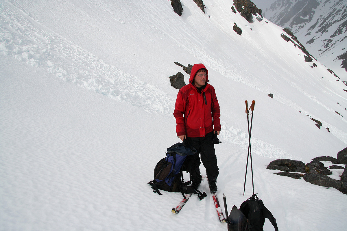
This is just below a cliff. If the snow is good you may consider to ski all the way up, otherwise
this is a good place to proceed on foot. Turn the corner and climb more steeply to higher ground.
The slope is not very steep, and this section is indeed short. Higher up one can resume skiing.
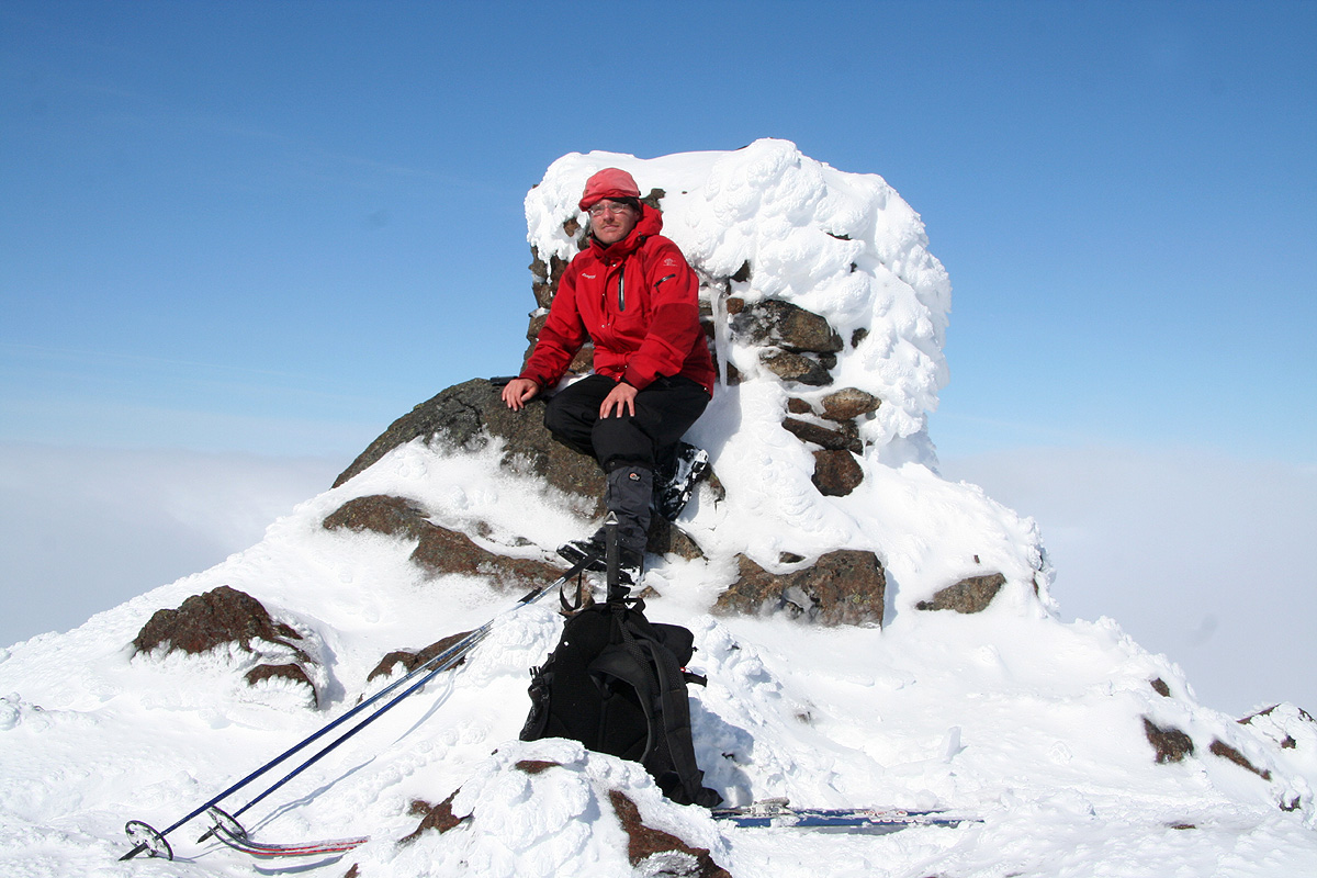
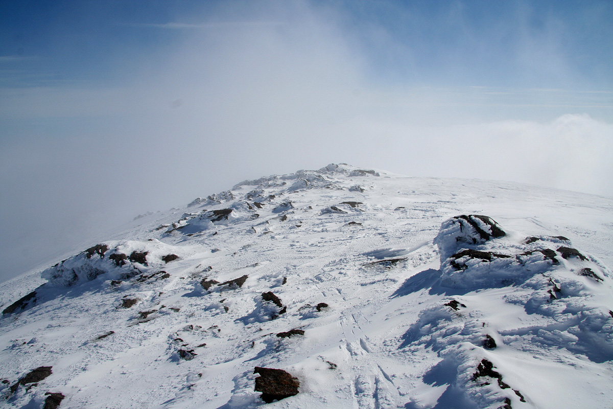
Continue up the very broad glacier and gain location N70:10.679, E022:08.139, there is a nice cairn here.
At elevation 1175 meter, this is the highest rock in Finnmark. From here, continue more or less straight
west (a slight south arc is best in order to keep the elevation), to the highest point on
Øksfjordjøkelen at 1204 meter.
Comments:
I did this climb with my friend Geir Åke Dahlen. We had tried to schedule this
trip several times in the past, however, there was always at least one snag that prevented
the trip. Thus, we were both quite focused on making this trip finally succeed.
I flew to Tromsø, picked up a rental car, then Åke near the Arctic Cathedral. We drove
to Breivika and caught the 1505 ferry. Arriving in Olderdalen by 1645, we realized that we better
hurry along in order to catch the last ferry in Øksfjord leaving at 1915. This worked out rather
well and as we turned left towards Tverrfjord, we soon discovered that this area has been left uninhabited,
the road was even blocked by snow. We put up Åke's new tent and then quickly fell asleep.
We woke up slightly after 0400, had breakfast and prepared for departure. We were on our way by 0515.
It is nice with midnight sun, there is no need to consider daylight when planning a hike/climb.
The terrain and snow were better than feared and we made nice progress up Tverrfjorddalen. The skiing went smoothly
and we were soon at the only slightly steep section, the section above 850 meter. The weather was overcast, but not
bad. On the glacier, we had some fog, but also patches of blue sky.
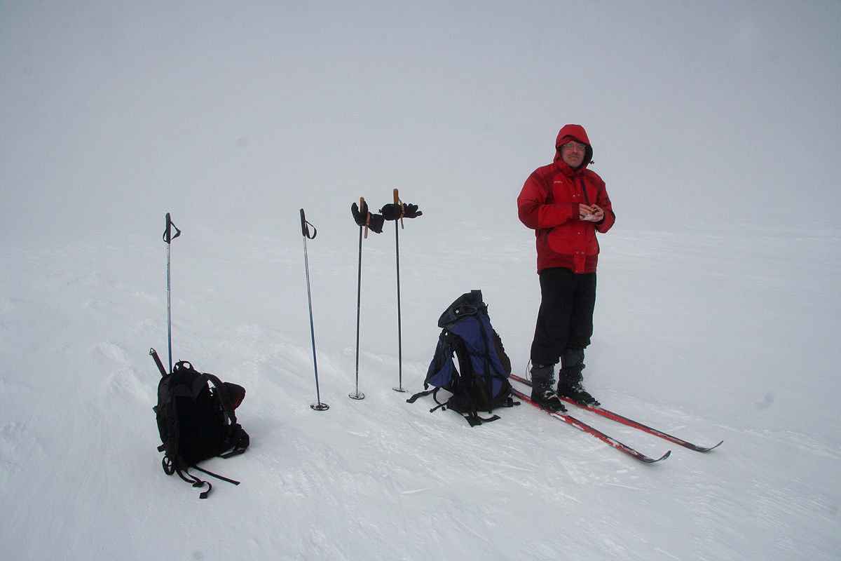
Just as we arrived at point 1175, the highest
rock point in Finnmark, the sun came through very nicely.
Later, as we approached the highest point, 1204 meter,
we again had fog and the views from the summit never materialized.
We arrived at 1045, the climb had required 5:30. We waited around for 30 minutes hoping to get another
break in the fog, but this did not happen. Starting down at 1115, nice skiing brought us back down to the
tent and the car by 1330, ie. only 2:15 on our return.
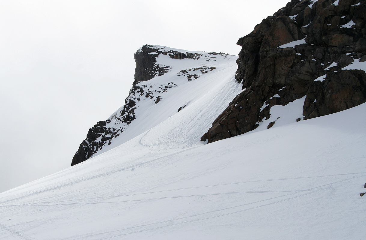
Downhill view, an alternate (not explored!) route may be the
distinct valley to the right of the white shoulder in the middle of the picture. Our route came
up on the left side. Tverrfjorden behind.
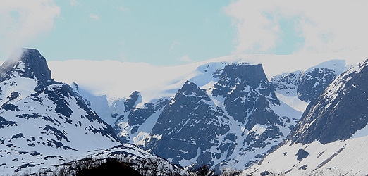
Arrival of the ferry, Tverrfjorddalen all the way to the right, the route
crosses left and ascends behind the mountain in the foreground.