Location: North 68.52599, East 015.45215 (GPS at the summit)
Hinnøy , Norway
Difficulty: (YDS) class 3
Climbed August 23. 2014.
Information:
How to get there:
From the Harstad/Narvik airport, Evenes, drive north on E-10 (towards Harstad)
and cross Tjeldsundet on a big bridge. You are now on the island Hinnøya.
Turn left (south), that is, do not continue to Harstad! Continue to follow
E-10 to Gillesfjordbotn, in the traffic circle, go right and follow Hwy. 85 north
along the west side of Gillesfjorden. Follow signs for Sortland as you leave this
fjord. About 5 kilometer from Gillesfjorden, you should turn left, there are signs
for Kaljord. The distance from the airport to Kaljord is approximately 140 kilometer.
Very near the end of the road, a ferry quay, a small dirt road forks left and uphill.
Continue on this road approximately 1 kilometer. Just as you arrive at a small local
hilltop, find parking on your right hand side. From here, the road just continues 100
meter to a house, do not drive this last stretch.
This location is N68.51447, E015.29118, elevation about 40 meter.
Route description:
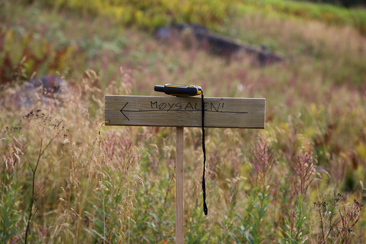
There is a sign next to the road, very near this trailhead that shows the beginning of the
trail. Very shortly, there is a vague trailfork, keep right here. The trail is now easy
to follow, it basically turns the corner (of the fjord) and
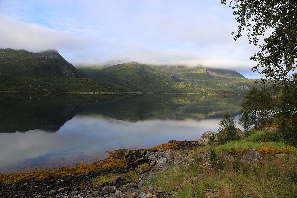
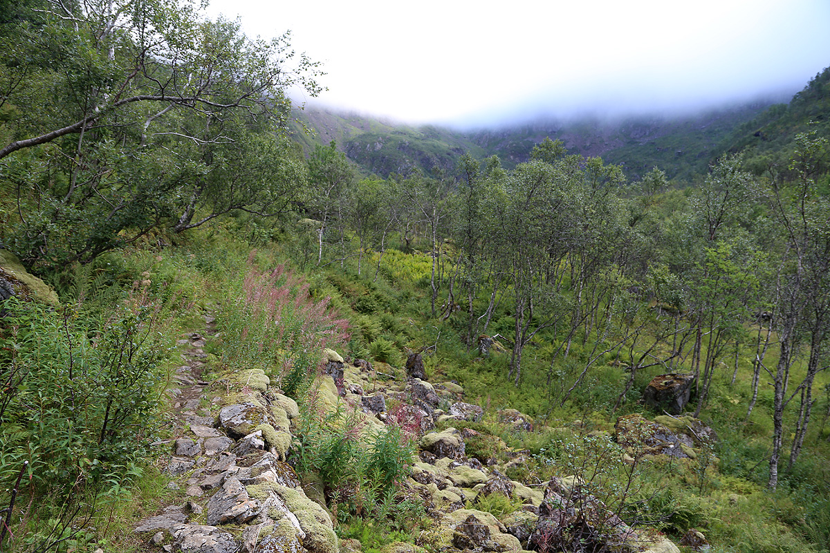
follows Lonkanfjorden to its end.
This trail is generally quite nice, several sections crossing open fields, then a bit more
up/down/rocks in between. After about one hour one arrives
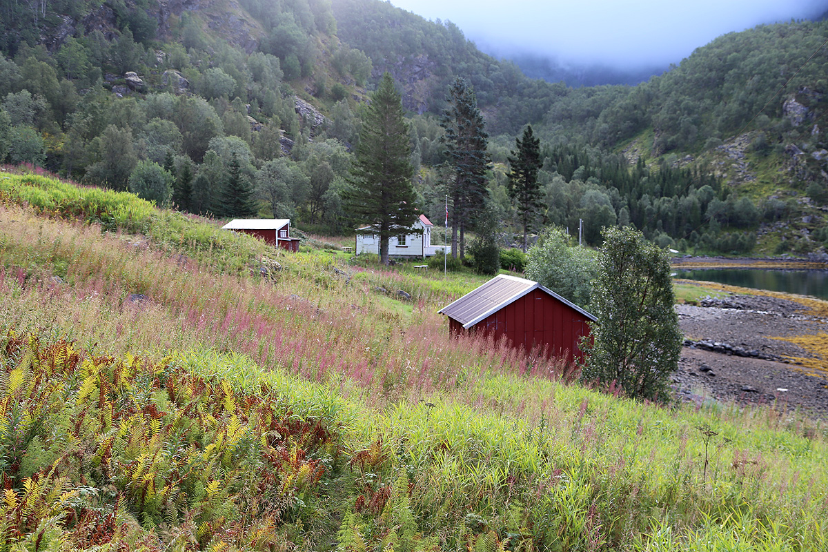
at Gammelgården (old farm), N68.50594, E015.34411,
where there is a sign and a
small bypass trail. In another 15 minutes the trail turns the
last little "corner" and then leaves the fjord
and enters Norddalen.
Norddalen is about 2 kilometer long and quite flat.
Next, follows a steeper section where the trail climbs to a distinct col, location
N68.51207, E015.42302, elevation about 505 meter. Immediately after this col, you should
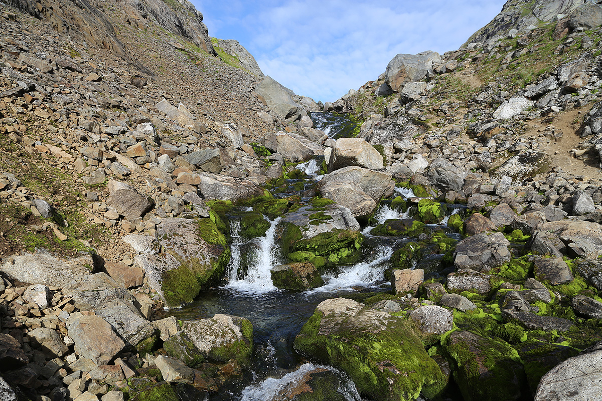
see a signed trailfork. Go left here and traverse some terrain in order to reach the
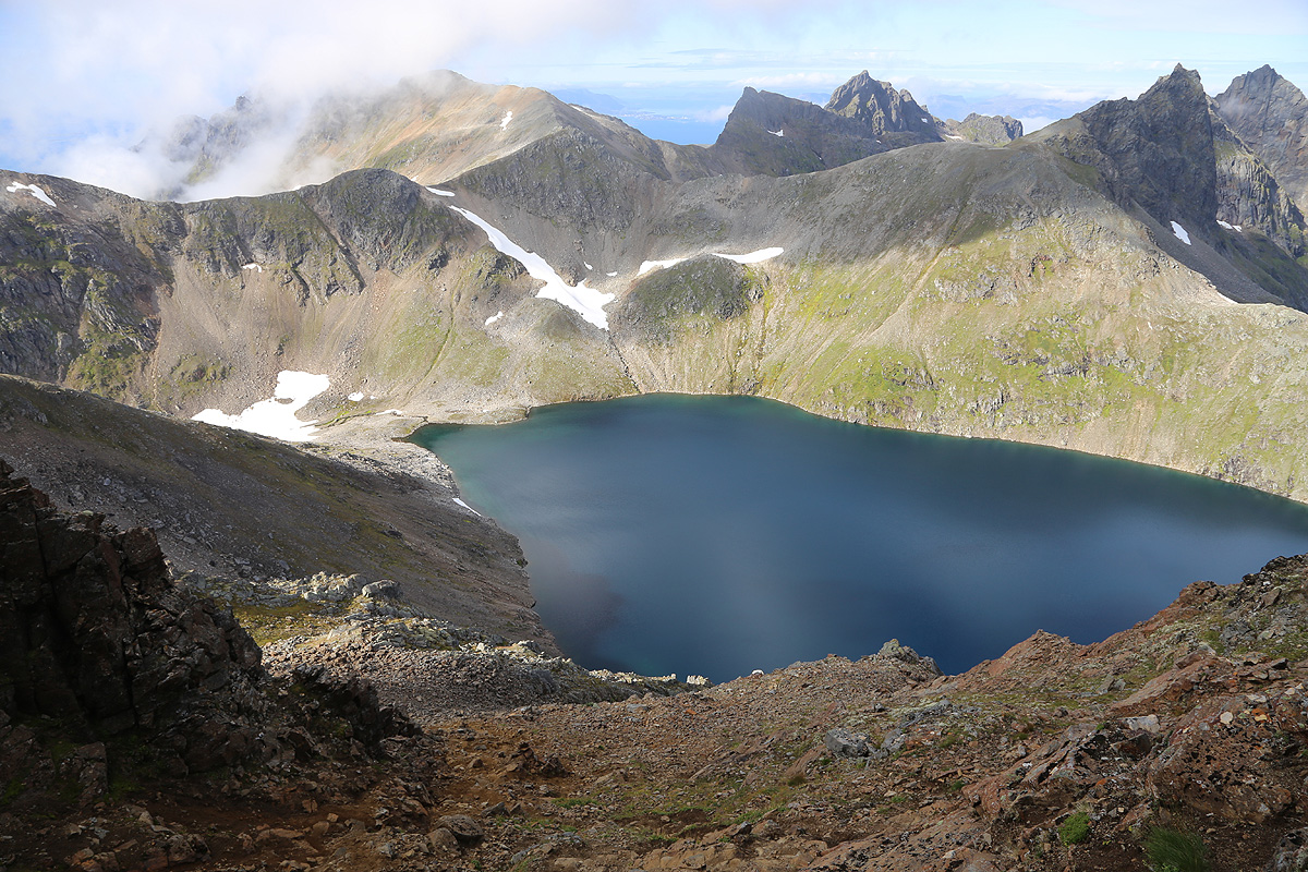
creek that drains lake 592.
You have a clear view of the summit as well as the ridge that
will get you there, from this part of the route.
This is the last place to drink/collect water. From here,
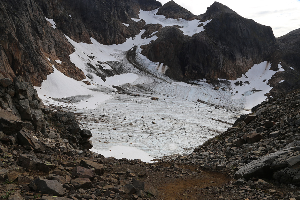
the trail zig-zags north up the hillside, altogether about 300 meter of vertical gain.
First 200 meter to the level of the glacier,
then more left with slightly more rocks, in order
to traverse the fairly steep hillside on a smaller trail that connects horizontally with the
clear col (N68.52330, E015.42873, 840m) that marks the natural beginning
of the ridge running up
to the summit.
The entire route is marked with small cairns, the traverse may start with a short crossing of a snowfield, it was
still there in late August.
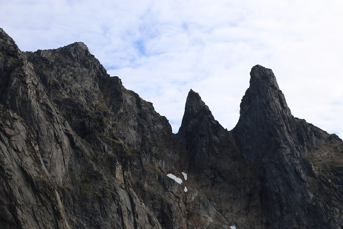
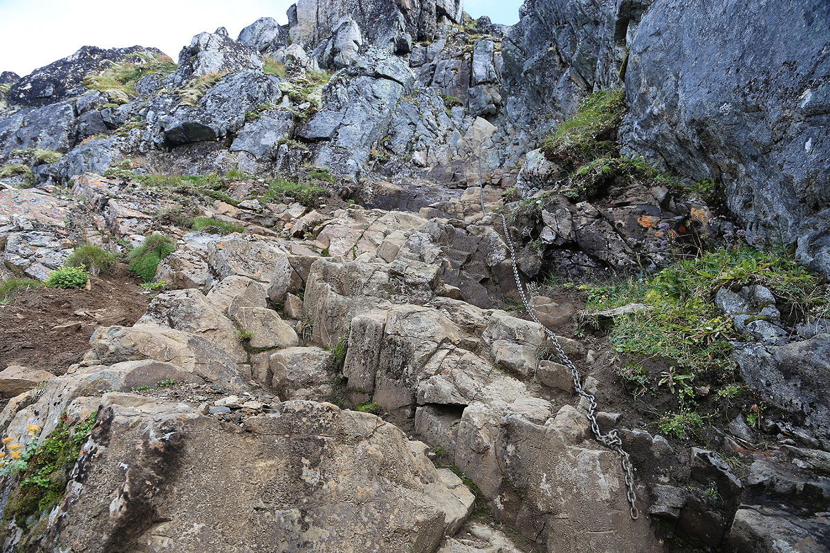
From the col, the route involves a bit more (easy) scrambling. First, up some slabs of rock, then across and
out on the left side of the ridge. You will locate a gully that runs right and regains the ridge.
However, very shortly before
gaining the ridge, one should climb a bit left to enter a more distinct gully that eventually is exited to
the left side. This gully has a chain that
is totally out of place. Anybody climbing this mountain
can do without it. The route is now easier as it runs uphill, clearly marked with small cairns.
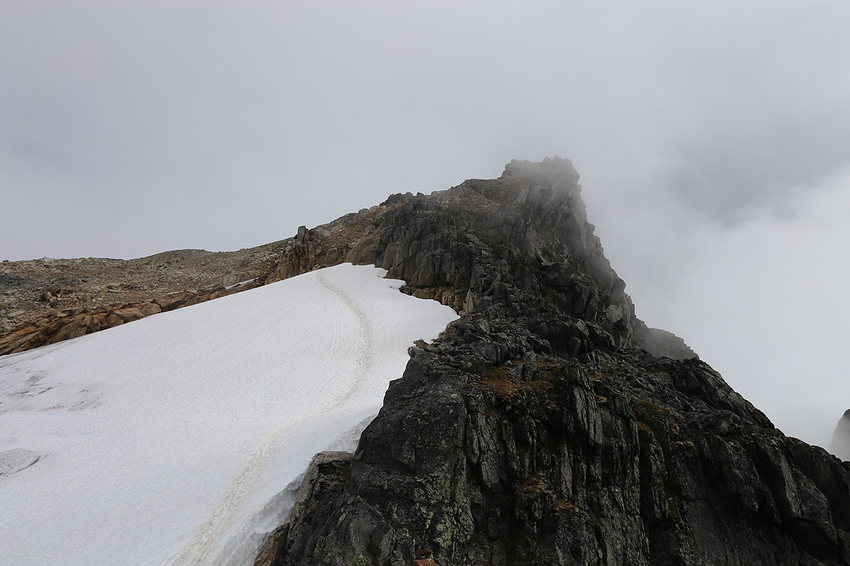
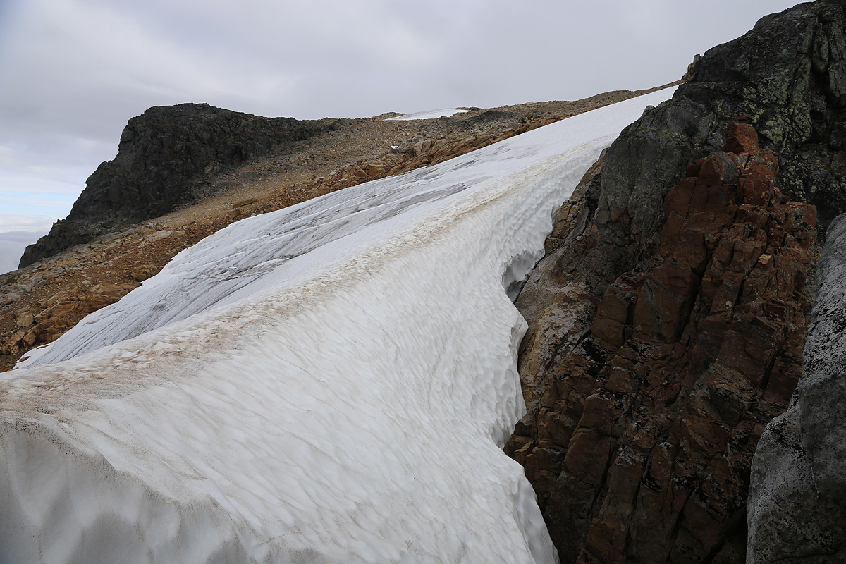
You will come up on a false summit, then see the final section. This involves a short down-climb, then
crossing on the very top ridge of
a small glacier, ascending a very gentle section and regaining rocks
at its upper end. One must climb a bit down to reach the glacier, there are several ways, the easiest is
to use a number of large steps located quite far to your right when facing the glacier. The glacier had
good snow on top in mid August. With an icy surface,
crampons may be needed here. The final section of
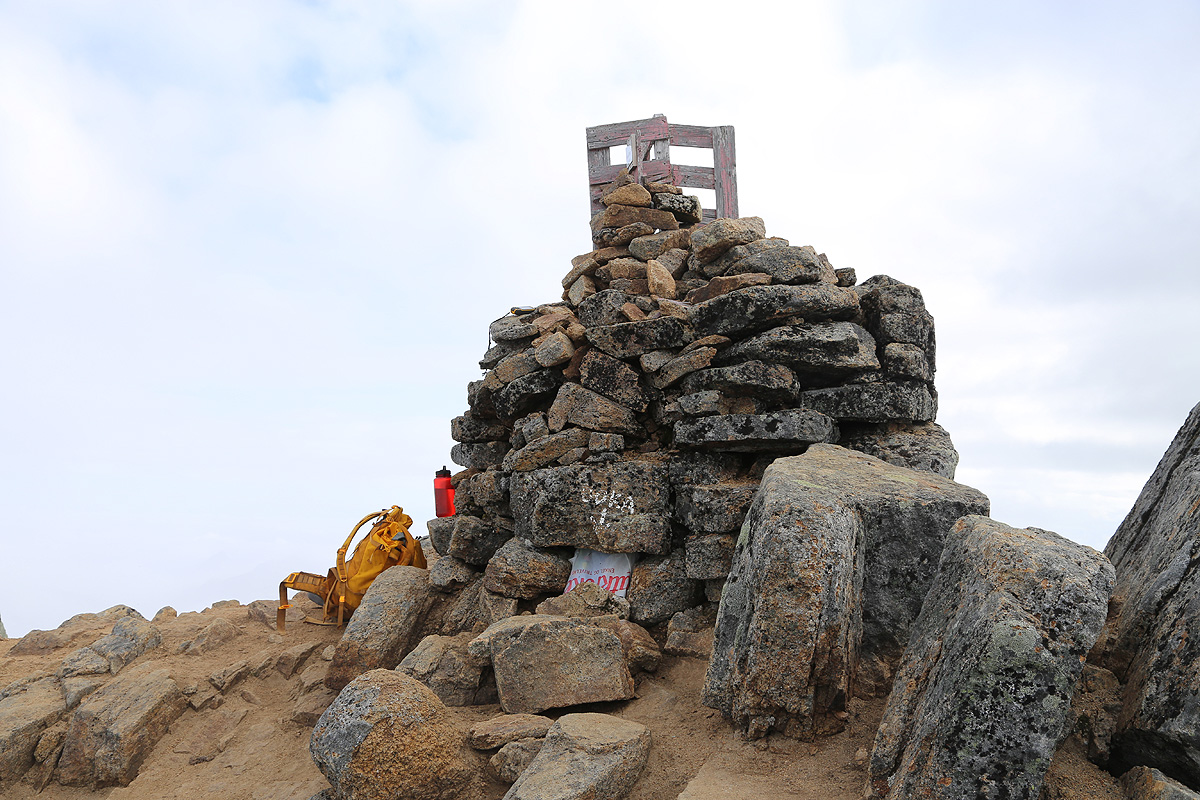
the route is just a short, uphill hike, stay
right in order to get directly to the large cairn
on the summit.
Comments:
Due to exceptionally good forecast, I decided to make another weekend-trip to
Northern Norway. I left work at 1500 and touched down at Evenes, the airport that
serves Harstad and Narvik, at 2130. Still a pretty long drive and I did not arrive
near the trailhead until midnight. I slept pretty well on the ground just next to my car,
until around 0600. Most people take a boat from Hennes to the end of fjord Lonkefjord.
When I called and asked about catching a ride with a guided party, the message was
that they would charge the full amount (NOK 600 in 2014), even if I only used the
boat in a single direction.
Thus, I decided to hike the trail that runs along the fjord.
I started at 0650, it took about one hour to get to the sign that directs hikers
around the first house near the end of the fjord. The clouds were still hiding all the
peaks, but the weather looked promising. I continued up to the first col, by now the
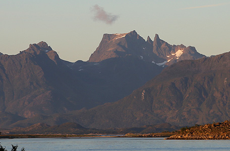
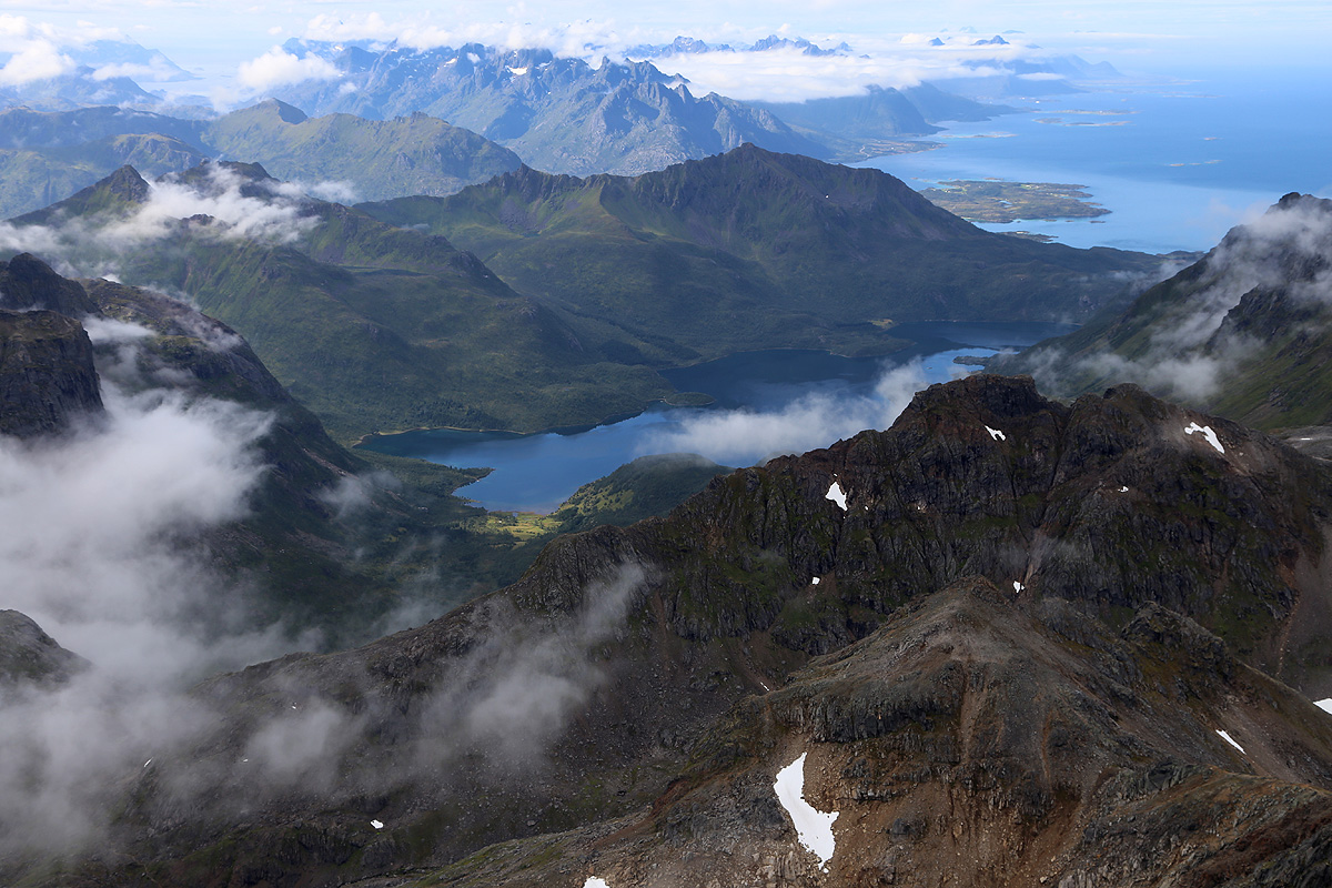
mountain was in clear view.
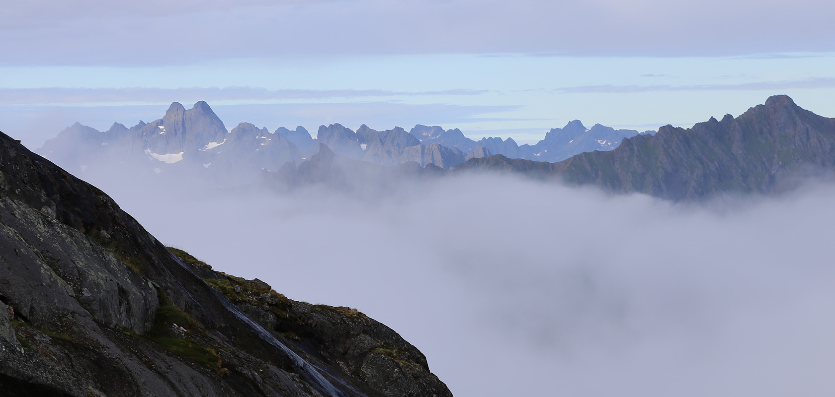
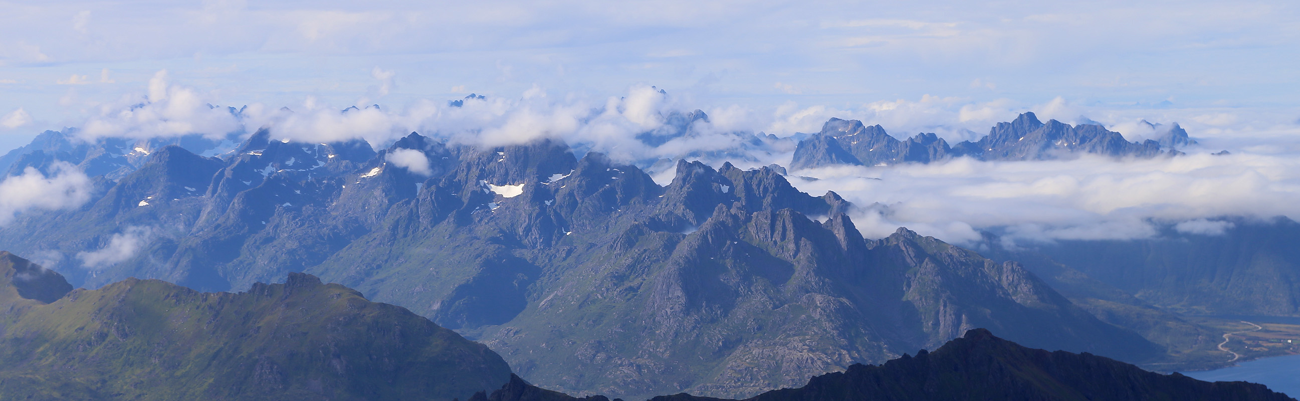
Clouds were still hanging around in the valleys, but I could
see impressive mountains in the distance.
I took some water in the nice creek that one must cross
just before the final hill before the mountain (and glacier). As I got higher, it
became clear that I could follow a cairned route that would take me directly to
the lowest col on the ridge that would subsequently lead me to the summit. Thus, I would
never cross the glacier (down on my right), I therefore left my crampons and walking
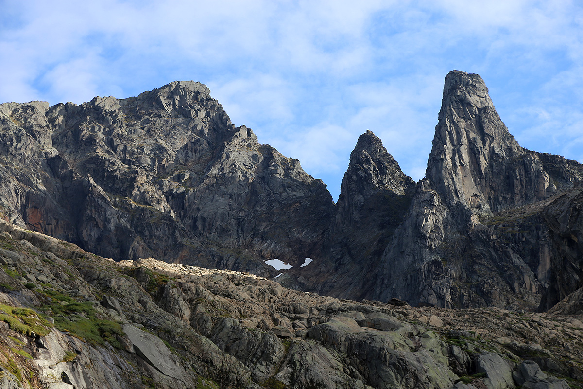
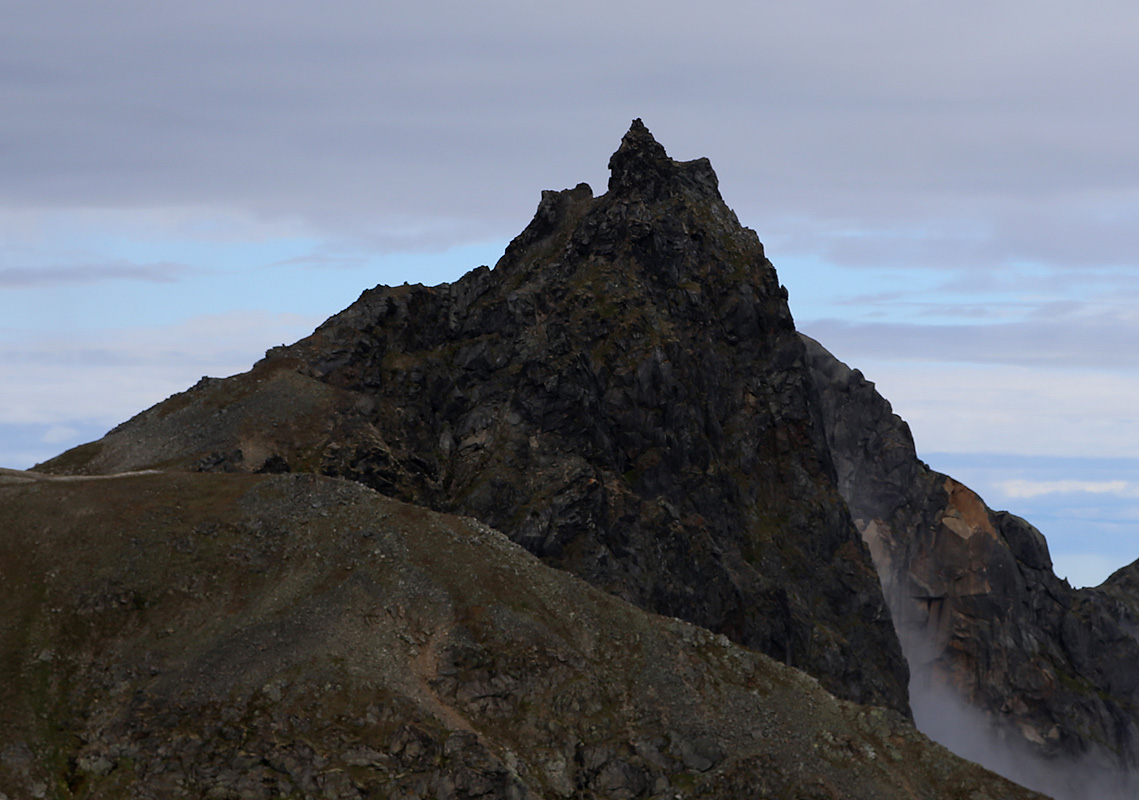
sticks in this col. The view north from this location, is superb.
Fisketindan at 962 meter, stands out.
The route was easy to follow and not at all difficult. In fact, it would be a significant
improvement if somebody removed the chain that "polutes" an otherwise very easy gully with
numerous places to step upwards. This is not the hardest part of the climb and anyone that
can climb this mountain can easily do it also without this chain. The next (and last) chain
is even more of a joke, protecting a perfectly fine trail that has several more exposed,
but "unprotected" sections.
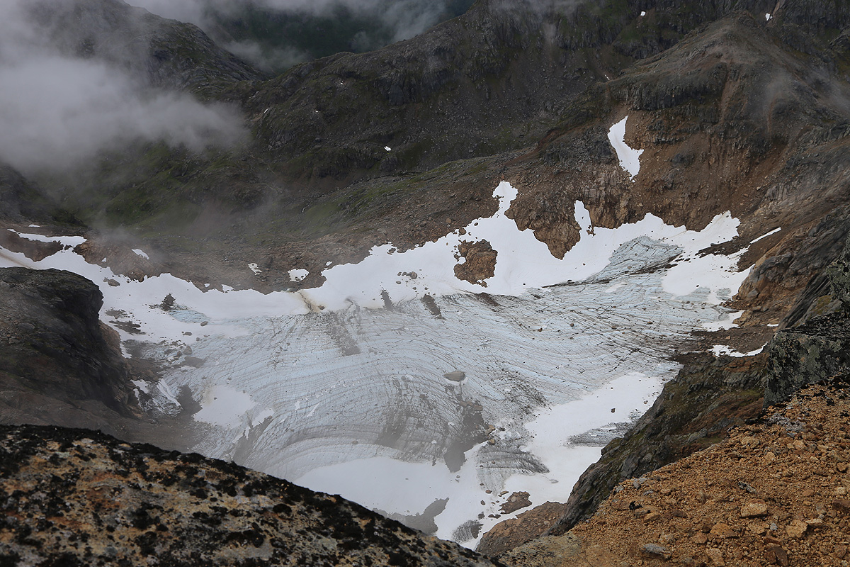
The biggest surprise came next, a small glacier
that fell steeply to the left. It seemed
that I would need to walk on top of this one. I sent some mixed thoughts back down to the col
where my crampons were sitting on top of a rock. The good news was that the route looked fairly
straightforward and that the snow on top most likely would be ok for my boots.
I climbed down to the glacier, then discovered an easier route a bit more to my left (looking back up).
The glacier was perfectly fine, so no need to worry about my crampons. I concluded the last, short
rock section and arrived at the summit at 1120, exactly 4.5 hours from my car.
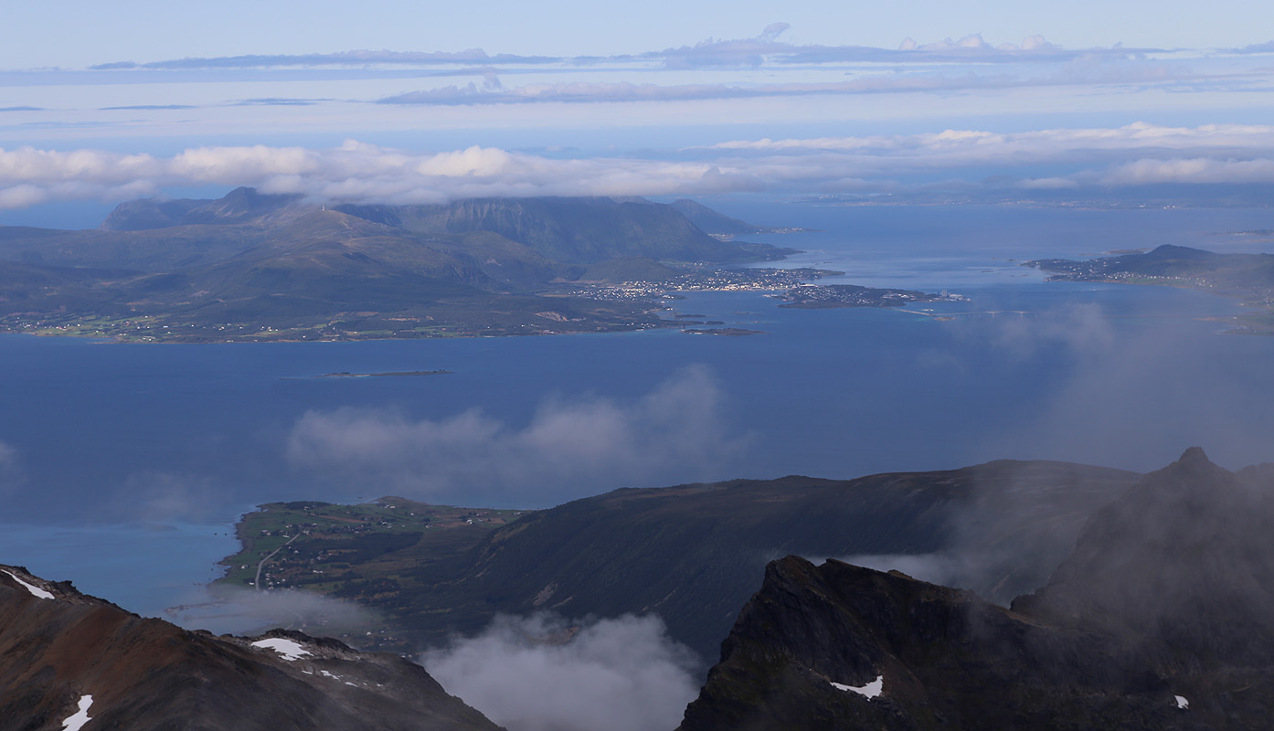
Clouds were still blocking my view east, while
the opposite views
were quite nice.
I stayed around
for 30 minutes before starting to descend. Nobody else on this fine peak, but I strongly suspected
that I would meet some people before my hike was over. I knew that a guided group would be on its
way. I had asked about sharing a boat ride with them, but the message was pretty clear, one had
to pay for the entire (guided) trip, NOK 600, even if I only wanted the boat ride one way. My desicion
to walk had been good, I got under way much earlier and the extra effort was really no big deal.
I was back down in the col pretty easily, picked up my crampons and continued across the short
traverse. Further down in the hillside, I met a good sized group of former students (medical) from
NTNU. We talked a bit and I informed them that they could safely leave crampons, ice axes and other
climbing gear right here. After continuing downhill, I met another even larger group by the
creek. The guided group must have taken a slightly different route, since I never met them.
The weather kept improving and I had a fine walk back to my car, arriving at 1610, so only slightly
faster down than up. I now drove all the way to Moskenes in Lofoten (about 4 hours), then hiked almost
2 hours in order to reach Munkebu, my planned overnight stay. A long, but fine day, 11 hours of
walking, 4 hours of driving, all the way with the unique Lofoten scenery.