Location: North 69:36.875, East 020:06.653 (GPS at the summit)
Lyngen, Norway
Difficulty: YDS class 3
Climbed June 12. 2011
Photo Credit: Kent-Hugo Nordheim
Information:
How to get there:
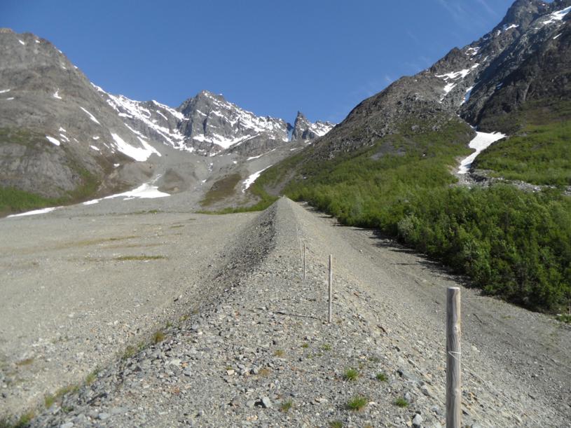
From Nordkjosbotn (where E8 from Tromsø meets E6), continue
north on E6 for 18 kilometer towards Storfjord. Make a left towards
Lyngseidet and continue for more than 40 kilometer. In Lyngseidet, make a left and drive
towards Svensby. Shortly after seeing the fjord on your left, you arrive at a place where
extensive work to protect the road against avalanches has been carried out. There are two
(artificial) tunnels here. Make a right (or left if you come from Tromsø via the ferry to
Svensby) and find parking on the small side road. This is the trailhead, location N69:35.357, E020:06.615,
elevation about 8 meter.
Route description:
This route is subject to (snow) avalanches throughout the winter season. Evaluate the conditions
carefully before going uphill here. Regardless, one should be fairly early to avoid slush and sun released
avalanches later in the day.
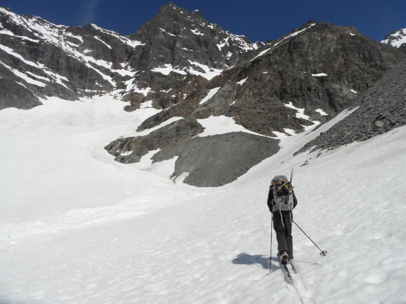
From the trailhead, walk up the small dirt road to the main avalanche control walls. Climb onto the first
wall that heads directly uphill. One can walk on top of this until
it ends. Continue uphill, it is best to stay away from the loose rocks
as long as one can. Eventually, you will find yourself on steep, loose gravel/rocks,
unless the slope is still snow covered. It is steep enough that a loose rock may pick up speed and pose a danger
to people below you.
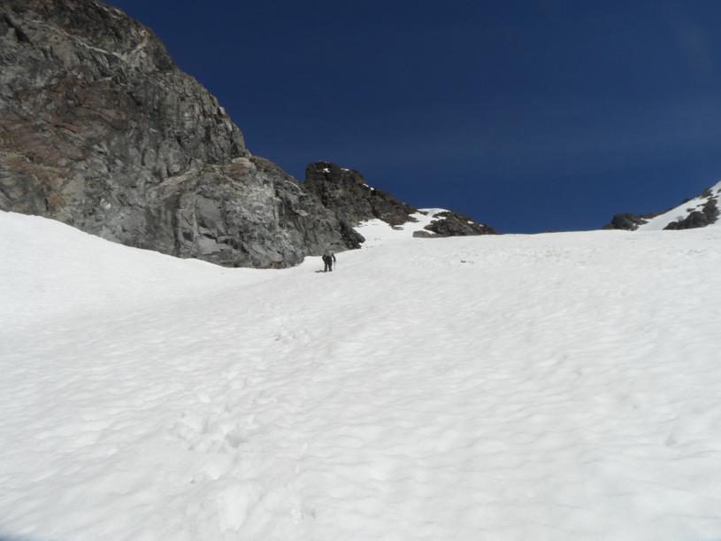
At 560 meter elevation, you reach a step in the terrain and you will find snow and skiing above here (at least through June).
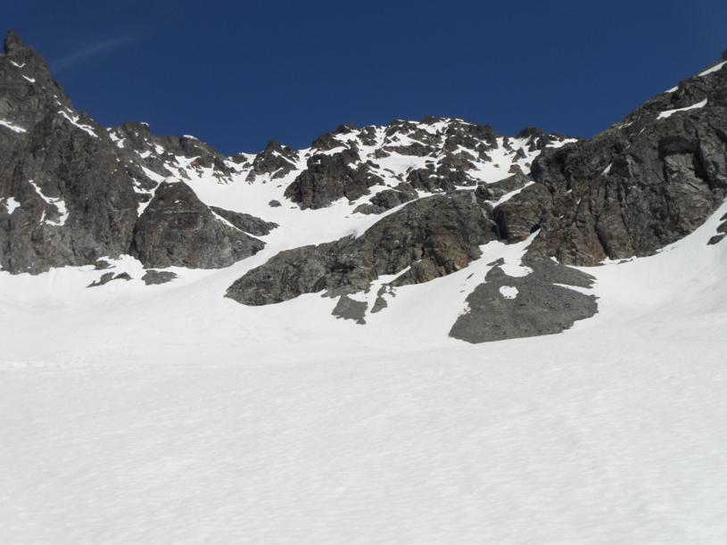
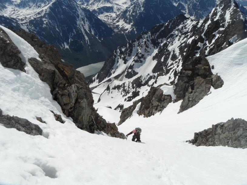
The route heads into the basin, then staying right of the rocks in the middle and up a
somewhat narrow and steeper passage.
As you reach another step, the route continues uphill in a pretty obvious way, stay left of the rocks that
block skiing and follow the snow as you gain elevation and approcah the steeper part of Istind.
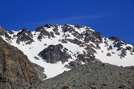
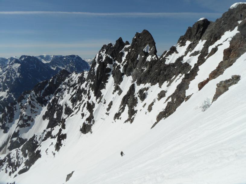
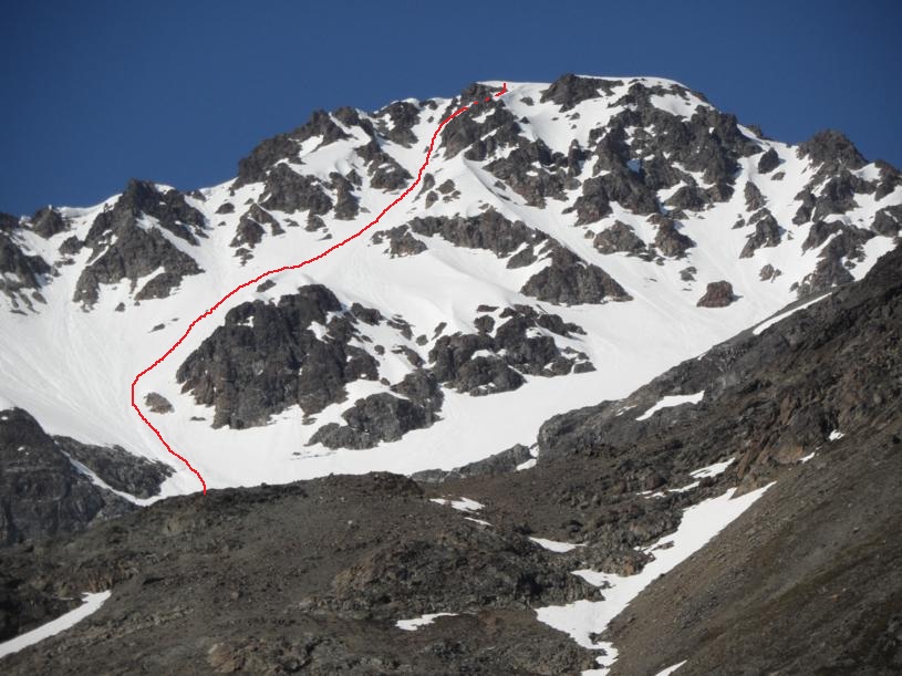
Higher up, the slope is about 40 degrees and it is pretty obvious that this is avalanche country.
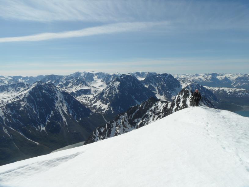
From here, you can see most of the remaining route towards the summit.
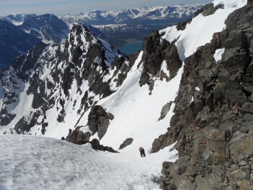
Observe that the top gully goes straight up, while we took
a steepish side gully right that got us directly to
the summit proper. The normal route, most likely tops out on the former gully, then follows the main ridge right to the summit.
However, as may be seen, there were some rather large cornices at the very top of this gully that we wanted to avoid.
There were no cornices on this route as
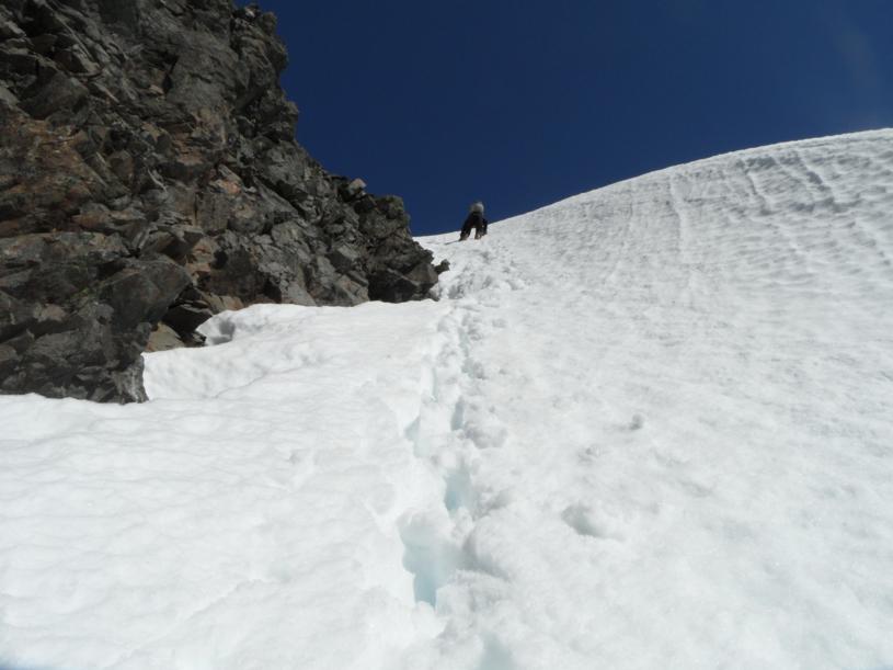
the final, steep gully leads
to the corner of solid rock. We climbed around this rock, traversed
left (above the rock) and completed another steep pitch of snow
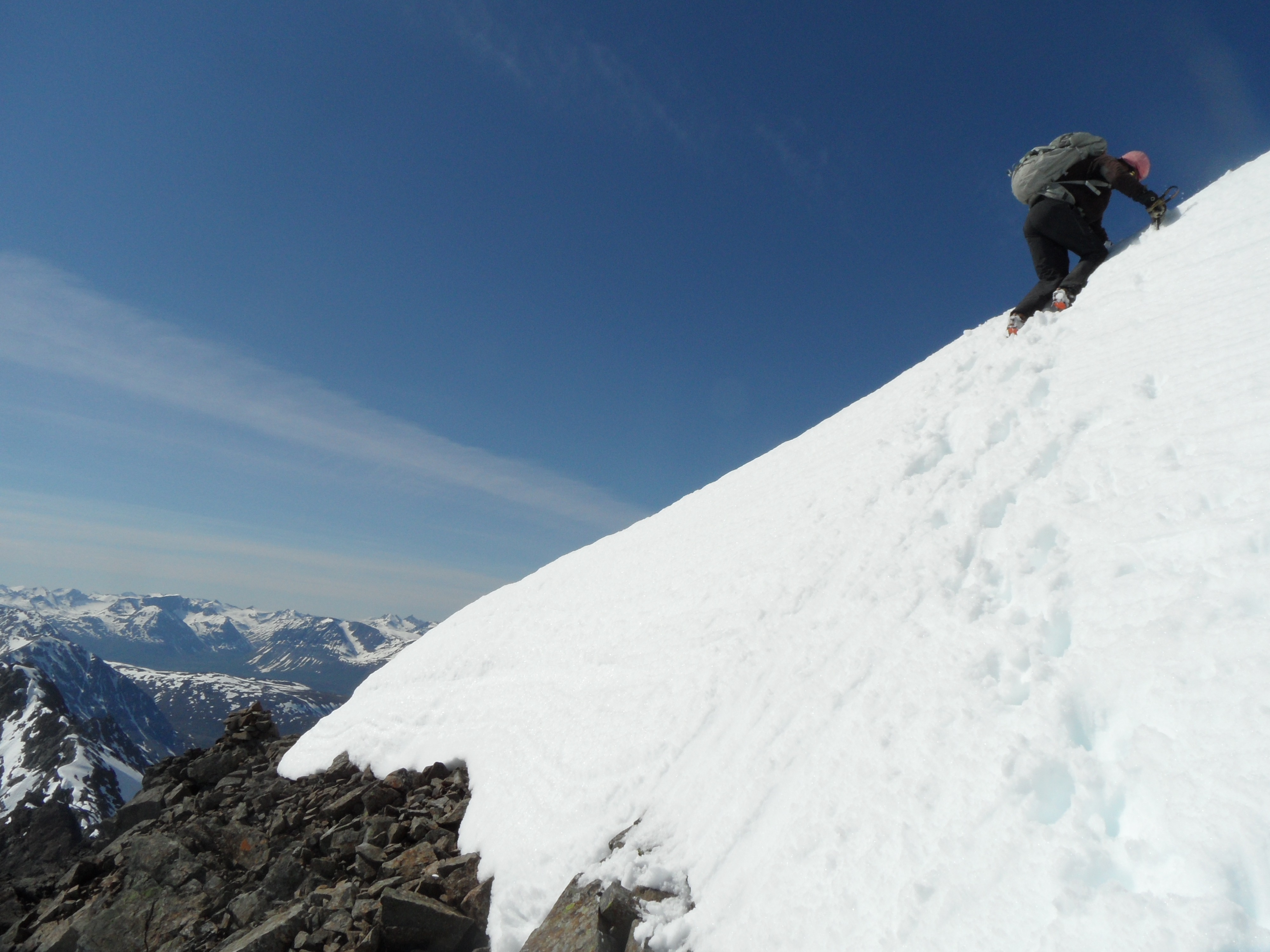
to enter the summit plateau of Istind.
Comments:
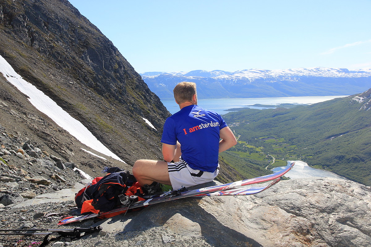
I did this climb with good company from Kent-Hugo Nordheim.
I slept well at the trailhead after my long hike of Biellogaisa the previous day.
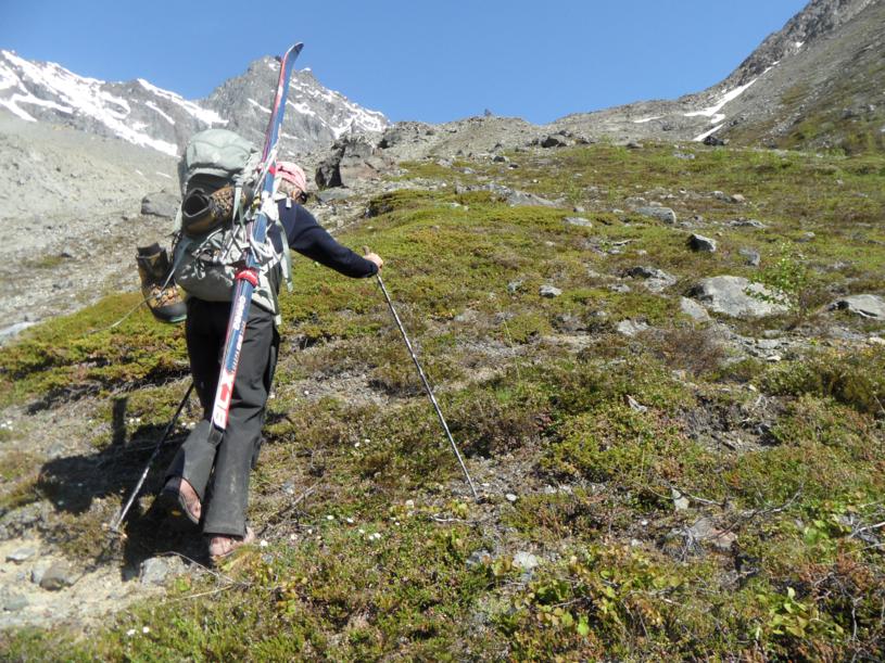
We started around 0840 and hiked up to the 560 meter level where skiing could begin.
Eventually, the slope became steep enough that it would be better to carry
the skis. At this point I left my skis behind and continued on foot. Kent-Hugo
decided to walk as well, but with his fat randonee skis still attached to his pack.
We decided to go right at the upper part of the climb and found a steepish gully that lead directly
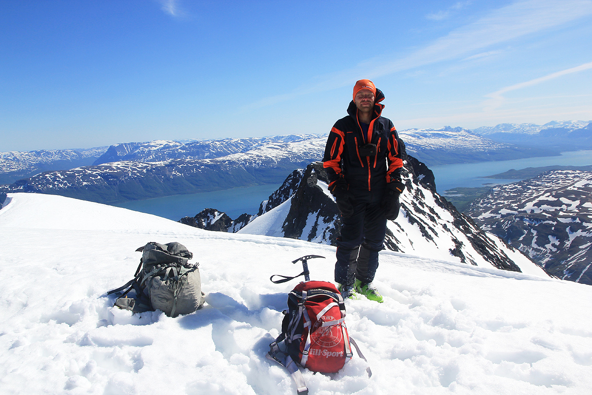
to the summit. We summited at 1310 in
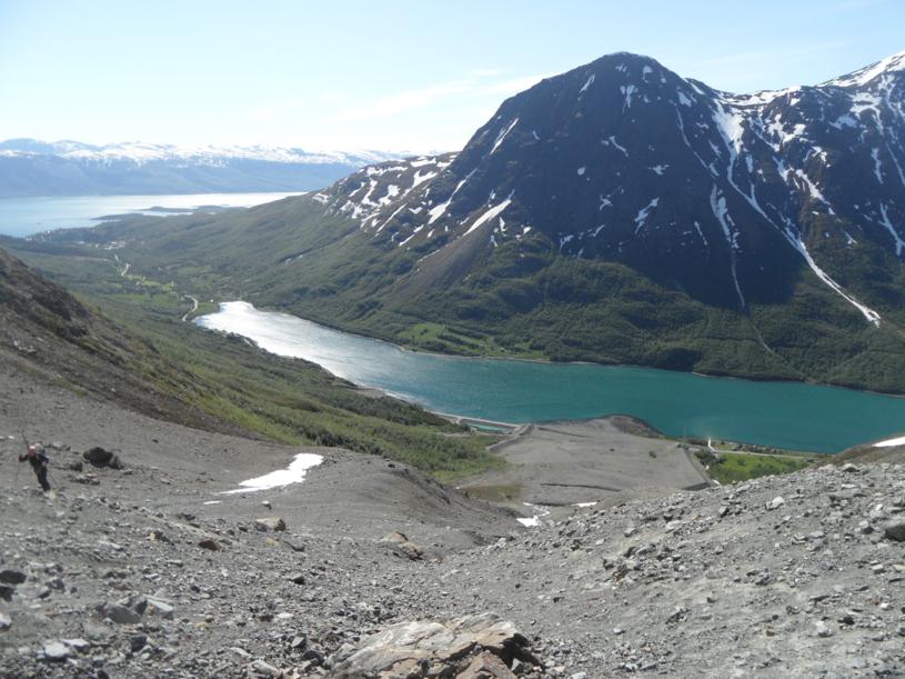
brilliant weather and immediately enjoyed the great views of Lyngen. The summit was
quite windy and we descended after about 15 minutes. Immediately
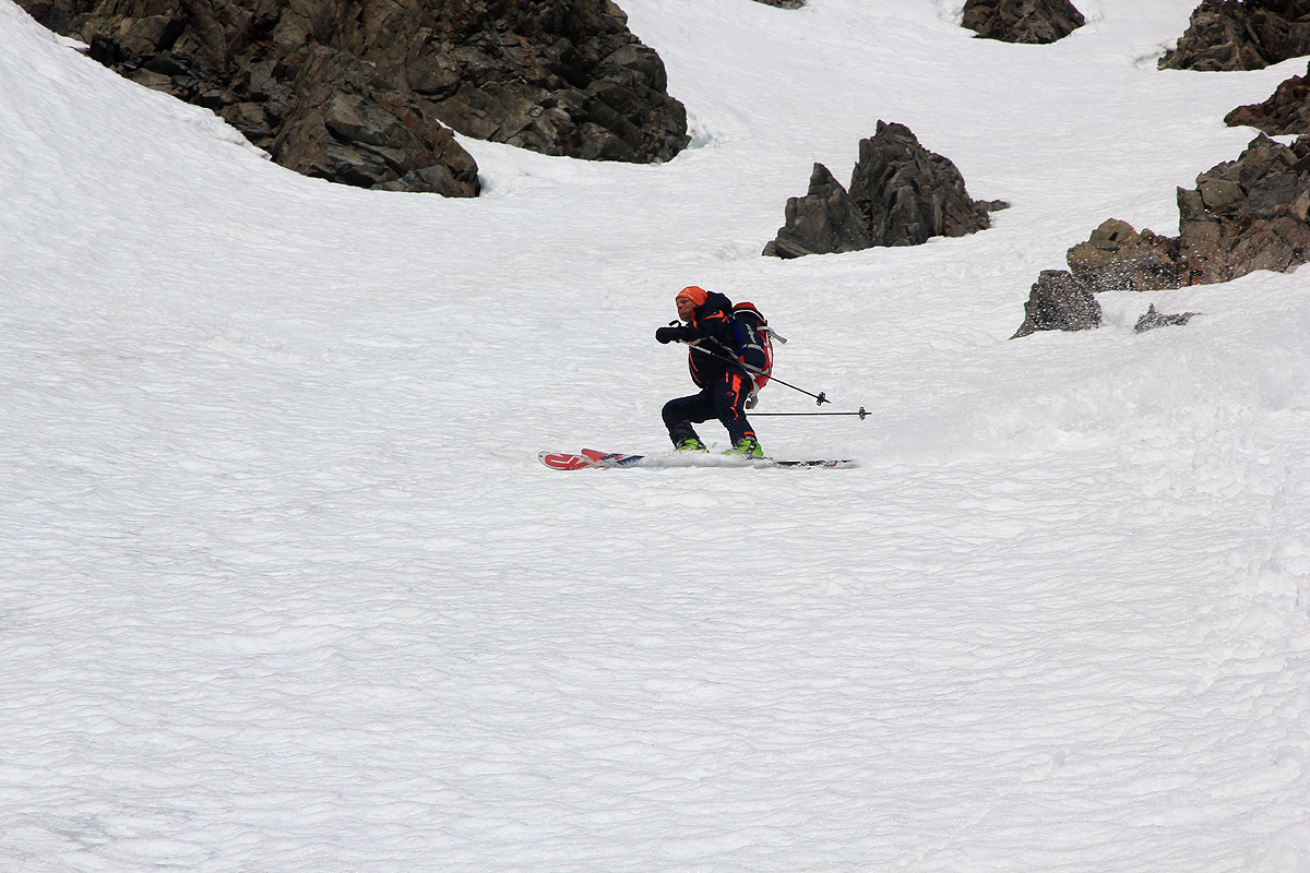
after Kent-Hugo cut his first turn, the upper 20-25 cm of
sun creaated slush started to avalanche. Not
a big problem, but we did observe how even a thin layer of snow creates a lot
of mass as the avalanche continued a long ways down the steep slope. We were back down by 1540, a total trip time of about
7 hours. Many thanks to Kent-Hugo for good company on my last mountain in Lyngen having more than 1000 meter of prominence.