Location: North 61:29.040, East 007:22.978 (GPS at the summit)
Sogn og Fjordane, Norway
Difficulty: YDS class 2
Climbed: May 2, 2010
Information:
How to get there:
A good point of reference is the small village Sogndal on
the north side of the Sognefjord. From here, drive 28 km along
Hwy. 55 to the village Gaupne, make a left turn and continue
approximately 18 km up the Jostedalen valley. Just before a tunnel,
a road forks right to Vigdal. This road crosses the river, then
climbs steeply with several hairpin curves including a small, but
interesting tunnel. This narrow road will lead you to a small
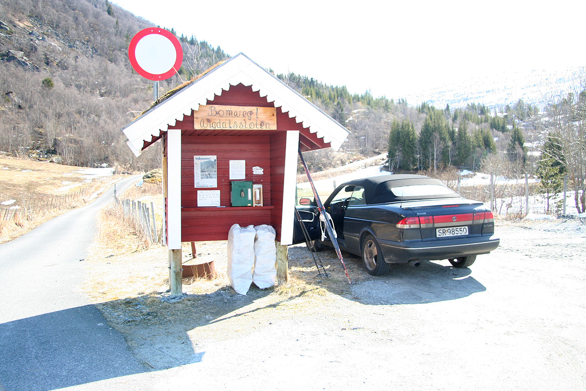
parking area just beyond the last farm. From here, a short toll road
can be followed to Vårstølen, this road is closed in winter and spring.
Thus, the all year trailhead is
located just after the last farm
at location N61:30.775, E007:18.936, elevation about 555 meter.
Route description:
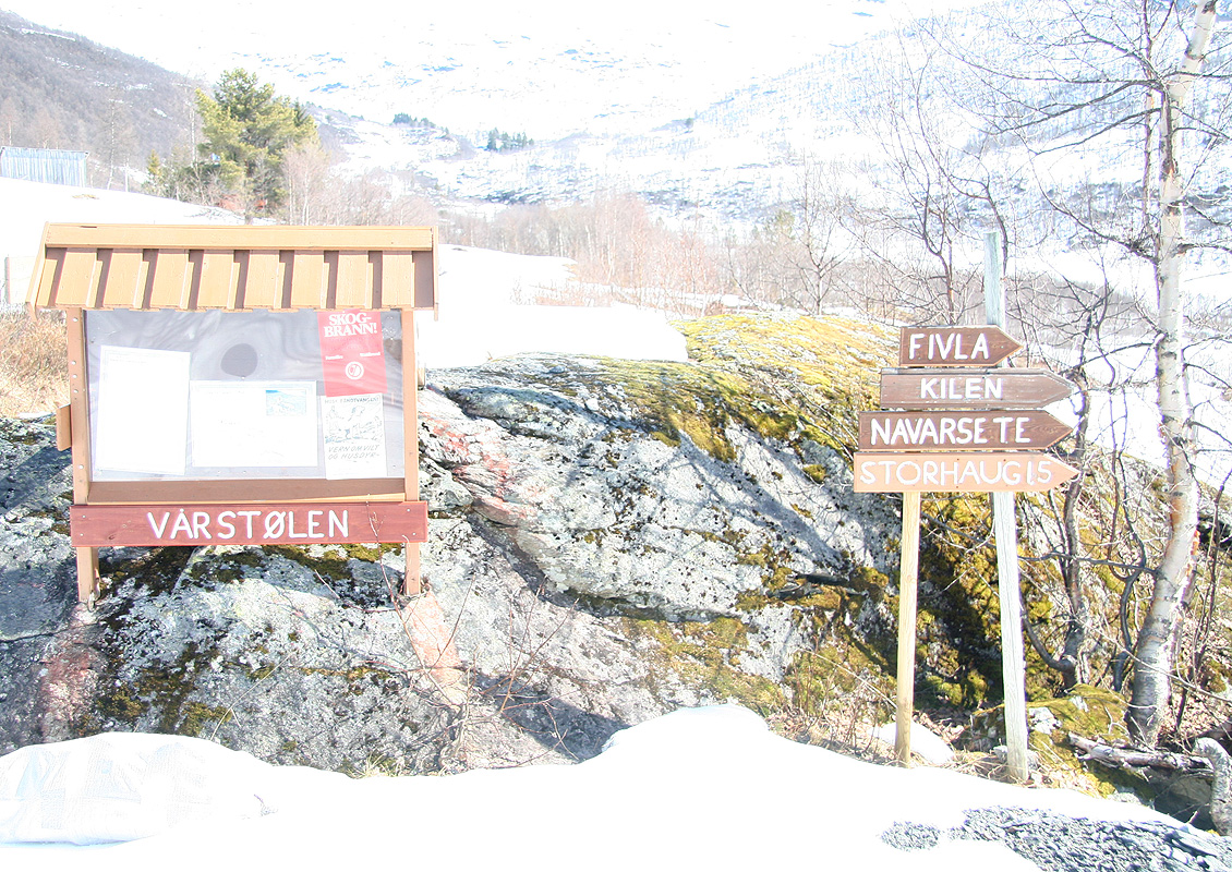
Take the road onwards to Vårstølen, this is just a few gentle uphill
sections of the (paved) road. Shortly after the road levels out you will notice
a sign on your right hand side.
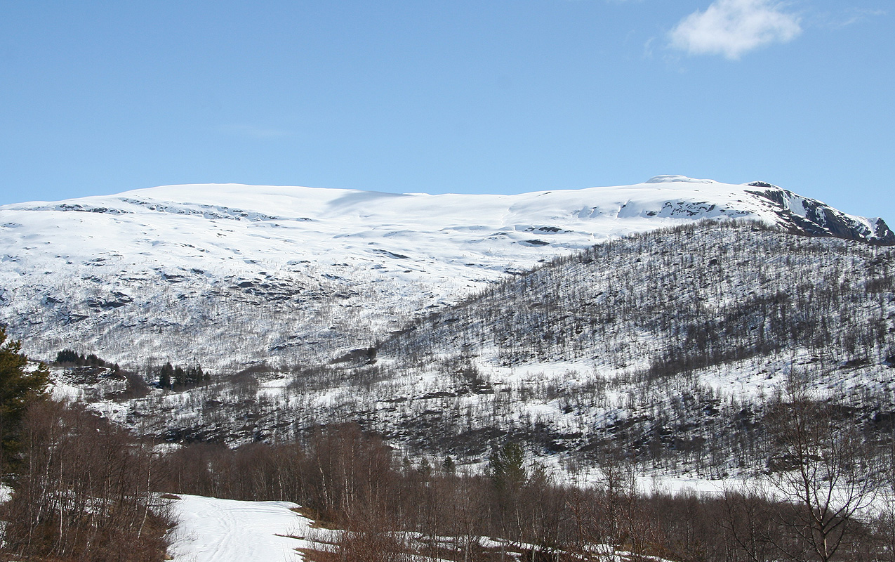
The road continues and the mountain ahead
is Kattøyro (1411m), with the hill
Storhaug (868m) in front on the right hand side (across the river).
Do not continue, but leave the road by the sign and follow the trail downhill to
the small river that can be crossed on
a well made wooden bridge. The next challenge is to climb the somewhat steep hillside above.
In winter/spring, it can be hard to locate the best route if there are no tracks. Turn left
and cross some meadows, then start a very gentle ascent going left (when facing the hill).
Do not ascend too rapidly, you will then find a fairly smooth slope leading to the 740 meter
saddle south-west of Storhaug (868m). From here, ascend the ridge towards point 935.
With skis, I found it best to stay on the west (right) side of the ridge and follow a pretty
natural path well below the upper part of the ridge, then gradually turning left (south) and
gain the flat area just west of the cabin Fivla.
From the Fivla area, one can ski pretty much directly towards the summit using the natural
variations in steepness to own advantage, perhaps moving a bit more right before the final
summit push.
Comments:
I climbed this peak after a very early morning climb of
Grovabreen, it seemed
a shame to end the day several hours before noon.
Thus, I drove across to Sogndal and further to Gaupne before finding the
small, but steep road leading up to Vigdal. This road is narrow and I found it
quite entertaining. Perhaps most interesting is the tunnel, narrow and with
several curves and charming small lamps hanging from the ceiling.
I started out by 1130, still not noon and it felt like I had already been
out quite a while. After crossing the bridge, I made a stupid mistake of
climbing the hillside instead of traversing to the small col. I had no idea
about doing two mountains, therefore my map was left behind back in Bergen.
The next 30 minutes was not at all pleasant. Small cliffs, then enormous boulders.
Add in the general steepness and too many trees - the mountain itself seemed like
abstract theory.
I gained the ridge and progress immediately improved, I quickly decided that
I would follow this ridge further down on my return trip. The trees grew thinner
and I emerged quite a bit west of the Fivla cabin. No problem, my goal was Fivlenosi
not a mountain hut. Unfortunately, skiing was not anywhere as nice
as on Grovabreen. No new snow and a rather icy crust that required constant use
of the steel edge rather than the ski itself. I kept gaining elevation, but started to
feel the morning trip possibly combined with lack of food (I had no breakfast at
Skei before 0500). Somehow, I had the idea that this peak exceeded 1500 meter, as I
took a break and checked my elevation, the GPS read "only" 1350 meter. Quite a disapointment,
almost 200 more vertical meter to gain. My happiness (and surprise) was quickly regained when
the peak turned out to be almost 100 meter lower.
I arrived at 1420, less than 3 hours despite the fight in the first hill. I took pictures
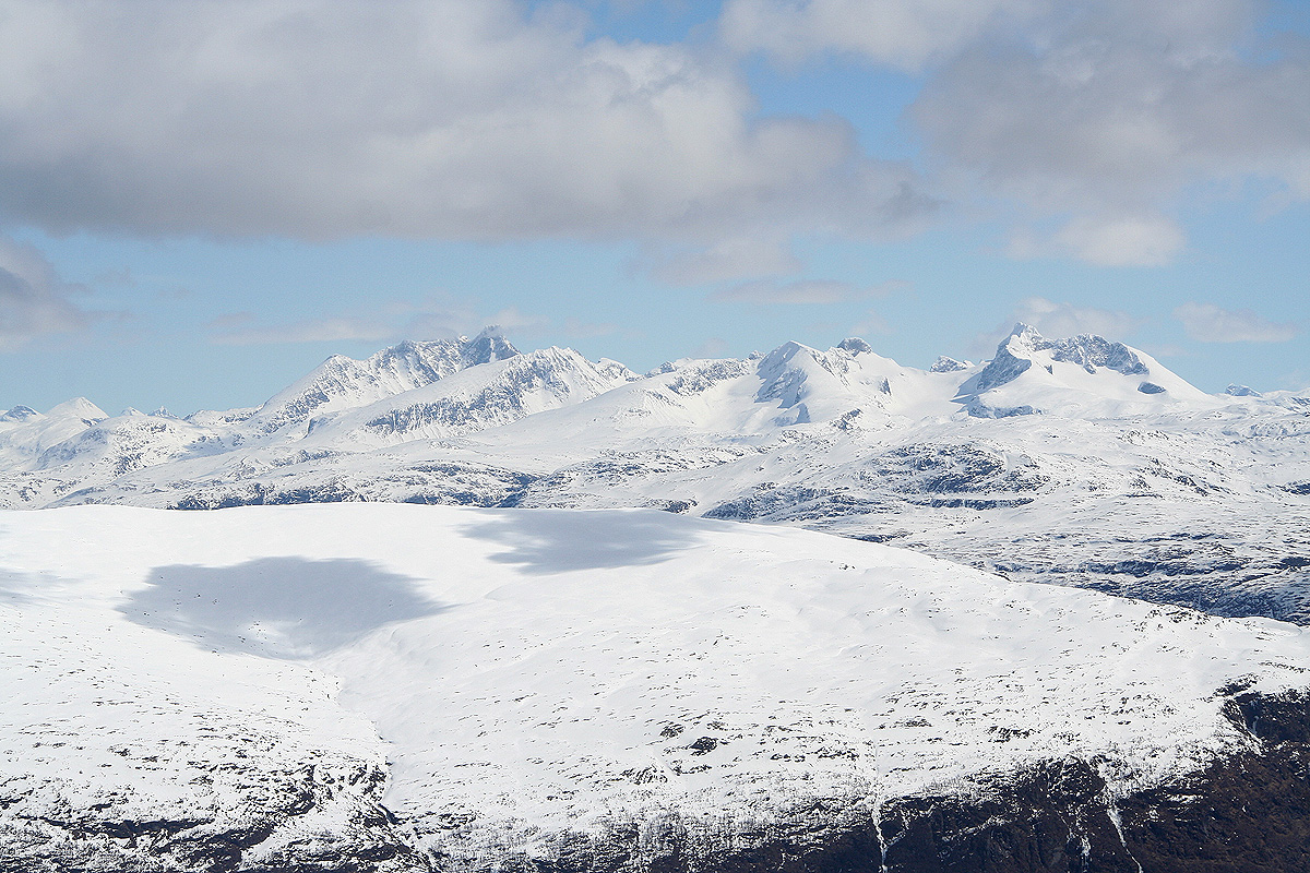
and had a good look around. Hurrungane were
noticeably closer here than when seen from
Grovabreen. After 10-15 minutes, it was time to return. The skiing back down was uneventful
and I returned to my car by 1545.
I had a nice drive back home to Bergen after a pretty long day, "a doubleheader"
is what this is called in sports. I had more than 2000 vertical meter of ascent
and felt I deserved a shower and some dinner upon my return.
Resources:
Images
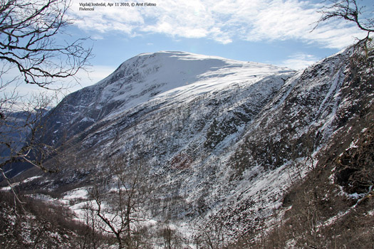
Fivlenosi, as seen from the vicinity of the col
connecting Storhaug with the ridge towards Fivla (Photo Arnt Flatmo).