Location: North 61.65879, East 006.53810 (GPS on the summit)
Difficulty: YDS class 3
Climbed on June 30. 2017.
Information:
How to get there:
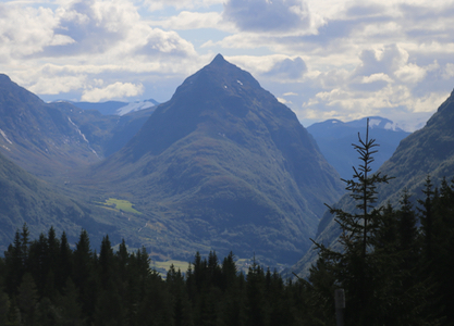
This peak is between Skei and Byrkjelo. The peak look fantastic when driving south
to Byrkjelo from Utvikfjellet. Seemingly standing proudly in the middle of Våtedalen.
There is a running competition to the top of this peak, the famous Jon Tvedt still holds
the record in about 47 minutes. One should note that the race has a much lower start than the
route/trail described here.
Drive north in Våtedalen along E-39, About two thirds of the way from Klakegg to Byrkjelo
you come to the first farm houses on your right, a place called Egge. There is a sign for
Eggjenipa down by the main road. Take this small farm road, it has a self serve toll payment
up beyond the farm. This road climbs in sharp curves and enters a small valley called
Øvredalen (Upper valley). You should drive on until you arrive at a good sized
parking area, park here, location N61.67062, E006.55023, elevation about 550 meter.
Route description:
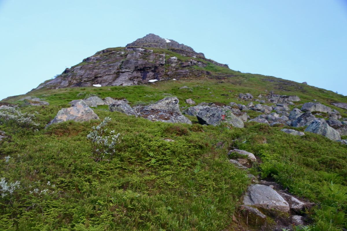
The trail starts directly from the parking area. There are a few information signs.
A well maintained trail with a couple of board-walks across meadows as well as
a good bridge across the river. The trail then starts more steeply uphill through
birch forest before reaching the main ridge, there is a trail sign at this location.
Next, up the broad, but pretty steep ridge.
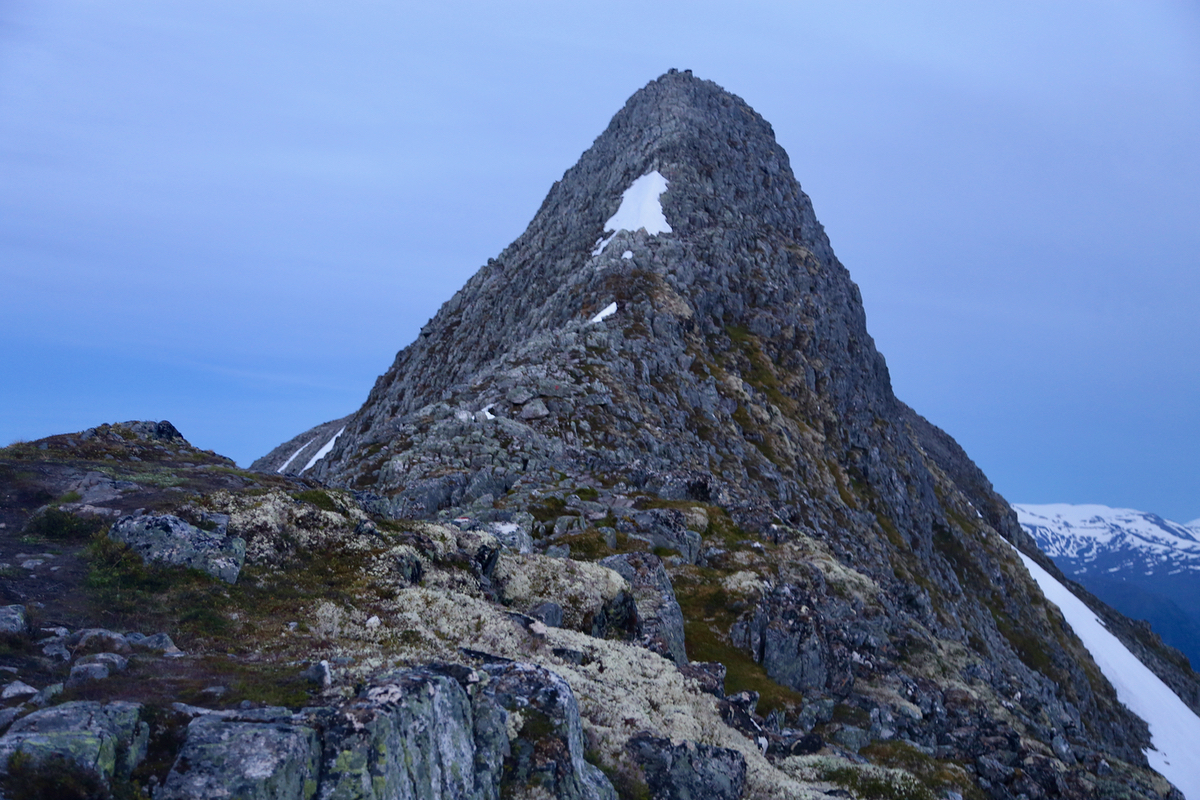
You will soon run into a couple of short
sections were a chain has been anchored in place in order to provide
some added protection. Nothing difficult, but you need to scramble using your
hands. Easy (YDS) class 3, but mostly just normal class 2 terrain. It is important
to look for the red (T) marks pained on rocks. The route zig-zags a bit in order to
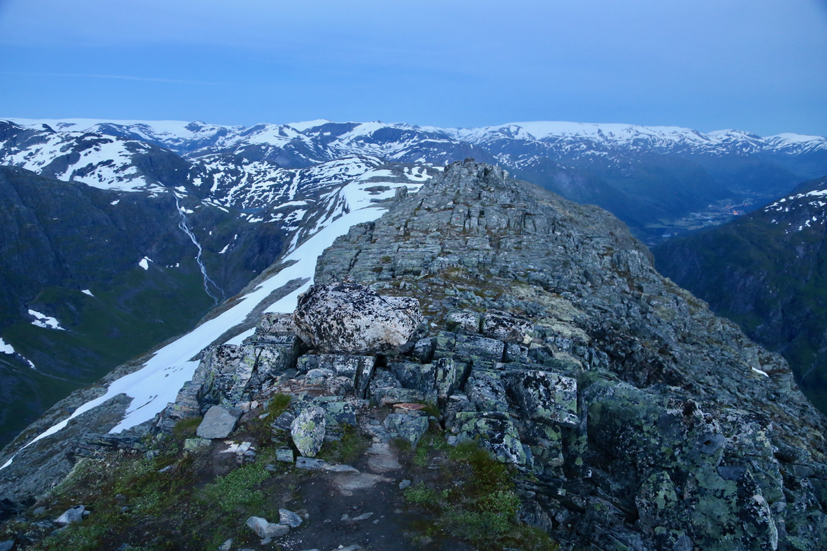
follow the path of least resistance. Near the top, you cross a somewhat more
level section before a final climb to the top.
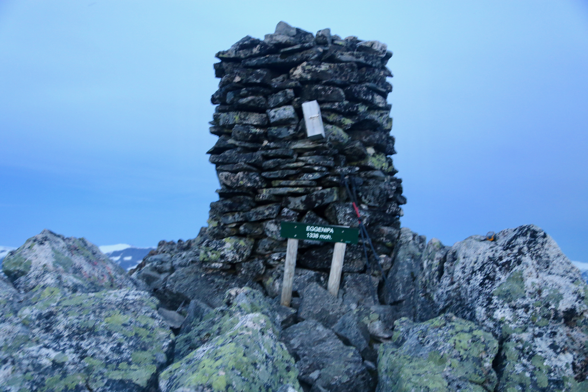
There is a large cairn with summit registers etc. Note however,
that the highest point seems to be about 20 meter further ahead
(behind the cairn)
Comments:
I was driving to Loen in order to participate in the inaugeration of the
new hut on Skåla - Skålabu.
I had started late from Bergen after a busy day in the office. The weather was
exceptionally good. I thought a hike besides the driving would be very nice indeed.
As I was approaching Førde, the plan started to form. I had driven south from
Byrkjelo to Skei a large number of times over the past 30 years, each time looking at
Eggjenipa when driving down to Bykjelo from Utvikfjellet. Always saying to myself that
this is a peak I need to visit, but unfortunately, there is no time today.
This time however, it was all decided while driving and I parked my car at the
trailhead parking at 2230. This would be a night climb, but with plenty of light, this
is June in Norway. I had a good hike and scramble up along a very well marked route, near the
top I slowed down slightly in order to arrive
at the cairn precisely at midnight - 2400.
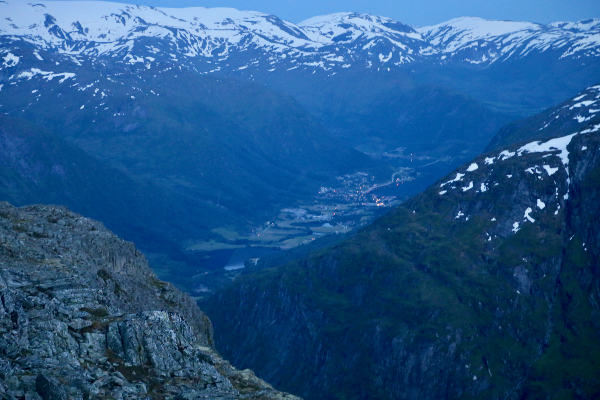
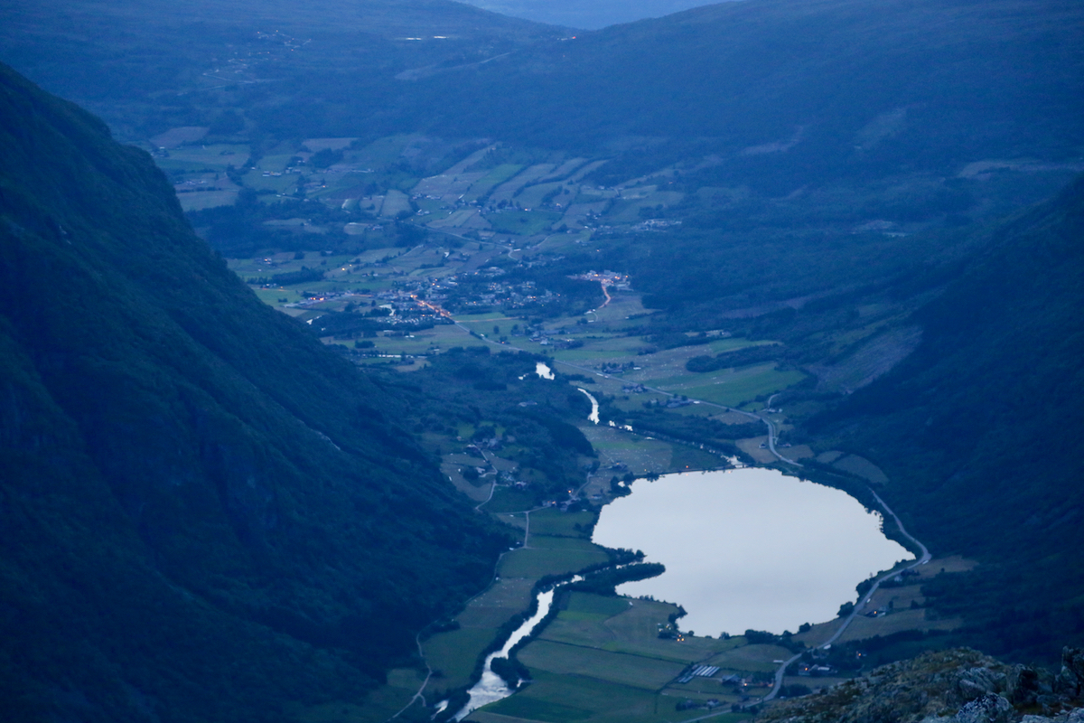
The view was nice in all directions, I think this is one of very few places where one
can see the village of Skei
and the village of Byrkjelo at the same time.
I started my descent at 0020, a new month had just begun. An equally nice hike down and
back to my car by 0145. Now, it was time to drive onwards to Loen where I planned to
camp in my car before ascending Skåla starting at 1100.