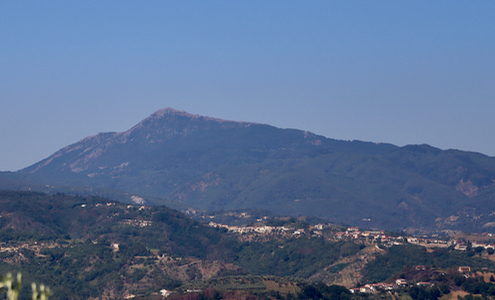
Monte Cocuzzo
- Monte Cocuzzo
- 1541 m
- Primary factor 822 m
- Italy
- Location: North 39.21874, East 016.13290 (GPS at the summit)
- Difficulty: YDS class 1
- Climbed August 2. 2017.

Monte Cocuzzo
|

|
How to get there:
This is indeed a good question. It turns out that a small paved road runs
all the way to the summit. The pavement is badly broken about one kilometer before
the summit, so the peak must be hiked unless you have a very rough 4WD. This small
road appearently starts (near a cluster of small roads, possibly a tiny village) from
location N39.19034, E016.19622. I was never there, see below.
In any event, a natural starting point is the city Cosenza, located at the north-south autostrada A3.
An easy alternative to finding the summit road is to start a short, nice
hike from Hwy. SP45. This road begins just outside Cosenza
on the south-west side of town at location N39.27678, E016.20011.
SP45 connects with the coastal Hwy. SS18 in a place called Scalo
Ferroviario.
Drive SP45 up across the main crest.
Very shortly after the road starts descending find parking next to the road at or near
location N39.22886, E016.14770, elvation about 1105 meter.
Route description:
Continue (walking) a bit further along Hwy. SP45, until you find a track that forks left where SP45 makes
a right curve. This location is at N39.22802, E016.14709. Follow this track/trail as it climbs gently, then turns
more left and descends slightly in order to curve around a tiny valley. You will have a concrete (farm) structure
on your right. Continue up on the next hillside, the trail is now a farmers road. It continues with a gentle
climb going right, then curves left and connects with the summit road at location N39.22486, E016.14133, elevation
about 1190 meter.
From here, just follow this road to the summit
of Monte Cocuzzo.
Comments:
I had visited the summit of Botte Donato earlier in the day. This was mainly
a driving exercise and I had time to visit the other high prominence peak in the
area, further west in the coastal range. Driving back down towards Cosenza, it was already
pretty obvious which peak to aim for.
I pretty soon was drving up the hillside along SP45, and it seemed that this would get
me close enough for a reasonable hike. After locating the promising track/trail, I quickly parked
and could start walking at 1120. The fact that the somewhat primitive trail quickly turned into
a farmers road gave me a hint that this hike would turn easy. Still, I was a bit surprised to run into
a small, but nicely looking paved road.
Following this road and observing that it had a
few sections where the pavement was broken and only
a pile of rocks remained, I still had a good
walk arriving at the very summit at
1220, so one hour from my parked car at Hwy. SP45.
The summit had some pretty ugly buildings,
but otherwise the views were nice all around.
I left at 1230 and about half way down the road I bumped into another hiker resting in the shade
of a tree. We had a nice chat, it turned out that he was born in England, but now lived
in the local area. He had among other accomplishments walked across the entire Balkan when younger.
He was essentially one of only 2-3 people I met on a trail in the span of 3 full weeks. How
typical then that he came from England.
We parted and I returned to my car at 1315.