I wake up at 6AM and
look out my window.
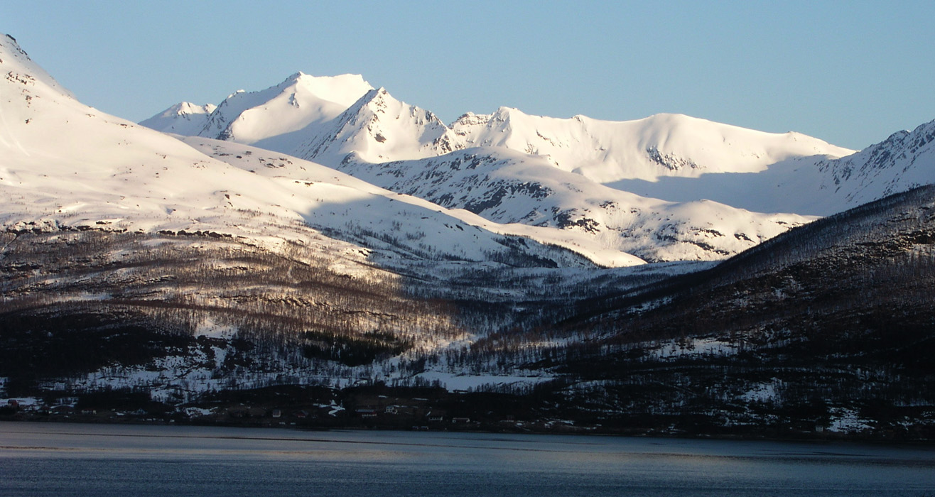
The sun has been shining for hours already. The weather
looks great and the views even from my room is breathtaking.
Torstein will leave from Tromsø right now. I shall
have breakfast and then only drive 5 minutes to the trailhead.
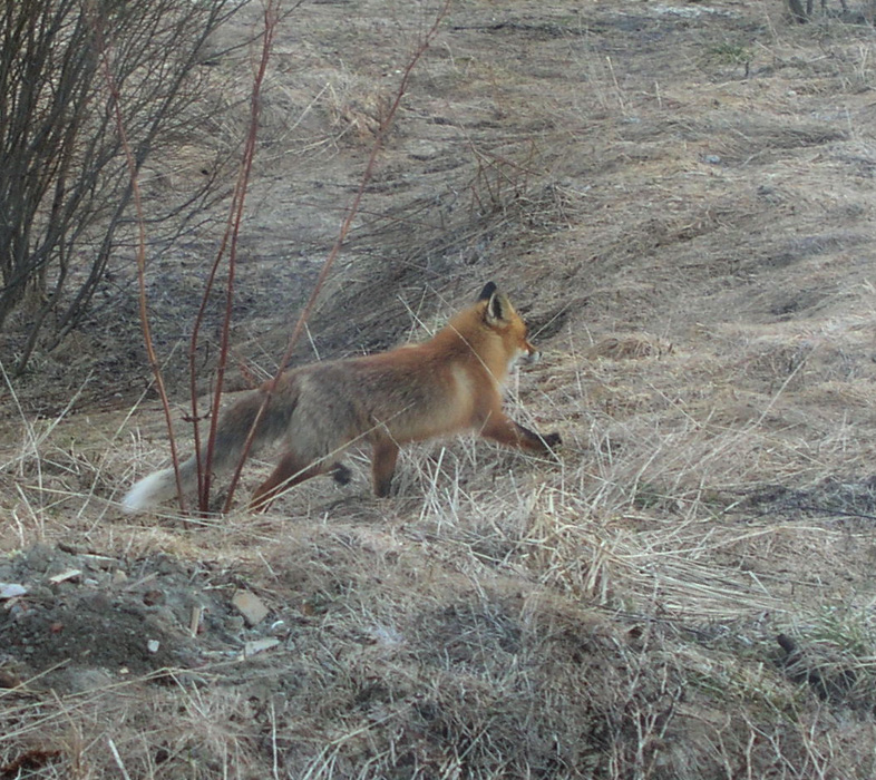
As I still admire the views outside, a fox walks by just a few meter away. I am in Troms, this is certainly not commonplace in Southern Norway.
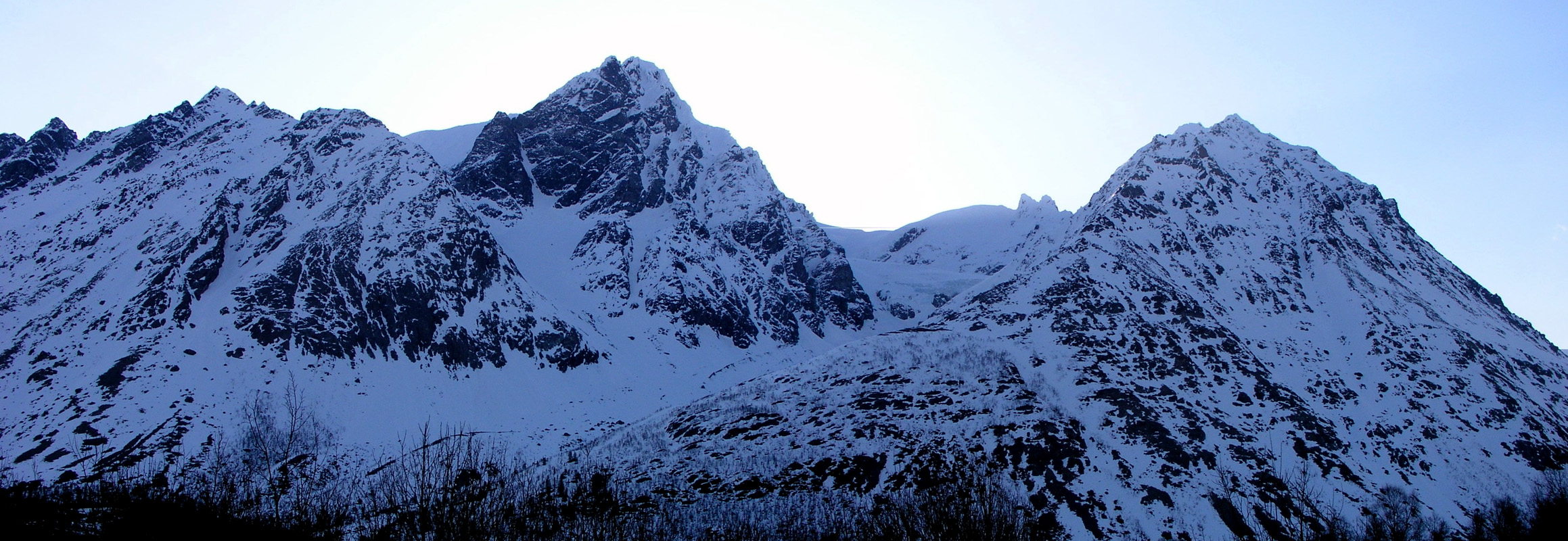
I drive the few kilometer to the agreed meeting place and look at Holmbukttind, the route this morning heads up on its left side in a steep and narrow small valley.
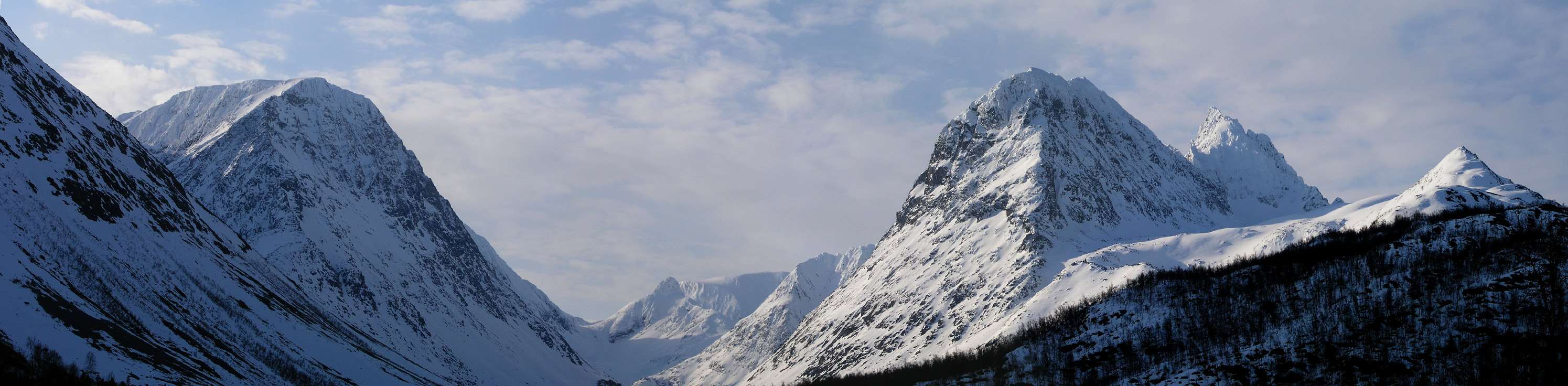
I arrive at the bridge where we have agreed to meet, a few minutes before Torstein. There is plenty to do, I admire Lakselvtind (right side of the valley) for quite some time this quiet, early morning.
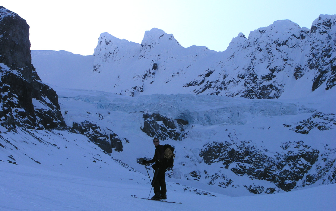
Torstein arrives on time and I take a look out across the fjord before heading in the opposite direction. We will start at sea level, the summit is more than 1800 meter up and requires about 2000 meter of vertical ascent.
Our route does not head up the main valley. This valley is partly blocked by a huge glacier that can be seen behind Torstein. Besides, this valley does not really provide a good route of ascent higher up.
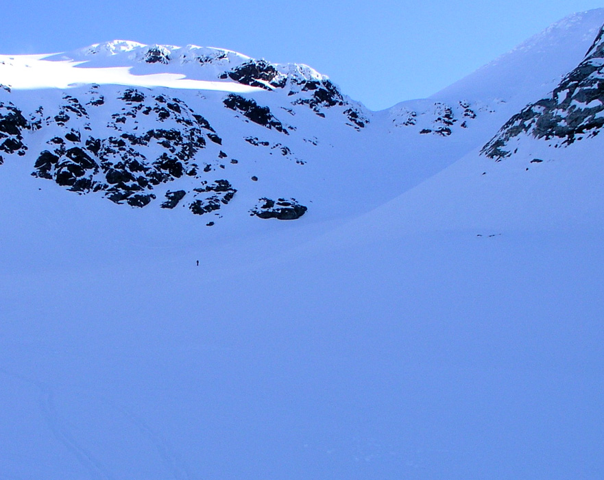
I look up the narrow valley. It is steeper higher up and I decide that it may be better to cover part of the distance on foot with crampons, rather than on skis.
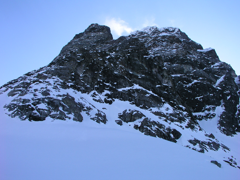
Above our heads on the right side is Holmbukttind.
This valley is facing west and north, so we will be in the shade until we reach the main Holmbukttind ridge. However, as I climb higher, the view south-west towards Laksvatnbukta is getting more and more impressive. We move pretty efficiently. Torstein is very strong and gets ahead, but then waits for me where the slope gets so steep that we must continue on foot. Several teams, some with paid guides are following behind us, but we have nobody ahead. Gradually, we pull more and more ahead of the other climbers. In fact, for all practical purpose, we had Jiehkkevarri completely to ourselves this beautiful day.
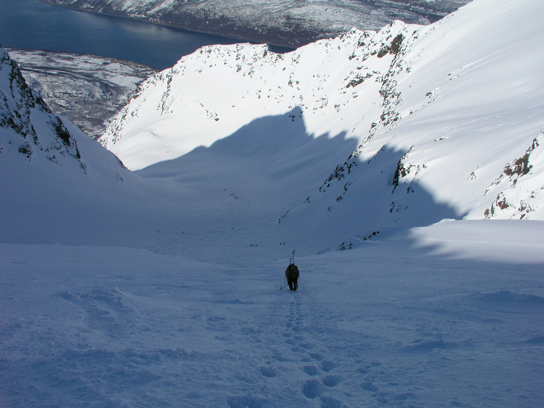
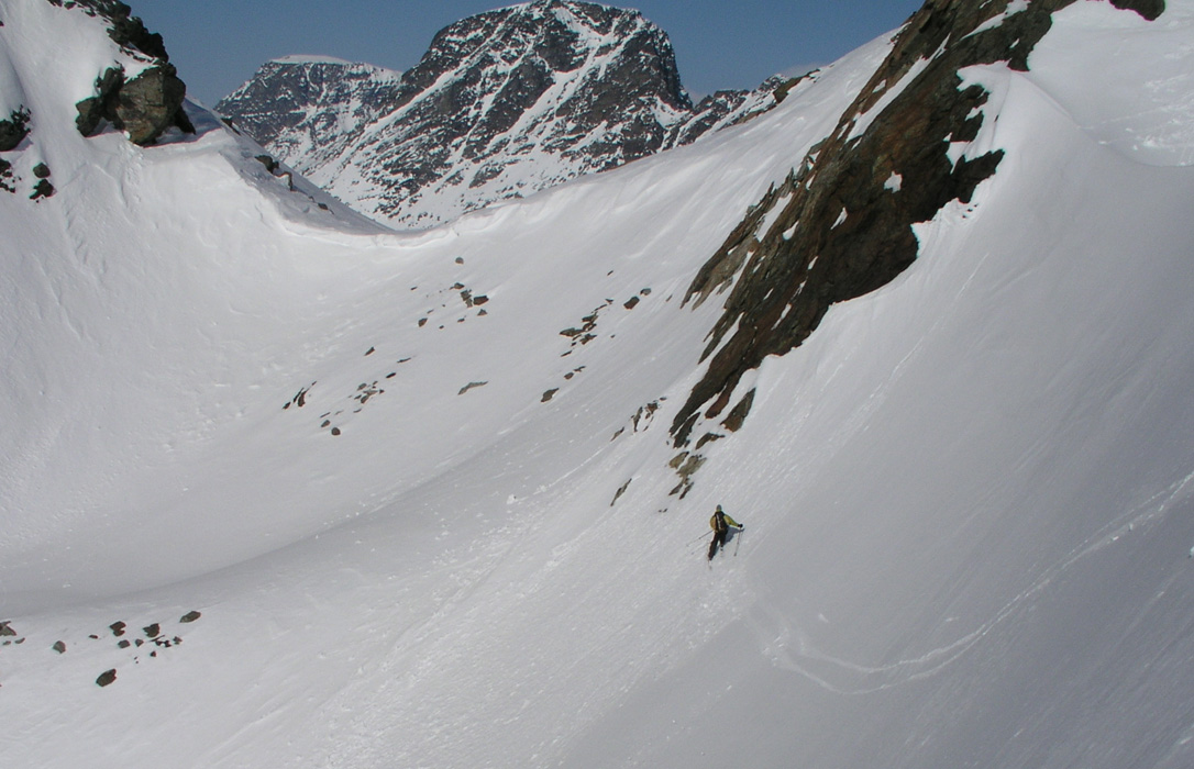
I move onto the steeper slope ahead of Torstein. I have good crampons, he left his behind and is not entirely happy about this decision at this point. There are some old steps in the snow, but they are partly filled/covered with new snow. I try to kick good steps in order for Torstein to be at least reasonably comfortable The slope starts out at close to 45 degrees, then gets gradually more gentle higher up. Notice the teams that are skiing below us. The slope they ski on is actually quite steep and require zig-zag skiing. However, compared to where we are, the slope below appears almost flat.
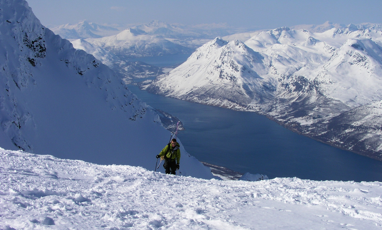
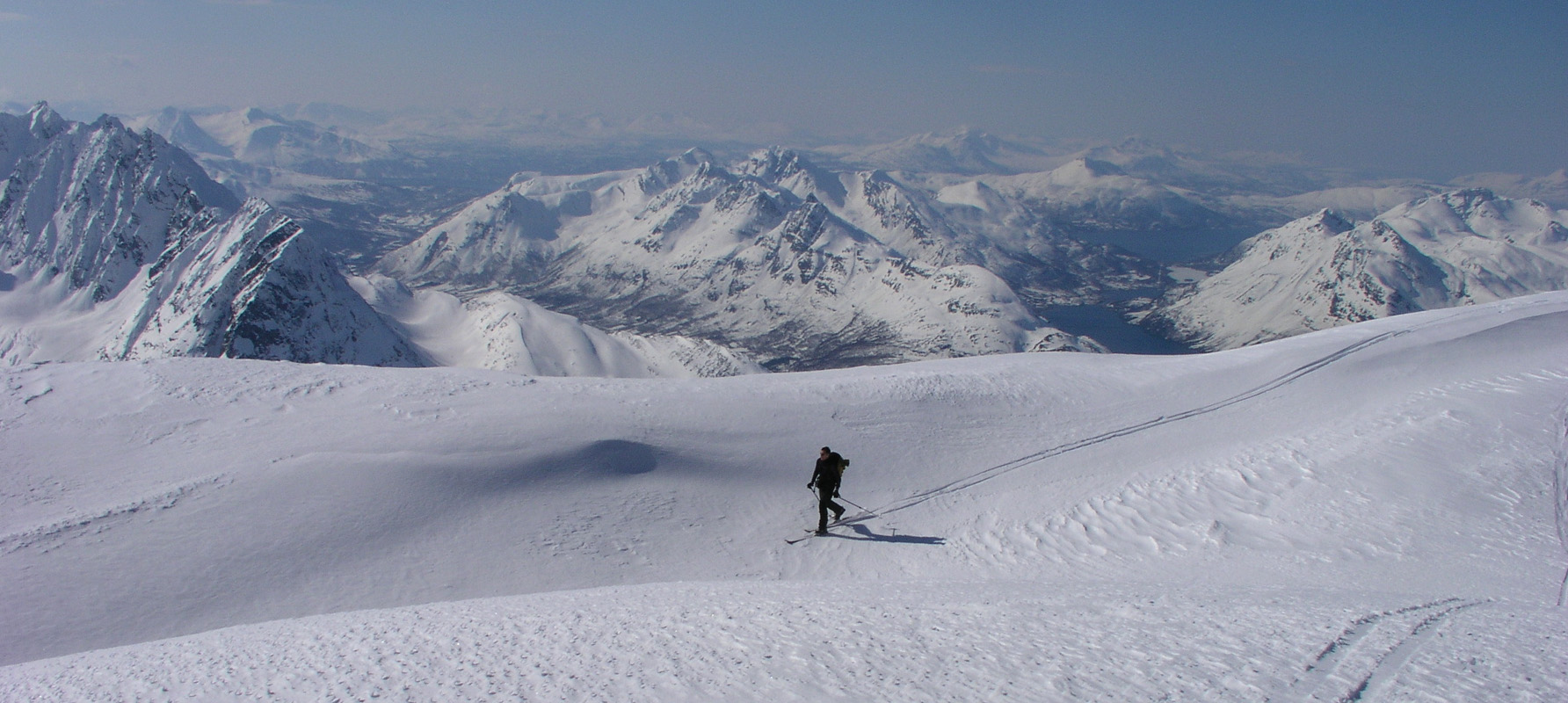
We gain almost 300 vertical meter on this slope, I turn around and face out while capturing Torstein carefully advancing uphill in my footsteps.
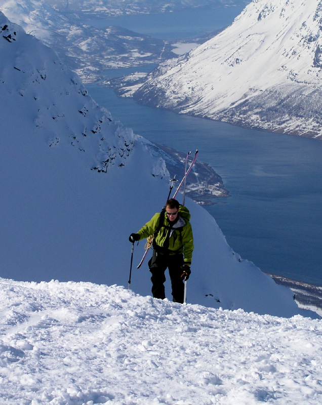
I gain the ridge and therefore also the first rays of sunshine since we started the climb. Soon, Torstein is getting near the top as well.
He
is closing in on the ridge.
I bet
he is happy
to soon be back at terrain where he can put his skis back on.
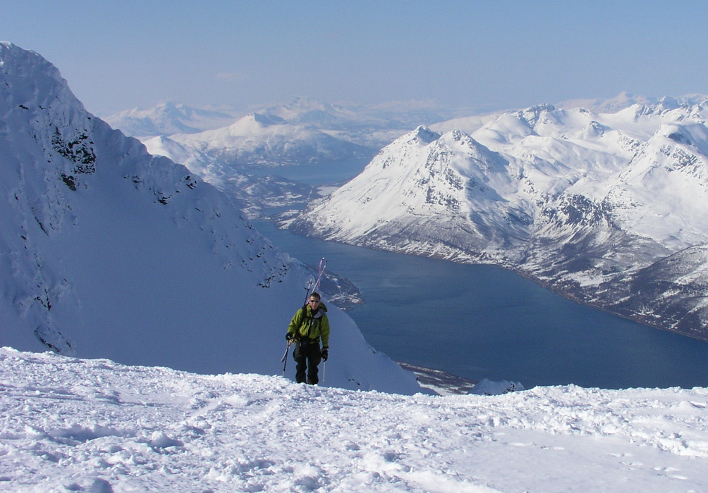
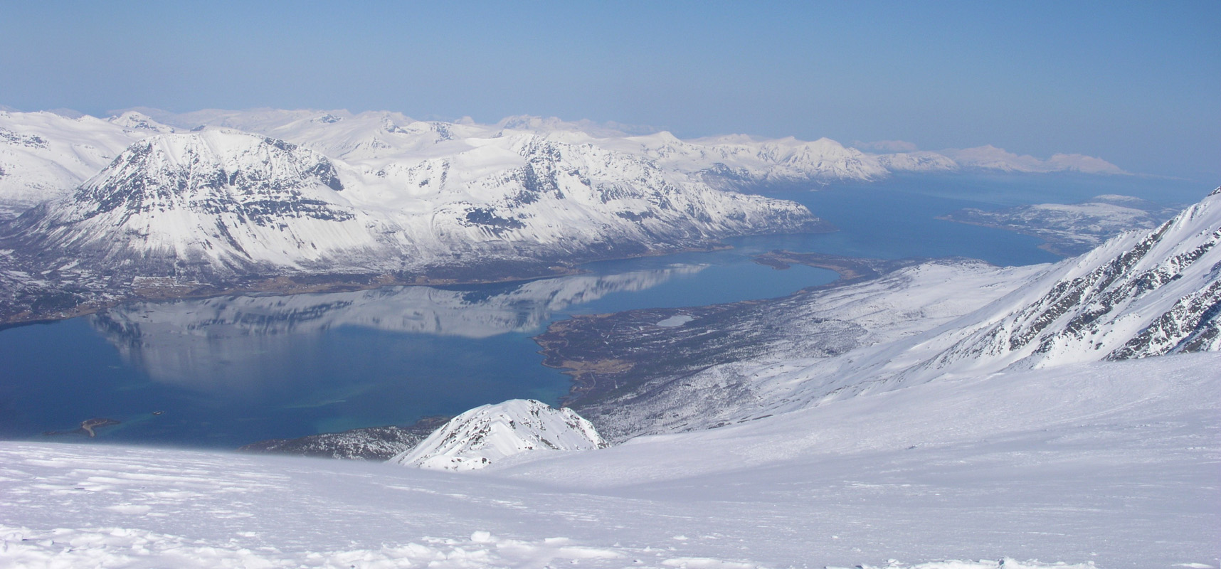
The view from this ridge
out the fjord on the west side
of Lyngen is just fantastic and hard to describe. The morning
is very quiet, the giants all have their mirror images in the deep
blue fjord.
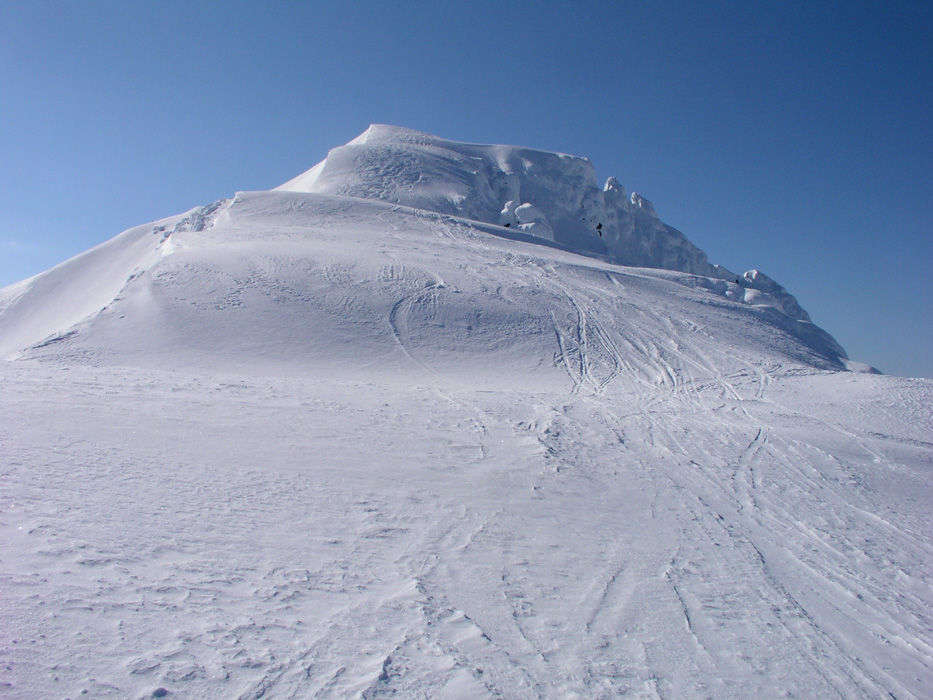
The skis come on and we look up the ridge to Holmbukttind.
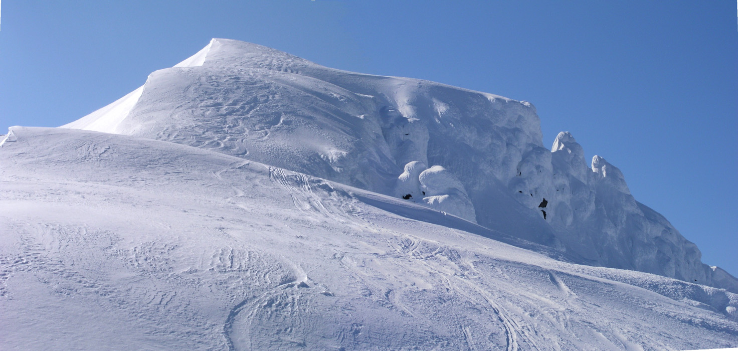
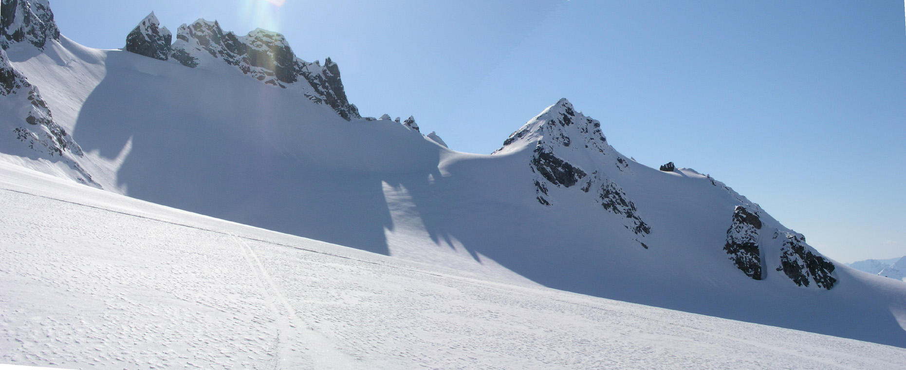
Here is another closer look of the last part of the Holmbukttind ridge. The route actually climbs this peak to the summit as it is too steep to contour around. We depend on two different ridges, one up and a second back down. The ridge ahead is wide enough, but quite a bit steeper than what the picture seems to tell.
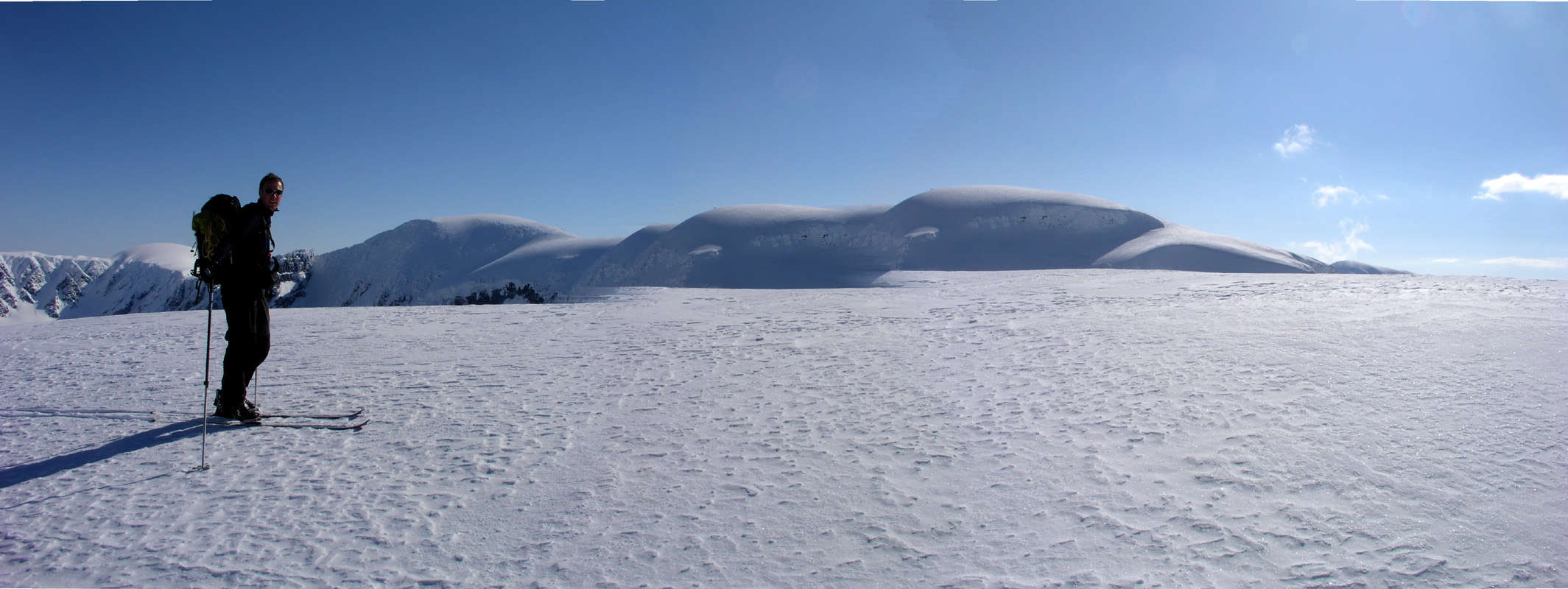
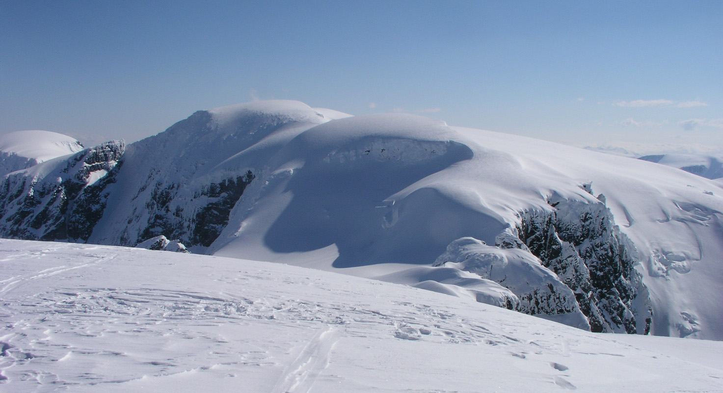
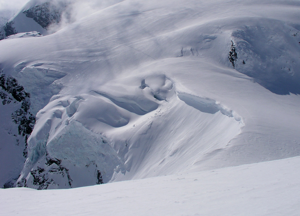
Up here, we see Jiehkkevarri. This is the first snow dome immediately to the right of Torstein.
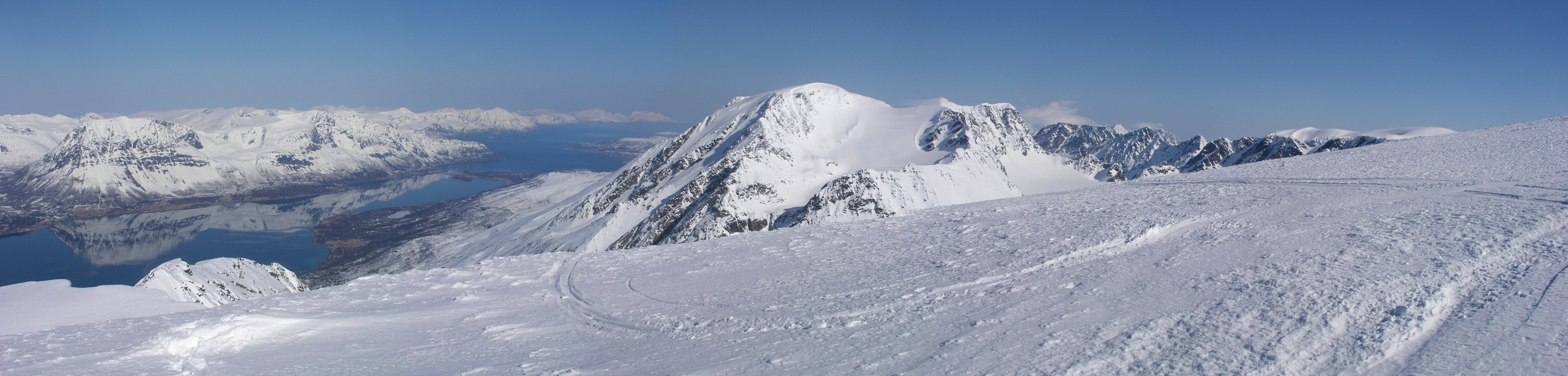
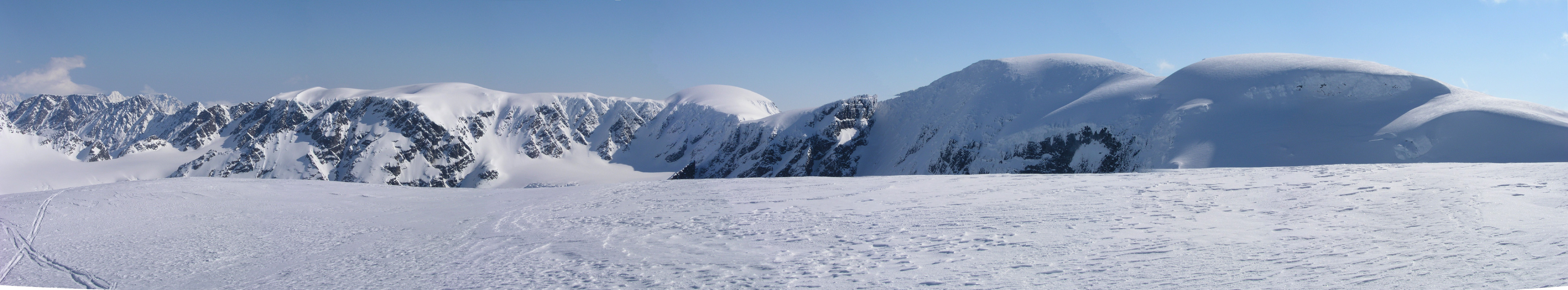
The view from
Holmbukttind is enough to
justify the trip. Here, from right to left, you see the first snow dome
that we contour around on the far side. The access after descending from
Holmbukttind goes up from left to right on the glacier in front, not too far
from the distinct line separating shadow from sunshine.
The next snow dome is Jiehkkevarri, then follows Kveita.
We shall traverse Kveita and later ski on top of the ridge that can be seen to the
left of Kveita.
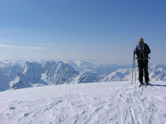
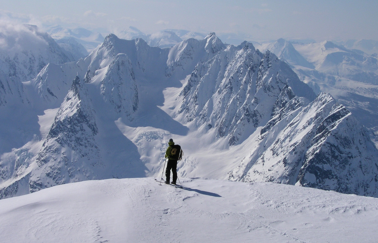
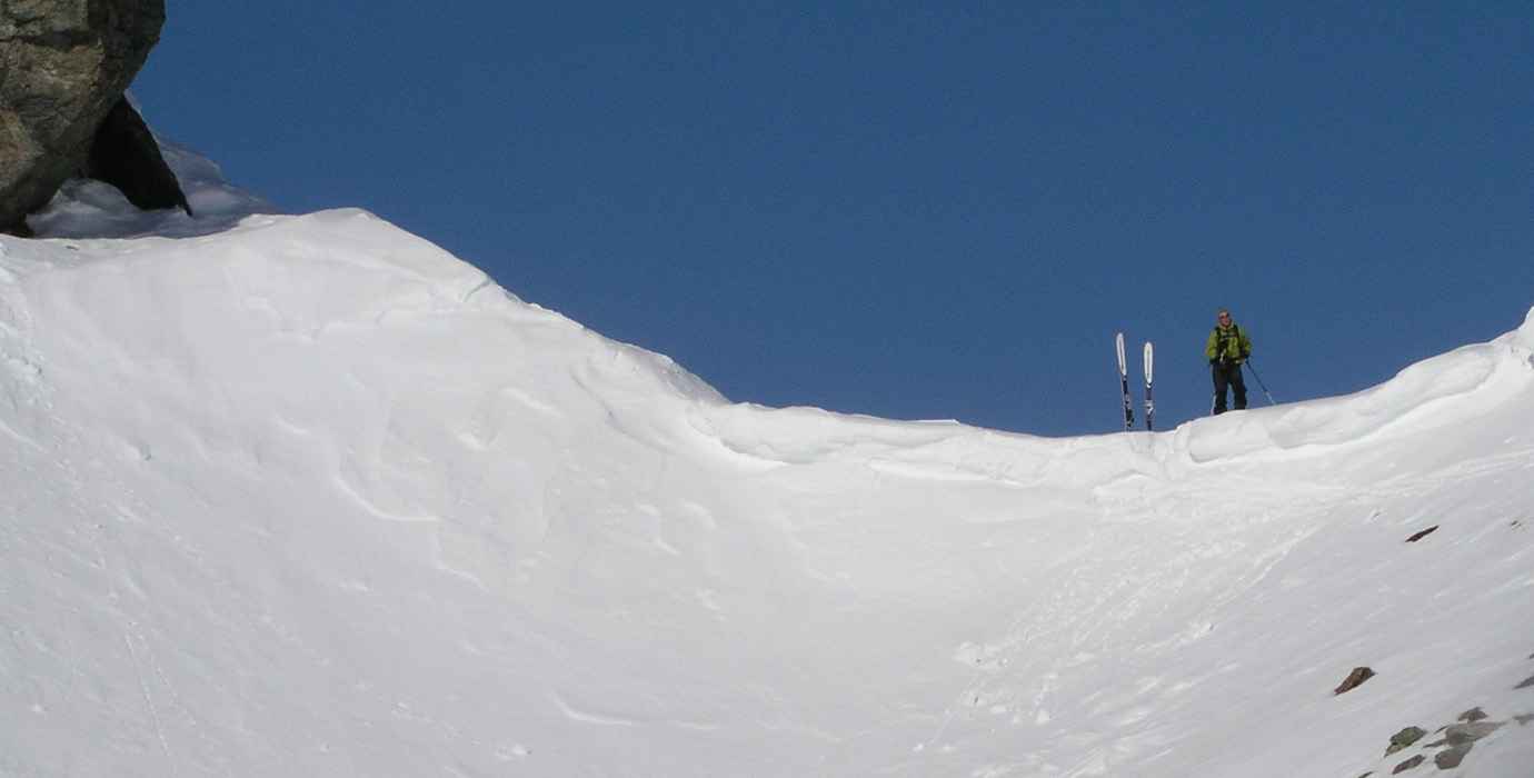
We get to the summit of Holmbukttind. Here is a picture of me at the summit. Surprisingly, all traces and tracks from previous skiers end here. There is not a single track that indicates how to proceed to Jiehkkevarri. It is clear that we need to explore in order to find a safe passage down onto the other ridge.
We look around from the summit of Holmbukttind.
The fjord easily catches your attention.
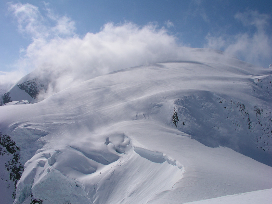
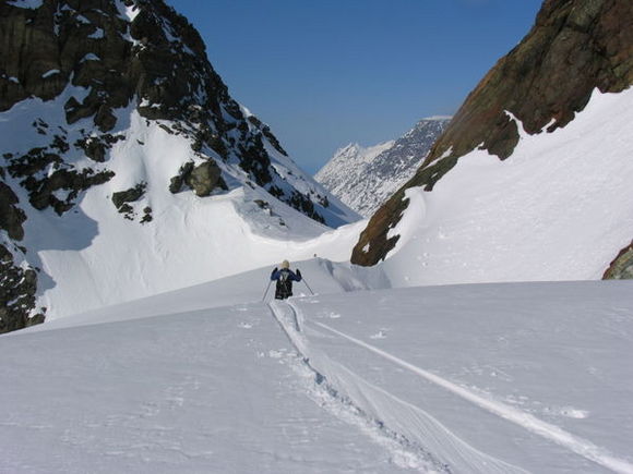
We focus on the task and look towards Jiehkkevarri. Soon, we locate a good route down onto the ridge that provide access to the glacier below Jiehkkevarri. The route goes down a ridge that initially is narrow, then gets wide. We will ski into the shaddow and steeply up, first left then right, before reaching more level terrain back up where the sun shines. Jiehkkevarri can be seen further along with Kveita all the way left.
Before leaving Holmbukttind, I just must take another picture of Torstein with the impressive Lakseelvtindene behind.
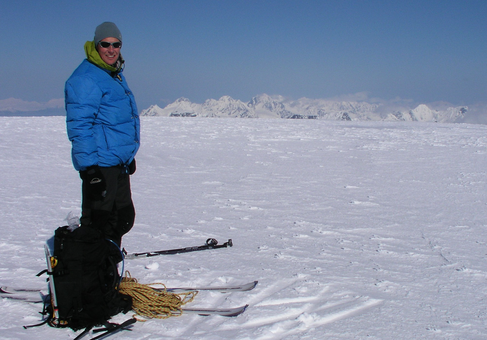
Five hours after leaving the car Torstein is on the summit of Jiehkkevarri, the highest mountain in Troms.
There is a very nice view around, but scattered clouds do reduce the
visibility some.
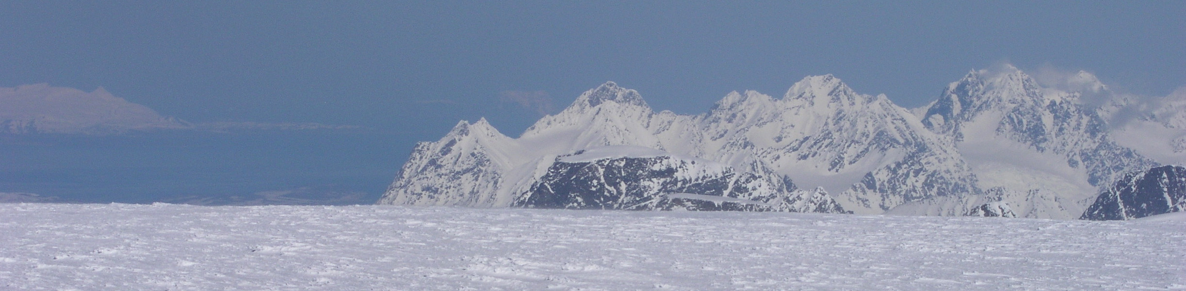
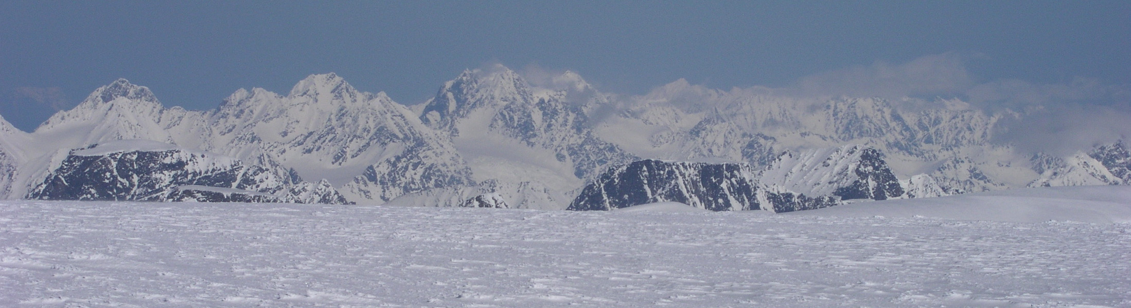
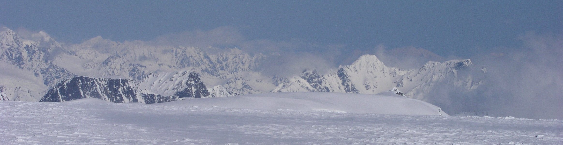
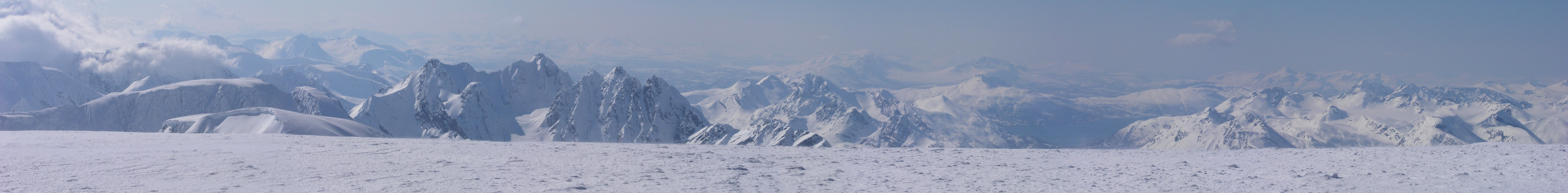
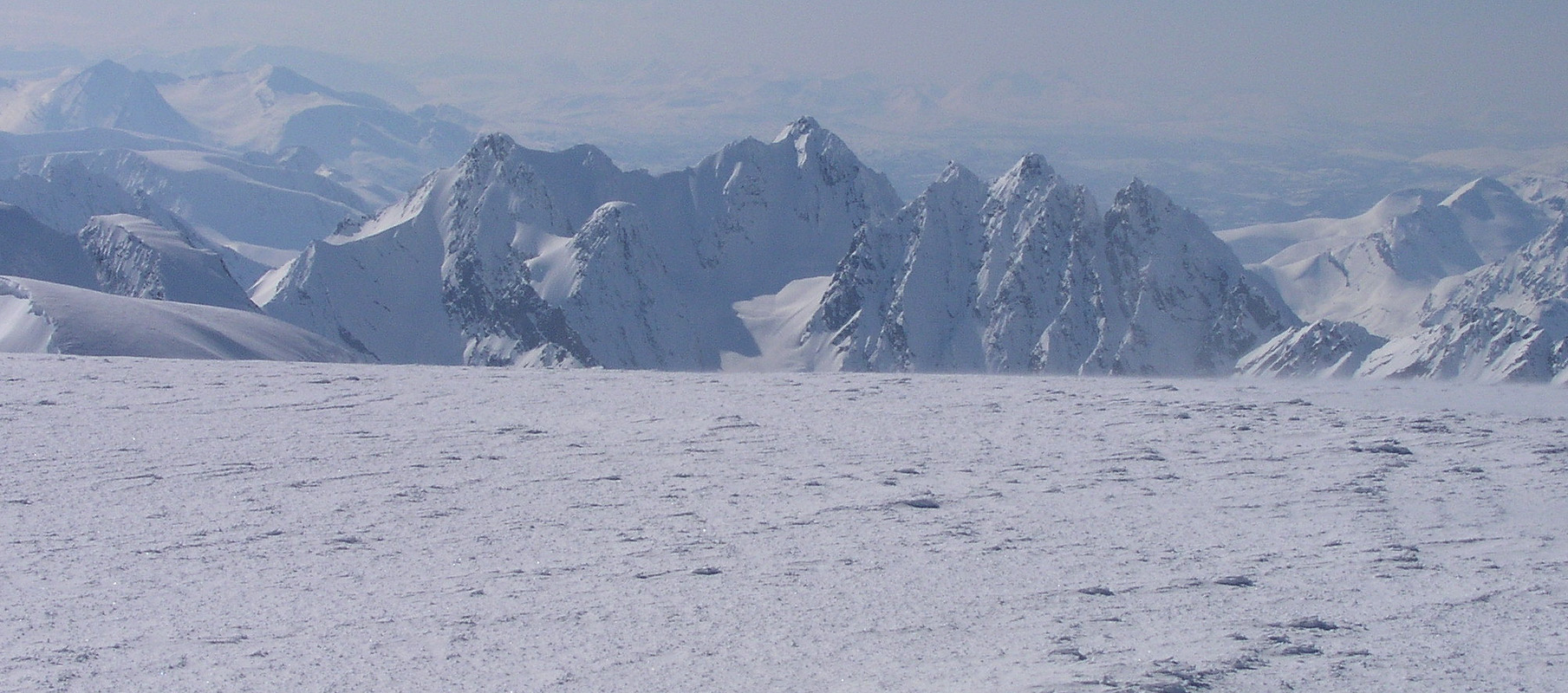
Panorama view from Jiehkkevarri I-A.
Panorama view from Jiehkkevarri I-B.
Panorama view from Jiehkkevarri I-C.
Panorama view from Jiehkkevarri II.
Panorama view from Jiehkkevarri III.
Lakselvtindene look good from almost anywhere, also from the summit of Jiehkkevarri.
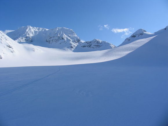
We wanted to traverse the mountain. Therefore, after half an hour on the summit we continued with very nice skiing down towards the saddle that connects the mountain Kveita with Jiehkkevarri.
This descent is pretty long with breathtaking landscape along the way.
We look back at the The Kveita saddle, impressive landscape, and a good line for skiing.
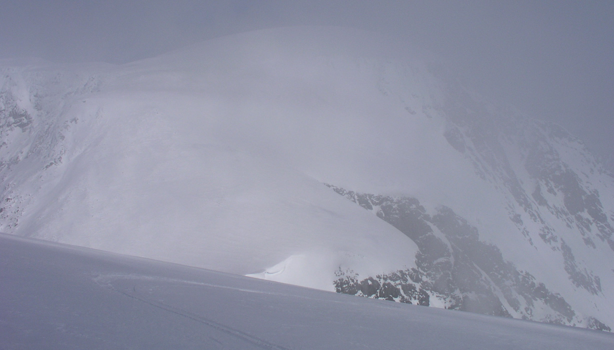
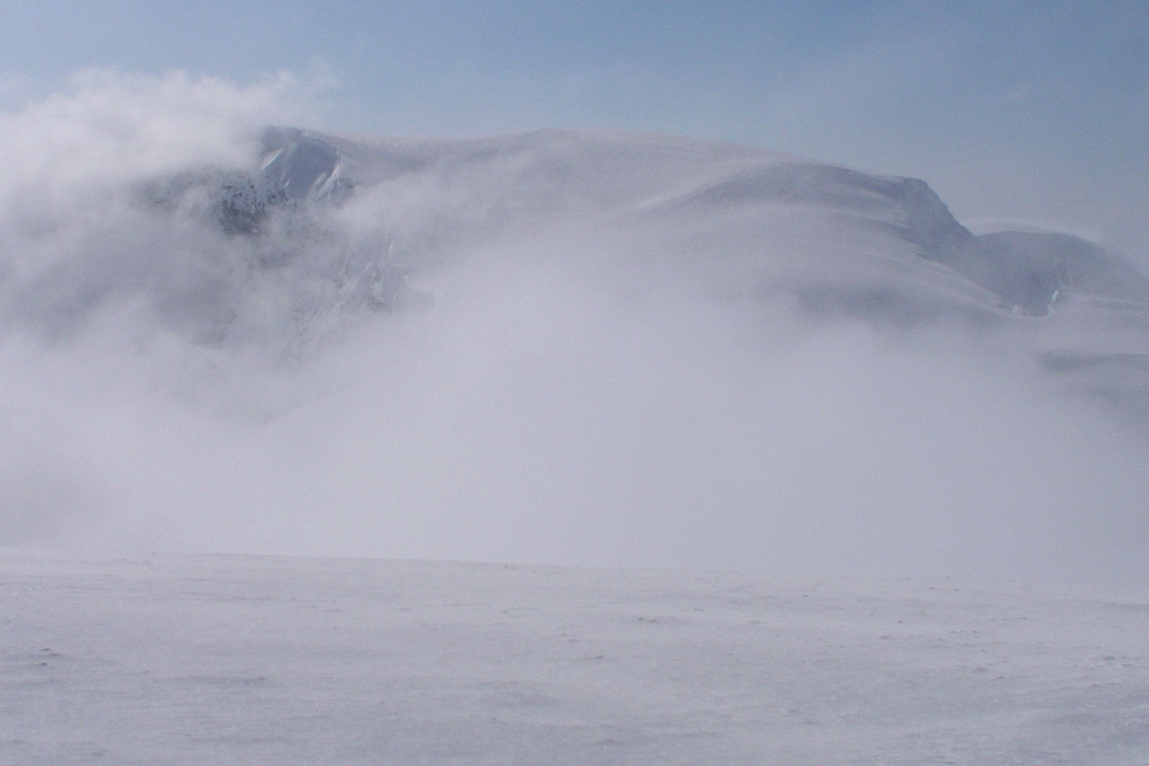
Here is another shot of the Kveita Saddle area. Jiehkkevarri is far up among the clouds.
Jiehkkevarri as seen from Kveita. Clouds are accumulating and we had a brief moment with very poor visibility when descending from the Kveita summit. Compass was needed to stick with the right direction.
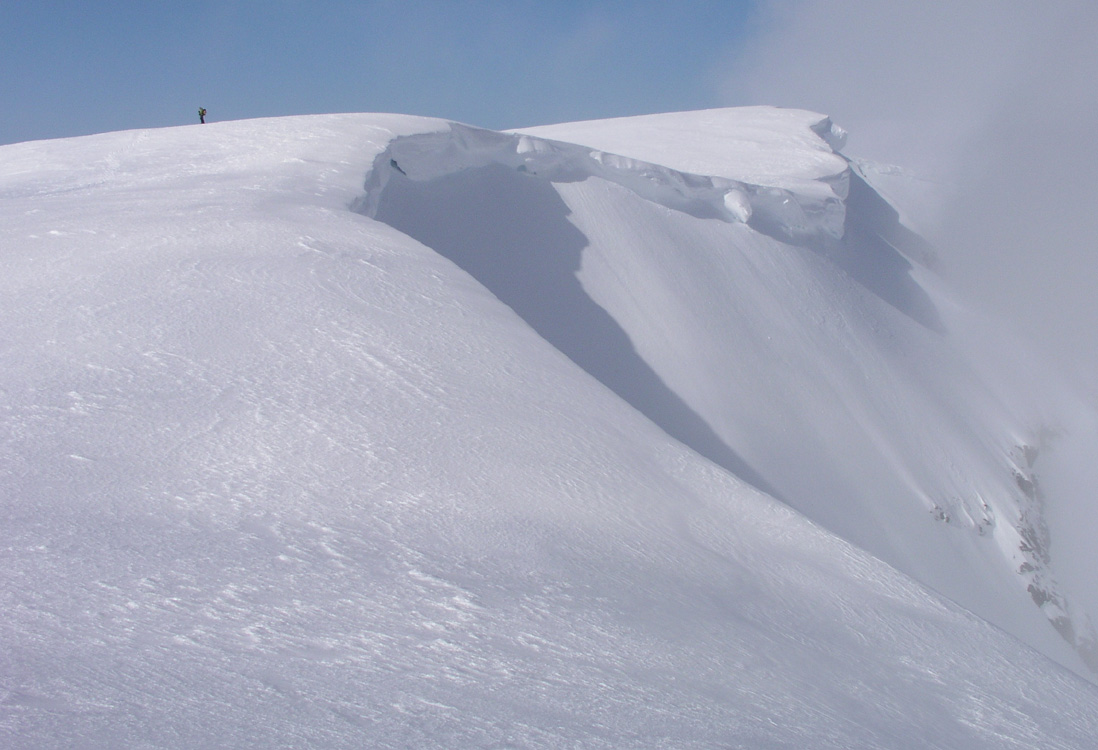
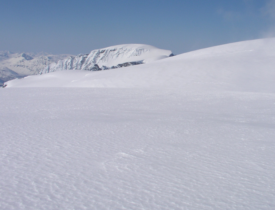
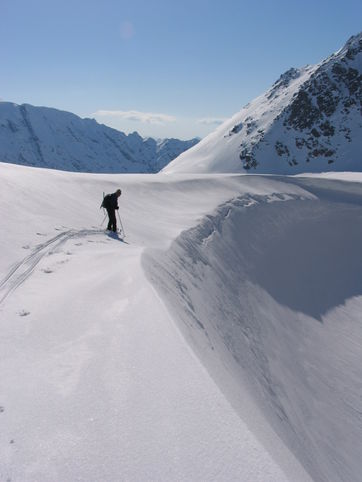
The route after descending from Kveita, be careful for the overhanging snow on the right side. Fugldalsfjellet, 1686 meter, is the white dome in the distance.
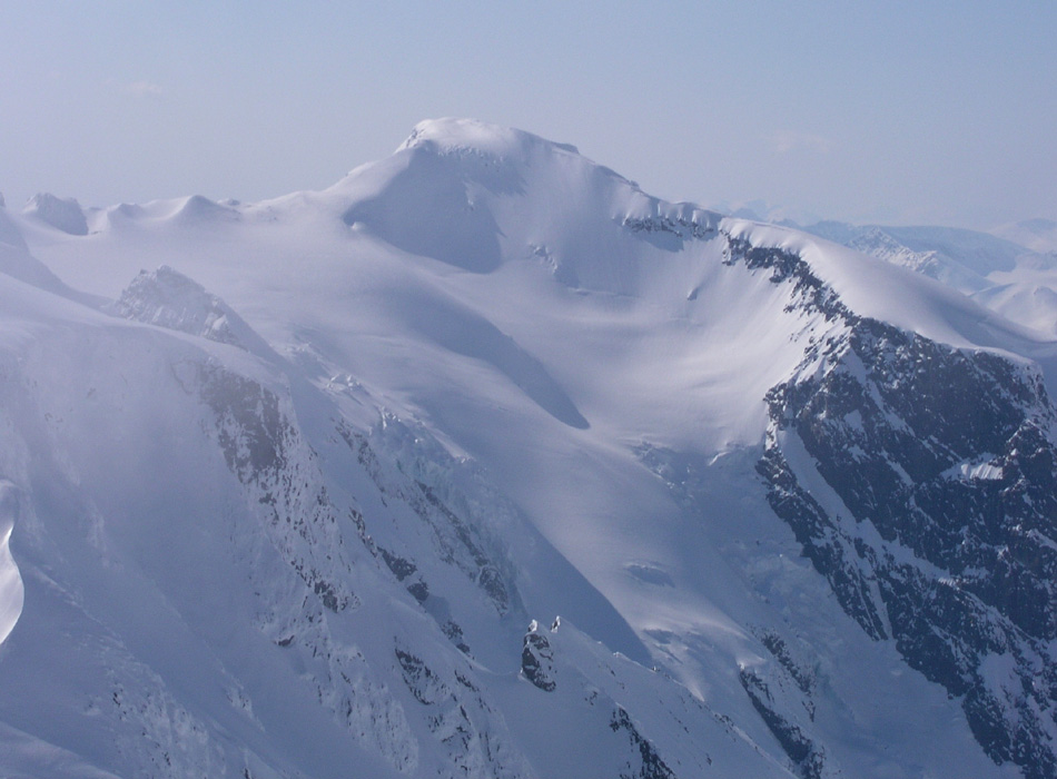
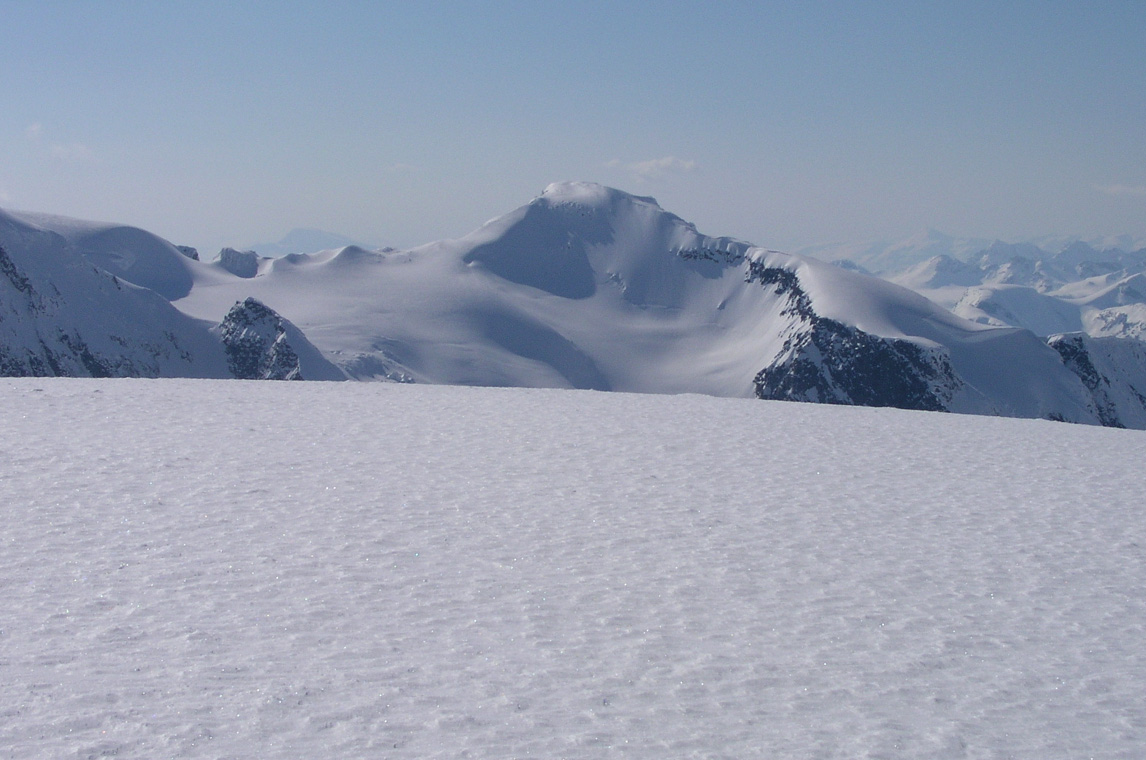
From this broad ridge we have a super view across to Holmbukttind. The ascent ridge is along the horizon on the right, while the traverse across to Jiehkkevarri is down the ridge further left. Notice that there is a fairly narrow section quite high on on this ridge.
We continue along the high, but broad ridge as it continues north.
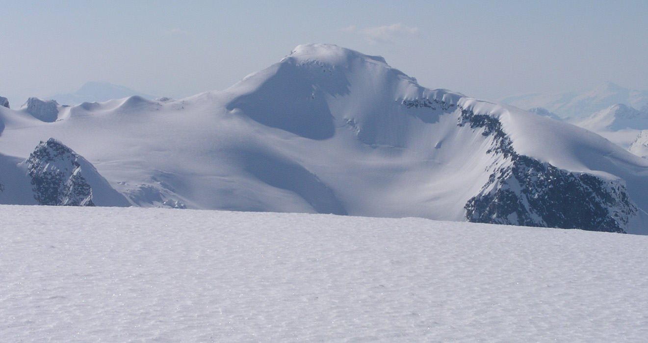
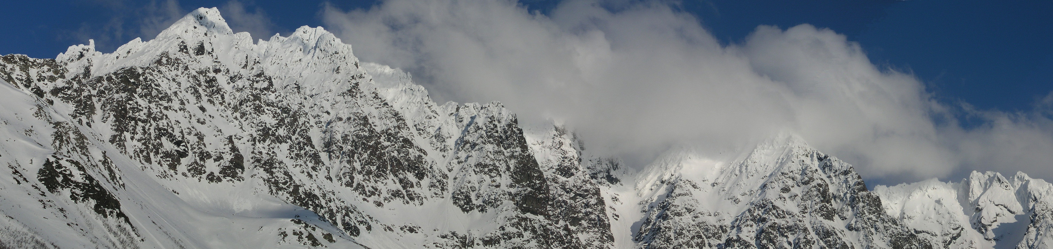
From here, Holmbukttind catches your eyes. Here is another great view to Holmbukttind.
We need to focus on finding the best route. I know that a steep descent is ahead of us, down to Fugldalsbreen. However, there are two steep glaciers connecting down there, and I have no idea which one is normally used. We decide to look at the one furthest to the west. We ski west of point 1666 seeing Fugldalsfjellet, 1686 meter, right ahead. Things are further complicated by the fact that we ski across the boundary between two topographical maps right here in the upper part of this steep area.
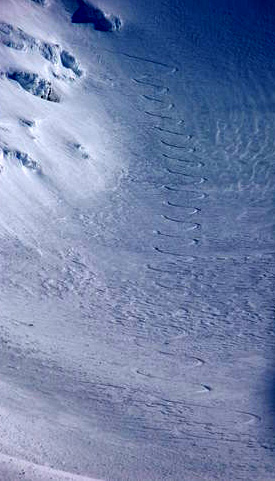
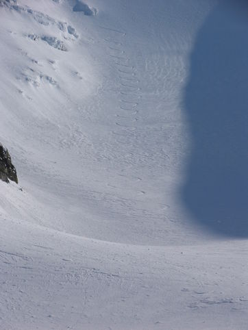
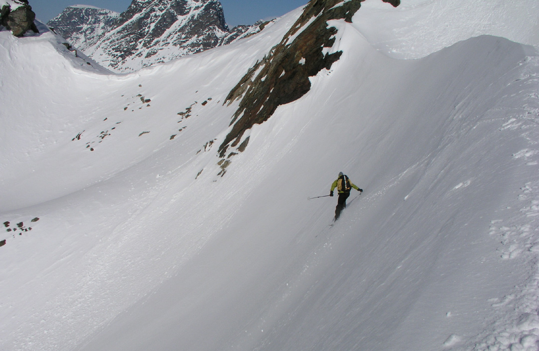
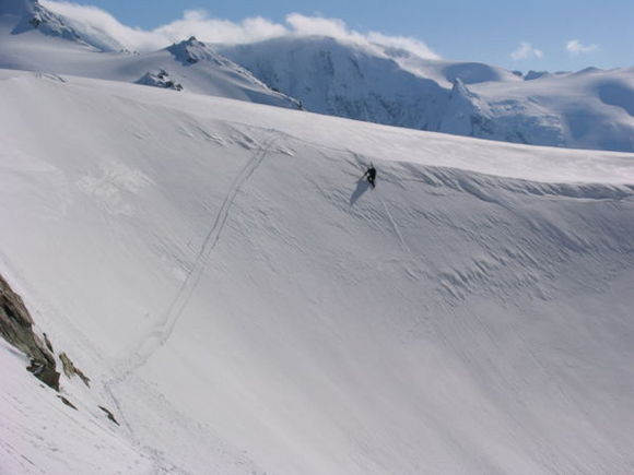
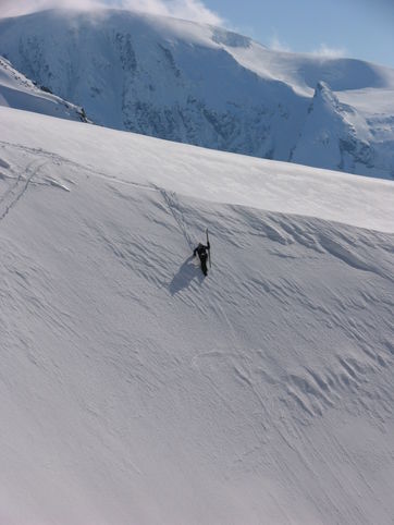
We first ski west of this glacier and to the edge of the main glacier above in order to judge the route. We quickly agree that a descending traverse into this steep glacier from the opposite side looks better. We ski back up and around before a new approach, this time from the east side. Torstein skis into the glacier and makes a large number of tight Telemark turns down. It is steeper than it looks, however, more than 40 tight turns in one go speaks for itself. The pictures show how we entered by way of a traverse from the left when seen from below. (The first picture has increased contrast in order to better see the ski trace.) I do the last part of the traverse and the first and steepest part of the descent on foot with crampons and the axe for safety.
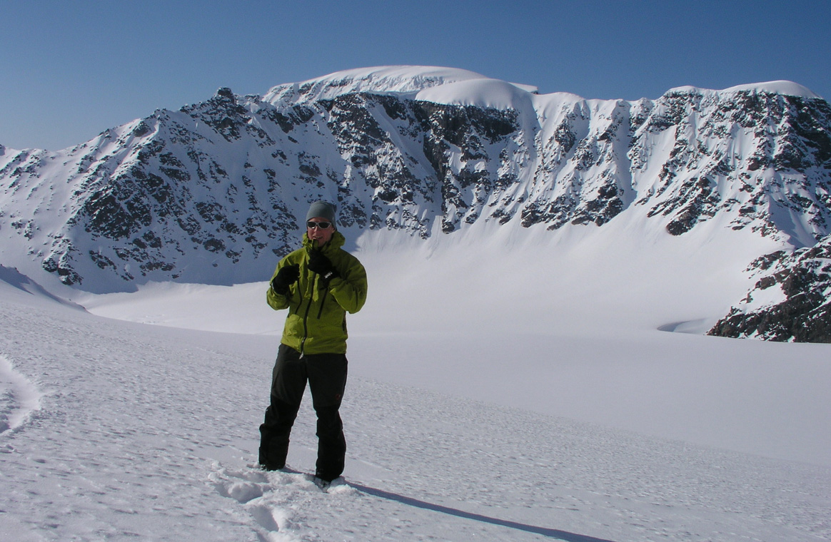
Here is Torstein at Fugldalsbreen, this is a nice and spectacular place.
Another picture of a boy enjoying life.
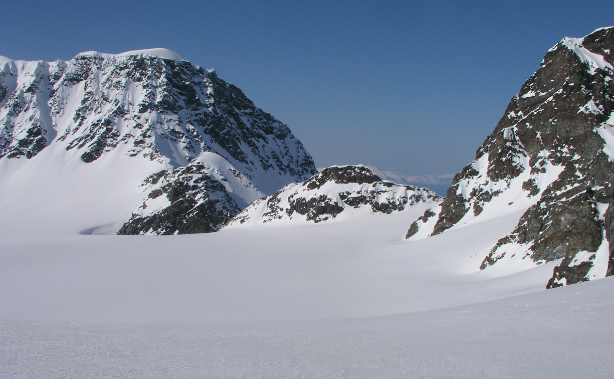
The route now proceeds through Fugldalsskardet, the deep cut left of middle.
Landscape around Fugldalsbreen.
The two descending glaciers plus more landscape.
Fugldalsskardet is an impressive passage connecting the route to the Fornesbreen glacier further north. An unexpected challenge, a wind generated, huge snow formation makes a very steep step before the pass. Torstein makes a steep traverse on his Telemark skis. It is steep enough to touch the uphill with the arm while skiing.
Torstein does a perfect ski into less steep terrain.
I probabely should have followed (on much thinner skies), but decided to down climb on foot. Good practice in an objectively safe area. Ice axe, but no crampons, one step at a time. I get down and can put skis back on.
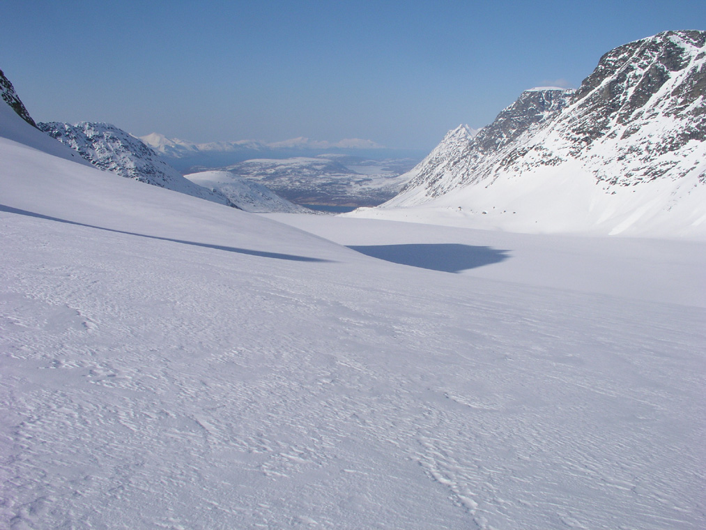
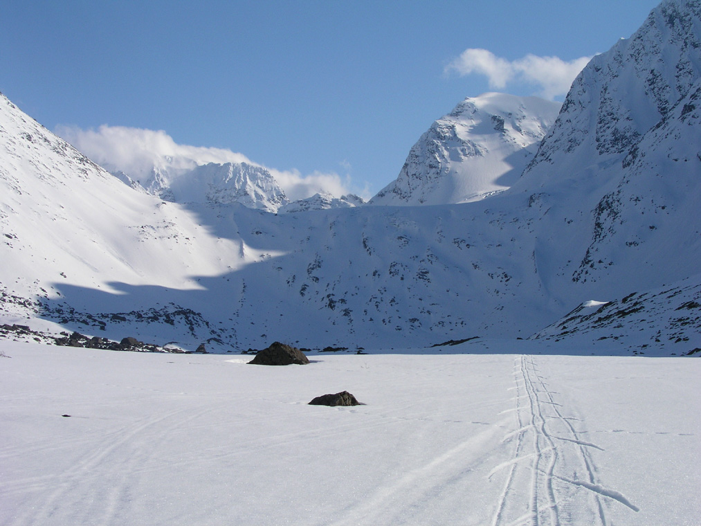
The route ahead, down Fornesbreen towards the blue fjord further north. Looking back, we came through the lowest pass that is under the small trace of cloud.
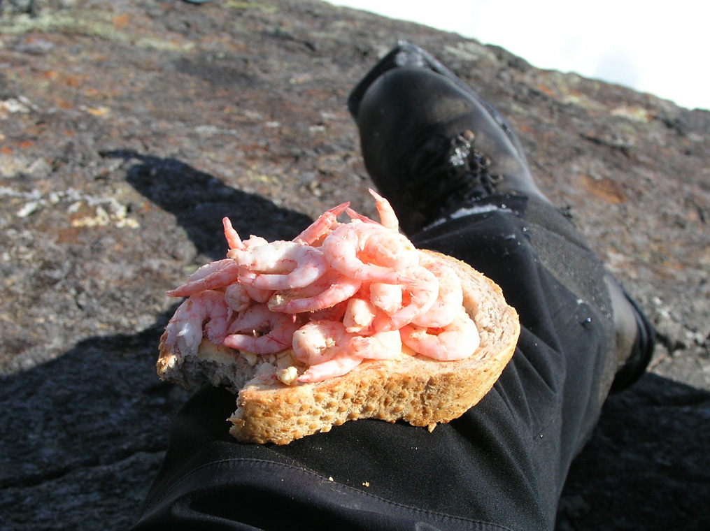
A break in Fornesdalen, Fresh bread with local, super fresh shrimp, very nice..
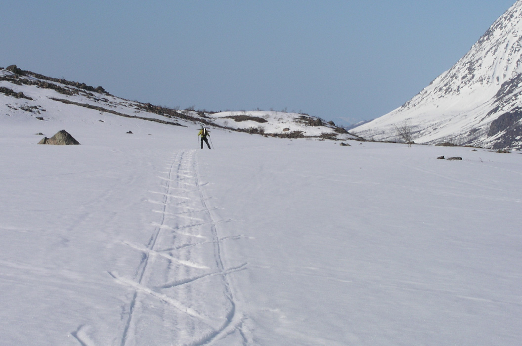
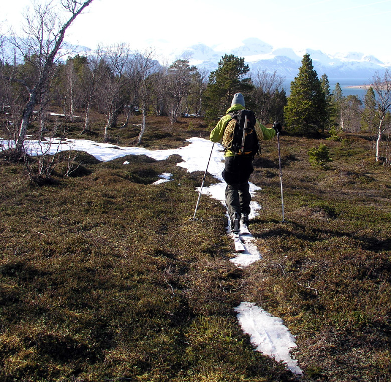
Torstein skating in Fornesdalen.
Landscape across the fjord the outer part of the Lyngen penisula.
A look back, the step below the glacier is very distinct. We are about to exit from a mountain landscape second to none.
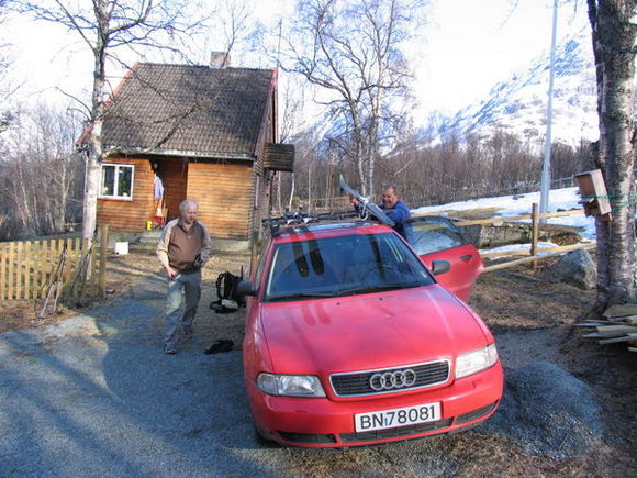
Torstein near the end of skiing. We end up at the very last house on the road. Fortunately, there is both a car and a potential driver there. He agrees to drive us 20 kilometer back to our trailhead for half the money I wanted to offer.
Here is a look up the Fornes valley from across the fjord.
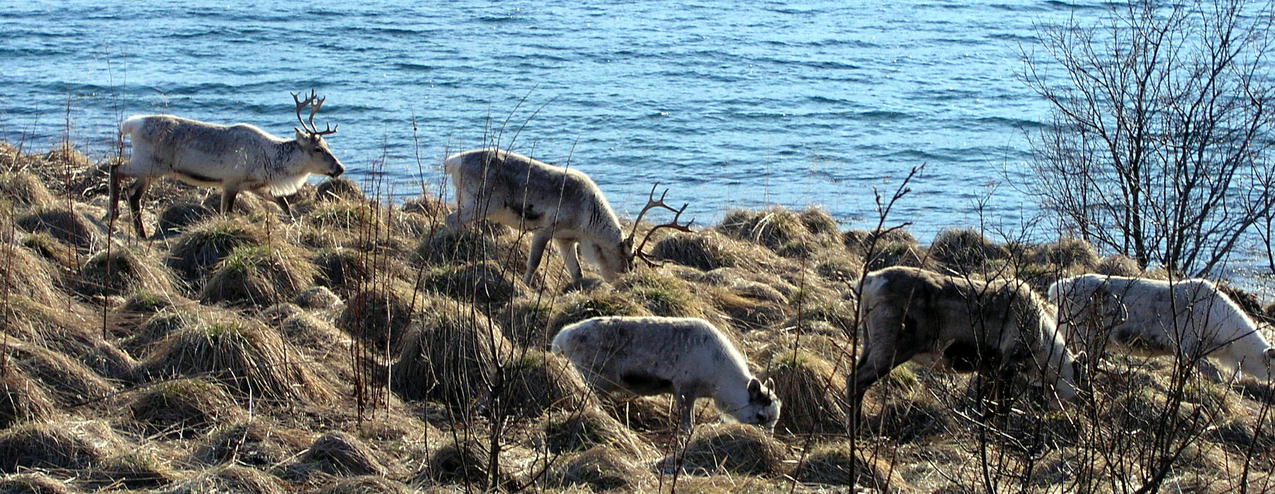
Reindeer, as we drive back to the trailhead.
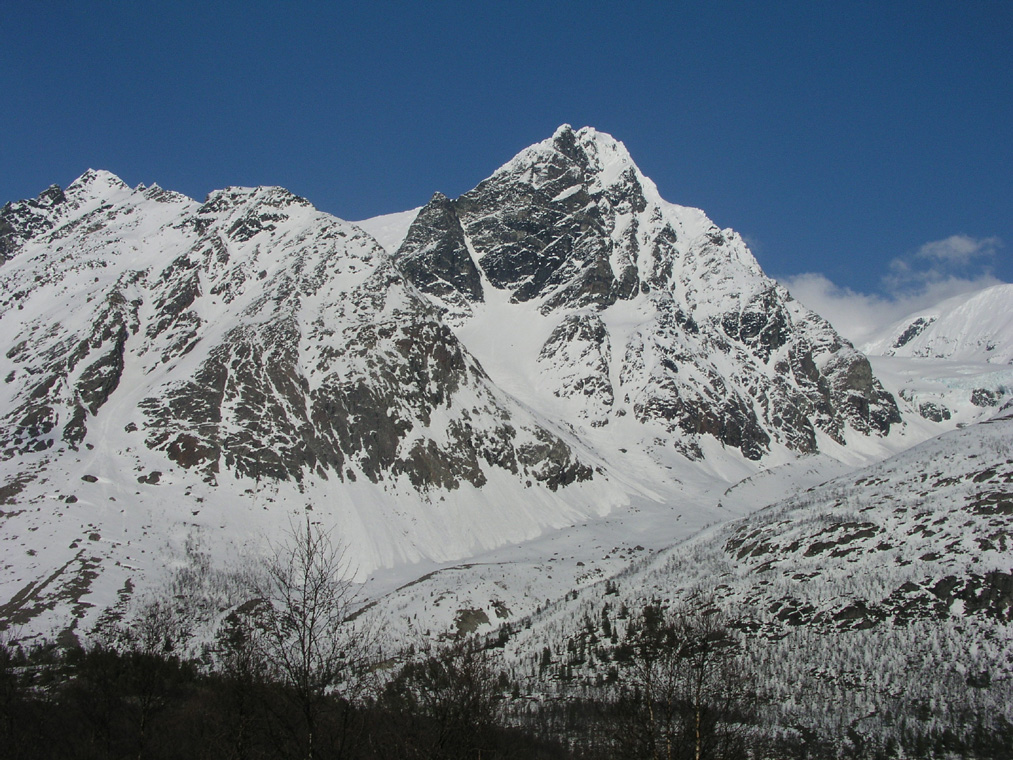
Holmbukttind after the climb. The afternoon light makes the mountain look more impressive than the early morning shadow.
I return to the nice cabin I rent from birger in Lakselvbukt. The final view before the day ends is again the fantastic Lakselvtindene.