Sort of by accident, it seems like my big mountain expeditions'
are in even years, while more local projects receive attention
in odd years (Greenland 04, Troms 05, Denali 06,..). Thus, I had planned
a trip to Northern Norway in May 2007. Plans were fuzzy, but quickly became
more concrete when Edward Earl (esquared) asked me about the possibility of
another attempt on Store Lenangstind. At the same time, Geir Åke Dahlen
suggested that we climb some peaks together in Northern Norway.
I quickly made up my mind to suggest that we should define the two/three arctic
"Ultra peaks" (peaks having at least 1500 meter of prominence or primary factor).
Thus, a plan formed that would have us attempt Sarektjåkkå in Northern
Sweden, Store Leanangstind in Lyngen and possibly a few more peaks having 1000 meter
of prominence. After I returned to Bergen, Åke and Edward would then attempt
Jiehkkevarre. Finally, Edward would go and climb Snøhetta in Southern Norway
on his way home.
I travelled to Tromsø from Bergen on Friday, May 25th. Loaded with most of the
group gear (including two sleds), as well as with a complete ski package for Edward,
it took focus and many nice smiles to check about 75 kilogram of luggage without any
questions being asked. I got to Tromsø, checked in on the Tromsø Scandic
hotel and waited to pick up Edward. He called from Gardermoen, had just missed his connecting flight,
however this was still substantial progress as he arrived a full 24 hours late two years
ago (3 hours this time). I went shopping for gas and common food, then picked him up.
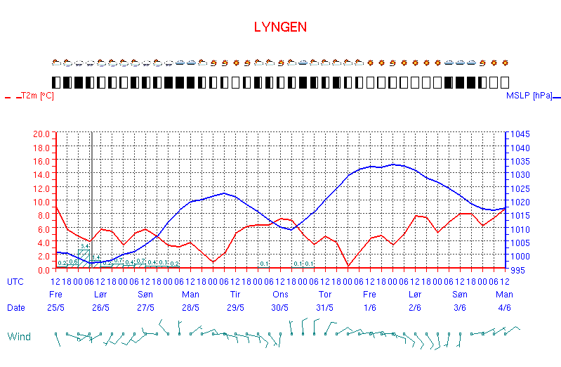
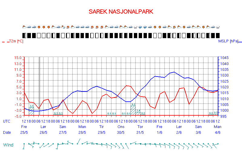
We stayed at Scandic and received 1. class service on the weatherforecast
from my friend Roar (who works for the met-office). He sent us "customized" forecasts for our
two main areas, in order for us to decide whether we should go first to Lyngen,
then to Sarek, or vice versa.
After careful examination, we decided that our best bet would be to
start with Sarek, then go to Lyngen. Warm thanks are due to Roar.
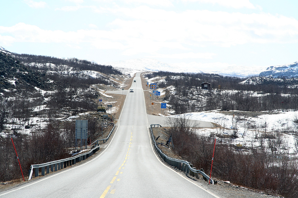
At 1000, Saturday morning, Åke arrived on time and soon thereafter we were on the way to Sarek.
While driving to Nordkjosbotn, our expert on local geography quickly decided that it would be substantially
quicker to drive via Finland rather than via Narvik. The road is shorter and the speed limits are higher.
We made a pit stop at the gas station near Skibotn,
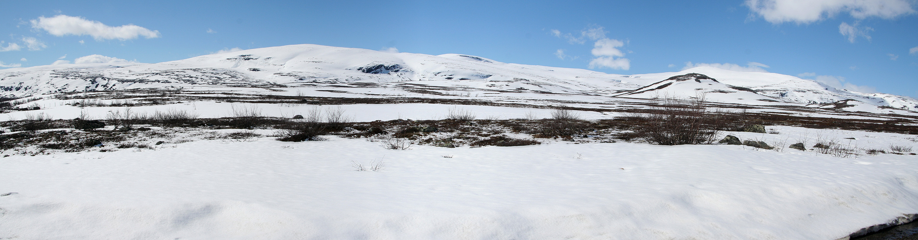
then drove to the Norwegian-Finland border. The mountains
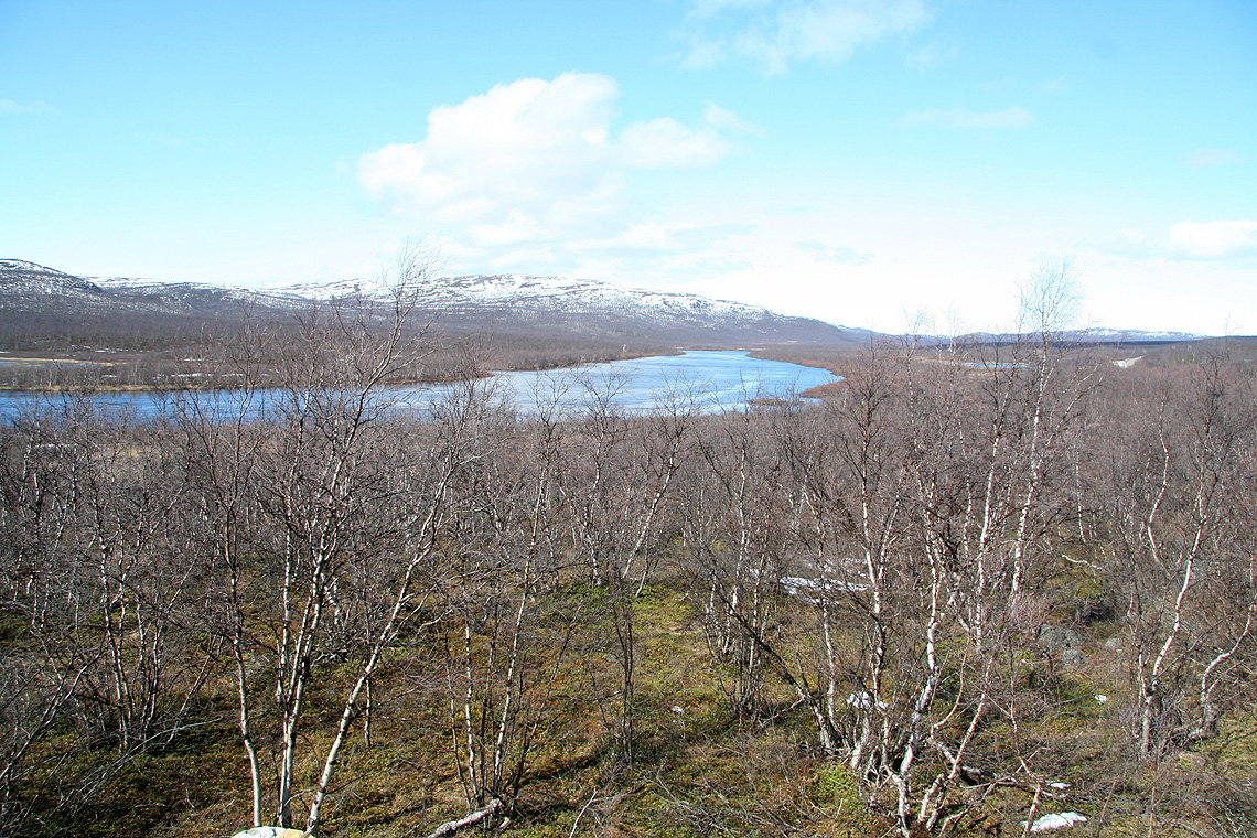
west of the road looked very nice for skiing.
We continued south in Finland, but very near the border to Sweden. This border is defined by the
river Könkämäälven.
We arrived in Gällivare, had dinner and continued to the trailhead in Stora Sjöfallet National
Park.
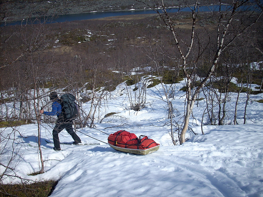
Unfortunately, the snow started quite high on the mountain, thus a carry on foot would be needed.
We agreed that a good evening project would be to make camp at a point from where we could start
skiing the next day. However, to get there turned out to be harder than it looked.
We did not
locate the proper trail (before on descent 3 days later). Edward carried two plastic bags, while Åke
and I tried to walk while carrying the two sleds between us. This was incompatible with dense birch forest
as well as cumbersome between large boulders. On top of this, we soon faced the challenge of crossing a rather
big creek. After about one hour we left the sleds behind and decided to do a double carry; first locate
a place to camp, then return and carry up the rest of the supplies.
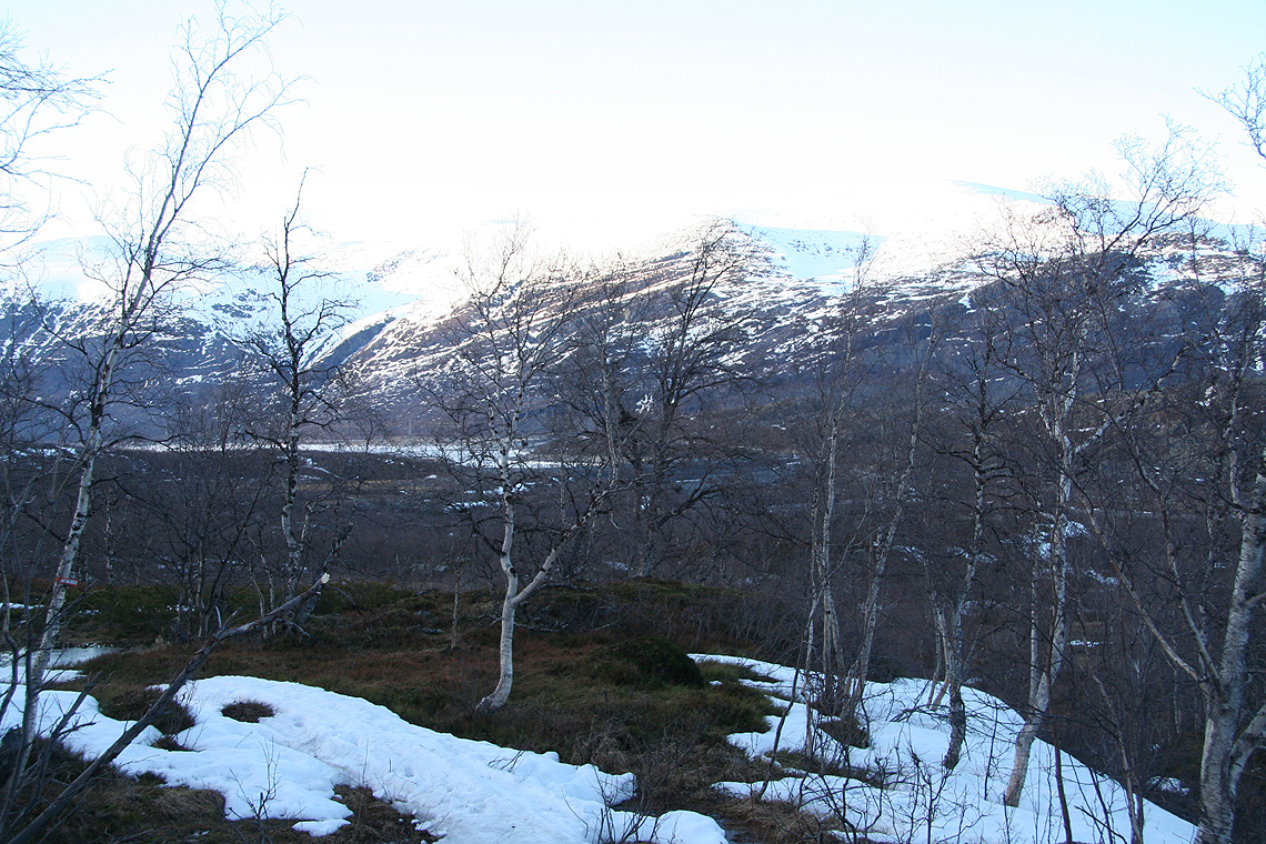
Despite some initial trouble, we were on the way, the adventure had started and the view and the low sun
provided a memorable backdrop that made us forget how tired we all were.
We finally accomplished all goals and
made camp with a good view near snow that looked reasonably continuous above us.
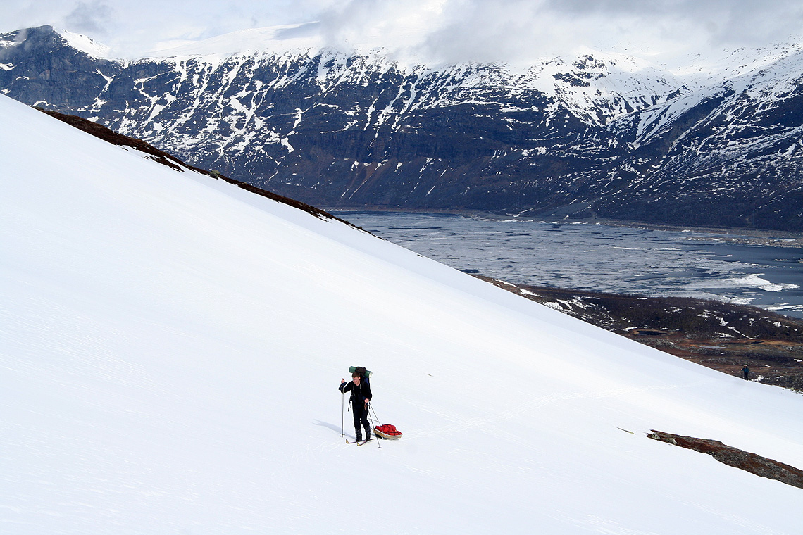
We woke up to cloudy skies and a mix of light snow and hail. The first section of snow
was rather steep.
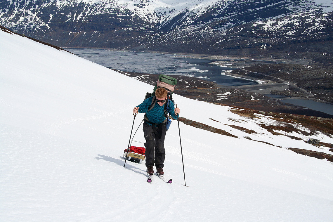
Edward and Åke started out pulling the sleds. This was perhaps a pretty rough return to
skiing for Edward, after all, he
does live in Southern California. The weather
improved and as soon as
Edward had completed the first steep hills, we changed and I took over the sled.
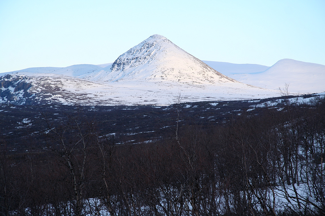
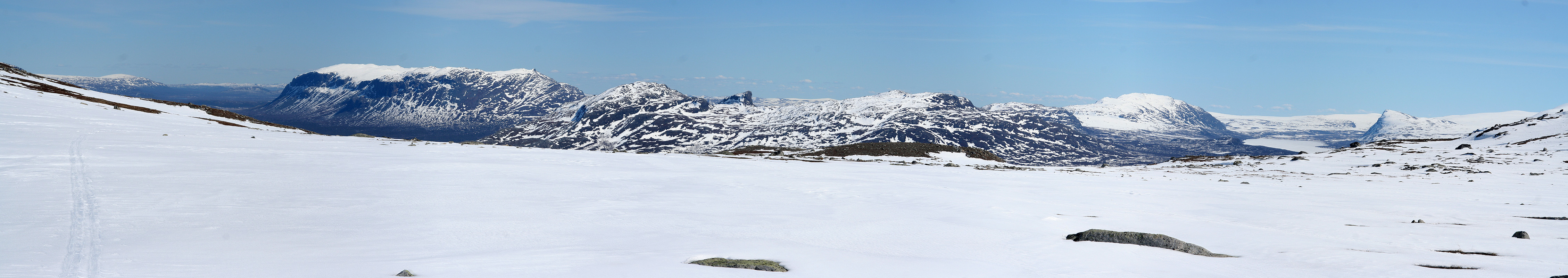
We steadily continued across this first range of mountains and by 1700 we were in the saddle
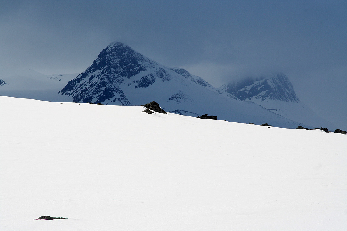
from where
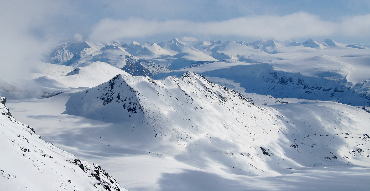
we could look into Sarek. Immediately, sharp and dark peaks
going straight into the clouds. What a contrast
to the more gentle mountains we had crossed today.
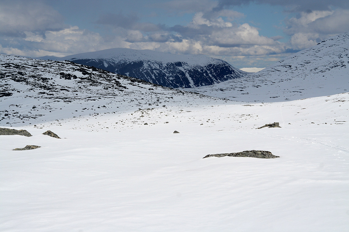
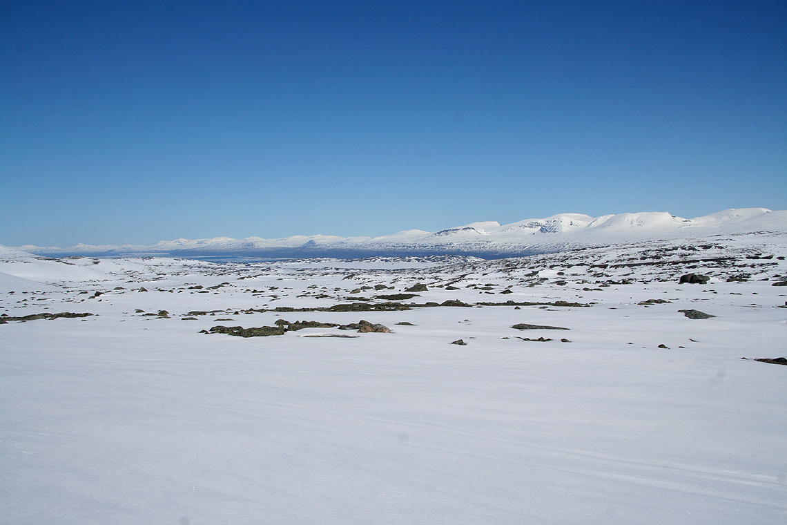
As we skied down into Sarek, we realized that more problems could be in store.
The river from the lake Vuosskeljávrre (930m) was open as far as we could see, the snow
turned rotten and we started sinking in, some places to our knees. We decided to circumvent the
river problem by skiing across the ice on the lake. I subsequently skied to where my Garmin map
had placed a hut, there was not a trace of any building ever being there. We crossed a couple
of more creeks on very dubious snow bridges and agreed that this trip should not have been much
later or the difficulties across this large, flat valley floor could easily become much worse.
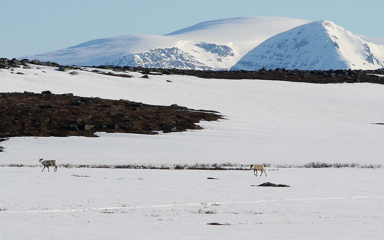
A long day came to an end as we made camp almost at the west side of the valley floor. Reindeer with
newborn "babies" were quietly walking around, but keeping their distance to this "intrusion" into their
peaceful valley. We made an effort to disturb as little as possible.
The night gave us a few strong gusts of wind and some more hail, but as morning came the weather
improved in a steady manner. We had a healthy breakfast and then started out uphill well equipped
with climbing gear. We knew little about the route and decided to prepare for possible difficulties.
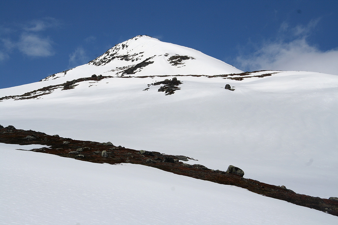
Starting out around 0900, we came to the end of the east ridge around 1230 after leisurely skiing up
the gentle slope followed by the even more gentle glacier.
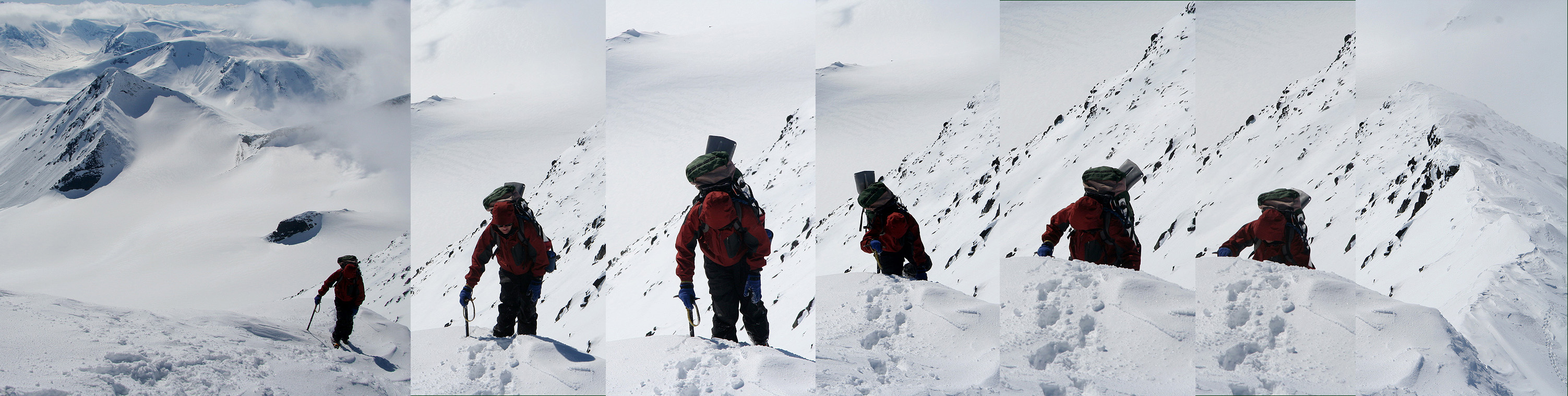
We left the skis and started up the flank, a short discussion on the route made us decide to climb
the relatively easy slope on the north side and hit the ridge quite a bit higher up. We started out
with the rope in the backpack, at least initially this
route looked quite doable. (photo: Geir Åke) We hit the ridge
for the first time just below a rockstep that could be bypassed to the left. The right (south) side of the
ridge is far steeper along the lower part. Soon, we could see the ridge
above us, including what looked as a somewhat steeper section. (The slope going
left got gradually steeper, however it was significantly steeper than what it looks like in a few
of the pictures.) We had partly cloudy weather,
but breaks allowed for getting a glimpse of the terrain below.
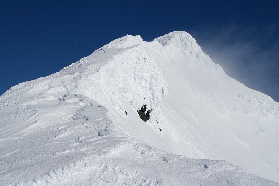
As we got higher, the ridge narrows and the exposure to the left (north) increases.
We agreed that things should not get much steeper or we would need
the rope, notice in this picture the
footprints below in the rightmost picture, while one can enjoy the view to the south in the leftmost
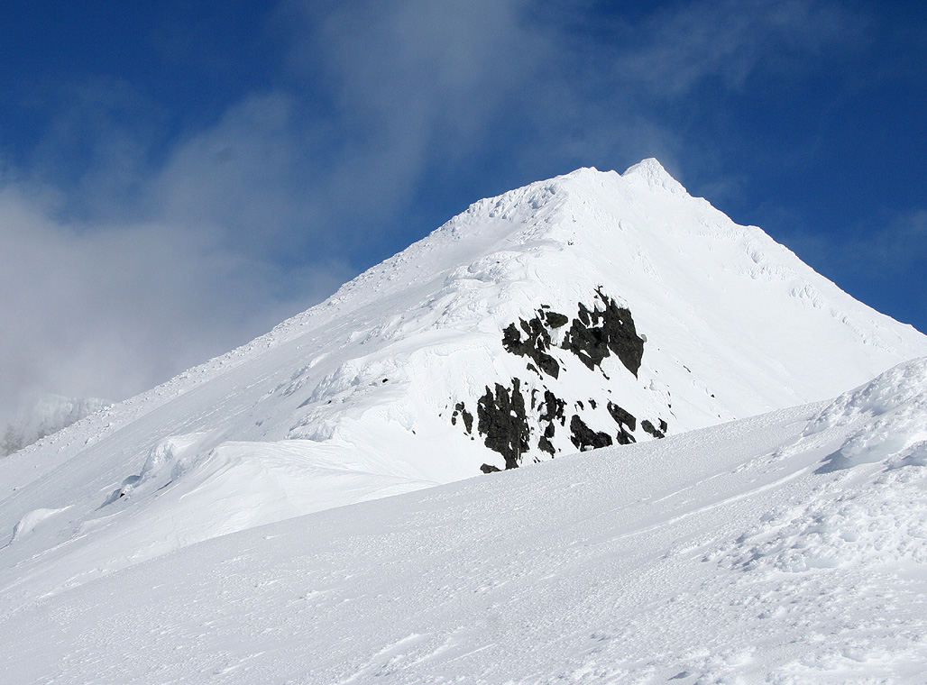
picture. As we got closer to the summit, we all observed the ridge leading up to a first hump followed
by a small saddle before a steep and fairly formidable wall went straight up to what appeared to be
the summit. Oh, Oh, the party was struck by silence, this looked like a pretty good challenge, what if
we would not be able to finish the last 20 meter? Edward had moved ahead, but I could hear and see that
Åke shared my thoughts - that certainly looked like technical climbing up front.
We continued cautiously and each step brought us closer to what looked inevitable, a major difficulty.
Meanwhile, Edward had disappeared beyond the first, small hump on the ridge, but then he suddenly
exclaimed: "This is it". It seemed hard to believe, but there he was right next to a 1.5 meter tall
snow tower, possibly just a buried summit cairn. We had all been terribly deceived, the vertical wall
had been rather small, somehow completely blown out of all proportions. We talked about it and had to
laugh, very seldom had we ever experienced such a mistake in judgement about what lay ahead.
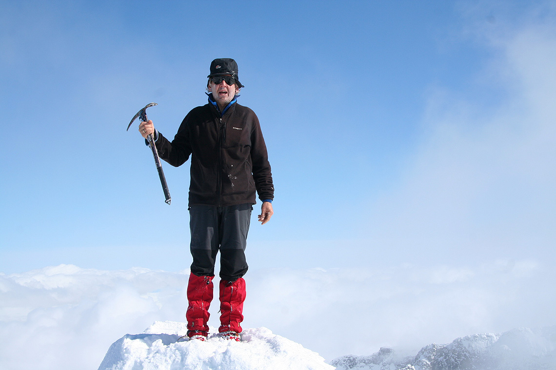
Edward made "the summit" slightly lower, in order for us to climb it.
Here, I finally stand on this
summit, just 34 years after it entered my mind.
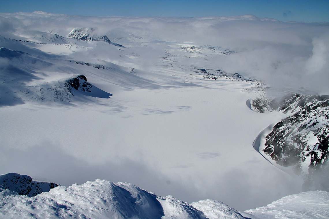
The weather was nice, we were sort of above the clouds. (photo: Geir Åke)
Drifting clouds made for a change of views and after
a while we had seen most of the terrain below.
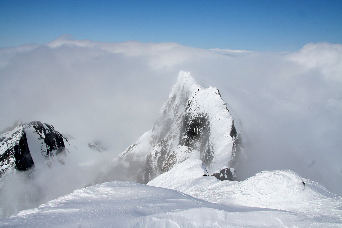
Nearby, the ridge to the North Summit would rise out through the clouds. It looked
uninviting, sort of good to know that this point can be climbed from the opposite side
with no technical effort. In the opposite direction the Rapa Valley
would sometimes come into view, a valley
that I have crossed earlier both in winter and summer.
Finally, after a long summit break, it was time to start down the ridge. It had taken us about
3 hours just to ascend the ridge. Looking down to where we started,
this ridge has gained almost
500 vertical meter, we acknowledge that this is indeed quite a formidable ridge.
Formidable, but with no major difficulties, the rope remained in the pack.
Descending partway down the ridge, sort of brought me back below the clouds and I got
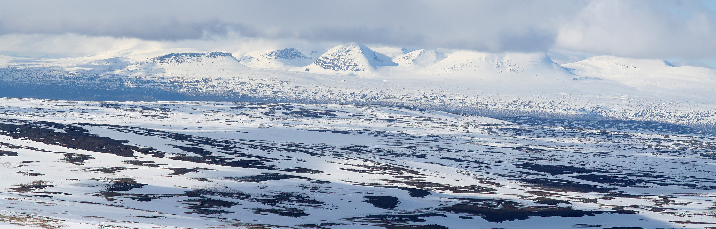
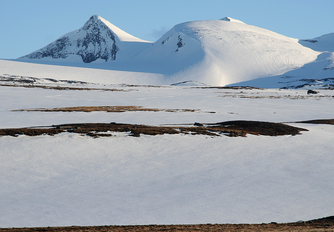
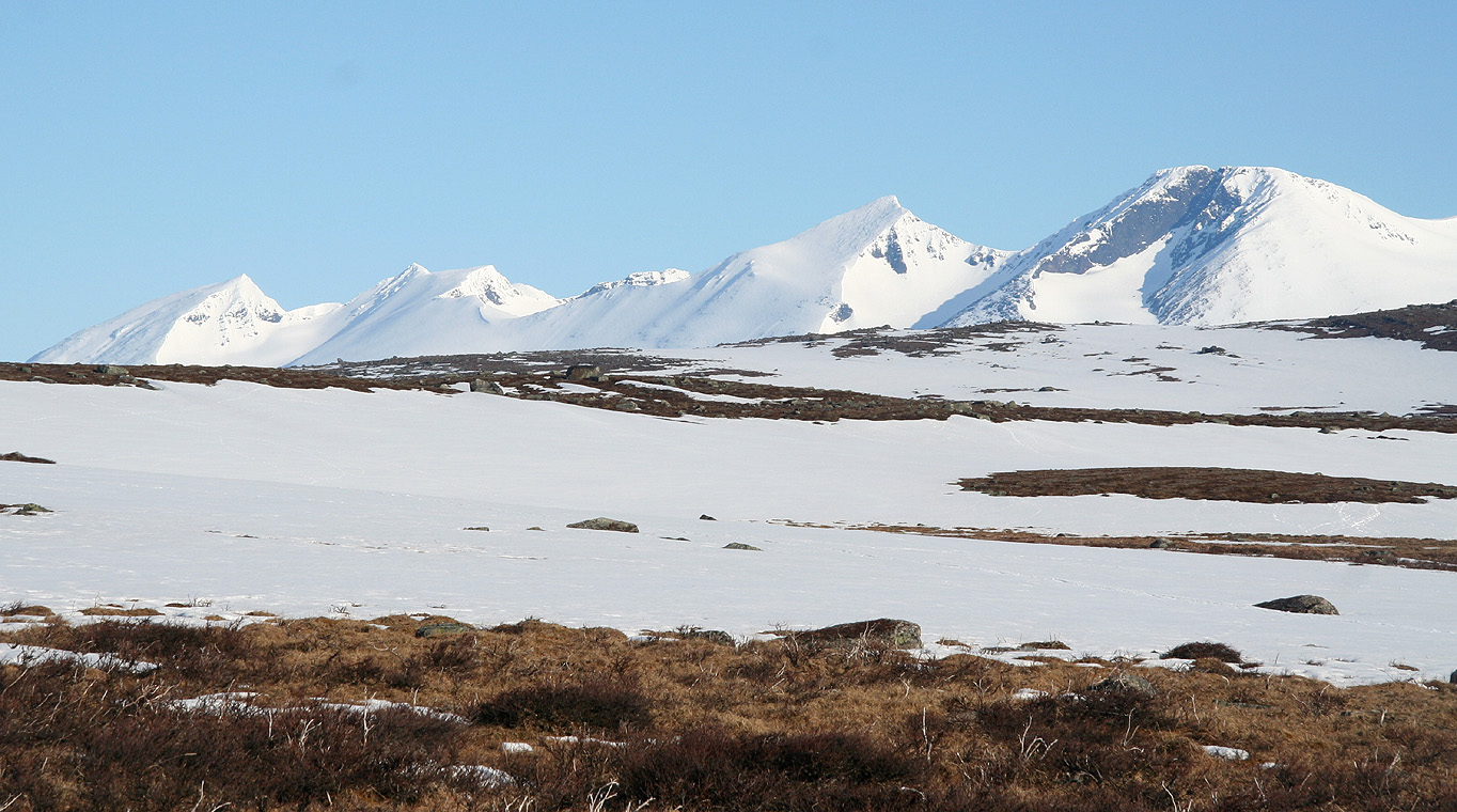
a new and different glimpse of Sarek towards the south.
Towards the north, but more in the distance, the Akka mountains
dominate the landscape.
We made it back down considerably faster than going up, all looking forward to a long, gentle,
continuous downhill back to our Base Camp. As I ski back down, my thoughts are drifting to
Alaska, there is some sort of Alaska proportions in this landscape. The single word that
comes to mind is BIG, BIG country. Not just down into a valley and right up on the other side.
Down, then across for a considerable distance.
Somehow, you know that you are not in Norway.
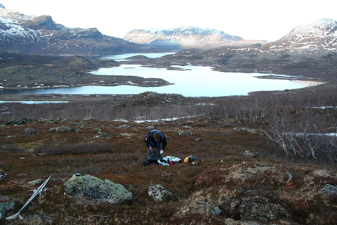
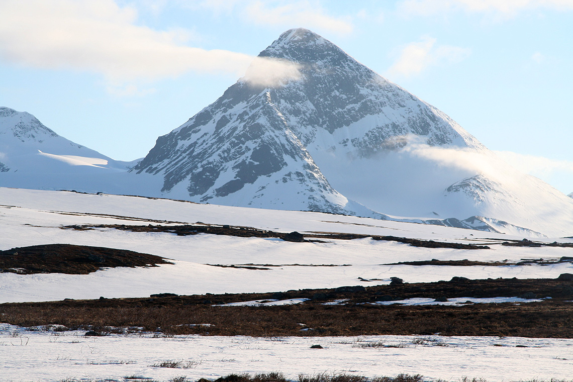
A happy team returned to BC as the sun got lower and the sky cleared to produce a brilliant,
arctic evening. Right now, I wanted to stay here
for a week, there are
lots of nice peaks within reach.
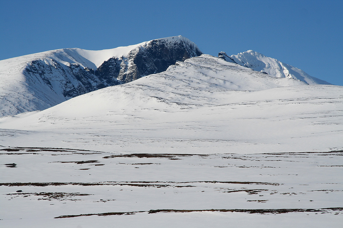
Our main objective had been reached
in a long, but quite nice day. It certainly looked like we would get another good day tomorrow.
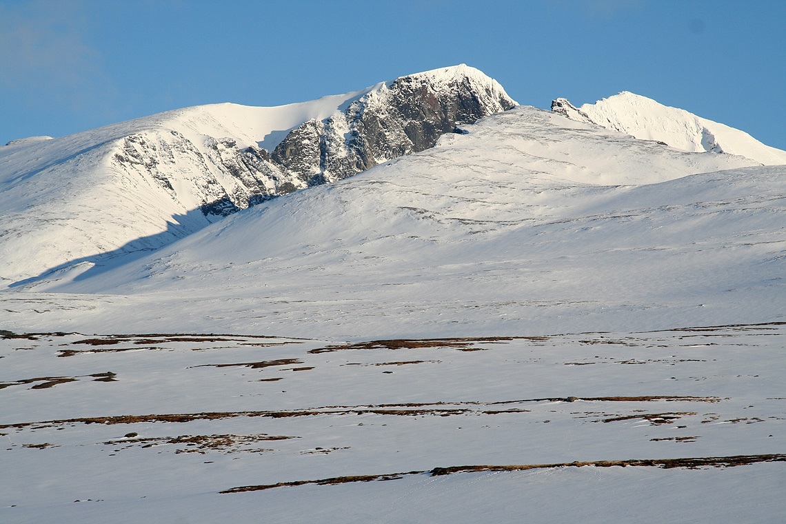
May 29th. the third morning of our "mini-expedition", the summits
are still there, but the light has changed. The reindeers are already active,
the mountains are quietly lined up in the bright morning sun.
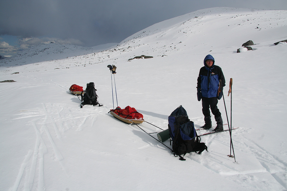
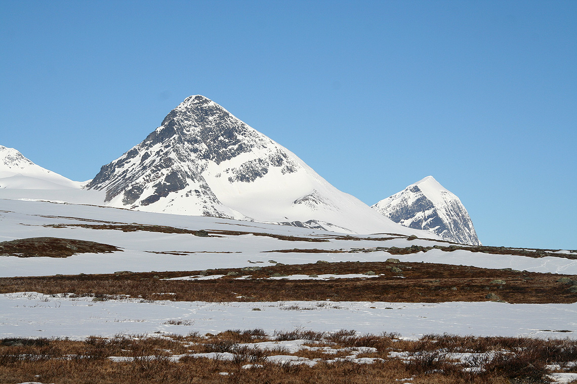
We pack up camp and say goodbye to Sarektjåkkå then cross the
creeks and lake on solid morning crust. Then a long uphill in order to deserve
a good rest in the saddle. This is the place to look back, as well as north,
to take in the Sarek panorama in a deep breath and then
a last gaze on the highest peak.
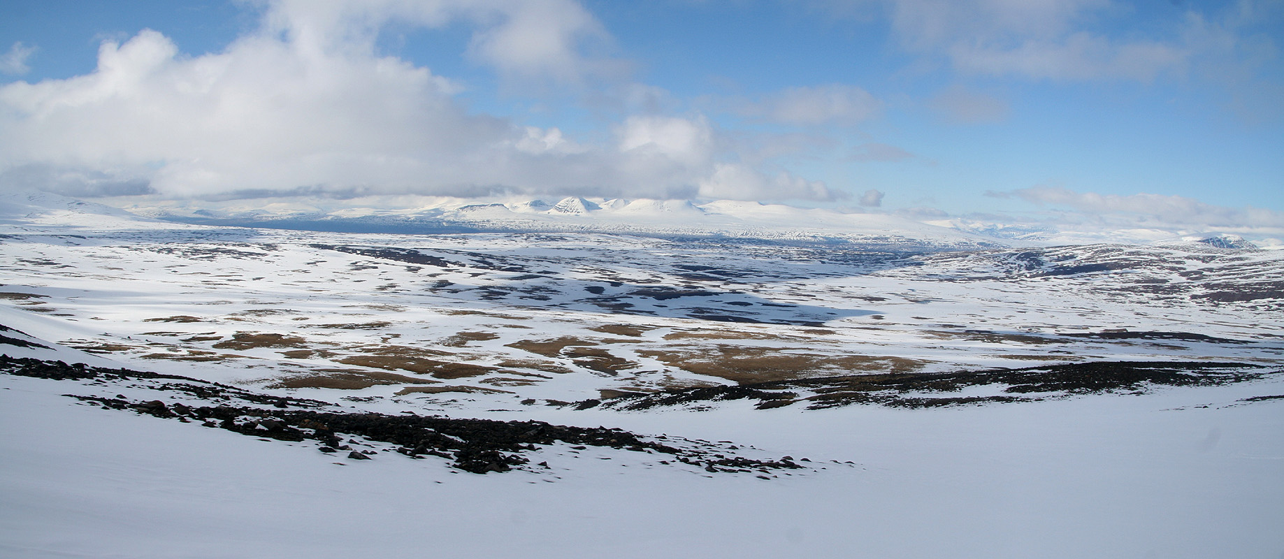
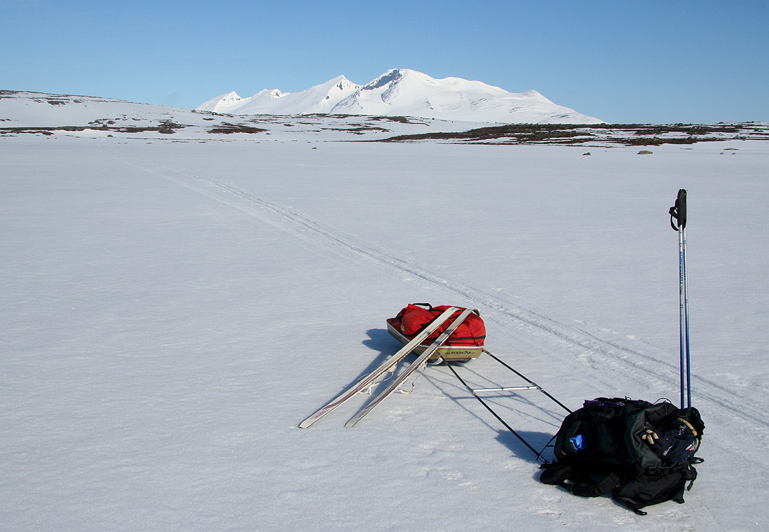
The ski trip back is certainly easier, more downhill and good views
as we approach the main valley in Stora Sjöfallet.
Looking downstream, we certainly see that
we return from winter to spring. We skied a bit higher
on our return and managed to bring our sleds
quite a bit closer
to the trailhead before a last
carry was called for. (The first of these pictures, photo: Geir Åke.)
This time, we came upon the proper trail and the return hike was quite easy compared with
the struggle we experienced on our first day.
The trip had come to a successful end. We drove back to Gällivare for a well deserved night
in the local hotel including dinner and breakfast. The next day, we headed north along the same
route. We started early as our goal for the day was to establish a new BC, this time on the
Strupebreen glacier at the foot of Store Lenangstinden.
Return to the Sarektjåkkå page.