May 30. 2007:
After a great adventure and "mini-expedition" in Sarek, Edward Earl,
Geir Åke Dahlen and I had now driven back from Gällivare via
Finland and to Lyngen. It is a long drive and we were all pleased when the
well known mountain Saana (1029m) appeared in front of us. A sign that
the Norwegian border was close and the drive to Lyngen nearing the end.
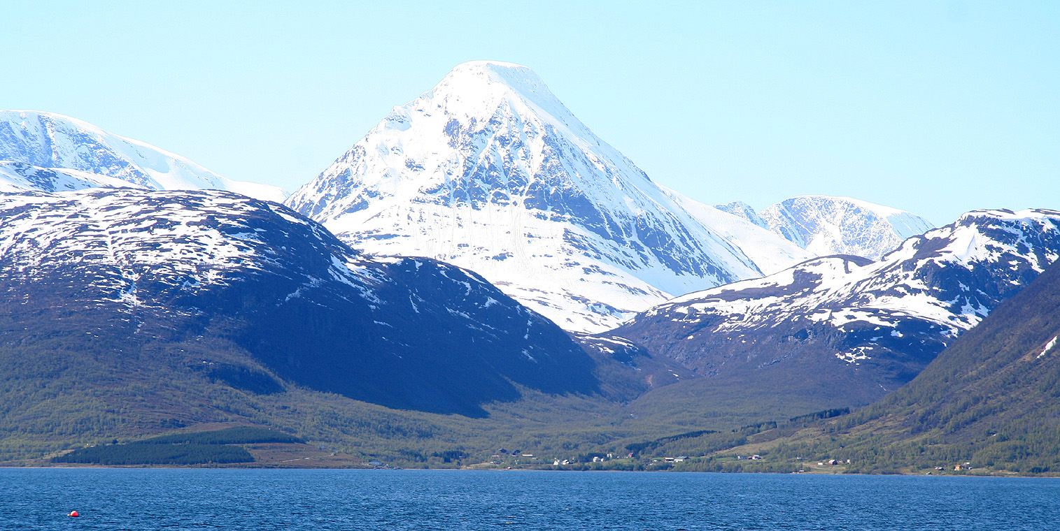
Our next ambitious goal was Store Lenangstinden, 1624 meter
high, the king of the Northern part of the Lyngen Penisula. The weather was just
gorgeous, and we were eager to establish camp up on Strupbreen this day.
We passed Skibotn, admired the nice view of Biellogaisa (1510m)
as we drove around Storfjorden and proceeded out to Lyngseidet on the east side of Lyngen.
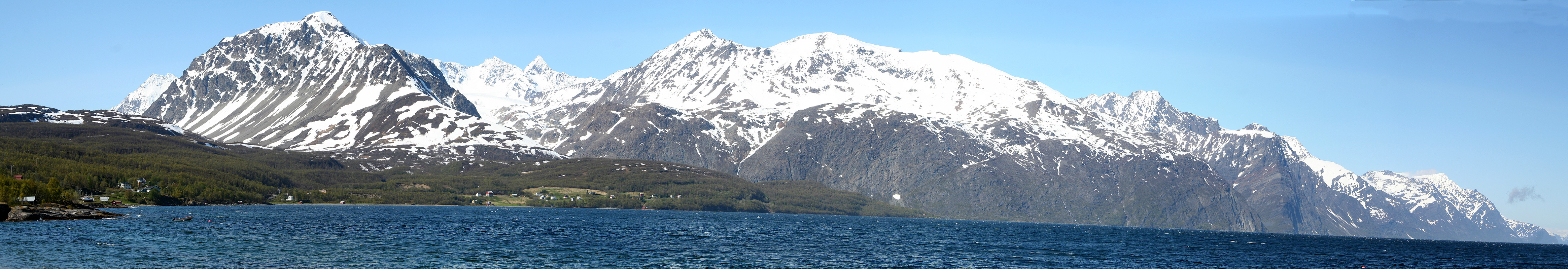
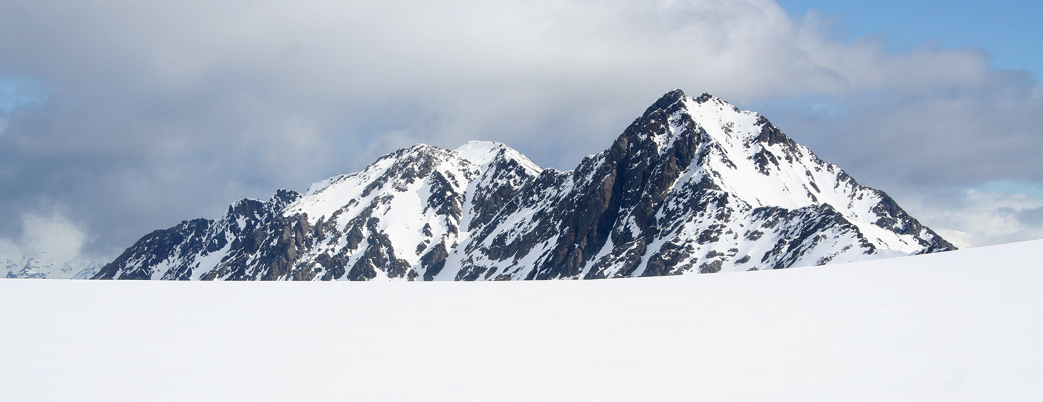
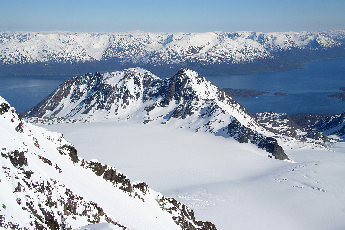
Finally, the east side of the outer part of Lyngen came into view.
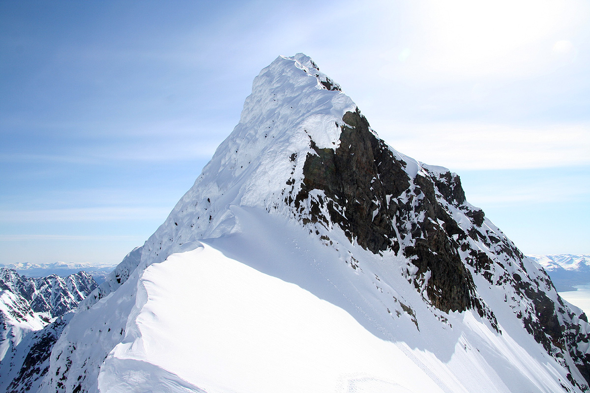
Looking closer, we identified Koppangsbreen glacier with
Store Lenangstinden (left) and the proud
East Peak of Lenangstindane further right.
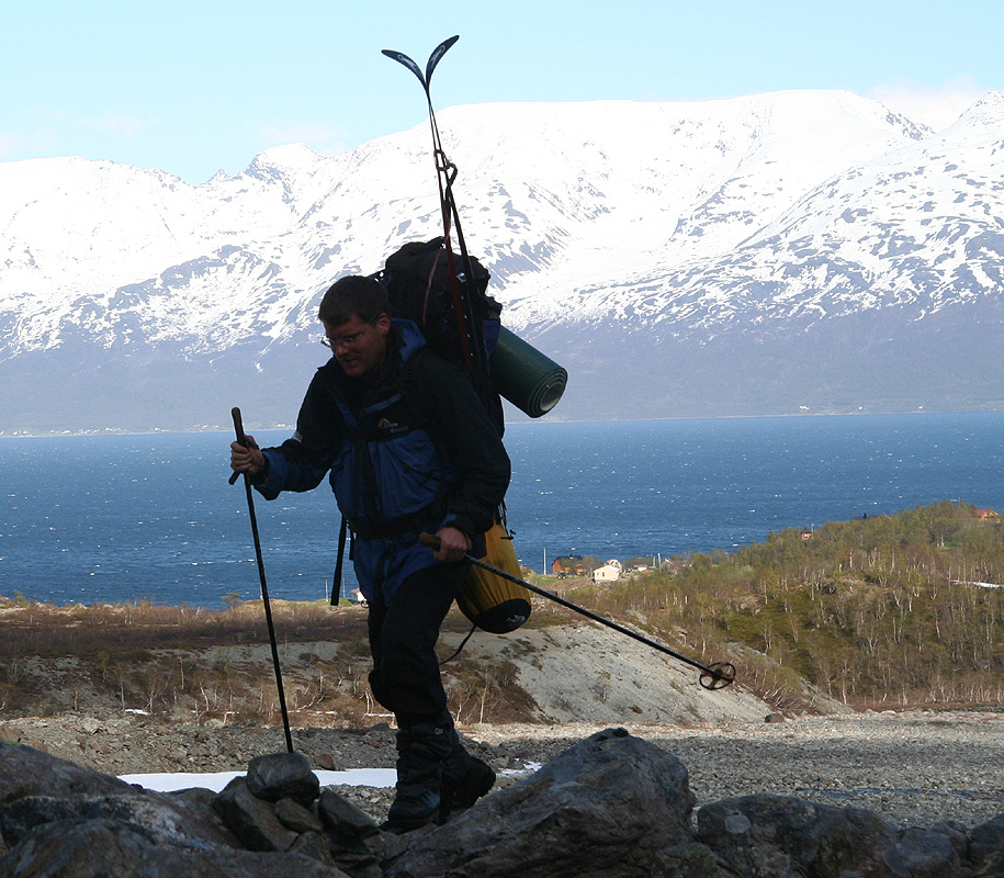
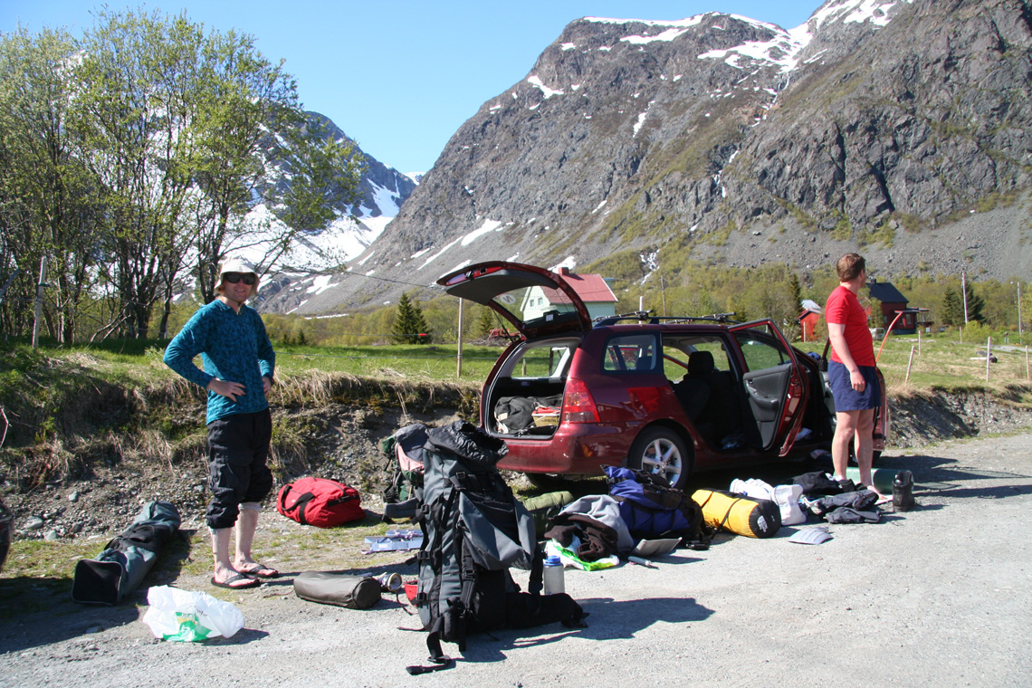
We got organized, the backpacks would be fairly heavy, loaded with tent and climbing gear. The first
part of the trail follows a river and is fairly flat.
It felt very special to walk here, memories from the previous attempt almost two years ago readily came
back. The start, on the beach, and the wild peaks looking down at us.
Åke had never been here
before, it was evident that he also had respect for these wild peaks and the adventure that was about
to begin.
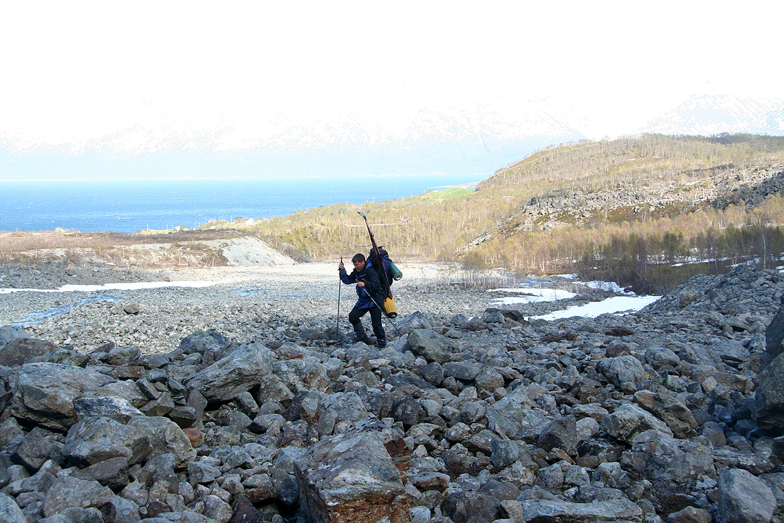
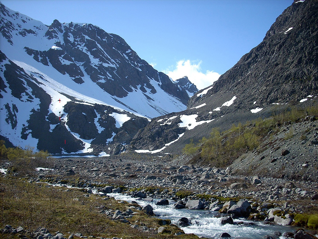
The trail remains fairly flat until it actually becomes quite steep. On this picture, the
route heads up the slope identified by three red lines. There is a small
trail buried under the snow, but we had to climb the talus a bit further left in order to
avoid the steep snow in the upper part of the hill.
Edward and I remembered this section from our first attempt.
It is steeper than
it looks and one must walk carefully when
carrying a heavy load up here. I hoped that we could start
skiing on top and that turned out to be true. A first rest was called for, the fjord still appeared
near, but we all had a sense of leaving civilization behind.
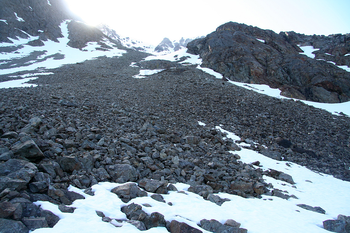
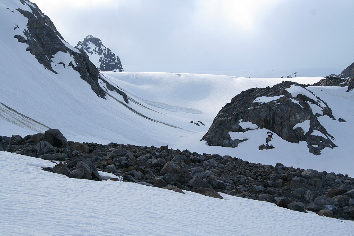
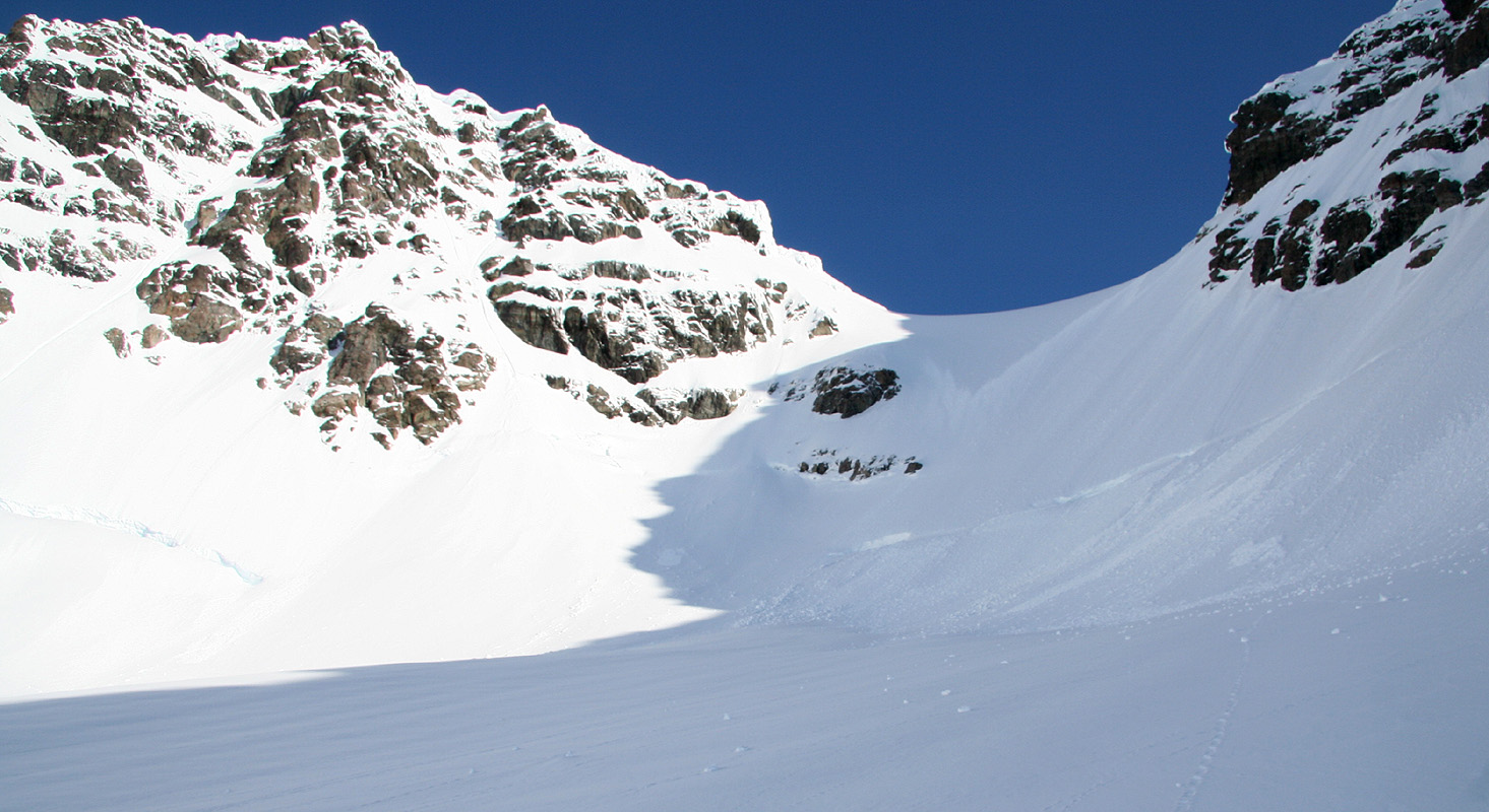
The valley that extends from the talus to the lake
below Koppangsbreen had a continuous section of avalanches
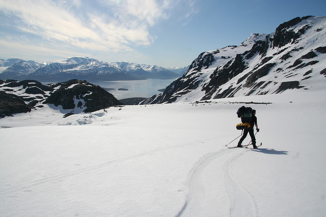
from its left side. Skiing was still pretty easy and we ascended this section without any incidents.
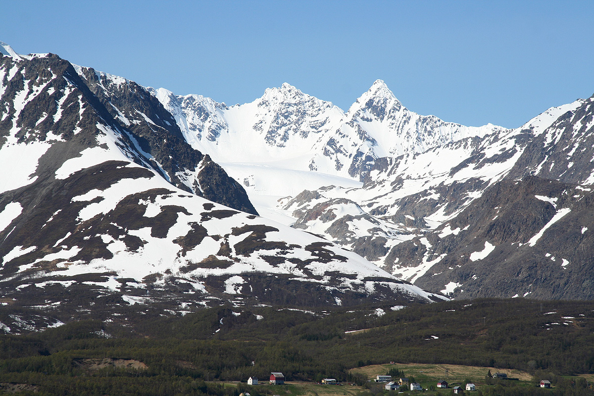
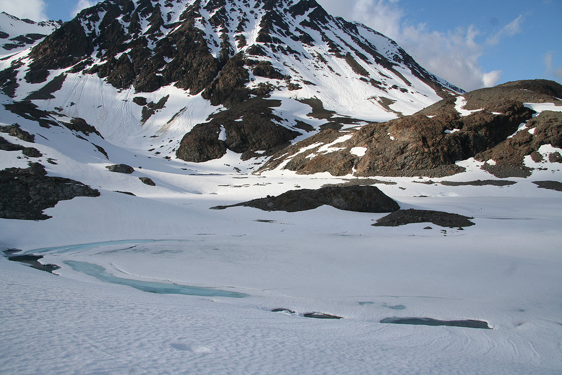
The Koppangsbreen glacier
looked very nice, a big contrast to the myriad of crevasses we had encountered
almost two years ago. Despite this, I still suggested that we should rope up and ski as a team with Edward first
from here to our intended base camp on Strupbreen. With somewhat different skiing abilities, the rope
is a good way to keep the team together as we all surely would get tired before reaching camp.
Edward picked a pretty good line, it was obvious to me at the end of the rope, that he remembered the
route from last time. Still, the contrast was significant, we had visibility and pretty good weather.
Last time, we never saw the mountains that borders the glacier.
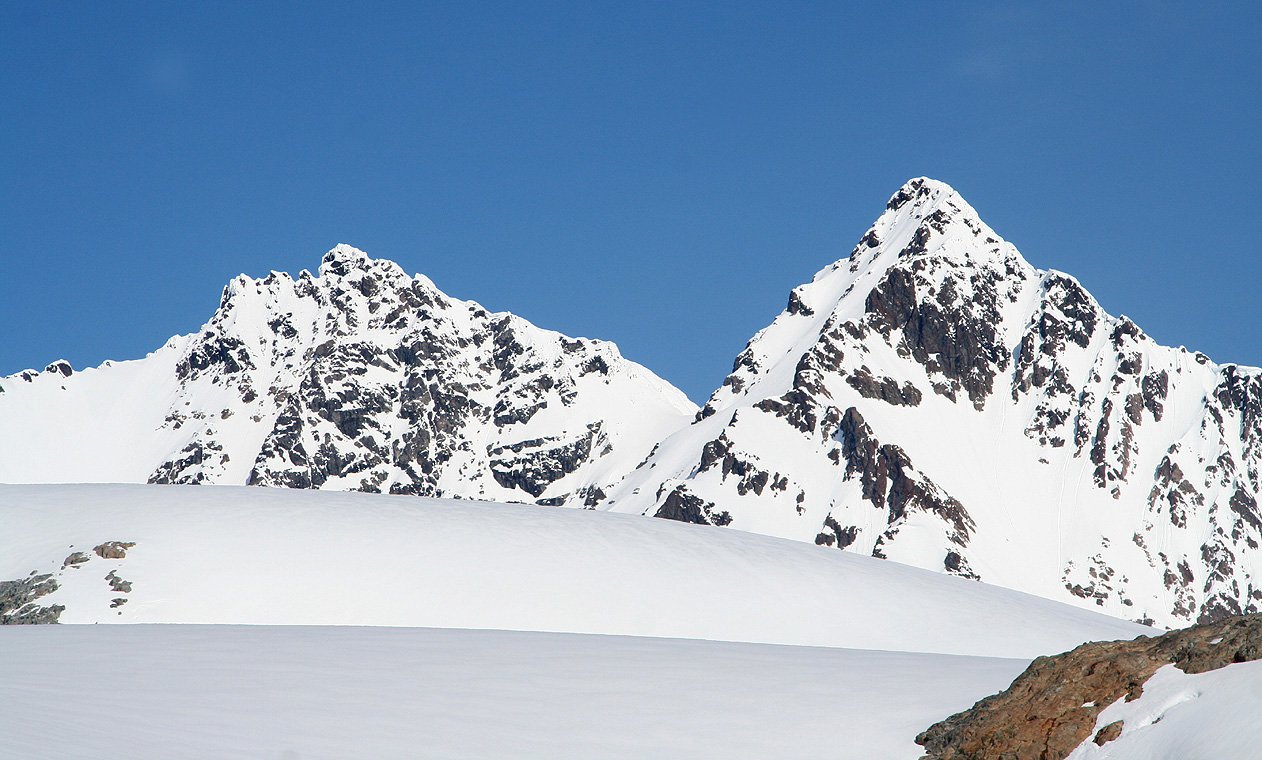
Store Koppangstinden (1224m) separates Koppangsbreen from Strupbreen, we easily
skied the slightly steeper section west of this mountain, then proceeded on the more gentle
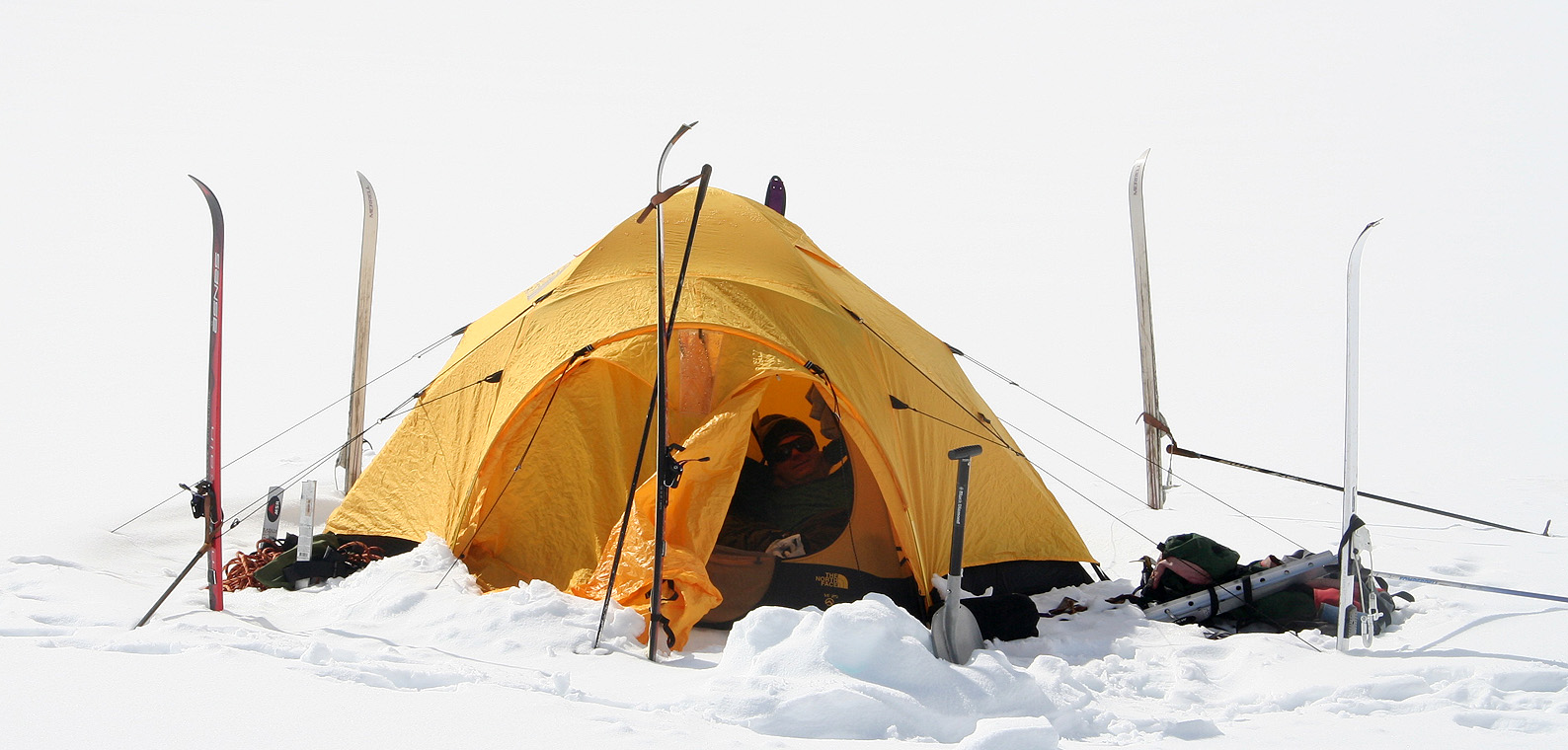
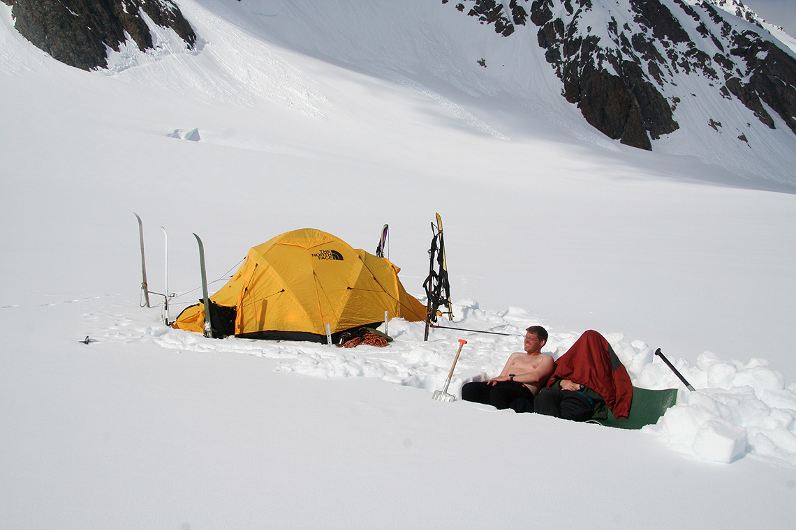
Strupbreen glacier. The weather had gradually turned more cloudy, by the time we arrived at our
camp site, we had complete overcast. The wind picked up and it started to snow. Thus, it was pretty
good to get the tent up and move indoor.
May 31. 2007:
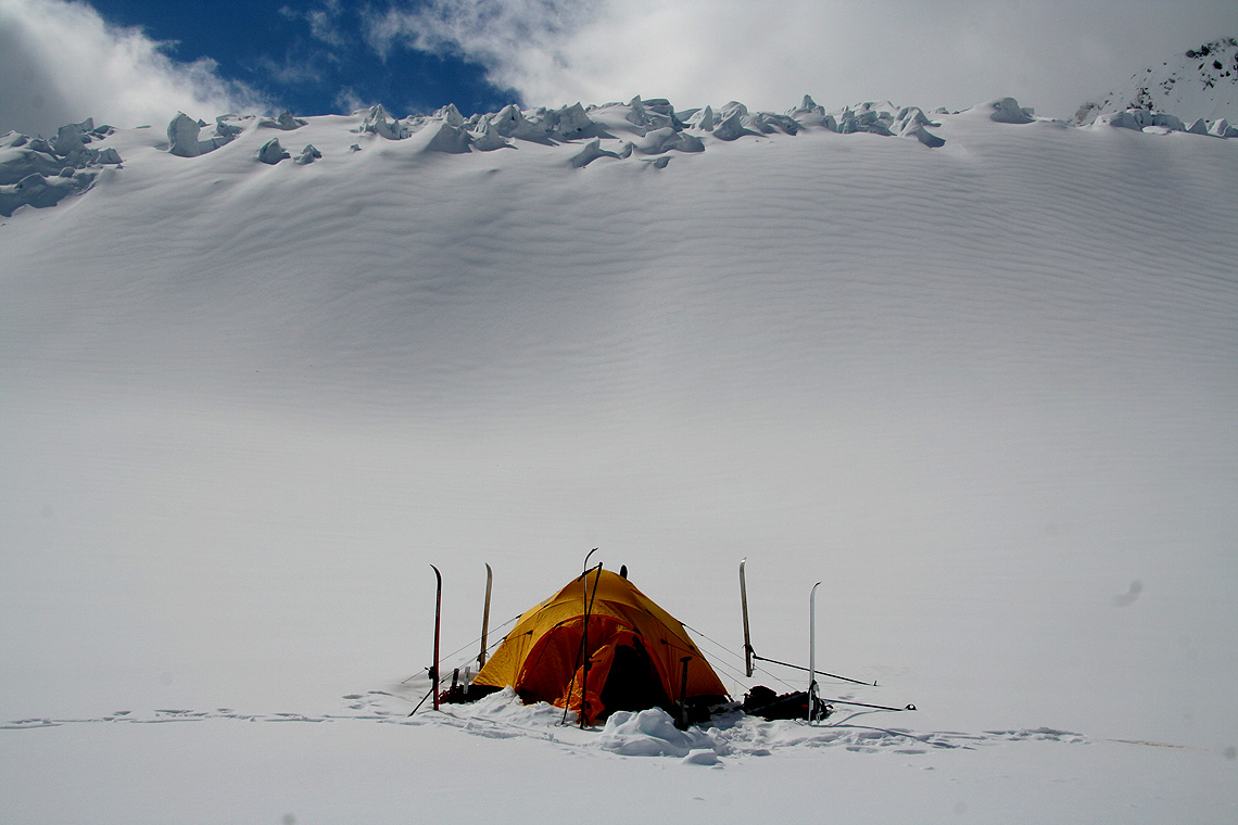
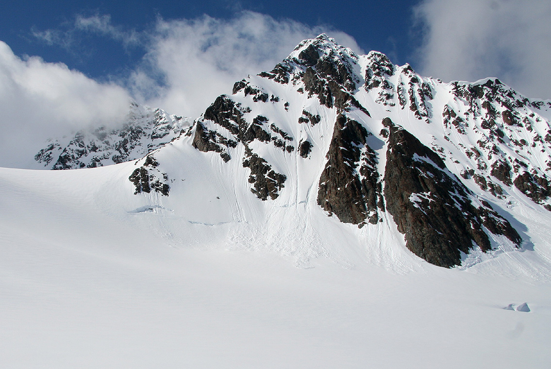
The next morning, it had stopped snowing, but it was completely overcast and the mountains went straight
into the clouds. Looking up the glacier towards Lenangstinden did not
reveal much. It was clear that we would wait. The weatherforecast
was good, so patience was called for.
Only a few hours later, there were good signs, small patches of blue sky
started to appear. We debated whether to start around noon with the assumption that the weather would
continue its nice trend and then turn perfect by the time we were higher on the mountain. We assumed that
the climb from here and back to the tent might take about 7 hours. Thus, starting around 1200-1400 would
mean a return around 1900-2100 and a second night. We could then descend to the car early the next morning.
The alternative would be to wait until June 1st. that is, spend a second night here, then start early and
come down to the car in the early evening. We decided for the second option, partly also because
a day of rest was quite tempting after the Sarek trip,
we had been on the move every day since May 26th.
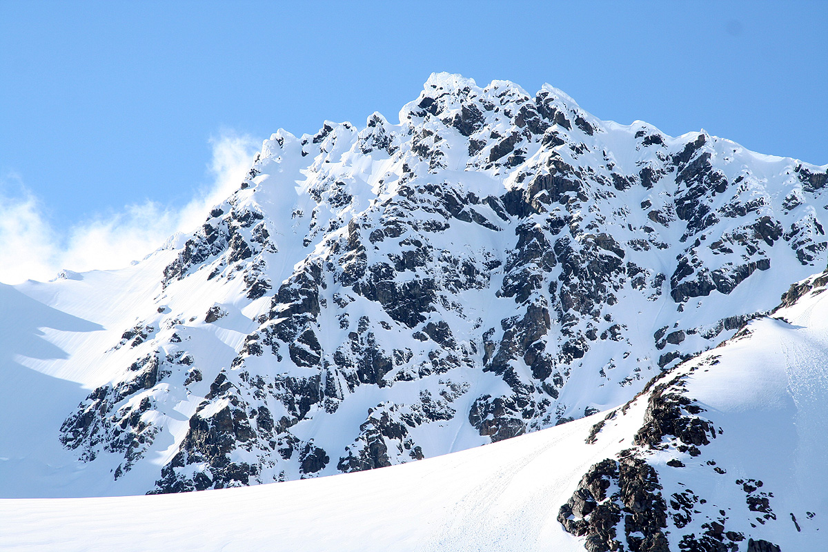
It was pretty late in the afternoon before the East summit cleared, then about
30 minutes later, Store Lenangstinden came into view for the first time, as seen
from our Base Camp. The evening turned extremely nice
and we all felt it had been right to spend a full
day here on Strupbreen.
June 1. 2007:
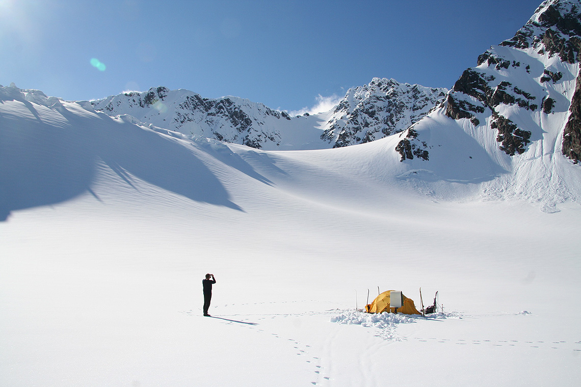
We woke up around 0530 to bright sunshine, no wind and what in all respects promised to
be a perfect day. We had planned on spending only one night up here, so food was running a bit low,
however, we had a big breakfast reasoning that with plenty of "trailfood" for the climb, we would
descend and have dinner for example in Lyngseidet later that day.
We roped up at the tent and started out on foot, this time with Edward last
and as always with
Åke as the middle man.
What a beautiful day, the fjord seemed
close as we walked in the sunshine up the first hill. We started
at 0630, the snow had formed a good crust that supported us well, however, the sun was already so warm
that we easily overheated. Turning in between the East summit and the main peak, we arrived at
the first shade of the day and I immediately called for a stop. For the first time, we could now
see the steep snow slope
leading up to the saddle between the two peaks. Last time we had
climbed this slope without ever being able to see from top to bottom.
There were almost no crevasses, the passage from the glacier to the snow slope had
been a pretty complex affair last time. A single, hungry crevasse went across, but with
snow bridges on the left side. Still, one could see that this crevasse was already wide enough to
swallow any object sliding from above.
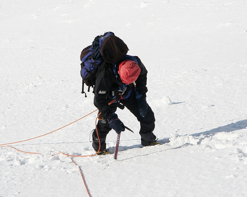
Unlike last time, when we ascended this slope without any belays, we decided to use our snow pickets
and go on running belays in a way that, hopefully, would transfer our five pickets from me to
Edward while arriving up in the saddle. Thus, I started uphill, putting in a picket about
every 40 meter. This worked well, and as the slope became gradually nicer near the top, the last picket
went in about 60 meter below.
Both Åke and Edward
soon joined me in the saddle, a very proper
location for a rest in preparation for the next stage.
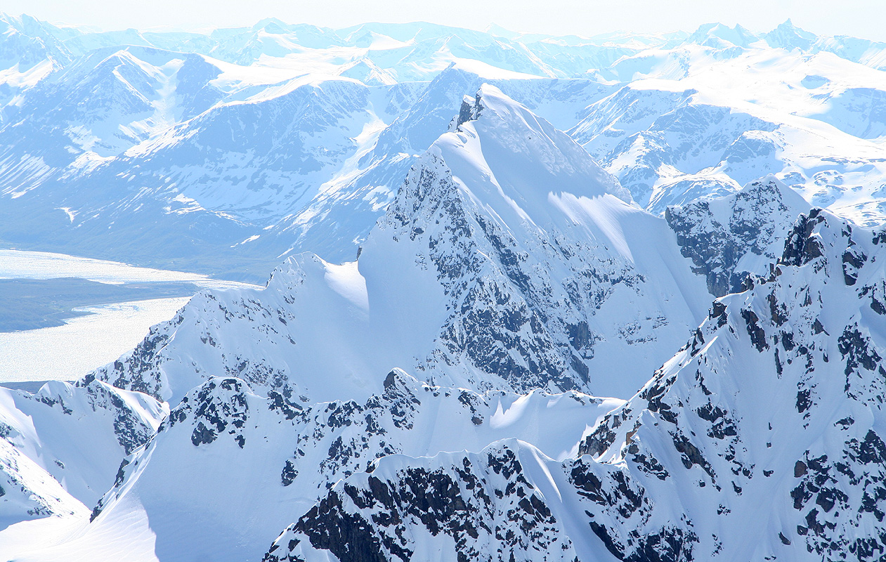
The panorama view from this saddle is already better than most
views. From the steep rock of the East summit, via Lyngen and Kåfjorden to Istind, Kveita and
Jiehkkevarre, then finally the steep slopes of Store Lenangstinden.
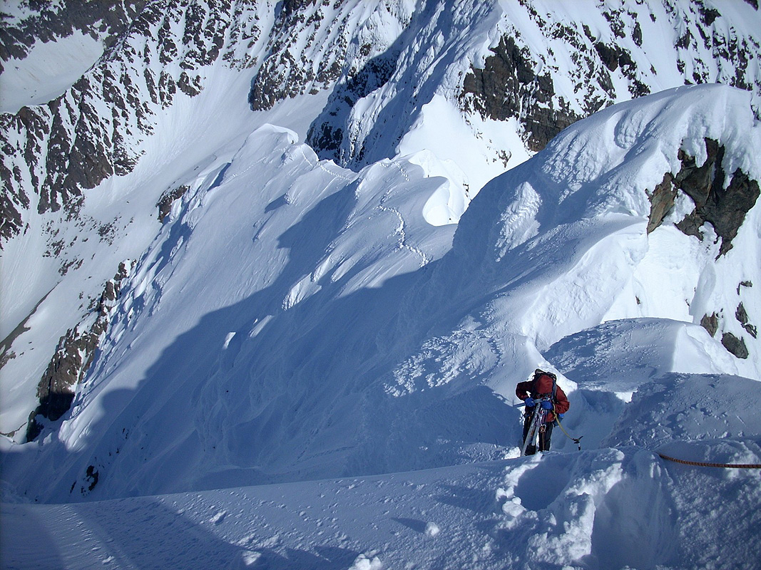
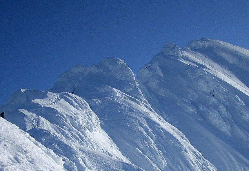
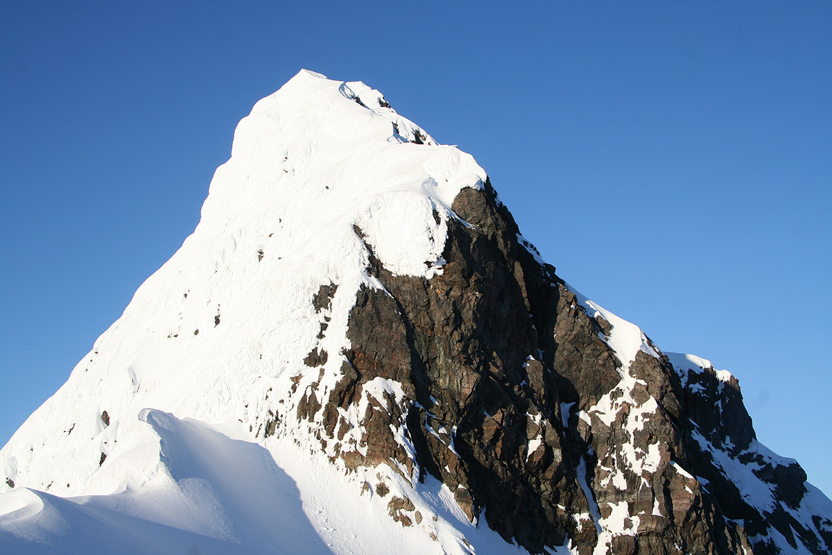
From this saddle, the East summit looks pretty hard,
the view north is a timely reminder about
cornices.
The first slope, starting up from the saddle is certainly
steeper than it looks on a picture.
The rocks higher up signals the first obstacle,
where one needs to traverse on the
right hand side (picture from descending).
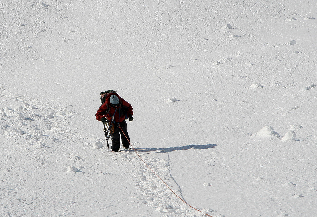
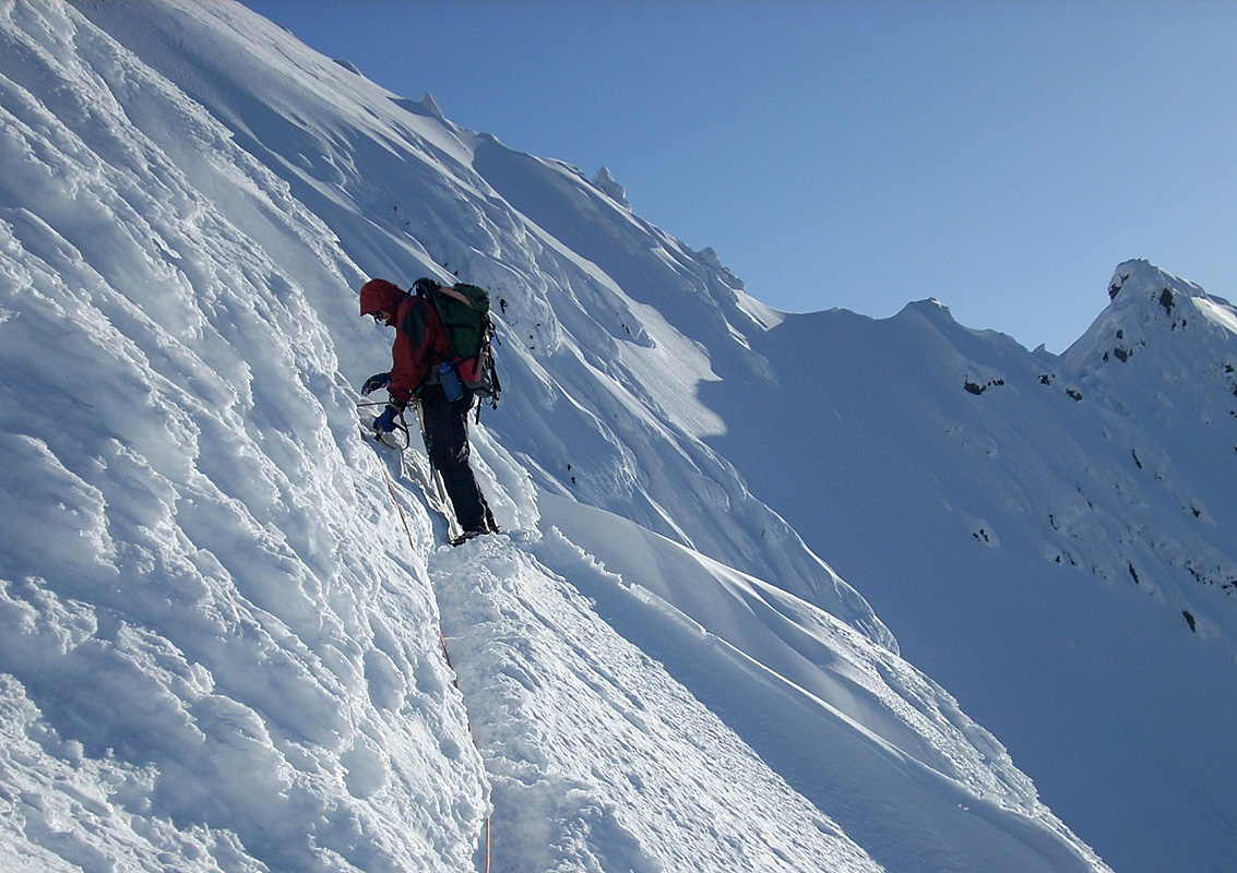
Edward and I would alternate in the lead,
in this way
the person having all the snow pickets
could proceed to place them on the next stretch.
This climbing still took considerable time. Higher up, we ran into the
next big obstacle on the ridge and to traverse around did not look inviting.
The snow did not look good and I quickly realized that one would need to descend a bit
before attempting a traverse. Still, before even trying this, we decided to climb
up and explore if there was a reasonable way to descend into the next higher saddle
(that could be seen also from the base camp), rather than doing the traverse. I climbed
up and with some effort gained this local high point in pretty rotten snow, since it had
been exposed to the sun for many hours already. Disappointing news, to descend on the
far side looked still worse than the traverse below. "Cliffed out".
After "wasting" 30 minutes on this
exploration, I returned down to Åke and Edward with the news. If anything, the
descend and traverse option had shade and would remain in the shade for many hours.
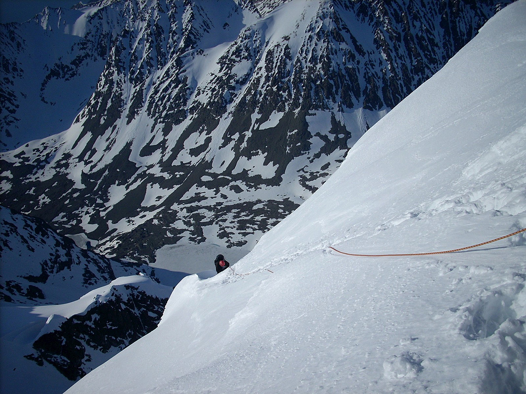
Here Edward did a fine lead and prepared a pretty good route down and across to the
large gully that subsequently could be ascended to the notch above.
This crux of the route,
is finally behind us on this picture.
One may see a trace in the snow (my footprints) on the
very top (behind and up to the right from Edward) of the false summit.
To descend back down on this side
was difficult due to soft snow and the cornices that can be seen. Instead, we
downclimbed in the shade (cannot be seen in the picture), then traversed a very
steep section before emerging in the gully coming up below Edward on his left side
(behind the first snow-bump)
as seen in this picture. This same section can be seen (looking back on our descent)
on this picture.
The false summit is in the middle of the picture, with our steps
coming up the gully, partly visible behind to the right. My steps ascending the false
top on its left side can also be seen.
I fumbled my
ATC away (about 400 vertical meter down?) and thus had to continue using my figure eight.
Inexcuseable, a good lesson learned, all it takes to avoid this is an extra safety strap,
never happened in the past, but one time is always the first.
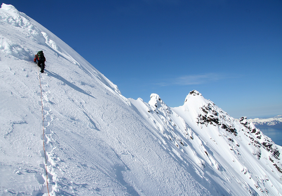
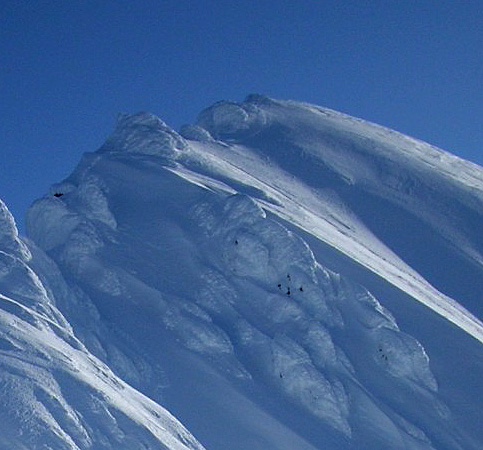
Time for another rest, and another panorama, this time towards the north.
The East summit is about to disappear below us,
another good sign that we are moving higher.
The next section was fun climbing, I decided to
stay high on the ridge and take the gamble that
there would not be another difficult dip in the ridge. This time the bet went my way, a nice section
with air to the left and a small zig-zag before getting back into a pretty good belay stance.
Åke and Edward followed and we sensed that the summit could not be much further.
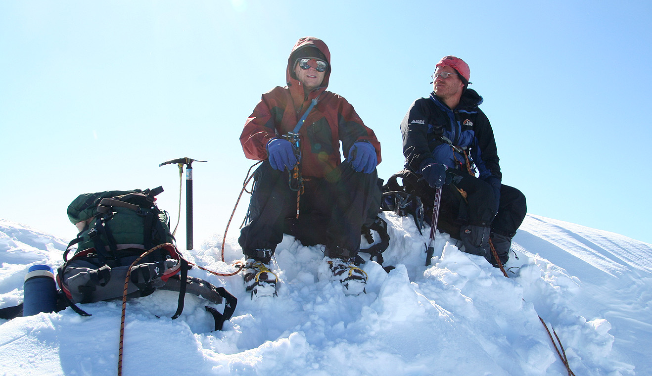
Always more than you think, another full rope length brought us to the summit. The time was
1520, almost 9 hours one way and there was no reason to believe that the return climb would
be any easier. (Most of the climbing photos in the preceeding three paragraphs were
taken by Geir Åke Dahlen.)
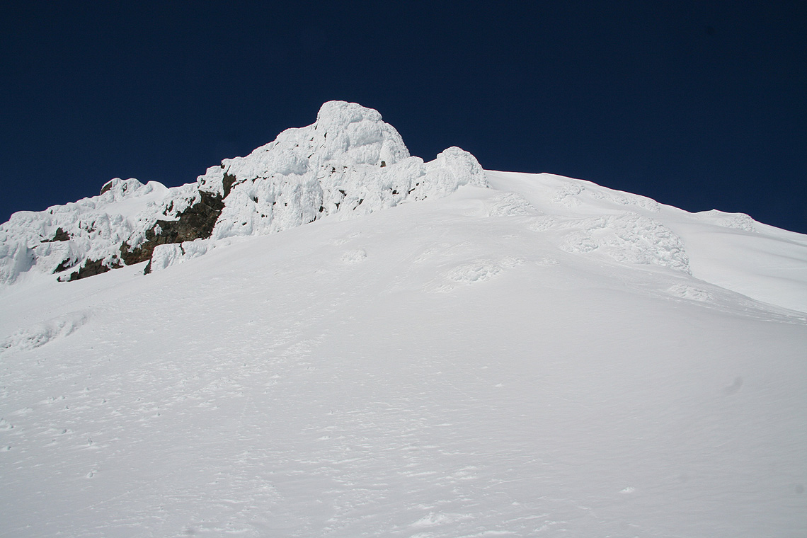
What a spectacular summit, a small, fairly flat area where we had arrived, a
small bump that likely
is the cairn buried under snow, then a short, but fairly sharp summit ridge.
Then air - in all
directions.
Looking back down, where we came from,
one cannot see the section that caused us most trouble,
it is simply hidden from view.
The East summit, the snow saddle, then the first traverse and our steps back to the ridge. Next
follows the relatively easier part which seems (this is not the case) to connect to where we are
sitting.
There is a north-west ridge having a small, summit.
the way there does not look inviting either.
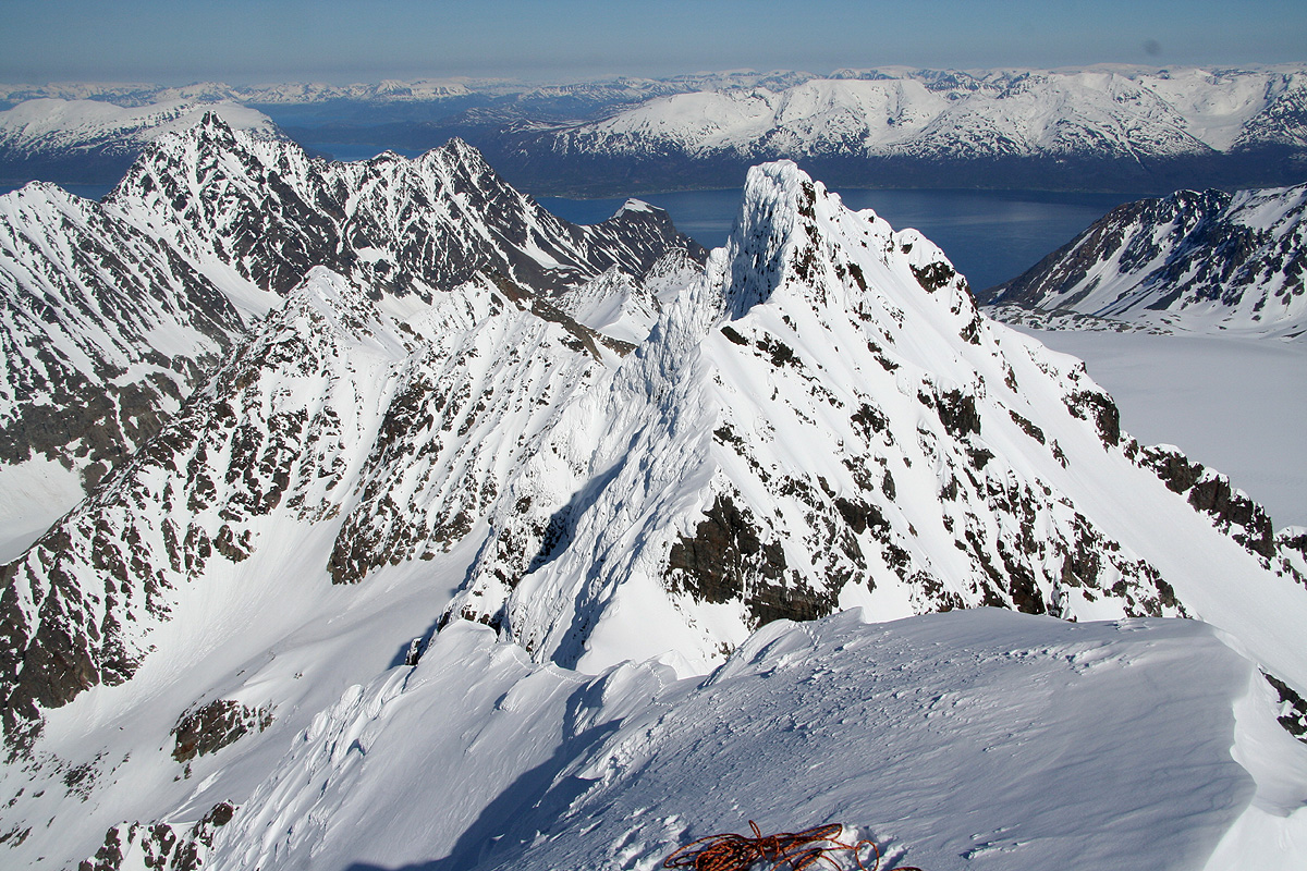
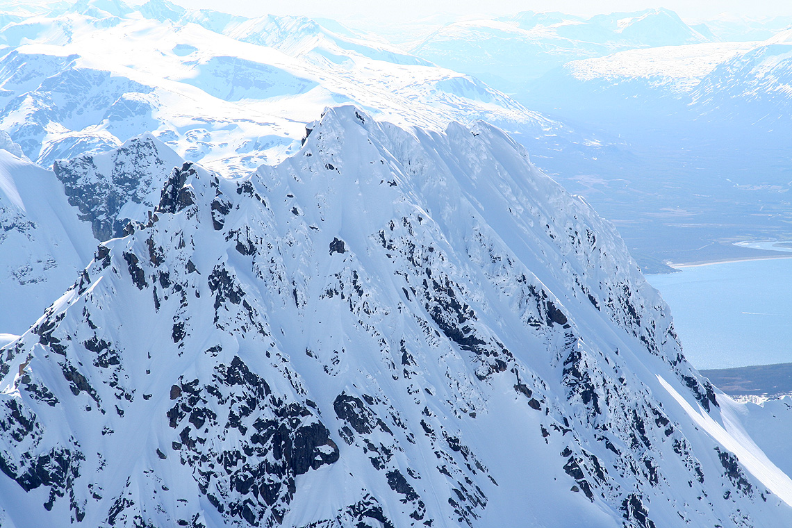
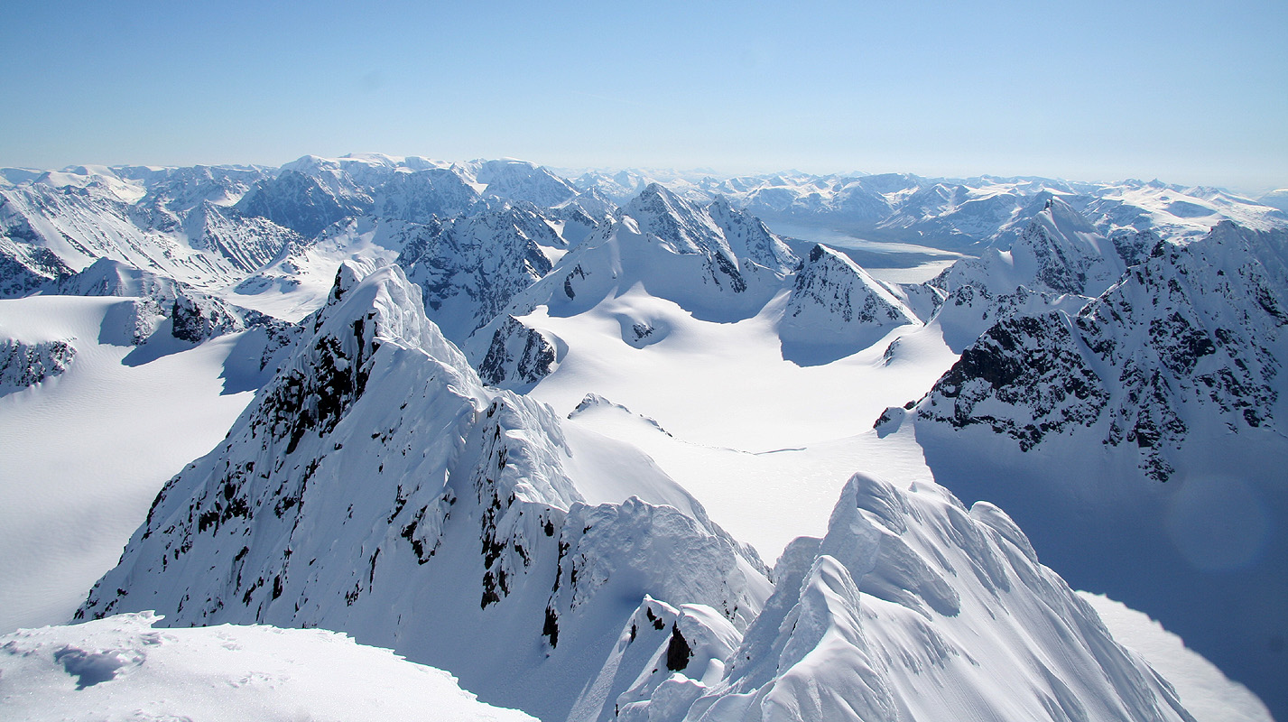
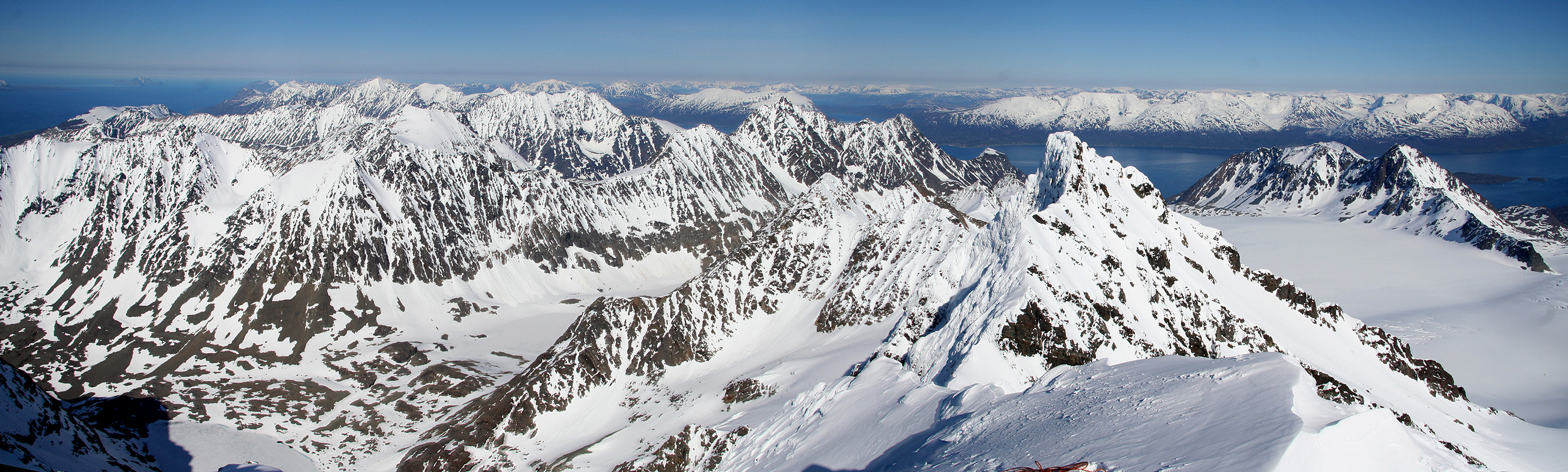
The view north is an ocean of sharp ridges, Tverrbakktind,
another peak with large prominence, can
be seen out there. Store Koppangtinden and Strupbreen is about
the most gentle terrain that can be spotted anywhere.
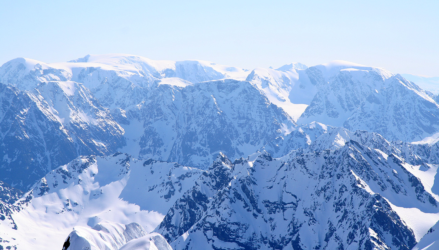
There seems to be tougher peaks around, Stortinden (1512m) may
be one example. Another impressive view is Store Jægervasstind (1543m).
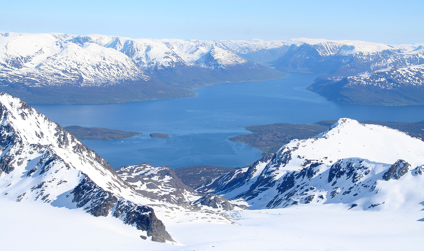
To the south, Jiehkkevarre and Kveita, it is difficult to understand
the skiing route that Torstein and I completed going straight north toward us, even more that there
is a fjord (Kjosen) cutting almost across between here and there.
We were in no hurry. The weather was perfect, no wind. The sun would shine all night up here -
midnight sun. I considered the crux part of the climb, still in the shade. By the time the sun
would hit it would be low on the horizon and quite a bit weaker. Nothing to worry about, this summit
is worth a long, long stay. The South ridge
did not look easy either, rather the contrary.
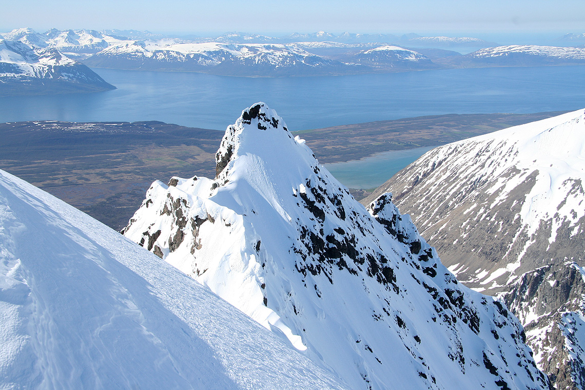
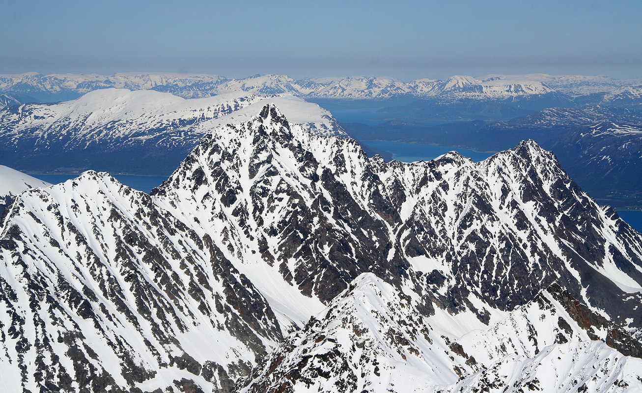
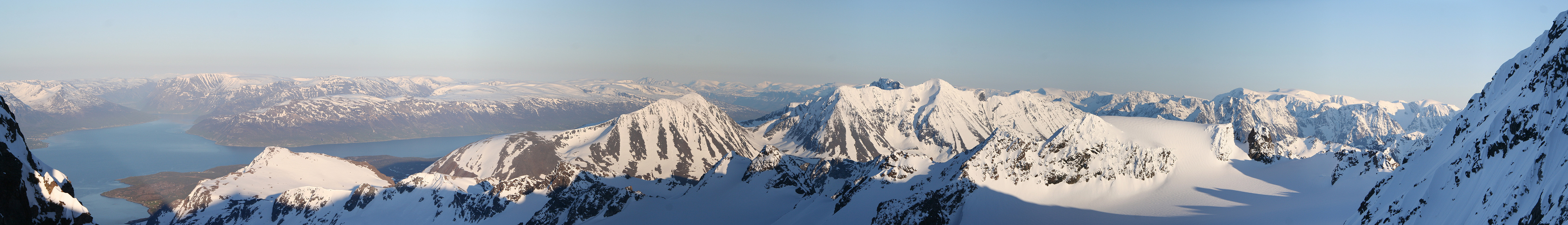
The view towards the south-west continued to capture my
attention, Stortind and Jægervasstindane, with the blue fjord behind and below.
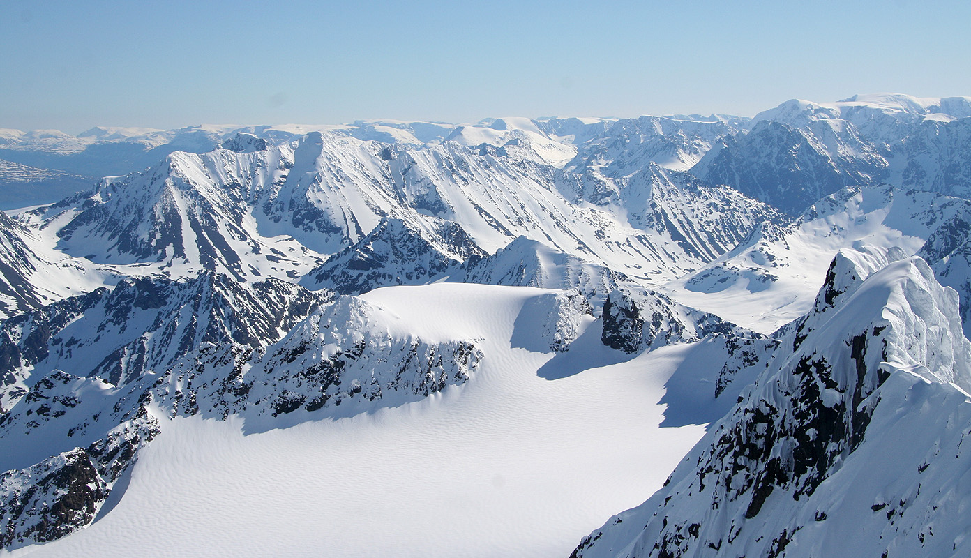
South-east to Istind, another peak with more than 1000 meter
of prominence. This tiny north section of Lyngen has four such peaks, few places can match
this density. Our route to Base Camp can be followed all the way
down to the steep talus slope. To the north-east, one sees
Støvelfjellet (1464m) blending with a snowcapped dome across the Lyngen fjord.
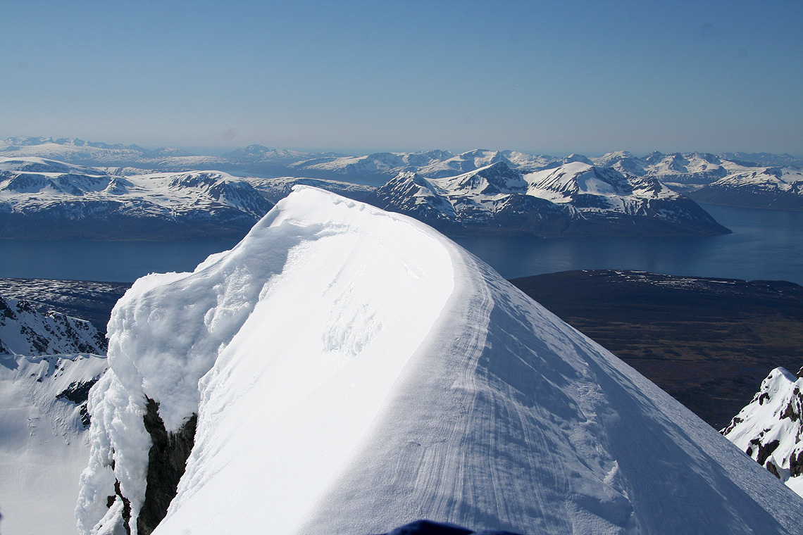
Moving into wide angle panorama view, the entire peninsula
going north is laid out, all lower summits, but wow! how impressive.
All good things must eventually come to an end. After a record long stay where few words were
spoken, but many visual impressions absorbed, we started our way back down. It took about as long
as the climb, and it was late evening by the time we stood back down in the main saddle.
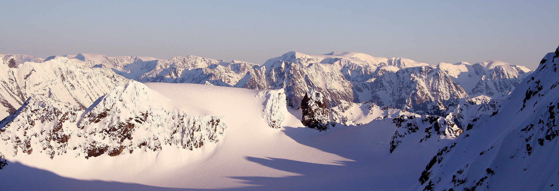
The panorama
view south was the same, but different - the sun was lower and the light had
clearly shifted towards red.
The East summit now has sunshine hitting
it from the north, only a few hours before midnight.
At last, a farewell view north
as seen from the main saddle, the peaks all look significantly
higher compared to the summit view.
We descended the steep slope rather carefully, the snow was pretty bad on the upper part.
A full day of strong sunshine and the snow turned rotten and unpredictable. It was better
further down, but we needed to relay snow pickets from Edward above to me below before we
could change into walking mode and get back down to the tent. Almost 18 hours, none of us
had believed it beforehand. We needed another night of sleep, June 2nd. came upon us before
we were back in camp. We had essentially no food left and the thirst was definitely present.
I melted water for about one hour, then we all fell asleep with an absolute sense
of accomplishment.
June 2.
The same good weather, but no breakfast. What was planned as a single night camp had turned
into three nights.
We got up early in order to take advantage of the morning crust as well as a safer (unroped)
ski back down the glacier.
The glacier and the skiing were close to perfect and going down
is much easier than going up,
at least for two in the party. Edward picked up some more tricks on how to ski downhill on
skis with a loose heel and with a pretty heavy pack. He is quick to adopt and obviously has
done more cross country, wilderness skiing on this trip than perhaps ever before.
We turn back and say goodbye to two great peaks
that has been in focus and on our minds
the last several days, then they disappear out of sight as we descend into the narrow valley below the
Koppang glacier.
Just as we shall start the last leg of skiing, Åke points to my ski and says it is
broken. Sure enough, exactly under the boot, no appearent reason, just general fatigue after
more than ten years of service. Edward prefers to walk through the avalanche area and I therefore
put on his skis while he carries mine. We complete the descent and
arrive back at the car, in
good shape, but certainly a bit hungry. We subsequently rushed to the first cafe at
Lyngseidet and had an early (morning) dinner.
Thanks for a great trip with all aspects that will make it stand out among
many good memories: Perfect weather, landscape, solitude, steepness, the unknown difficulties ahead,
success to attain this summit, midnight sun, a team that works well, the right joke with perfect
timing, sometimes in an awkward place, the list goes on.
This ascent completed my ascents of the Scandinavian Ultra prominent mountains, but that by itself
carries no significance. The trip and the memories does.