October 14th. - An early evening drive through Yosemite.
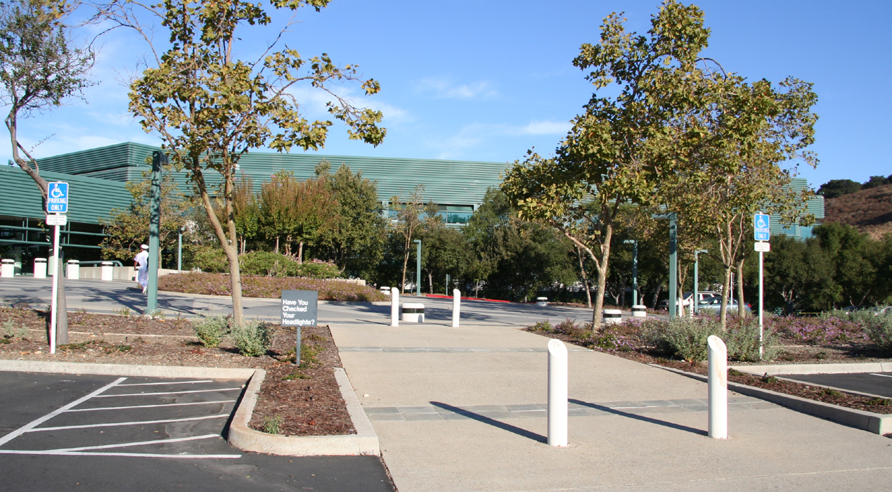
I finished up a two day seminar with IBM on "deep computing" and left their
very nice research center
in Almaden, south of San Jose, Friday around 1300. My plan was
to drive to the White Mountain Peak trailhead, then climb this peak on Saturday
morning.
The traffic was tolerable as I made my way out of the Bay Area, through traffic in
Livermore then up visiting all the windmills before crossing the Central Valley.
These windmills were pioneers, already there when I lived in the Bay Area, their number
seems to have grown. Before long I was driving along Hwy.120, reflecting on many nice memories
from driving here more than 25 years ago to Yosemite summer and winter.
I stopped in Big Oak Flat and bought 6 liter of water, a bread, a cheese and some salami. With at
least one meal every day in some small town, this supply should work fine for the next
3-4 days. I had singled out White Mountain, Jefferson Mountain, Arc Dome and Star Peak,
the plan would be to climb each peak in the morning, then move on to the next trailhead
in the afternnon. I planned on sleeping in my Chevy Trailblazer the next 4 nights and
make it back to the Bay Area early afternoon on Tuesday.
Yosemite park entrance fee was 20 dollars, my memory said 10, however, a small contribution
to hopefully good management of this unique piece of nature is worth every dime. I wondered
if I would make it up to the area near Tenaya lake before sunset.
That worked out, but just
barely. I made numerous short stops along the road to have a closer look at the
impressive landscape.
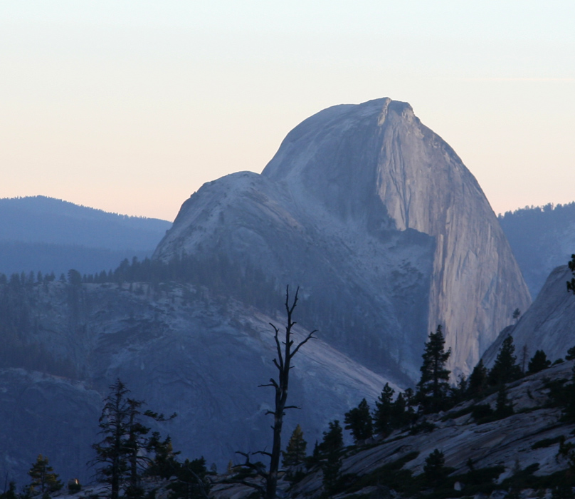
Half Dome is visible
from a short stretch of the road, uniquely shaped,
my trip there with student friends was one of many nice excursions in the late 1970's.
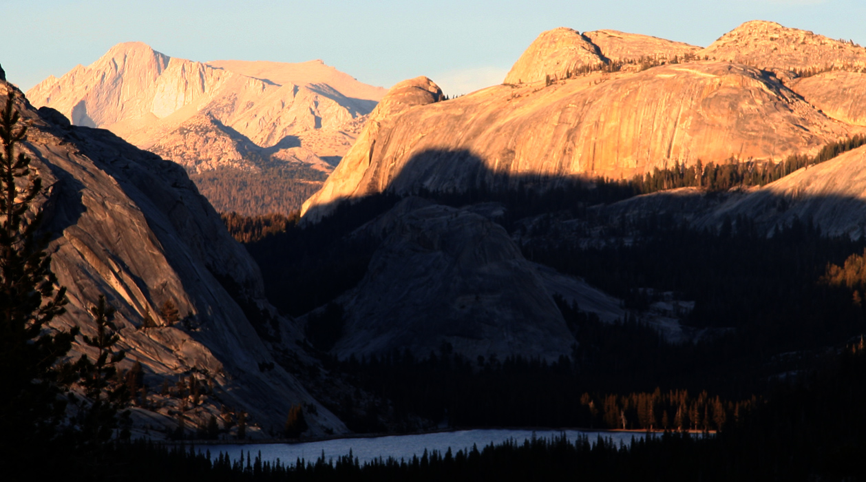
Our friends in Menlo Park decided to name their first baby girl Tenaya back in 1978,
inspired by the beauty that nature mirrors in this special lake.
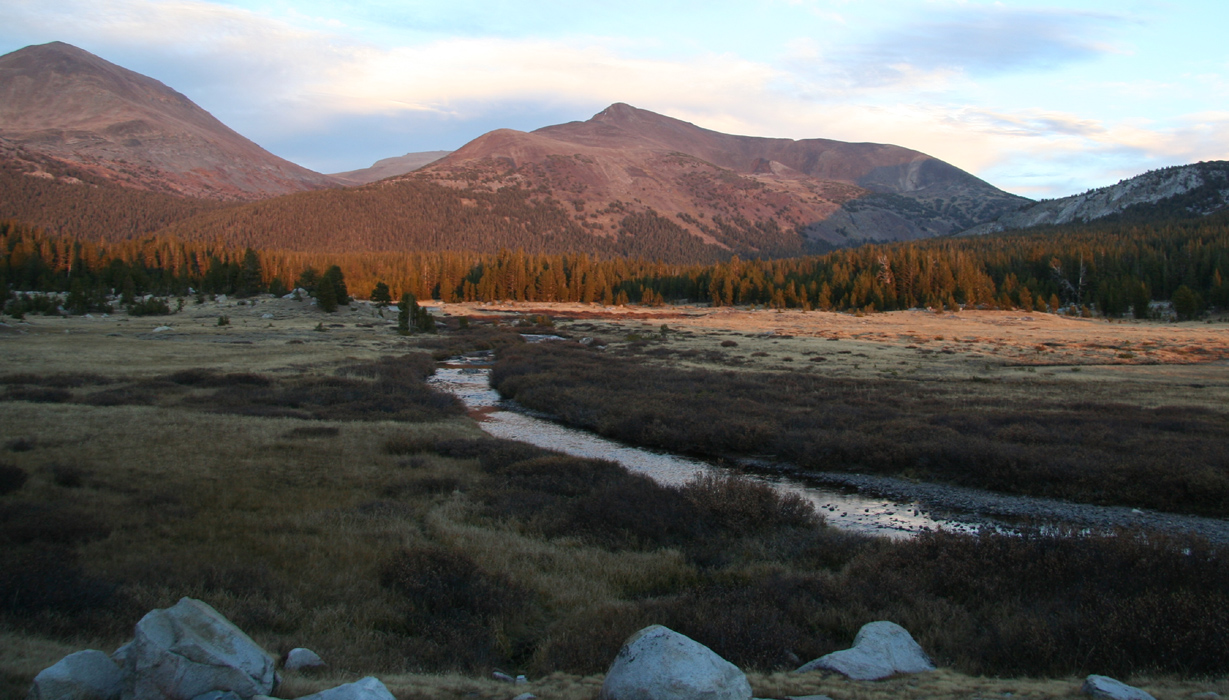
The last rays of sun stroke the fall colors of
Tuolumne Meadows as I continued towards Tioga
Pass. This was where my wife, a friend and I skied in
the spring of 1980, having started south at Badger Pass, our week long single
track being the only sign of
human life.
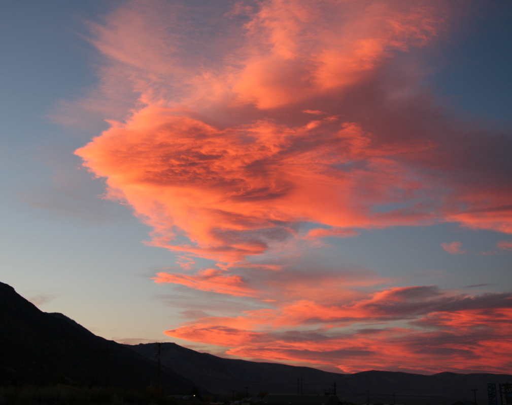
The sun set in an impressive theater of visual effects
and it was dark before I descended
to Mono Lake, this salty place where I once stumbled across a dead horse just minutes after
my mother had expressed that this was exactly the kind of place where horses would die.
I turned south on Hwy. 395 and quickly made my way to Big Pine where the local restaurant
provided ribs, many ribs..
Back on the road, I had no difficulties with navigation, but listened with some degree
of concern to the weather forcast for Owens Valley: "Saturday 50 percent chance of rain
with snow-level at 8000 feet, gusty wind reaching 90 mph on ridges". White Mountains sits
right on the eastern side of Owens and I was heading more than 25 miles into this
wilderness with planned parking above 12000 feet. A 4WD without chains
does not buy you much if nature
dumps a foot of snow.
I decided to be careful and rather abort early if the weather turned to snow than risk
spending several days deep in the White Mountains.
The last 10 miles, I had small rabbits running onto the road in front of the car
repeatedly. They seemed almost paralyzed by the headlights and proved difficult to
pass. Whenever the rabbit was reasonably close to the side and I tried to pass, s/he
would immediately strike right back on the road again. As soon as one was finally
safely behind a new rabbit would pick up the same dangerous game. I did not kill
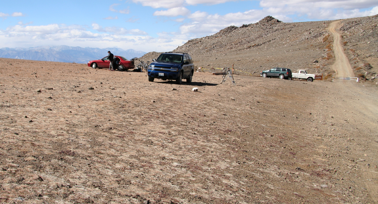
any and arrived at the trailhead around 2200. A single car and a tent was there as I
quickly prepared my sleeping bag in the back of the truck and fell asleep.
Sleep did not last long before I woke up in a corner of the truck, slippery surface.
I rearranged myself and went back to sleep only to have the same thing happen.
Although very sleepy, it did occur to my brain that the reason for this trouble
could be traced to parking on a sloping surface. I jumped behind the wheel and
moved the car to more level ground. In doing so, I noticed an almost full moon
and thought about how this would make early hiking easier. Back to sleep, this
time with no further interruptions.
October 15th. - White Mountain Peak and a long drive to Belmont.
I woke up at 0500, it was pitch dark and initially a moment of confusion before I
really woke up and realized that the moon had set. Thousands of brilliant stars, there
is no better place to view the sky than above 3000 meter far away from any source
of light, a crisp cold morning. I had two slices of bread for breakfast and started out
shortly before 0530 with a headlamp to guide my steps. No signs of activity in the
other cars, it looked like a couple of cars had arrived during the night.
Part way up the first hill, I saw 10-12 brilliant small lights quite close and on my
right side. The lights moved slowly and suddenly I noticed that the lights remained
in pairs, the eyes of some kind of deer that reflected the lights from my lamp. An
interesting meeting, I never saw the animals despite a distance of no more than 10 meter.
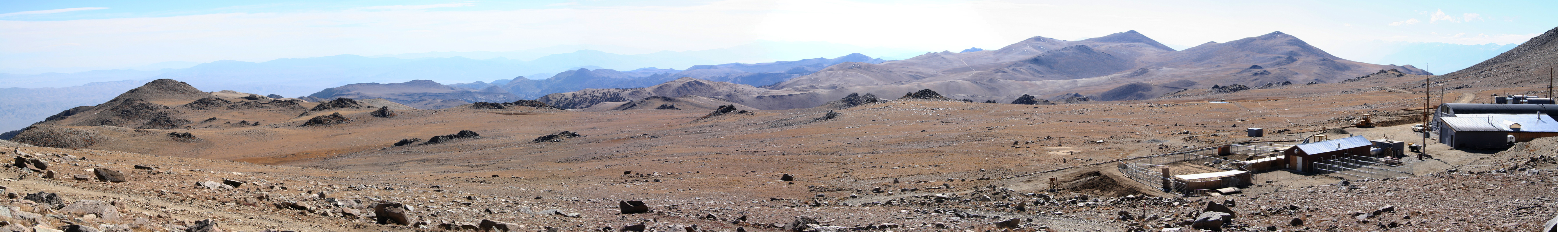
My hike continued and soon I noticed the outline of buildings in the university
high altitude research station. Here, I somehow lost the trail and headed more straight
uphill towards Mount Barcroft, elevation 3975 meter. As the slope got slightly steeper,
I hiked by a somewhat larger patch of snow and gradually visibility arrived and my headlamp
could be turned off. Immediately, I made the somewhat unpleasant discovery that
another peak far off to my
right seemed clearly higher. I turned right and started scrambling
down the slope, this detour had not been very bad, a map would certainly have prevented
it altogether. In hindsight, I wish I had completed the climb, seldom can a peak just shy
of 4000 meter be bagged any easier. (Mount Barcroft has 140 meter prominence and thus is
an independent peak.)
I completed this 4 peak trip without any map, this is likely in violation of all
mountaineering commandments regardless of country and is, of course, inexcuseable.
However, a certain sense of discovery and surprise that would otherwise not be there
kept me very alert on this trip. The risk of failure due to bad navigation was a
constant reminder. I would not even consider this approach in Norway, however, both
landscape, trails and weather contribute to making the hiking/climbing of
US mountains much easier than in almost any other location where I have been.
From now on, the hike was straightforward, but longer than anticipated. This hike is not
a steady climb, but a high altitude cross country trip with a hill at the very end.
There are two significant downhills along the route to the summit, first after the
pass just above the university research station, then in order to reach the saddle
separating White Mountain Peak from the rest of the plateau. The final uphill has
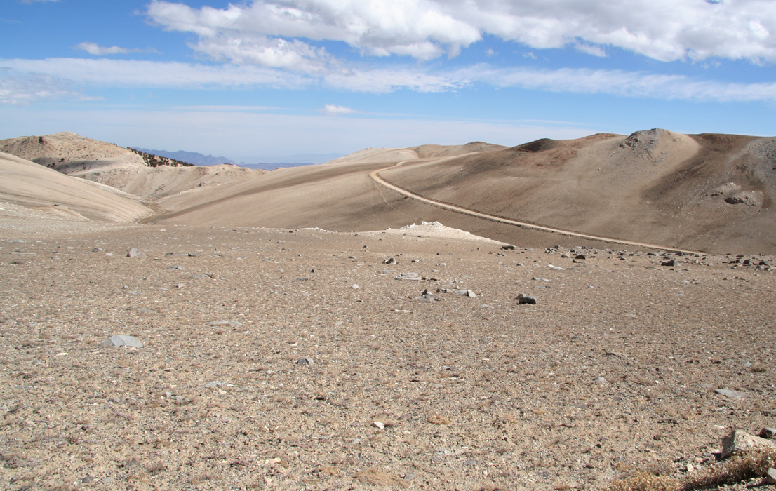
the jeep road make a zig-zag route with long level stretches. Thus, one is much better
off by making a direct line up the slope for the summit. There were signs of previous
climbers doing the same thing, perhaps mainly when descending. Ideally, one should
make a trail up here in order to prevent erosion and at the same time separate
climbers from the somewhat ugly road that serves the research laboratory with a
way to conduct experiments at the very summit.
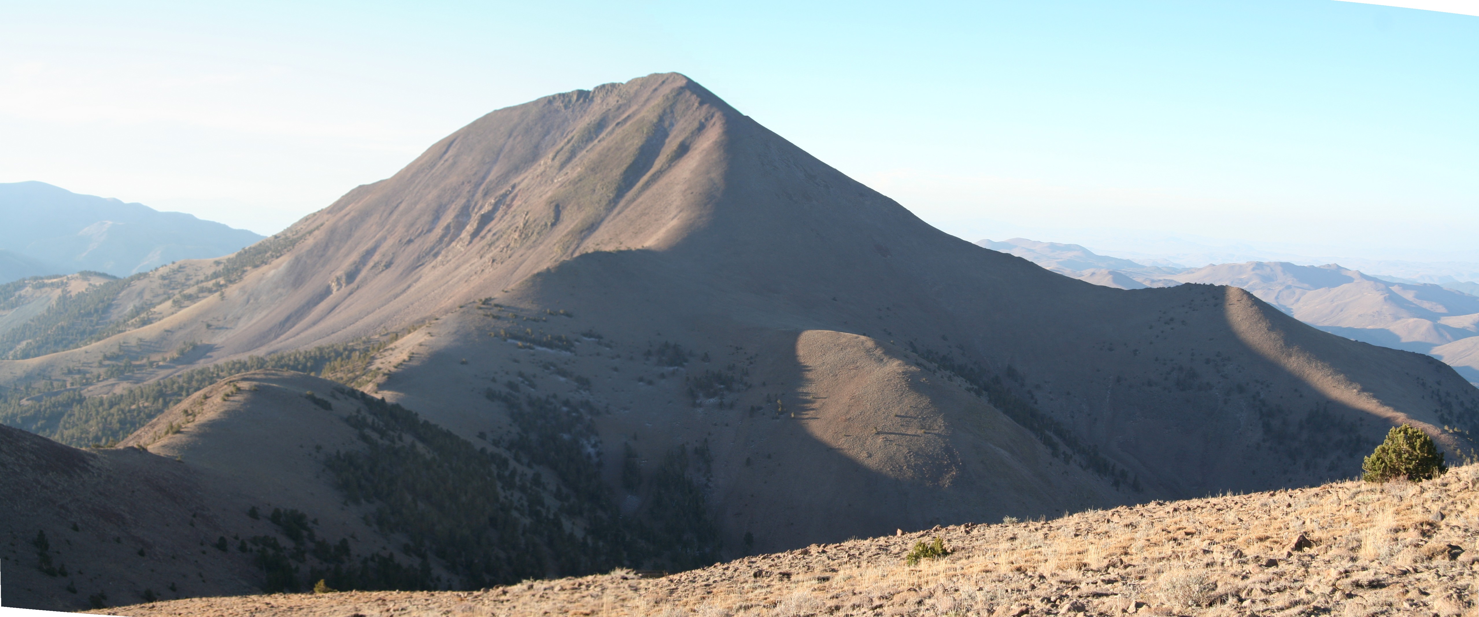
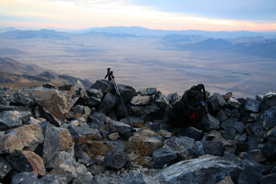
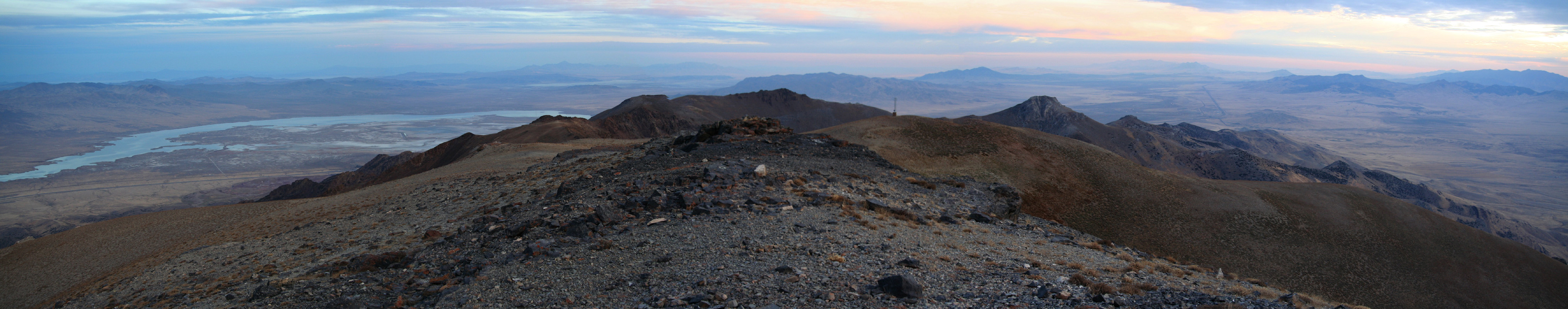
I arrived at the summit at 0850 and immediately noticed the wind. It had been strong
all morning, but up here it really pushed me around. Not 90 mph any longer, but strong
enough to affect balance and impose a wind chill that pretty much prevented me from
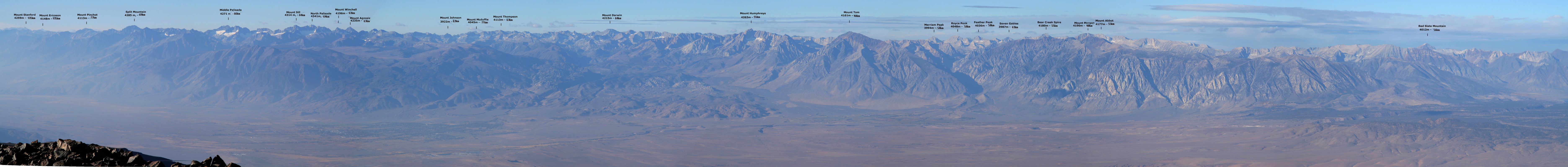
removing my heavy duty gloves. I proceeded to take pictures of the impressive
Sierra Nevada, when
another stupid incident caused problems and cold fingers.
My new camera that I still had not read any owners manual for, refused to take
pictures. Instead it complained by beeping, bip-bip-bip. I immediately concluded
that the battery was severly affected by the cold and that this was its way of telling
until a picture suddenly was taken, most likely of some rocks near my boots. I slowly
realized that the camera had confused itself into a self-timer release, but there was
no way I could study this and deactivate whatever mechanism causing with the current
wind and cold. Reluctantly, I took about 10 more pictures, patiently waiting about
10 seconds for each picture to fire.
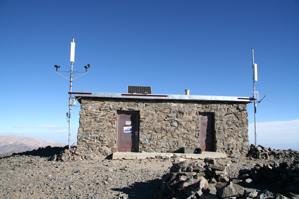
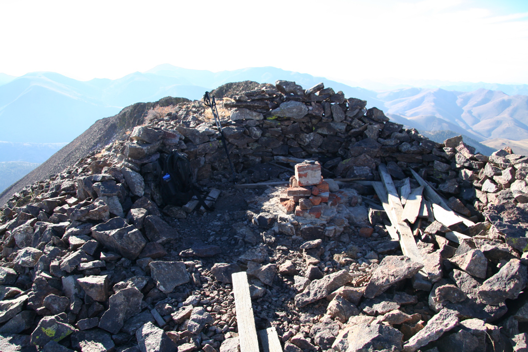
The summit register was signed, it is stored right next to
the small stone hut that
had a sign saying "do not disturb, experiment in progress".
After 30 minutes I was more than happy to leave
this somewhat unpleasant place and head back down to calmer conditions.
Interesting, there is wildlife at this very high elevation in what looks like
a very dry area. Very near the summit, I came upon a very big rabbit. It was at
least ten times the size of the ones on the road last night, but did look more
like a rabbit than a hare to me. Further down, near the saddle connecting White Mountain
Peak to the plateau, I saw a large animal that first looked like a horse. It was very
shy and walked out of sight long before I could get much closer. I cannot think that this
really was a horse, rather some large deer or elk type animal?
On the way back,
clouds were quickly building from the west and I was quite surprised
to meet two different two-person teams heading for the peak. I met them around 1100,
not very far from the research station and thought that they were quite late for the
summit. They asked about the remaining distance and I told them that their hike was
far from over. The weather actually held for several more hours and I wonder if they
made the summit, then most likely had a rendezvous with bad weather on their
return hike.
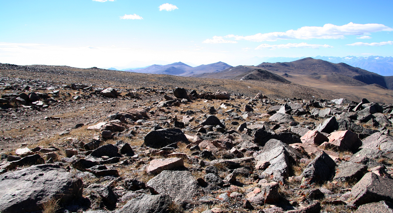
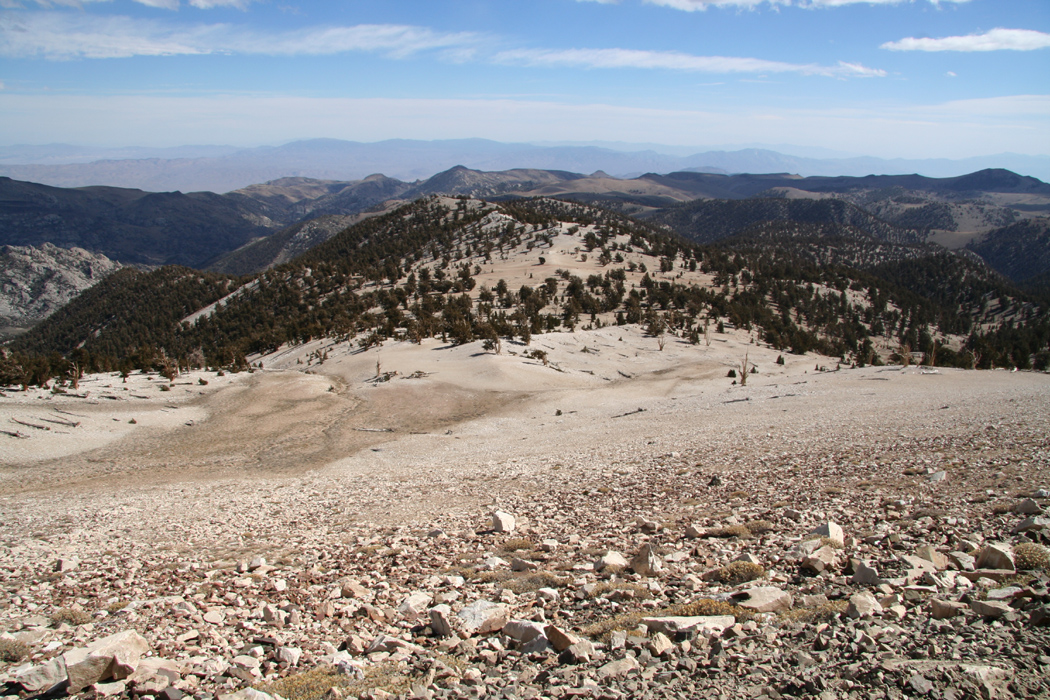
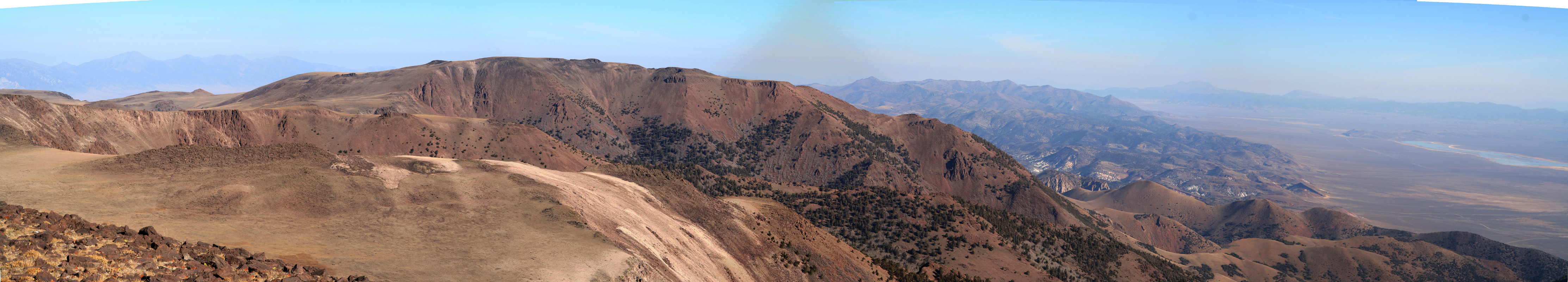
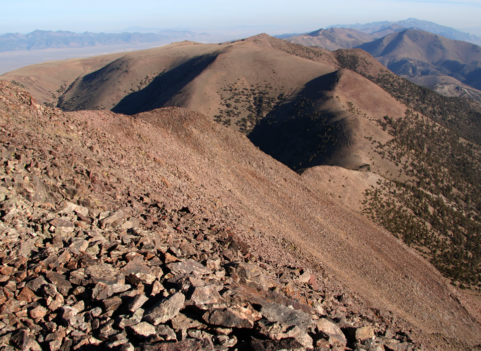
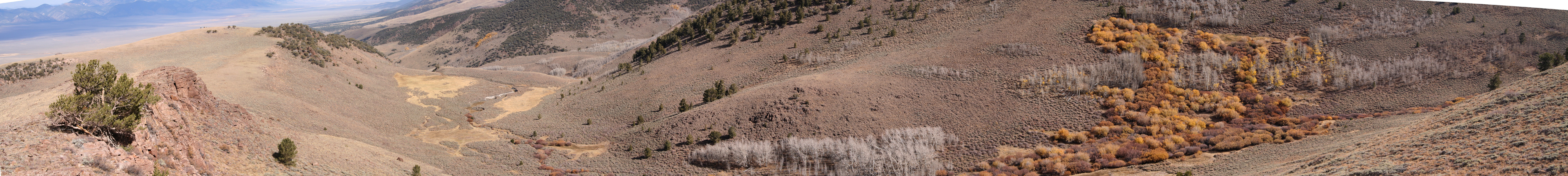
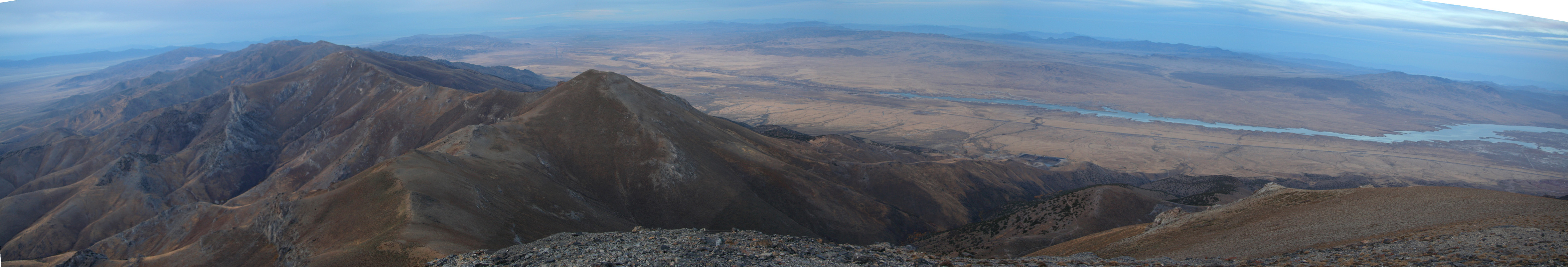
I followed the trail across the broad, gentle saddle above the research station and
paused to view the nice panorama that unfolded in front of me.
I returned to the trailhead and talked to two young guys that
had arrived and wanted to use mountain bikes on the trail the next day. It turned out that
they were Ph.D. students at Stanford (where I got my Ph.D.) and that their advisor
recently had asked them to study a paper written by somebody belonging to
a mathematics research group in Bergen, Norway (my research group!) - small world!
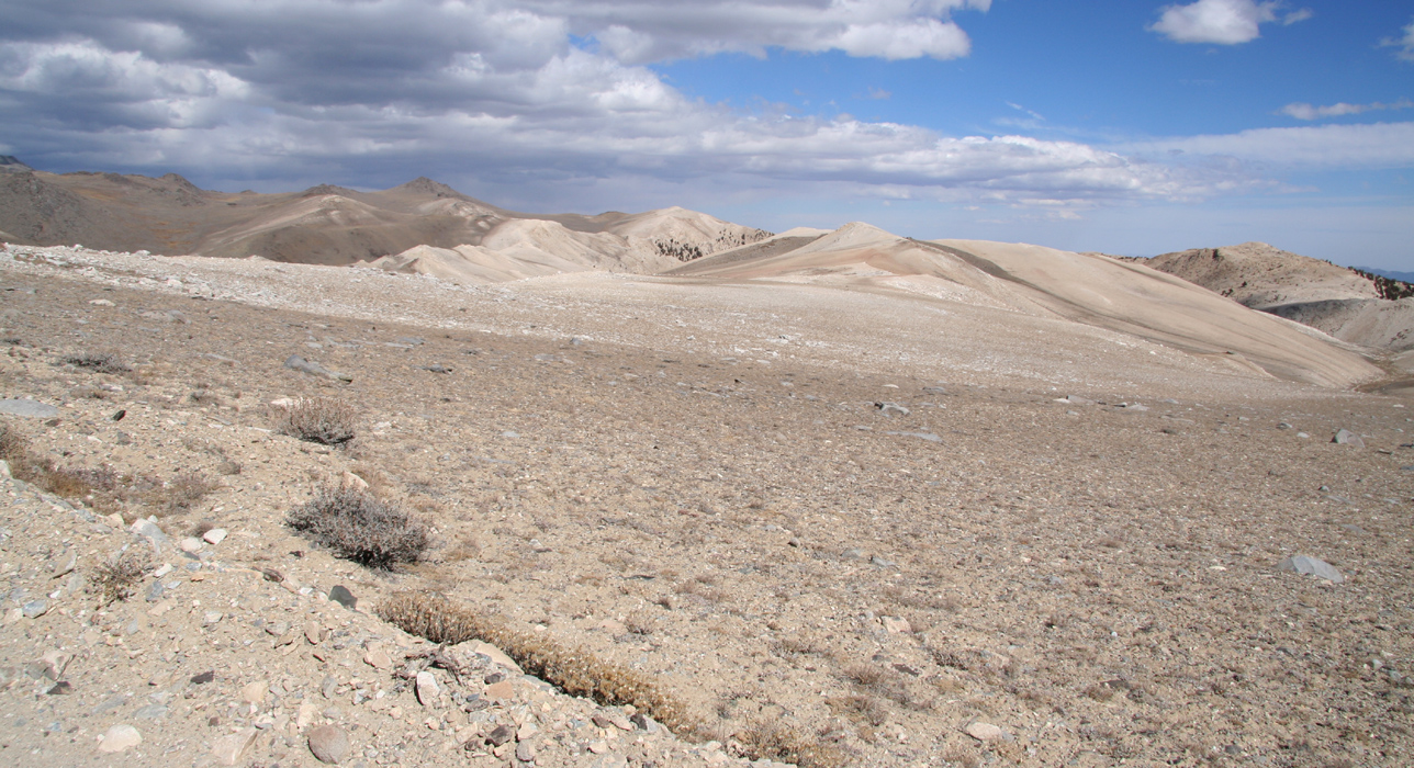
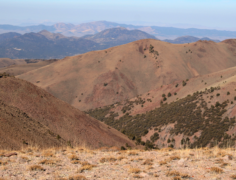
I drove back down the road,
enjoying the special landscape of a desert mountain.
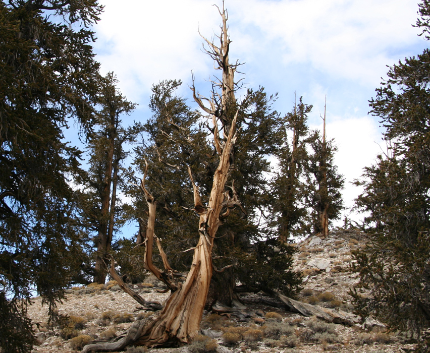
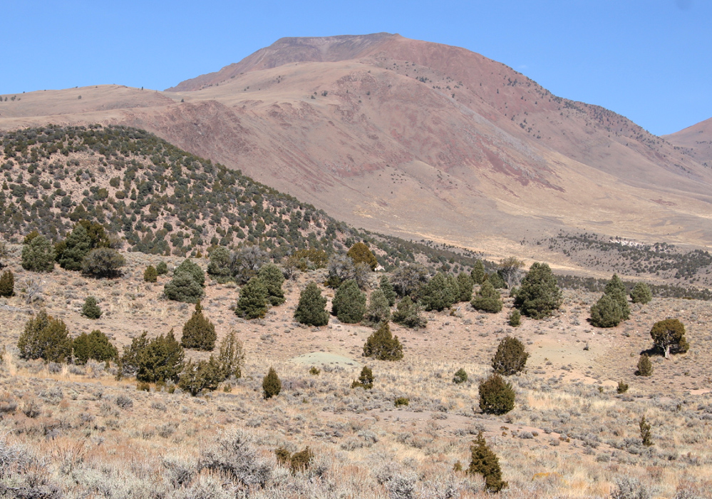
At lower elevations one observes the trees
growing right out of seemingly barren,
dry soil that cannot support any other vegetation. Under this harsh conditions
lives the bristlecone, the oldest living thing on the planet.
I stopped by the
visitor center, paid my dollar 2.50 for using the road and looked around in order
to learn a little more
about this strange plant
and how it lives so long.
The next thing was to drive across to the trailhead of Jefferson Mountain, this is
a pretty long drive that turned even a bit longer. My first goal was the town of Tonopah
on Hwy. 95.
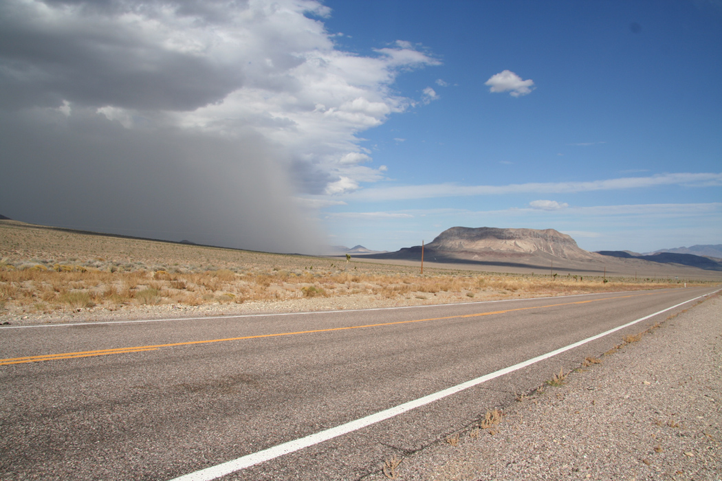
The storm I had seen coming, came rolling
north of me attacking a flat top mountain.
Only out in this area can one sort of observe the weather in this fashion on a grand scale.
I sent a wish of good luck to the 4 hikers still up on White Mountain, then returned to
the task of navigating eastward.
I connected across to Hwy. 95 as planned and set my cruise speed at 70 mph
(or slightly higher), the speed limit going north.
Nevada roads are very different from
Norway roads, the first 100 km going east of Bergen has 3-4 short sections of road without
a curve, in Nevada the road often continues near endlessly without a single bend.
Consequently, as I slowed down to about 40 up a curved hill behind a truck, this was
likely the first time I had to slow down due to a vehicle in front. As we cleared the hilltop
south of Goldfield, the road stretched out and I proceeded to pass the truck.
The truck quickly picked up speed on the downhill slope and as a car approached
in the far distance, I decided to complete my maneuver without any further delays.
However, as the oncoming car came closer, it turned out to be the only Nevada Highway
Patrol I ever saw in these 4 days of driving. I was safely back in my lane and had slowed
back down below 80, but he had radared me just as I passed the truck at a speed
exceeding 80. Bad luck! The first oncoming car in perhaps 15 minutes, precisely as I
overtake a truck on a downhill slope. The officer understood the rationale behind the
event, but said that one should never exceed the speedlimit by more than 10 miles when
passing. This cost me hundred dollars and a trip to the nearest town to settle the
issue. "Nearest town" in this case being Beatty about 50 miles south. OK, turn around
and drive down to get this out of the way, a 100 dollars and a 100 miles, the sunset on
the mountains overlooking Beatty was nice.
No further incidence to report on, I drove back to Tonopah, had a good Mexican dinner,
then continued up the road to Belmont. I had read that the road to Belmont should
be in bad shape, however, the State of Nevada has fixed this. The road was wide and
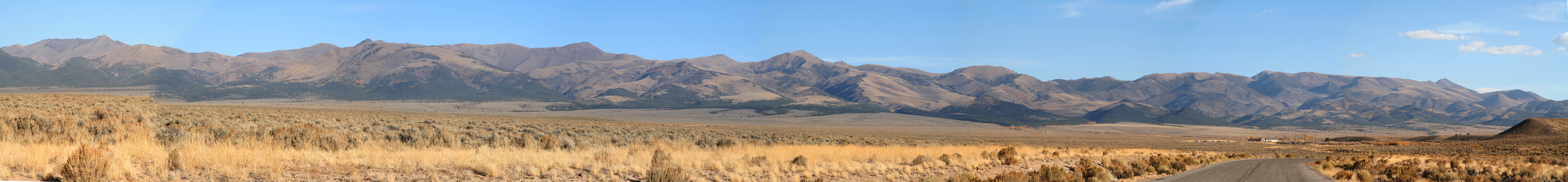
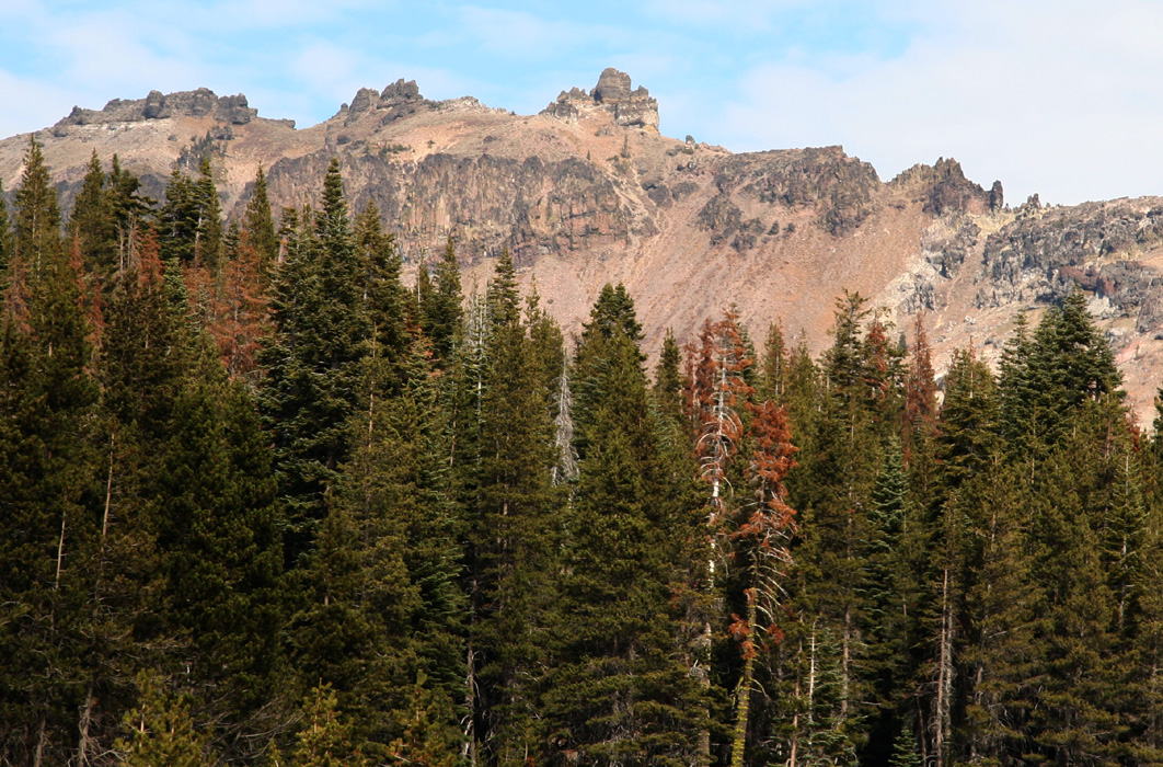
looked pretty new. From Belmont, it was pretty easy to find the way to the trailhead called
Jefferson Summit, this place is not a summit, but a
broad saddle between Shoshone Mountain (3324 m) south and
Mount Jefferson (3640 m) north.
I decided to have a good, long night of sleep and not start hiking until dawn, the moon
was bright, but I knew it would set well before sunrise.
October 16th. - Jefferson Mountain, a visit to Manhattan and Austin.
I woke up shortly before sunrise and had my standard breakfast, two slices of bread with
cheese and/or salami. At 0700, I was on my way,
the mountain in full view straight ahead.
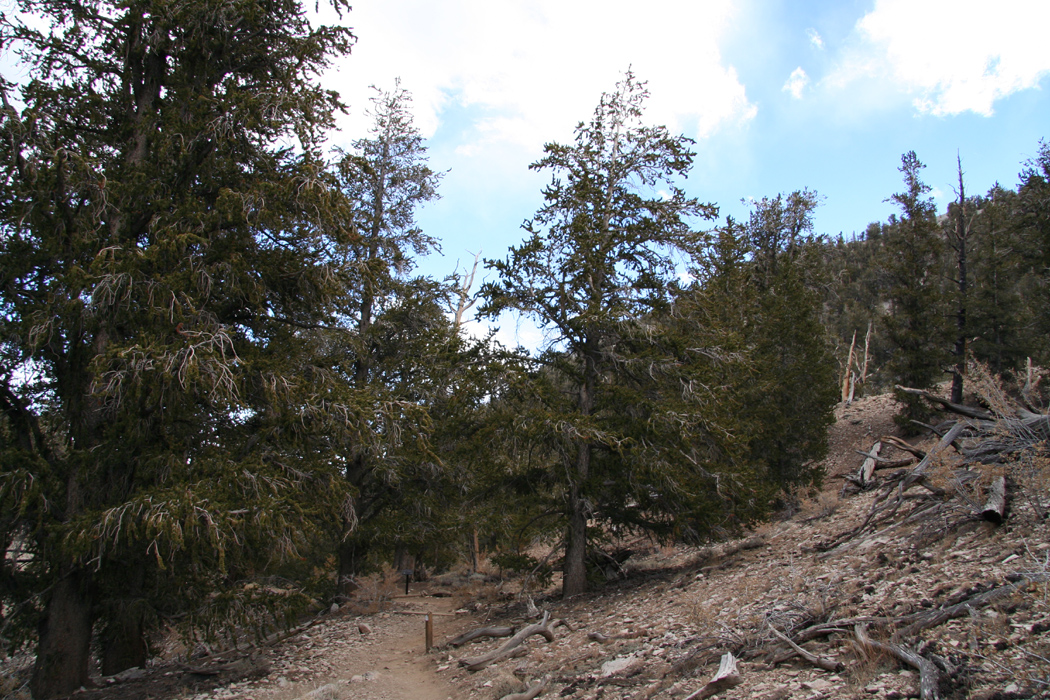
The trail initially follows a 4WD track.
The first section is downhill until one reaches the low point of the saddle, then gently
uphill along an old fence. It was a nice morning, almost no wind and easy terrain. I headed
up the obvious broad ridge,
mostly following the trail. The morning view of the
desert valley to the west as well
as Shoshone mountain on the south side
of the trailhead told me that this would be a good day.
As I got higher, but before
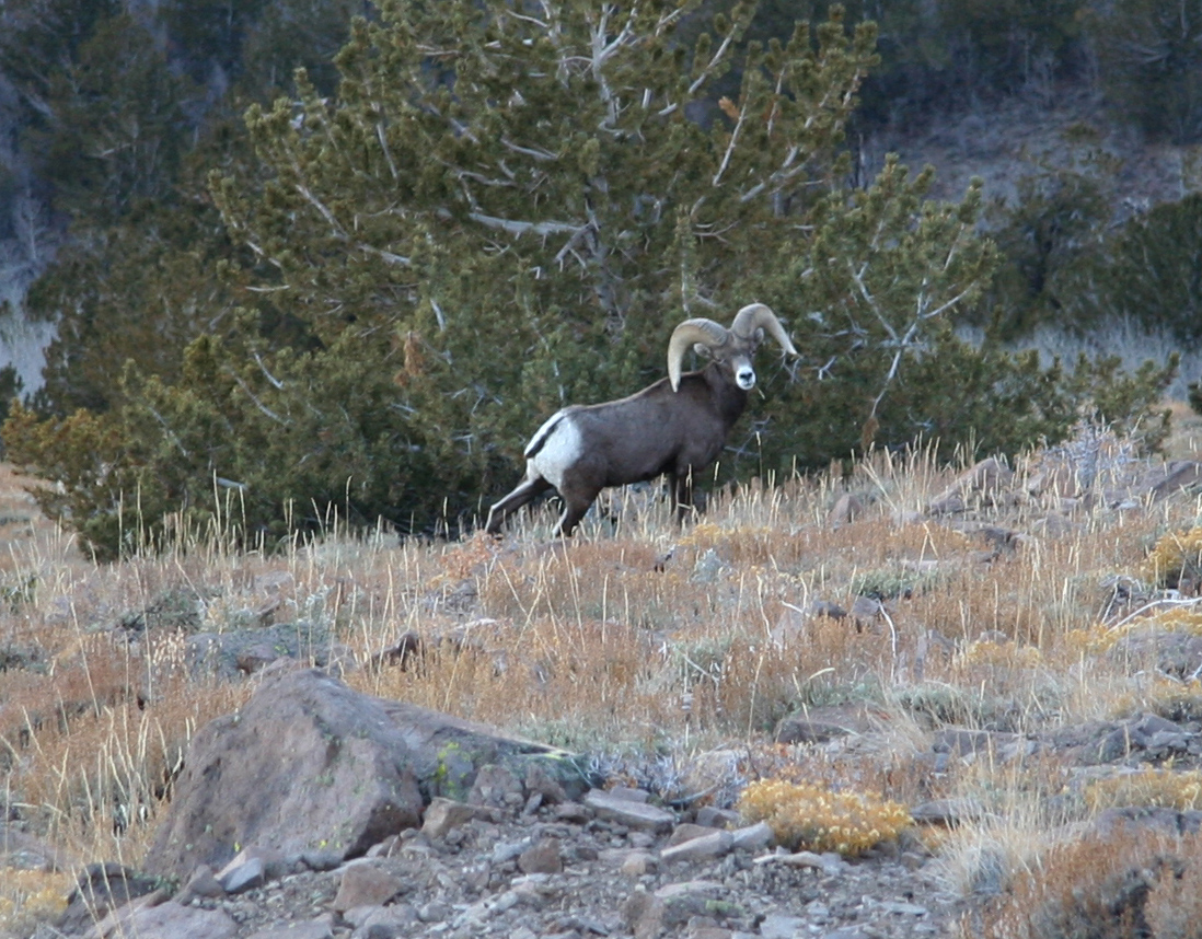
the traverse below the pointed subpeak, something moved downslope on my left. I quickly
looked that way and observed an animal that looked like a bighorn sheep.
I dropped my backpack and walking poles and set out downhill with my camera. The idea was
to cross a small ridge that blocked further view downslope. I spotted the animal a few
times, but only partially. Finally, I got a picture
that I hoped would show the
animal reasonably well. No question, this animal was alert and extremely shy.
Heading back up the slope to resume my hike, I realized that, in the excitement of
the photo hunt, I had left few clues as to where my backpack was. In fact, I did not
see it anywhere. After some slightly random looking around, I decided that a more
systematic approach was called for. Thus, I walked on parallel lines across as well as
up and down in the likely area. No luck! Slightly annoyed for being a bit careless, I
backtracked to near the saddle further down and recovered the trail. I followed the trail,
but still did not see the backpack. However, after following the trail a bit further
and higher than I thought reasonable; and there it was. Old lesson repeat, it is easy
to go downhill, on return one most often starts searching too low.
The continued hike was easy as I traversed below the pointed peak and circled the
summit to arrive
from the north side. I signed the register, there was somewhat
to my surprise, quite a number of visitors over the last 4-6 weeks. A few small
box-like buildings and an antenna were signs of human activity.
The view was good, north to Shoshone
and south to the
other Jefferson summits and beyond.
After a good rest, I was ready to descend. Almost
the entire route. was visible
from the summit. I made it back to the car before noon and prepared for moving
to the trailhead of Arc Dome.
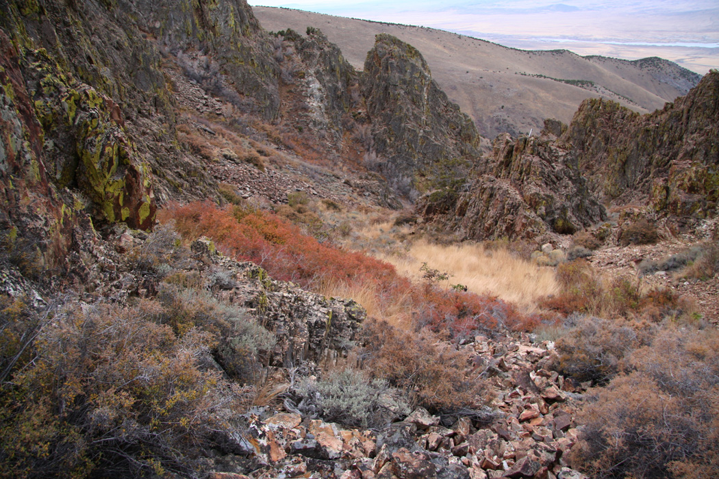
I drove back down into Meadow Canyon looking forward to seeing this place in
daylight.
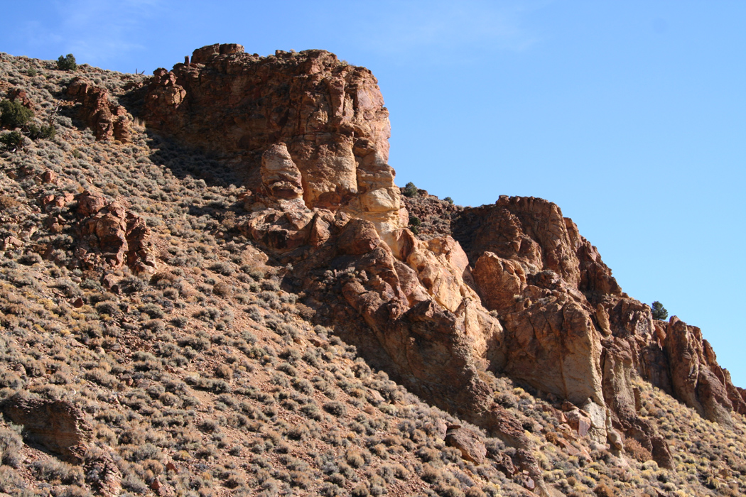
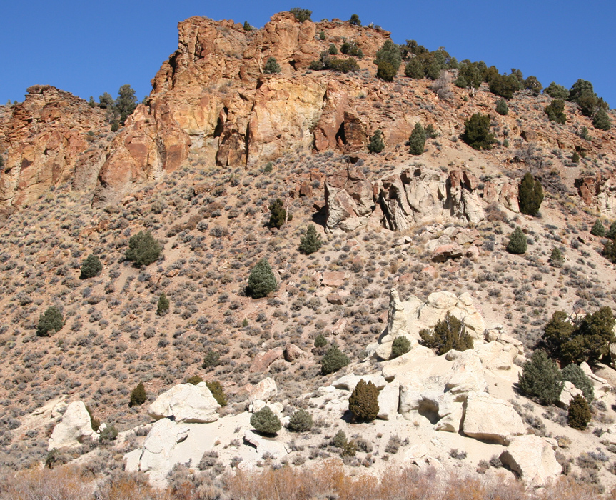
Meadow Canyon is actually very nice, a last look
up and back on Jefferson,
then more focus on the road leading from a fairly wide
and fertile canyon to a more narrow section further down.
The colors of the rocks
changed from deep red to bright white over a short distance.
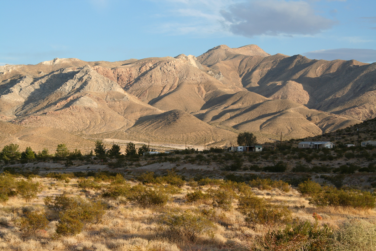
Arriving back in Belmont, one readily observes that
the town has seen better times.
I drove partway back the way I had come the night before, then turned right
onto a dirtroad that should take me across (instead of driving around on the south)
the Toouima Range and into the Big Smoky Valley. In doing so, I should pass
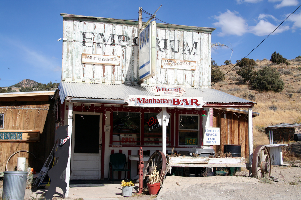
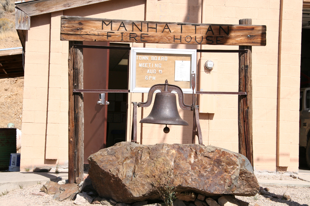
East Manhattan, then arrive into Manhattan on the west slope. East Manhattan was so
small that I simply never saw it, while Manhattan
was a somewhat larger place with
more than ten buildings including a fire department.
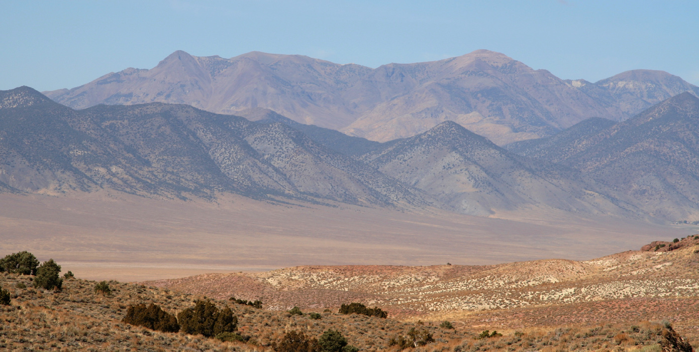
The view across the valley to the Toiyabe Range was nice,
I wondered if one
could see Arc Dome, but as became clear when I later stood on the summit, this is
not the case.
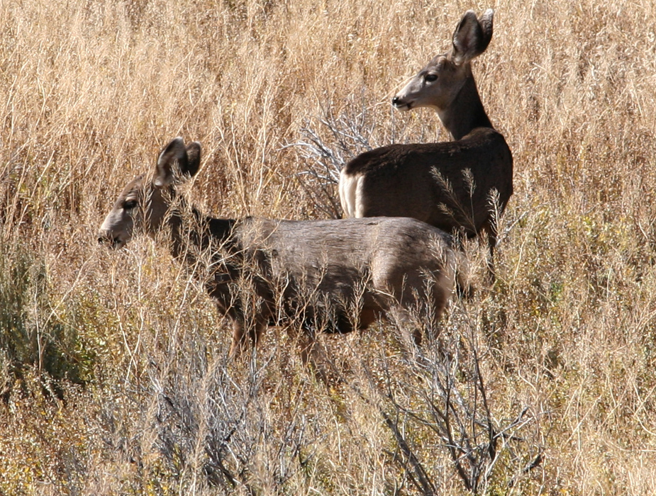
I continued from Manhattan, now on a paved road, into Big Smoky Valley and north to
Austin. Not much traffic, but wildlife along the road.
My plans for Austin included gas, grocery and a restaurant. Austin turned
out to be much smaller than "advertised", gas and a restaurant yes, grocery no unless
a mini-mart at a gas station should qualify. I had a big bowl of chili and enjoyed
observing the three men and three women at the next table. Six motor bikes were
parked outside and this group both talked and looked like aliens, what a different
style of life.
I quickly left Hwy. 50 and headed south
towards Reese River Valley. This road is dirt and runs by the "O Toole Ranch" with
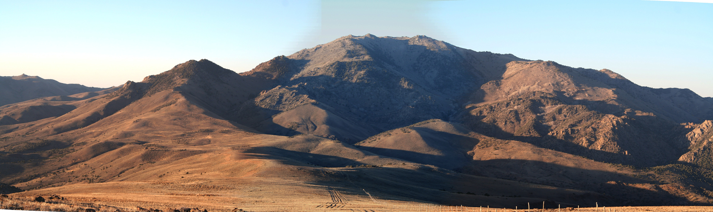
a private airport etc. At last, I got a full view of the
Toiyabe Range from the west including Arc Dome
streching towards the sky near its southern end.
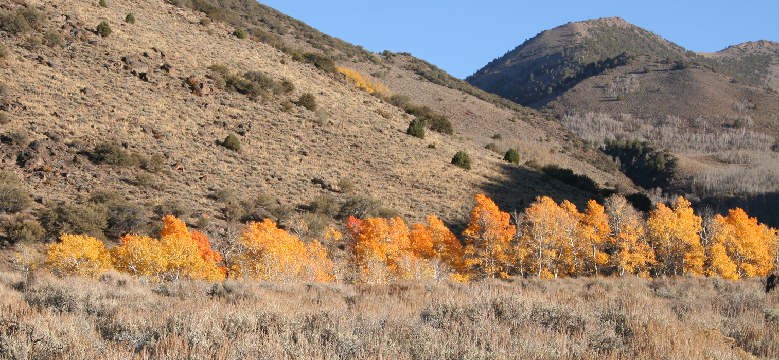
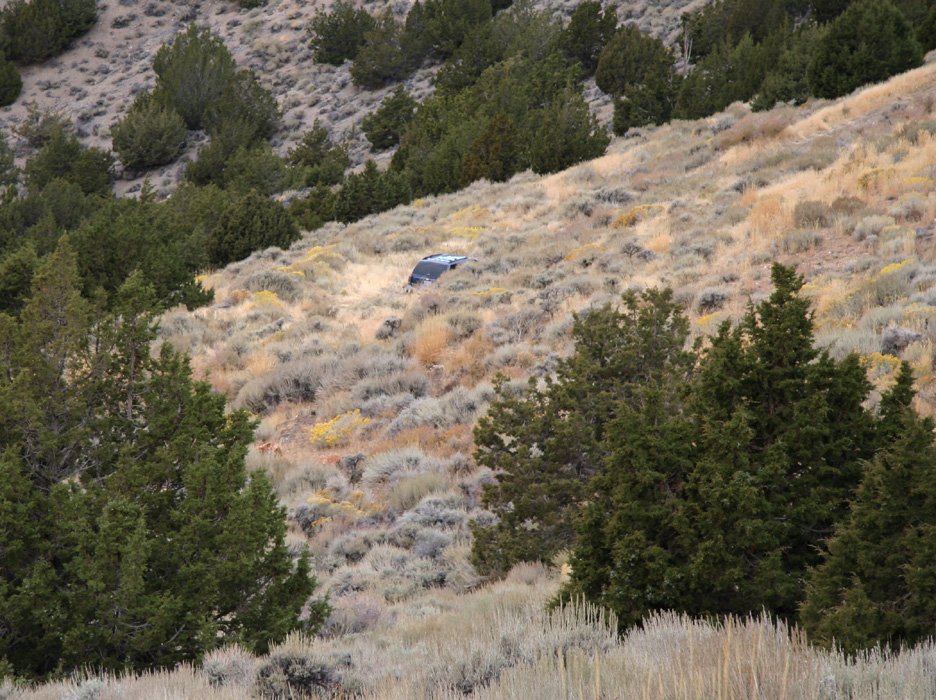
The sun was still bright by the time I parked at
the Columbine Campground next to Stewart Creek.
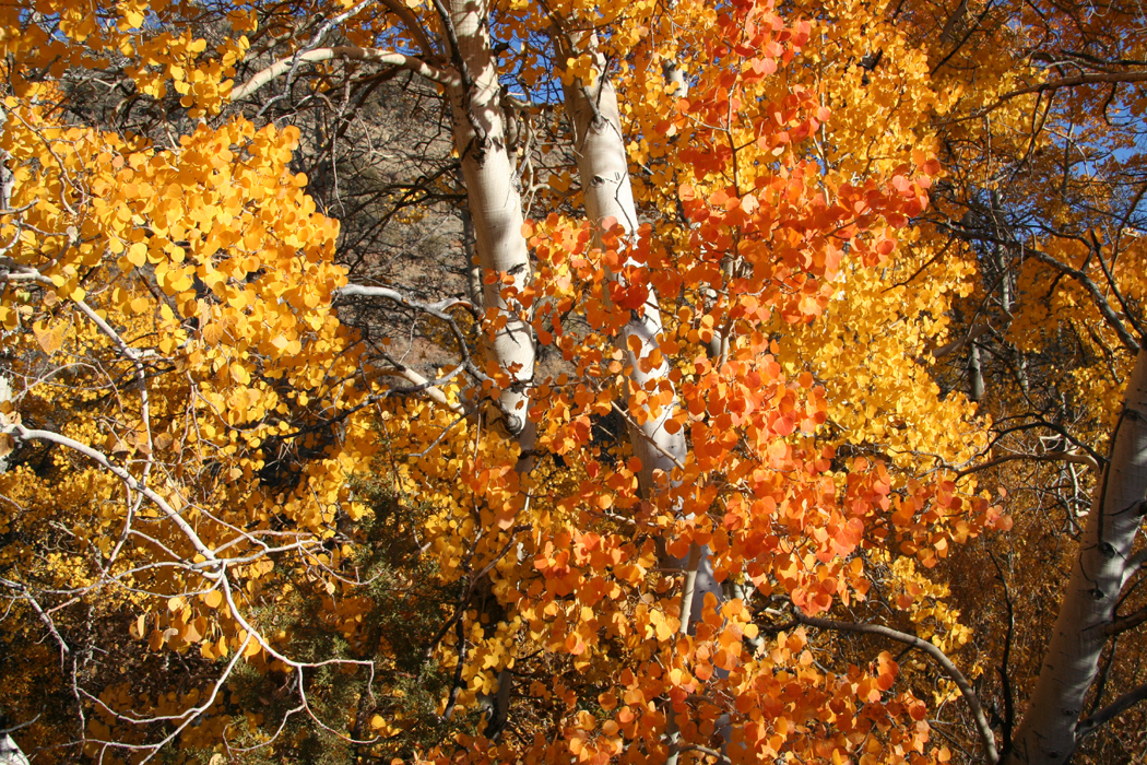
This creek serves animals and plants, aspen trees
and fall colors were abundant.
I decided that a pretty early start would be ok, given my early arrival. The sun
set and the moon came, I read a few chapters in a book, had some snack and fell
asleep fairly early.
October 17th. - Arc Dome, a bonus peak and a drive with complications.
I am getting used to living in the car, slept really well and got up around 0530.
While having my standard breakfast, I noticed that the moon had not set yet. I started
out at 0600 with a headlamp since the first part of the hike went through the trees
and there was moon shadow because of the hill up on my right side. The trail was quite
easy and by the time I reached the upper meadow with the gate and the fence (see
the route description), there was enough light to turn off my lamp. The trail continued
up around the next ridge line, then started to negotiate the rather large slope leading
up to a very large plateau at considerable elevation. From here, after quite a long
hike, I saw the Arc Dome for the first time.
From the view, it was clear that this hike was not over yet. For the first time
on this trip, I also noticed patches of new snow. This snow was most likely dumped
here by the storm that I saw in the afternoon after climbing White Mountain Peak.
The continued hike progressed well, down into the saddle, then up the ridge to
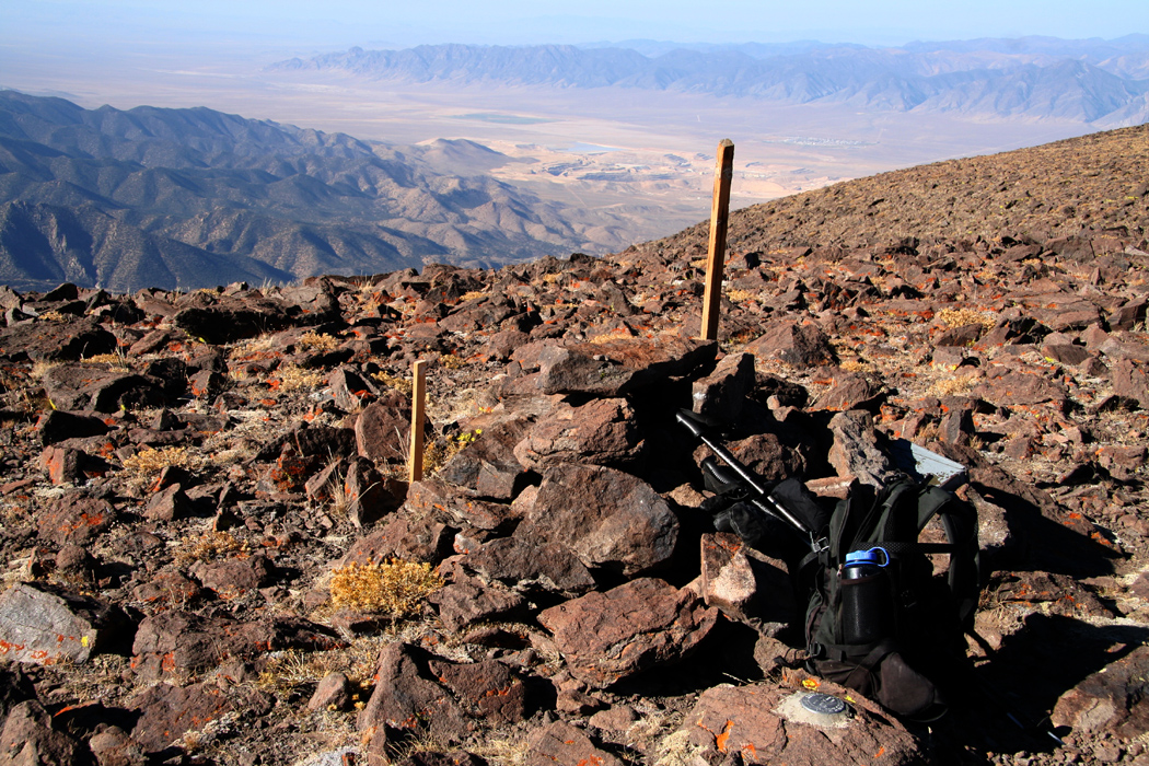
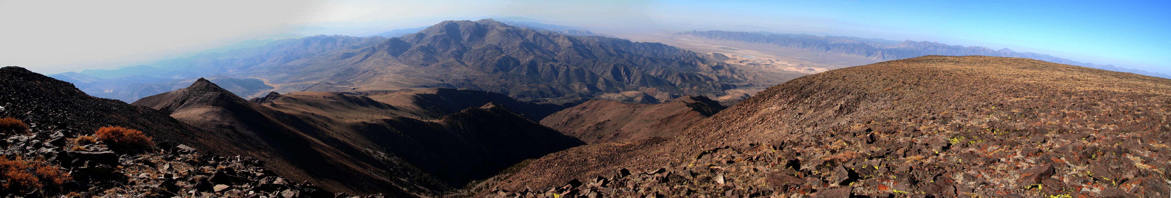
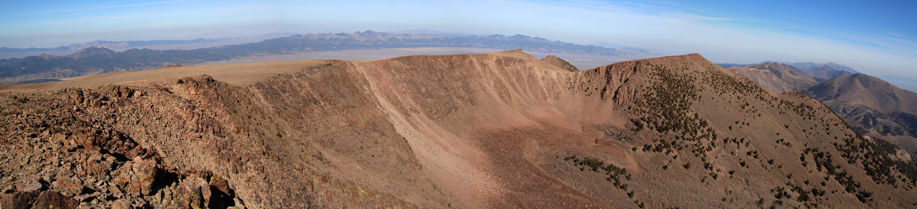
the summit. I reached the top at 0850, signed the register
and took panorama pictures. (You may look at these under the Arc Dome entry on my
climbing list.) The view west was quite typical.
After 20 minutes I started the descent. I had decided to visit the summit of
the big mountain straight north on my return hike. If I was lucky, this would be
just a very minor side trip. However, when
observing this mountain from
Arc Dome one observes two summits. One is quite close to the saddle, just a bit
east of the route I came. The other summit is at the far end, also to the east
ayt the end of a rather nicely shaped ridge. This latter summit would require
a somewhat bigger effort. I suspected that the closer summit would prove to
be the higher one, but decided to determine this with more confidence. I descended
from Arc Dome until the two summits lined up vertically, then made a GPS reading
at that point. The idea being that I could compare this elevation with my readings
at the first summit and then determine if I needed to visit the second summit.
I made the first summit one hour after leaving Arc Dome, having also measured the
saddle along the way. The view east from this saddle was also quite nice,
hills and valleys, no sign of human activity.
The elevation reading was lower than where I measured the
line of sight confirming that the second summit
was indeed lower. I rested and
looked at the landscape as it unfolded in all directions. Another 20 minutes and I
started the very pleasant hike back to the Columbine Camp trailhead.
Scattered in smaller valleys
where there are small creeks there are also aspen trees with bright colors
otherwise, the entire mountain landscape is dry and desert-like.
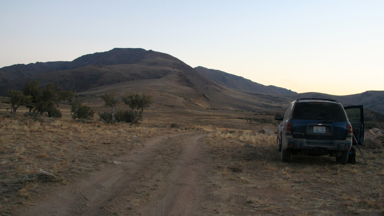
I get back to my car and start driving to the trailhead of the last peak, Star Peak
is located near Interstate 80, so in a sense much less isolated than Jefferson and
Arc Dome. Getting there takes me through Ione, then passing near a place called
Berlin before hitting a road north that connects with Hwy. 50.
I find I-80 and head east to the small town of Lovelock. Get gas and locate a nice
Mexican restaurant for dinner. The sun is still pretty high, I feel confident about
parking high in Eldorado Canyon before it gets dark. After a very good meal, I exit
and discover that my truck has a flat tire. Bad news! Then I look around and notice
a tire specialist across the street. Good news! I drive slowly over and enter the
garage. A very friendly guy immediately starts working, locates a 2 cm iron object
in the tire, extracts it and seels the hole with approved procedure. Three quarters
of an hour and the problem is fixed. He writes a bill for 9 - nine !! US dollars.
I thank him warmly for great service when I needed it most and pays him 15. This
time he is the surprised guy, a customer that almost doubles the pay..
I head north and find the exit, then parallel back a few miles looking for the
access road to Eldorado Canyon. I am pretty confident that the biggest and
most obvious canyon that I can see below Star Peak must be Eldorado. I soon determine
the correct road, but soon discover a serious mismatch between my description and
this road. I have a pretty recent description saying that normal passenger cars should
be able to drive to a sharp bend on the road well into the canyon. However, I am not even
into the canyon and facing an increasingly more difficult 4WD road being partially
washed away by the creek. It gets sufficiently bad for me to conclude that I may be
on the wrong road and therefore looking at the wrong canyon.
I turn around and carefully make my way back to the frontage road. As there is only a
mine of some sort further south of this canyon, I search for a second canyon a bit
further north. Sure enough, there is a dirt road
leading back up to the mountains and
something that may develop into a canyon. This road is much better, but still quite
borderline for passenger cars in a couple of spots. I head up and into a canyon, but
it is dark by now, so not much to see. Finally, I get to a very sharp curve as
described, a very good sign indeed, but there is a sign of concern. My description
says that there should be a couple of ruin buildings near this bend of the road. No
such thing, however, I tell myself that the dark may prevent me from seeing these.
Next, the road should head steeply uphill with some hair-pin curves. It does! Good,
slowly I direct my car uphill engaging the 4WD option. I reach a ridge, then continue
onto a mountain slope. There seems to be a long time since anybody drove here. Vegetation
everywhere also in the road. Suddenly, with no warning, the road dead ends. This is
definitely not what the description says. OK, I have no idea where I am, it is pitch
dark, but a few facts seem clear: 1) I am on the slope of Star Peak, 2) It must be possible
to climb the peak from here. Happy with the day and my conclusions, I park and fall asleep almost
instantly.
October 18th. - Star Peak in moonlight, then an easy return to The Bay Area.
I wake up at 0345, bright moonlight. I have a long way to drive back to the Bay Area and should
really be there around 1500 at the latest in order to finish my stay in California according to
plan. What I had planned as an easy walk uphill along a 4WD road has turned into a slightly
more complex task. Find your way up this mountain without any trail whatsoever.
I start out uphill at 0400. Soon, I reach some ridge between cliffs and look into a pretty
rugged canyon/valley with deep shadows from the moonlight. I do not like what I see and backtrack.
Going back down, I contour below the cliffs towards what looks like a major valley coming
down further in. This looks more promising, I enter the valley and fight a lot of thorny Nevada
bushes. The terrain seems to alternate between rocks and these somewhat dense and unfriendly
plants. Shall I carry on up the main valley or shall I stay more right and climb through
a somewhat more narrow passage higher up? Impossible to say, but my feeling tells me that I may
get higher in a more direct line by taking the rightmost alternative. Higher up, the terrain
becomes less unfriendly and I advance towards a horizon ridge with a few local towers. The light
tends to make smaller features look quite significant. This effect is not unlike hiking in
the mountains in fog. I make the ridge and decide to climb it upwards to my left. After a while
I reach a local summit, but it is easy to see that this cannot be the top. There is higher
terrain ahead. I carefully traverse my small summit and descend to its saddle with higher ground.
As I near what seems like a new summit, I suddenly cross what looks like a quite good dirt road.
Shortly thereafter I locate a pretty tall antenna with supporting wires attached to the ground.
Am I near the summit? I look around and notice that I have found the very end of the dirt road.
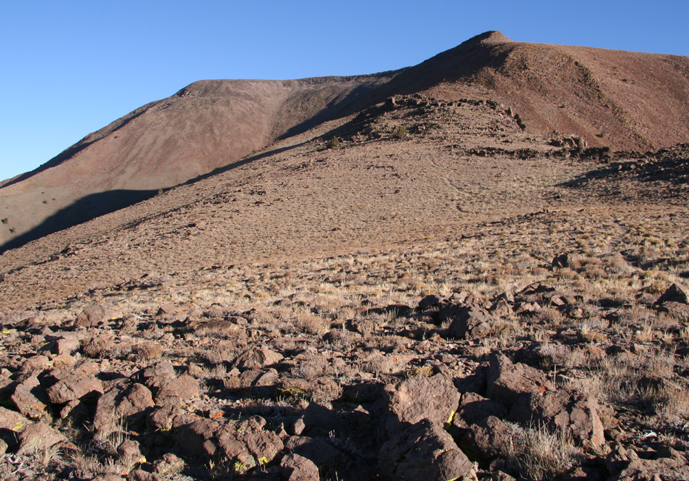
There seems to be no higher ground nearby, however, I realize that Star Peak must be the next
mountain across in the directin that the dirt road comes from. So I climbed the wrong peak in the
dark. Well, this can easily happen when your approach is to just go uphill and you do not know
where you started from. Fortunately, the saddle is shallow, about 60-70 meter down, ie. my first
summit is not really independent. I climb the new hill, it is gentle with a few rocks and grass.
I walk nearby a second antenna structure and head directly for a small band of rocks that must
consitute the summit. The daylight is coming fast now and I reach
the summit exactly at 0700 while
the east sky turns red
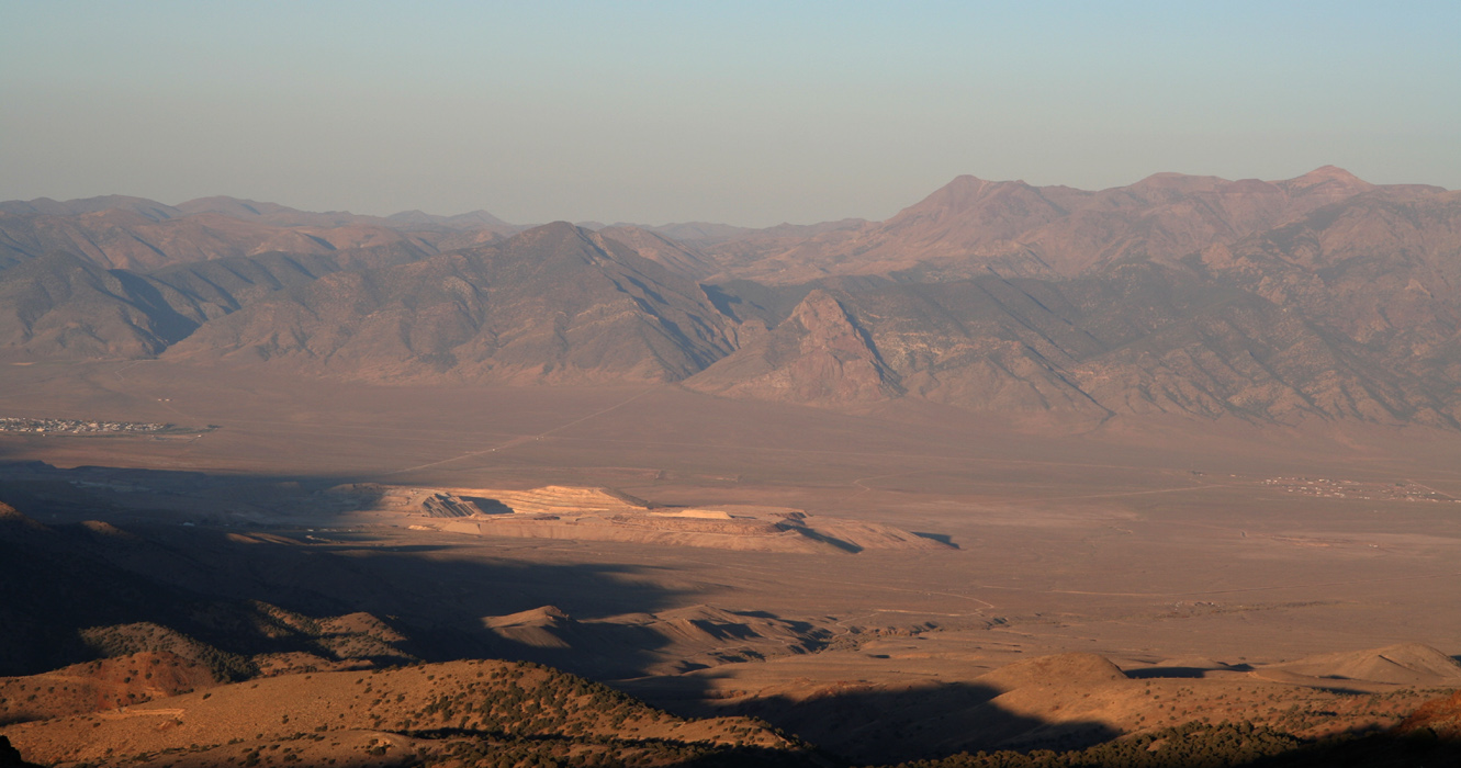
by the rising sun. I sign the register and look around. I-80 stretches
along the flat, there is also a quite long and
significant body of water on my west side.
I feel this is a good way to end my trip of four peaks. After all, quite an entertaining and
direct route. I have climbed 1000 net vertical meter in three hours, all in moonlight and having
made two detours along the way. With no trail and at times quite hostile vegetation, a YDS class
2 route.
After a good rest, I decide that the return shall be significantly easier since I now can see
much further downhill
and thus make a route that minimizes trouble with the vegetation. I return
more or less along the same route, but skipping the detours and
arrive back at the car by 0900.
The drive back to San Francisco is smooth, I make a brief stop at Donner Pass to take
a picture of Castle Rock
that I climbed back when I was living in Menlo Park, almost 30 years ago.
The day is completed by finishing up a few outstanding issues in Palo Alto, then enjoying a nice
dinner with my good friends Rob and Karen, many thanks are due for their great hospitality.