The following diary was written in the tent as the expedition
took place. A few sentences that just carry references to pictures
have been added after returning.
May 14.
Departure Day.
A lot of planning and uncountable hours communicating by email
or by the phone has come to an end. My visit to the Danish Polar Library,
my communication with The Danish Polar Center, permits, radio licence, insurance,
and a number of other details, it is all history.
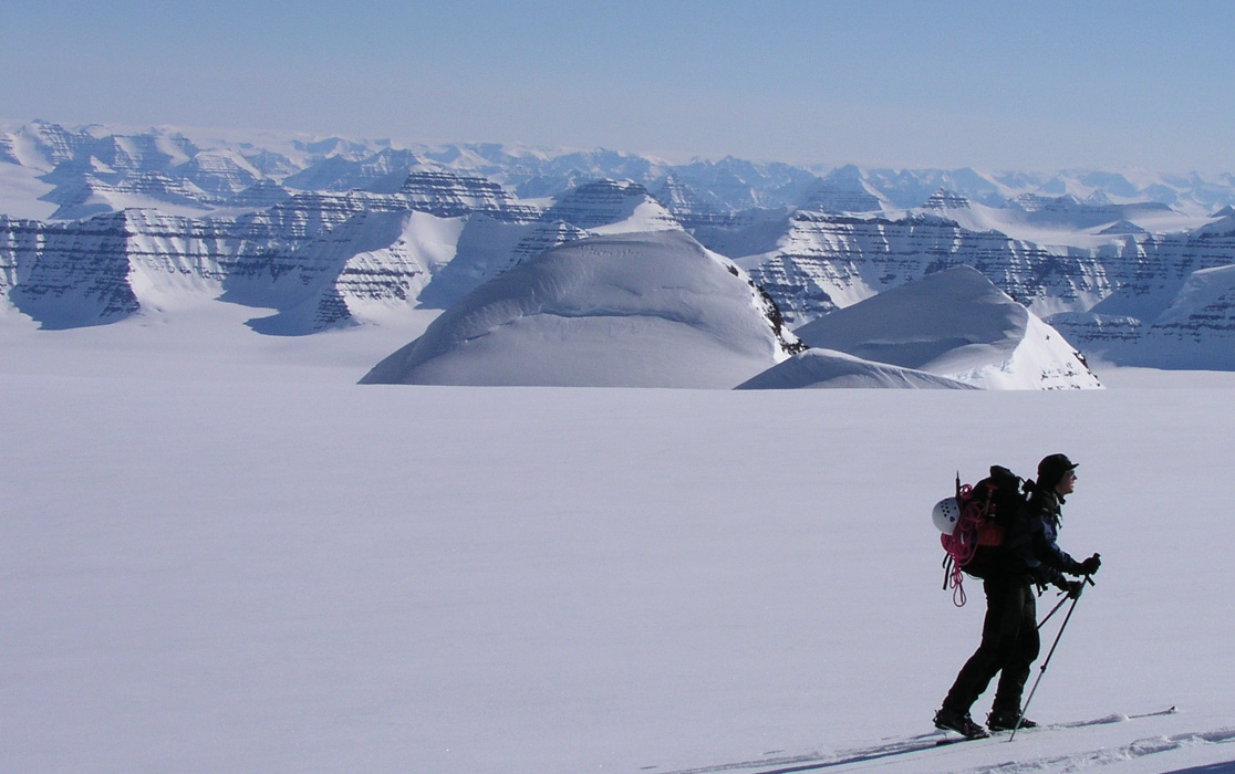
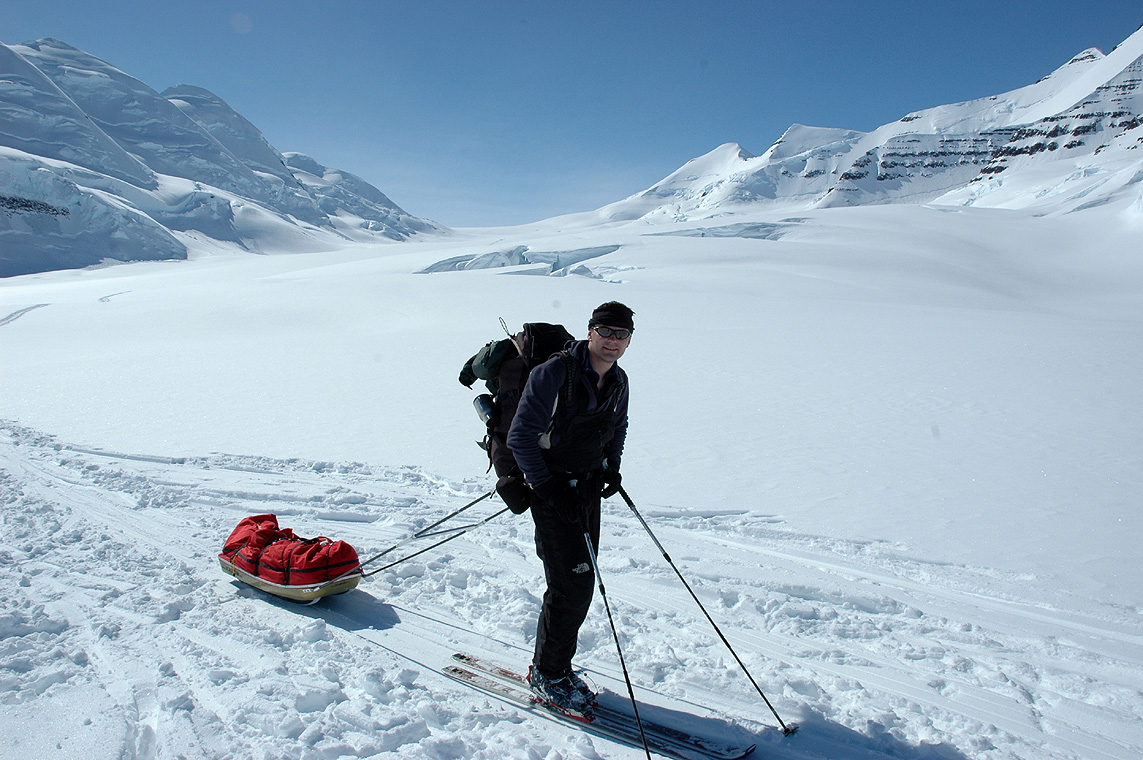
We are on the way, 6 boys from Bergen, Jan-Frode, Torstein, Per Ove, Ståle, Arnt
and myself. I am the only one that has been there before, they have paid a lot of money, will
this live up to their expectations? Only the days to come will show.
Our flight left Flesland, Bergen at 1200, noon, everybody showed up at 1100 as agreed,
except Ståle. Where is he? After getting increasingly worried, he showed at
1130, just in time as one says. I already made friends with the young lady at checkin, telling her
that ours was an expedition to Greenland, possible extra luggage/weight should therefore not
be an issue. The strategy worked, she was even a bit disappointed and exclaimed: "Is this all?"
when we finished checking 15 heavy pieces of luggage.
Our flight was delayed, just enough to make the transfer in Copenhagen a rush. Our flight
to Iceland was boarding as we reached the gate. What about all our gear?
Copehagen airport has pulled miracles before, today was no exception. The friendly Danish ground
crew invited me down on the tarmac to see that indeed all our checked luggage made it
safely across from the Bergen flight to the Icelandic airplane that would carry
us to Iceland. Needless to say, it is critical that we do not loose
luggage on the way to Iceland.
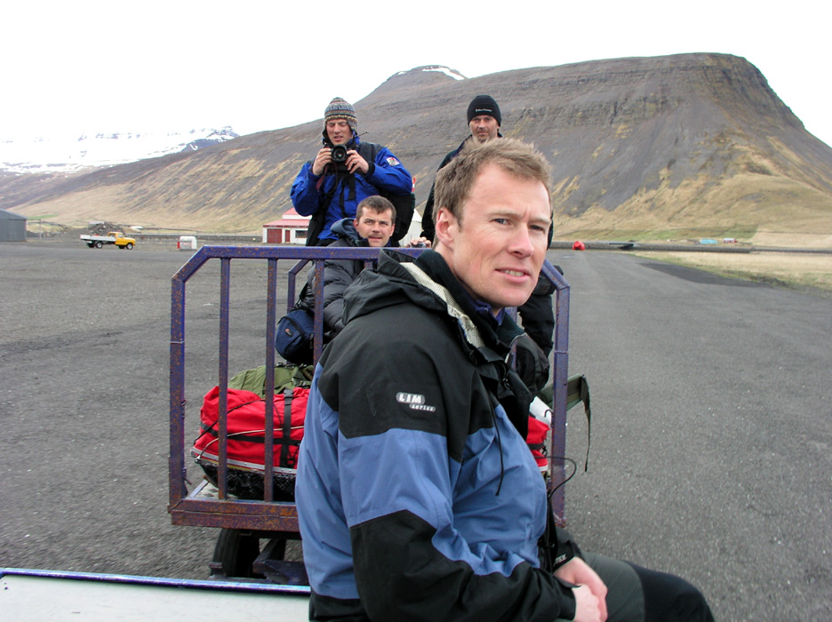
Arrival in Keflavik after 1530, local time. This will indeed be another
close call. Our flight to Isafjordur leaves at 1630 from the Reykjavik local
airport, this airport is 50 kilometer from Keflavik!
The boys are waiting for the luggage while I run out and locate the taxi
that Fridrik has booked for us. Then a call to Fridrik, can the flight
to Isafjordur wait? Then rush back through customs in reverse, this called for
some polite smalltalk with the local head of customs, strictly against
regulations, but since this is a Greenland expedition..
Long at last, there is the luggage, however the time is passed 1600 when everything
is loaded in the taxi. This taxi could have been larger. An extremely overloaded
van with the 6 person G4-team, skis and 15 large pieces of luggage.
Ready to go, then a clear voice: "Jan-Frode, where is he?"
We are missing a man! I run back into the terminal building and quickly
locate Jan-Frode, back into the car and we drive off, - fast. Fridrik calls
back and say they will hold the plane, but we better hurry. Our driver does
his best, we are overtaking a bus, slowly. It seems like we could talk to
every passenger in the bus before we finally succeed. Our van is overloaded and
barely able to go about 100 km an hour.
The time is now 1630 and we are nowhere close to the airport. In fact, we are
stuck in traffic, rush hour in Reykjavik, never heard of it, but indeed there is
no question about it. Violent ringing in the cell phone of our driver, where are
you? Heavy traffic is our answer, about 15 minutes later and the traffic is moving better,
but we are still a bit from the airport. More RING RING RING in the phone, YES, YES, YES,
almost there..
Finally, we are there, fifteen pieces of luggage, people are stressed, we get our
boarding pass, but there is a bit confusion. Nobody is able to keep track of the
luggage. Arnt expresses deep concern for his bag, where is it, has anybody
seen it, etc. We get on board. The plane is filled to near capacity of 30-40
impatient passengers. They have already been delayed significantly.
We are airborne, the Captain offers his apologies for the delay, only in
Icelandic. We recognize a story about some Norwegians headed to Greenland
as the primary cause of delay, the other passngers were not amused.
The approach to Isafjordur airport is interesting. The airplane must fly straight
towards a ridge from a nearby mountain, pretty close for being a big
commercial craft, then bank sharply left and subsequently touch down on
one of the lesser known airports of the world.
The taxi to Aslaugar guesthouse cost 3000, after checking in we quickly located the
only pizza place in town. Lamb and beer, I quickly ran out of my first 20.000 Icelandic
crowns and paid another visit to the ATM in order to cover the bill.
Tomorrow is a critical day, we must have weather for the flight to Greenland.
The Tromsø group, lead by Espen Nordahl, that is heading the same way has been
stuck here for five days, they finally flew out yesterday. I buy food for tomorrow's
breakfast, then sleep.
May 15.
We fly to Greenland.
We get up around 0700, breakfast then getting organized for the
flight. I call Fridrik at 0930. He had no report from Espen, (he had hoped to
get the local weather from the Tromsø team), but satelite pictures and
the general forecast promised acceptable weather.
We have a go for the flight! We can expect the Twin Otter from Akureyri around
1100. We shall be ready by then at the airport. There will be one or
two flights depending on a decision by the captain. Our advance cargo, two big
boxes, are in the hangar. They must be opened and repacked.
The hangar is open
and we start working. An employee of the airport comes by and asks us to
work inside the hangar. The enormous hangar door has collapsed twice already,
he informs. We quickly follow his advice, to have the entire team wiped out in
a hangar door avalanche would not be good.
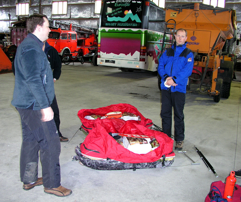
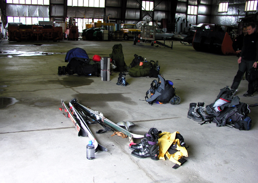
We prepare for two flights as the maximum payload to Gunnbjørnfjeld base camp
is 700 kg. Torstein, Jan-Frode and I shall go on the first flight, the other three
on a second flight. The gear
must be distributed such that we can operate
independently for several days in case of different landing sites combined with
bad weather. We are indeed quite busy
and anxious to know before the plane arrives.
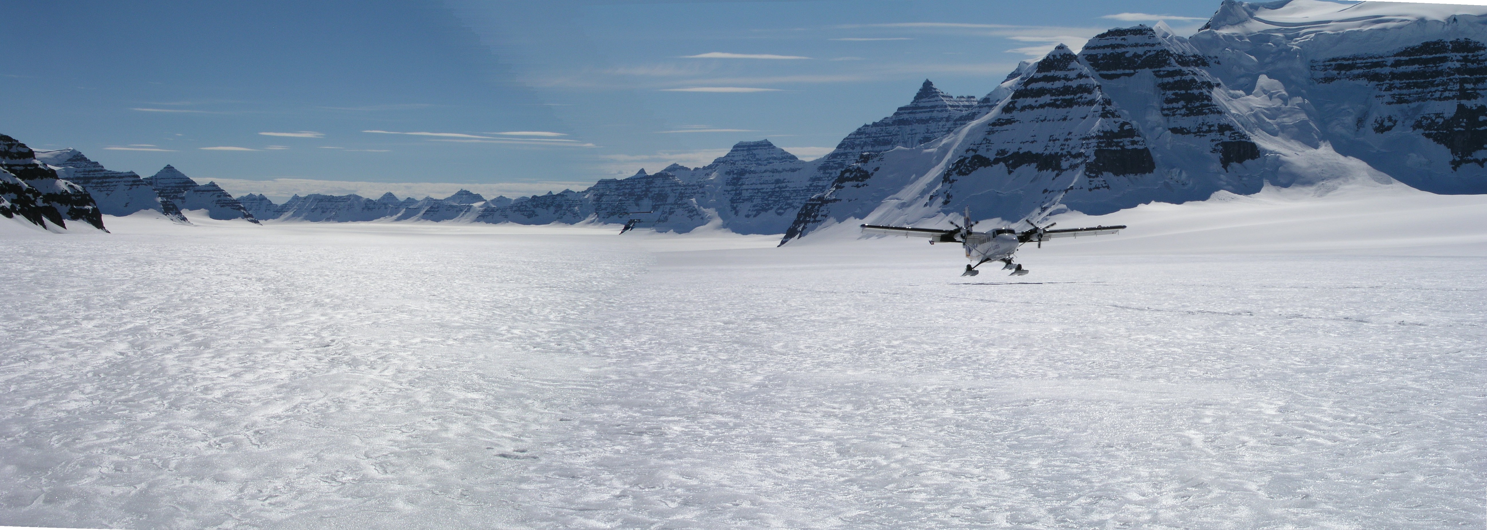
The Twin arrives at 1115. The captain, same guy that picked us
up in Queen Lousie Land in 2000, says he will take everything in one go.
That is 800 kg payload. Well he certainly knows his way, more than 20 years
of wilderness flying in East Greenland. When he picked us up in 2000, we had
fog forming a very low cloud cover. He flew far inland above the main icecap,
located a hole in the clouds, landed, then skied the Twin all the way back to
our camp for a successful pickup.
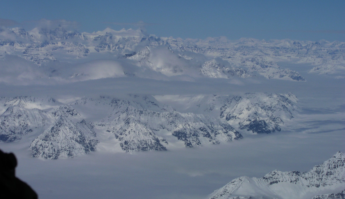
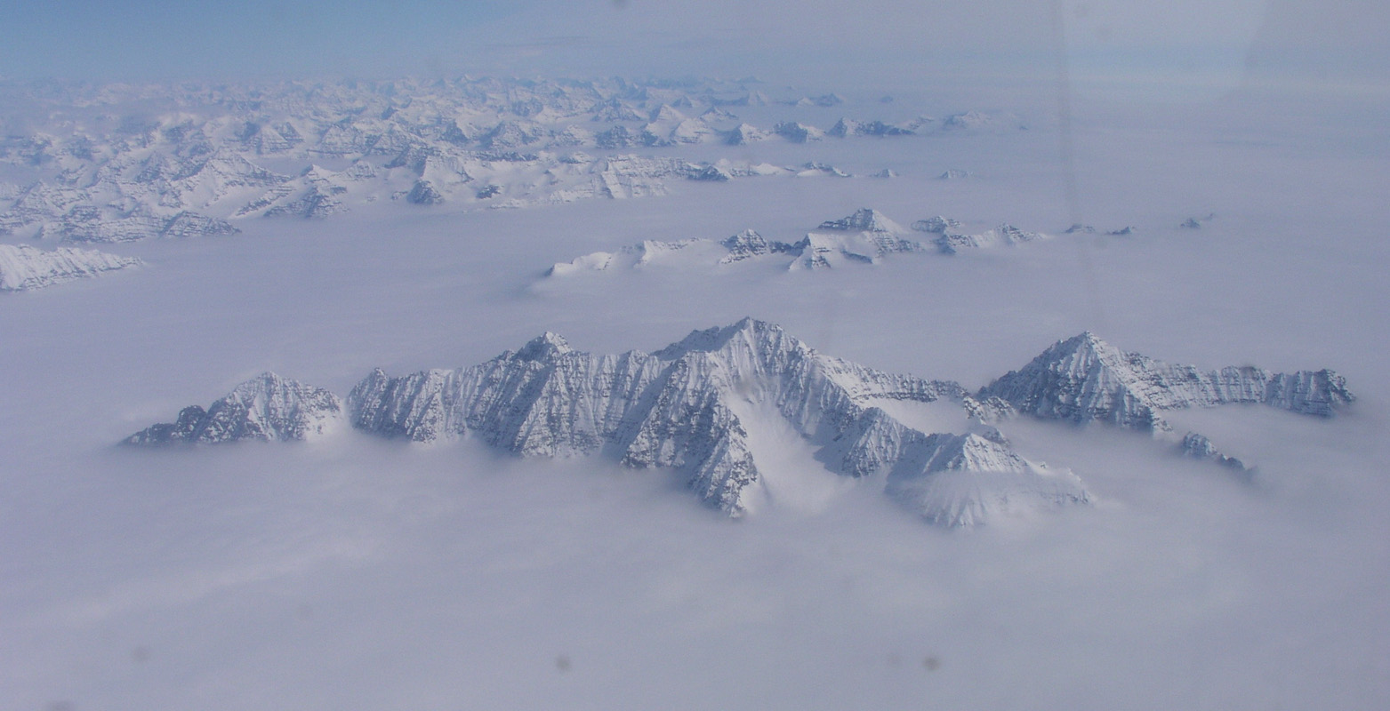
The flight turned just as spectacular as previous flights. Only 1:45 flying time above
a pretty dense cloud cover until we reach the coast, but then just perfect weather
with peaks and glaciers
as far as one can see in
all directions.
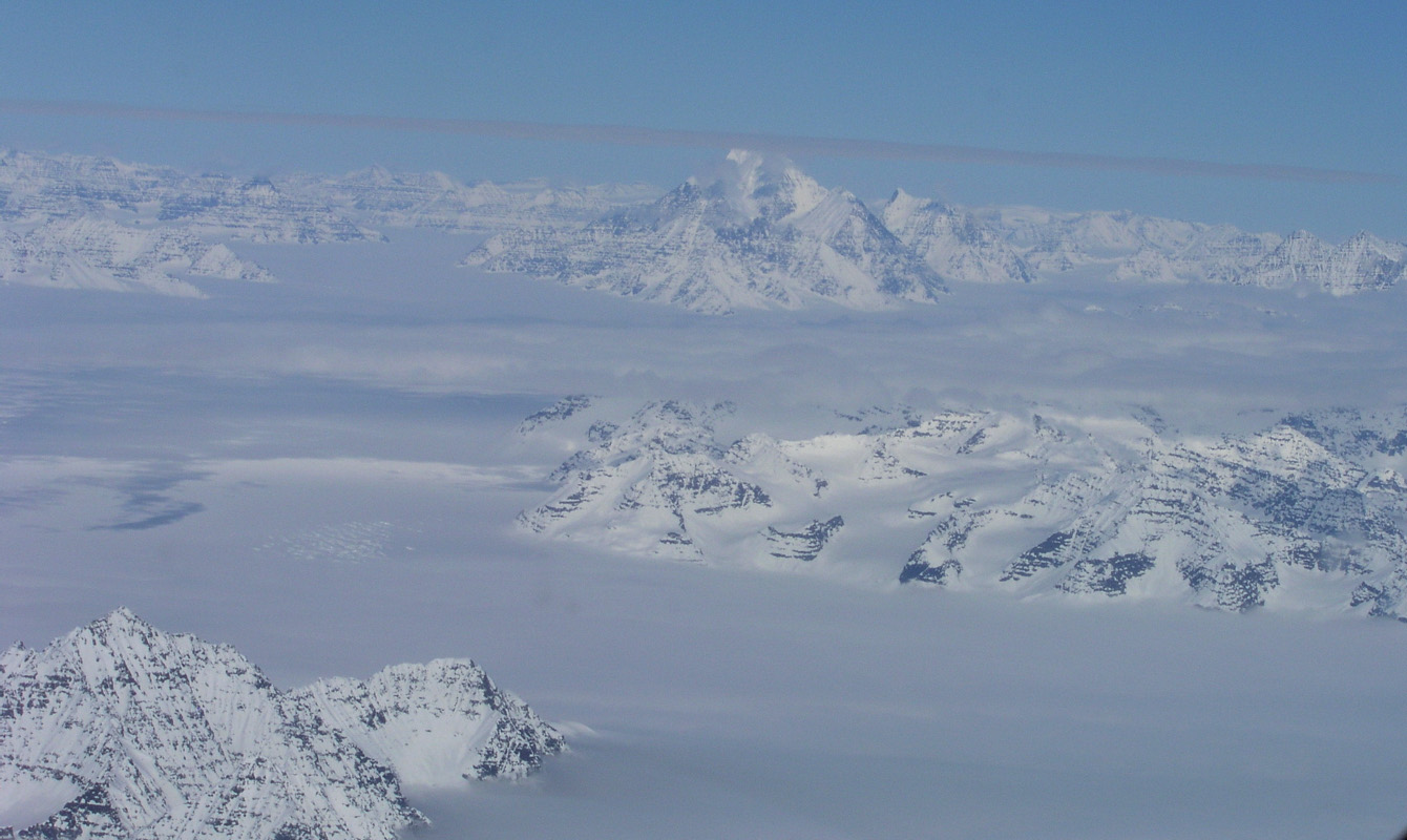
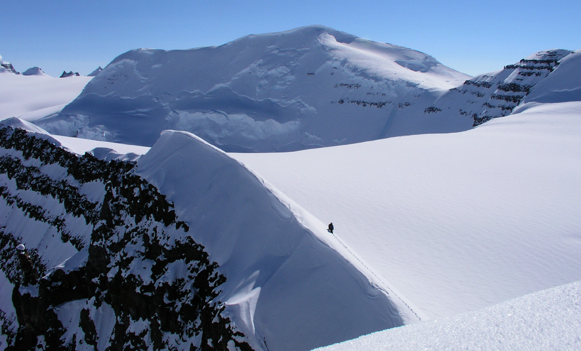
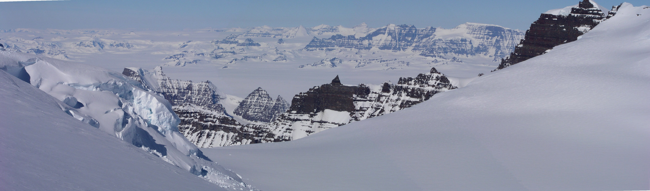
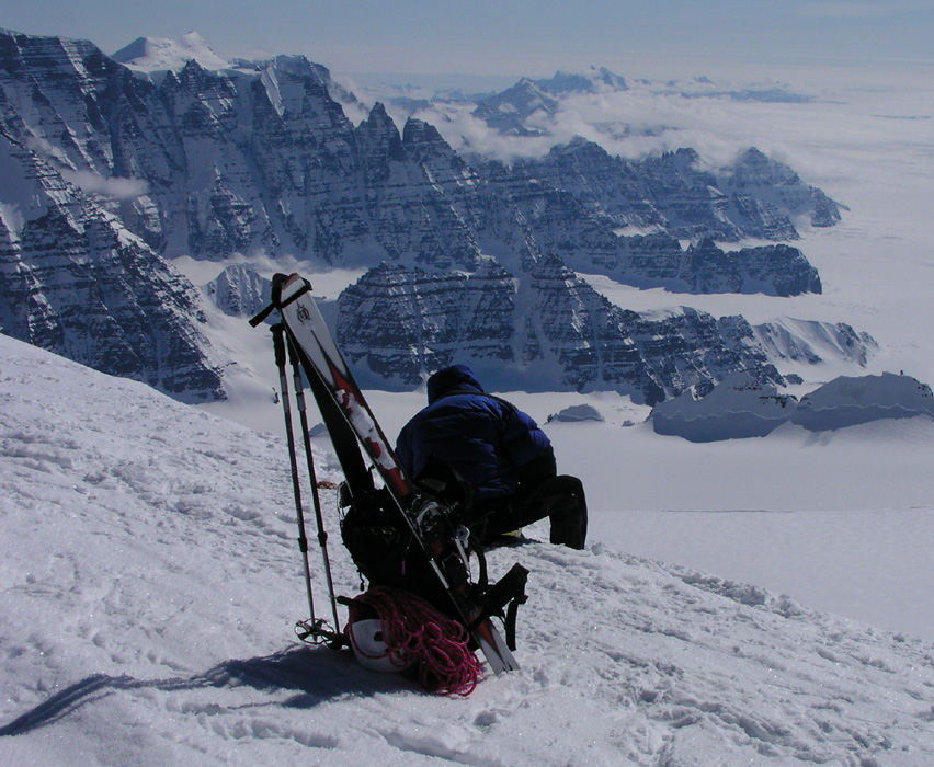
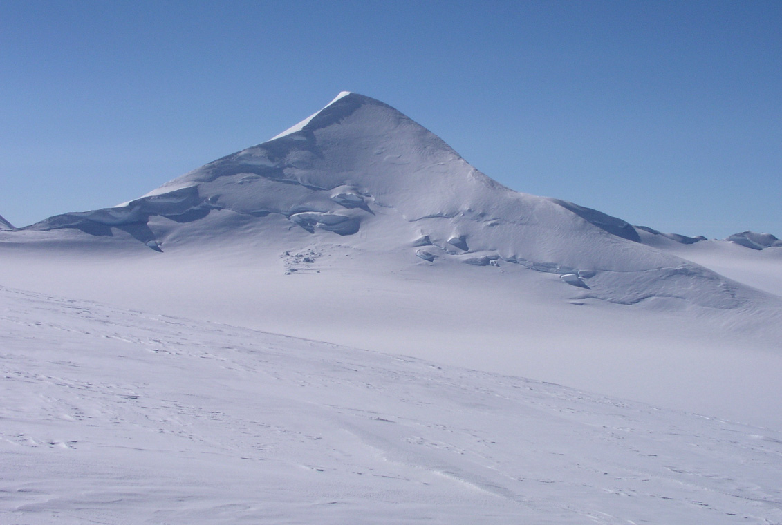
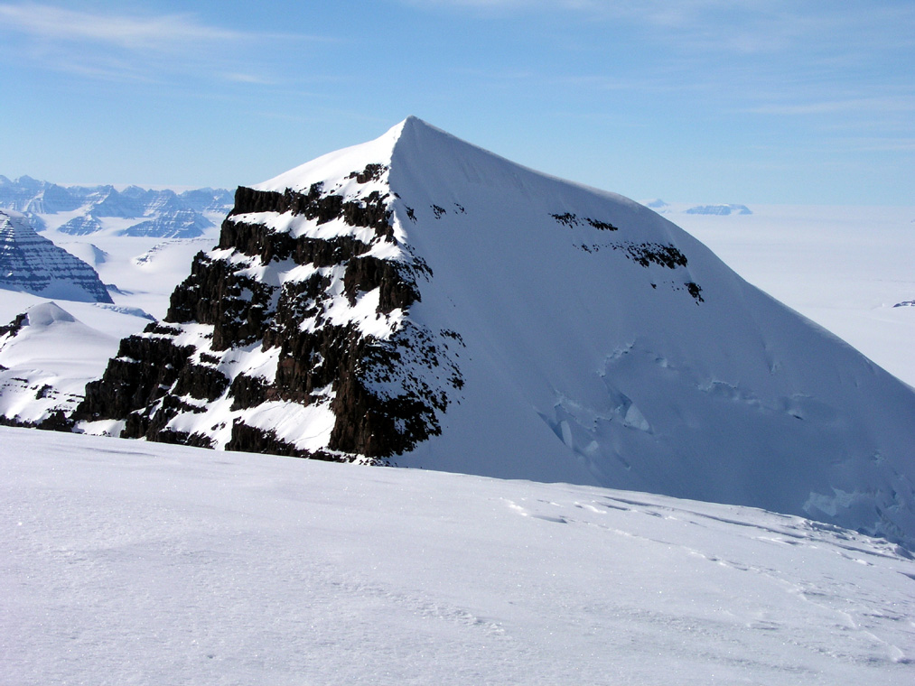
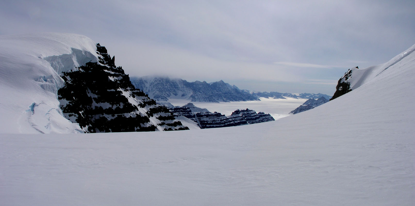
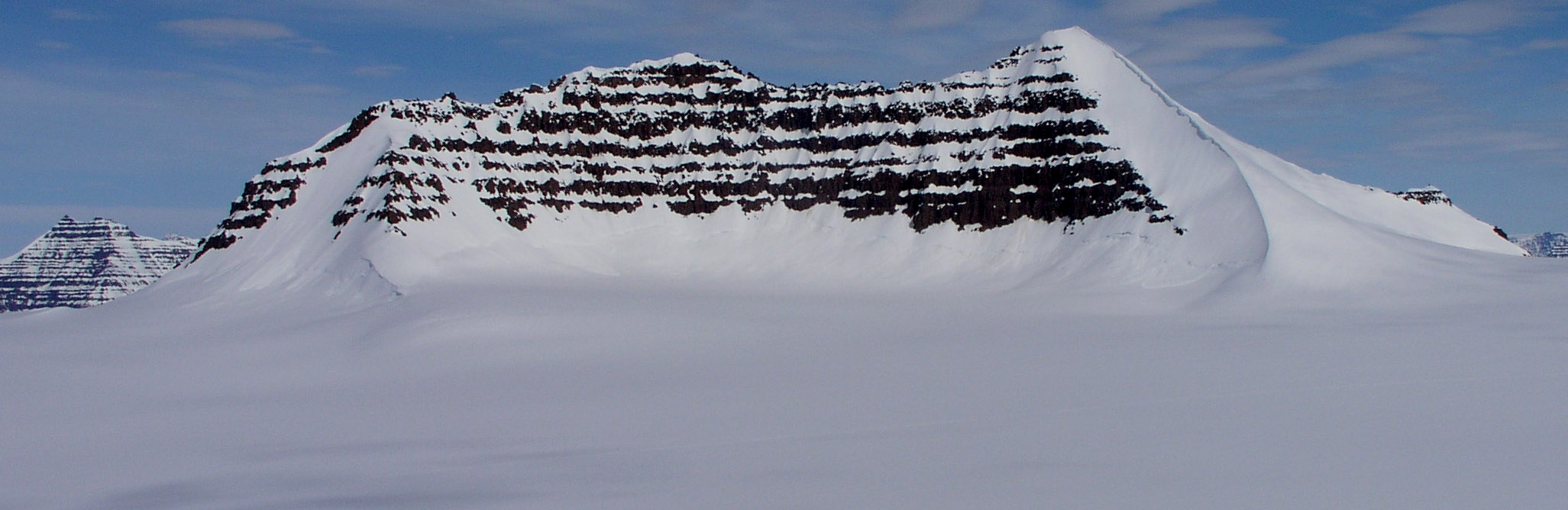
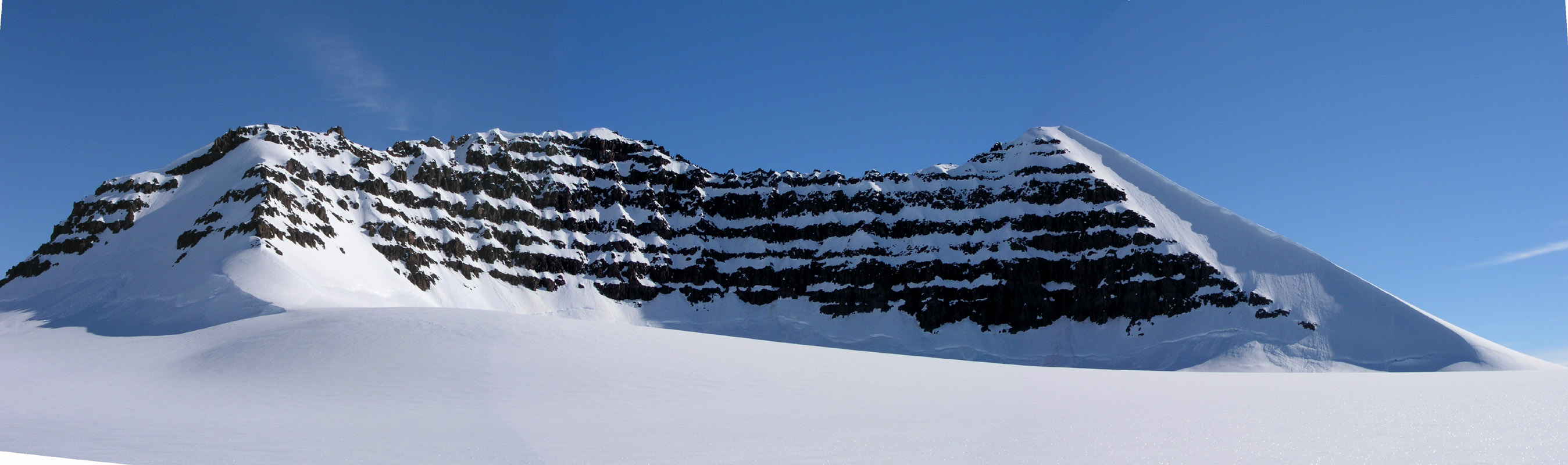
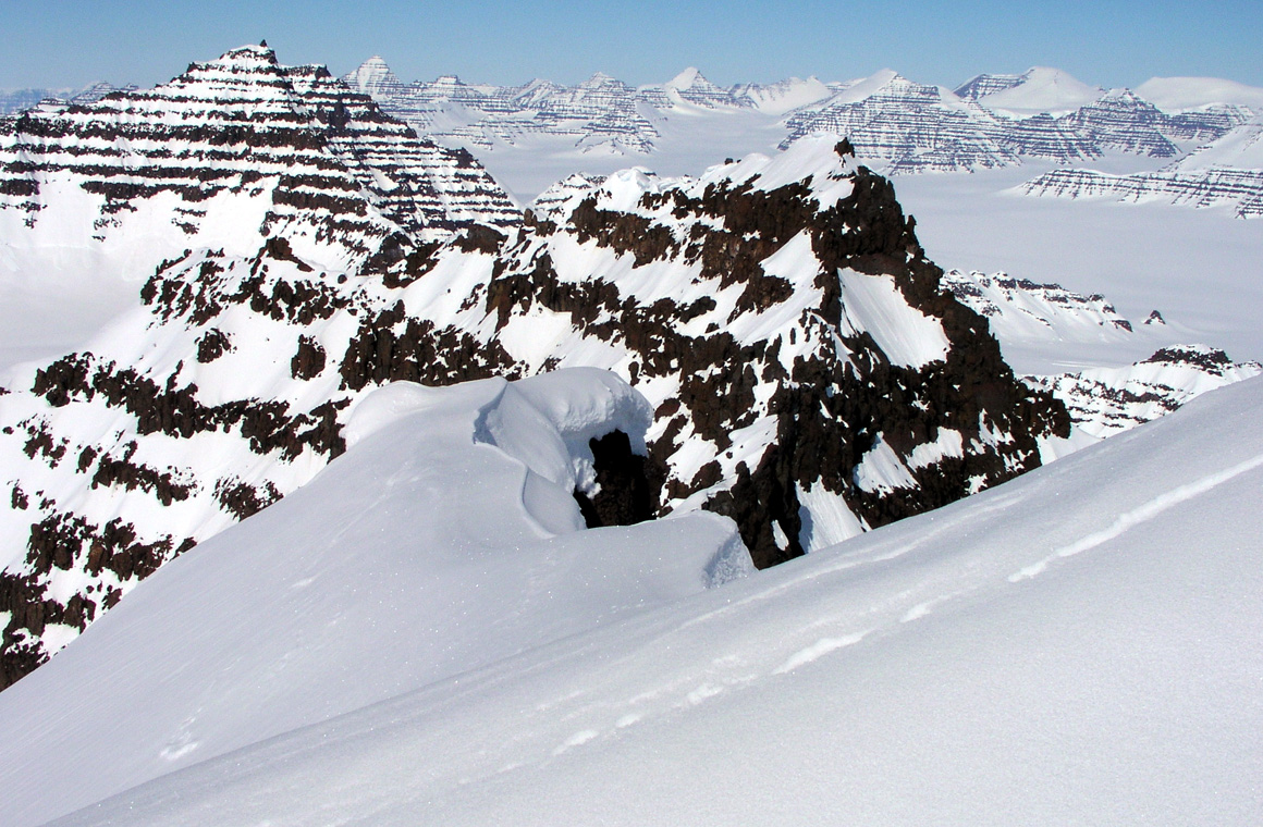
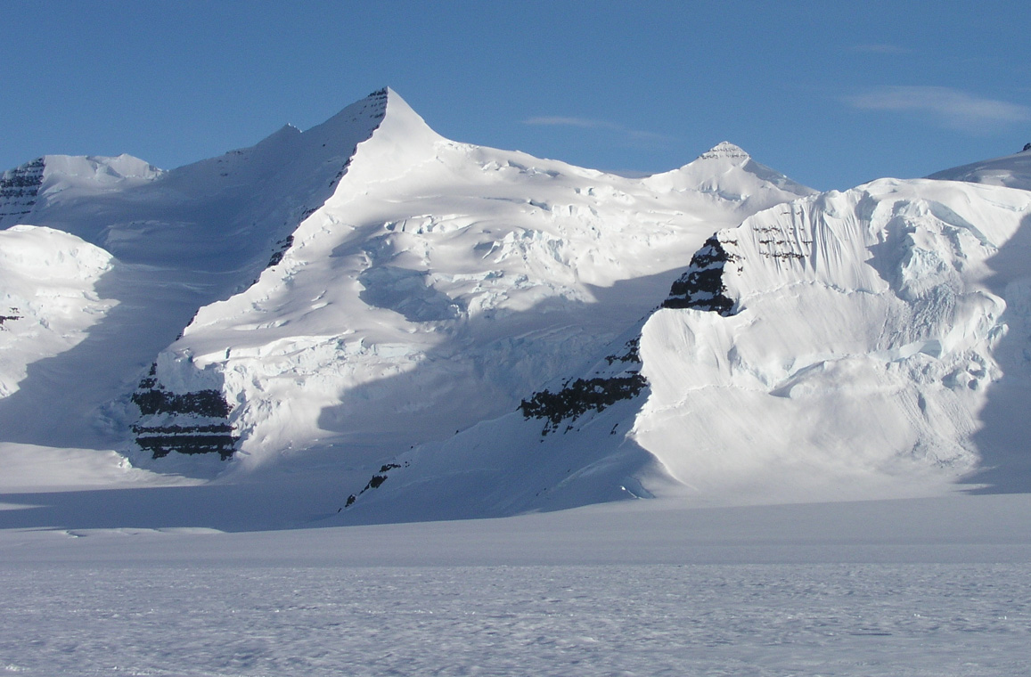
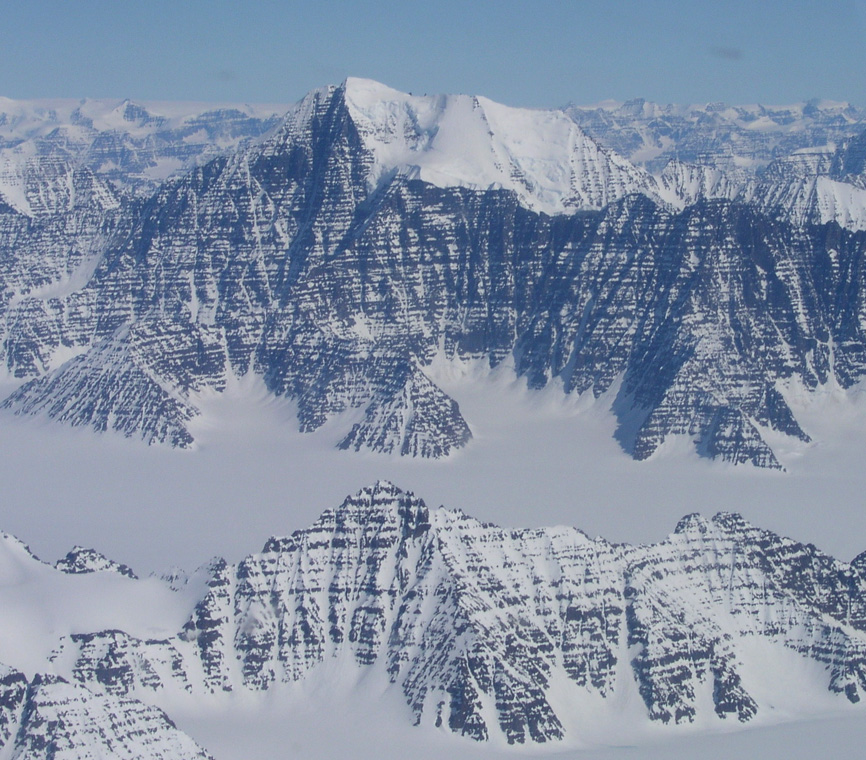
Shortly before getting into the Watkins, we catch a good view
of Ejnar Mikkelsens Fjeld a very huge and impressive
mountain slightly to the north-east of the Watkins range.
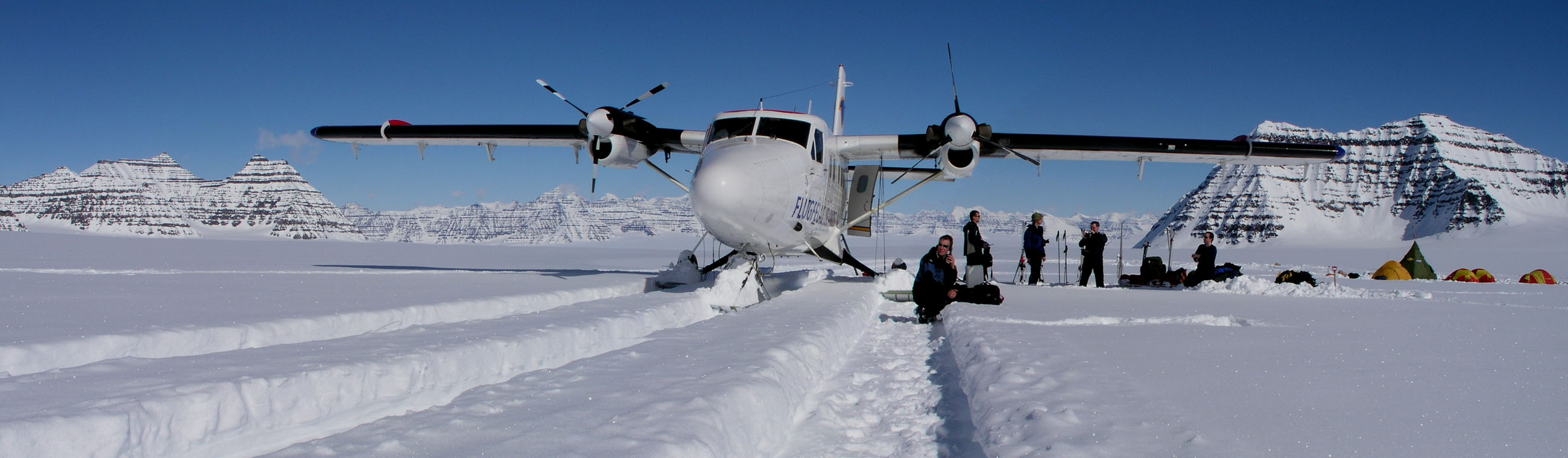
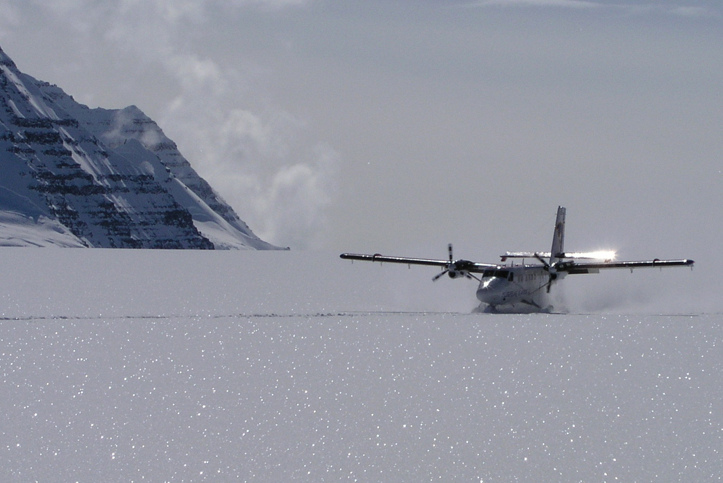
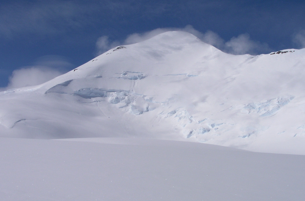
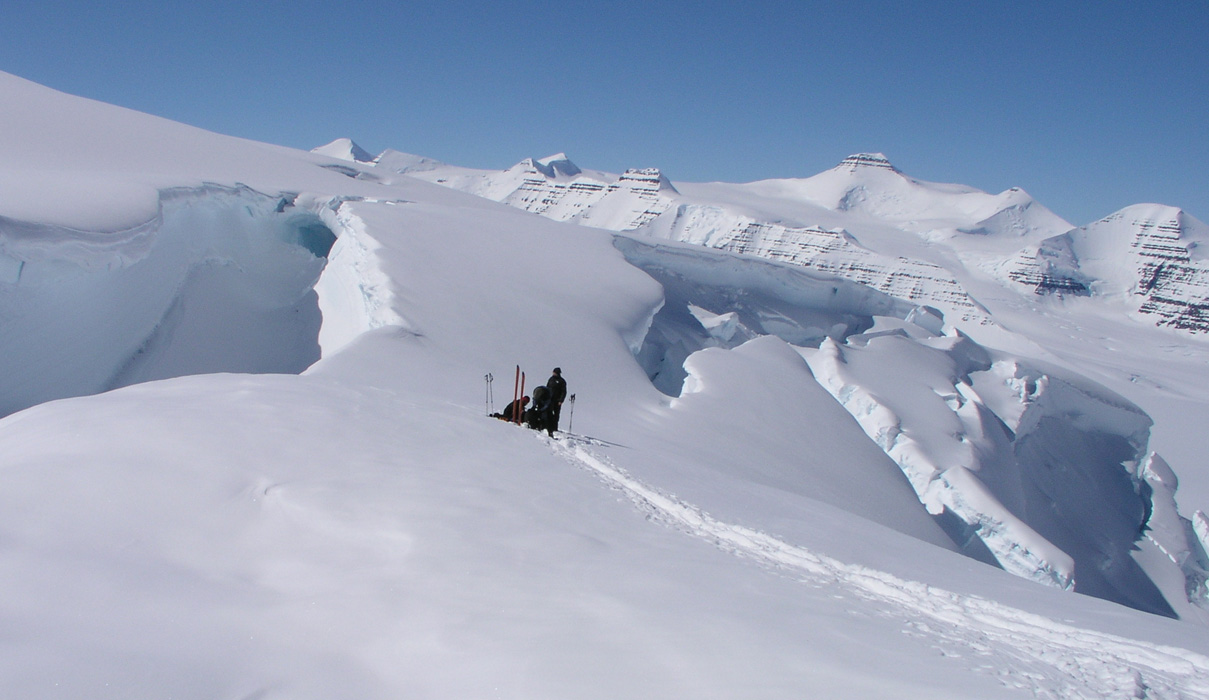
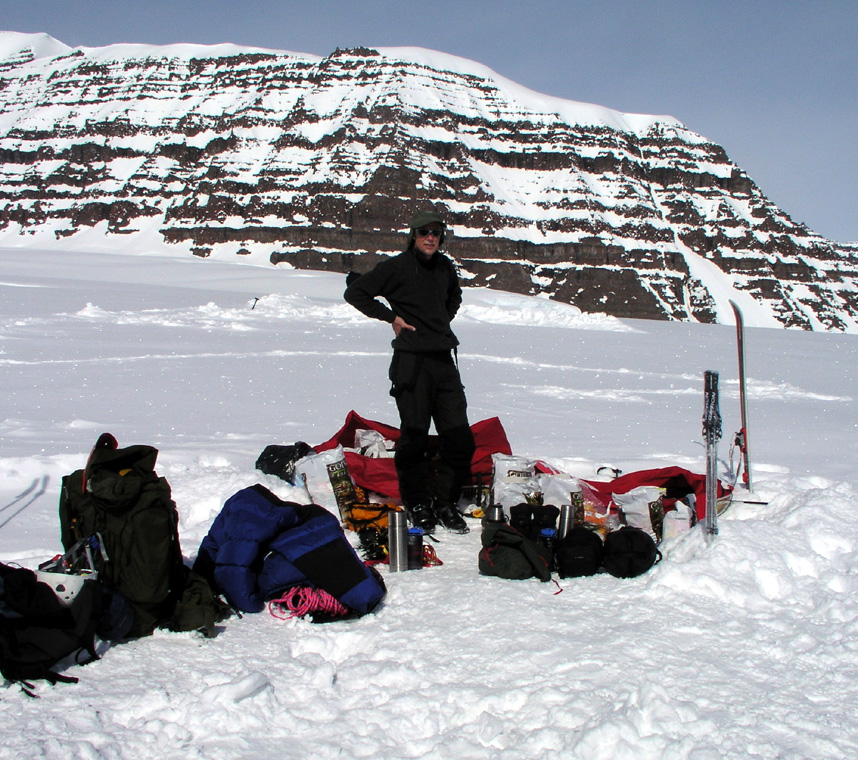
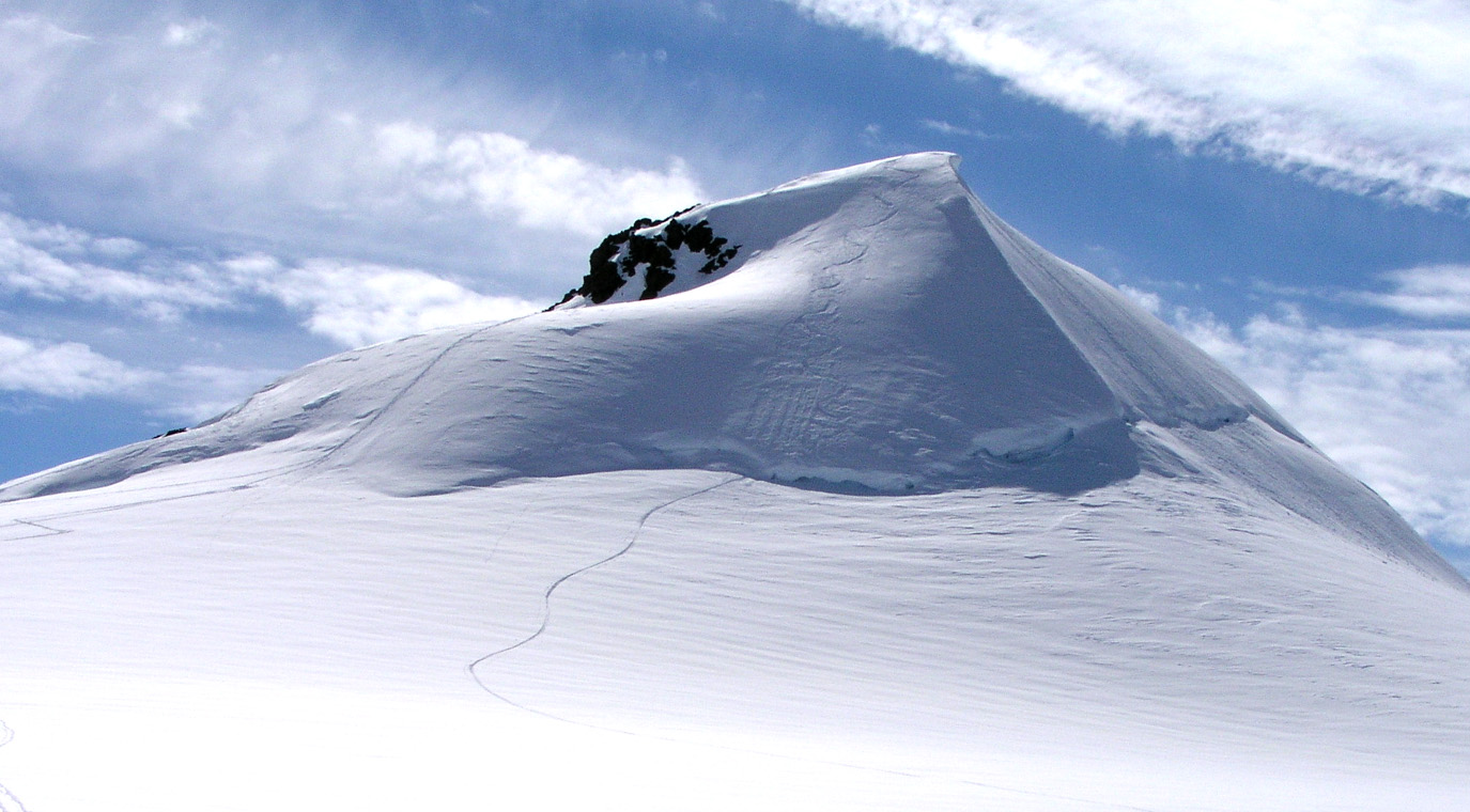
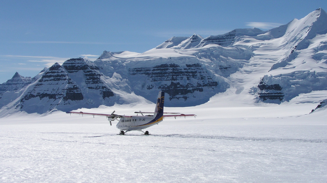
We touch down at Gunnbjørnfjeld
near the base camp
of the Tromsø team, at 1315 in fantastic weather and
a full, half meter of superdry powder. A softer landing is difficult
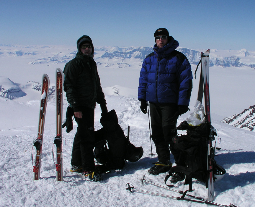
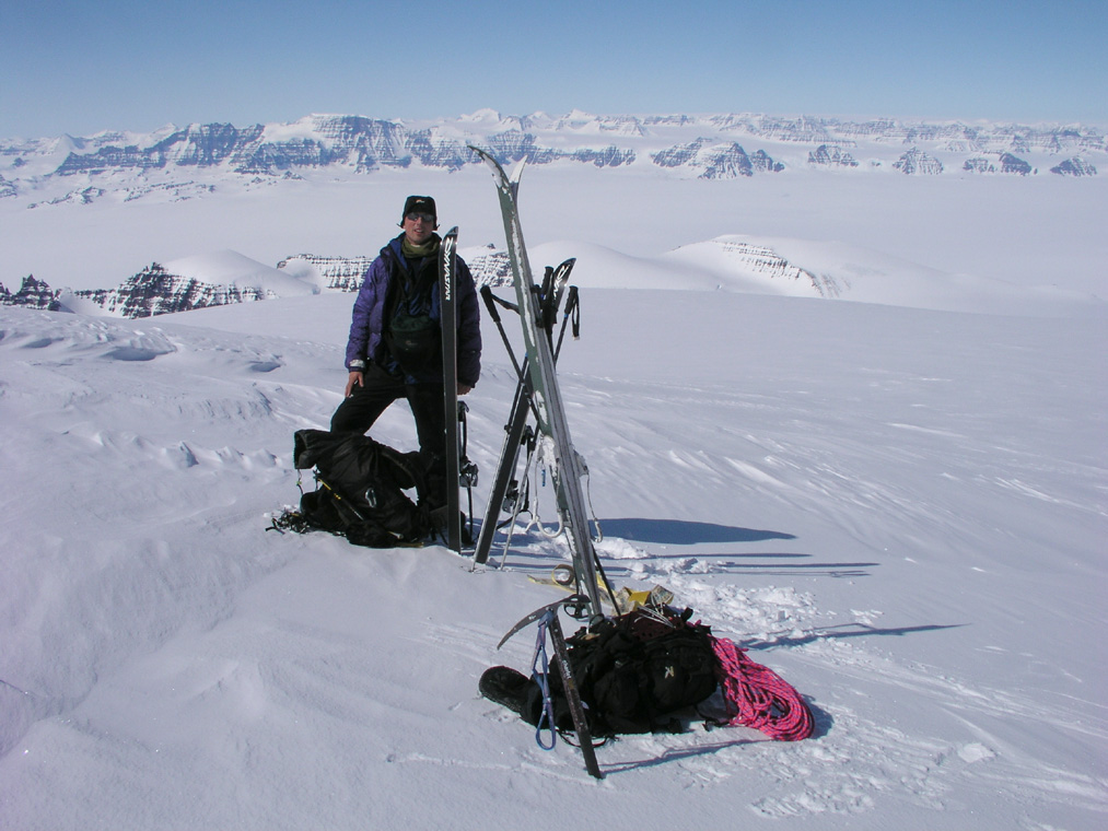
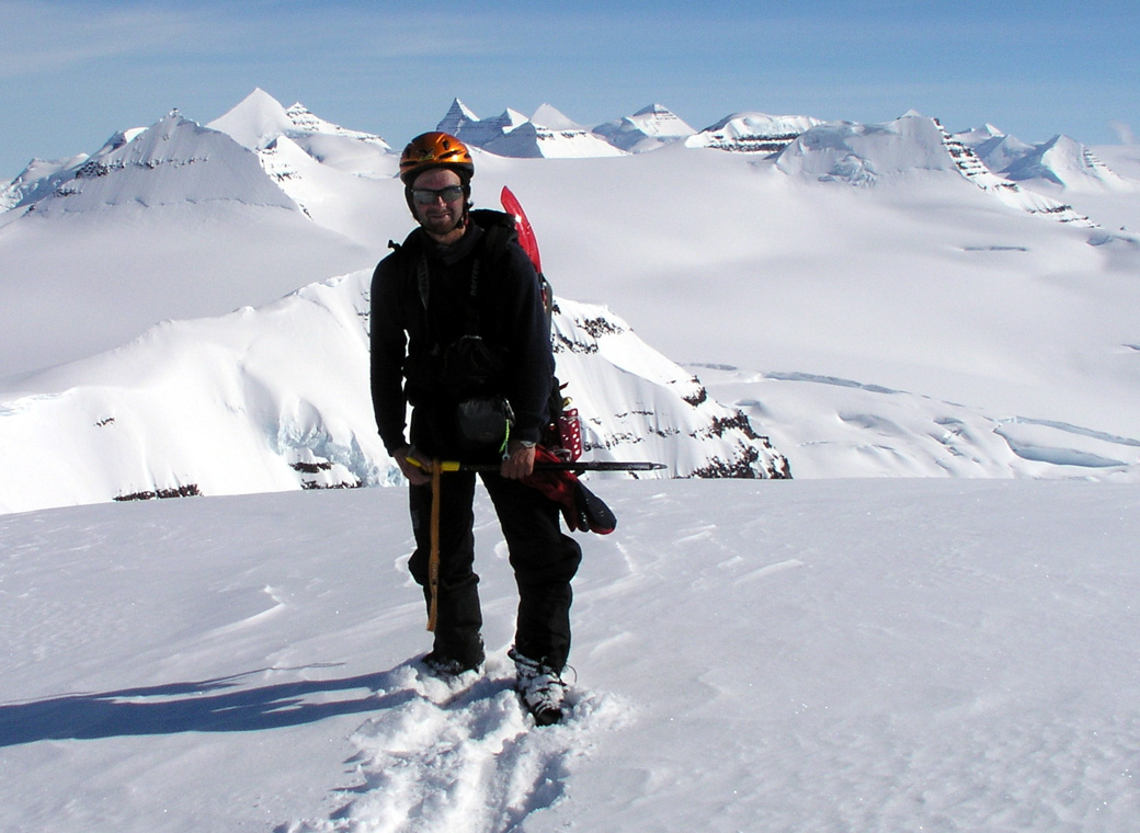
to imagine. We quickly unload the plane and shoot some pictures of the team in front
of the Twin for sponsor purposes.
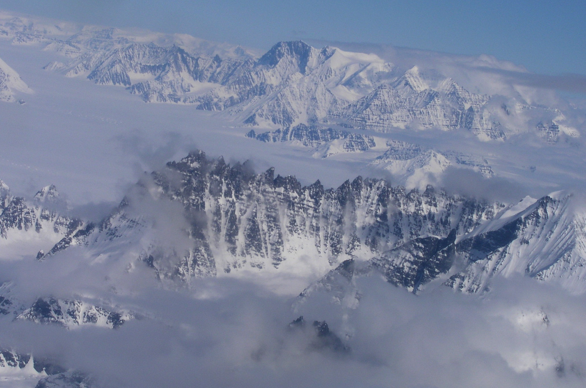
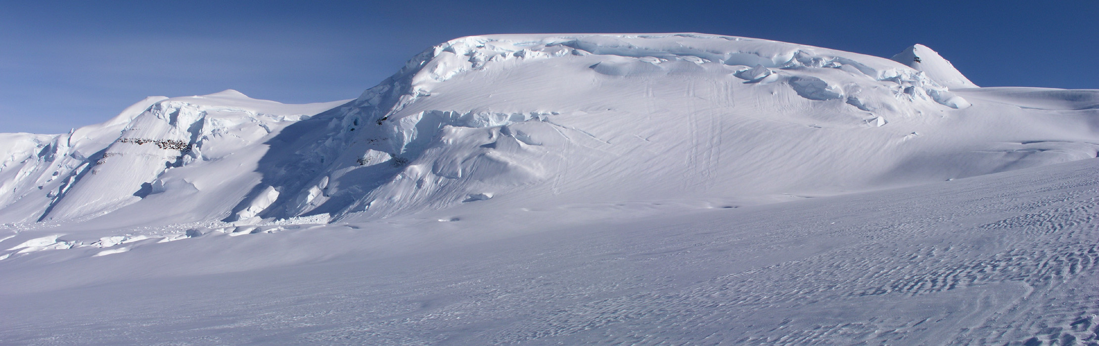
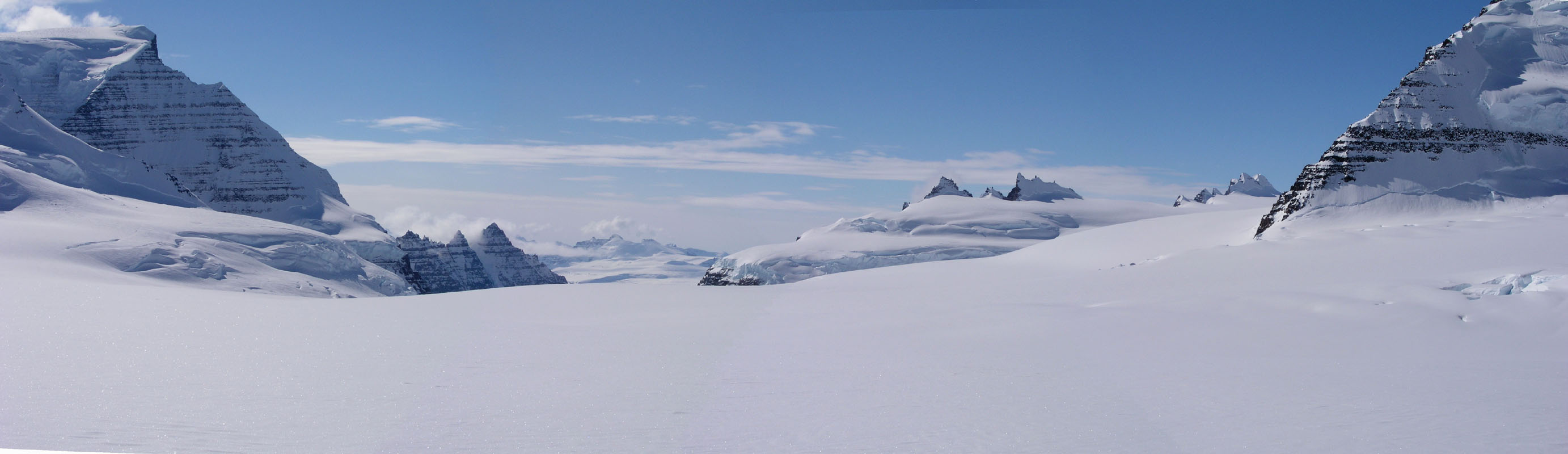
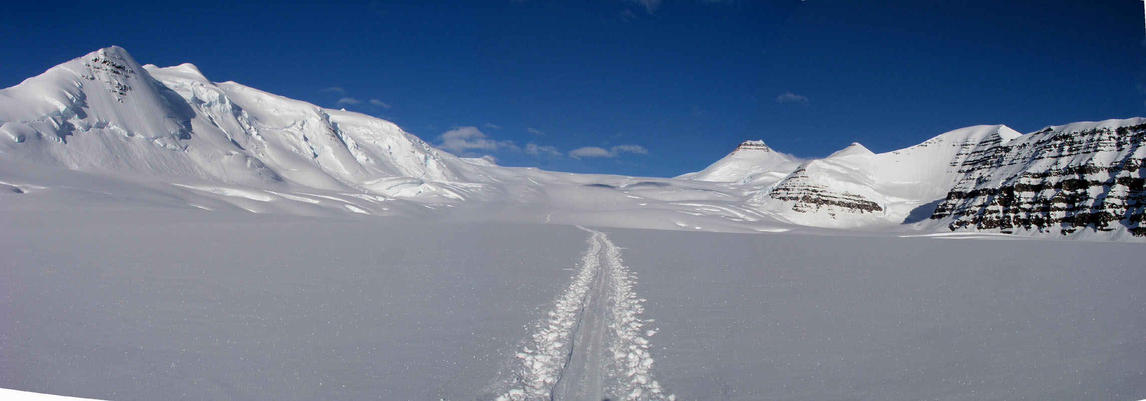
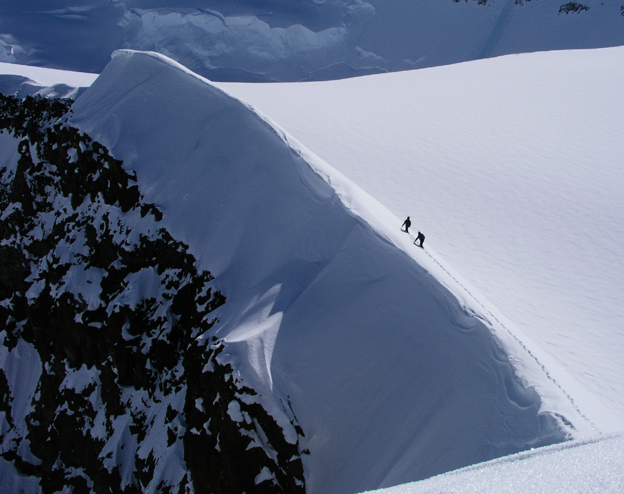
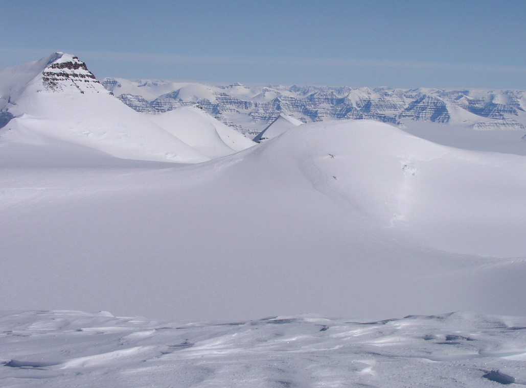
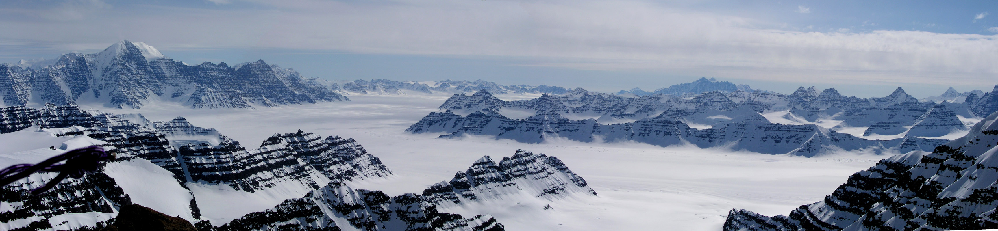
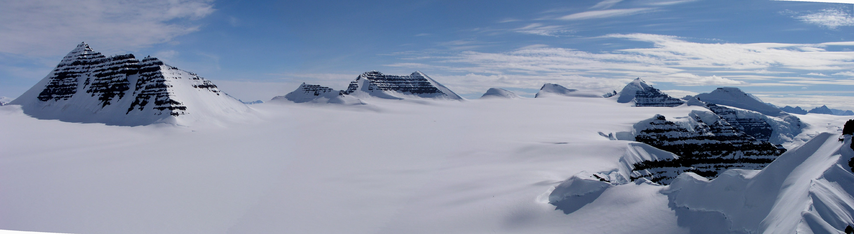
What a scenery that unfolds in front
of us,
a long glacier leading up
to Gunnbjørnfjeld,
the Tromsø team has made a single ski track
that way. Further left, first an impressive ridge, then in the distance an
even bigger ridge. This impressive ridge leads up to the second biggest mountain in
the Arctic, Dome, but the peak is not visible from our location.
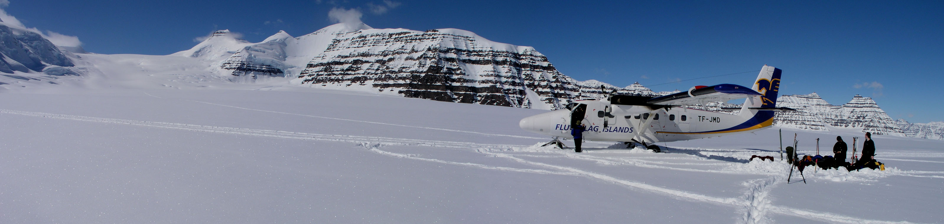
The Twin Otter is actually a bit stuck in the
deep powder, the first attempt at moving is unsuccessful despite a roar from the
engines and a local snowstorm behind the plane. The captain jumps out with his
big rubber hammer, this is not a first and the remedy is known. A few blows to
the skis in order to shake things a bit loose, then a second try. This time the
airplane shivers, engines thundering and the bird moves, first slowly, then around and
across to the tracks from the landing. With a roar the Otter is airborne and gains
altitude, turns between us and Gunnbjørnsfjeld, waves goodbye with its wings and vanish in
the distance. Silence, landscape, Greenland, we are ready to start our 16 days in
this arctic wonderland.
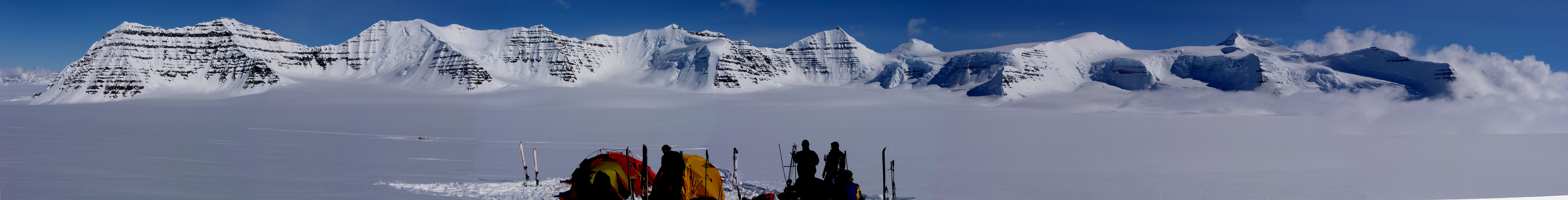
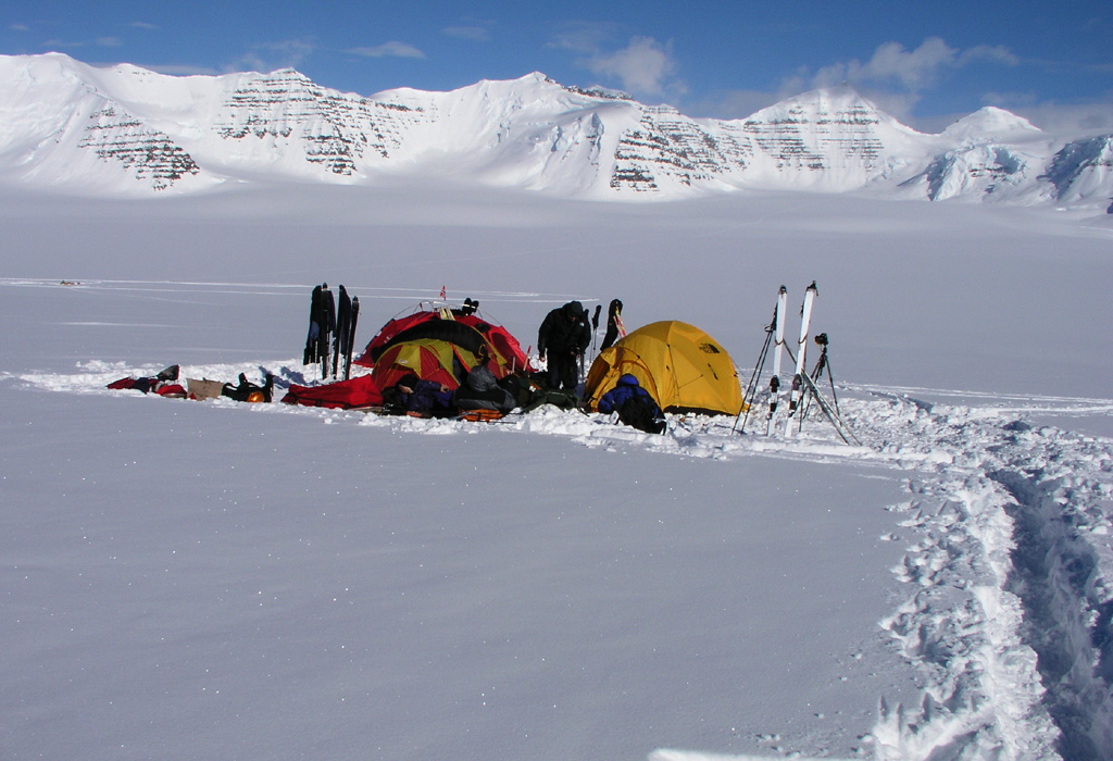
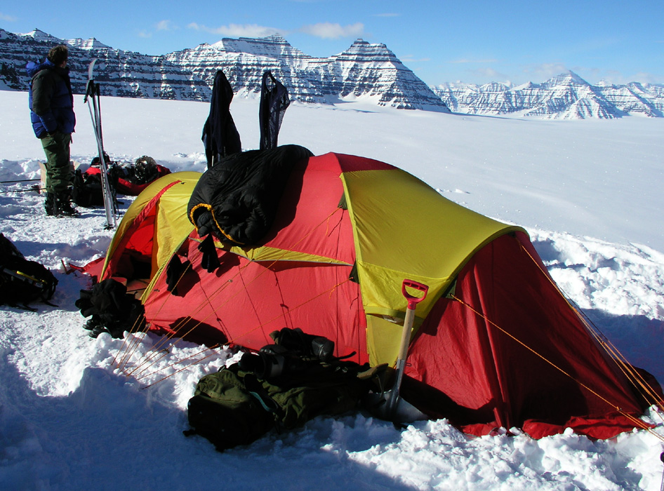
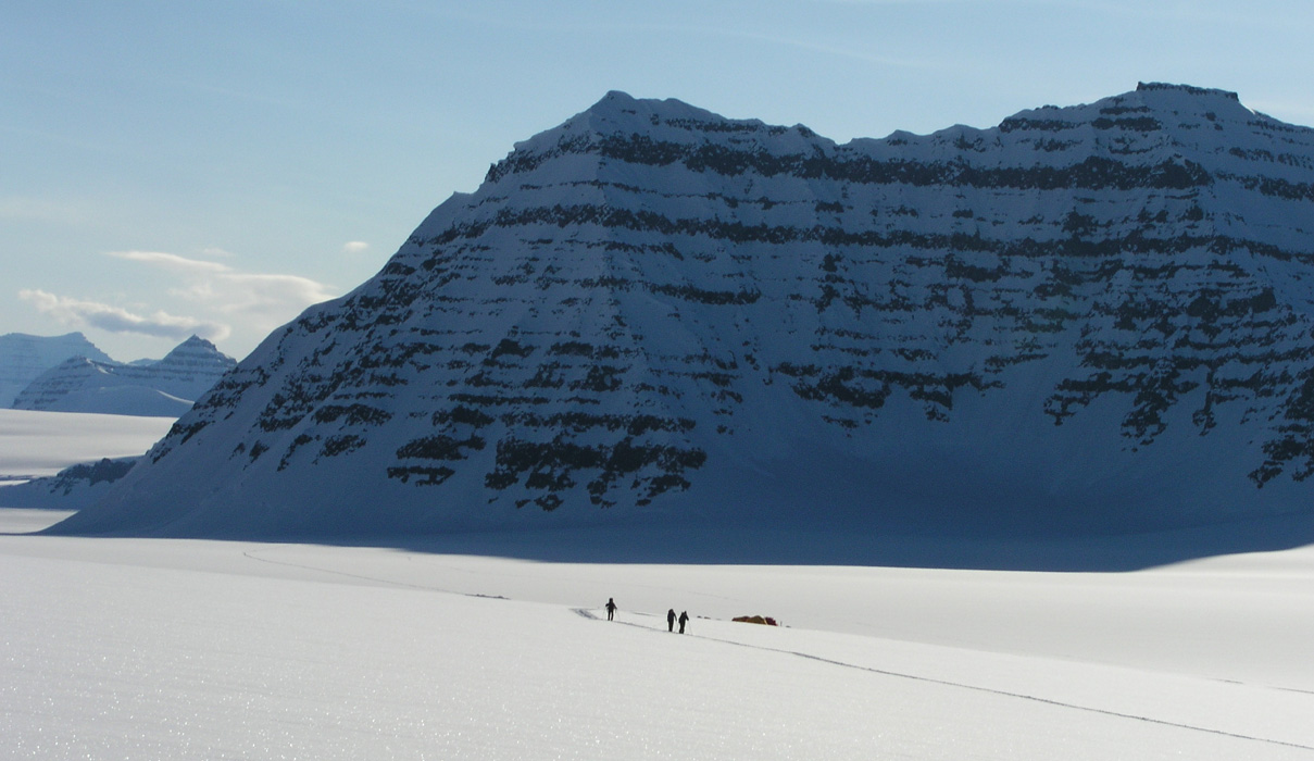
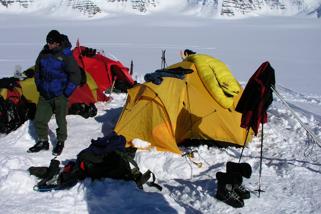
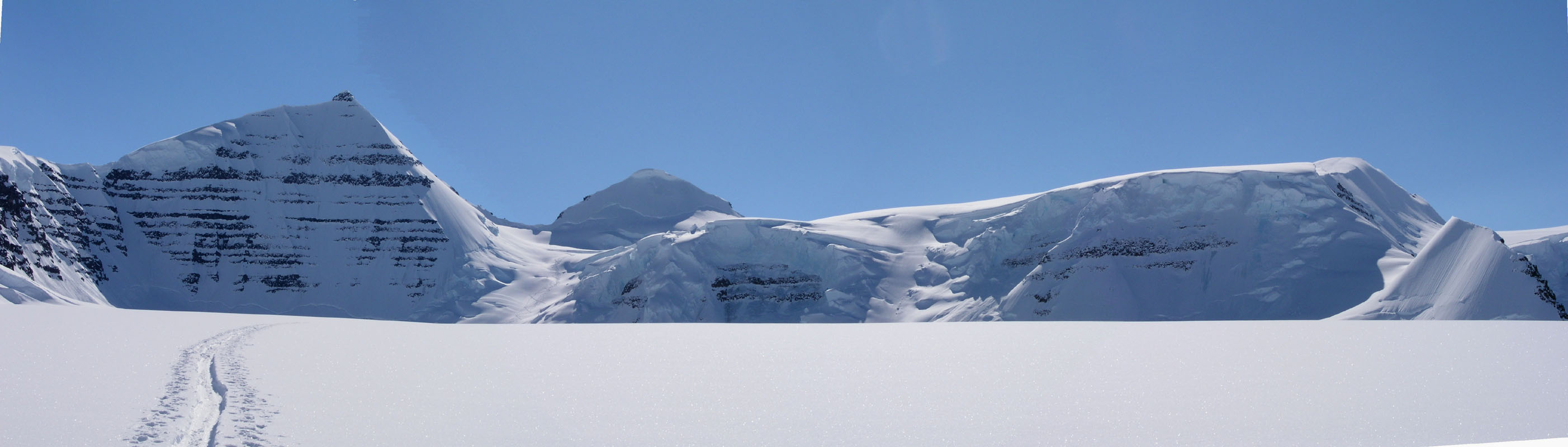
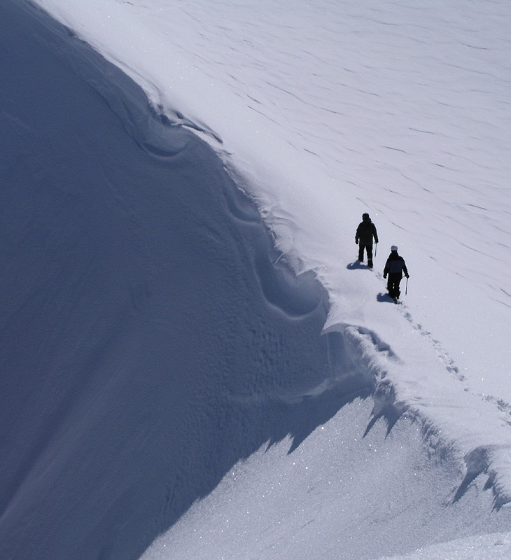
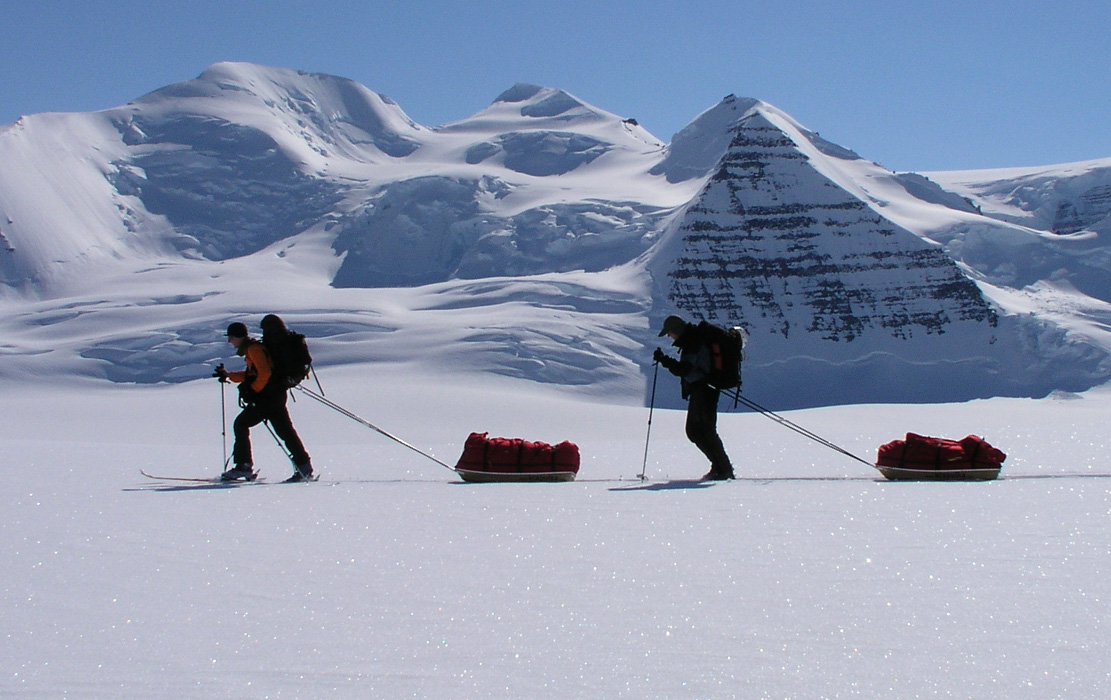
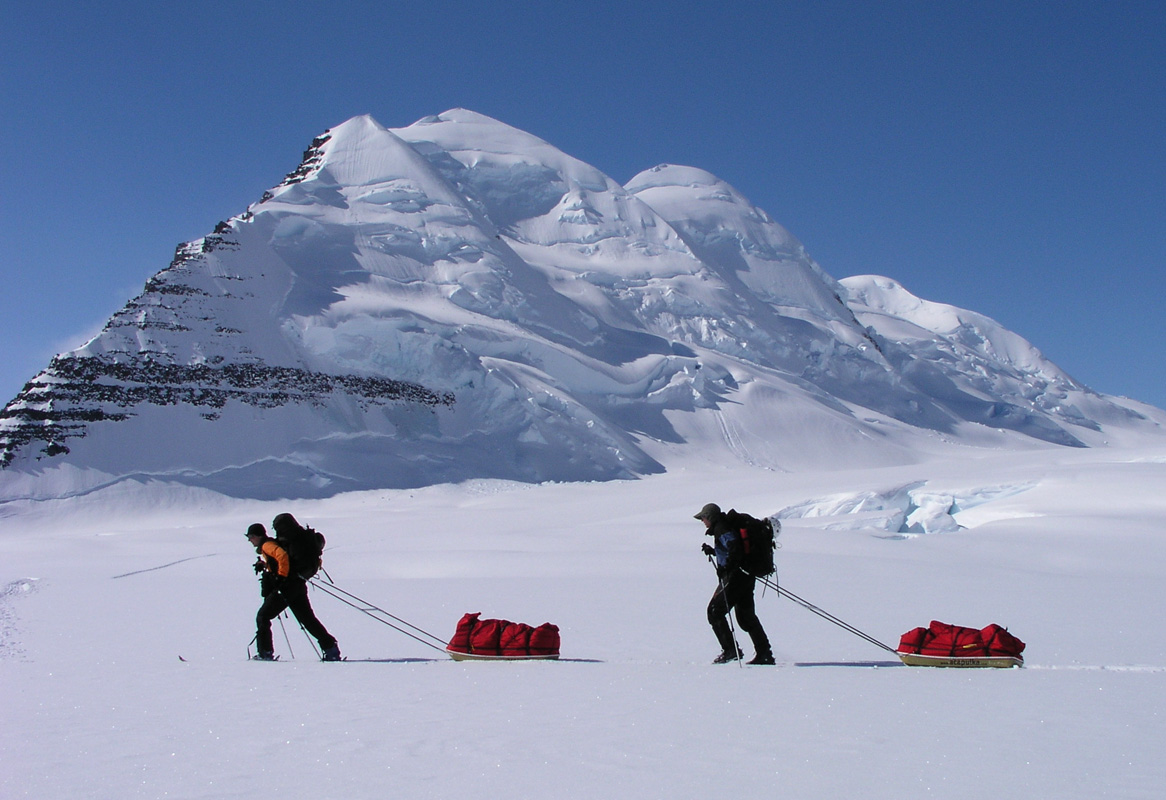
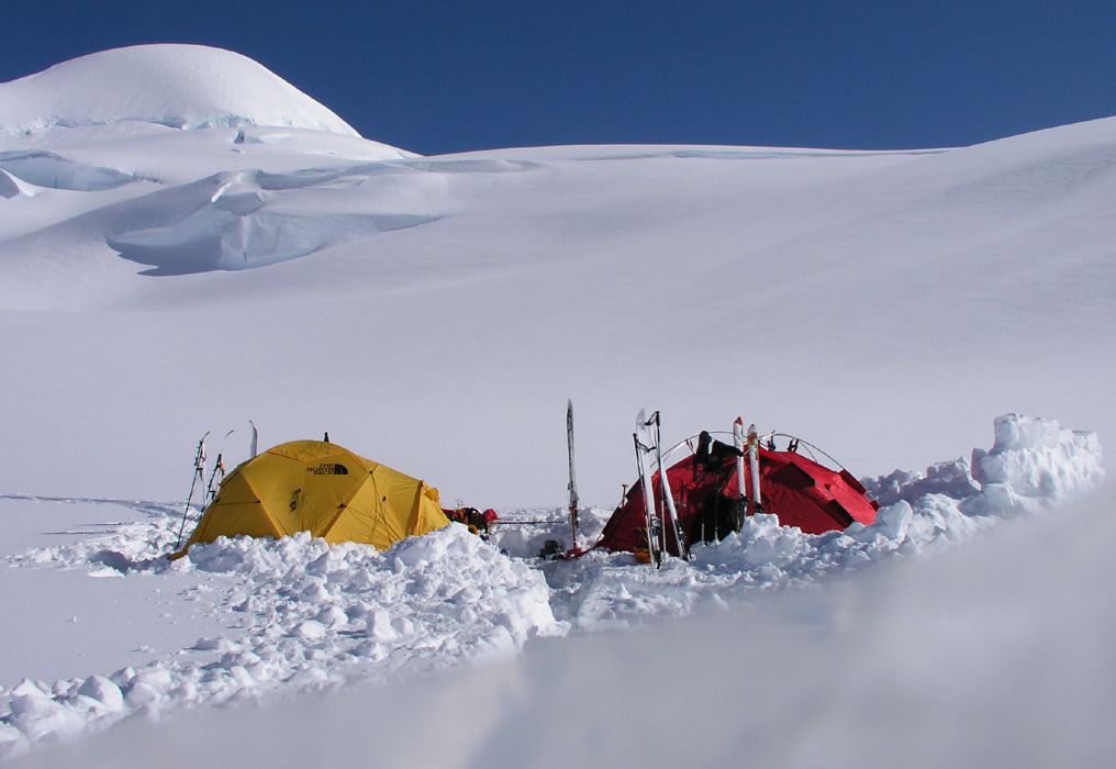
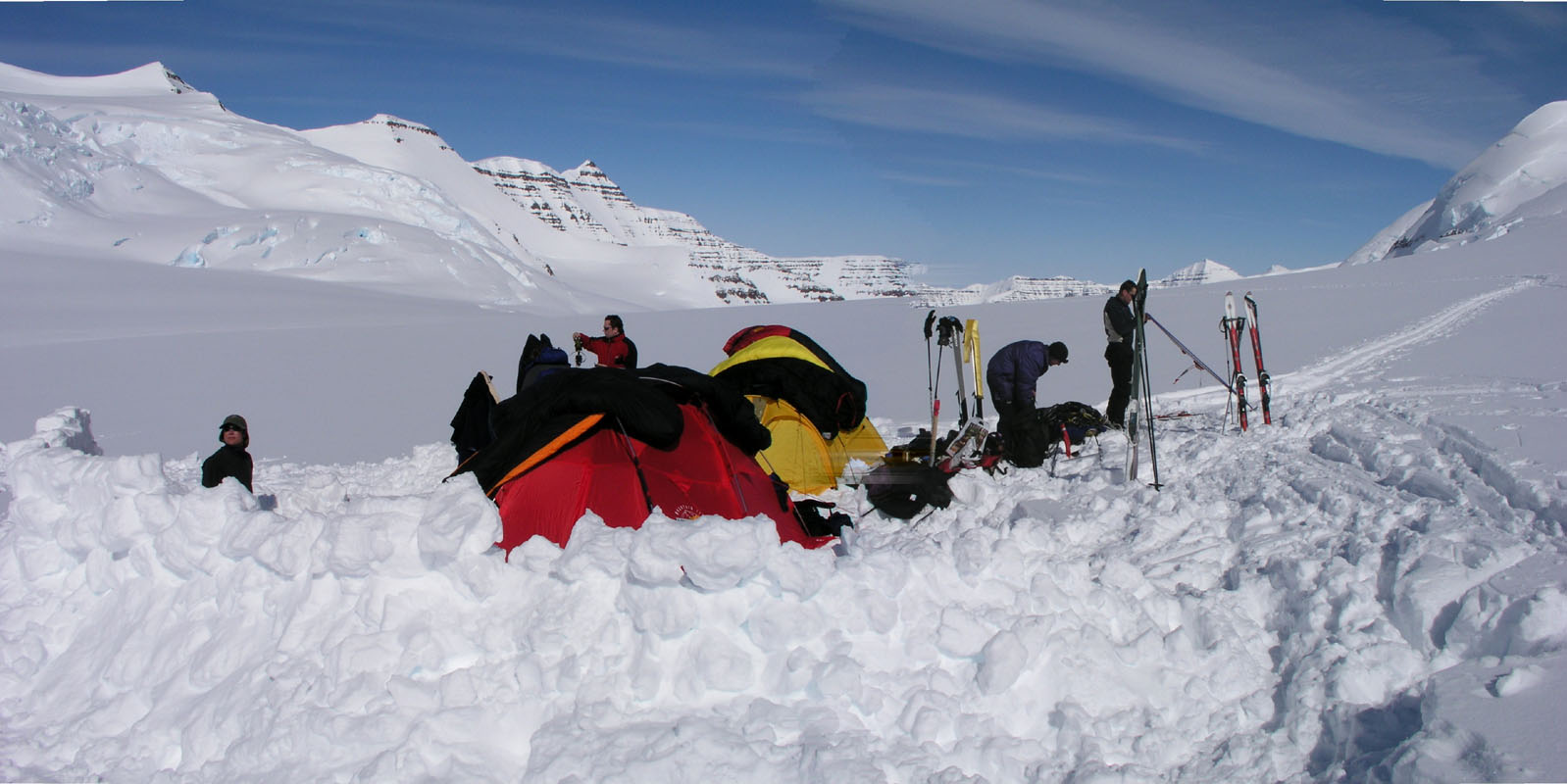
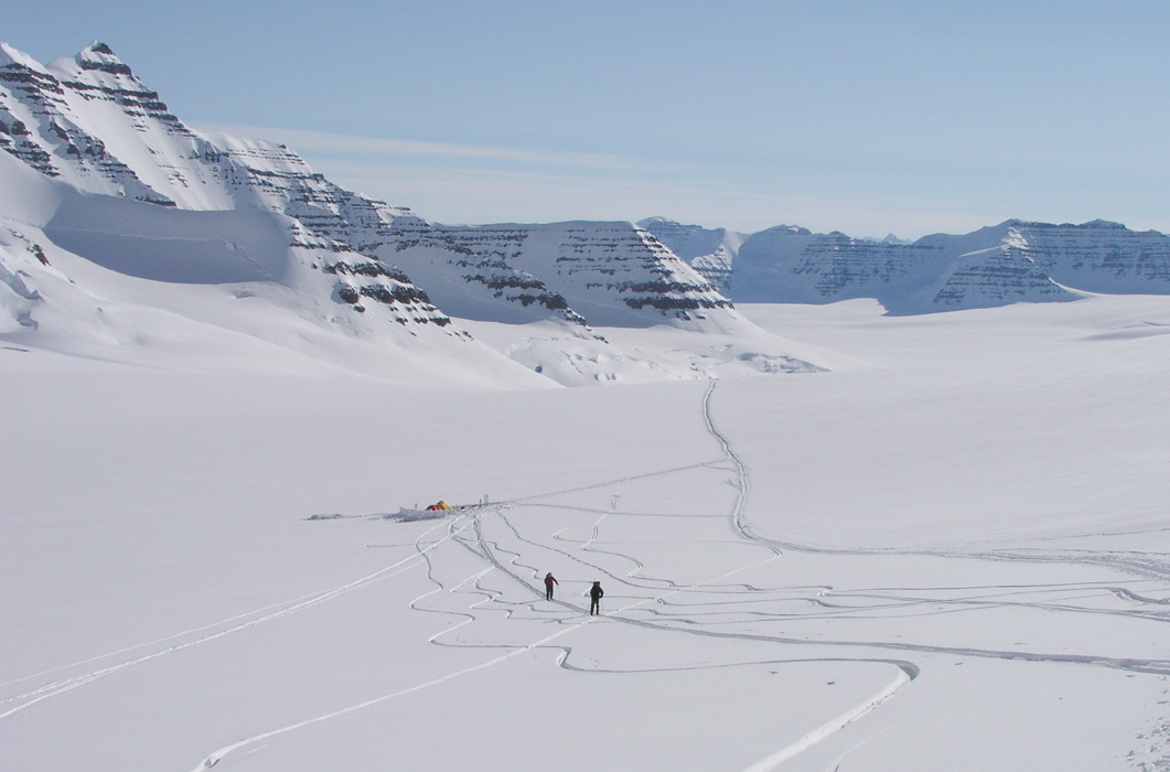
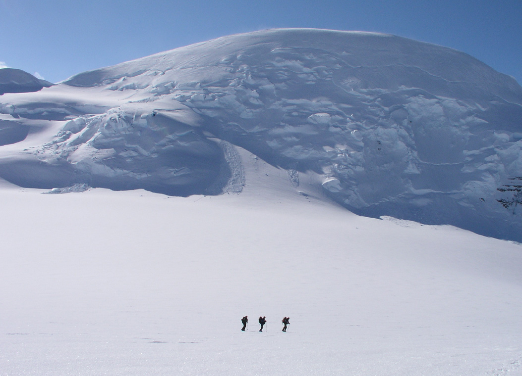
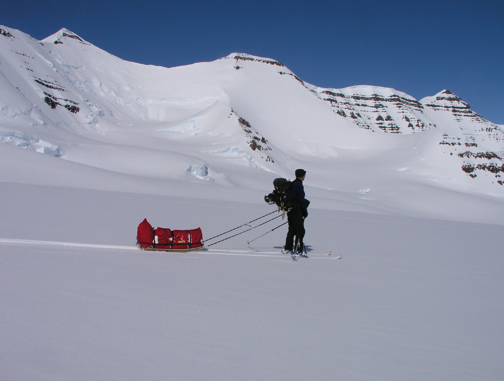
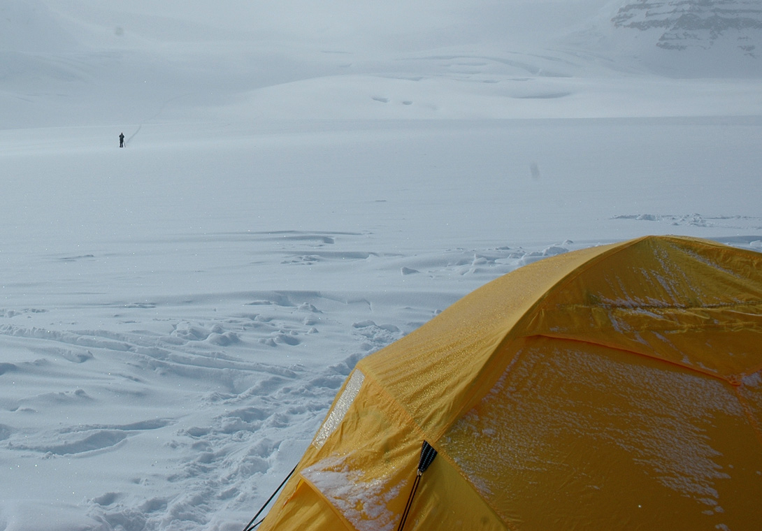
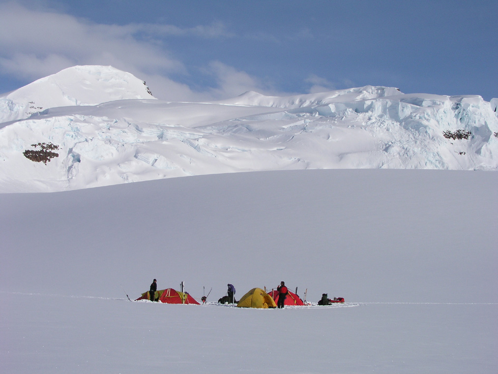
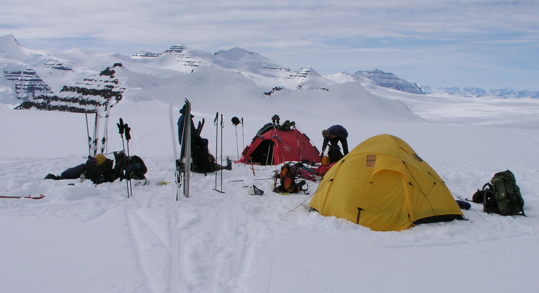
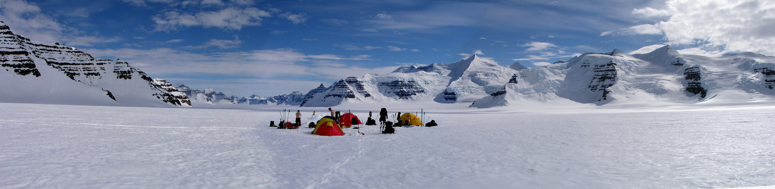
We establish camp about 500 meter in the direction of Gunnbjørnsfjeld. We do not
want to be very close to the group from Tromsø. Our trips are totally
uncorrelated, it is just by chance that two teams from Norway are here at the
same time. They shall have their trip, we shall have ours. Our base camp is slightly
uphill and commands a very nice view
across the broad valley with the peaks and
glaciers that separate this area from the area of the Woolley Glacier.
The location is north 68:55.511, west 29:44.219, elevation 2229 meter.
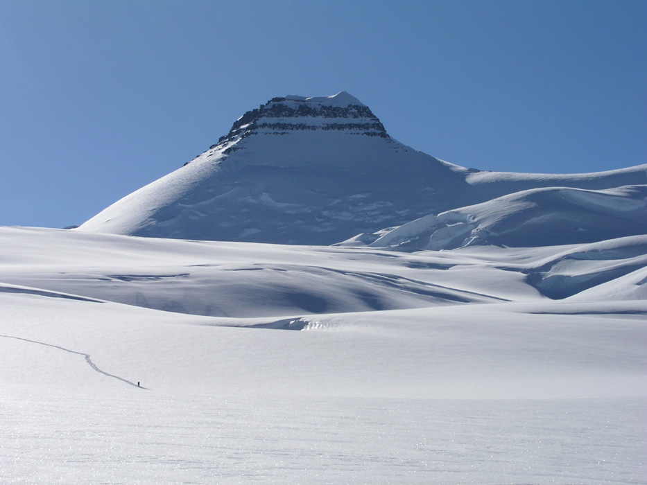
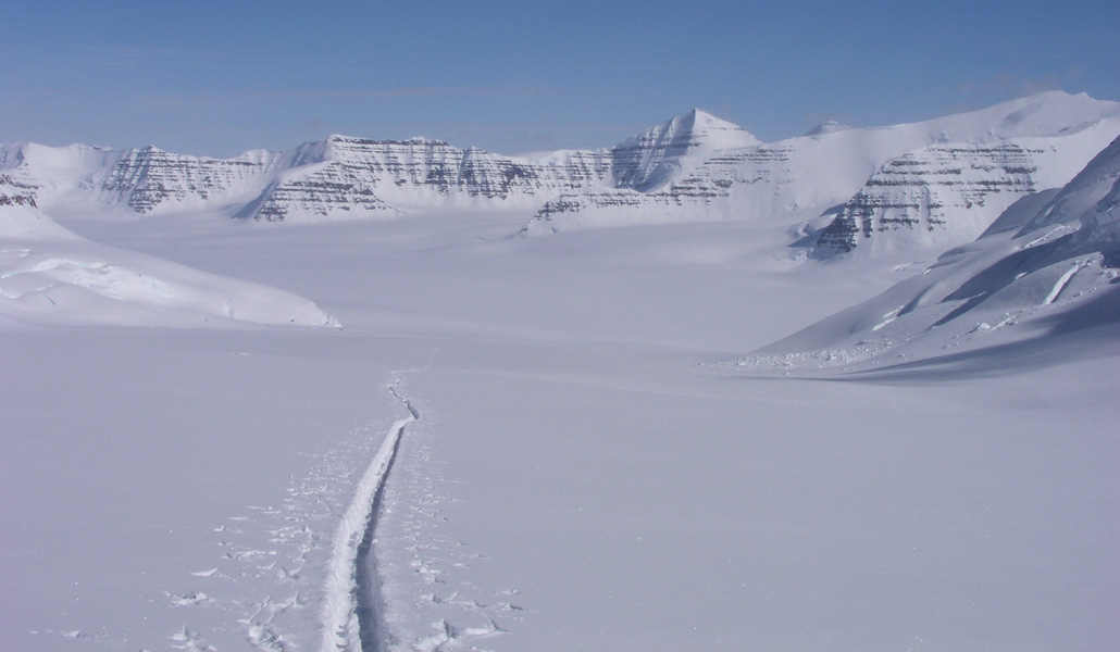
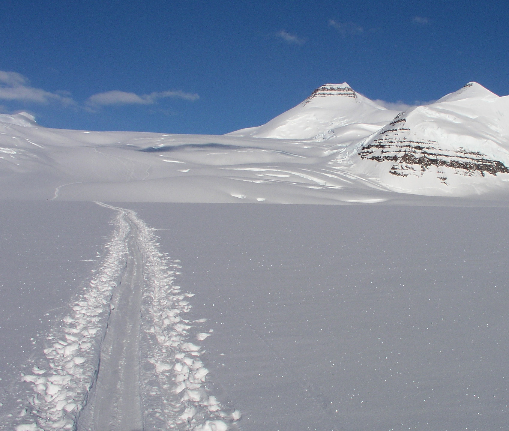
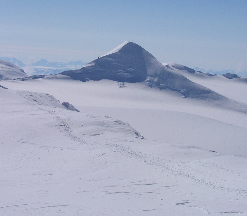
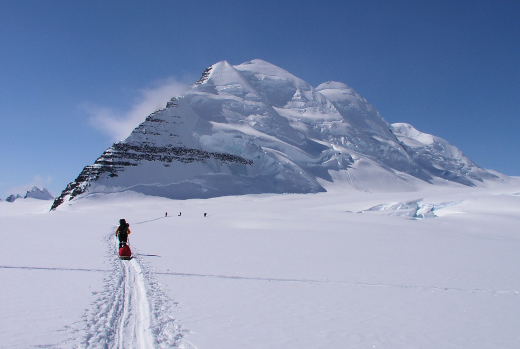
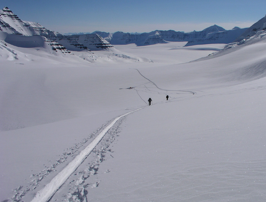
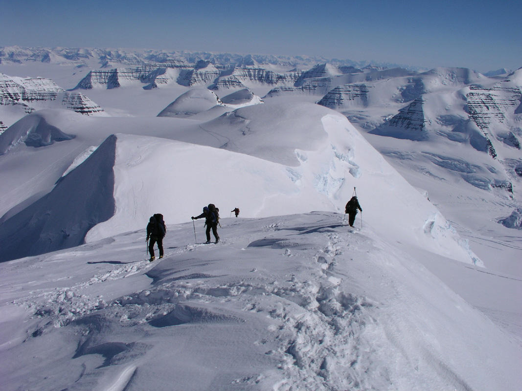
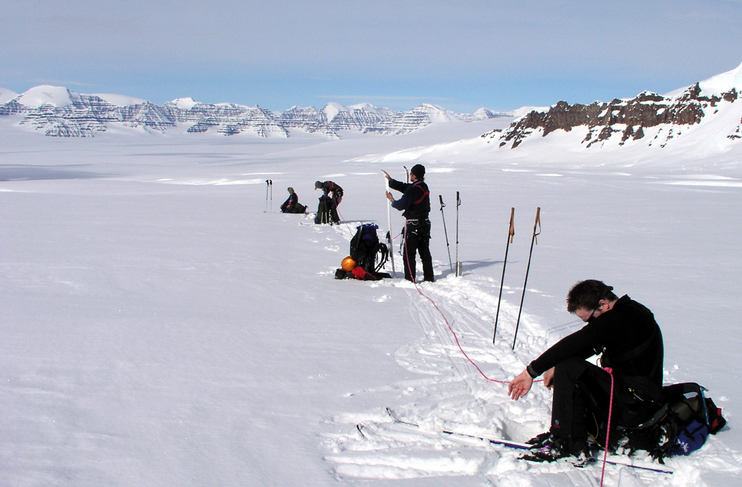
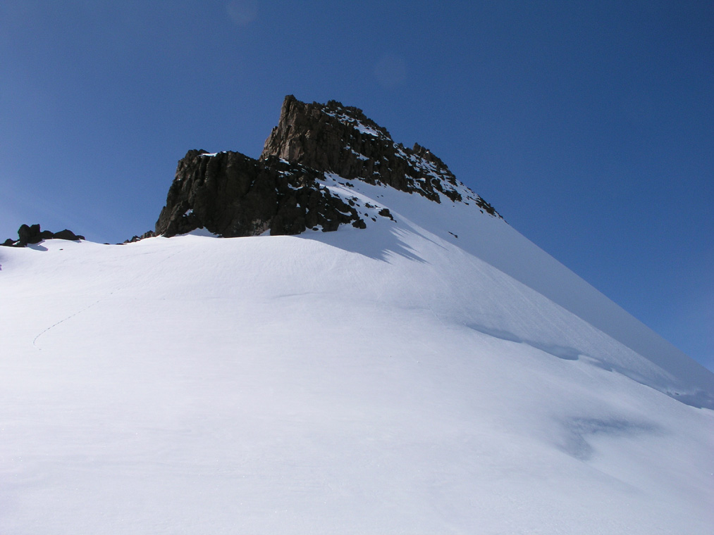
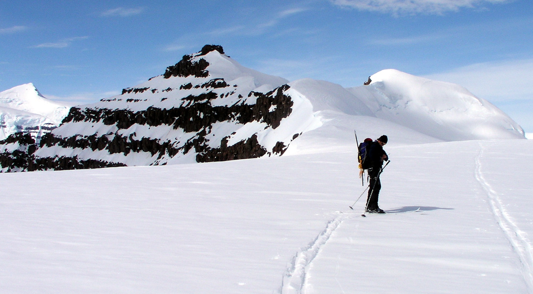
The Tromsø team is making a track towards Gunnbjørnsfjeld. When our
camp is ready we ski a bit uphill
along their tracks.
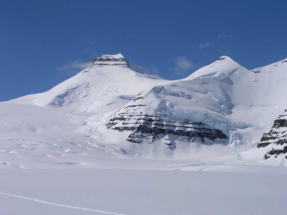
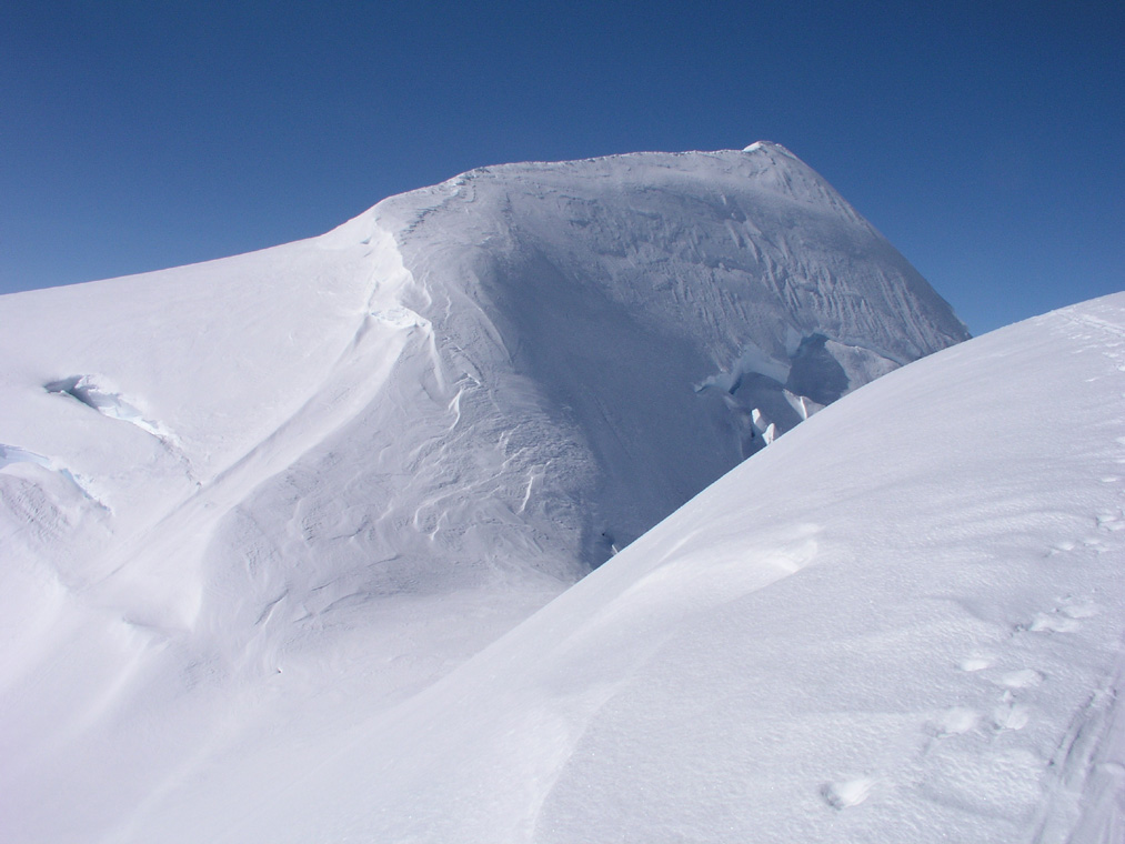
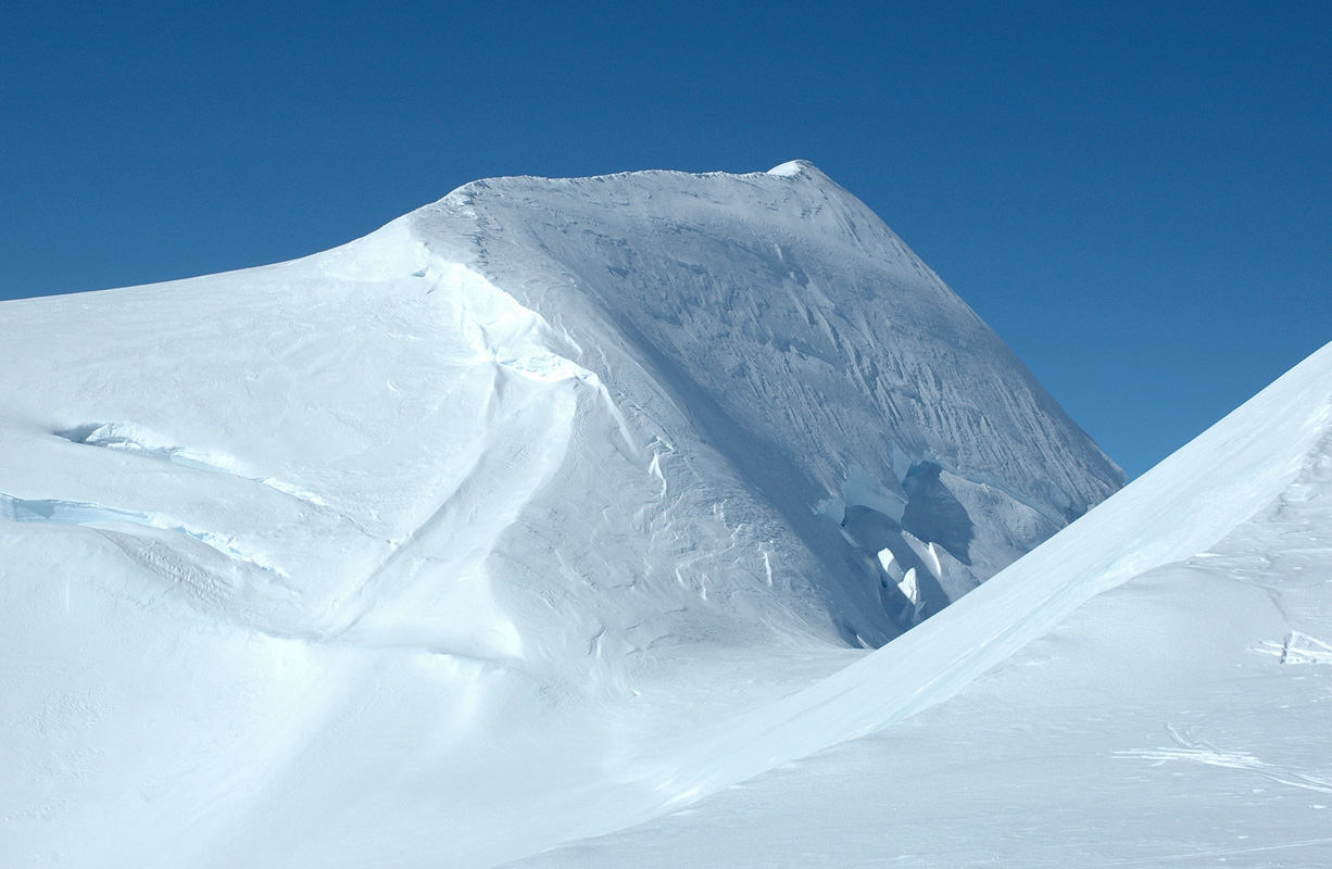
The landscape is very nice,
Gunnbjørnsfjeld is a bit closer,
but we realize that the approach to the saddle is quite a long trip.
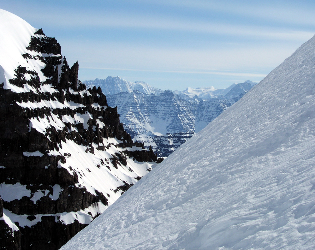
We have a good view of the ridge
that heads up on our left side.
We turn around at 2600 meter, about
1.5 hour after starting out.
The view back down and across
shows that we
have gained some elevation.
The Tromsø team overtakes us on the way down, they
reached a bit more than 3000 meter. It is hard work to break trail with all this
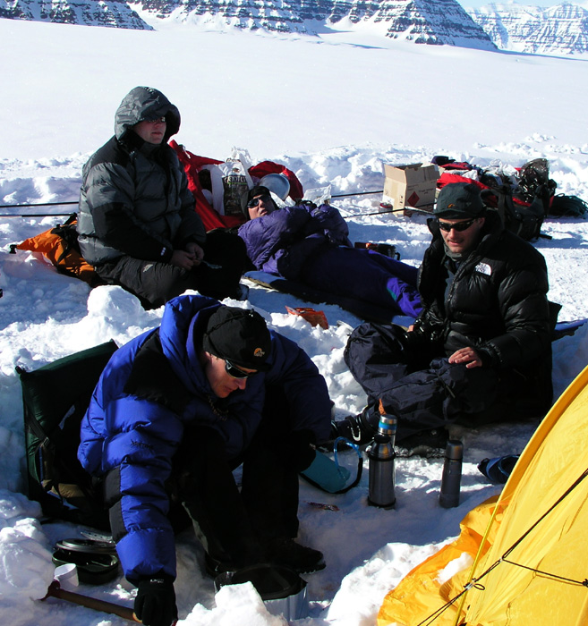
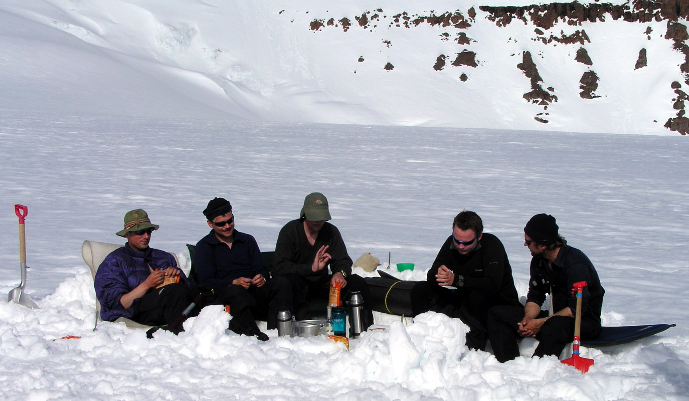
new powder. Dinner is served at 2100.
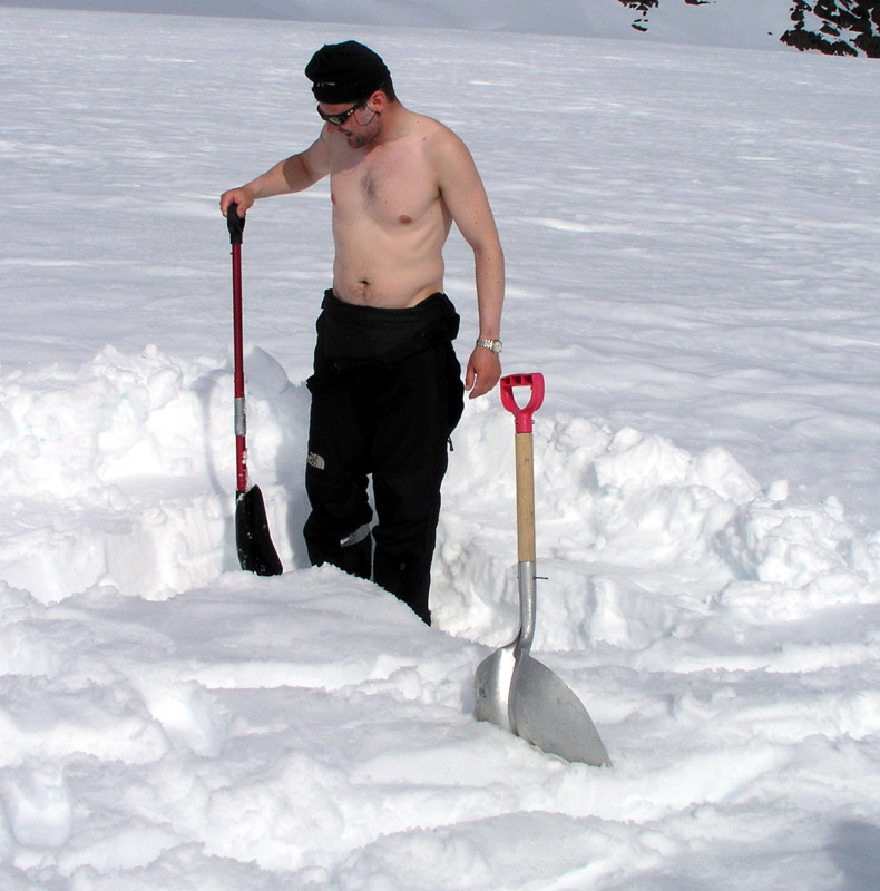
First unpleasant surprise, one of our stoves had a leak in the gas tube rendering it
useless. No way to repair. We carried a spare stove, but I disliked the fact that
it was called to duty already on our first day in Greenland. We have two stoves that
function well, this is minimum for a three tent team like ours.
Soon, the temperature is noticeably colder, we
finish the meal and as the sun sets around 2200, the cold will chase us into the tents and
sleepingbags. The sunset really cooled us, the temperature fell to around minus 30
Centigrade at night.
May 16.
Breaking trail.
The Tromsø team announced on their WEB page that they wanted
to be the first ever to ski down from Gunnbjørnsfjeld. Long
before we knew about the Tromsø plans I had also told my group
about the fact that Gunnbjørnsfjeld was still waiting for its
first ski descent. I knew that we most likely had the skill to do it,
but these things do happen. Just as we were looking forward to trying
this, the Tromsø team appeared and their schedule was one week
ahead of ours. It was clear that we would not take advantage of their
hard work at breaking trail in order to gain the summit and a possible
first ski descent ahead of them. Most likely, they would ski over to
Dome and Cone after ascending Gunnbjørnsfjeld. It therefore made
sense that we should use the day breaking a
trail across to that area.
This would then serve both teams later.
We left camp at 1000. The temperature was still negative 20 Celcius several
hours after sunrise.
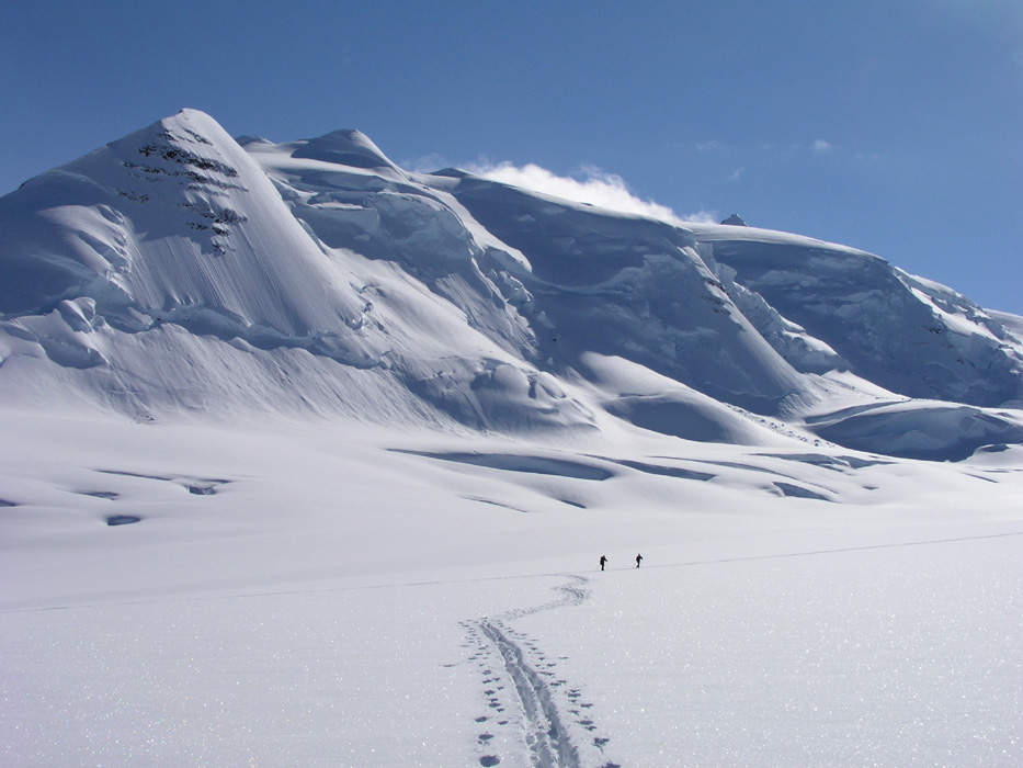
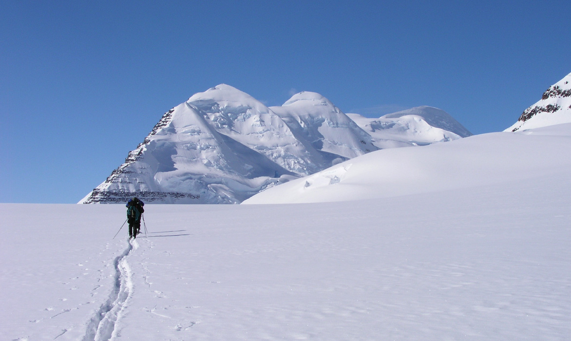
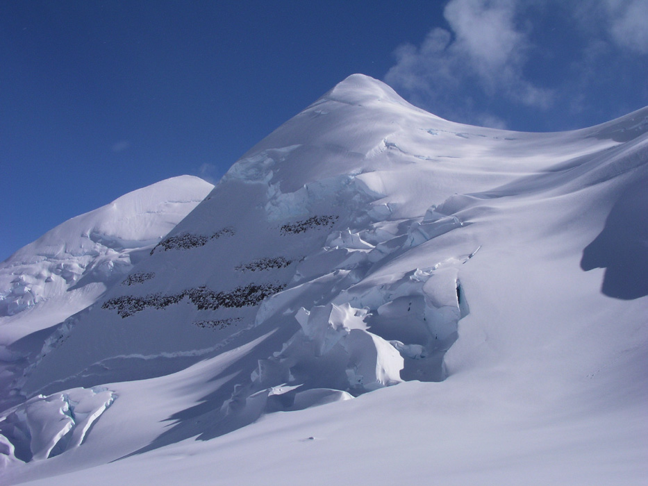
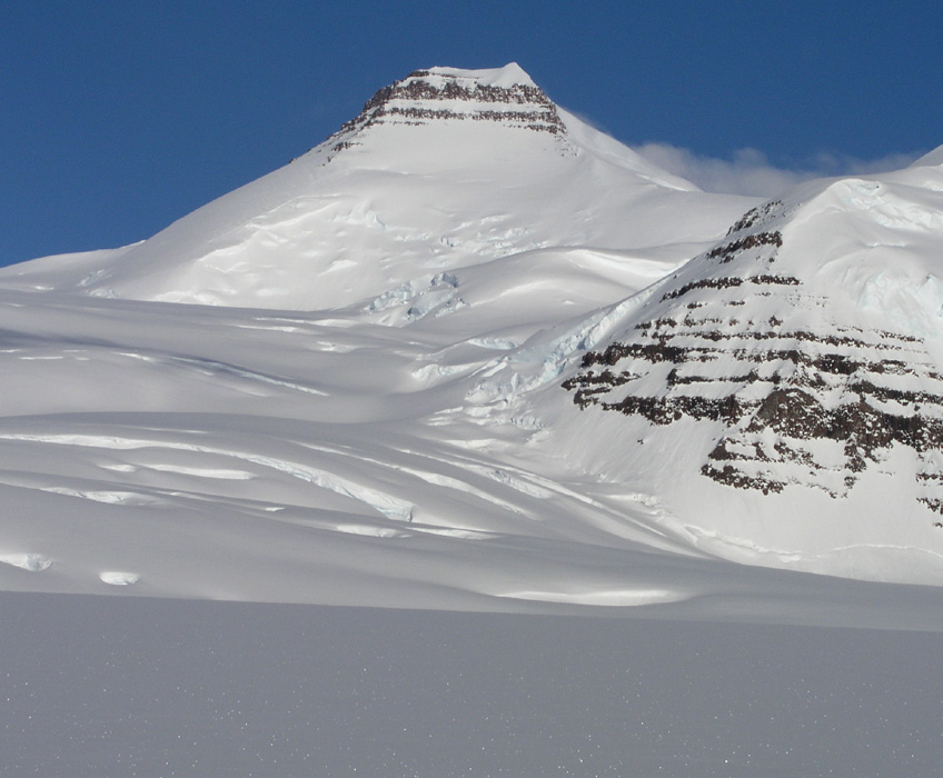
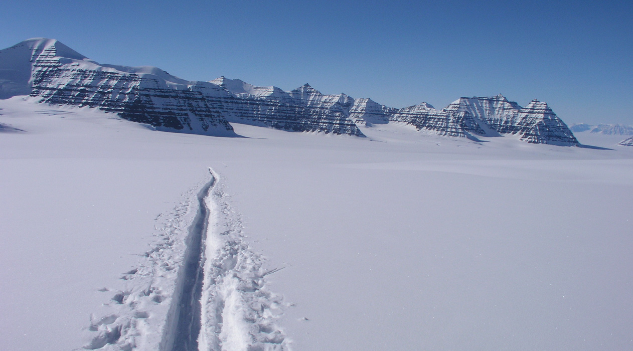
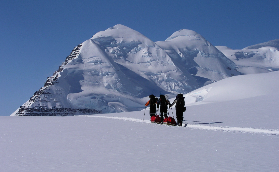
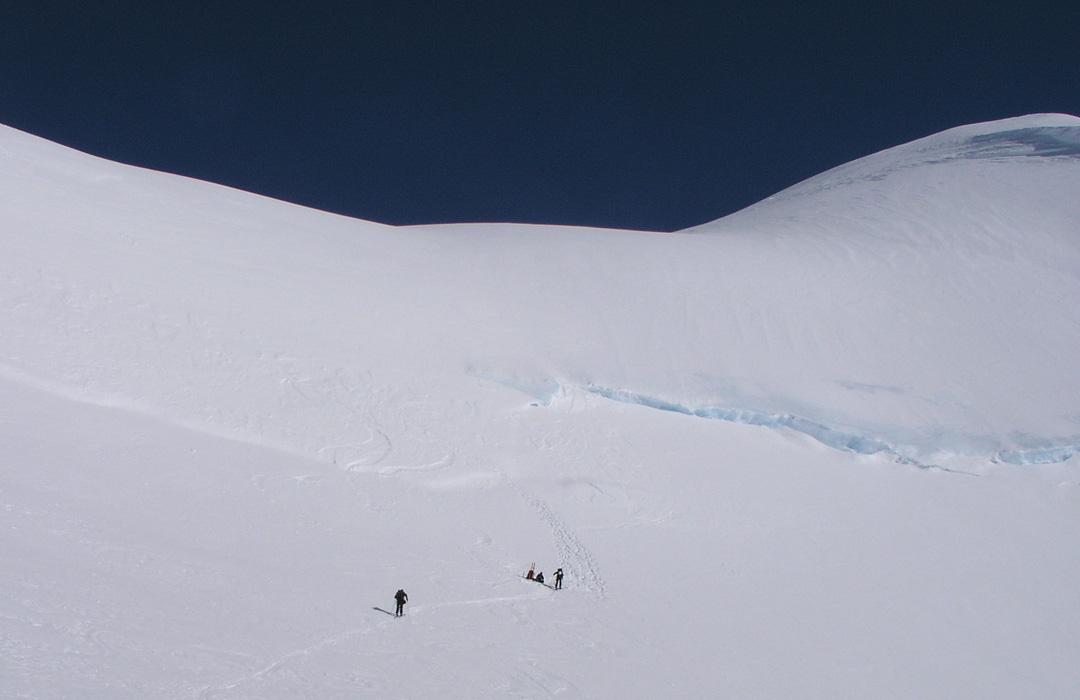
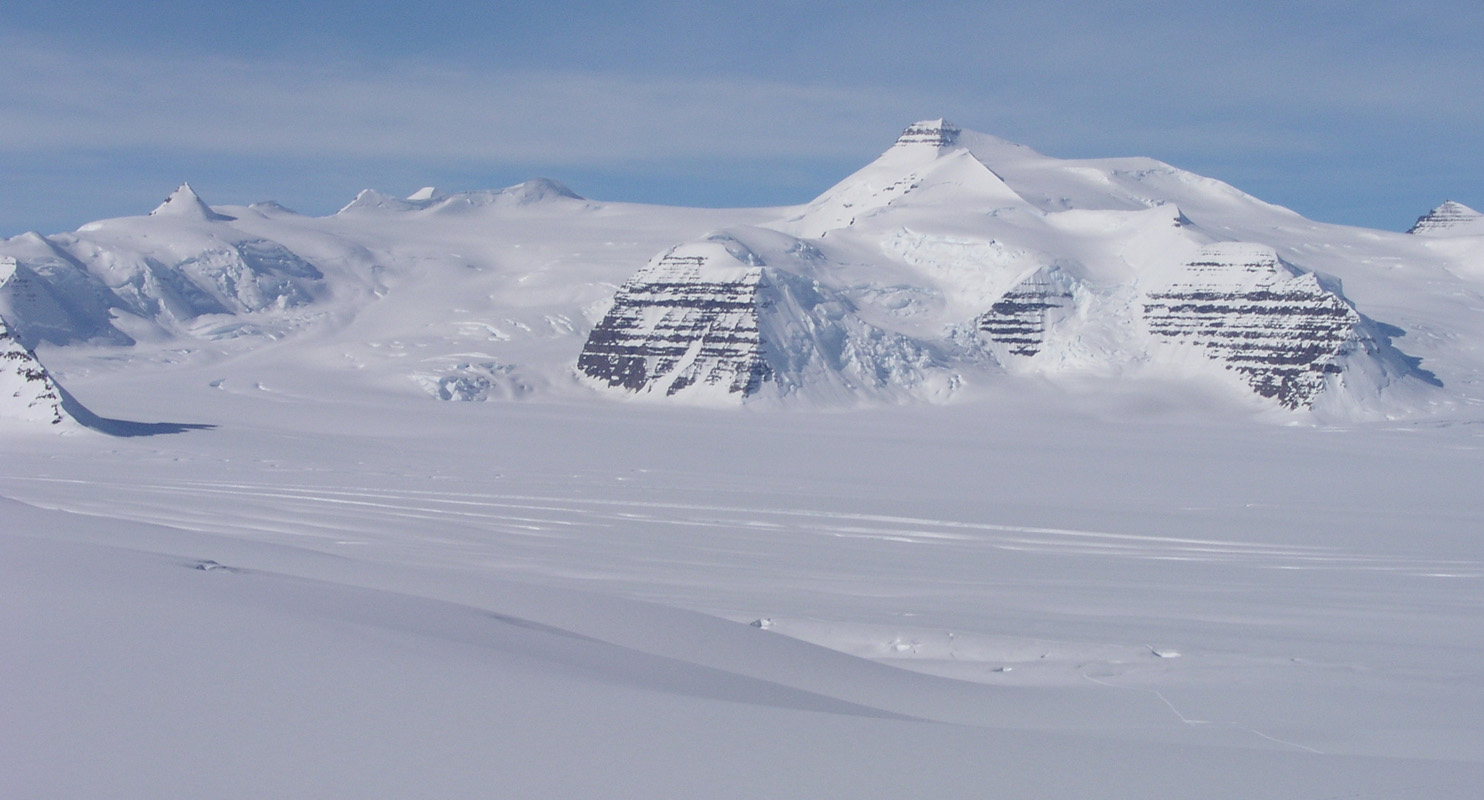
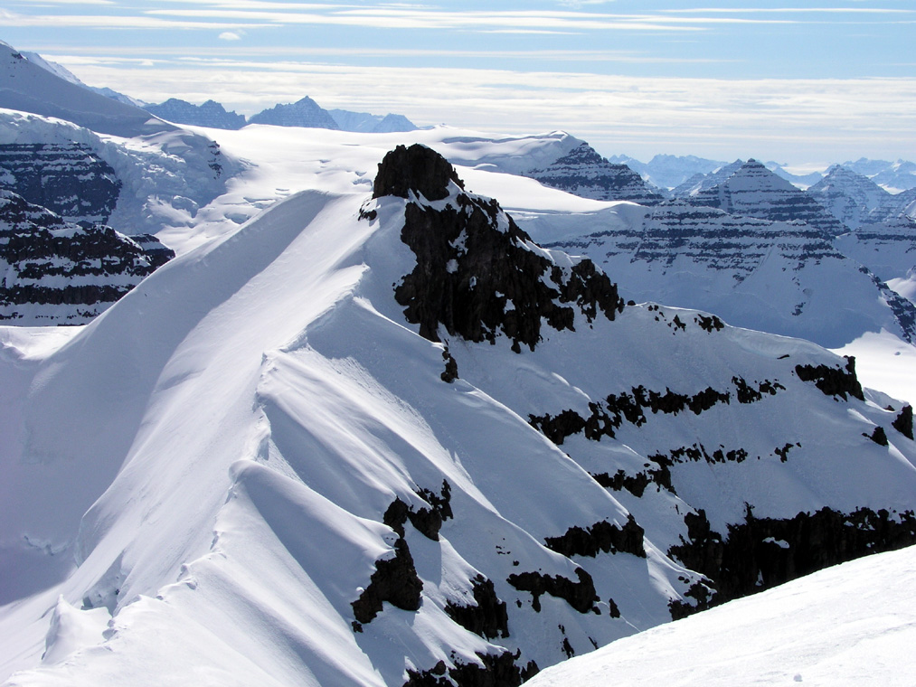
Before climbing the glacier that gives access to Dome and Cone, we had
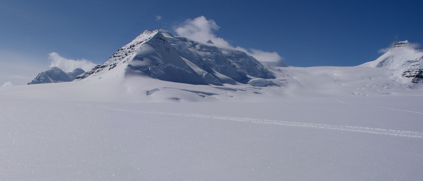
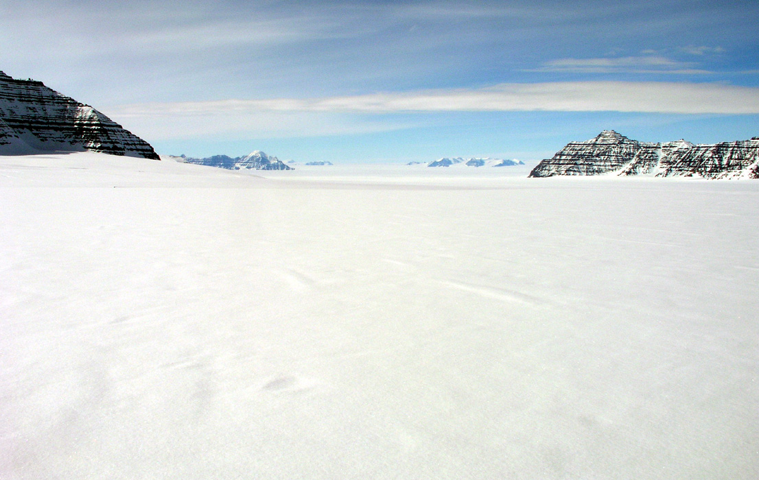
to ski eastward on the main glacier.
The landscape runs straight out
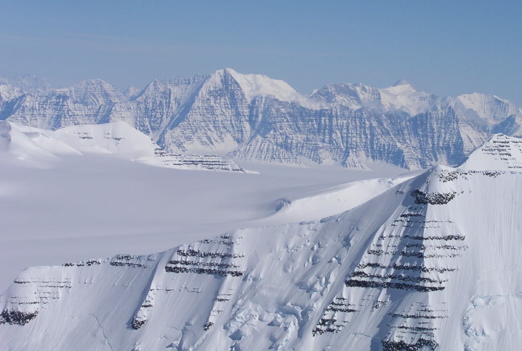
towards a gigantic icefall called "Mange Sprekker" (Lots of Crevasses!).
We have the mountains that contain PEV, the 4th. highest peak on
our left, while very jagged and sharp ridges form the backdrop beyond
the gigantic rigde that comes down from Dome.
Jan-Frode turned back fairly early in order not
to exhaust himself today. We broke trail to 1400 having reached
2721 meter in the valley
that heads up between Dome and Cone.
The view on our left (Dome) side
is spectacular, while a distinct
pyramid shaped peak
is guarding Cone
a bit further in on our right hand
side.
We get back to Base Camp
after this first day of work.
The team is doing
well on this first full day in Greenland, Jan-Frode needs
to improve endurance, with the program we have in the next
several days this is bound to happen.
Arnt complains a little, partly
this may relate to a first day in the 2200-2700 meter range. Again, I feel
pretty confident that his discomfort will go away.
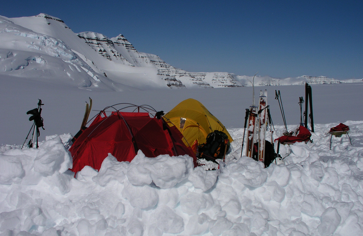
The tents are quite
comfortable and the weather is great.
Tomorrow, we shall
start out early in the track
that hopefully shall lead us to
the summit of Hvitserk.
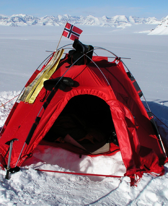
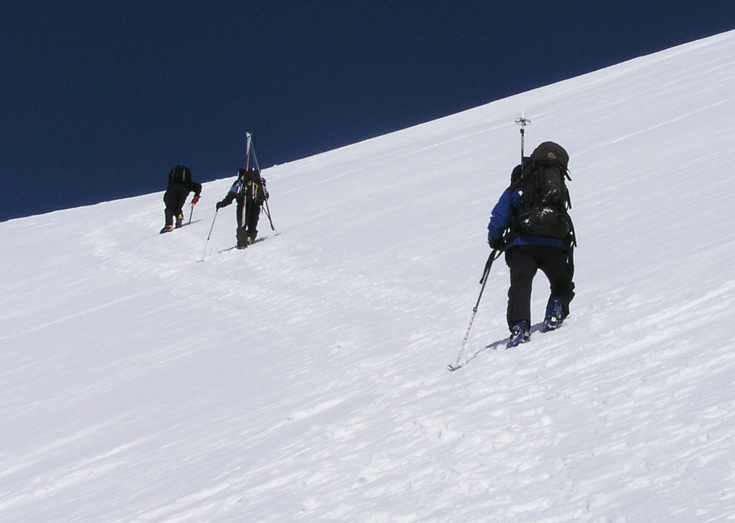
May 17. Norway's National Day.
Gunnbjørnfjeld.
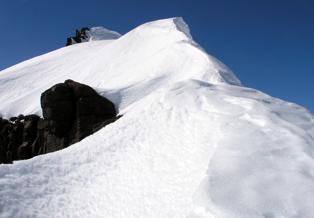
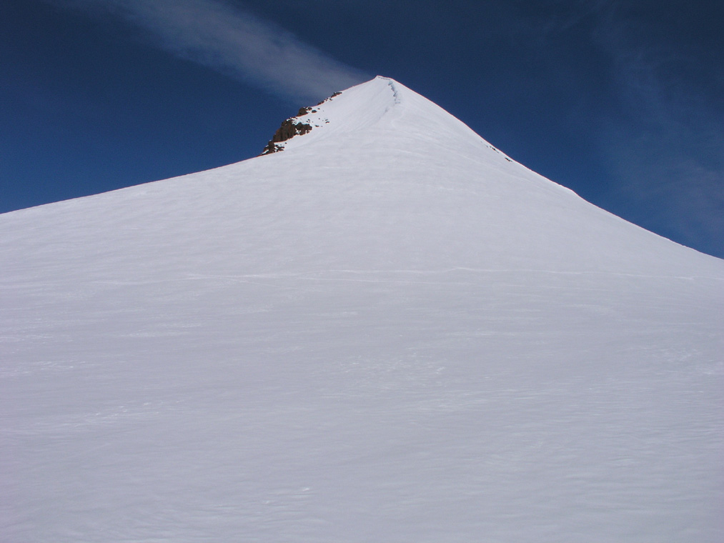
May 17th. and what a day this should turn out to be!
I had estimated that we would take 7.5 hours to the summit, I wanted to
be there when we had maximum heat a few hours after mid-day. We ran
Greenwich (= Iceland) time, thus a bit ahead of sun time. We prepared a bit
before going to bed, water was melted and ready for the next morning.
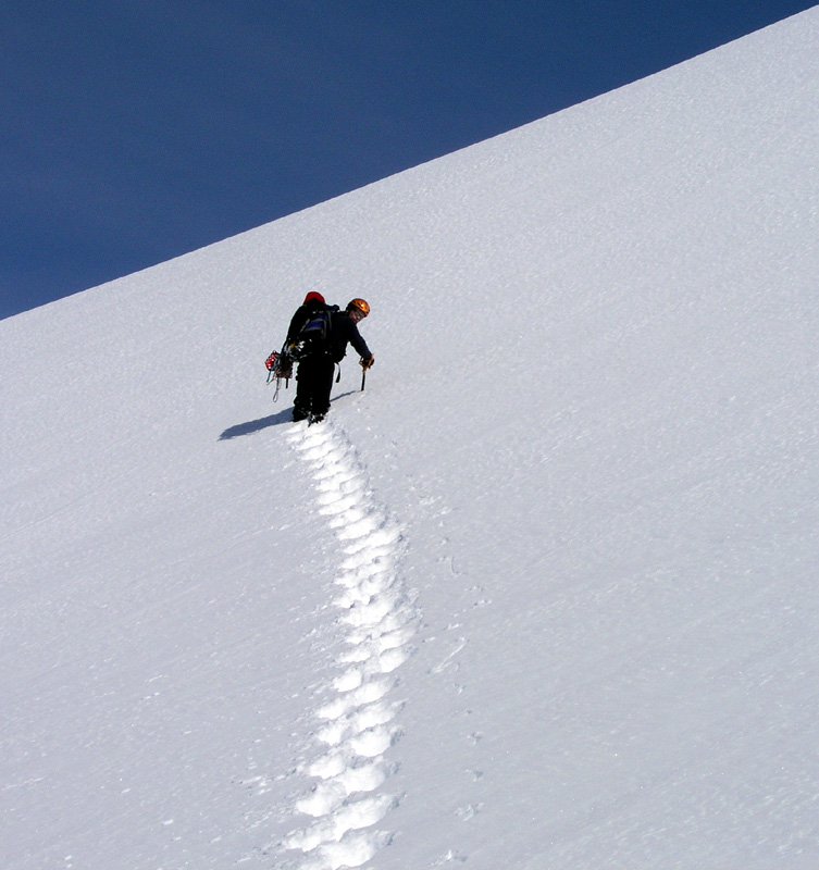
We had general wakeup at 0500. Departure time was set to 0700, with such cold
weather it always takes time from wakeup to departure. Jan-Frode started up the
glacier at 0630, and Arnt followed at 0645. I left at 0700 with the
three others leaving just 5 minutes later.
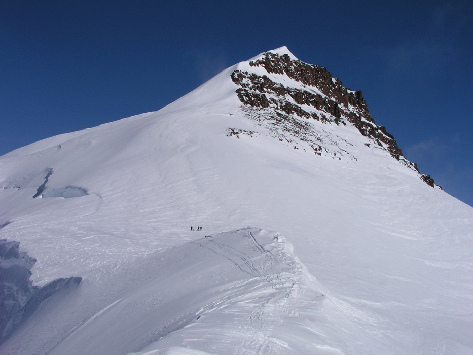
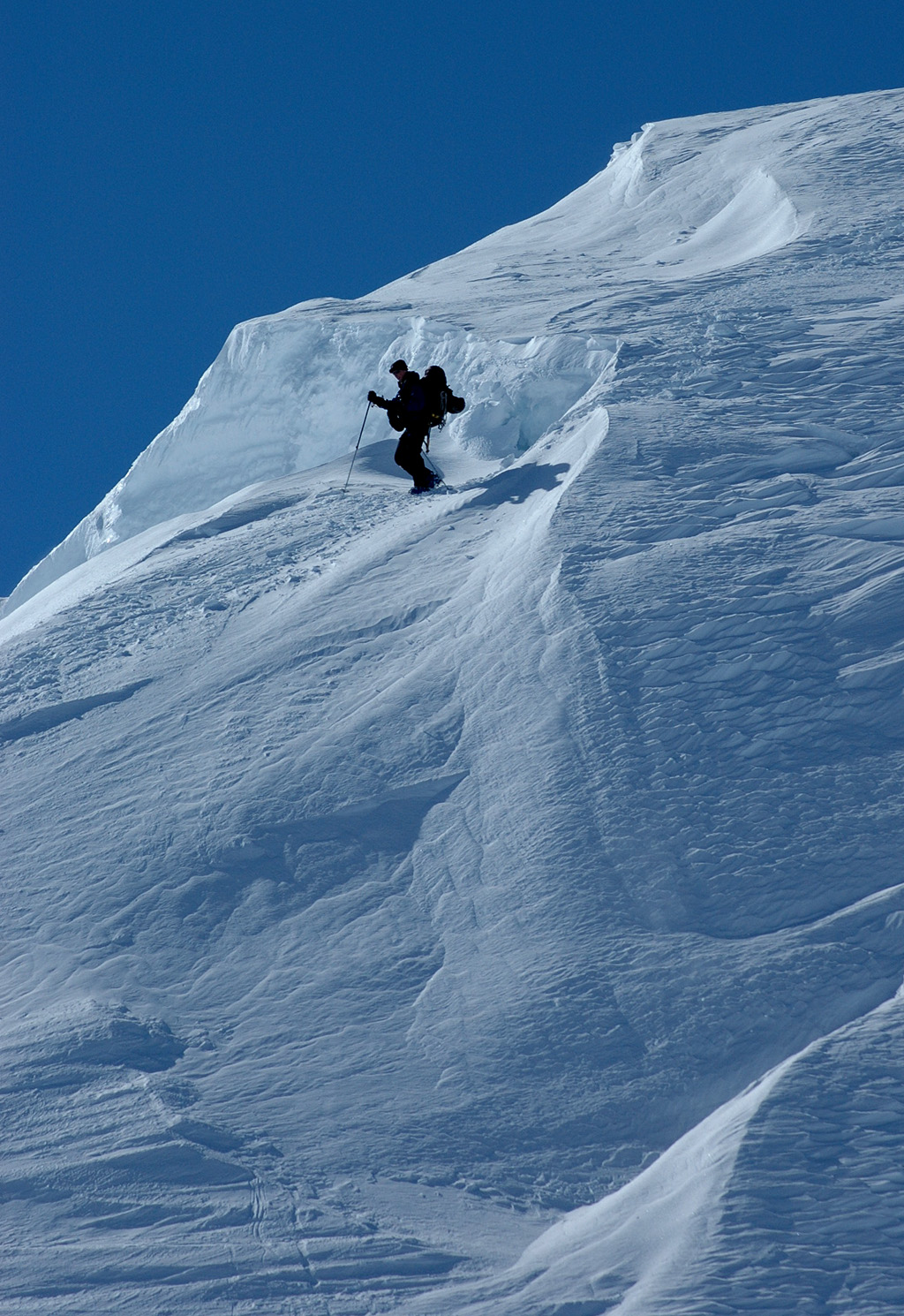
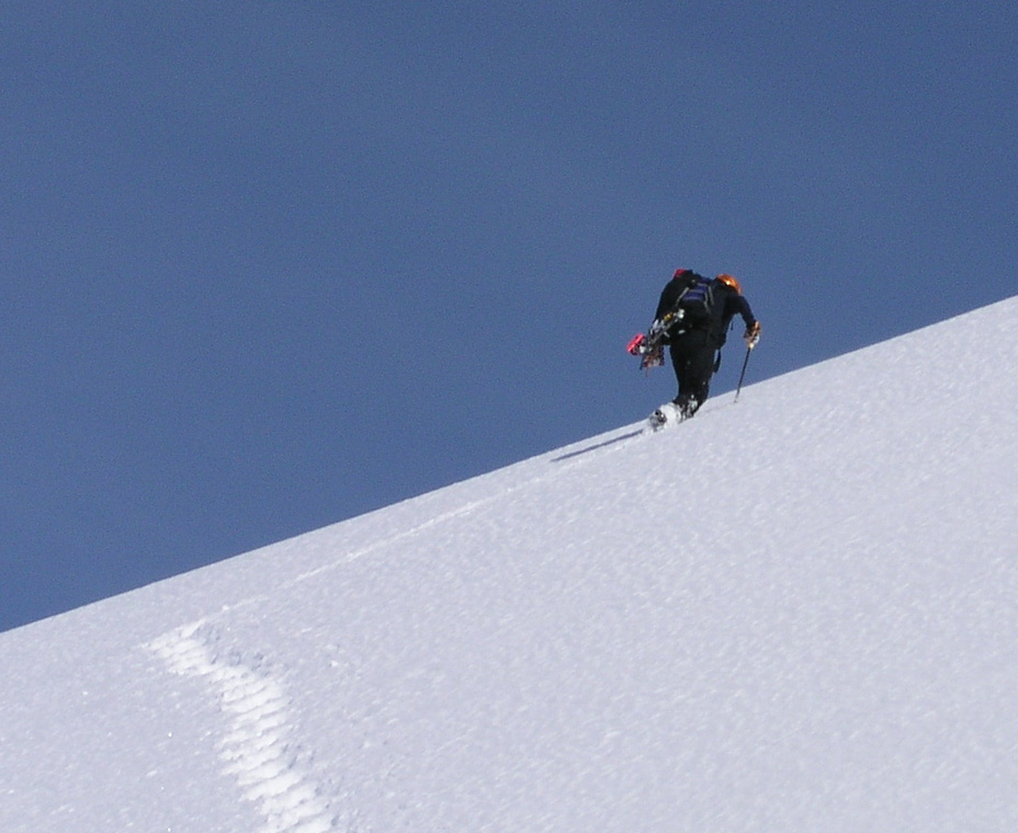
What a long hill this is!
I caught up
with Jan-Frode at elevation 2700m, we kept company further along. Arnt had more
or less our pace, but a bit ahead of us.
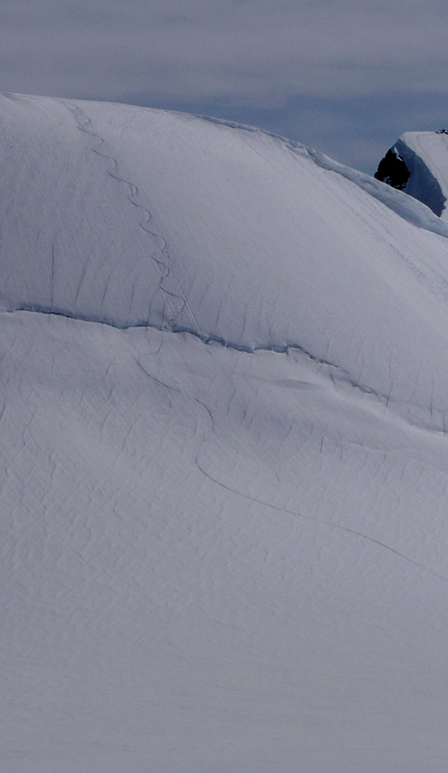
The scenery, fresh cold snow forming sculptures
out of mountains, will remain a lasting
memory.
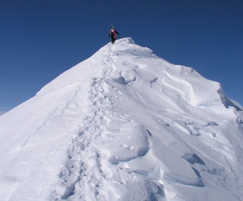
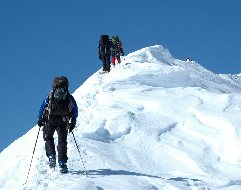
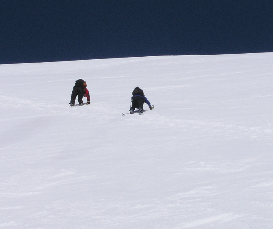
Soon, the three others also caught up
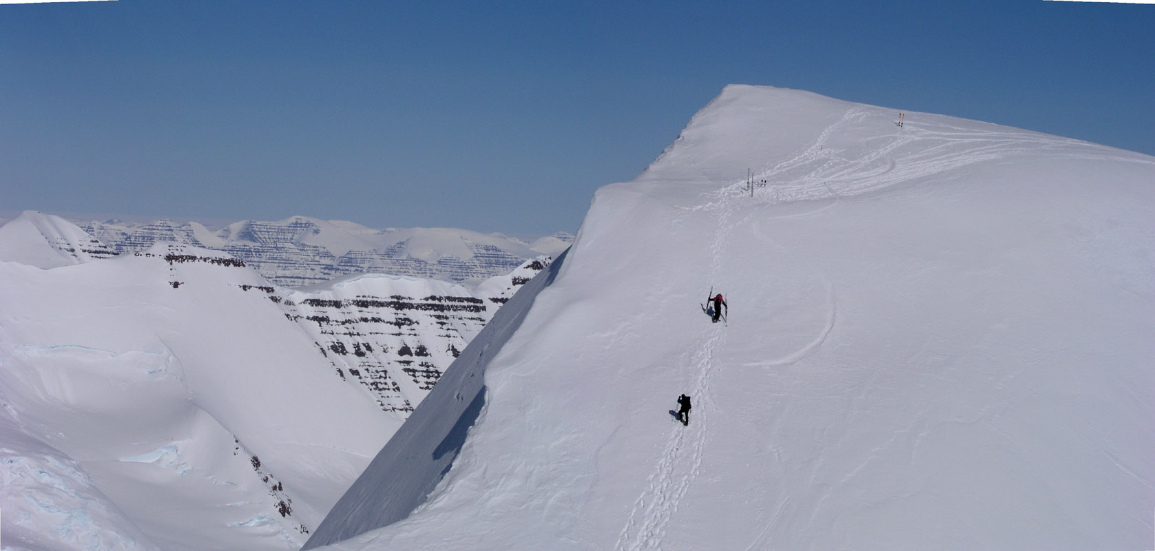
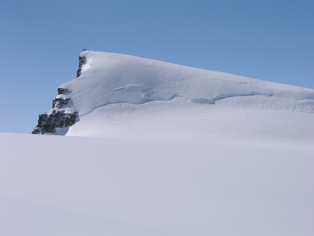
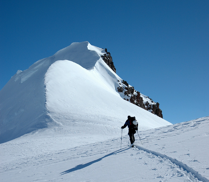
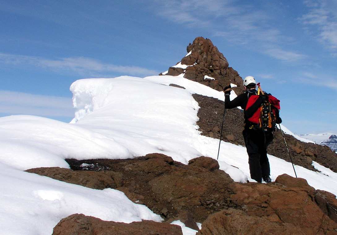
and we skied more or less as one group to a small rock outcrop on the ridge proper.
We got this far, to the south ridge
of Gunnbjørnsfjeld in a bit less than
5 hours. This location was north 68:54.552, west 29:54.836, elevation 3389 meter.
It turned out that the Tromsø group (except one team member) had climbed the
peak yesterday, however, much later in the day and therefore with severe cold
compared to our arrival at the same spot. They had not carried skis up the south
ridge and thus not skied the peak.
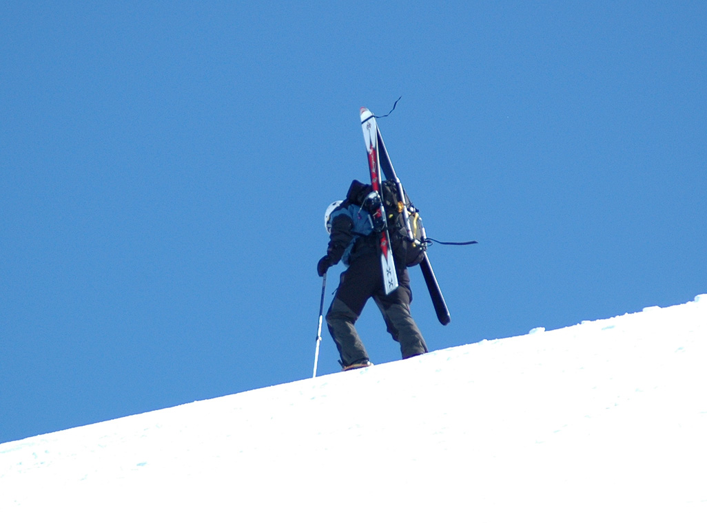
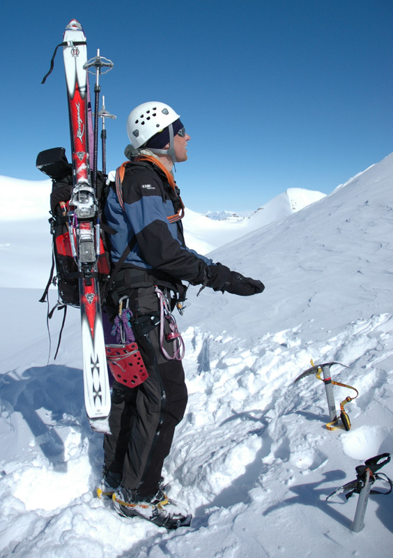
Torstein and Per Ove would
carry their skies
to the summit and attempt a world first ski descent (Telemark style) from the
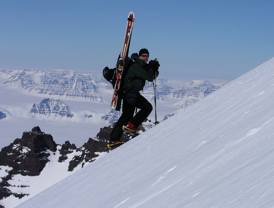
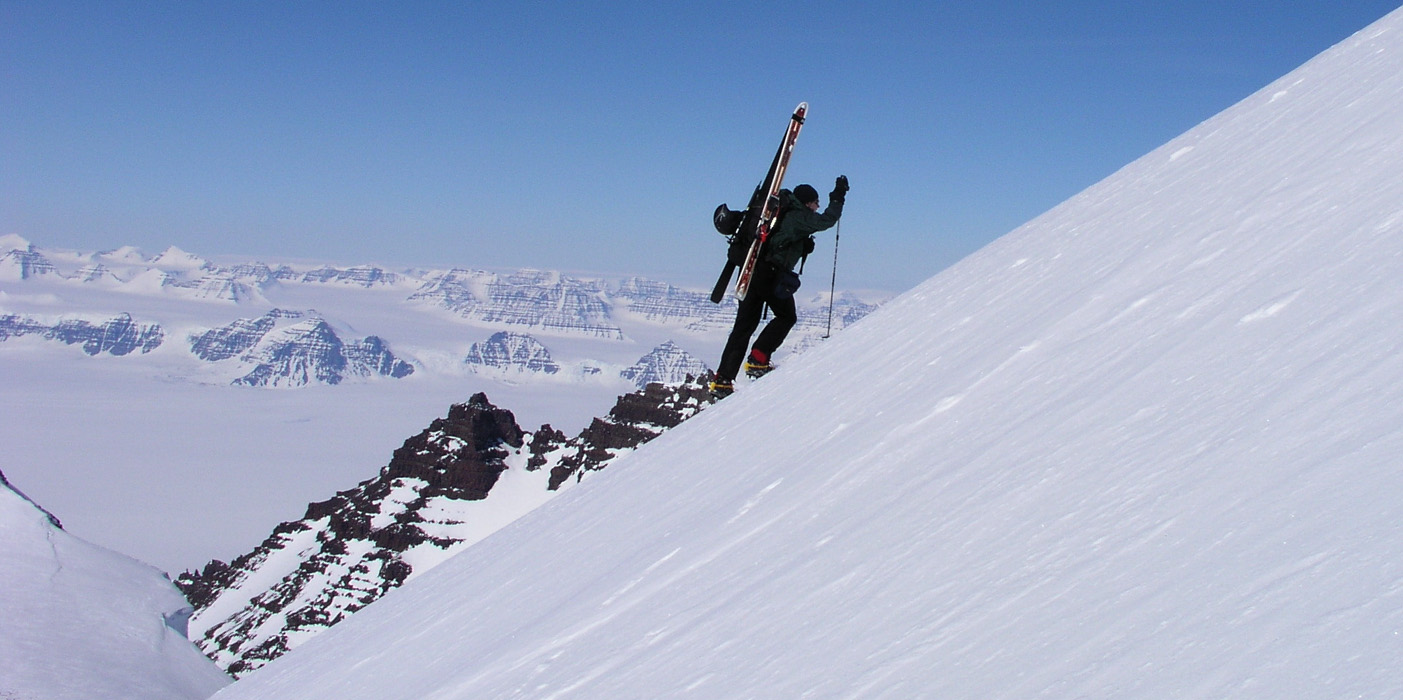
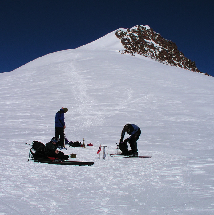
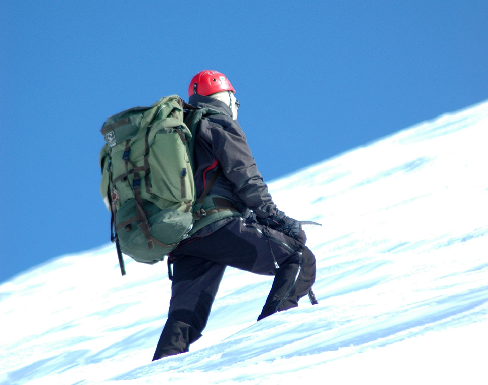
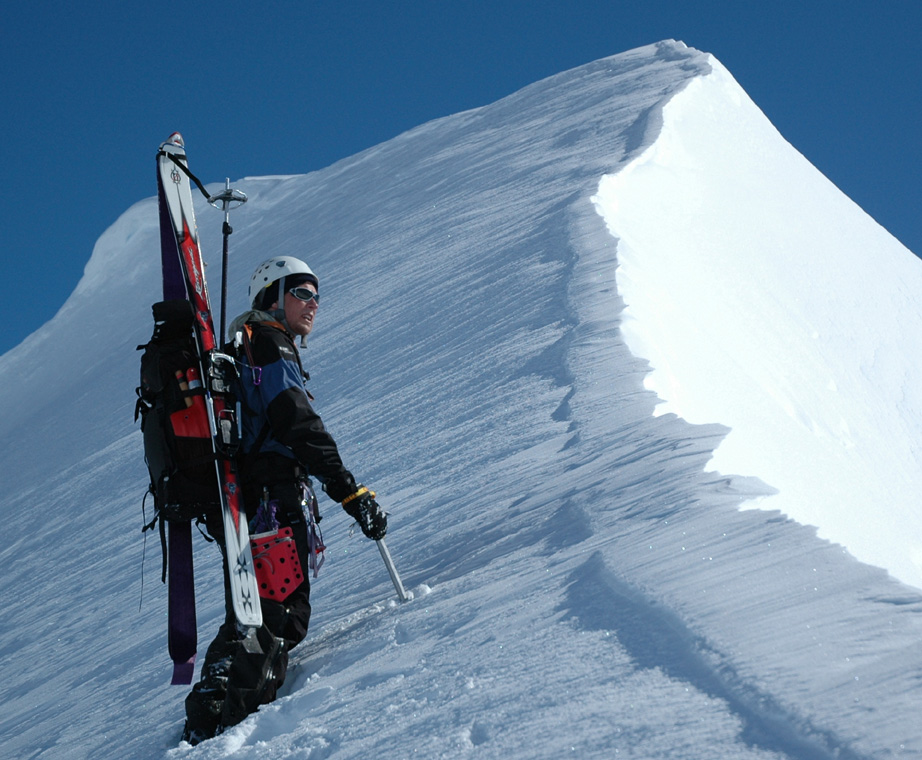
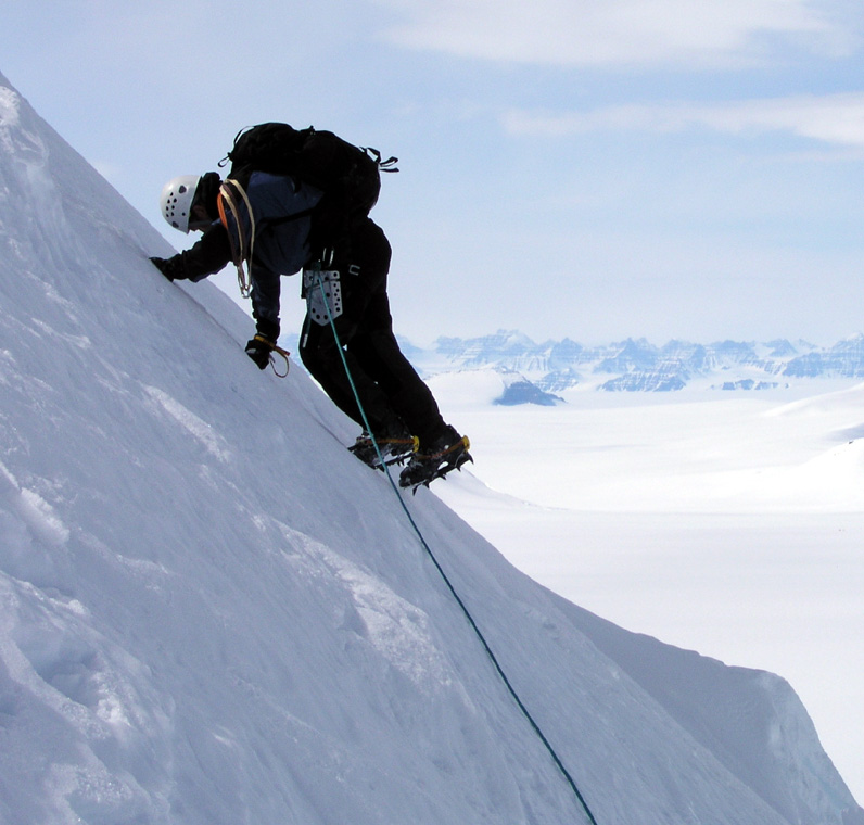
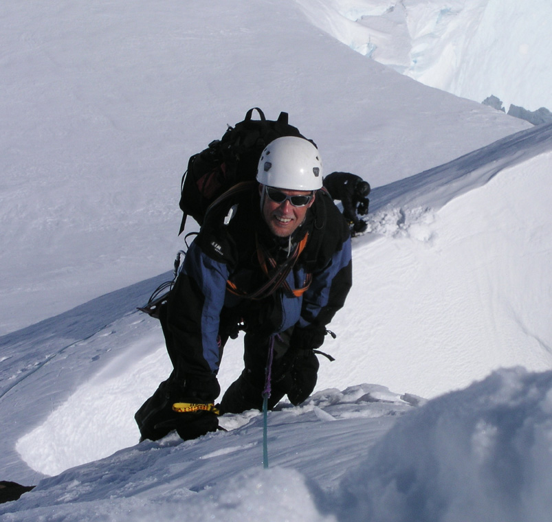
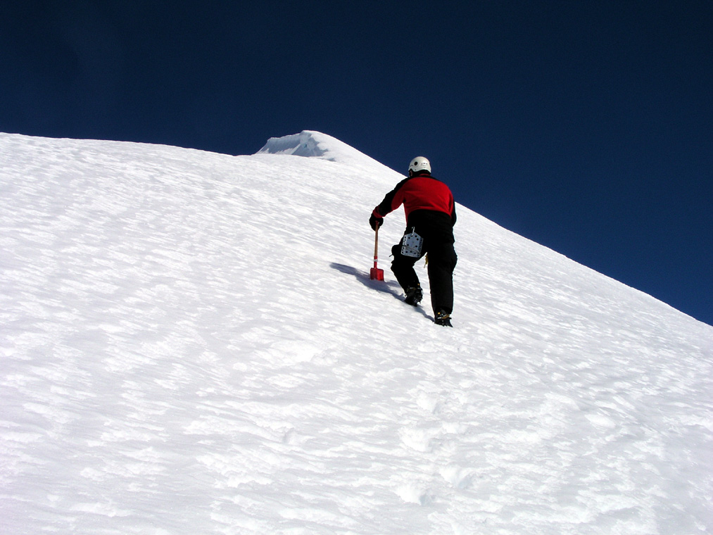
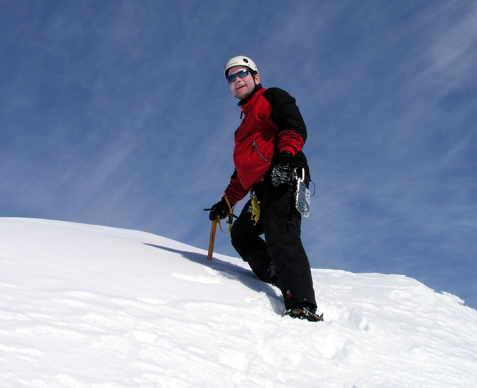
highest point north of the Arctic Circle. Everybody put on crampons, I changed boots
(Scarpa Vega), since my ski boots are kind of soft for crampons.
Jan-Frode was quite tired, Ståle felt a bit like throwing up (AMS sympton) and
felt a bit weak. Arnt took Dexadron (strong medicine against headache, relieving
AMS symptons), then took off like a rocket up the hill in hot pursuit of Torstein.
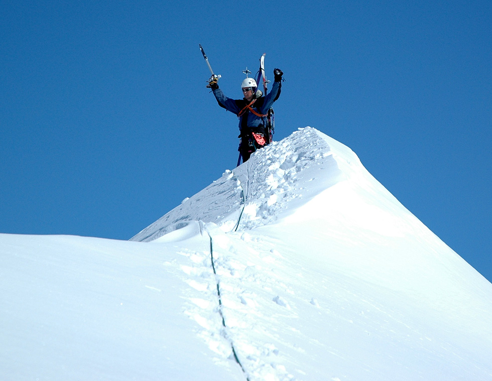
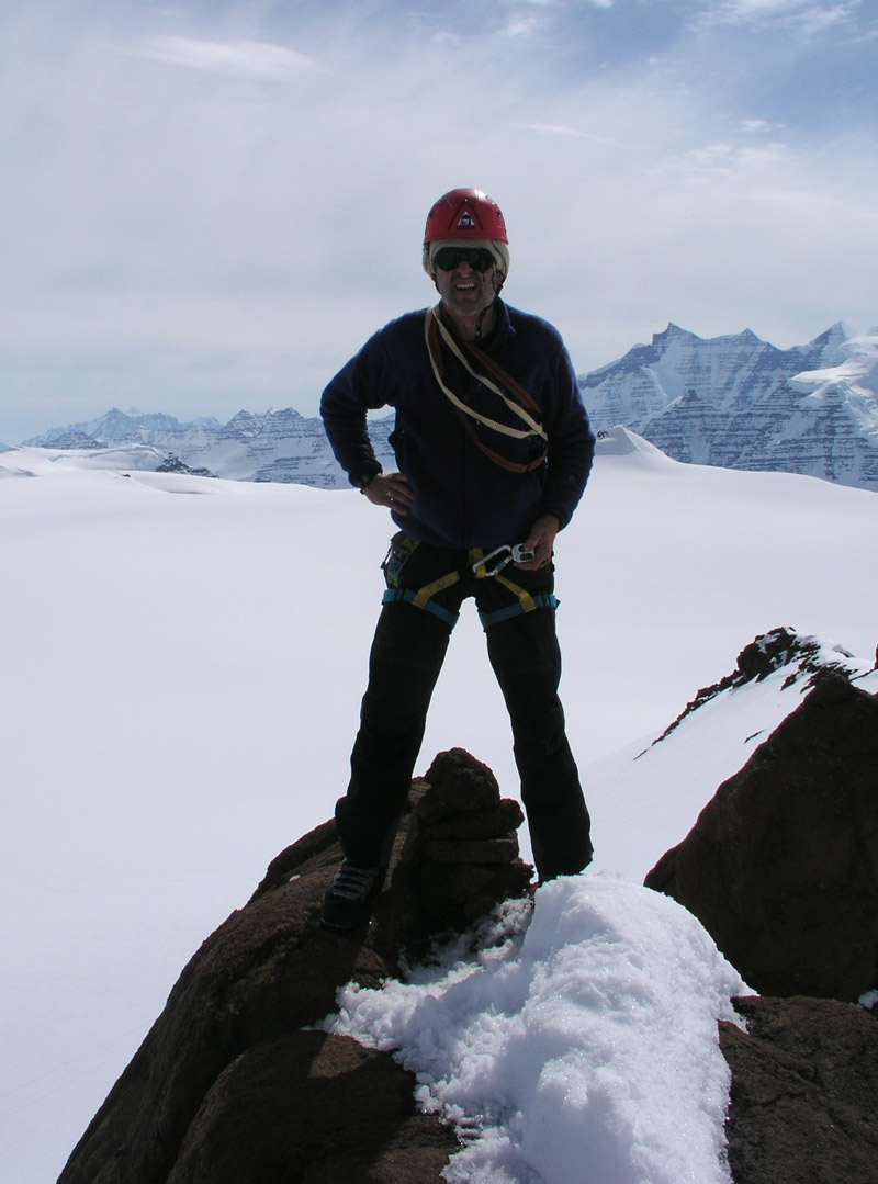
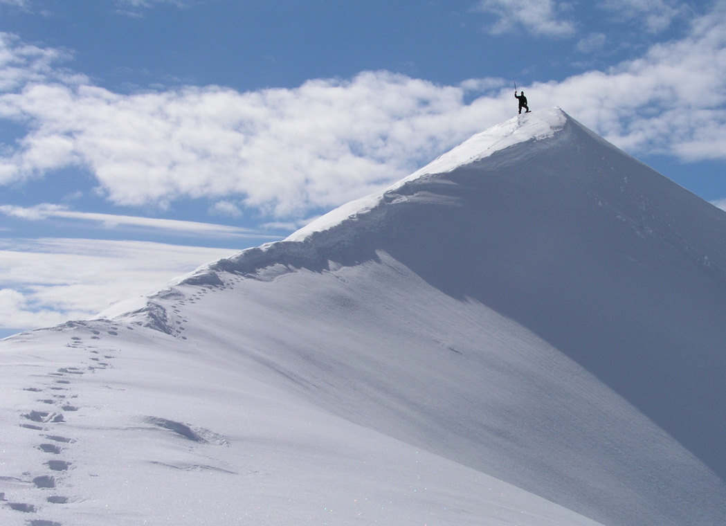
I made the summit about 3 minutes after Arnt, with Per Ove following fairly soon
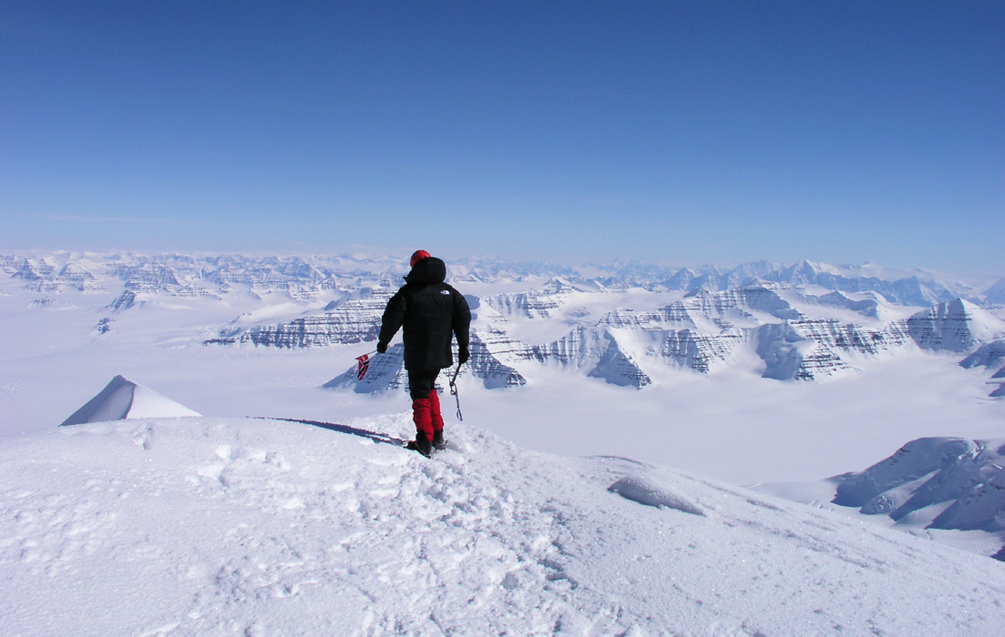
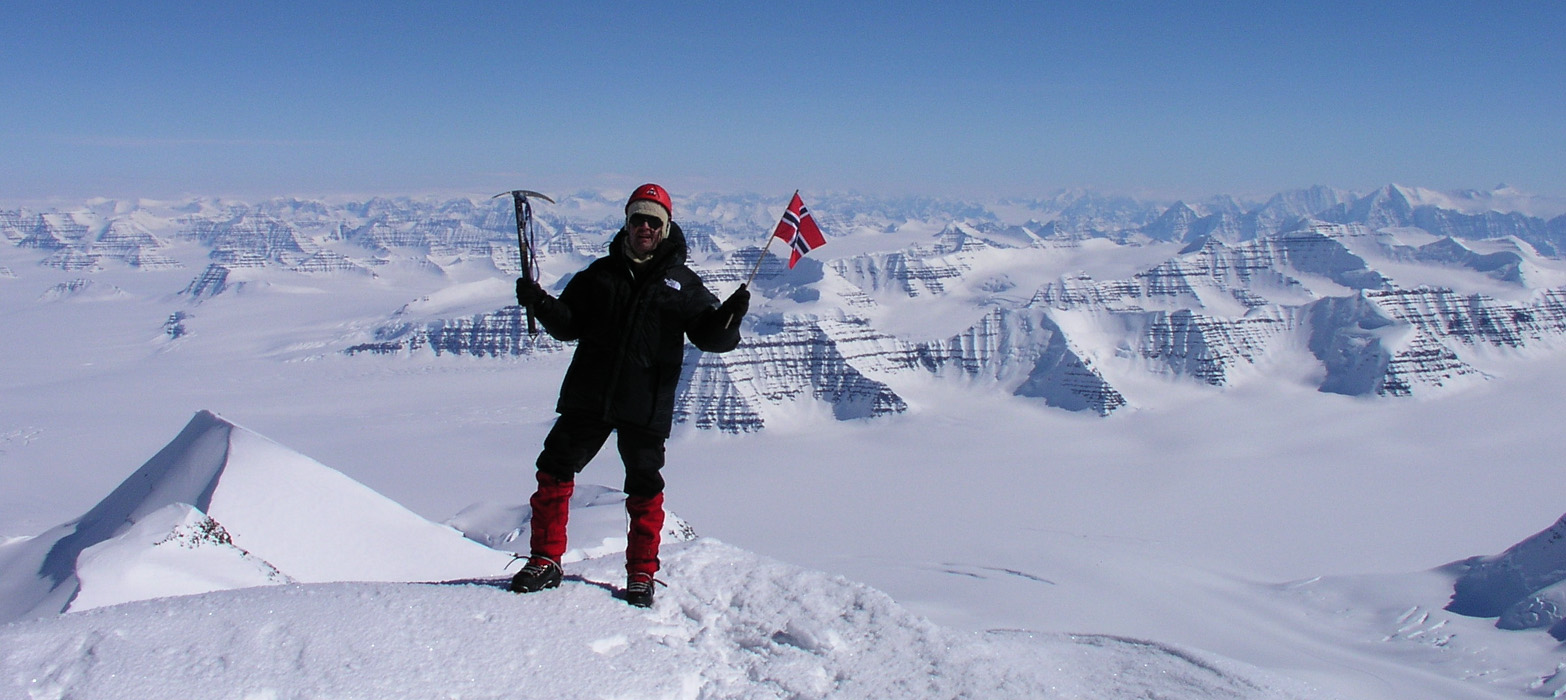
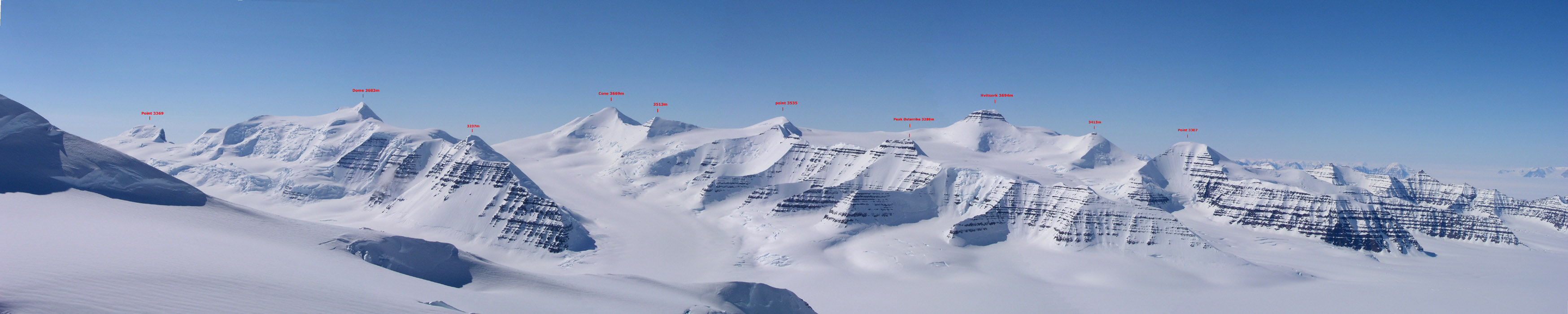
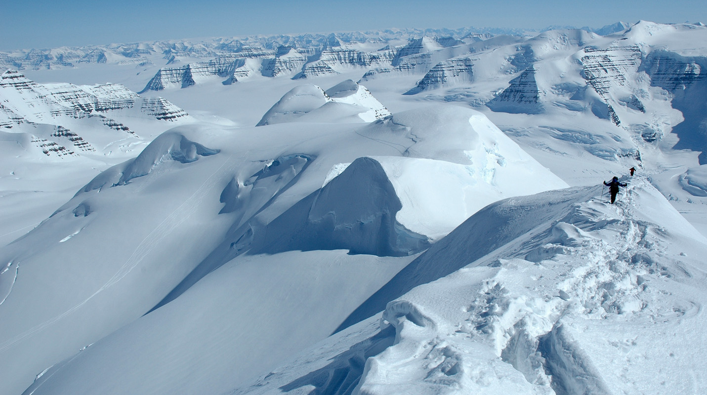
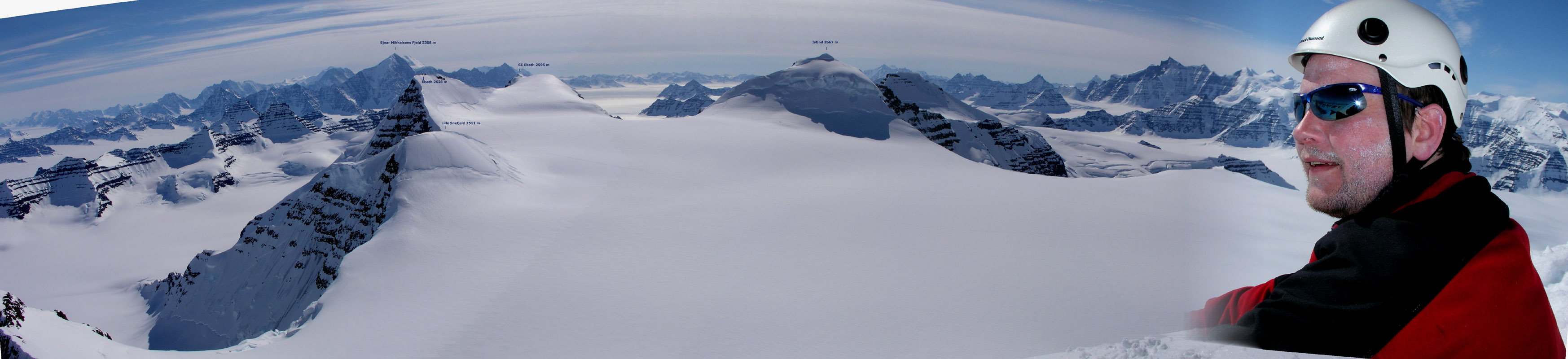
thereafter. FANTASTIC VIEW ! We put down the
Norwegian flag that had been brought because
of the National Day. Pictures and enthusiastic celebrations
of a very perfect summit,
there was no wind, the sun was warming, the views spectacular and breathtaking.
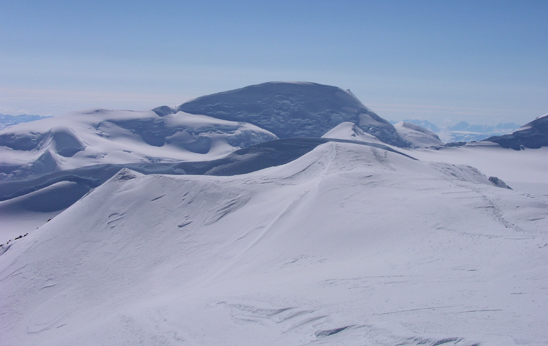
Our two next goals, Dome and Cone,
where striking features in the landscape.
These peaks are number two and three with respect to elevation.
Arnt felt very miserable due to AMS, poor fellow. Well his joy and celebration would
have to come later and gradually when recalling the moment and achievement. He hurried down
in order to minimize pain and agony.
After considerable more time, we started to see Ståle. Encouraging him along the
last few steps, he was visibly happy, but quite exhausted. After one hour on the summit,
Jan-Frode also showed up, extremely tired but with a broad grin across his smiling face.
Complete success, the entire team on top of Greenland. No problem to spend an hour
up here, warm sun, no wind, much joy.
My GPS read north 68:55.170, west 29:53.912, elevation
3695 meter. This is in excellent agreement with an official height of 3694 meter (There
may even have been an extra meter of snow on the summit).
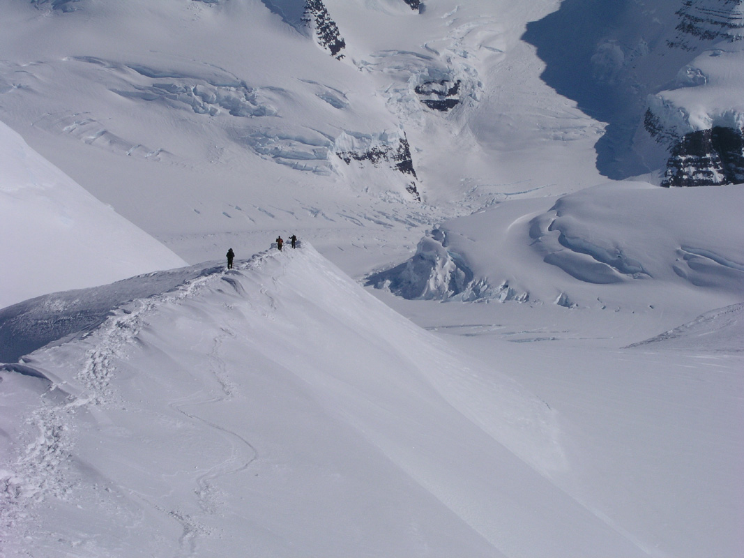
We took numerous pictures, continued to view the mountain landscape all around, there
was absolutely no need to move on.
(The panorama pictures are posted
under the peak description).
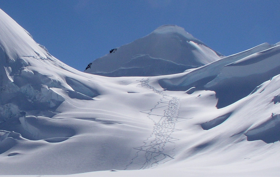
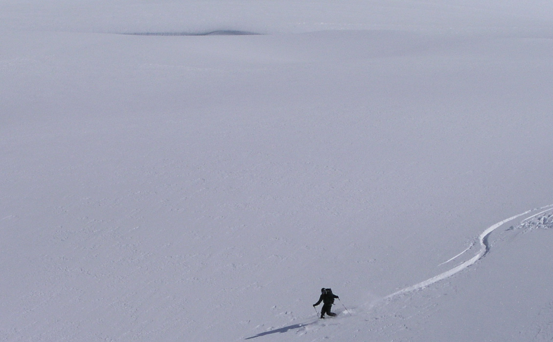
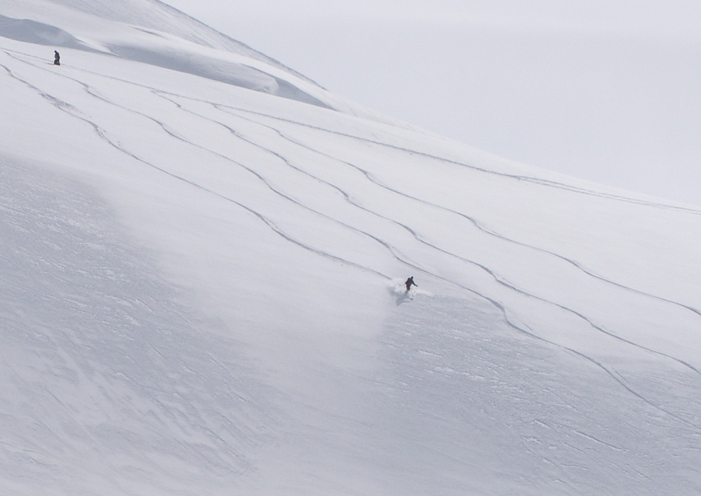
Finally, it was time to say goodbye, and start
downhill, and what a most memorable descent this was.
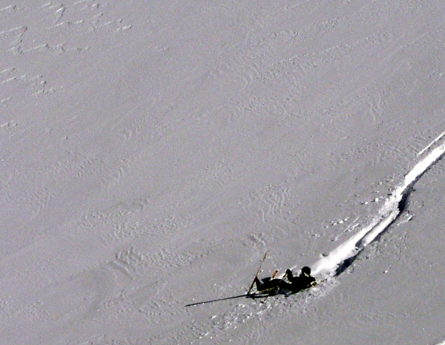
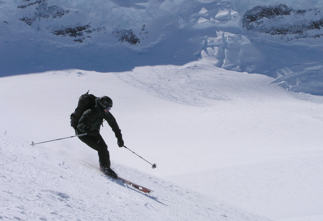
Torstein and Per Ove skied Telemark in good style from the very summit and back down to
the level area of the south ridge.
Torstein skied more or less along the ridge, partly quite
a steep section, while Per Ove skied a bit more on the west face of the ridge, more
exposure below and definitely not a place to risk a fall. Ståle and I was busy
trying to catch most of the historic action with our cameras.
Go here in order to see more pictures from
the first ski descent from the highest point north of the Arctic Circle.
Thus we succeeded beyond my highest hopes on Norway's National Day. The entire team
on top, the first ski descent ever from the highest point above the Arctic Circle,
perfect weather, perfect powder snow, there is no more than can be asked.
Arnt had a pretty bad case of AMS, thus he left the summit before Ståle and
Jan-Frode arrived. He returned directly to base camp, the lower elevation helped
him recover. I sincerely hope that he will have less problems on the next two
high summits. There is strong reason to hope, since he will have spent more time
above 2000 and since we will have to establish an advanced base camp (ABC), higher
up between those two summits.
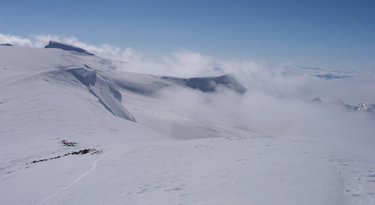
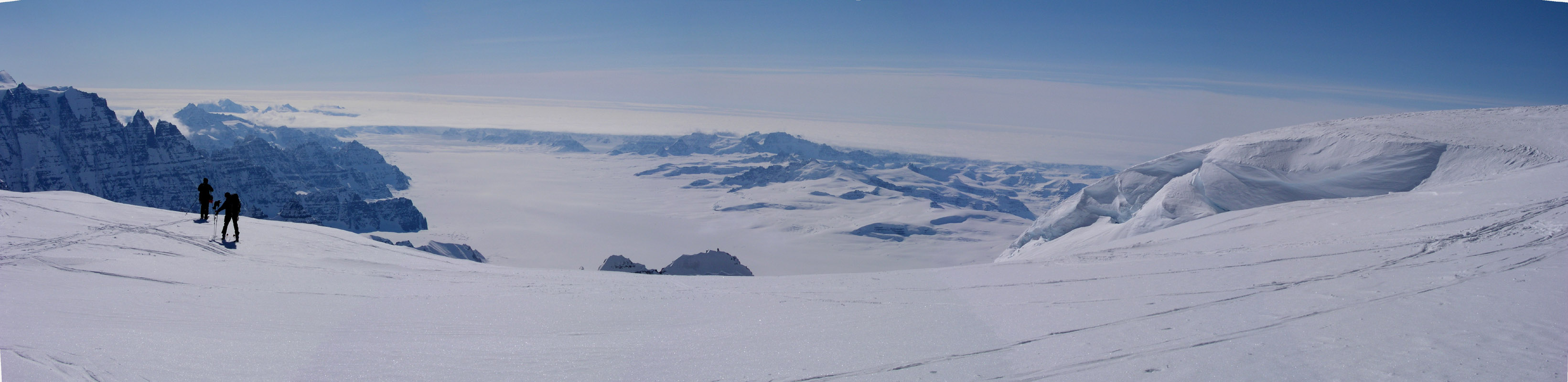
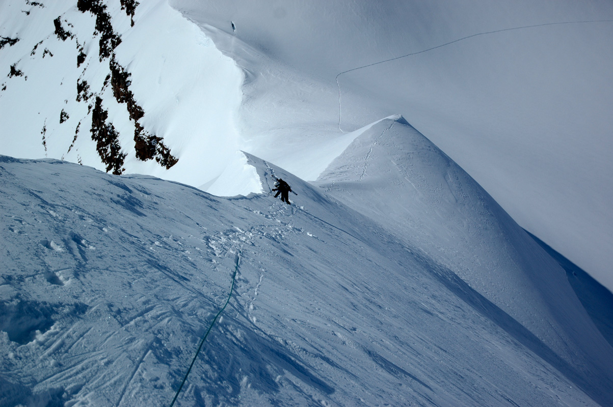
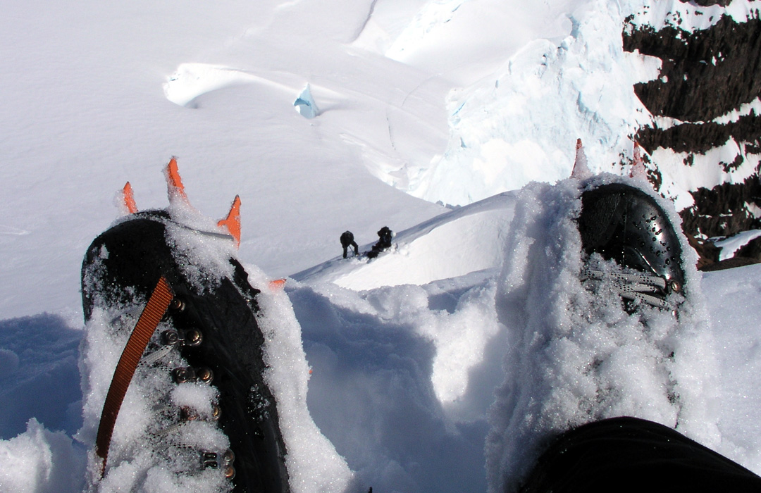
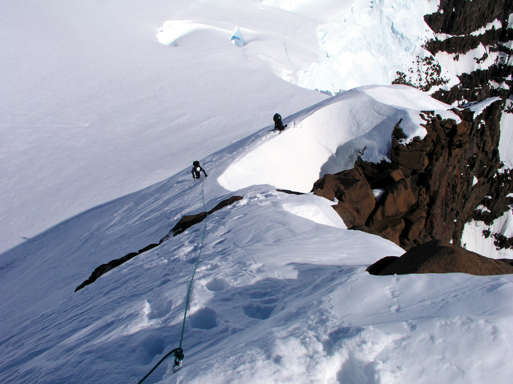
Just as we were back on the saddle, some clouds with fog
came drifting from the
west and just barely cleared the high saddle. Shortly after these clouds again
disappeared leaving the blue sky to stay in control.
Soon, the entire team was back down in camp,
the spirit was generally high after
all success and an unbelievably nice day in the arctic with a scenery all around
that is breathtaking beyond description.
I made a satelite phone call to Heidi and reported our success and general information
about everybody having arrived safely and that we were having a great time.
She would call around and report the news to at least one person for every member
of our team according to a predefined list.
This short
call revealed a second unpleasant discovery. The satelite phone seemed to kill off
one battery for each short call being made. We brought three batteries and it looked
like we were down to one. This one needed to be saved for a weather call on
pickup day to the airplane. I had worried that the boys might spend too much time
calling girlfriends when Torstein had secured NOK 5000. in sponsored calling time from
Telenor. Well, this would not at all be a problem.
Notes:
Near the Gunnbjørnsfjeld high ridge we recovered a broken climbers helmet with
the following inscriptions:
Name: David Pache (1988),
Arcadie 9
CH-1347, Le Sentier / VD
Switzerland
A final inscription read: "Cas Val de Joux FMO LA PIVETTE"
It would be interesting to hear anything about the events behind this incident.
May 18.
Skitoppen, 3266 meter.
A lazy morning with all of yesterdays events in fresh memory. Jan-Frode and Ståle
decided that a day of rest was called for. Physically, the ascent yesterday was a tough
call for both of them.
Arnt, Torstein, Per Ove and I decided to ski across the valley
and climb the top
we call Skitoppen. The trip across the valley is about one hour, looks a lot shorter.
Then the route climbs steeply up a nice glacier. Unfortunately, the Tromsø team
had broken a zig-zag trail up there that was just a tiny bit too steep for my waxed
skis. I had quite a struggle in close to a meter of dry powder, the only time on the trip
where skins under my skis would have helped.
The bottom of the glacier has elevation 2537 m, coordinates north 68:53.888, west 029:35.638,
the top is 2760 m, at north 68:53.593, west 029:35.016.
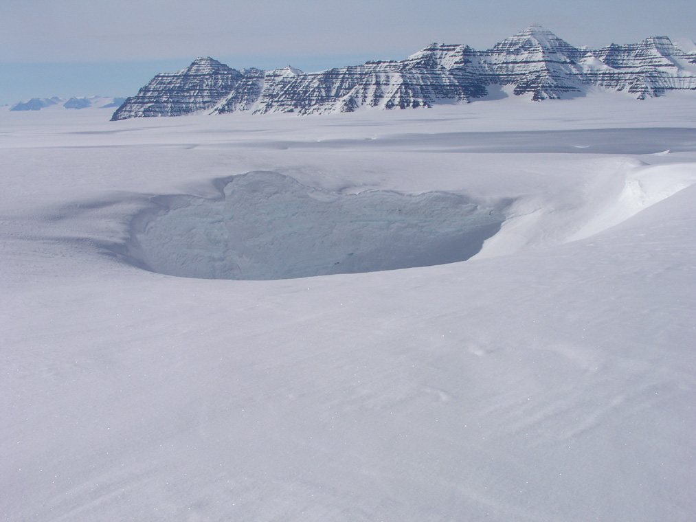
There were some spectacular crevasses
near the top of the icefall, however, a pretty safe route led to a broad summit ridge.
We could ski all the way to the summit, the last few meter being
a distinct ridge. The summit is
3266 m, location north 68:52.456, west 029:36.684. This summit has an estimated prominence of 103 meter.
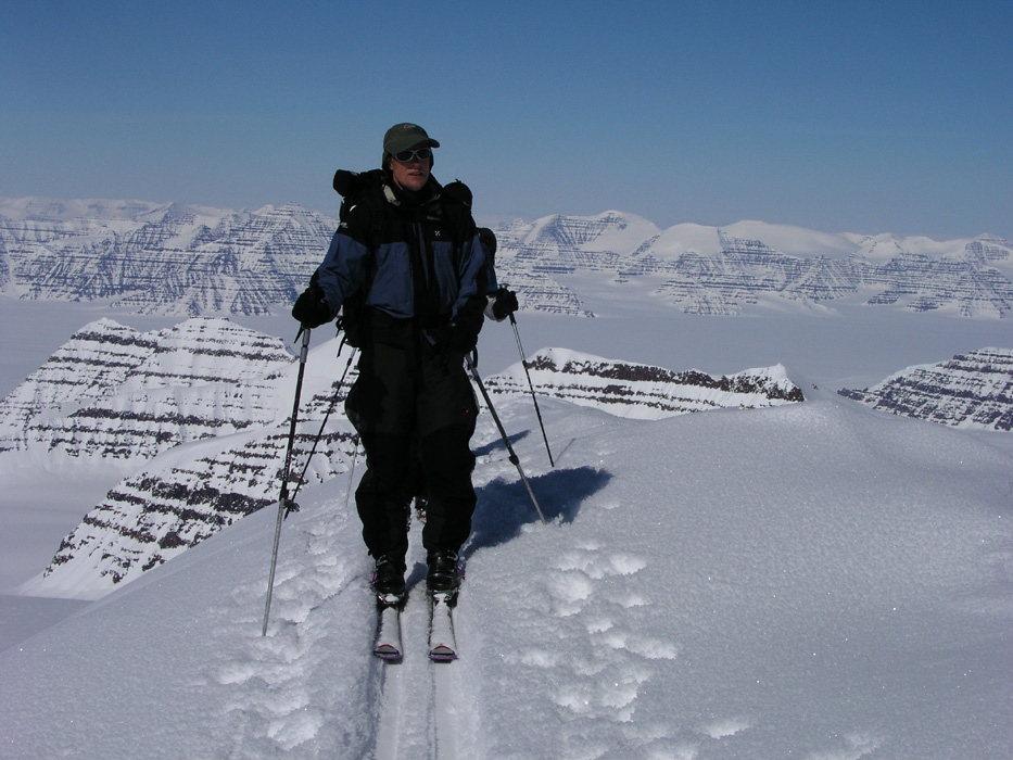
The summit view is very good, west back to the three highest peaks
in Greenland, as well as east,
a direction that we had not seen before.
Further north-east, the
impressive Ejnar Mikkelsen mountain came into
view for the first time. Looking even further north,
an ocean of peaks,
seemingly an endless area filled by glaciers and peaks.
Torstein and Per Ove descended to the next saddle,
then climbed along the ridge to explore a
possible
traverse with descent down the glacier directly below. They eventually returned to the summit and skied
down our ascent route. The steeper glacier offered excellent,
deep powder. Both Torstein and Per Ove made
an excellent demo of deep powder Telemark skiing, Per Ove so exhausted at the end that he took a fall
just as the hill ended.
The ski track across to Base Camp is longer
than it looks, but finally we are all back from
a trip that certainly was longer than anticipated this morning.
The team, perhaps in particular Per Ove, is feeling the burn of fat, there is a general feeling
that the power bar and chocolate is a bit inadequate for lunch. They want moore sweets and perhaps
some biscuits. I do agree that we should have brought some biscuits, that was an oversight and
should be written down as a point to be remembered for future trips. I will call Fridrik and check
if he can ship in about 10 kilo of additional lunch food. There is absolutely no critical issue,
but since the Tromsø team is being picked up anyway, we may as well see if this can be
taken care of.
Arnt expressed some concern about the trip to Dome and Cone being planned with too little time
and too much high elevation skiing pressed into two days. I had in any case, planned to bring
provisions for up to three days, but his points were indeed very valid. I quickly agreed with his
reasoning and assured him that we would set aside two full days for the Dome/Cone climb.
May 19.
Move to ABC.
Last night was quite cold, colder than minus 30 Celcius. Our thermometer cannot measure any colder.
I called Fridrik and asked if he could ship a box of biscuits with the airplane that shall pick
up the Tromsøo team.
He confirmed that this would pose no problem. The Twin Otter should arrive on Monday,
May 24th.
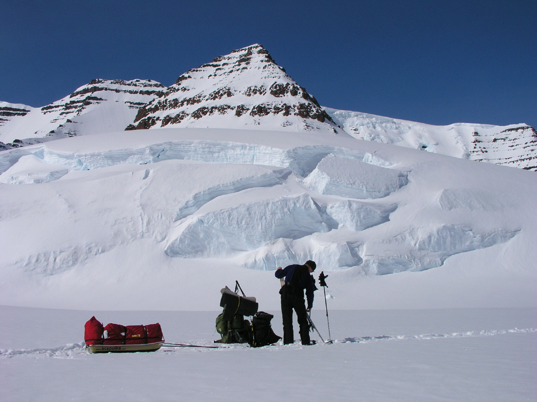
Today, we shall move camp and establish ABC - Advanced Base Camp, in preparation for climbing
Dome and Cone. We had a general wake up call at 0700. Breakfast and busy reorganizing gear, we left
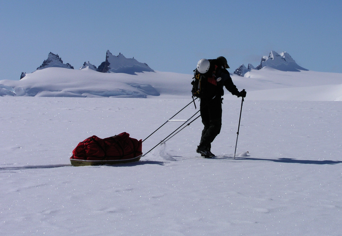
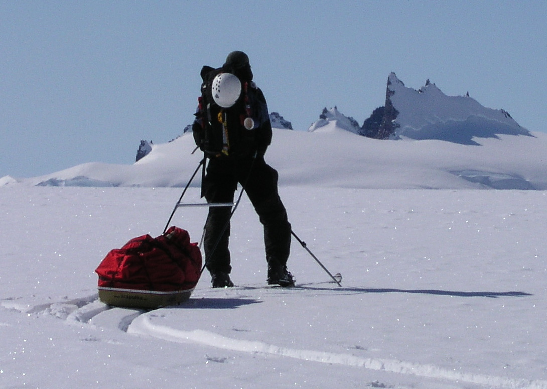
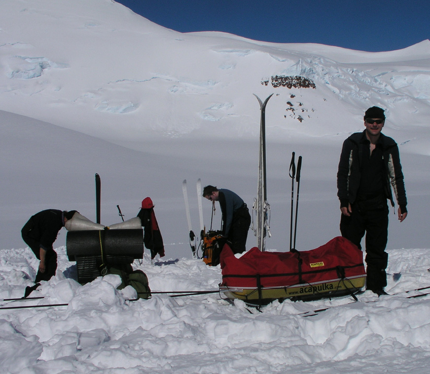
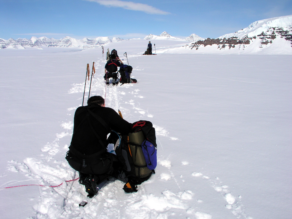
one tent at Base Camp and departed at 1000 with our two sledges.
Ståle and Torstein pulling
one each. We passed the highest point on our main glacier
at elevation 2330 meter, north 68:53.786,
west 29:44.931. There was a small ridge further on at elevation 2315 meter, north 68:53.221, west
29:45.938. From here on, our main glacier drops very gently in the direction of the horrific icefall
named "Mange Sprekker" on the map. This is an understatement indeed, the name means "Numerous Crevasses",
there is absolutely no doubts that this is the case, the glacier dropping 1000 meter before it continues
a more level flow towards the coast. The sharp peaks
along its side creating an almost unreal scene.
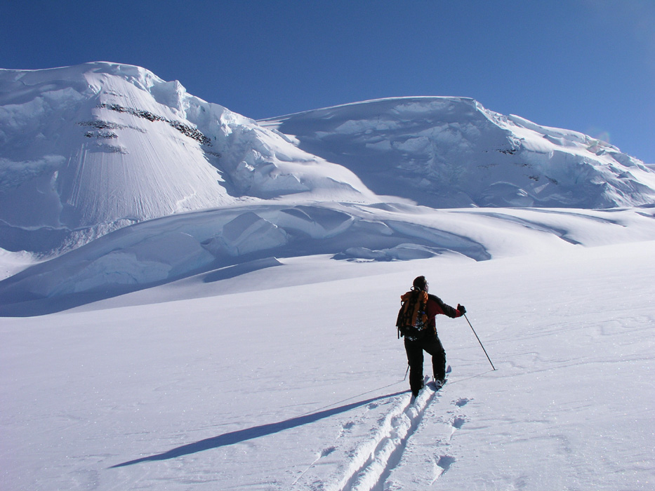
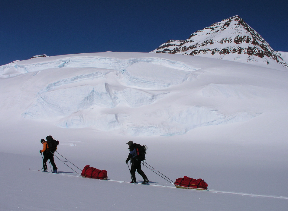
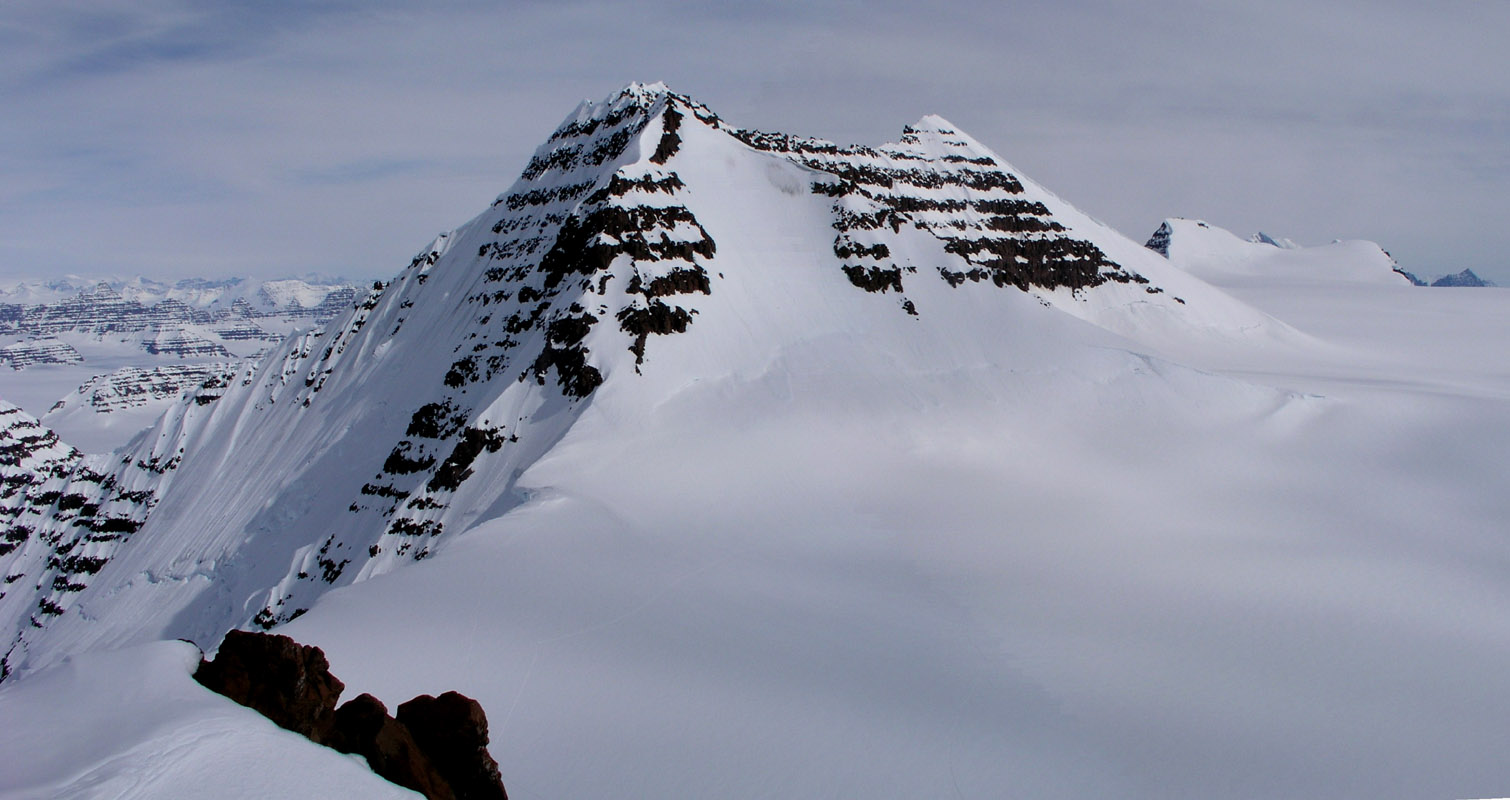
We continued up the glacier that flows down from the saddle separating Dome and Cone. What a fantastic
landscape. The high ridge emerging from Dome forms
the left and most impressive side, steep ice and snow
towering above us. We are indeed pretty insignificant in this environment.
We continued higher than the point where we turned on Sunday, hard work for the two
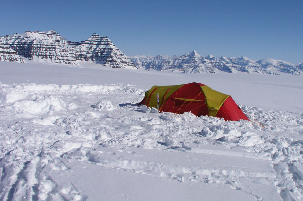
pulling the sledges. ABC established
just below a hill at elevation 2818 meter. This should serve as an
excellent starting point for Greenland's second and third highest peaks.
The ABC is located at position
north 68:51.616, west 29:53.875.
The team is functioning well, the camp is quickly established, everyone helps out, not many words
of coordination are needed. The time is now 1900, temperature is -20 Centigrade, the sun is still
high in the sky.
May 20.
Dome day.
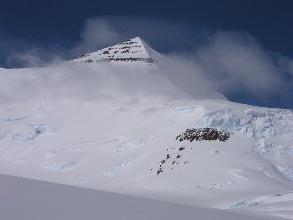
Beautiful, ice cold morning. We left at 0830.
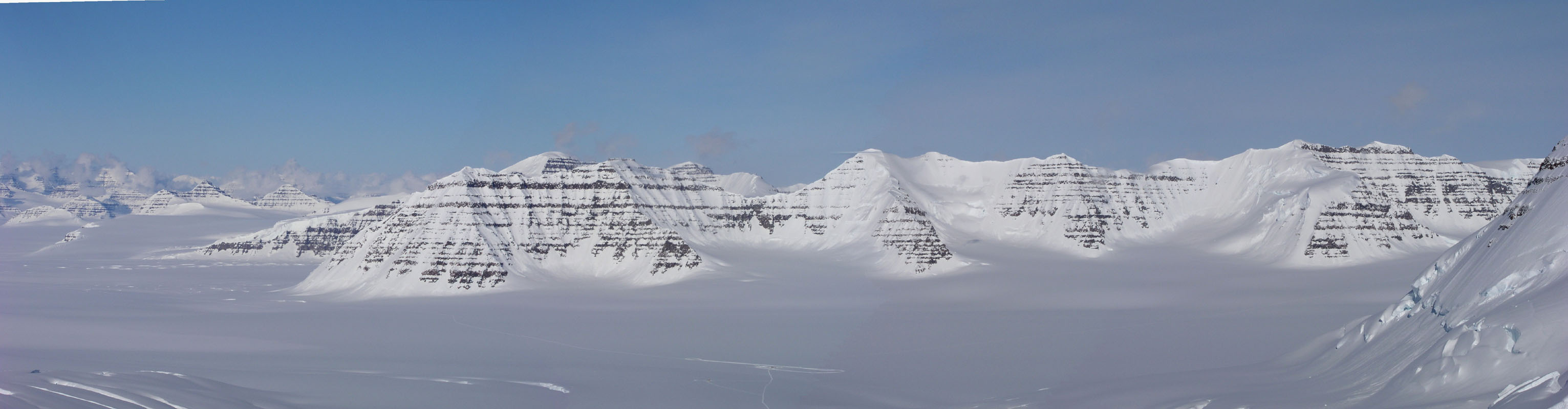
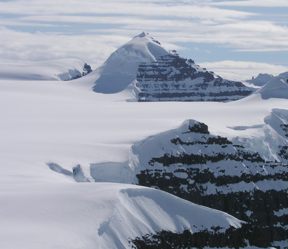
The route climbs gently up nice glaciers to the main ridge that extends
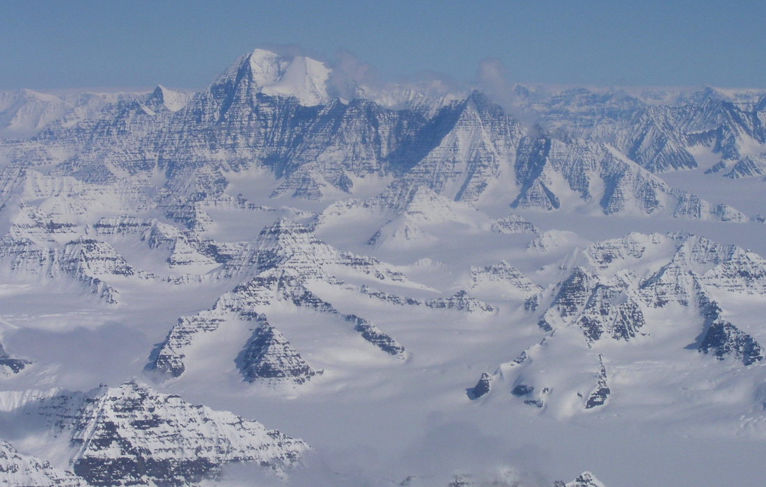
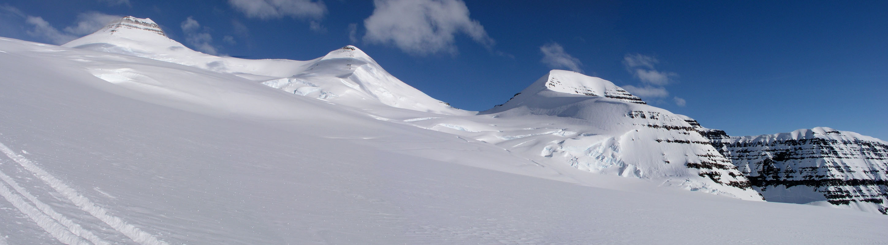
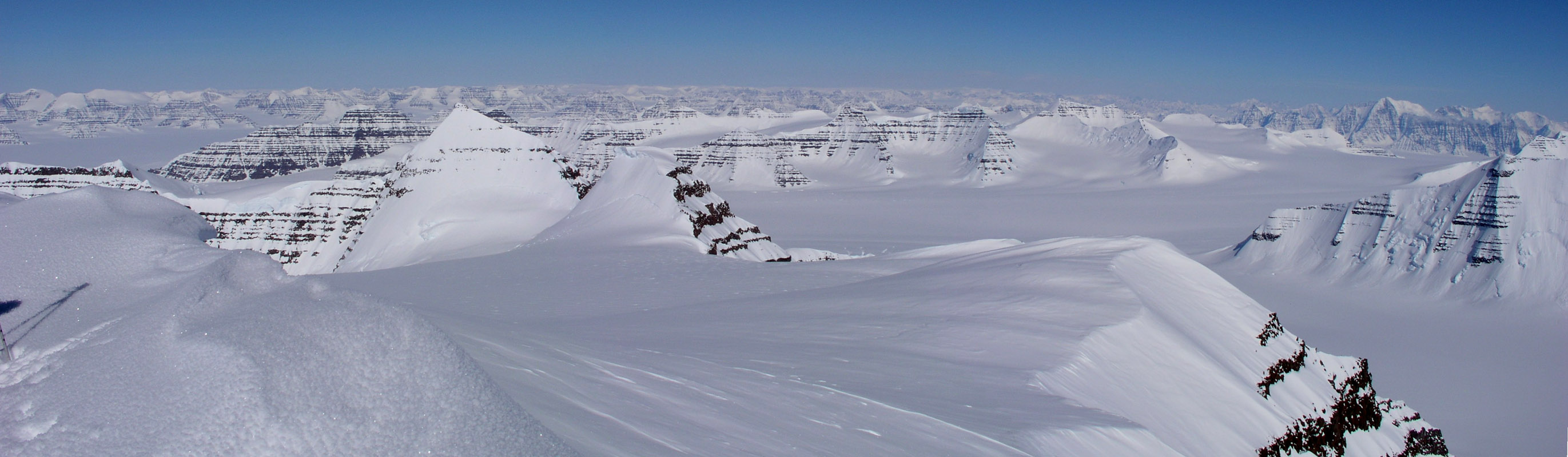
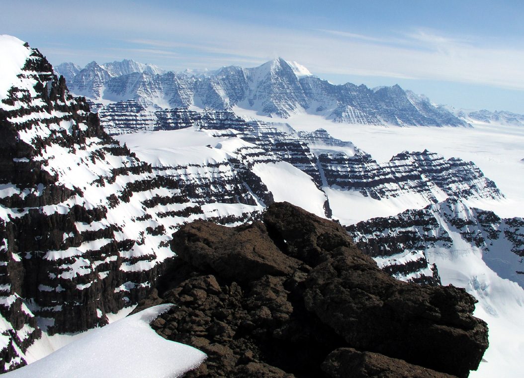
from Dome. In the beginning, the view back south-west across Korridoren to
Christain IV Gletcher,
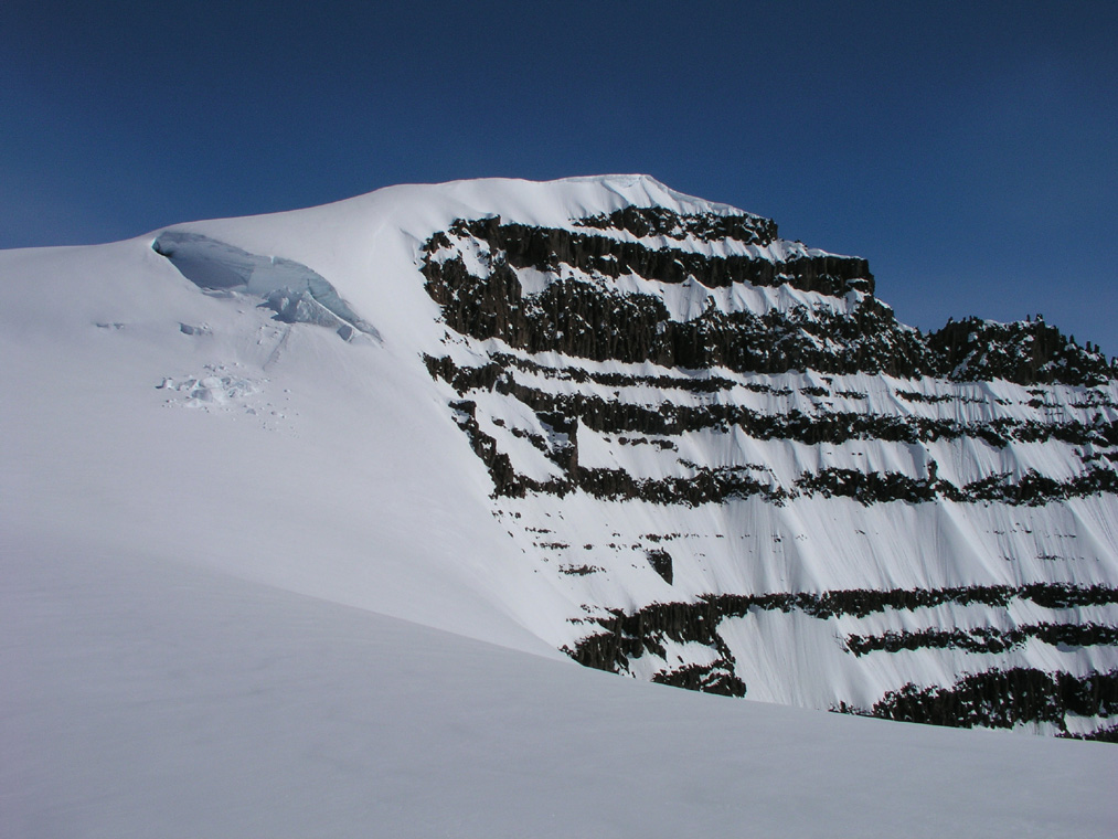
just gets better as we climb higher. The impressive vertical cliffs from
Styggehorn can be seen in the right corner of the previous picture.
We rested with spectacular views to the south at elevation 3326 meter,
location
north 68:50.898, west 29:52.649.
The ski route continued up another gentle slope
and ended at a small, local top,
elevation 3447 meter, north 68:50.634, west 29:53.685. From here, there is a 50
meter deep saddle
before the main summit ridge begins.
We continued on foot and
reached the top at 1230 after a very nice, one kilometer ridge walk.
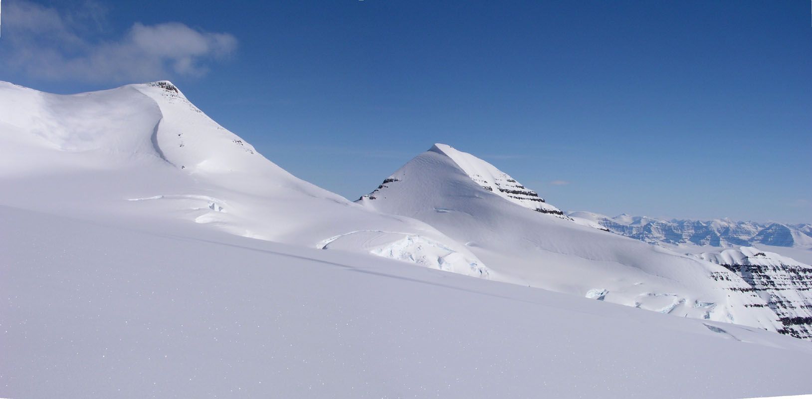
The summit panoarama views were perhaps even more impressive than from Gunnbjørnsfjeld
(these pictures are under the Dome entry in the mountain list.)
Our strategy has now worked well at two summits. By keeping the time on
Greenwich (equal Iceland) time, we are actually getting up a bit earlier than
local time should dictate. The early "suffering" has paid off. Firstly, one normally
regains comfortable temperature when skiing uphill in a sustained fashion. Secondly,
and most important, we reach the highest points in the Arctic when the sun is at
its highest and warmest. This leaves time for long summit rests,
long breaks for
photography and motivation to carry skis to the summit for then to capture good,
first ever, ski descents.
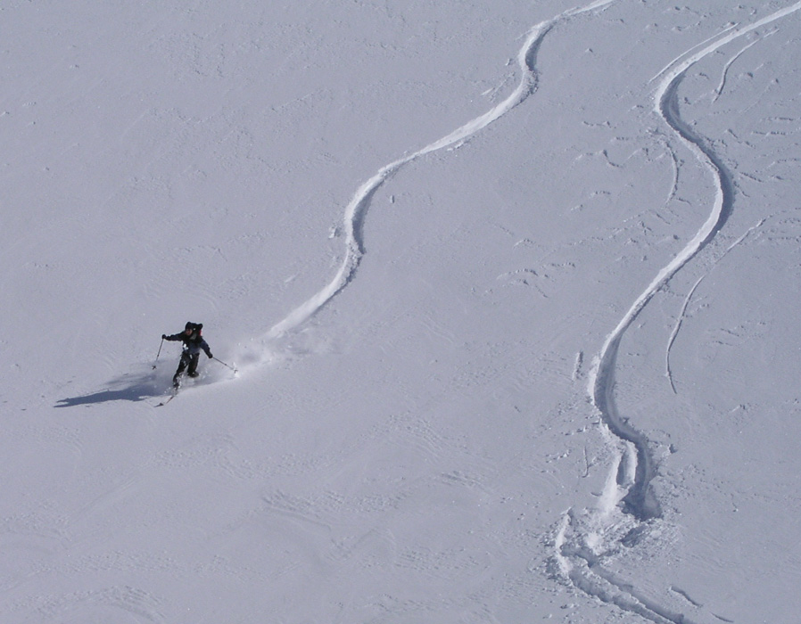
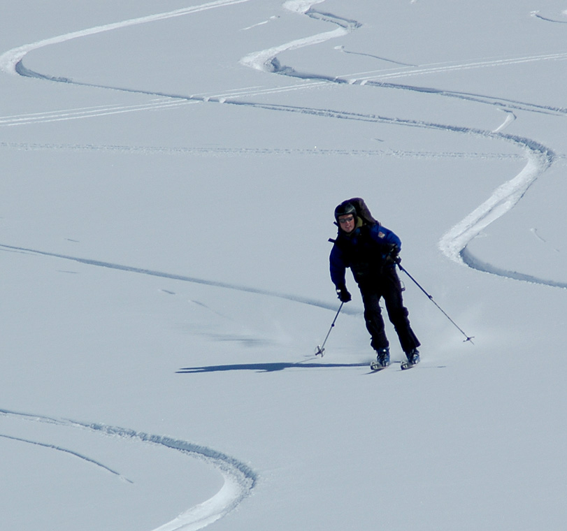
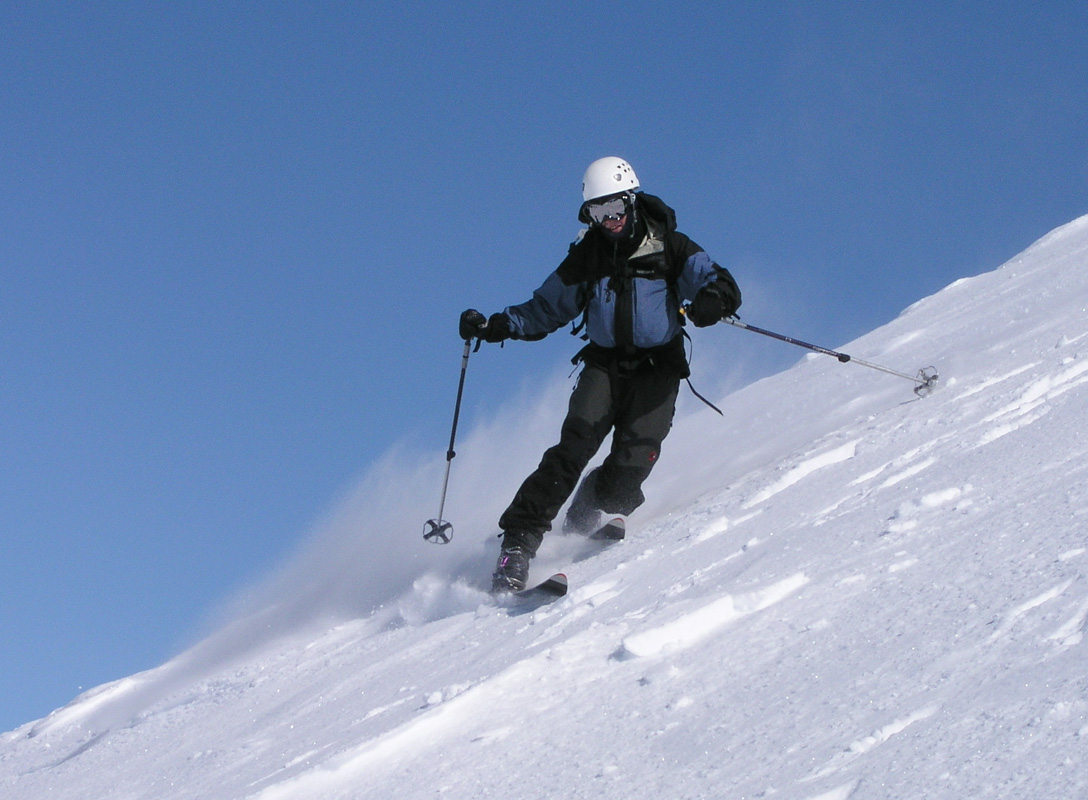
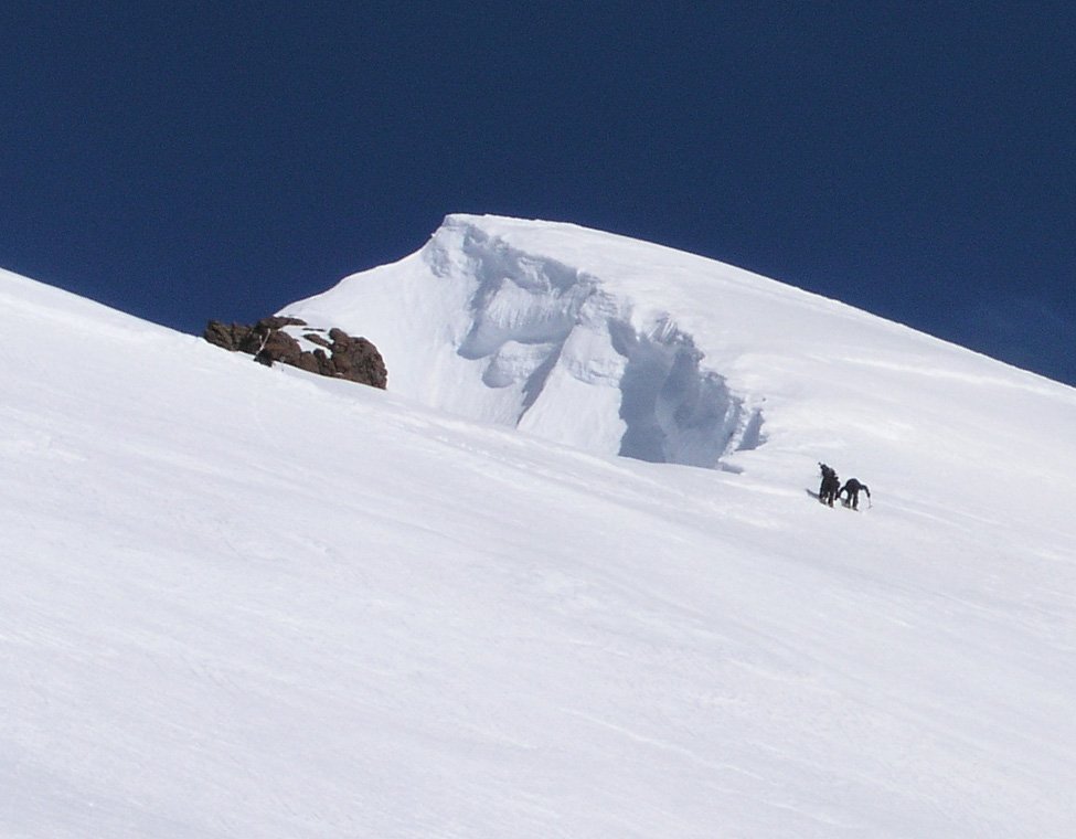
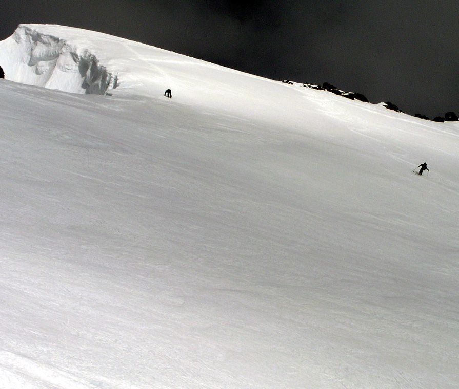
Again, Per Ove and Torstein skied from the very summit and down to the saddle before
the small local hump in the ridge. They started out down the very ridge, keeping on the
east side, then skied more steeply down to the glacier below. The ski descent finished on
more gentle slopes above two very distinct open crevasses
and traversing directly back
into the saddle below the Dome summit ridge. The rest of the team walked
back down along the route of ascent.
A final uphill
to the top before the Dome saddle,
then a very long and very nice ski descent back to ABC.
Dome is in many ways, the finest mountain in this area. Its position overlooking the lower
area extending to the east coast, its monumental ridge towards the icefall "Mange Sprekker",
its view across to PEV, the 4th. highest peak, lastly, but not least,
the one kilometer ridge,
very distinct, but not difficult,
all contributes to make Dome a very special mountain.
We returned to ABC
with good skiing, in almost no time. The last hill being such fun that
Per Ove, Ståle and Torstein skied back up, just to get a second run
down. Arnt, did
very well today. No signs of AMS, I think he truly enjoyed Dome, this is indeed very good and
I am very happy about it.
May 21.
Cone day.
Everybody slept OK after yesterdays great adventure.
We were ready to leave ABC at 0845.
We skied up on easy snow with Dome towering
behind us, to the bowl just below the south-west ridge that extends
out from Cone. This bowl is at approximately elevation 3425 meter. Except for our
two summit skiers, we left the skis and continued on foot. The first section, from the
bowl to the south-west ridge was steep snow and care
should be taken to avoid a glissade
back to our point of departure. The south-west ridge, elevation 3500 meter, is quite
level before it reaches the summit dome. The final ascent,
on moderate snow and appropriate
zig-zags carried no problems. I arrived at 1155, shortly after Torstein
and Arnt. We have
now made all three summits in the same order, Torstein, Arnt, me, then Per Ove followed
by Ståle and Jan-Frode.
This summit was cold and windy, more so than the previous two.
My GPS recorded an elevation of 3663 meter, a few meter low. The location is
north 68:52.283, west 29:57.009. I did pay particular attention to the interesting
summit Styggehorn to the west. This summit forms the top of a very big vertical
rock wall extending up from the glacier Korridoren.
This peak was more windy and therefore felt colder than the
previous two. Our stay was kept to a minimum and soon
Per Ove and Torstein
prepared for the ski run.
After photography and further
summit observations we returned down, meeting Ståle and Jan-Frode as they approached
this third highest summit in the Arctic.
Again, Per Ove and Torstein
did perfect Telemark ski descents from the very summit
and back to ABC. This completed our three ski descents from the three
highest peaks in the Arctic in less than one week.
We broke ABC and started back towards Base Camp at 1430.
Ståle had some
rather hazardous skiing down the glacier with a sledge behind. Despite a significant
crash, the equipment held up. Ståle
learnt that downhill skiing with a sledge
behind calls for some extra caution.
Per Ove
pulled the other sledge, he was quite a bit ahead of me and Ståle on the return trip.
We reached Base Camp at 1730, so only three hours
going this (easy) way. The day ended with a warmer evening than we have had
so far.
May 22.
A day for rest.
Last evening, the clouds came in. The first clouds seen since we arrived here.
The wind also picked up, however never strong, just noticable.
This morning came with grey weather. In fact, WHITE is a good description
for outdoors right now. There is a light snowfall, everything is white, nobody
felt like getting up early. Having accomplished all main objectives in less
than a week, partly because of good team dicipline in getting up very early
in very cold weather, this is clearly our well deserved day of rest.
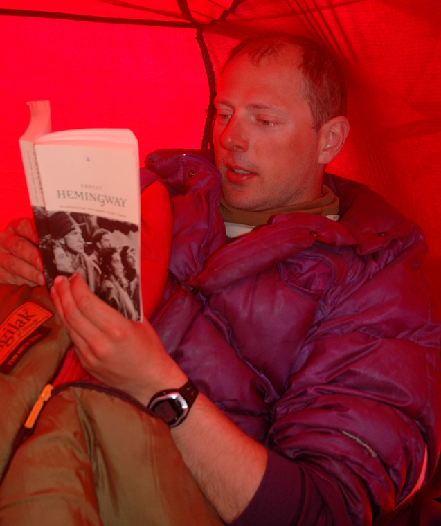
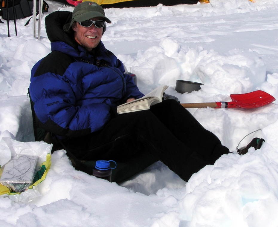
A day for reading in the tents. A couple of books on Everest, then the famous
To Whom the Bells Toll, by Hemmingway.
The time is now 1300 and I am still in the tent. I have completed breakfast,
not much more. The air pressure is a bit lower than what we have observed
earlier, in agreement with the observed conditions. We cannot complain, the
weather has been fantastic. As often is the case, conversation easily turns
to speculations about how long the current conditions will last. My guess is
not too long.
I got up and out later in the afternoon and skied a solo trip to waypoint 4,
the place we turned around last Saturday. Elevation 2600 meter, so I had a small
workout in whiteout conditions. The entire trip being guided by GPS. I ran into
the old track higher up. It was more visible and less filled with snow up there.
On my return ski,
the clouds started breaking, it seemed like good weather
was about to return.
Pasta for dinner, very tasty.
An unpleasant discovery followed as an aftertaste: We had brought 24 portions of
pasta for 6 meals, however 6 portions had by mistake been used for each of our two
pasta meals so far. Thus, one of our future dinners had already been consumed!
Not a big concern, we had pancakes as an extra luxury not allocated to a day, and we would
always go on various leftovers the last day if required.
We started to talk about tomorrows possible
goals. After team work all previous days, it seemed reasonable to split into
smaller groups to maximize individual preferences. The possible ascent of
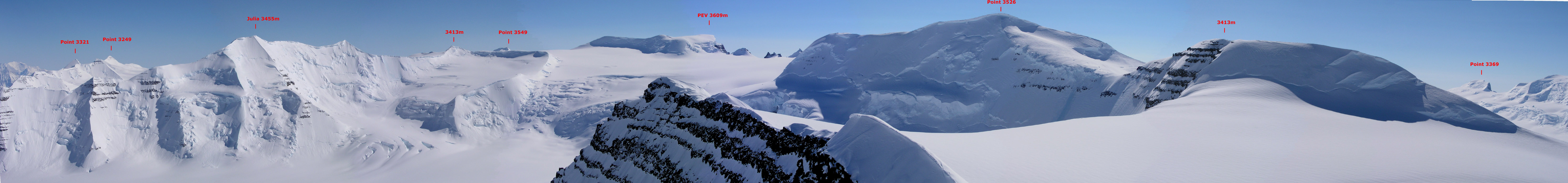
peak 3526 across the valley was discussed. This peak behind what we call
"the shark fin", looks interesting. Ascending it would require a ski up
what looks like a fairly broken up icefall. Another possibility was an attempt
at Greenlands number 5, peak 3603. This peak is up the glacier to
Gunnbjørnfjeld, across the saddle and further west beyond Cone.
Per Ove and Torstein would like to explore the pointed peak on the
left side as we ascend the glacier, possibly trying to follow the high ridge
back out towards Base Camp and the big valley glacier. Point 3535 just across
the high ridge from Gunnbjørnfjeld would be another possibility if 3603 should
turn out to be outside of our reach for the day. With three different
projects up the glacier, we settled for this. Agreement to get going at
0700 tomorrow, an early start guarantees the best conditions higher up.
May 23.
A day of further exploration.
It turned out that all three objectives being discussed yesterday, became
realities. We all skied up the glacier to the vicinity of the big
crevasse. At this point Per Ove and Torstein
headed left towards the pointed
peak that just barely is visible from Base Camp. They climbed it, the slope being
steep enough to require belayed climbing.
They carried the skis all the way up with the
intent to traverse the peak, however the terrain and snow
did not invite to any
further advance and they downclimbed carefully along their route of ascent.
The peak was named "Peak Bergen", however upon return to Norway I learned that
it was already climbed once by the Austrian team who christened it "Peak Austria".
It was a fine accomplishment and certainly the first time ever that somebody
visited the peak with skis on their packs. This peak is estimated at 3262 meter with
a primary factor exceeding 100 meter. A very fine climb indeed.
Meanwhile, Arnt, Jan-Frode, Ståle and I continued up the glacier. Arnt did
not feel any motivation for 3603, his goal was 3535 at the crest of the glacier.
Unfortunately, Jan-Frode decided to turn around and return to Base Camp, not feeling
up to the long and hard uphill that he already climbed on May 17. This created a
slight problem as Arnt wanted to know if he could climb 3535 solo in case Ståle
and I would head for 3603. I thought that would very likely be completely safe,
however told him that I would reserve judgement on this until getting high on the
glacier with a better view of the summit route. Not completely happy, but with
understanding for our general policy of no solo climbing, we all continued uphill.
I decided that either we make a (safe) exception to the rule, or the three of us would climb
3535 together. Arriving higher, it became clear that 3535 was a very gentle slope that looked
free of crevasses. Arnt got an OK to climb it solo, with a stipulation that he made a
very visible sign in the snow upon return to the main ski track before skiing back down to
Base Camp.
Ståle and I continued across the main Gunnbjørnfjeld saddle, crossing it just west of
point 3535 at elevation 3438 meter, north 68:53.556, west 029:55.234. A gentle downhill followed
across a pretty large glacier, our course being set just north of Cone.
We arrived at the
north-west ridge of Cone, elevation 3264 meter, north 68:52.743, west 029:57.581. It was not
hard to cross the ridge at this point, then very good skiing across the glacier that is
situated north-west of Cone, between it and our target point 3603. Our skiing brought us
easily up on the lower part of the north ridge of our mountain to a point at
elevation 3309 meter, north 68:52.346, west 030:00.401.
At this point it should be noted that our peak is 3503 meter, not 3603 as stated on our map.
We did not realize this error until after our return to Base Camp upon a closer inspection of the
map and carefully counting contour lines. This summit is pretty much exactly 30 degrees west.
We could have continued up the ridge on skis, however, having skied a long way and not knowing
what challenges the ridge might offer, we left the skis and most equipment including our
climbing rope at this spot. The ridge did look quite easy and according to the map it should
never get really spooky. We used crampons and encountered no difficulties while ascending about
200 vertical meter. However, the last 50 meter
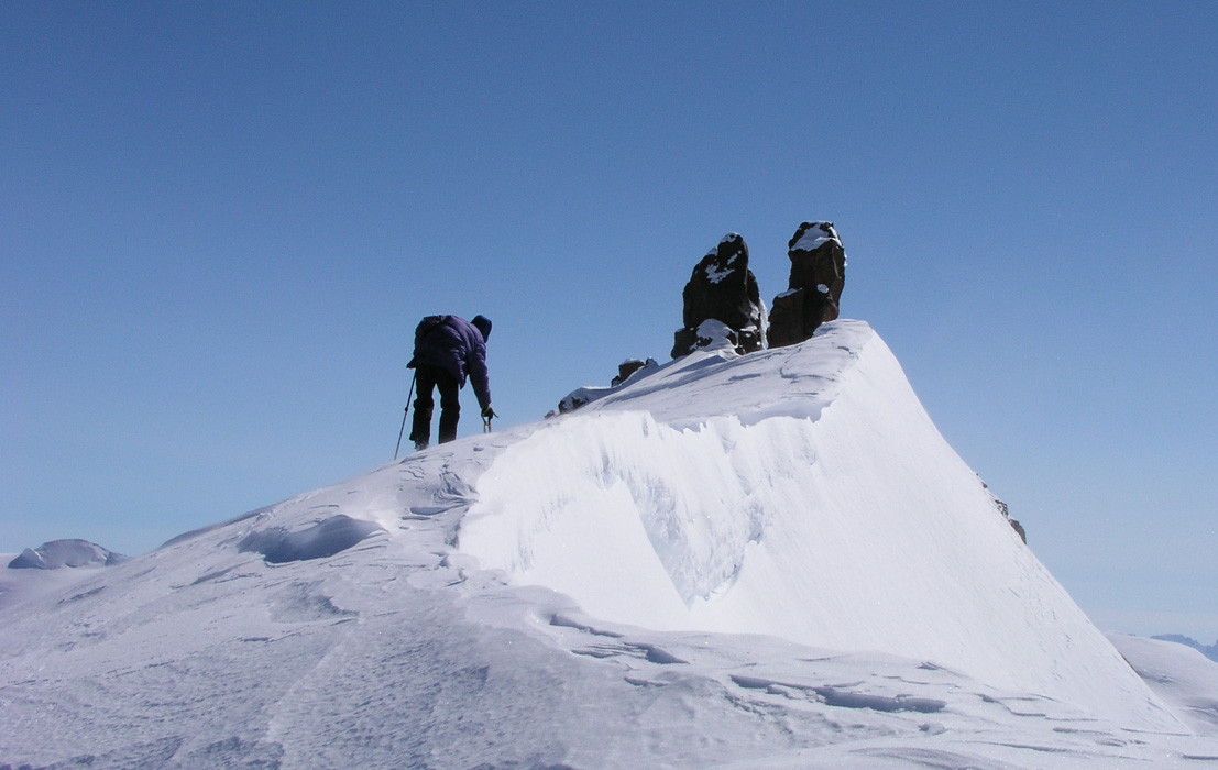
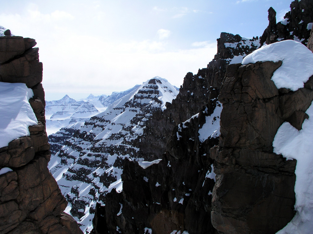
to the summit were quite interesting. The ridge
does narrow, and a vertical cliff appears on your right (west) side. As you approach the summit
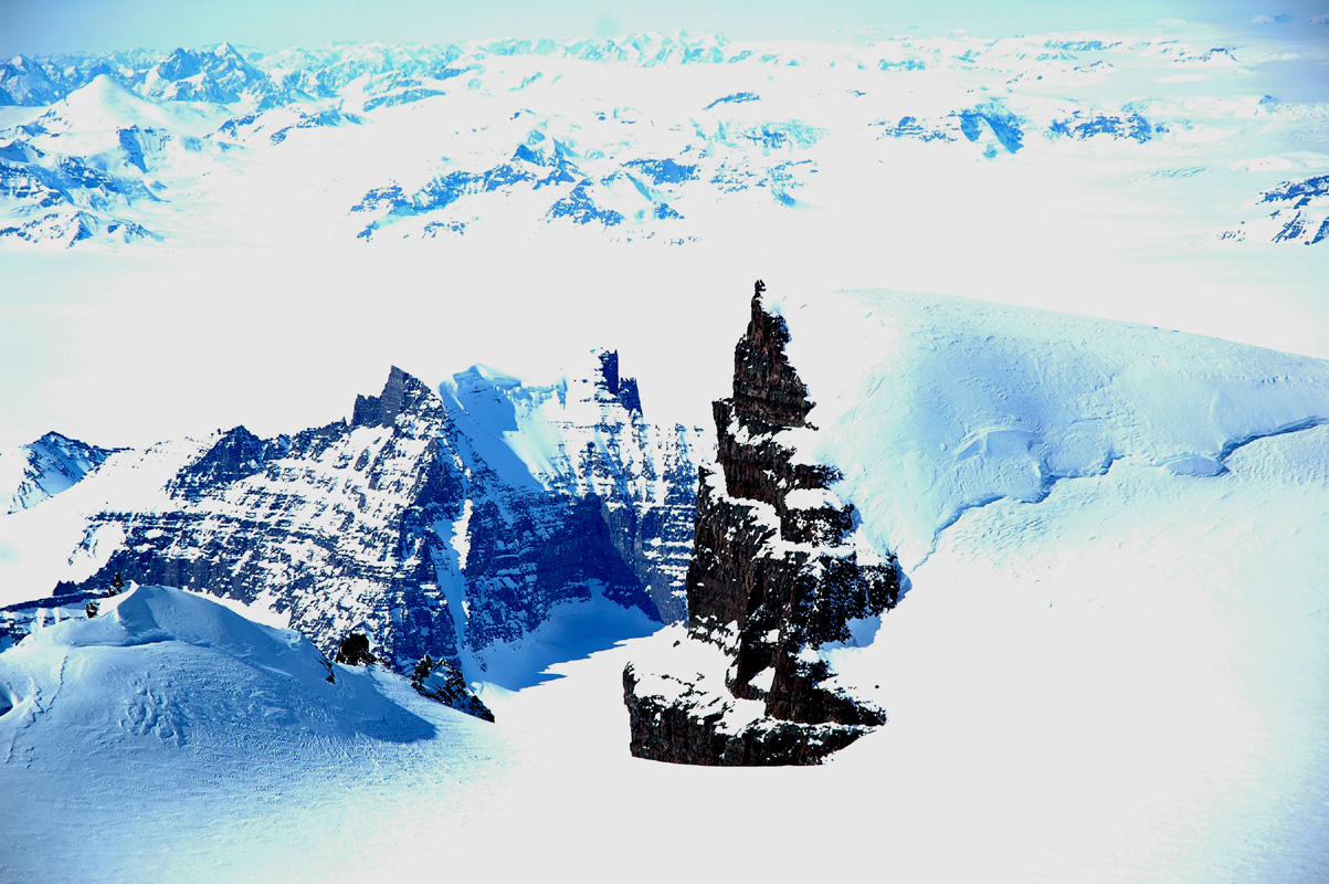
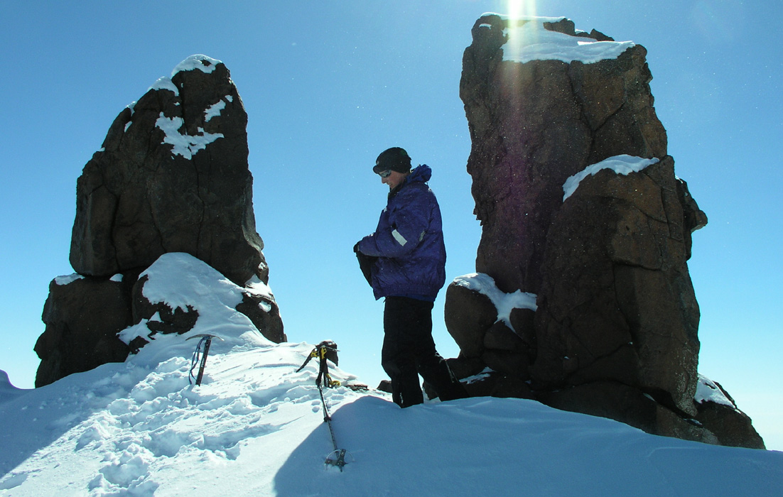
you realize that there are two single blocks of rock
at the summit. These pieces of rock, each
about 4 meter tall, stand there on the very edge, partly leaning out
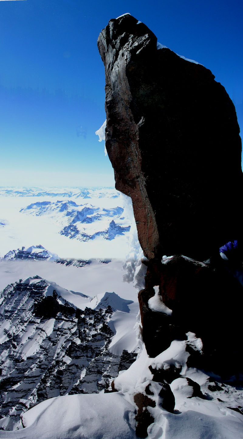
over an incredible void.
The glaciers below are 1800 vertical meter down. The whole rock formation with this
gigantic cliffs on two sides created a very strong updraft that whistled
and served as a constant reminder that this was indeed a place where one should move around
with considerable care.
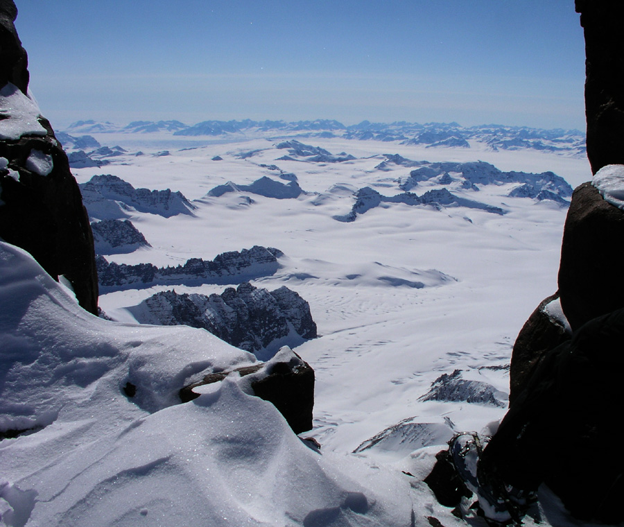
A totally unreal experience to look out like through a window on jagged peaks
incredibly much lower.
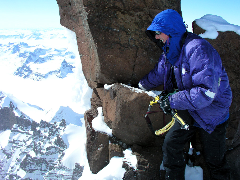
Should one try to climb on top of these horns? The rightmost had some
small flat footholds and cracks suitable for climbing. What if the whole piece would just break
loose and disappear into open space? Extremely unlikely, but maybe nobody had ever tested it.
Without a rope, there was really no option, but to take a few steps up as high as absolutely
safe, not quite holding your hand above it, but fairly close.
My thoughts go to the peak Sunlight among the Colorado Fourteeners. To me, it seemed absolutely
clear that you did not really climb that peak unless you scrambled the last ten meters to its very
top. This felt different, I think both Ståle and I felt we had indeed climbed the peak
even if we did not stand (or sit) on top of these insane horns. In any event, it is a fine point and
I do recommend that the next party headed this way do bring their rope to the very summit. Make a
bomb-proof belay and enjoy a very exposed position.
After a summit experience second to none, the time had come
to start descending. Ståle first,
while I captured the panoramic view
of an almost uncountable number of peaks further west.
Fantastic weather, exotic glaciers, our lone ski track
the only trace of life. Our trip totalled more
than 25 kilometer with a vertical ascent of 1700 meter. We returned to Base Camp after 10 hours, many
thanks to Ståle for sharing with me one of my finest skitrips in the arctic. The views we had both
west and north were just unbeliveable. They brought me thoughts to the first ascent party of
Gunnbjørnsfjeld in 1933. They came up Christian IV Gletscher, we also had a nice view directly
down to the long and more narrow glacier called Korridoren.
We named this peak Styggehorn (ugly horns) after the very characteristic summit. The immediate
disappointment when learning that the peak was indeed 100 meter lower than its map height, quickly
faded as we realized that we still may have completed a first ascent of the highest unclimbed peak
in the arctic.
Arnt had completed his ascent of 3535 without any incidents and safely returned to Base Camp. His peak
may be the 7th. highest on Greenland.
Various notes:
I changed a new 256 Mb memory card into my digital camera today.
May 24.
No flight today.
Today, the Tromsø group is leaving and a new group from
Tangent (Paul Walker's company) is due to arrive. The Tromsø group
decided to have their logistics taken care of by Paul W. Clearly, convenient,
but at a significant expense compared to our budget. As things turned out, we
probabely would not have saved a lot by coordinating our trip with Tromsø.
The key to cutting cost on this kind of trip is to find some other party that
can help utilize the Twin Otter better. We have the luxury of paying for two
empty flights, the upside being that we are completely independent and can ask
the pilot to pick us up anywhere without regard for where an incoming party
would like to land. Even with this expense our trip is significantly
cheaper for the participants than what a commercial operator like Paul W.
offers.
I shall inform the captain on the Twin Otter about our pickup point. We want to
move into what hopefully is an unexplored area for the rest of our trip. Thus,
an advantage not having to return back to Gunnbjørnfjeld Base Camp. We have
had a team meeting discussing where to be picked up, I sort of favored a point fairly
high up on the glacier that we intend to ski to. A majority wanted the pickup
coordinates to be further down on the bigger, main glacier. This will mean that we
shall move camp an extra time, however, the skiing down to this location is likely
to be very easy, so this is not an important issue. We therefore decide on the
lower pickup point, coordinates approximately north 68:59, west 29:20.
Bad news! Here comes wind and clouds, preventing the Twin Otter from making any
pickup here today. We discussed briefly whether we should leave the pickup coordinates
with the Tromsø team and start out without waiting for the airplane.
Initially, I seriously saw this as an option, however, it became pretty clear that
my team wanted to wait for the airplane. Several arguments added up to make this
the most sensible thing to do. Perhaps most importantly, the Tromsø team was
reluctant to act as an intermediate link in our communication with the captain on
the airplane. I can see this point. We could always just call Fridrik with our
pickup location, that had been agreed before our departure. However, our satelite
phone was not at all living up to expectations, consuming a full battery for each
call to be made. We had asked Fridrik to send us a box of biscuits, it seemed that
the need for this was less acute now than a few days earlier.
There was really no sense of urgency, we were all enjoying Greenland to the fullest, most important
goals already accomplished. The next week would be a bonus week in all respects. Thus, the decision
to wait an extra day was not hard. If the weather improves, the flight should be here around 1200, noon.
A quiet day, I finished reading the book by Anatoli Boukreev on the fatal Everest expedition of 1996.
May 25.
Moving day.
Today, we shall depart for the exploration of new land. The Twin Otter
came as expected shortly before 1200. I agreed with the captain on our
pickup point on May 31. We borrowed an MSR burner from the Tromsø team
in order to make up for the one that is broken. They also generously donated
us a DryTech dinner, thus we are back to having a dinner for each day plus the
pancake reserve. The airplane failed to bring us our promised box with
biscuits, never mind, the team does not seem to think that this is quite so
important any more. Getting used to burning off a bit of fat reserves.
The team spirit is good and we are all eager to move away
from this area into
an area where we may have first ascent opportunities.
We departed at 1230. Per Ove and I are pulling the sledges, while we named
Ståle chief glacier and crevasse navigator. We needed to cross the big
Woolley glacier that originates on the high plateau behind Skitoppen as seen from
our Base Camp. This is also the area where the 4th. and 5th. highest peaks in
Greenland are located.
Even the map indicates that there are serious crevasses on this glacier,
a question
remained how high we needed to cross, or if an option had been to try a big arc to the
north-west in order to avoid them. That would have gotten us even lower, it seemed like
the safest option to try a more or less direct crossing, going higher (south) whenever we
ran into problems.
The first part was easy, gentle downhill. As soon as we started the crossing, we roped up
before proceeding with Ståle first, the two sledges last on the rope.
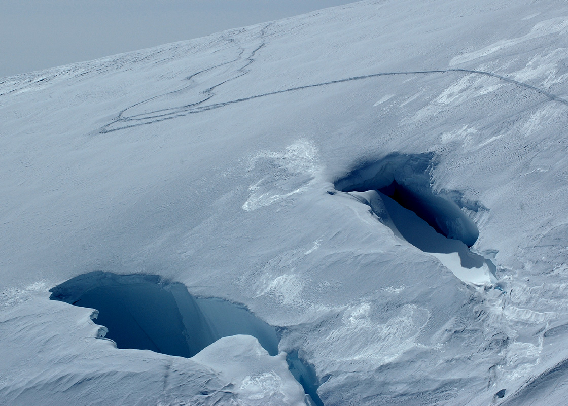
After several hours, the first crevasse came into view. Gigantic and open,
running exactly
perpendicular to our course. We turned a right angle and proceeded up the glacier parallel
to the crevasse. We finally located a snow bridge that looked solid at elevation
1926 meter, north 68:58.715, west 29:34.874. Jan-Frode looked at the deep crevasse as we
crossed the snowbridge and said: "This crevasse can eat a (roped) team", expressing the fact
that one should be careful even when roped. Back home a member of a team can go through
a crevasse, here the crevasse was so wide that at least two would be on the snowbridge
simultaneously.
We encountered more crevasses parallel to the first one, all very long and very deep and wide.
This made us ski more south, but finally the last one was history and we could turn more
on north in order to get back on our route. The terrain here was a bit more confused with
various crevasses, small hills and depressions all glacier. Ståle did a fine job
navigating us safely across. We arrived at the slope that would bring us over a saddle
and into new terrain around 1900. It was time for camp, we all felt this had been an
interesting day, small humans crossing in a giant sea of ice. The evening was beautiful,
sunshine, warmer temperature and no wind. Our camp
is at elevation 1841 meter, north 69:00.244,
west 29:32.226, our first visit north of 69 degrees. The dinner tasted better than ever, we
had a long chat as evening arrived, until 2300 when we finally hit the tents for some
well deserved sleep.
May 26.
Brekruna and Anita Fjeld.
We woke up to sunshine and no wind, it is definitely a different climate, much warmer.
The views of the hanging ice on the mountain above us is fascinating. We soon started up
the hill, pulling the sledges is hard work when the terrain slopes. Arnt was up in front
breaking trail and making sure that his track did not get too steep for the rest of the party.
A final look back
saying goodbye to Hvitserk and the landscape we know well, then continue into
new land.
As we reached the crest of the hill a new landscape with good looking mountains came into
view. We decided to stop at the highest point and explore the nearby peaks before moving on.
Thus, we made camp at elevation 2081 meter, north 69:00.603, west 29.26.777.
Yesterday, the GPS seemed utterly confused with respect to sunrise and sunset. Today, the
GPS claims that there are no sunsets or sunrise. Most likely, this means that the midnight sun
has arrived. By chance, this also has changed the temperature here from full winter, minus
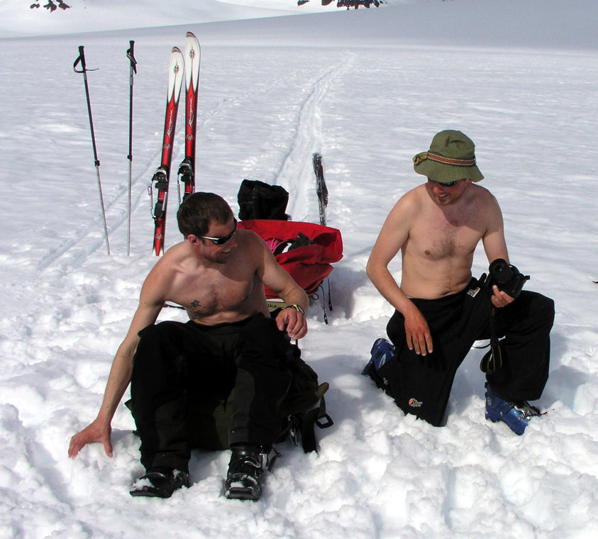
20/30 Centigrade to full spring with temperature around or even above zero Centigrade.
Per Ove and Torstein started out to climb a very beautiful peak
nearby, however, the snow seemed
unstable and they did not get to the summit. Meanwhile, Arnt and I went up a valley that climbed
more steeply to a nice saddle between two peaks. The righthand peak is the highest,
but the ridge coming down
to the saddle turned out to be very difficult. We set course for the
peak to the left,
this involved a fairly steep initial snow slope
from the saddle, then more gentle terrain to the
summit. Arnt named
the peak Brekruna (Crown of the Glacier), the map gives an elevation of 2824 meter.
Our GPS gave an elevation of 2815 meter, north 68:58.186, west 29:26.830.
We wondered if this was indeed
a first ascent. Later, Paul Walker has informed me that
a Tangent party climbed this peak, however
no further details are known at this time.
The peak across the saddle is marked at 2868 meter, it
looks pretty hard, at least from this side.
The map has a saddle elevation of 2613 meter, giving
Brekruna a primary factor of 211 meter. It took us 4 hours from our camp and up, only 35 minutes
return, close to perfect skiing. Brekruna has a very nice view, the peaks further south and around
the Woolley Glacier are spectacular to see from this position.
Our GPS reading from the saddle gave an elevation of 2605 meter and location north 68:58.425, west 29:27.514,
that is, the elevation seems consistently about 8 meter low relative to the map in this area.
Everybody enjoys the possibility of sitting outside
now that the climate has turned
warmer.
Torstein shows real team responsibility by digging good sitting areas.
A good day came to a close.
May 27.
Moving day, to Bergen Gletscher.
This morning, Per Ove and Torstein started out at 0500 in order to make a second
attempt on the peak they turned on yesterday. With morning snow, they successfully climbed
it, reaching the summit at 0655, a first ascent and a very beautiful peak.
They went on to climb Brekruna, Ståle joined them and they all marveled of the fine summit
views. The skiing back down had been most enjoyable, Per Ove caught a great picture of Torstein
skiing down across a snowbridge from the saddle.
Meanwhile, Jan-Frode, Arnt and I explored a rather small mountain that is located in the
opposite direction from our camp. This mostly snow covered mountain had elevation 2255 meter,
location north 69:01.739, west 029:25.618. We discovered a cairn on this mountain, somebody visited
here, but when? We speculated that this cairn may have been built by a party coming up from
Ejnar Mikkelsens Fjeld on the way to Gunnbjørnfjeld. Arnt did not seem too happy today,
most likely this is just a temporary state, his good sense of humor and interesting remarks
shall soon return.
We broke camp and continued our move at 1400. Ståle and I pulling the sledges. First, a gentle
downhill, then a very long, almost endless gradual uphill. There is no wind, the sun is baking,
the heat is very strong, summer in Greenland.
After deciding on the place to camp, Torstein came skiing back down the slope to ask Ståle or
me if he should pull one of the sledges the last hill. We thanked him, but insisted on completing
the job. He did succeed to take some weight from Ståle and generally helped keep morale
high. This is Torstein in a nutshell, we all knew he had some trouble with his neck and back, but still
his concern was immediately to ski back down and see if he could help.
We establish camp at elevation 2191 meter, location
north 68:59.509, west 29:10.782. There seems to be plenty to do in the next three days. The glacier
has peaks all around. Hopefully, we are now in a virgin area where no previous expedition has
visited. The day ended in a spendid evening, we sat outside the tents until 2200.
May 28.
Istind prevails, Ebeth is skied.
We all started out up the glacier towards the peak we already named
Istind. It is the most prominent peak here with a somewhat unusual shape,
steep lower down, then a summit that points to the sky. All ice forming the
slopes, an impressive and attractive goal. Istind is 2675 meter, the map is
way off with an elevation of 2875 meter. Again, we did not really realize this
until Per Ove and Jan-Frode actually climbed the peak.
We reached the saddle
between Ebeth and Istind, this is really where our glacier
ends. A steep drop to the much lower terrain nearer to Ejnar Mikkelsen Fjeld.
Torstein, Per Ove and I started out on Istind. Our plan was to climb from the side
onto the east ridge higher up, then hopefully follow this ridge until the
mountain slope became less steep higher up. The snow was hard and steep,
much steeper
than anything done so far. Per Ove first climbed to the ridge and stopped in a
small notch. Torstein
followed and soon joined him. I was third and instead of
traversing to the ridge, Torstein suggested that I continue straight up to the
ridge somewhat higher, then climb this to the horizon where we could see some
rocks. The ridge had a very big drop into unfriendly terrain
off to the left. I passed some
rocks where an intermediate sling could be attached, then continued to what looked
like a flat area higher on the ridge. I had good hopes that the route from there would be
somewhat easier until we would join a much broader snowfield higher up. Big disappointment!
I reached the flat spot, it was about one by two meter,
but the continued ridge
looked
very bad indeed (much worse than what the picture shows).
The sun had warmed the snow, the ridge itself looked unstable as it
continued above this phenomenal cliffs dropping hundreds of meter to the left. Staying right
seemed like the only safe option, but here the snow formed a vertical wall.
I called down to the notch in order for the next man to start climbing.
Torstein
joined me
and we did agree that this was not a very promising route. We reached
2526 meter, north 68:58.582, west 029:04.494. The view
was already nice, but Istind won the first round.
We downclimbed and headed across the saddle. Meanwhile, Arnt and Ståle had explored
a south-southeast ridge from Ebeth, reaching a very fine viewpoint at elevation
2595 meter, north 68:58.590, west 29:02.339. This point was separated from Ebeth by a saddle
of elevation 2535 meter, thus havig a primary factor of about 60 meter.
Our hectic
activity continued, Jan-Frode and Arnt had already climbed the snow mountain we called
Lille Snefjeld, elevation 2507 meter, separated from Ebeth by a saddle of 2393 meter.
I headed over there and skied all the way to the summit. Looking at the nice landscape
all around, I realized that several team members were now attempting Ebeth, a
direct route
near the left side of the slope facing Istind. Arnt and Jan-Frode turned while Torstein
and Per Ove made the summit, Per Ove with his skis on the back.
Torstein measured Ebeth to 2641 meter (GPS), while our map gives 2628 meter. The summit is
located at north 68:59.086, west 29:02.879.
Per Ove proceeded to Telemark ski
down the rather steep slope, while Torstein carefully
climbed back down. On the way back to Base Camp,
Per Ove also skied down the steep side
of Lille Snefjeld facing our camp. A long, nice day came to an end, we knew a lot more
about the area. What had been a virgin, unvisited glacier mountain area just a day ago,
now looked more like a ski resort, ski tracks crossing the area all over.
May 29.
Snefjeld and Kristine Fjeld.
Today, Jan-Frode and I had decided to attack Snefjeld, while the
rest of the team wanted to explore a smaller, rocky mountain that we call
Kristine Fjeld.
Snefjeld is a very characteristic mountain.
The mountain consists of a rather
long, rugged ridge of rock,
but in the direction of Istind, it has a very long
snowridge that terminates at the very top.
This ridge looks like a long snow ramp
when seen from the side. We already decided that this would be our first choice for
a summit route.
The day was about as perfect as one might ask, bright blue
sky, a warm sun, warm weather and absolutely no wind.
We made a short stop at the foot of the ridge, elevation 2327 meter,
north 68:59.557, west 029:06.312. We left the skis, put on crampons and
headed upwards. The ridge was quite easy to climb
initially. We paid attention
to the sharp drop off to our left side, never too close in case of overhanging
cornices. Higher up, the slope got somewhat steeper and we encountered a short
section with ice. However, we never felt like using the rope and belays, careful
steps and the ice axe for protection was fully adequate.
Soon, the summit was ours,
quite pointed, only one man
up at the highest point at a time. The mountain continued
on the other side as a jagged rock ridge
with what looked like pretty bad, crumbling rock.
Our GPS gave an elevation of 2648 meter, north 68:59.899, west 029:06.459,
the map gives 2650 meter.
We descended in our footsteps and came back down to our skis. A short ski around to the
saddle between Snefjeld and Kristine Fjeld. We saw the tracks from the other four and soon
left our skis at the ridge. A short, but nice hike
on foot with some easy scrambling at the
end and we were on the highest point
of the ridge. From here, a good view back to the much higher Snefjeld.
What a splendid day this was. We descended and
skied back to camp where we met the others. They had crossed over the glacier
and climbed a small peak they named Rabben. Per Ove had skied down
a pretty steep slope.
May 30.
Istind.
Our last full day is here. The weather is still very nice and the
temperature mild. We have a few degrees below freezing at night, then
nice warm days. Per Ove and Jan-Frode start early, they will make
a second and last attempt on Istind. We spotted a possible alternative
route already the first day, today will show if this indeed is the
key to success.
Torstein has been bothered by pain in the neck, the day seems perfect for
a well deserved rest.
Arnt and I set out slightly downhill in order to explore a smaller, but somewhat
steep mountain that we had christened Skorsteinseggi.
The name means ridge with a
chimmney, a very characteristic rock feature somewhat on our side of the highest
snow ridge. The snow facing us looked pretty steep, but doable. Thus, we carried
snow anchors, ice screws and rope. However, as soon as we arrived below the face,
Arnt went ahead to explore the far ridge that could not really be judged from our camp.
It soon turned out that this ridge provided a nontechnical summit route. I followed
Arnt and after a short stretch of careful (snow) ridge walk, I could join him
at the summit.
A good viewpoint indeed, we could see all of Bergen Gletcher
and the peaks that
had kept us busy in the last several days. The ridge
across to the chimmney did not look inviting,
looking further, Istind where Jan-Frode and Per Ove hopefully succeed.
As we descended, we saw Torstein heading our way. Clearly, he had observed us from
camp and decided to bag the peak when he realized that it required minimal effort.
As Arnt returned to camp, I decided to sweep Rabben
before calling it a day. I skied there
rather quickly while looking at the trace from Per Ove's Telemark ski descent
yesterday.
The tracks from yesterday showed two routes up the steeper upper part. Numerous tracks went
left and up in between some rocks. What looked like a single track had front pointing
steps kicked straight up a pretty steep snow slope. I kicked steps the same way, an interesting
slope getting steeper the higher you got. From the summit
of Rabben, I looked towards
Istind to see if Jan-Frode and Per Ove had succeeded, however I did not see them.
Upon my return to camp, Ståle could tell the good news that the boys had been seen
on the summit of Istind. Thus, this last day is crowned with sweet success. We have climbed
the summits we wanted and tomorrow is going home day.
After Jan-Frode and Per Ove had returned and told us their story, we started breaking camp
in order to move camp down to the agreed pickup point. This move turned out to be just as easy
as we had hoped. A smooth glide on a gentle downhill. Without much effort we arrived at the
lower glacier and established our last camp.
The weather was now warm as summer.
We decided to make the long awaited pancakes.
Not a very
practical dish for arctic Greenland, it took quite long to complete each pancake, thus almost
infinite time before it was your time again. The landscape here is also very nice. In particular,
a long unbroken ridge that runs down right across for us,
caught everbodys attention and imagination.
Arnt kept looking at the last peak above us, we skied right by it when we moved camp down to
here. It was clear that he wanted yet another peak. It looked like a fairly simple trip and
he was given thumbs up to go while we kept waiting for more pancakes to be produced.
When Arnt returned from a successful trip, we were still making pancakes. No problem to
sit outdoors any longer, almost unbelievable how much warmer this last week has been.
May 31.
Pickup Day.
Woke up by the sun warming the tent at 0800. Perfect weather and
the summer in Greenland carries on.
I called Fridrik and reported excellent weather. He said we could expect
the Twin Otter around 1300. The snow has a good crust after a few degrees below
zero last night, but with this kind of sunshine, the crust will be gone in a few
hours. We have climbed 18 peaks altogether, not at all bad in 16 days. The team
was generally sitting around in the sun, what about a little extra tan this last
day in Greenland? A last opportunity to experience just this landscape.
Clearly, anticipation - would the Twin Otter arrive without
problems? Just on time a weak sound, then the blinking reflex from sunrays hitting the
wings. The Twin Otter flew straight overhead, I had made a long track next to our camp
as an indication of a possible landing area. The Twin Otter banked left, flew between us
and the peaks across the valley, how tiny it looks in this setting! Completing the turn,
the airplane is now coming straight up the glacier, touching down
more or less precisely
along my skitrack. Turning around, then stopping just a few meter from our camp. What a
luxury, no need to even go to the airport, here the plane comes to you.
We loaded everything onboard, got into our seats and then with engines roaring we
left Greenland much in the same way as we arrived 16 days ago.
The flight started with new, great views of the peaks east of PEV. The cliffs on this
side looks very bad indeed. However, at least a few peaks have relatively easy access
from the opposite (west) side. On the left side, Ejnar Mikkelsens Fjeld,
very impressive and only climbed a couple of times.
Soon, Greenland was behind us and Iceland ahead. We landed
in Isafjordur, then connected in a somewhat more orderly fashion with the domestic flight
to Reykjavik. On arrival there, one bag was missing. Soon, it was arranged that this bag
be transferred to the Keflavik airport where our flight to Denmark would depart the next day.
We found our pre-booked hotel in Reykjavik and everybody enjoyed a good, long shower before
we went out to explore downtown Reykjavik and have an official farewell dinner/celebration.
The dinner
was good, the beer tasted well and a very successful evening came to a conclusion
with Arnt ordering a round of Margarithas, OUCH !, the salted rims still hurt our cracked lips.
June 1.
Iceland.
We checked out and took a bus to The Blue Lagoon. This is on the way
to Keflavik and therefore not a big detour. This place is quite well known,
a large lake with hot water from the many underground reservoirs. We relaxed
and enjoyed the warm water. Torstein had a dose of massage that hopefully helped
his neck and back. Another short ride by bus and we were at Keflavik ready to fly
home.
One last obstacle, the woman behind the check-in counter was definitely NOT in
her best mood and insisted that we pay overweight charges for not just a few, but
closer to 100 kg. This would definitely kill our budget and a pretty long argument
followed. I eventually called Fridrik and asked if he could help explain the
situation. He talked and the situation got resolved. All our cargo got checked in
as regular baggage. We are all extremely thankful to Fridrik. Obviously, he really
did not have to help with this and in fact, he had no official authority to help
either. With warm feelings for his help we boarded the plane and had a good flight
to Copenhagen with a problem free connection to Bergen.
Arriving pretty late in Bergen,
but with a warm welcome by wifes and girlfriends.
Our G4 expedition to East Greenland had come to an end. It was a huge success by
any measure. All objectives achieved, no injuries or other losses. All 6 had
a very nice trip with lasting memories. I certainly was concerned that there
would be some more serious problems and that the pretty expensive trip somehow
should fail to deliver lasting value to the participants. I am genuinely thankful
to Jan-Frode, Torstein, Per Ove, Ståle and Arnt for each and every contribution,
small and large, that made this a trip of a lifetime.
The sharp horizons, the white powder snow, the blue skies, the fantasy landscape, the crisp cold
and the positive contributions from everyone all blended together to make our G4 an
expedition that cannot possibly be repeated.