The idea to travel south and attempt Aconcagua gradually formed in the spring of 2001 while I was still living in Boulder, Colorado. However, the plans did not become concrete until November that year, only about two months before the trip had to be scheduled. I was committed to attend a conference near Mexico City in the period January 6th. to January 11th., this served as an "official excuse" for the trip, already in Mexico one might as well sweep by Argentina on the way home.
I contacted Victor Herrera of Mallkuexpediciones by email and made the necessary agreements concerning the local logistics. The idea was to have him organize the practical details from our arrival in Mendoza and until our departure, including the mule transport of gear between Puente del Inca and Base Camp. Also, we rented a tent for base camp use and purchased about 10 days of meals to be cooked and served while in Base Camp. I decided early on that everything we did above Base Camp should be completely independent and unsupported. This scheme worked great for us, we could focus on the objective and not have to waste any time on figuring out many of these practical details.
Tor flew directly from Norway via Frankfurt to Sao Paulo with a convenient connecting flight to Mendoza on January 9th. We planned that he should spend a few extra acclimatization days in Puente del Inca, waiting for my arrival a few days later via Mexico.
The text that follows here is straight out of the notes that I made during the trip, so perhaps more a diary than a trip-report.
Today, I leave Mexico City and the conference. The bad news is that
I have gotten a very nasty stomach infection that does not seem to
go away. I have therefore decided not to touch food for the next 24 hours, then
carefully resume eating, hoping that this will cure the trouble.
Check-in at the busy Mexico City airport went smoothly, but I was
stopped in the security control because of 4 tiny, spare AA batteries
in my hand luggage. The Mexicans had made yet another post September 11 rule,
chemically free of logic. I pointed out that there were more such batteries
readily accessible in my camera and also in the GPS, so what's the point.
I guess security people need not explain anything, the 4 AA batteries had
to be checked in a separate box for Buenos Aires.
We landed in Cancun and continued after about one hour. My GPS works fine
when kept close to the aircraft window. We fly in an altitude of about 12 km
and the Equator is crossed in sunshine. The Amazon river zig-zags in the jungle
below just before sunset at 2100. Yet, about 4 more hours to fly to Buenos Aires.
It is about as far from Mexico City to Buenos Aires as from Norway to Seattle.
I hope Tor has had a good day in Puente del Inca and that he has been able
to hike a bit higher. Argentina has big financial problems these days, there are
reports of serious disturbances in the streets. I bet the situation in the
mountains is still quite OK. I do really look forward to getting there.
In Argentina! I arrived at the international airport south of the city, got a taxi to the airport north of the city. Straightforward, 36 US dollars. The time right now is 0230 (AM) and check-in opens at 0400. Not much to see or do, a good looking young woman is organizing the papers to be sold the next morning, that is about it. Easy flight to Mendoza, Eliana (who works for Victor) showed up at the airport with a taxi. She confirmed that Tor was well taken care of and ordered the taxi to go directly to the permit office, located in a park at the outskirts of town. Very crowded and long lines, Eliana knew a guy that worked at the office and quickly (a bit special service) I had my climbing permit in return for 200 US dollars.
I am now at hotel International, earlier I strolled around in the central area of Mendoza. I am worried about my stomach, it is just as bad as before despite no food whatsoever on Saturday. I tried a small, carefully selected lunch today, Sunday. The situation is just as bad as it was in the afternoon last Wednesday. More observations, if one walks (gently uphill) along a main street until hitting Plaza Independencia, then five blocks to the right one will find a large supermarket VEA which is indeed open also on Sundays. I bought some pasta and a few other things. We do not have fuel and gas for cooking, VEA did not carry this. If I had known that some stores are open on Sundays I might have completed the shopping today. I decided to seek some medical advice for my stomach, I cannot simply afford to have this problem any longer. I called Heidi in Norway and asked here to get advice and call me back. A quick check with Terje back home and Heidi called me back with not only the medicine brand name, but more importantly, the name of the active agent in the suggested medicine. I went to an open Pharmacia and bought 20 tablets, the staff seemed to think this was way more than needed. I swallowed two pills right away and do hope they will work.
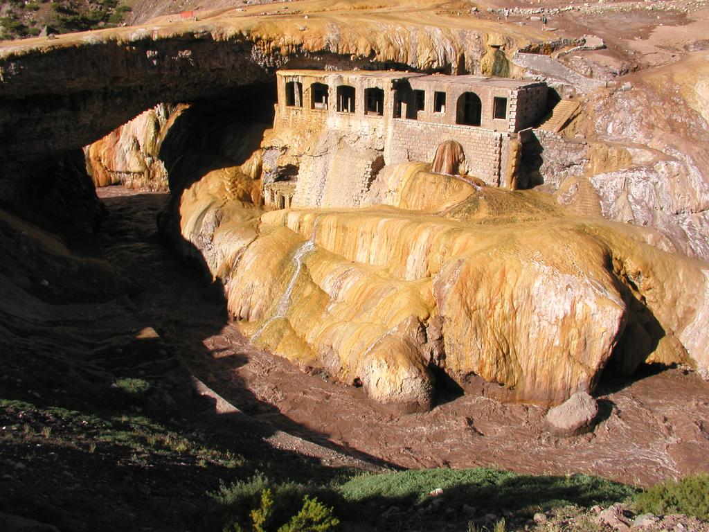
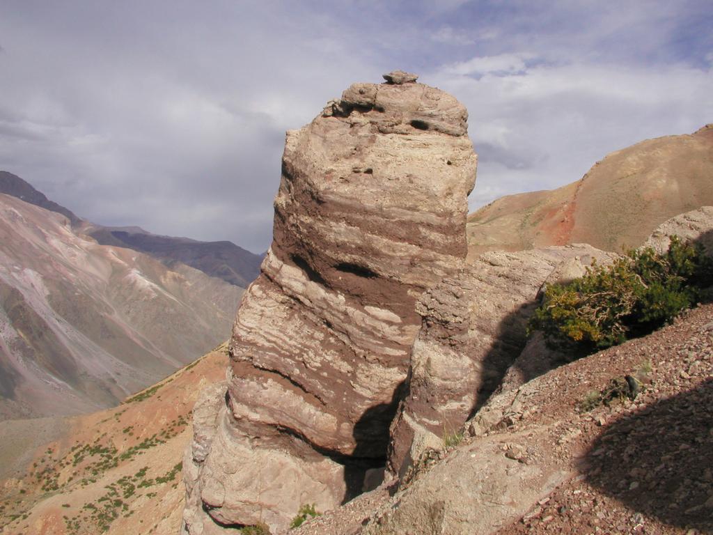
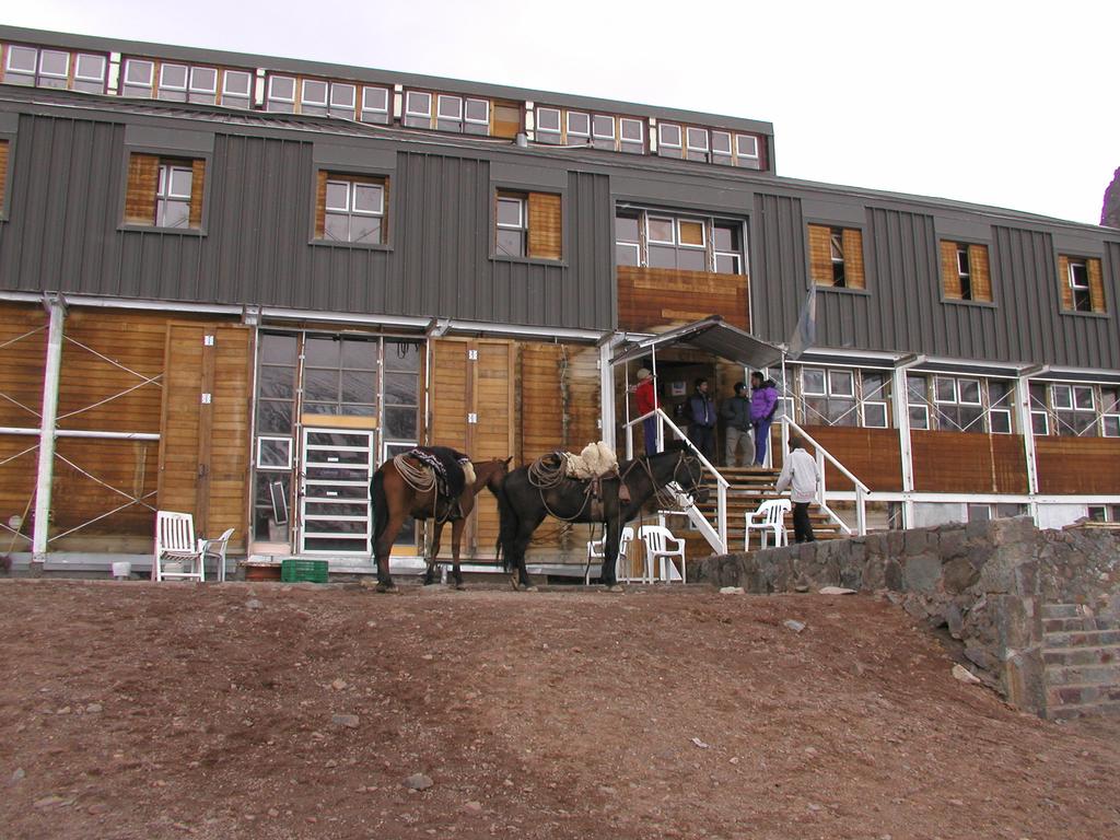
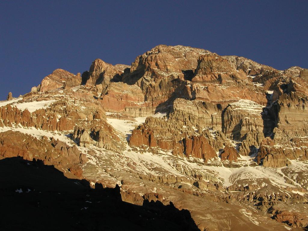
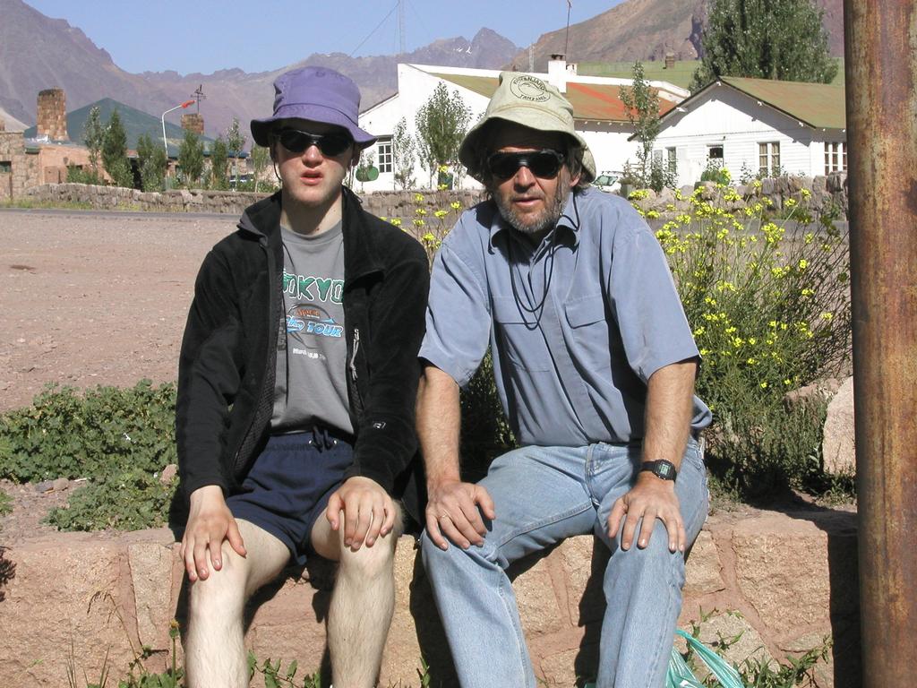
Purchased MSR fuel in a sports store, also two small containers with buthane. A big disappointment not to find the Primus propane/buthane grey boxes. I bought this multifuel/gas burner from Primus on specific recommendations that the gas would provide more efficient cooking at altitude. There is no way to carry these gas containers with you so they better be locally available. Several stores could tell that they has this gas last year, but no more. Back at the hotel where Eliana picked me up and transported me and all my cargo to the bus terminal. A very nice bus ride, first class bus. After about 4 hours, including a few short and one slightly longer stop along the way,- Puente del Inca. On arrival, Tor was out hiking. I got access to the room and started to sort through and organize gear. After a couple of hours Tor showed up, very nice to meet here, quite far from home. The sky is blue, the temperature 25 C. The place has its name from the natural bridge spanning the river, additionally, mother nature has also created a spa, a small jacuzzi with 40 C water. I went alone on a short afternoon hike up the slope on this side of the river (the south side) to 3250 m and explored a characteristic rock formation. Puente del Inca at 2730 m was visible below, one could see the natural bridge and the small military garnison across the road. Our lodge is close to the road on this side. Returned back down and had dinner with poor appetite and a rumbling stomach.
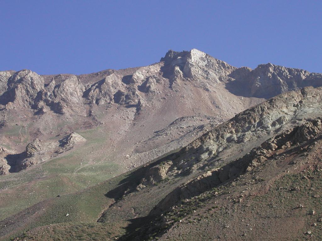
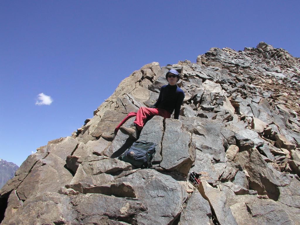
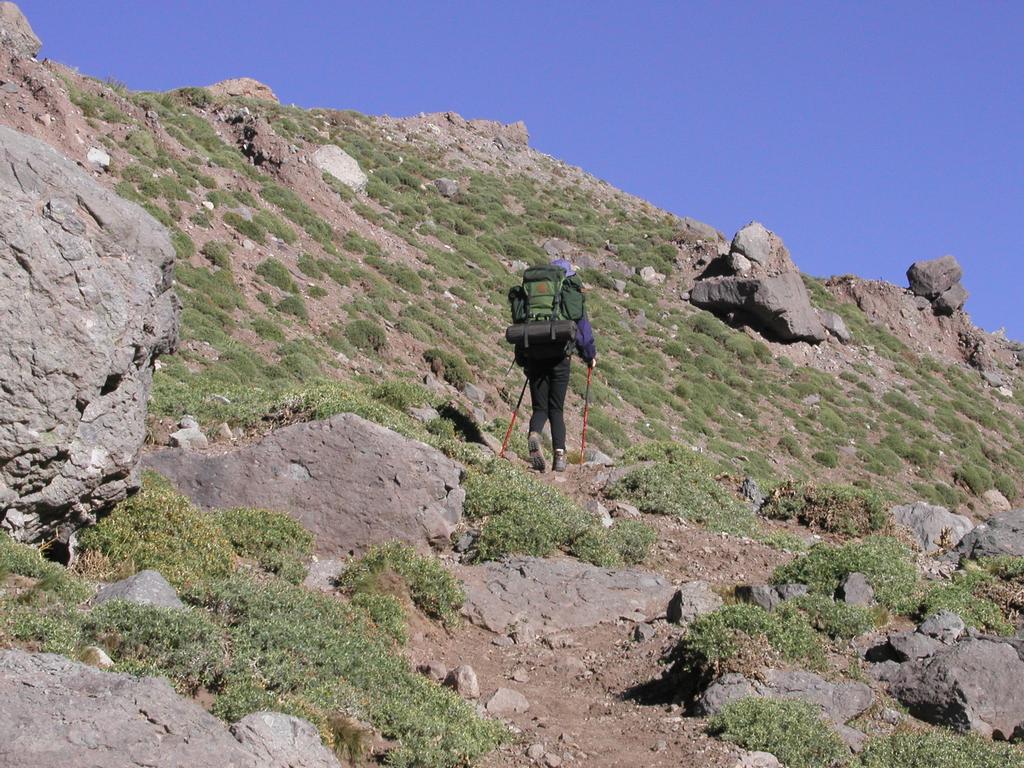
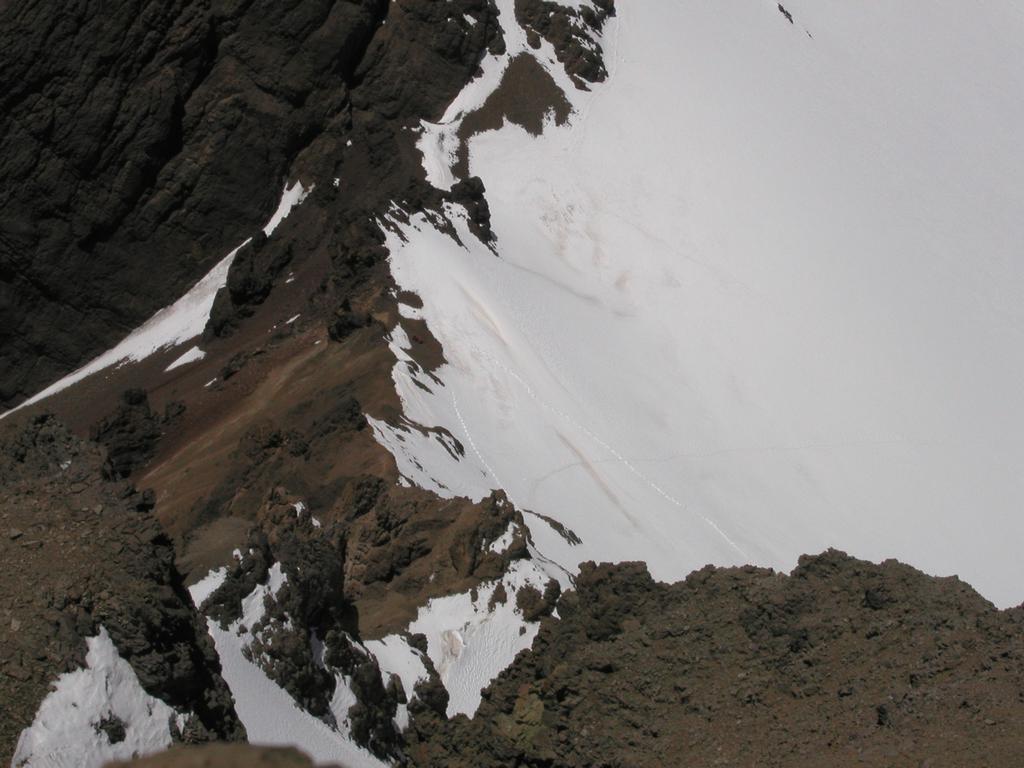
Wake up to bright sunshine and blue sky. We hiked to the north. This mountain had been explored by Tor on two earlier hikes, but not all the way to the summit. We hiked along a trail that went into a distinct gulley with a small stream, then up some gentle slopes and contouring around to the back side of the mountain. Eventually, the trail reached a somewhat larger creek. Instead of crossing this creek, we left the trail, hiked along the creek and then up along a very nice ridge. This ridge connected to the main ridge at a small, local summit. From here, it was quite an easy walk to the summit of Banderitas Norte, our first Argentine summit, 3910 m, the highest point north of Puente del Incas. The summit is not directly visible from Puente del Incas, but one can see a point quite close to the summit, near a solar panel that serves the army of Argentina powering an antenna. We traversed the summit and descended along a somewhat more rocky ridge with easy scrambling in a couple of spots. The entire trip took a leisurely 5 hours and served our acclimatization well. The good news is that my stomach is gradually improving, the medicine clearly works by essentially blocking all throughput. However, over time this seems to stabilize the situation. The bad news is that Tor is coming down with a serious cold and sore throat.
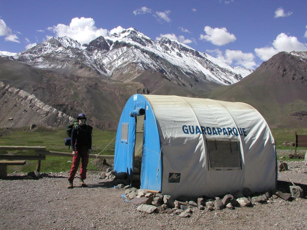
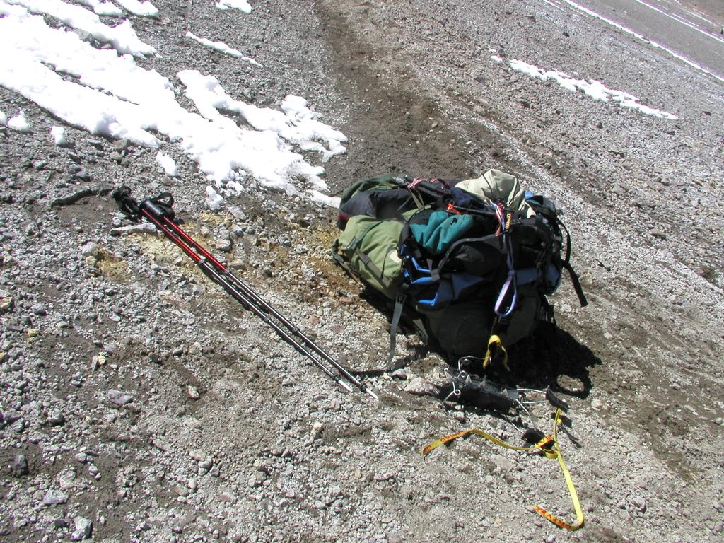
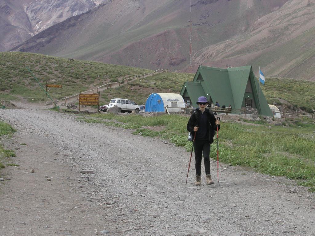
Yesterday evening gave reason to appreciate the rapid changes in the weather. Heavy rain, thunder and lightning flashing up and down the valley. A storm that we were fortunate to experience from the mountain lodge of Puente del Inca. Tor has now spent 5 days here at 2730 m, I have spent two nights, it is about time to proceed. We woke up to brilliant sunshine, white snow from the storm streching down the slopes. The mules started at dawn this morning, we have about 50 kg that will be taken to base camp, - Placa de Mulas, today. The idea was to have our permits stamped (the 20 day clock start ticking) and start hiking at 10 AM. Obbbssss, the trekking poles left behind at Puente del Inca. A phone from the ranger entrance station to Ariel (who works for Victor) and he came up to the park entrance for the second time with our poles, thank you, excellent service to absent minded tourists.
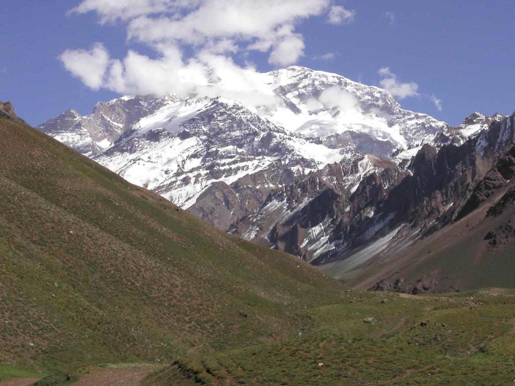
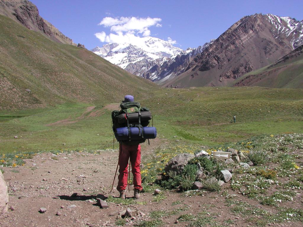
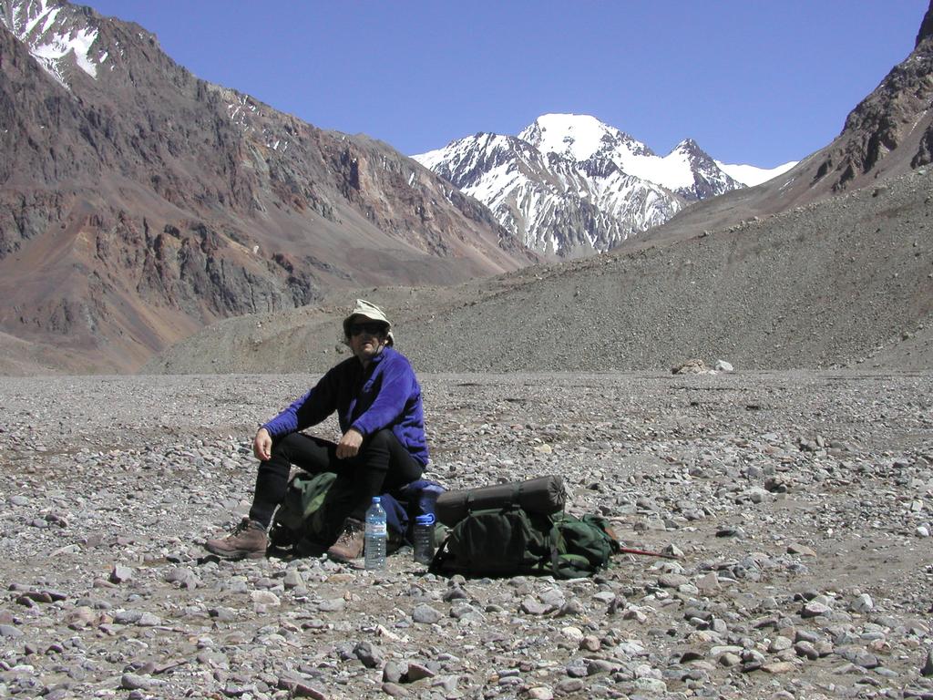
We started at 1115, had a few stops to drink and arrived at Confluencia after 2.5 hours. We carried about 15 kg each, the trail was clear and easy to walk. In the beginning we also had a perfect view of Aconcagua, beautiful with all the new snow from last night. The distance from the park entrance to Confluencia is about 8 km (straight line), so likely about 10 km along the trail. We were a bit surprised as we arrived, since we had expected the hike to be somewhat longer. Confluencia is at 3380 m, the GPS coordinates are south: 32.45.476, west: 69.58.388. We had a nice lunch, pizza and peaches, later the rain started again. About 30 tents plus the commercial support tents. Dinner consisted of soup, ravioli and fruit salad. We went to bed around 2100. Tor's throat is worse, not better. It is hard to see how it shall improve as we climb higher. We decide anyway that we continue to Base Camp tomorrow, how high Tor can climb will clearly depend on how this situation develops.
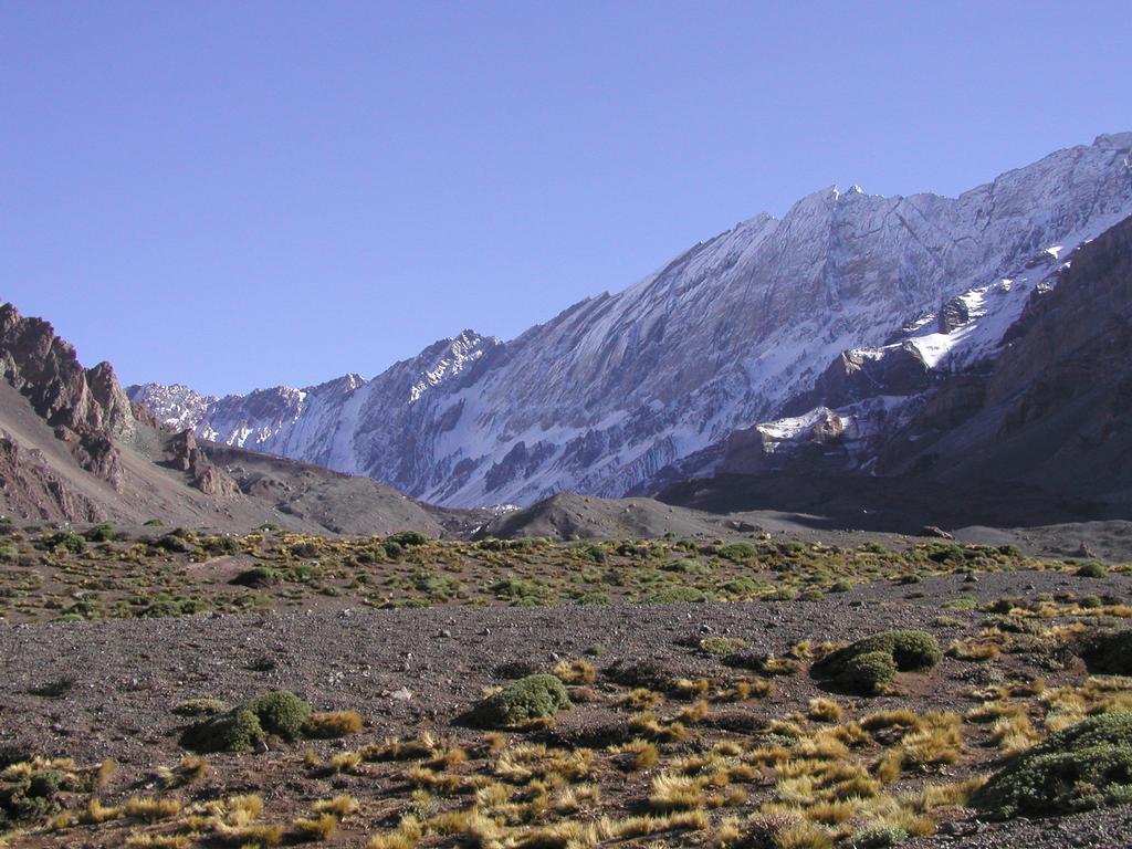
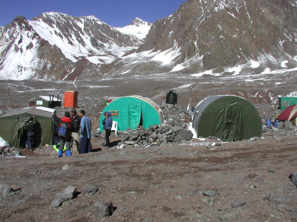
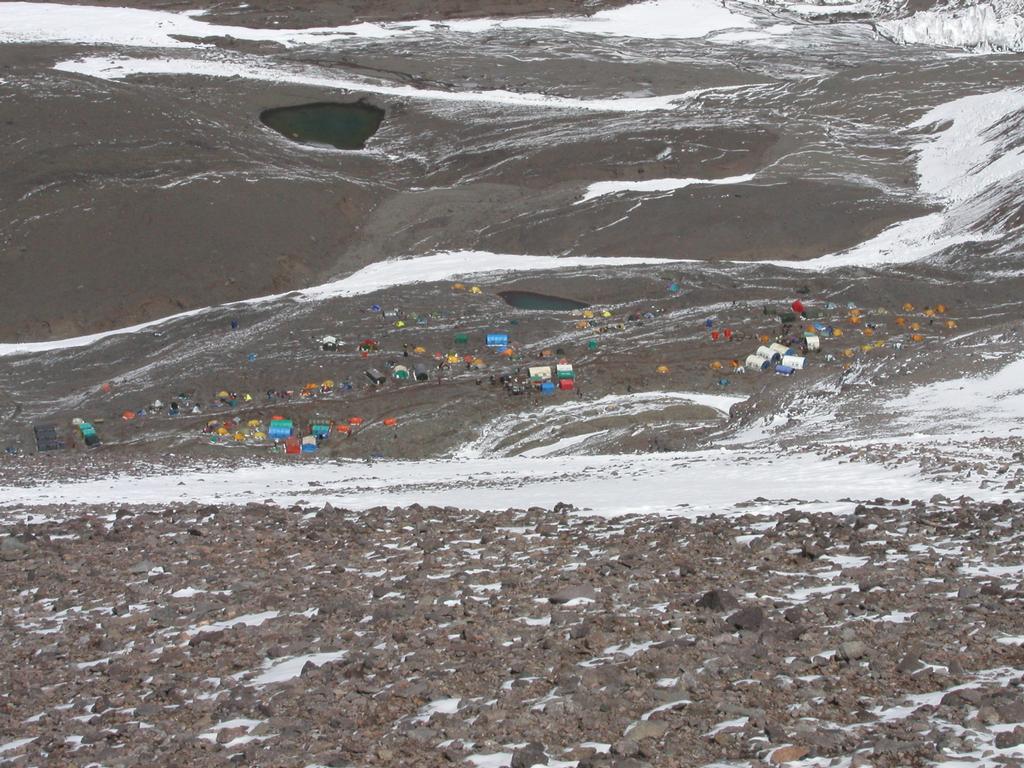
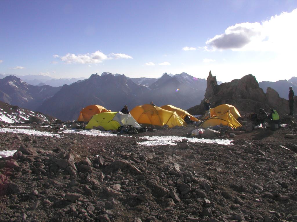
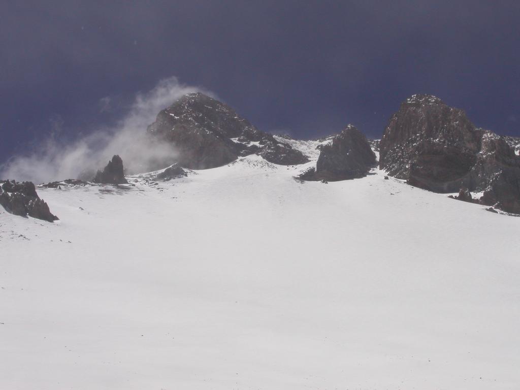
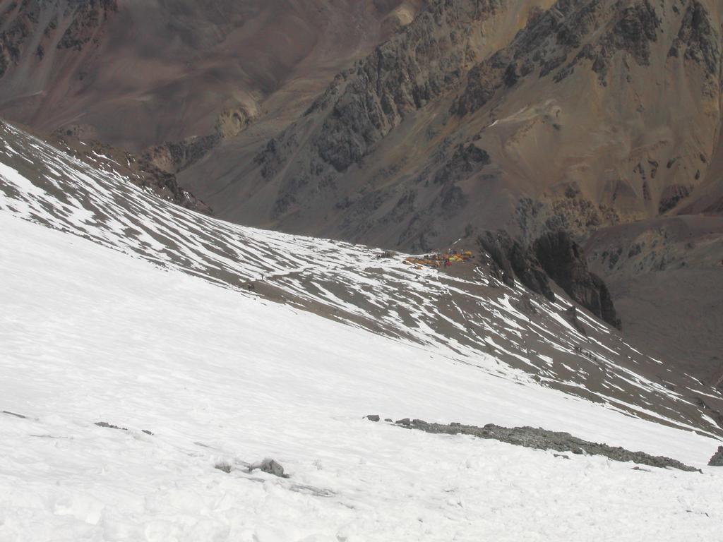
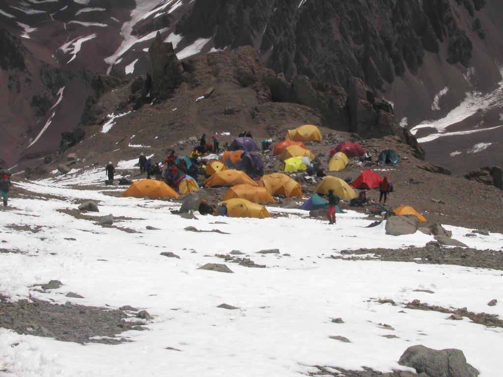
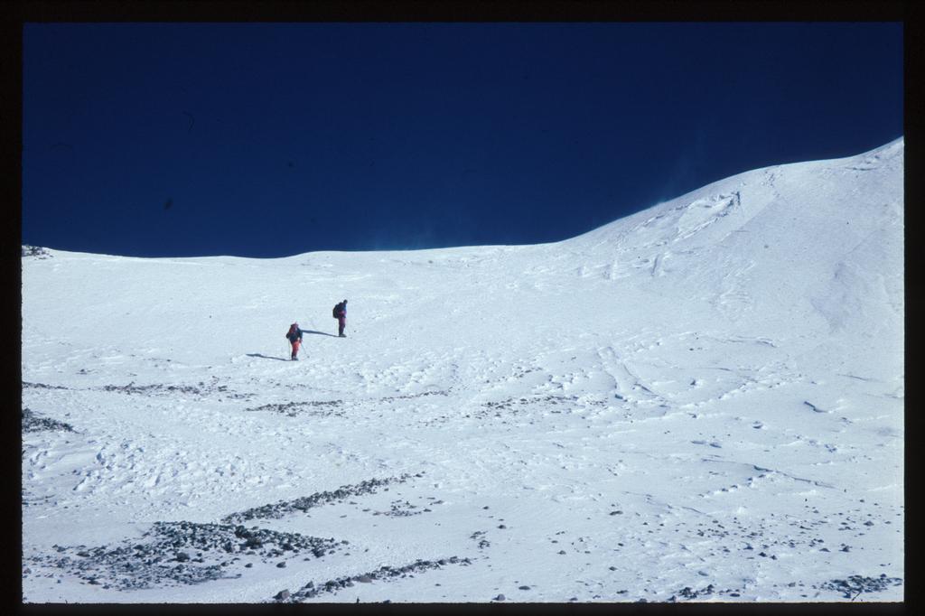
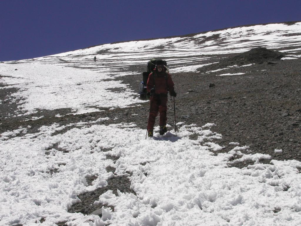
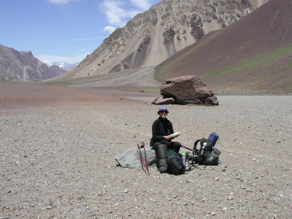
Breakfast at 0800, on the trail at 0900. After crossing of the river on a good bridge, the trail climbed up and out of the river gorge. The name Confluencia tells that two rivers merge, the other one comes from the valley leading to Camp Francia, giving access to the south side of Aconcagua. The landscape quickly turned very flat and dry. We crossed the creek that drains the base camp area perhaps 6 times. This was relatively easy using rocks and skilled jumping, the first and the last crossing being most challenging. Tor got a bit wet on the very last jump. We had a few rests along the way, sitting at the few rocks we could find. We arrived at Ibanez (which marks the end of the very flat and monotone valley floor) after 3.5 hours, elevation 3800 m, coordinates, south 32.41.919, west 70.00.251. From here, we also saw the very nice mountain named Cuerno which is just behind Base Camp. Further up the valley, the trail is now a bit up and down, mostly up on the right side of the river. We met a long line of mules in the only place where this was tricky, the trail traversed a steep, loose side, no space to meet. Attempts to get off the trail immediately triggered some minor rocks sliding and thereby scaring the mules. The trail is good all the way, higher we passed the ruins of the old hotel. Finally, the trail climbed more steeply towards Base Camp. We expected to see the camp around every next corner and ridge, but this part of the hike seemed longer than expected and we were both tired upon arrival. Base Camp is at 4390 m according to my GPS, this is the higher part, as there is a distinct slope and quite some difference in elevation between the highest and lowest tent in Base Camp. Coordinates: south 32.38.890, west 70.03.504. We arrived at 1600, Victor had put up a good North Face tent as our base camp tent. A friendly welcome by Hernan and Karina serving us fruit juice upon arrival. It started to snow around 1700, we had a very nice dinner at 1930.
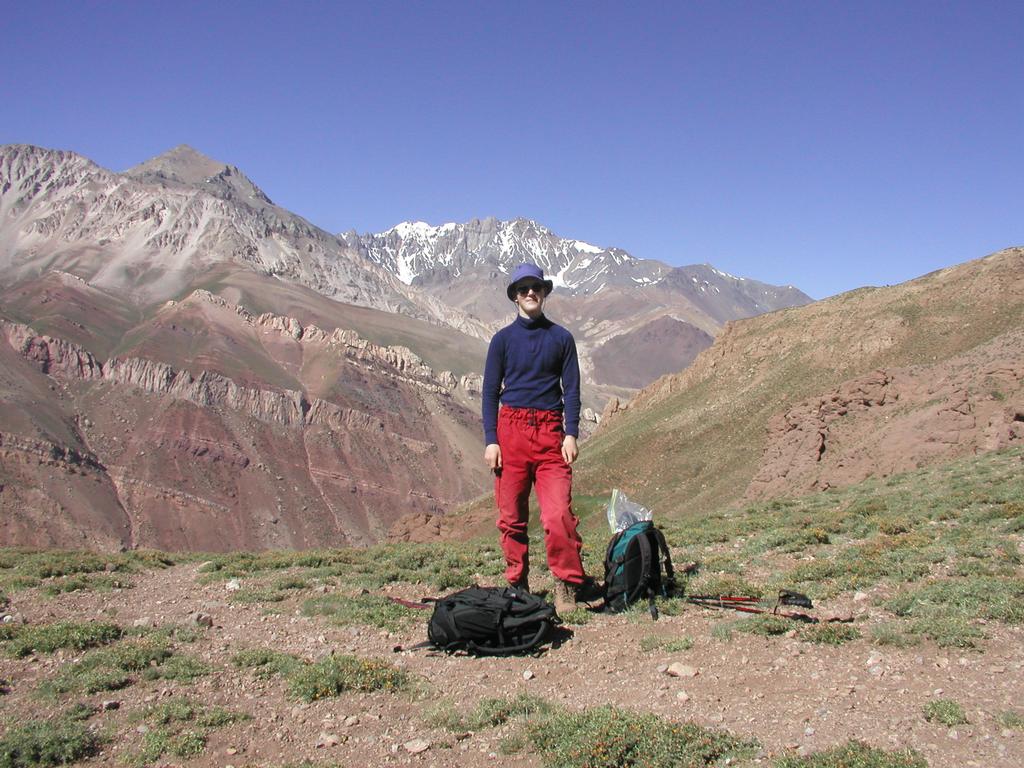
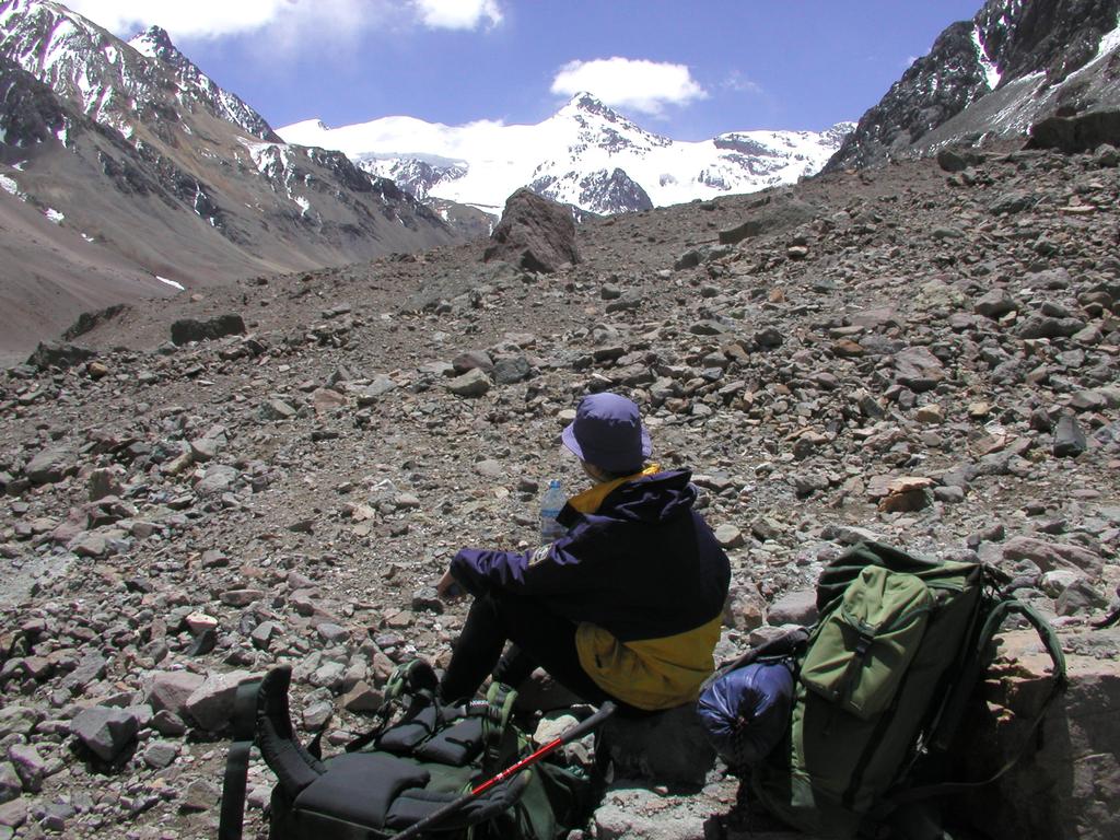
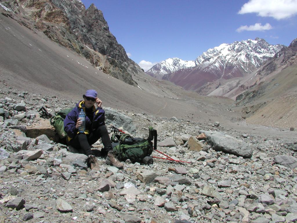
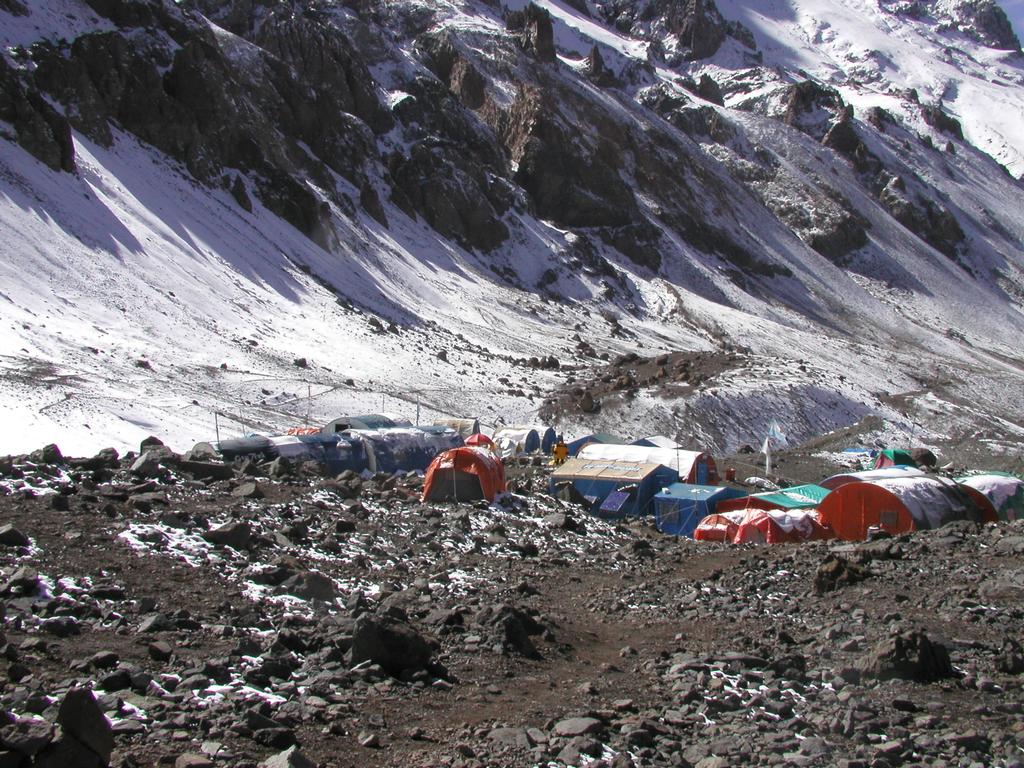
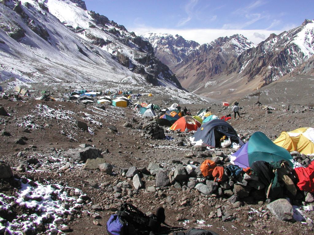
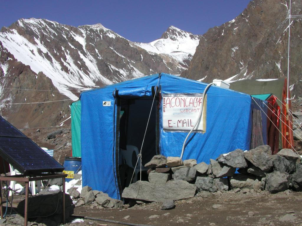
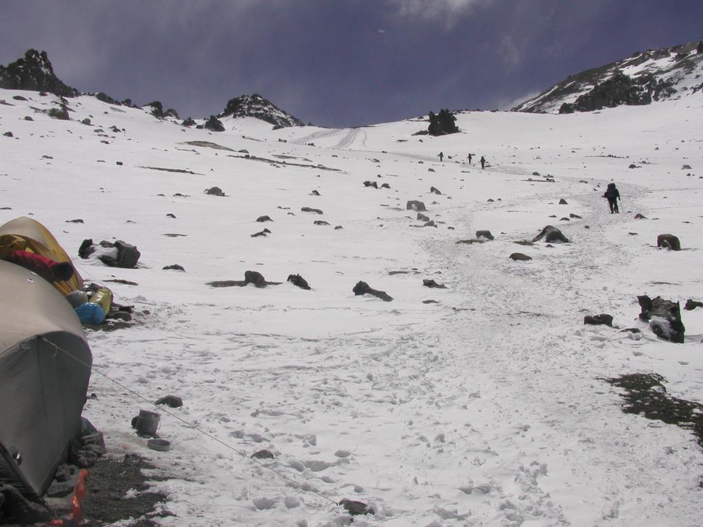
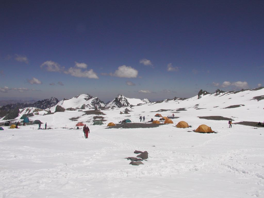
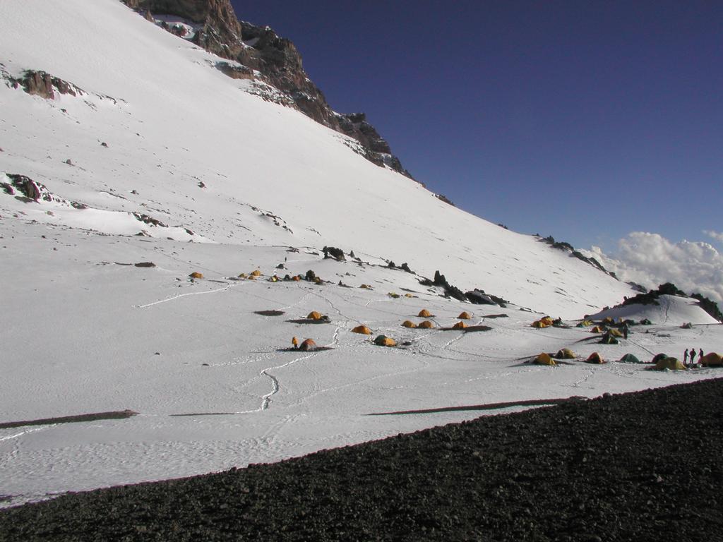
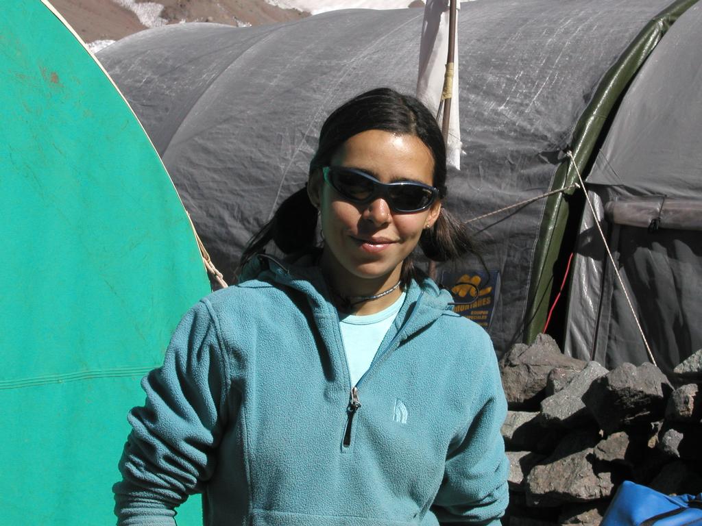
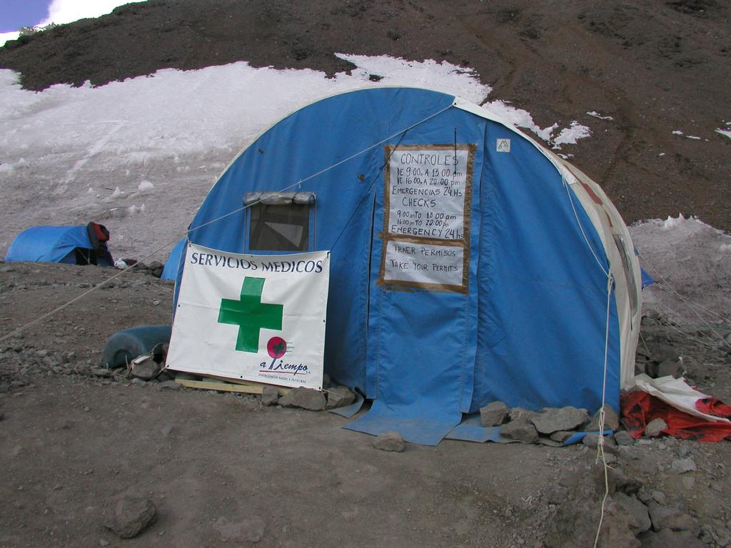
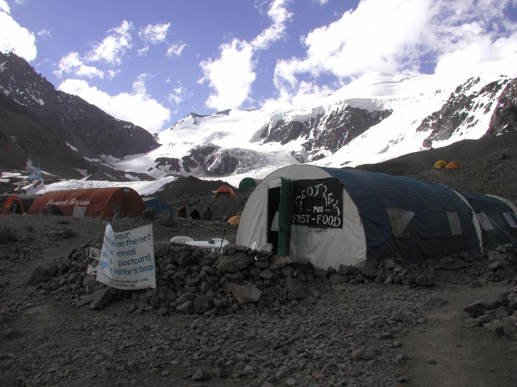
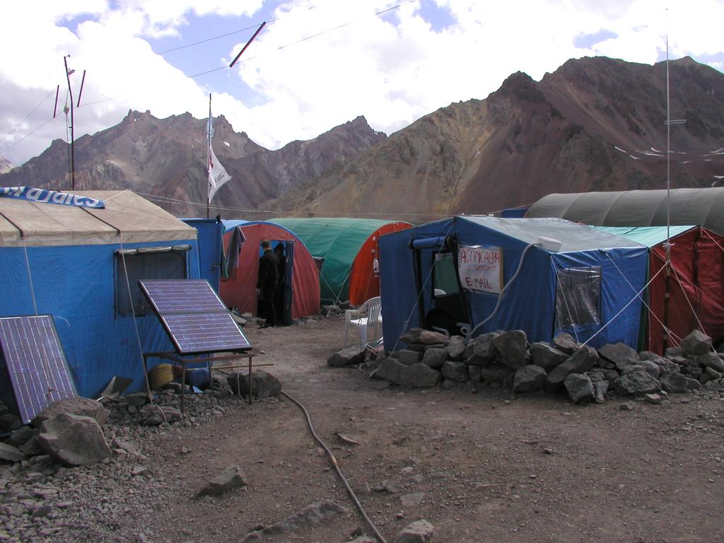
Rest day in Base Camp, Plaza de Mulas. This base camp is said to be the largest anywhere except at Mt. Everest. It is a very colorful place with people from everywhere. Modern technology is here, you can send E-mail, 250 bytes for 4 US dollars. The location is not bad, close to the steeper slope of Aconcagua near the end of the valley. Cuerno is the most prominent peak nearby, but also Bonete attracts attention right across the valley. A little left of Bonete as seen from Base Camp is the new hotel. Excellent breakfast with pancakes made by sweet Karina, a young woman with two brown braids. She works the kitchen in the Mallku headquarter, meals being served in the tent right next to it (on the right). It is mandatory for all visitors to buy toilet service, our private (Mallku) facility can be seen behind and to the left of the kitchen (red). We hiked across to the hotel and called home. A new snow storm came already around 1300 (1 PM). Not too much snow dumped, but the conditions higher up is clearly far from optimal. A man that descended to Base Camp fell on the last stretch and had to be carried down the last 100 meter on a primitive sled. Tor's cold is not any worse, but not much better either. If the weather is OK tomorrow, then I will explore the trail up to Canada, Camp I. There is snow on the trail all the way.
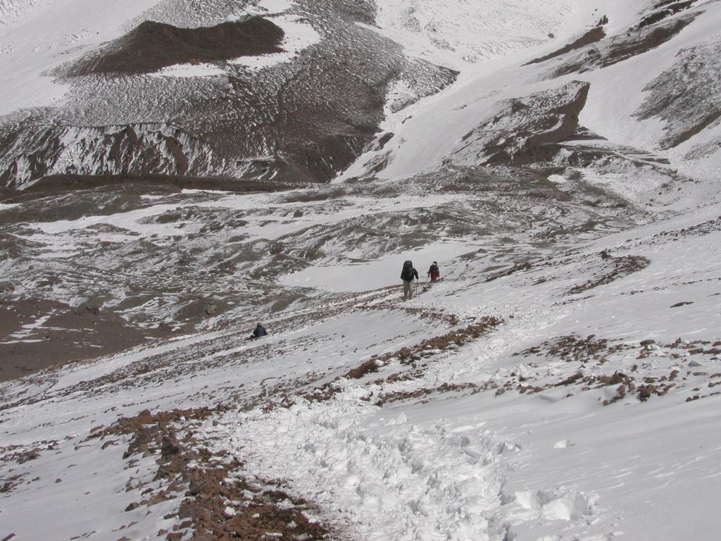
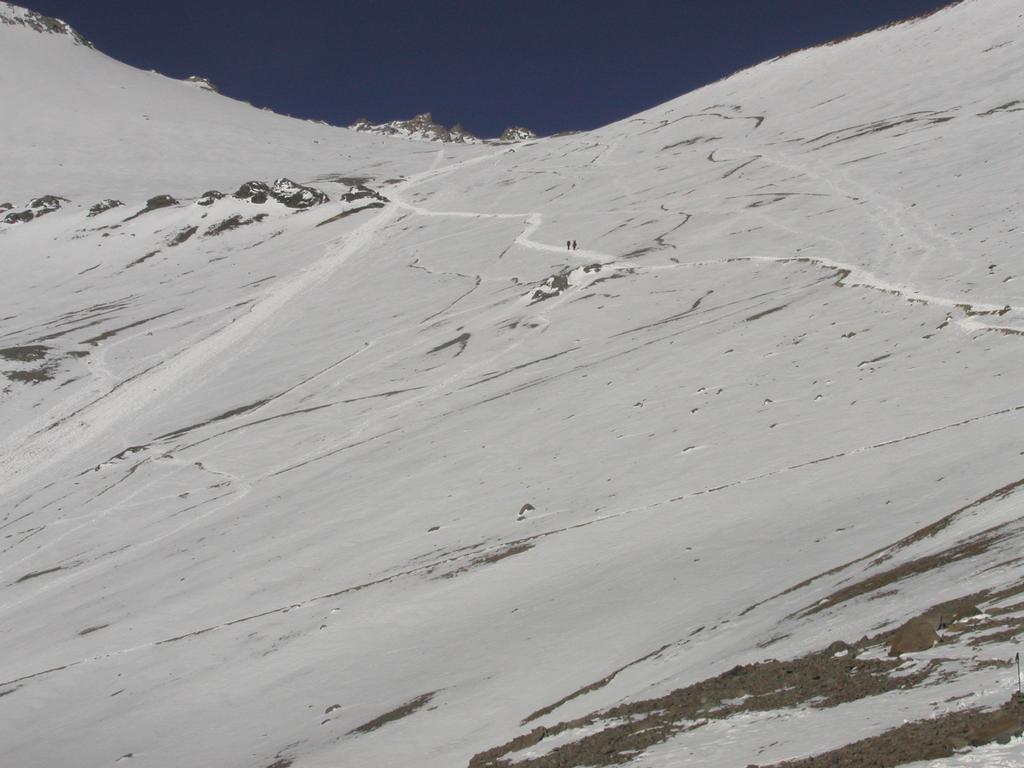
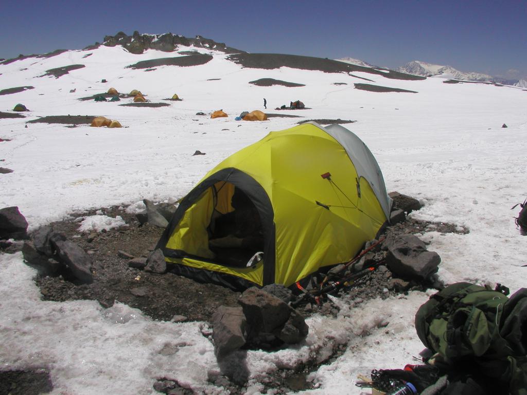
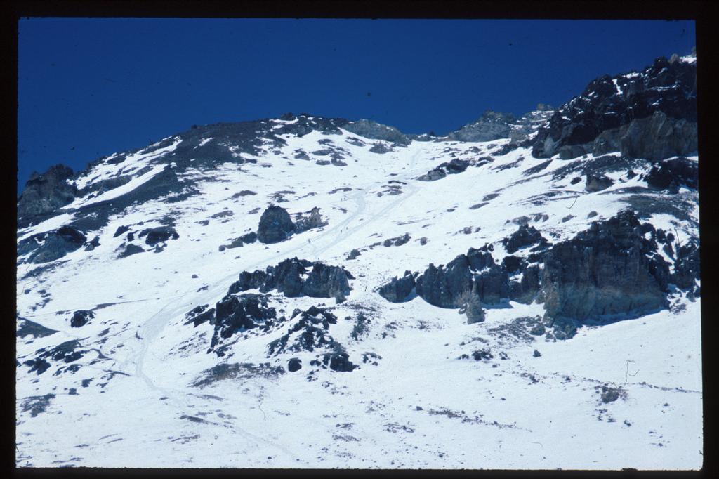
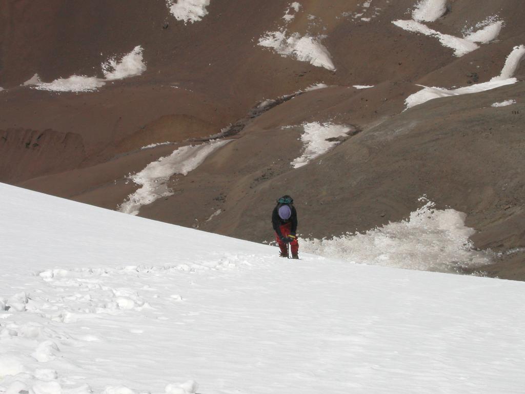
Morning with sun and blue sky. Actually, the sun does not hit the tent until 0930, there is little point in leaving the tent before we have sun. Tor has headache from the altitude and sore throat and a running nose, he will definitely have another rest day. I started out at 1115 with a pack of approximately 20 kg. The trail climbs a small slope, then there is an ascending traverse to the right before a switchback that takes you across a short slightly steeper section to a first small flat area. Quickly, Base Camp is below you. From this point the slope is less steep until just below Canada where, depending on which trail one chooses, the terrain again becomes a bit steeper on the very final section. Arrived at Camp I, Canada at 1415, quite exhausted. The air is thin and I felt it, no signs of altitude sickness, but generally a bit hard breathing. I put up our new Bibler tent and left a sack with food and equipment inside. I stayed 45 minutes at Canada before returning down. Jogging, I reached Base Camp in only 30 minutes, what a difference in time. The trail had mostly melted off and is quite easy all the way.
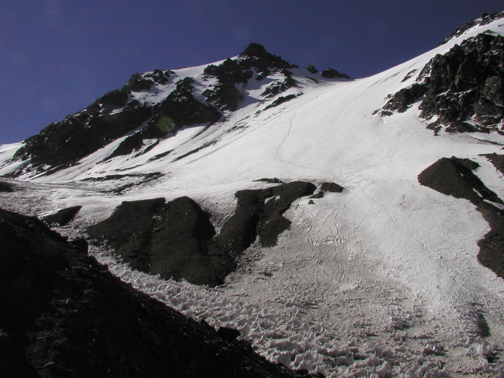
Breakfaat at 0930 as usual delicious pancakes. Departure at 1050. Tor slept well all night and is definitely better. It is a bit special to cure a bad cold above 4300 m. There is a characteristic rock formation about half way between Base Camp and Canada, a good place to rest when climbing up. We arrived at Canada in good shape after 2 hours and 15 minutes. The elevation is 5050 m, this is also consistent with my Swiss Thommen, relative to the elevation at Base Camp. This camp is now well stocked, almost nothing remains at Base Camp. We made some hot chocolate and tried the compact food "Fjodlar" a special energy bar produced in Hemsedal, Norway. OK, concentrated energy. After another 45 minutes we descended to Base Camp, again in about 30 minutes like yesterday. I guess we will try to move up and sleep at Canada tomorrow. I tasted genuine "Mate" today, a local drink made from herbs. You drink it through a straw (made of silver) and the cup is typically passed around. The weather is unstable, sunshine and snow showers in rapid succession. This is a minor complication in Base Camp, but causes more accumulation higher on the mountain. We only hope that this weather pattern must come to an end.
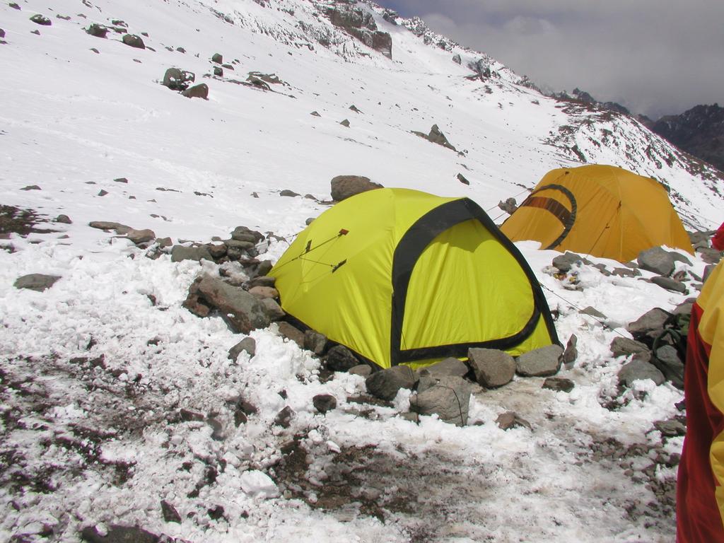
We left Base Camp at 1130 with the intention to start moving up the mountain. Arrival Camp I at 1400 in fantastic weather. We had stronger winds last night and the pressure has gone up. Perhaps this indicates a change and more stable, nice weather ahead? Let us hope so. Two servings of soup have been served. Our stove burning gas is not behaving as it should, very hard to ignite, then the burn is sometimes so violent that the titanium pot is close to meltdown. The time is 1800, the sun is shining, a few nice looking clouds, the weather has changed. The coordinates for our camp is: south 32.38.708, west 70.02.611. Fantastic campsite, but my head has a weak symptom of altitude. I took a short evening walk and talked with an Englishman married French and living in Chamonix. Just to stand here, above 5000 m, one layer of Devold wool, viewing summits and glaciers not a trace of wind, - a fantastic evening.
First night ever above 5000 m completed. Not much sleep to talk about, but some rest. We had strong wind for most of the night and it was pretty cold. Here, the sun strikes the tent at 0922, no point in doing much before then. Breakfast with oat porridge and soup. Tor suggested that we make a carry to Nido de Condores, Camp II. We tried and agreed after only 100 m to turn back. We immediately felt tired and in pretty bad shape. The day has been declared a rest day. This means that we will sleep three nights here, the camp is fine with a wonderful view towards Cuenta, so we will do just fine here. The time is 1900 and we will call it a day.
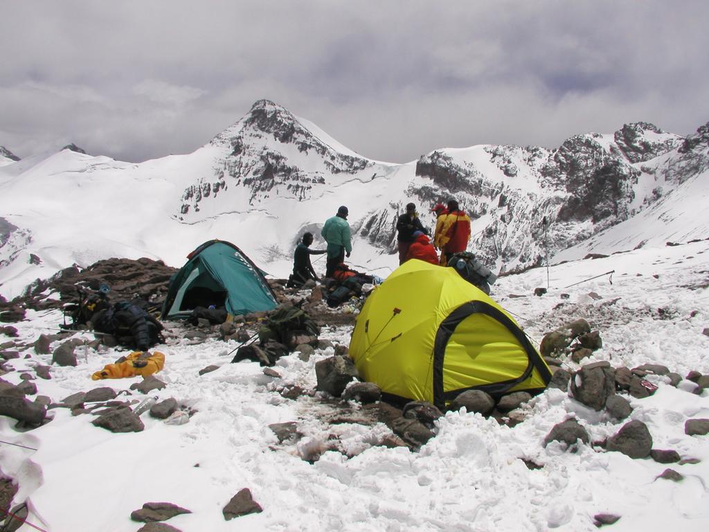
We woke up with the sun at 0922. Today, we left at 1100 and made a carry to Nido. A nice climb of about two hours. First an ascending traverse, then more direct up to the camp Alaska (Camp 1.5), after Alaska the trail is less steep until a short final climb up to Nido. In fact, the Spanish name for Alaska is more appropriate as it means "change of slope". We left a sack full of food and some gear. The coordinates were south 32.38.205, west 70.01.769. The GPS gave an elevation of 5570 m, this is quite a bit higher than the "official" figure. On the other hand, my Swiss Thommen said that Nido was exactly 500 m higher than Canada. The difference between the two instruments is less than 20 m, so I believe these figures to be fairly accurate. Not a cloud and just gorgeous weather today, however the wind higher up near the summit still looks quite strong. We hiked back down towards Canada and found the place considerably more crowded than when we left. Tomorrow, we shall move up to Nido.
Again, we woke up by the sun exactly at 0922. Breakfast and a quiet morning. We broke camp and left at 1136, beautiful weather, but some wind. We arrived back at Nido after 2 hours and 10 minutes, just as yesterday, however Tor carried a bigger load today. Our camp II has been established. We have had significant trouble with the buthane gas, at the next camp we have the more proper mix of propane/buthane, which seems to function much better. We hiked to some small cliffs at the outskirt of camp in order to get a better view of Nido de Condores. There is a lot more wind today, wonder how a team of Norwegians on a guided Hvitserk climb is doing. They are making a summit bid today after planning to move all the way to White Rocks yesterday. We also have company of two Swedish teams altogether 5 climbers. Two will proceed to Berlin (Camp III) today, the other three are likely in phase with us. The way things look right now, we may make a summit bid on January 27th.
We woke up and waited for the sun hitting our tent at 0903, no such sun ! This is the very first day of the entire trip without sunshine in the morning. Strong wind and snow showers made the decision easy, let us return to Base Camp and good tasting pancakes. The hike down was easy, we left almost everything in the tent at Nido. It is surprising to see how much snow has melted. The trail is now free of snow from Canada and down. It took us 1.5 hours to go down. The time is now 1430 and the weather is still overcast with snow showers. The plan is now to spend two nights here with a hike to the summit Bonete across the valley tomorrow. Provided that the weather is better than terrible, we will then hike directly back to Nido and hope that the weather improves. The current forcast says that this will be a three day low pressure system. Our acclimatization should now be excellent. We have spent 5 consecutive nights above 5000 m, wonder if that record will be broken.
An incredible change! We looked out this morning at the most gorgeous weather. We should have been on Berlin ! THIS should have been our day to summit. Well, these things cannot be predicted with any accuracy, at least not in this area. Yesterday, we had bad weather even in the morning, the first time ever in two weeks. The forecast said three days for this front to move through etc.
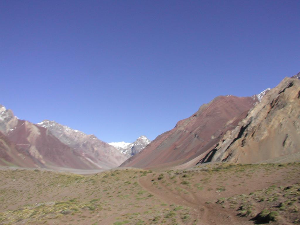
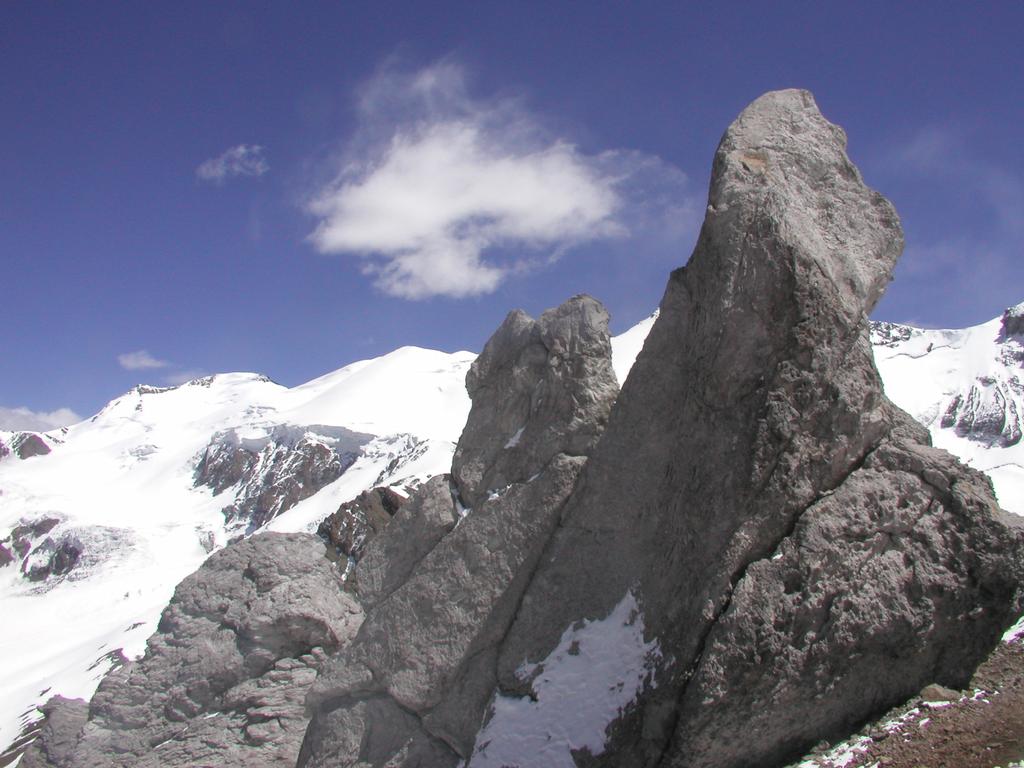
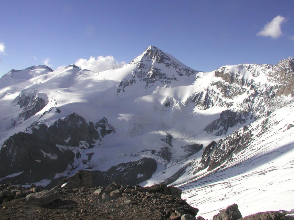
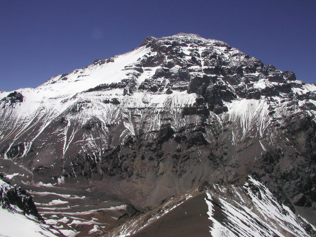
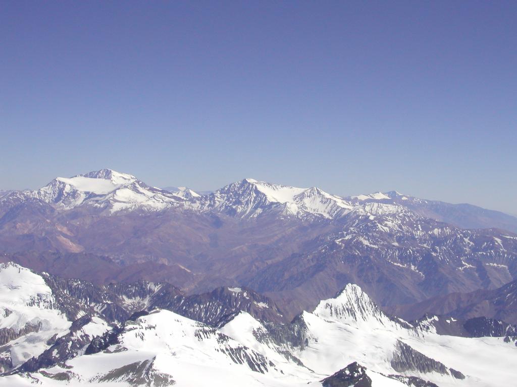
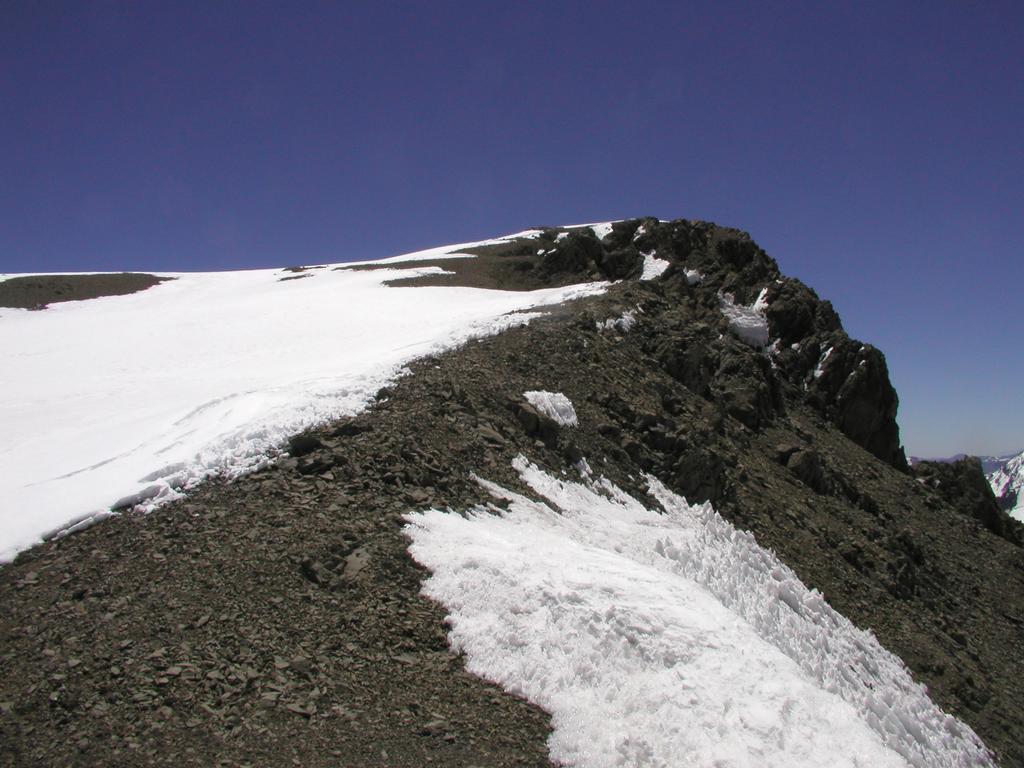
In any case, we had a very nice hike to Bonete, the characteristic peak across and up the valley near the hotel. The summit is located at: south 32.39.560, west 70.05.317. The GPS gave 5060 m as its elevation. This is Tor's first 5000 meter mountain, congratulations. The climb took 2.5 hours up, we had absolutely perfect conditions, no wind, nice and warm. Very nice view in all directions, Aconcagua is of course very dominant as seen from this summit. The trail to this summit requires little but walking, an easy class 2, US rating. We spent a full hour at the summit, then another hour on the return hike.
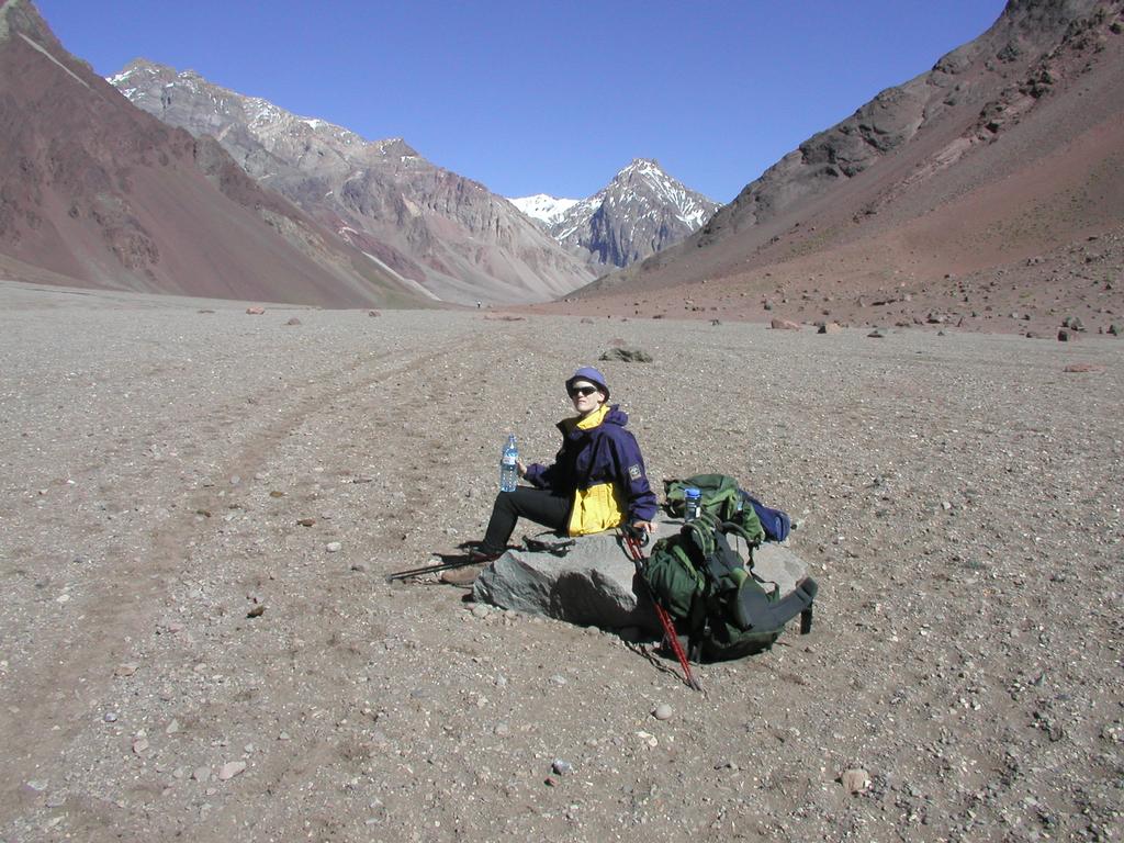
Tomorrow, we shall go directly back to Nido. Maybe this return to Base Camp, excellent food and thick air to breathe and sleep is just what we needed to really push hard for the summit. If this weather continues then we should consider going directly from Nido to the summit and skip Berlin altogether. We could start from Nido as early as anywhere between 3 AM and 5 AM depending on the wind. That is going to be a very cold start, but should give us enough time to reach the summit. With weather like today, we will have ample time to return even if clouds accumulate from, say 15-16 (3-4 PM) in the afternoon. Today was a planned summit day, however yesterday was just unbelievably bad. It is hard to come to terms with. If the weather is more questionable the day after tomorrow the plan will be to move to Berlin. We had a very nice chat in our Base Camp kitchen after returning from Bonete. Dinner today has been set to 2000, then to bed and hopefully a very nice hike back up to Nido tomorrow.
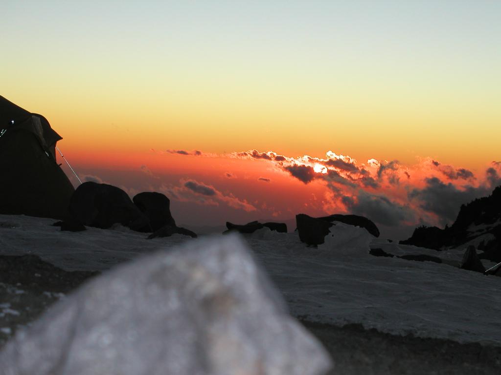
A new morning at 0930 with blue sky and calm winds. We had an extra serving of the breakfast pancakes, then ready with the backpacks for a direct climb back up to Nido. We left 4 minutes before 1100. A very stable pace, we both feel in great shape and well (super!) acclimatized. We had a total of three rests with the backpack off drinking water and eating chocolate. Arrival at Nido exactly three hours after departing Base Camp. We both agreed that this was significantly better than expected. The tent was exactly as we left it 2 days ago. We have now melted about ten liters of water, mainly for tomorrow, but also for hot chockolate drink and a Mexican pasta dinner. Unfortunately, the clouds came in already quite early today, visibility is now near zero and we have snow showers. Good luck with the weather is still not our best record. I will try to monitor the weather tonight. If the clouds clear, then we will give it a try early tomorrow. We have reconsidered the Berlin option altogether. We will stay here for several more days if needed and wait for a nice day, then push directly for the summit from here. Overall, this seems like a much better strategy than having to suffer at Berlin. Now, late as the sun is going down, the weather again as cleared and we have a magic view of the upper part of the mountain as the sun sets. Maybe tomorrow will be our day after all?
CERRO ACONCAGUA !
It did indeed clear up last night. I checked the
conditions at 0300 and it looked good, we therefore
started our preparations for departure. We left the
tent around 0445 in good moonlight. The full moon was
actually yesterday.
The hill
up to Berlin seemed quite
steep in this light. We arrived at Berlin, coordinates:
south 32.38.315, west 70.01.287, elevation 5960 m. Most
people seemed to still be in their tents/sleeping-bags, we
saw the headlamps of some parties above us. It was still
dark, cold and windy. Tor had some problems with cold
fingers. He took my gloves while I got his and the situation
improved. We continued without much rest towards White Rocks.
Interestingly, we met several parties along this way that
had given up and were returning to Berlin. The stretch above
Berlin was clearly the coldest and most windy part of the
entire climb. Above White Rocks the trail zig-zags up through
a small col with even more wind. We are now on the far side
of the mountain ridge as seen from Nido. The route continues
in an ascending traverse of a slope towards the climbers right.
Further ahead, the route passes through what looks
quite like a gate with some rock formations on either side.
After crossing through this formation the route keeps bending
a bit more right. We could now see the summit towering above
steep cliffs.
At this point it was appropriate to put on crampons, we soon noticed
the route that connects here from the Polish glacier. This is called
the False Polish route in contrast with the steeper glacier route
(the Polish Route proper) that ascends directly to the summit.
More upwards and we arrived at the small col with
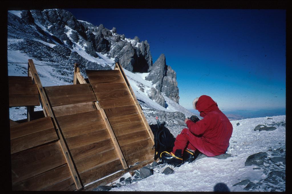
the hut Independencia.
This "hut" is said to be the highest "hut"
anywhere in the world. Its purpose is however questionable, half the
roof was missing as well as part of the wall. Obviously, the structure
was half filled with snow. The "hut" is quite small, perhaps 2 meter
long and 1.5 meters wide, a bit more than 1 meter tall.
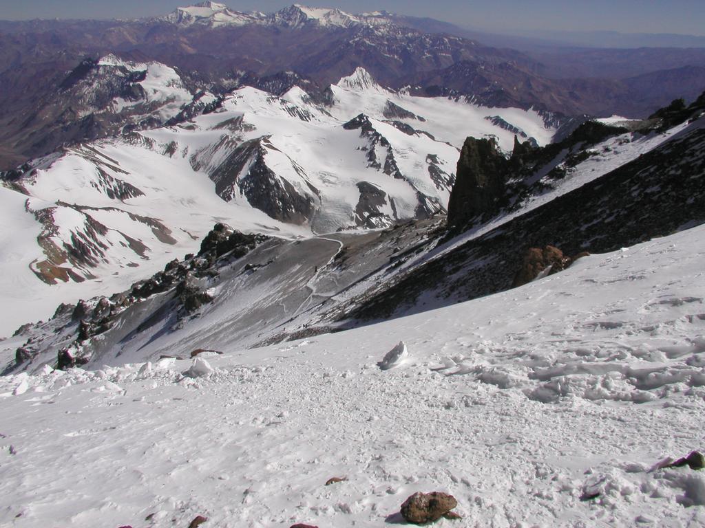
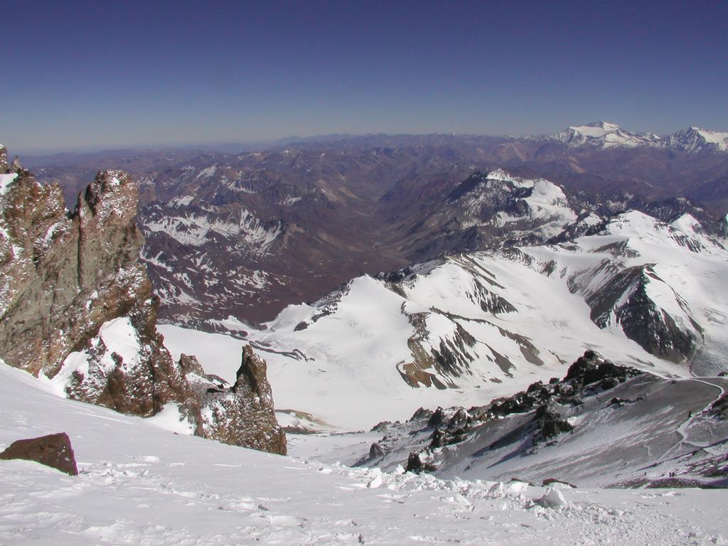
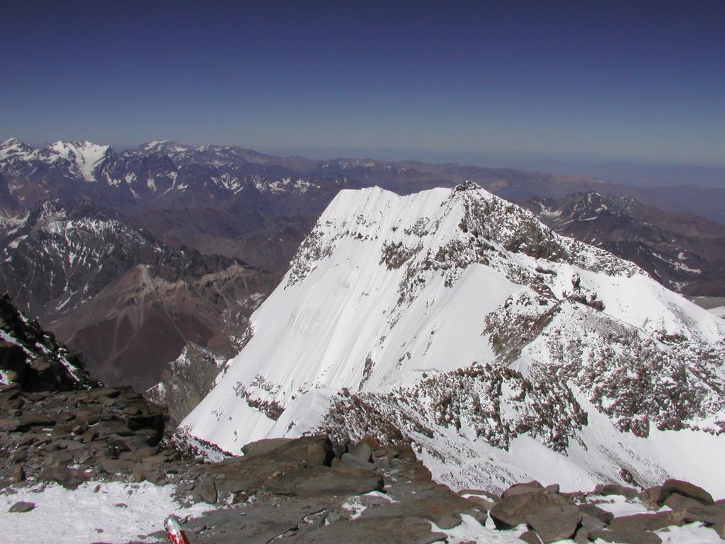
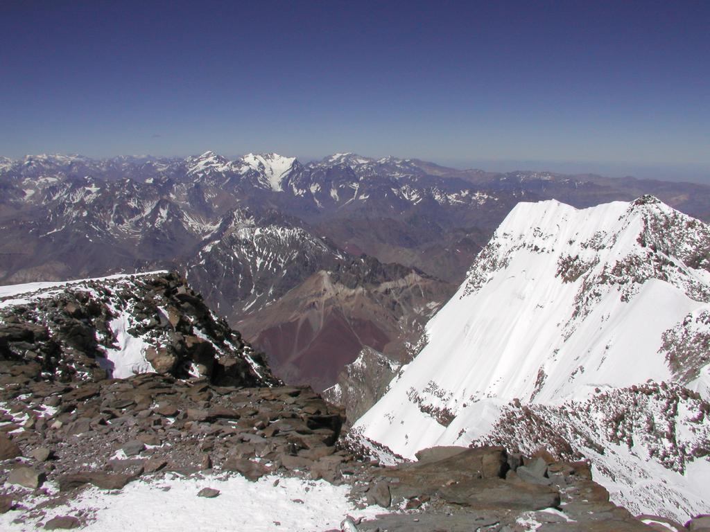
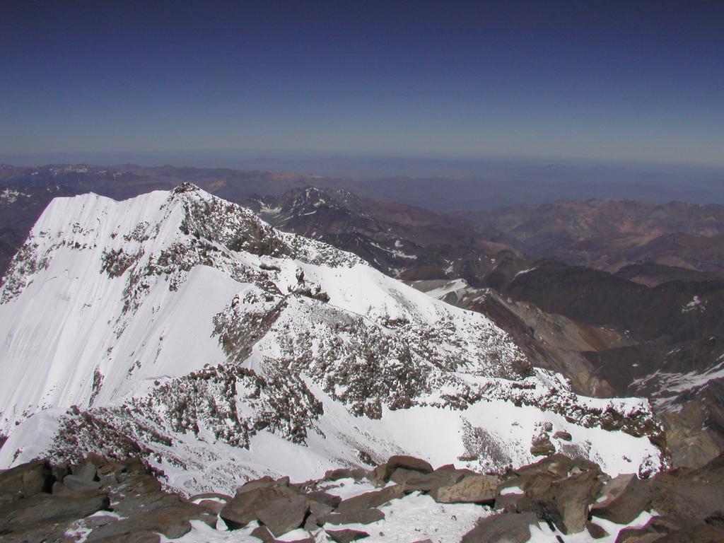
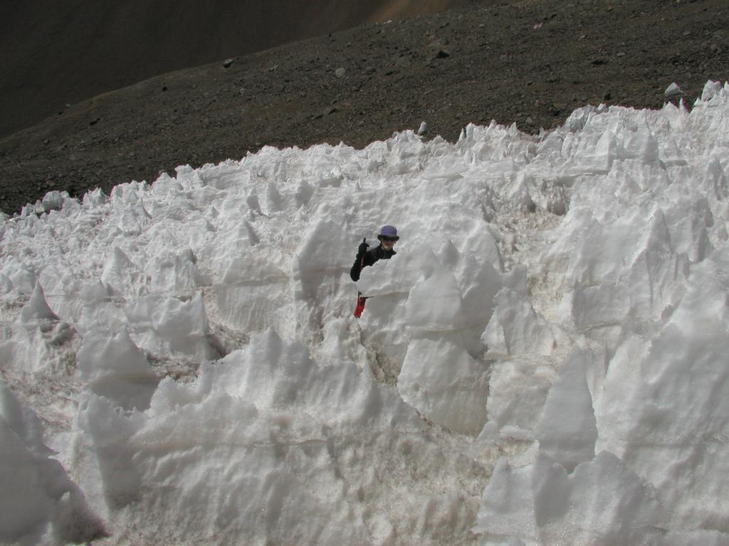
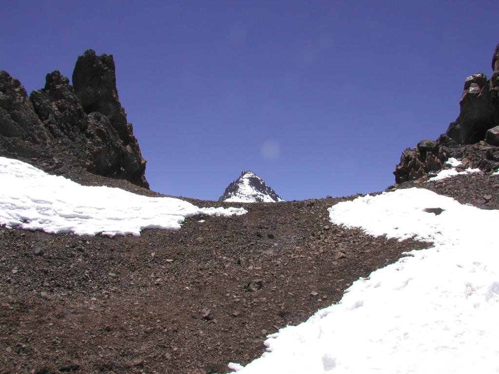
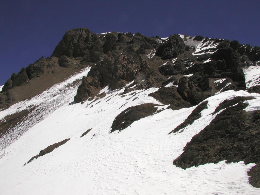
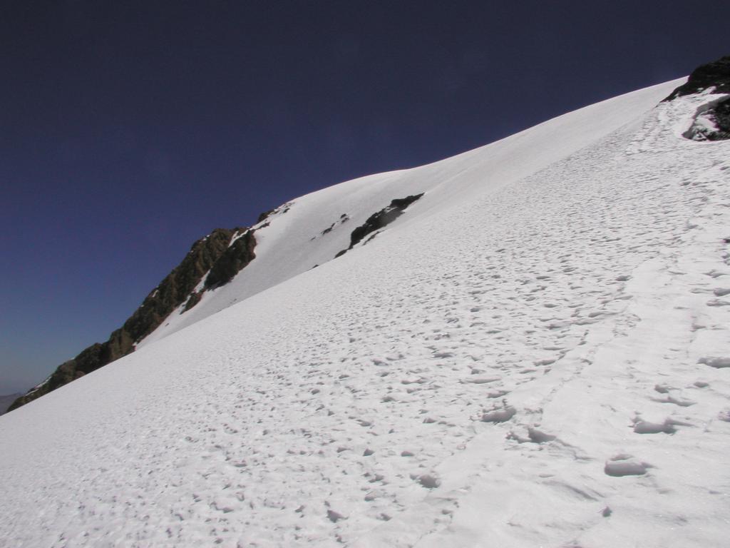
From Independencia, the route heads up a slightly steeper snow slope to a distinct ridgeline. Again, we cross back and start to see the slopes down towards Nido. The view of the mountains to the north is now telling us that we are getting higher than most anything around. From this ridge the Traverse starts connecting with the final huge gulley called the Canaleta. The Traverse starts out horizontally, but gradually turns into a climbing traverse. We still had no sunshine and the Traverse is in the shade this early in the morning. The route started as a fairly visible trail, but gradually we ran into more snow and could only follow some steps in the snow from a few climbers ahead of us as well as traces from the past few days. The Traverse was a cold experience and it took us longer to complete than I had expected. Finally across, the last part actually crosses the Canaleta, we found ourselves for the first time today in sunshine. The sun sure makes a difference, you feel the warmth and it certainly also provides mental strength. The entrance to the Canaleta is guarded by some impressive pinnacles forming the beginning of a rock wall that marks the right side of the Canaleta when viewed uphill. We rested under some large rocks that partially form a small overhang. The weather is just great, we both feel strong and our time is very good. We decide to leave both backpacks here and just carry food, water, camera, and some spare clothing in the generous pockets of our Norønna Anoraks, a typical Norwegian mountain garment of cotton. The Canaleta was filled with snow, but rocks could clearly pose a danger. We stayed all the way on the right side following a cliff band that streched upwards and marked the right boundary of the Canaleta. The terrain The terrain is moderately steep, but the snow provided good steps and the crampons served us well. We passed an incredibly slow moving climber (solo?) crawling along on knees and arms. Soon, we could see the ridge connecting the south and the north summit. We also observed one party ahead of us that would reach the summit and a bit later start their descent. This party climbed in the central part of the Canaleta, a route that looks more prone to rockfall than the way we had chosen. At the top of the Canaleta, we traversed across staying close to the ridge. In a few spots we were at the ridge proper with the chance to look down the extremely impressive south face. This is a near vertical wall of snow and ice that falls down thousands of meters. What remains at this point is the very short final pitch to the summit. This is indeed quite short and for the first time the summit looks close on this enormous mountain.
Just below the summit we passed the frozen body of a climber that had died a few days earlier. It was a clear reminder that 7000 meters is indeed a marginal zone for human life. The margins become very small, differences that may go unnoticed at more normal elevations could have serious implications here. I thought about our push from Nido to the summit in only 7.5 hours. What made it possible is related to our 3 hour hiking time from Base Camp to Nido with backpacks yesterday. Our work in the last two weeks carrying our supplies ourselves. The use of porters and more commercial support may be dangerous in the sense that it may bring people too far into this hostile environment with inadequate physical preparation. In particular, if the weather suddenly changes up here and the wind and clouds of Aconcagua attacks on short notice, then climbers must be strong enough to get down off the higher slopes under their own power.
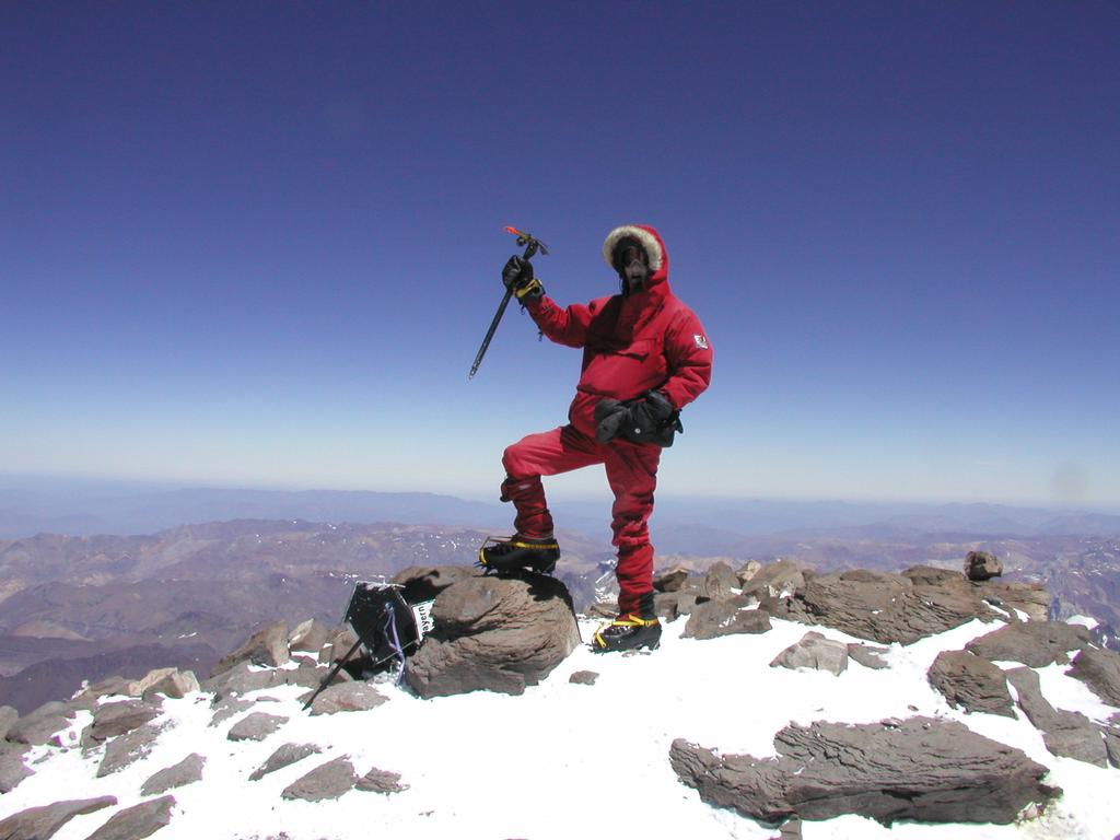
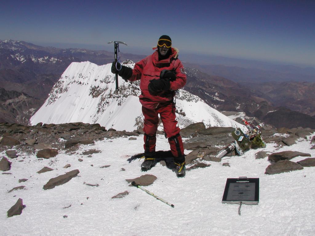
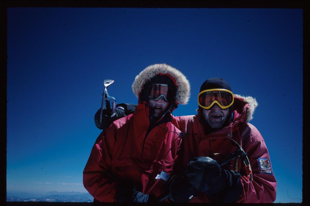
CERRO ACONCAGUA, we were on the summit at 1215, 7.5 hours after the start from our tent at Nido. There were nobody here, we had the summit and were the highest humans on the planet for more than 15 minutes. We signed the summit log, a very fancy book in a large metal box. The famous metal cross that can be seen on many summit pictures had fallen. We took pictures all around and just stood taking the view into our memories in deep and large chunks. My GPS gave the following reading: south 32.39.186, west 70.00.724, elevation 6970 m. The official elevation is 6962 m, so this reading is yet another confirmation that the lower elevations likely are quite accurate, that is within say, 10 meter. The most impressive view close up is the south summit and the impressive snow wall facing south. Other mountains of the Andes are visible both south and north, it seems clear that we are on the highest of them all. After about 20 minutes a single climber joined us. Just in time to have a summit picture of father and son father and son together. The weather had decided to cooperate, this was our summit day, not a cloud and even the wind had calmed and was not noticed. The panorama was just perfect, one can even sense the curvature of the earth in the far distance.
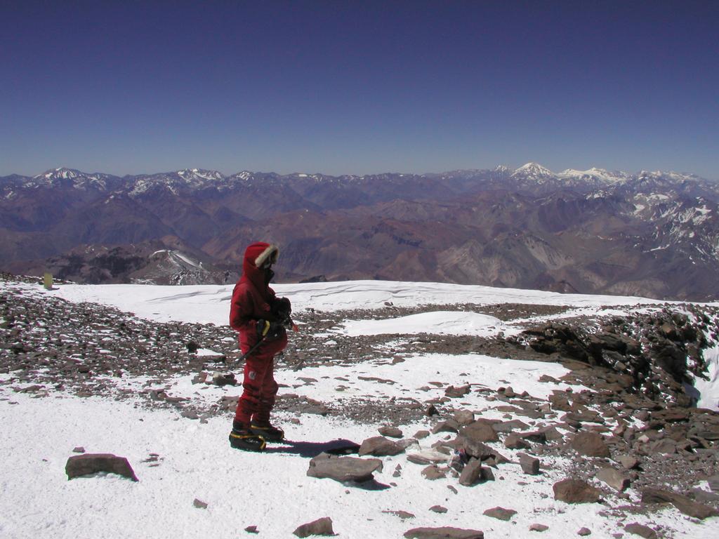
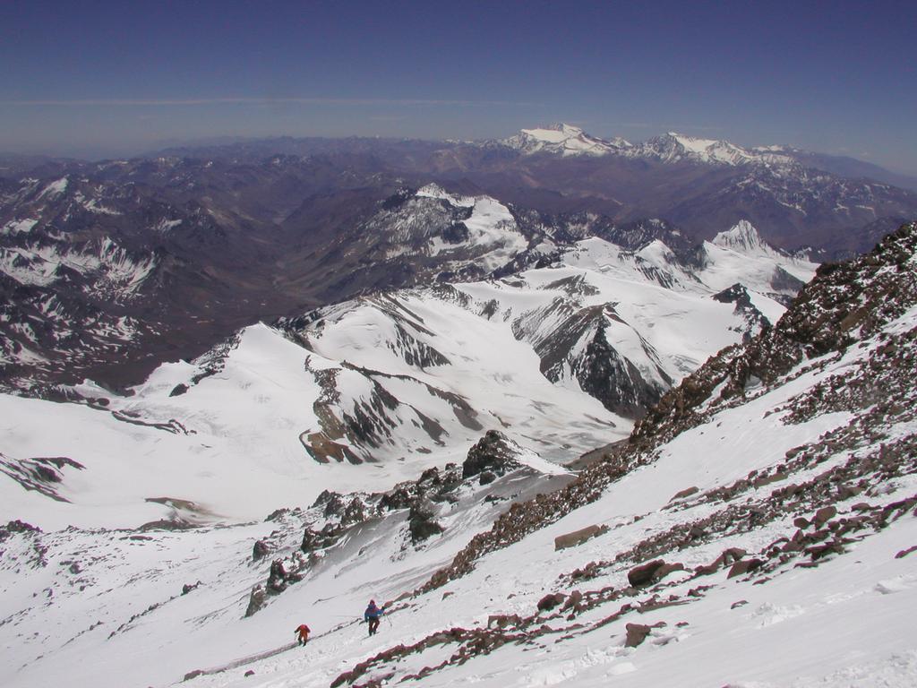
We left the summit after approximately 30 minutes, first traversing the upper part of the Canaleta then climbing about two thirds down the Canaleta following the same route as on our ascent. There, on a nice rock we sat down and had some chocolate and energy drink. The sun was warm and we were sheltered from the wind. We measured our blood oxygen consentration to 67 percent, the lowest reading of the entire trip. However, we felt perfectly comfortable, neither of us had any signs of altitude sickness in the form of headache or similar signs. The return from the summit to Nido took about 3 hours and 15 minutes. When we arrived around 1600, the weather was still warm and sunny. I have now been above 5000 meter every day for 11 consecutive days, we have slept above 5000 meter for 7 nights. Right now the time is 2000, we are resting in our sleeping bags at Nido, reflecting on the day we just have experienced together. The wind has picked up in force, it is now blowing hard outside. Tomorrow, we will break camp here and hopefully be able to carry everything back down to Base Camp.
Woke up with the sun hitting the tent at 0902. The effect is immediate, the temperature inside the tent increases quickly. The strong wind is still here. We take a lazy morning, no hurry, mission completed. Breakfast with hot soup. Later, we pack everything onto two (HEAVY!!) packs and start down the slopes with crampons, this is the easier way with such loads. What it took us several days and trips to carry up shall now go down in one carry. I am very, very tired as I stumble into Base Camp with more than 30 kg on my back. We celebrated immediately with two cold beers, later a stroll across to the hotel to call home and tell wife/mother that father/son had completed the ascent successfully. We have ordered beer also with dinner to be served (at a table) at 1930. What a luxury life. Tonight, we shall sleep here, in this dense air and tomorrow we have already planned to make an attempt on Cathedral, another 5000 meter peak across the valley. The plan is now to spend two more days here, then hike out on February 2nd. (My wife Heidi's birthday). Then a night in Puente del Inca before a final night in Mendoza. Our flight out of Mendoza is on February 4th. so this works out nicely.
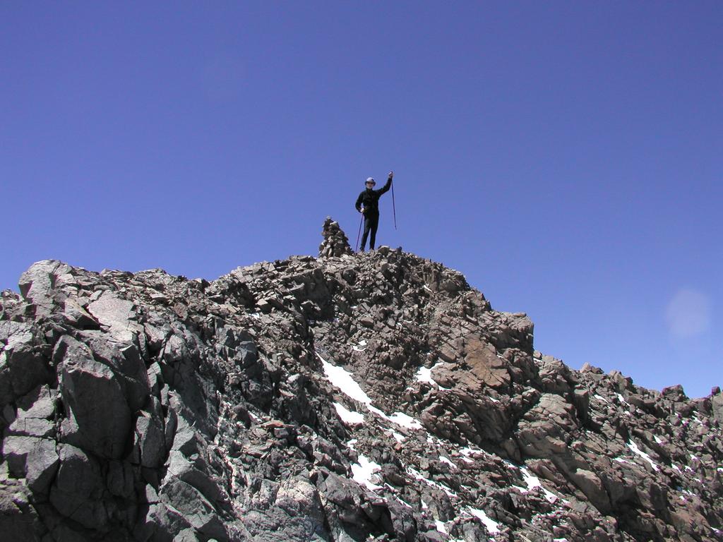
Another morning with warm sun hitting the tent at 0930. It is quite windy today, but this can change. The pancakes were nice as always, Silvina, who lives with her boyfriend in Boulder has taken over the Base Camp responsibilities. Hernan and Karina set out for Canada and perhaps the summit a few days ahead of us, however the altitude caused trouble and they returned to Mendoza several days ago. We left camp at 1100 with the big bulky mountain called Cathedral as a possible goal. Since we knew nothing about routes this had to be a bit exploratory. We saw the slopes when we did our climb of Bonete. We followed the trail to Bonete until it crossed and started to climb away from the valley floor. From here it looked possible to start up a large snow field after crossing through an area with the famous penitentes., We left our hiking poles on a rock and started up the slope with crampons and ice axe. After a rather long and moderately steep climb, we reached a saddle between the distinct spur summit overlooking the hotel (and Base Camp for that matter) and the higher mountain further back. Tor had significant trouble with snowballing crampons and decided to wait in this area while I explored a possible route higher. The coordinates of this first col were: south 32.38.953, west 70.04.609, elevation 4930 m. I continued below a few rock utcrops, then steeply up and around a rock with penitentes below and to a gulley full of loose gravel and smaller rocks. Crampons off, scramble up around some rtten rock, US class 3, possibly a single class 4 move. Further up, I exited the gulley to the right and followed a small ridge. The rock was slightly better here and partly just fine dirt. Moving a bit across to the left I reconnected with a large, steep snow field that comes up from the valley further in. Crampons on again, the best route now followed the ridge, the view back down on the saddle where Tor Erling was waiting showed that progress had been made. Finally, steeply up on what appeared to be a well rounded snow summit. This last stretch was rather steep. Once up, the summit is still some distance away, but the rest of the route is not steep. It is easier to walk just along the ridge the rest of the way. The summit has coordinates: south 32.38.723, west 70.05.074, with an elevation of 5295 meter. Beautiful views all around, no wind, I took several panorama pictures. I reached this summit at 1510, 4 hours and 10 minutes after departure. The down climb to Tor was smooth, but I had to climb backwards in two spots, it is interesting how much steeper it feels when descending. I reached Tor at 1610. We both had a major glissade down the snow field, I even triggered a small avalanche ahead of me. The fun resulted in a big hole in my wind breaking pants, too bad. From the valley, one could now see our tracks our tracks (up as well as down) quite easily. We stopped at the hotel on the return hike for some coke, back at the tent around 1900. The sky is still without a sign of clouds and there is no wind. Dinner at 2000, pizza was served and well received. After dinner we talked a bit to a man from Iceland that Tor had seen earlier. He was now next door neighbor and he told us that he was well on his way to the seven summits. He was only missing Aconcagua and Everest, the two highest. He had been trying Aconcagua for a month, had been sick and had to make an extra trip to Mendoza, he was now on his second dollar 200 permit. This just shows that one need timing that matches the conditions in order to strike when a window opens. We told him about our good experience with leaving from Nido, it seemed like he would adopt the same strategy.
Today is February, we will rest, hang around, prepare the loads for the mules and generally enjoy our last day in Base Camp. Yet another day with good weather. A group of climbers left camp and started up the mountain, a large group of mules left on their way back to Puente del Inca. It is quiet in Base Camp. The high season is over, even the price for a climbing permit went down today. This January is said to have been the worst for climbing Aconcagua in 10 years. A lot of snow most of the month and difficult conditions overall. The days ahead looks quite good for the climbers that still have time and unfinished business. Tomrrow, we will have our mule. We have prepared two big bags for the mule, the rest, which is rather minimal, we will carry out ourselves. We have walked around Base Camp, starting from our own kitchen and dining hall, to the hospital, the police station (the park ranger tent), the pub and the Base Camp email facility where 200 bytes (sent or received) is US dollar 4. Later, we have had a three course lunch and a three course dinner. We wished the guy from Iceland good luck, then went for a walk on the moraine nearby. The evening is here, tomorrow is hiking out and leave the park.
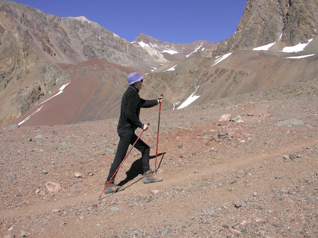
Finish packing and breakfast at 0900. Waive goodbye to the mules. They walked away with 50 kg. We went across to the hotel in order to call Heidi and congratulate her with her birthday. We left the hotel at 1130, arriving at the large rock where the flat valley floor takes over, at 1250, one hour and 20 minutes. This is also the place where one should wave goodbye to Cuerno, this landmark that has been impossible to ignore the last two weeks. We had a short rest by the (only) rock suitable for this purpose in the flat valley, this hike certainly feels much shorter going out. We crossed the bridge near Confluencia after 3 hours and 30 minutes, and arrived back at the ranger station by the park entrance after 4 hours and 53 minutes. This was fast hiking with lightweight backpacks, we estimate the total distance from Base Camp to the park entrance to be about 25 km, possibly a bit more, but in any case less than 30 km. We rested and had water to drink several times. The large, flat area of the valley can best be remembered by observing three distinct ridgelines that comes down from the Aconcagua side. One cannot see any further than the first, then the second, and finally the third. The distance between these are greater on the Confluencia side. We crossed the creek by jumping, this time without any incidents. Ariel came and picked us up at the park entrance. We have now finished a nice dinner at Puente del Inca. Two beds provided, 18 days since we tried one of these. All the luggage has similarly arrived safely, we need to reorganize it before the bus shall pick us up here tomorrow at 1145.
Puente del Inca.
Breakfast, then walk around "town". We bought a nice
piece of rock that can be used at home as a bowl.
The weather is nice, it is good not to be rushing home,
but have the time to just
sit in the sun
and make a first review of our good memories while
still in Argentina.
A "real" Argentine hamburger at 1130, then the bus picked us up at 1150. Arrival Mendoza at 1530 after a very comfortable trip. Eliana was there at the bus station, the attention provided by Victor is just very professional. Mendoza has summer, about 30 Centigrade and very nice. We now get 2 pesos for one dollar so big changes in the currency. We had a big, fancy dinner at a nice outdoor restaurant near our hotel, a combination of farewell to Argentina and celebration of the successful ascent.
Today is travel home day. We slept well, there was a local change in the weather during the night. The temperature is now somewhat lower, about 20 C. We went shopping in the morning. It is nice to see how people are cleaning up after the strong wind, sweeping the sidewalks etc. No question, this trip has been very successful. The flight from Mendoza via Cordova to Sao Paulo was right on time. The transfer to Varig/Lufthansa went ok and soon we were on our way back to Frankfurt/Europe.
Tor and I arrived on time in Oslo, he would continue directly to Trondheim in order to catch up with his studies, this trip made him miss the first few weeks of lectures. I arrived back in Bergen on time and schedule. I left on January 5th. so including the conference in Mexico, exactly one full month away from home.