Snowmass Mountain
- Snowmass Mountain
- 4295 m.
- Primary factor 351 m.
- 31th in Colorado
- Location: North 39:07.125, West 107:03.988
- Climbed July 14, 2002
Snowmass Mountain
|
|
Route description:
First, to Snowmass Lake:
The trail starts out just left of a ranch entrance, the first
part of the trail crosses private land and you pass 3 gates that
should be kept closed. Before the third gate, there is a trail
going sharply right. This trail crosses the Snowmass Creek and is
called West Snowmass Trail. It can be used to access Capitol Peak.
Do not take that trail, but continue straight along the
Maroon-Snowmass Trail. This trail follows the creek (on the left side)
up a very
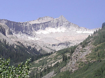
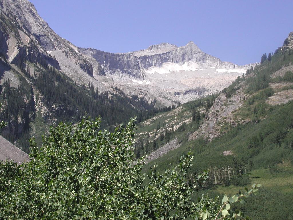
nice valley. After about 5 km, the trail starts climbing (left) and there
is a nice view into a side valley, drained by Bear Creek. Higher up, one
can see Snowmass Mountain to the south-west at the end of this
valley. The trail continues along the east (left) side of Snowmass Creek, the
valley is quite narrow here and climbing. Later, the trail becomes
level, the valley opens up, the basin ahead with meadows and forest
forms a truly beautiful wilderness landscape. A small lake on the right,
then a slightly larger lake. The trail crosses Snowmass Creek just before
this lake. This point is about 10 km from the trailhead.
(GPS coordinates, North:39.08.068, West:107.00.787)
At the outlet end of the lake there is a "logjam", several logs forming
a slightly complex bridge. It is strongly recommended to pick up a
sturdy pole to help balance across. Some logs are not jammed and rolls,
some are so saturated by water that they sink under if stepped upon,
while a few are quite good to walk on. The trick is to find the good
ones. We crossed without any incidents. The trail continues on
the west (right) side of the lake and crosses a
meadow, then climbs the hill to a new plateau where the trails to
Trail Rider Pass and Maroon Lake are indicated on a sign. There is one
final hill as the trail follows the Snowmass Creek up to Snowmass Lake.
Several good campsites are scattered among the trees near the lake just
south (that is across) of the creek.
Second, from Snowmass Lake to Snowmass Mountain:
There is a distinct, but fairly small trail along the east side of
Snowmass Lake that can be followed around the south end of the lake.
The trail, quite well marked with cairns then continues diagonally up
and across the lower part of the steep scree slope that is above the
south-west end of the lake.
This line takes you across rocks and boulders that are quite stable
and provide for easy hiking.
Follow this trail as it reaches a line of
vegetation on the right side of the scree slope.
The trail now heads straight uphill with a distinct gully on its
right side. Higher up one can either continue straight up on loose
scree or cross a small stream to the right (the crossing is marked
with two cairns) if the rock is not too slippery (wet). The trail on the
other side of the small stream is easier. The terrain levels off.
The area from the top of the scree slope and all the way to
Snowmass Mountain is supposed to be one of Colorado's largest
permanent snowfields. However, on our trip there was absolutely
no snow left, all melted away already before mid July!
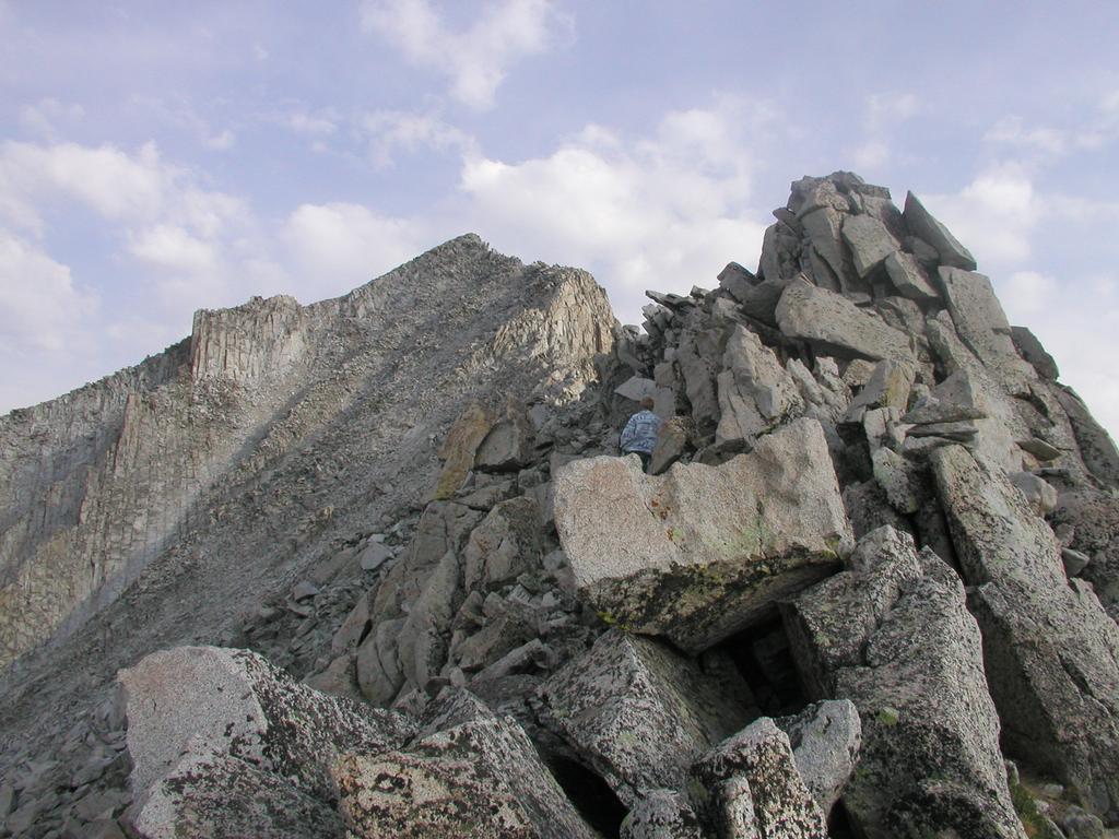
Snowmass Mountain
(GPS coordinates, North:39.07.124, West:107.03.988)
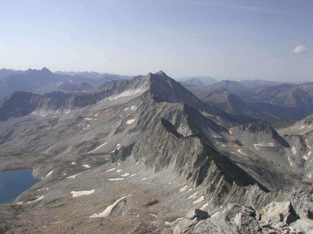
is the highest point on a ridge that encloses this high basin. To the left
(south) Snowmass Peak and Hagermann Mountain forms a high part of
this ridge. From Hagermann the ridge drops to a distinct saddle, then
the ridge forms a distinct hump about halfway to the Snowmass summit,
further north there is a small, but distinct subpeak called North
Snowmass before the ridge turns back towards the north end of Snowmass
Lake. There is a broad, very distinct ramp leading up to the hump that
is about half way between the low Hagermann saddle and the Snowmass
summit. Hike straight up this ramp staying south (left) of some steeper
cliffs. This climb is largely class 2, towards the end class 2+ unless
wasting too much time trying to find the absolutely easiest way up.
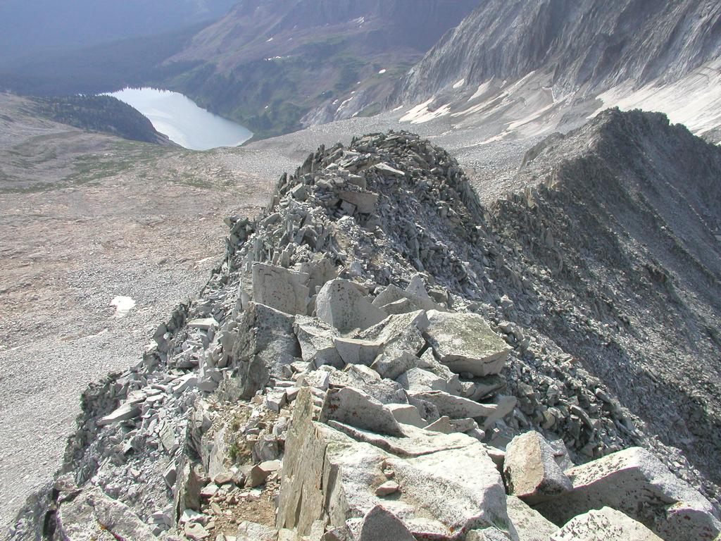
As soon as you are on the ridge, the route follows the ridge to the
summit. There are several variations, one can stay on the very top
of the ridge almost the entire way, this involves class 3 scrambling and
some exposure. In most places, one can find an easier route by staying
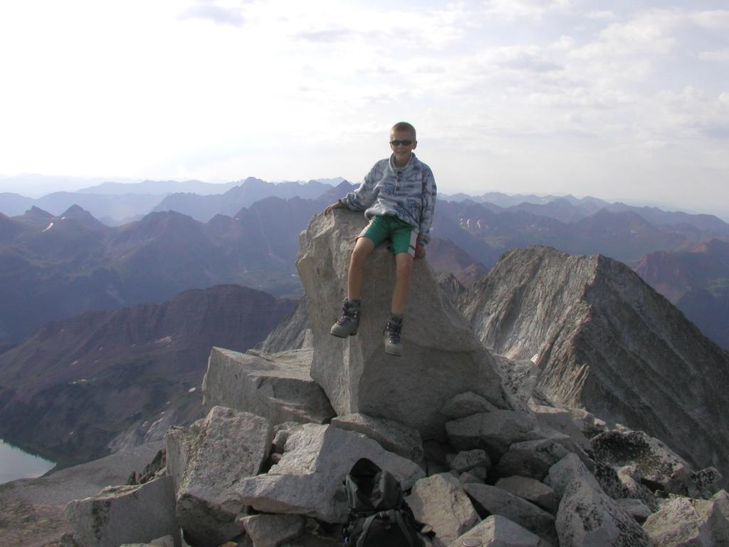
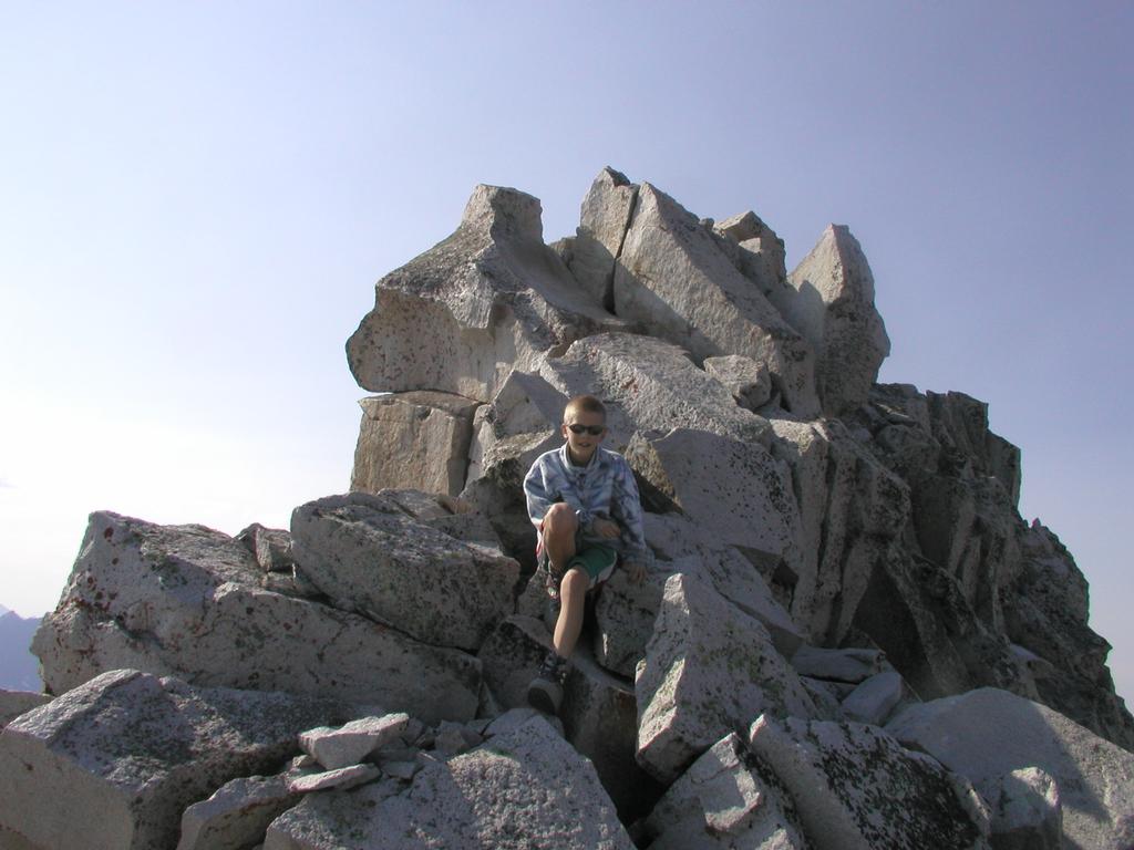
left (west) of the main ridge. The summit is quite nice, the very highest
point is a single rock, perhaps 1.5 meter tall.
We continued along the ridge, staying high (YDS class 3) and found an easy
way directly down to the lowest col between Snowmass Mountain and its
northern subpeak. From this col there is a gentle slope down back into
the basin. Thus, one can actually climb Snowmass Mountain by ascending
its high ridge either south or north of the summit. Both alternatives
involve some class 3 scrambling along the ridge. The easiest route is
likely from the south and staying mostly off on the west (left) side
of the ridge itself.
Comments:
I did this climb with my son Pål Jørgen, age 13.
We hiked in to Snowmass Lake the day before in 4.5 hours. Started
the next morning at 0550, reached the summit at 0845. We spent half
an hour on the summit with blue sky and good visibility. We continued
to traverse the summit ridge at 0915 and returned to our tent at 1130.
We left Snowmass Lake at 1230 and were back at the car at 1600 after
a 3.5 hour hike.